free to be able to rate and comment on reports (as well as access 1:25000 mapping).
If you look at the list of most popular Corbett ascents on Walkhighlands, you find Bidean a'Chabhair right at the bottom, with Carn Mor only 2 places above. I'd looked at these hills, particularly the fine pointed top of Bidean (Peak of the Antler) when climbing Sgurr Mhurlaggan and wondered why they were so infrequently climbed. Didn't seem unduly difficult to access and in a fantastic part of the country. I resolved to find out as soon as practicable.
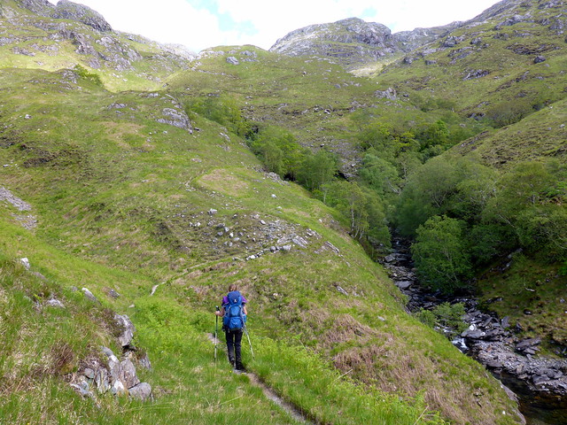
After a fortnight's holiday of constant rain and miserable weather, my return to work had been greeted by wall-to-wall sunshine every day. Would it hold for the weekend? The forecast suggested not - but Sunday was to be reasonably good. Undaunted, we set off on Friday late afternoon with the hopes that we could climb up onto the back of Carn Mor and high camp, complete Carn Mor on Saturday and finish off the unpopular Bidean on the Sunday. The sun began to disappear as we drove up through Glencoe and Fort William. The road along Loch Arkaig was busy with traffic coming in the opposite direction - must have been workers finishing up or the denizens of Murlaggan heading to Fort Bill for a wild night out. Anyway, we arrived at the parking space at a reasonable hour, had some sandwiches and checked our bags then set off into Glen Dessarry. We walked to the first house on the left then across a bridge into the forest. A sign was warning of operations and suggesting an alternate route, but that wasn't heasing the direction we wanted to go, and I felt pretty sure there'd be no logging going on upon a Friday evening. We saw no evidence of timber harvesting where we went anyhow. Followed the excellent track for a bit then decided to cut up through the trees and a seemingly narrower forrested section onto Monadh Gorm. This proved a bit of a kerfuffle - there was very little room between the trees and we were scratched and poked by branches. Did our best to keep to deer tracks where we could see them, but not a very pleasant experience. Once we made the other side of the treeline Allison stopped to try and get all the little bits of twig out of her hair/clothing - big mistake! Legions of midges appeared as from nowhere and chased us up the hillside. I had fondly imagined that the long cold spell might have starved the midge clan to death and that we wouldn't be troubled this year - wrong! I had forgotten just how harassing they are as they bite and get up your nose/in your ears. We moved as hastily as we could to the brow of the hill where a breeze was sufficient to remove the midge menace. From here we walked along the back of the hill, Mam nan Calum which resembles the parting of a balding man's head, with tree clad slopes to either side and a "baldy" section in the middle. I wasn't sure what to do- I knew the forecast for Saturday wasn't particularly good and did entertain thoughts of ascending Carn Mor tonight if it stayed clear. However, as we walked along the clouds settled upon each mountain top in turn and it was evident that by the time we reached the summit we'd be enveloped in clag. We therefore decided to pitch up on some flattish ground near the 568m marker. It is so wonderful to high camp in summertime - I really need to do it more often.
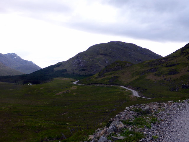
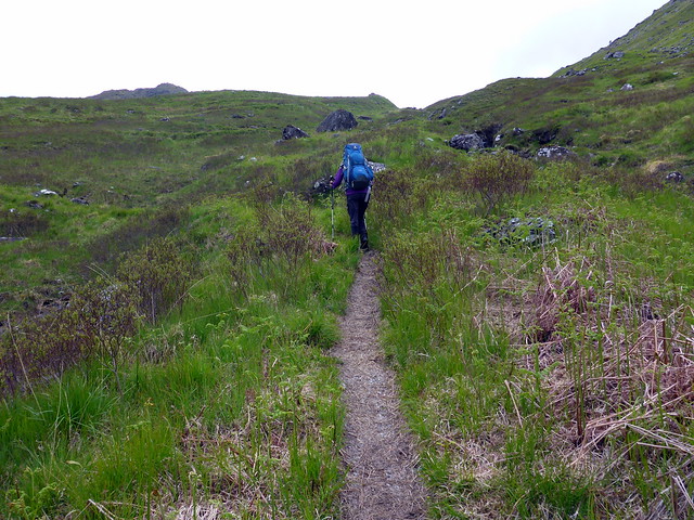
Track from car park, Monadh Gorm ahead
 P1080210
 by
Al, on Flickr
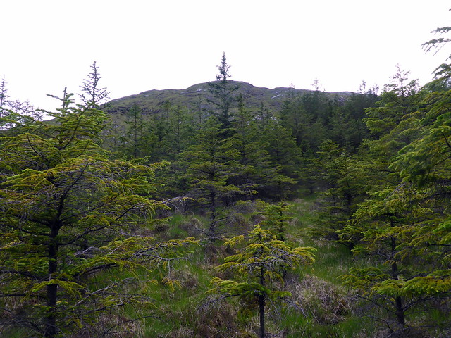
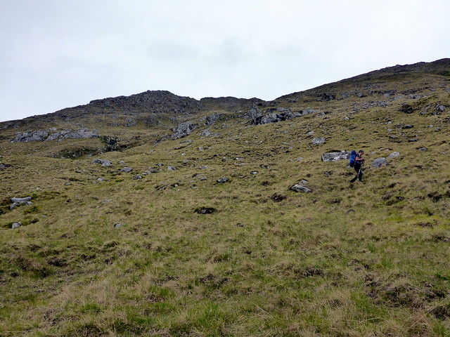
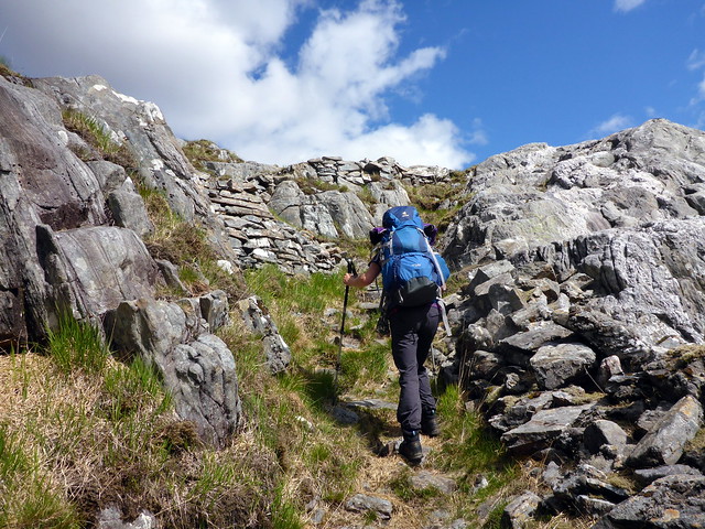
Up through the trees
 P1080212
 by
Al, on Flickr
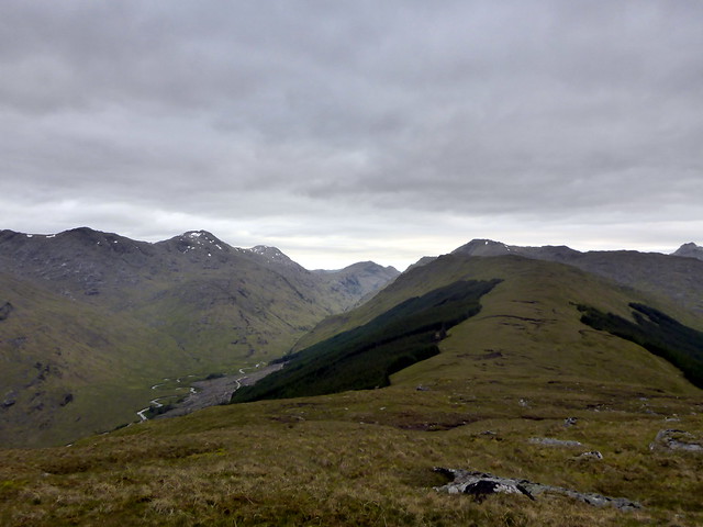
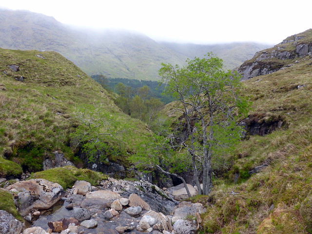
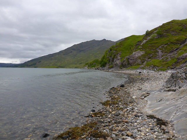
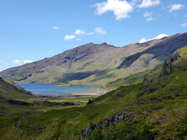
Looking back on Loch Arkaig
 P1080214
 by
Al, on Flickr
 P1080215
 by
Al, on Flickr
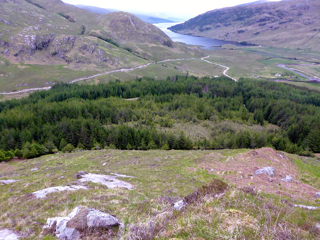
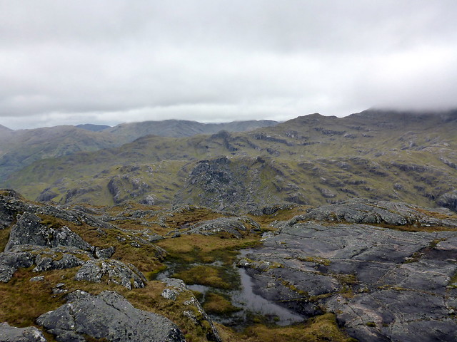
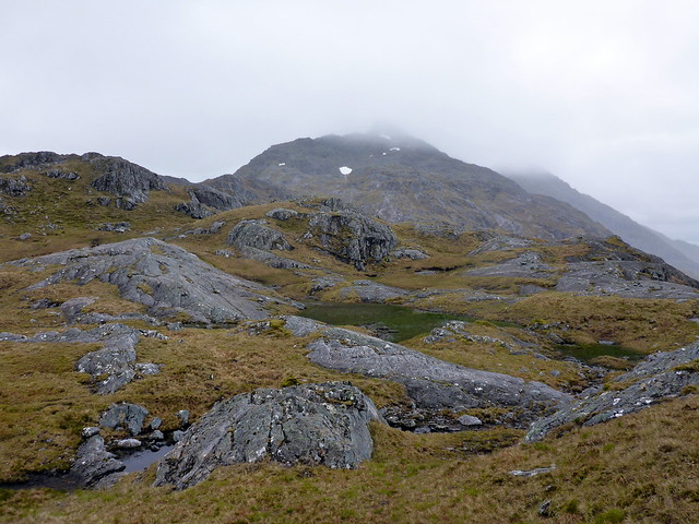
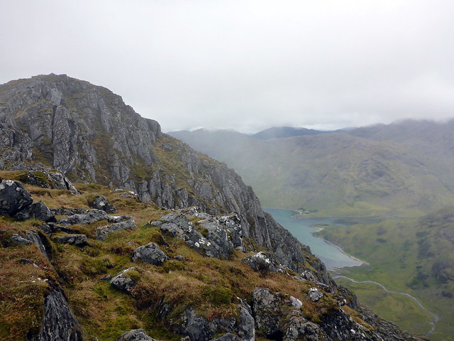
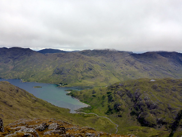
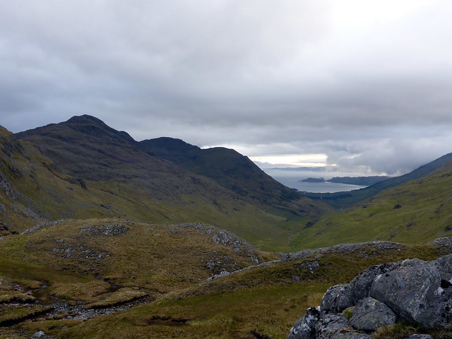
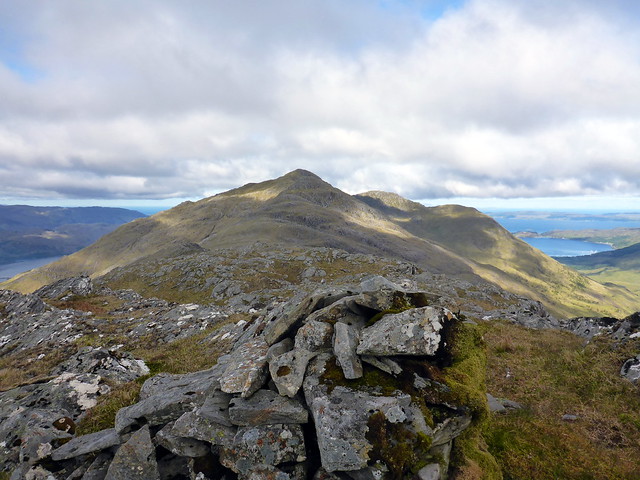
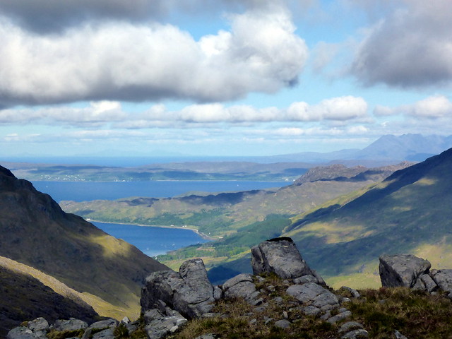
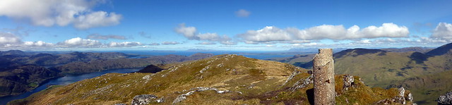
Pano from summit Monadh Gorm looking west
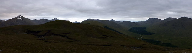 P1080216
 by
Al, on Flickr
Along Mam na Calum
 P1080220
 by
Al, on Flickr
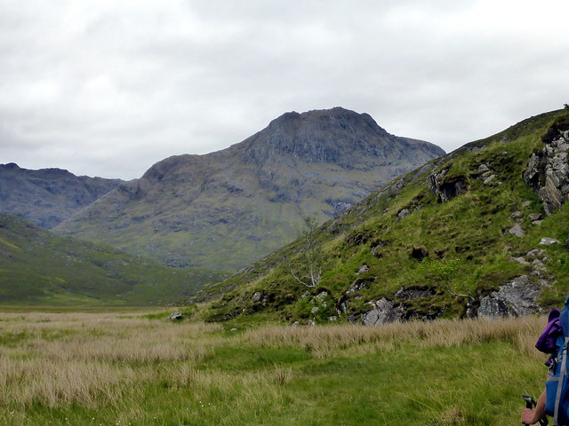
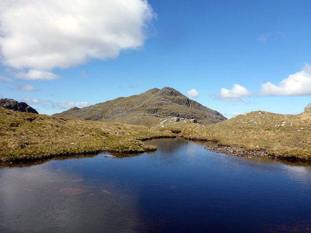
Campspot - Carn Mor ahead
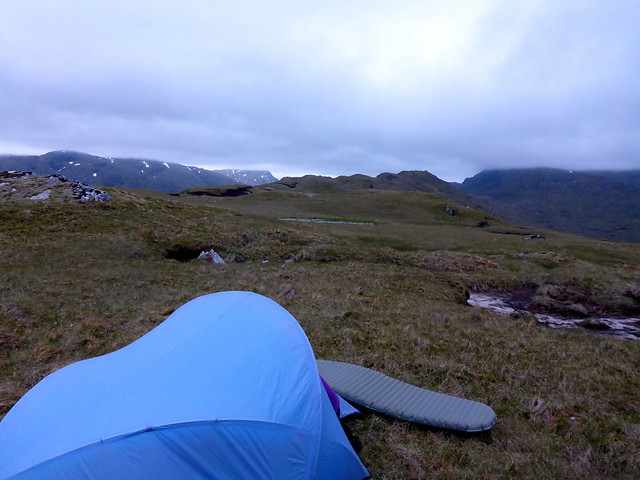 P1080224
 by
Al, on Flickr
Overnight there were no disturbances. We woke to find the tent coccooned in milky white air - damn - no moring sunrise then! The wind had died away, but fortunately the midges hadn't returned to persecute us. Breakfasted and got ready to set off. After studying the map, it occured to me that the distances involved in the route I'd planned were not very far - at this rate we'd summit our second hill by about 2pm and could be back at the car by tea time Saturday. That would mean we could go somewhere else for Sunday, but it seemed such a shame to leave Knoydart early when there was a good forecast. What other options did we have? I checked the map and noticed that Beinn Bhuidhe was within striking distance - would mean two long days, but the alternative meant leaving an awkward to get Corbett unclimbed. Allison took some persuading this was a good idea

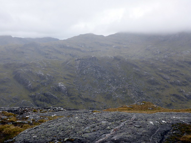
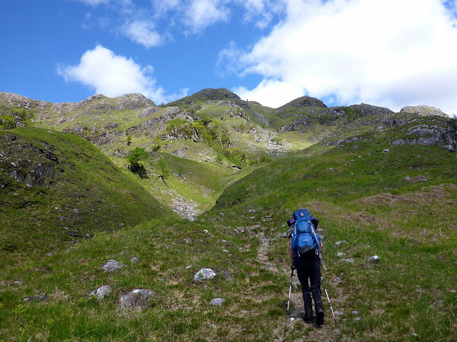
We set off for Carn Mor, which was an unremarkable experience in the clag and returned to Meall Nan Spardan where we decended. I'd originally planned to follow the shoulder of this rigde right down to the trees, but it looked perfectly possible to shortcut this descent, so we essentially followed the grid line down from the 640m top. Through the clag we could make out the flank of Meall na Sroine rising steeply ahead of us. Again, I had thought we'd need to go up the nose of this hill, but it seemed quite possible to pick a way through the crags, as long as we had visibility. As the clag was sitting at about 600m, so far so good.
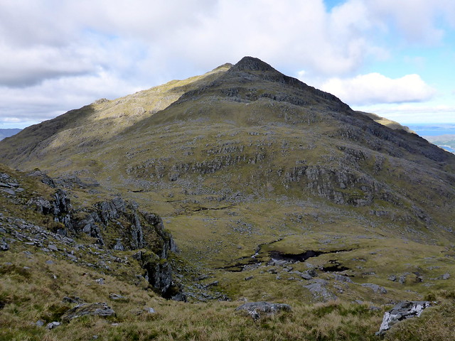
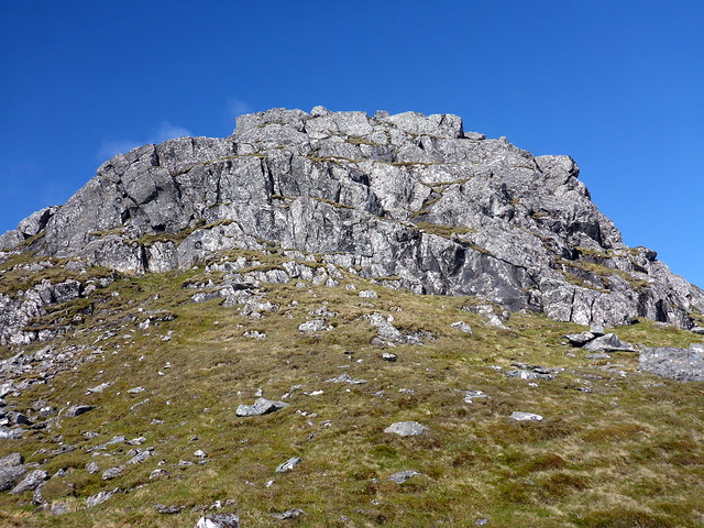
Towards the rocky top of Carn Mor
 P1080227
 by
Al, on Flickr
 P1080228
 by
Al, on Flickr
 P1080229
 by
Al, on Flickr
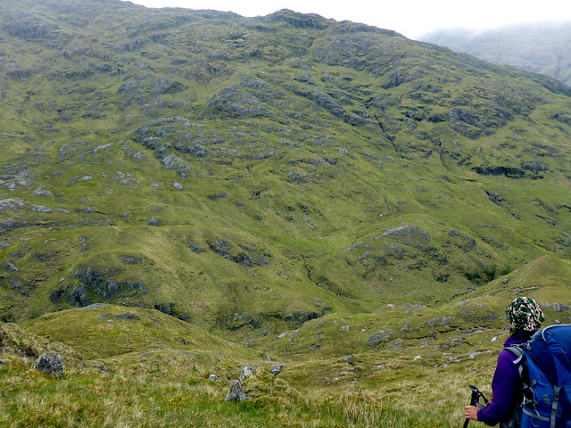
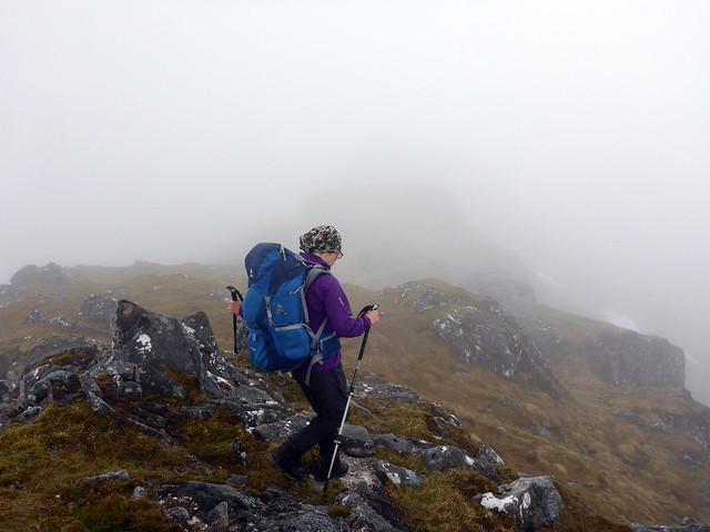
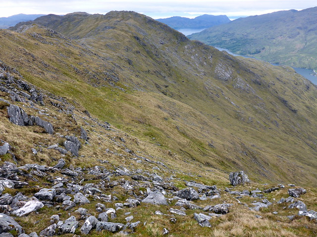
Along Meall nan Spardan
 P1080230
 by
Al, on Flickr
 P1080231
 by
Al, on Flickr
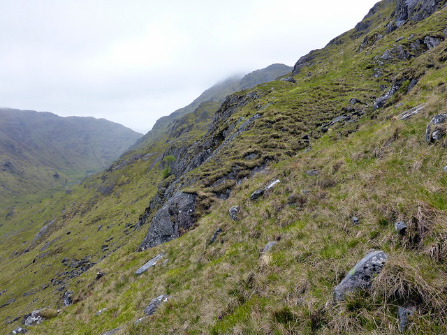
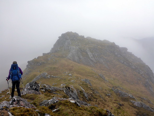
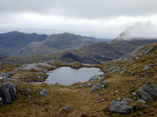
Meall na Sroine ahead
 P1080234
 by
Al, on Flickr
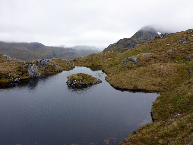
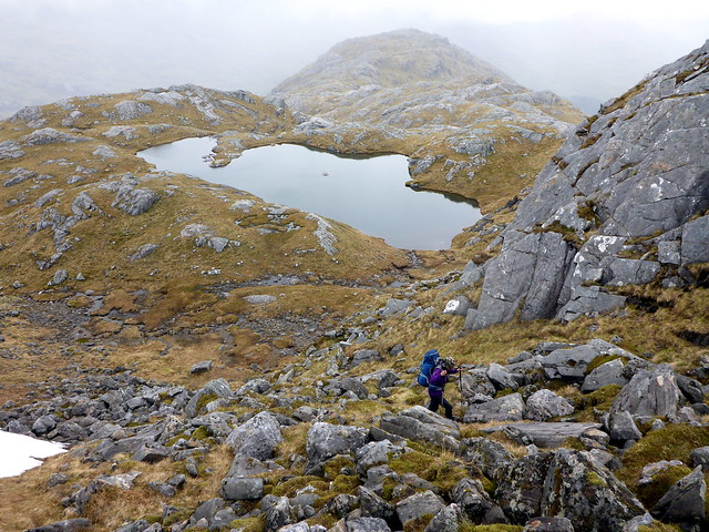
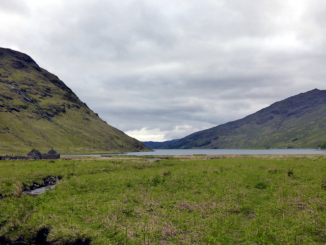
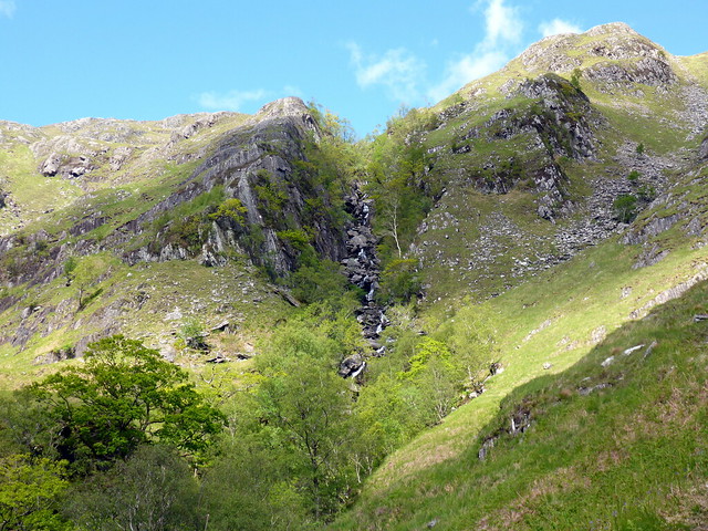
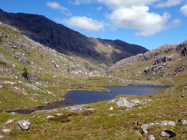
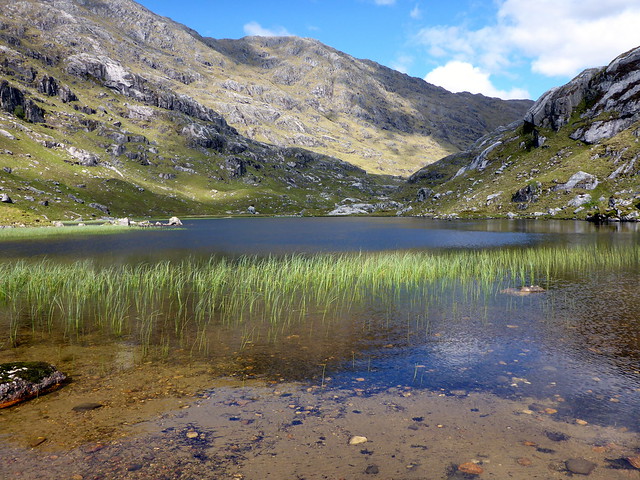
We crossed the Allt Coir an t-Serraich a bit higher up to avoid a gorge and parked ourselved over in Rod nan Daoine where we had lunch and prepared ourselves for the ascent - always more challenging with big packs, although we were both feeling the benefits of daily Corbetting for the two weeks of our recent holiday - finally I was starting to feel some fitness returning. The ascent was straightforward and we took in the summit of Meall nan Sroine before continuing along a broad ridge towards Bidean a'Chabhair. Over to our right was evidence of a major landslip. Lochans glimmered darkly. The going became rockier and we noticed 2 people coming towards us out of the clag - didn't expect to see anyone else on such a "rarely climbed" hill. We spoke for a while, were told there were no difficulties with the ascent, and pressed on.
Gorge
 P1080236
 by
Al, on Flickr
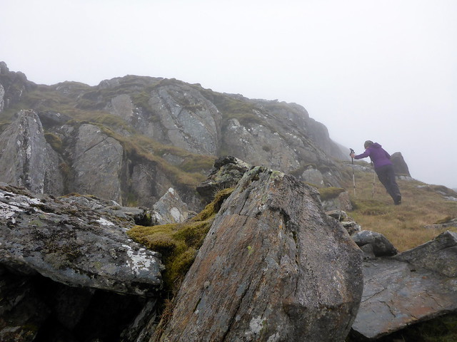
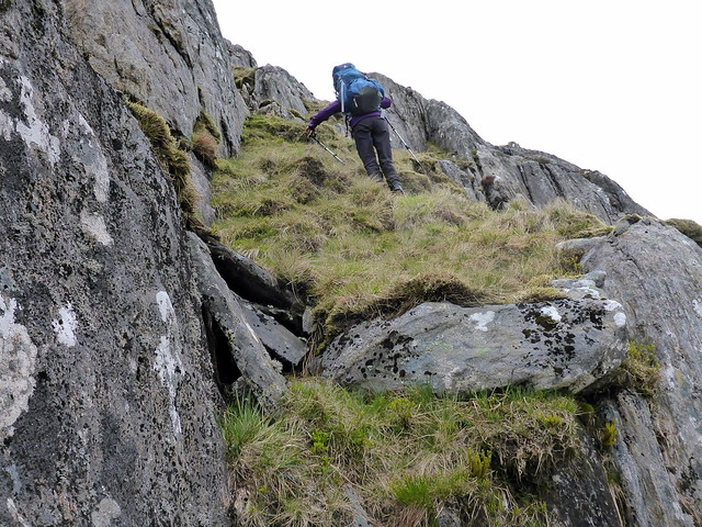
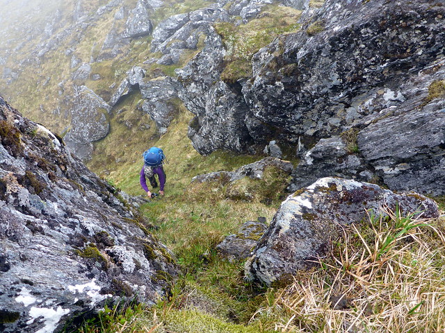
Picking our line up
 P1080238
 by
Al, on Flickr
Up
 P1080242
 by
Al, on Flickr
 P1080245
 by
Al, on Flickr
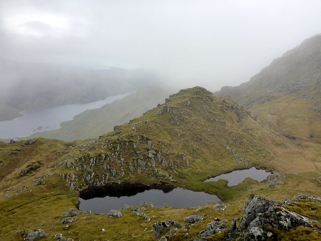
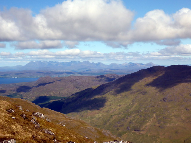
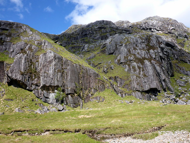
Landslip (in centre of photo)
 P1080247
 by
Al, on Flickr
 P1080253
 by
Al, on Flickr
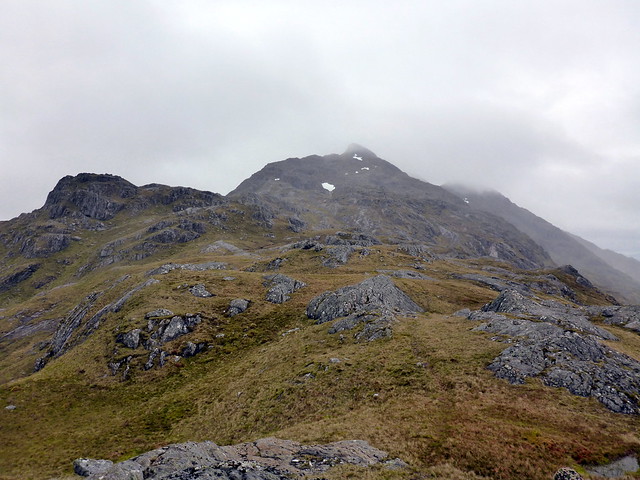
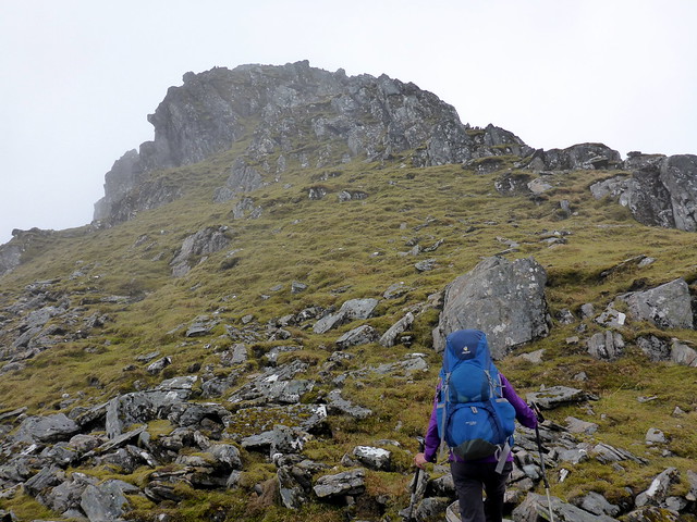
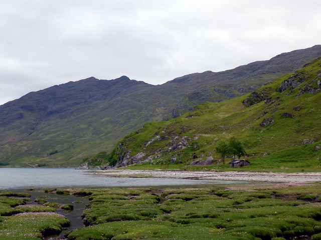
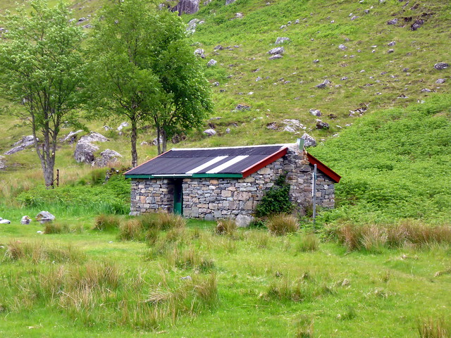
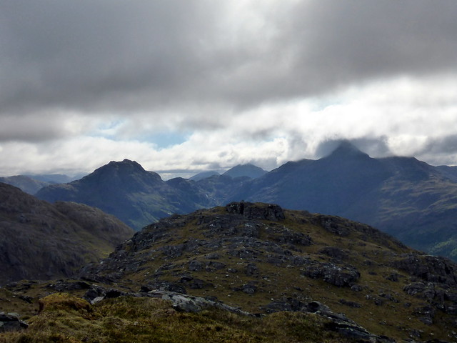
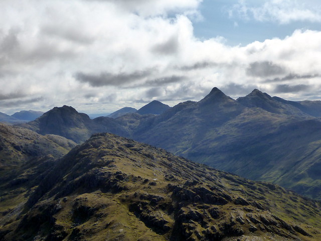
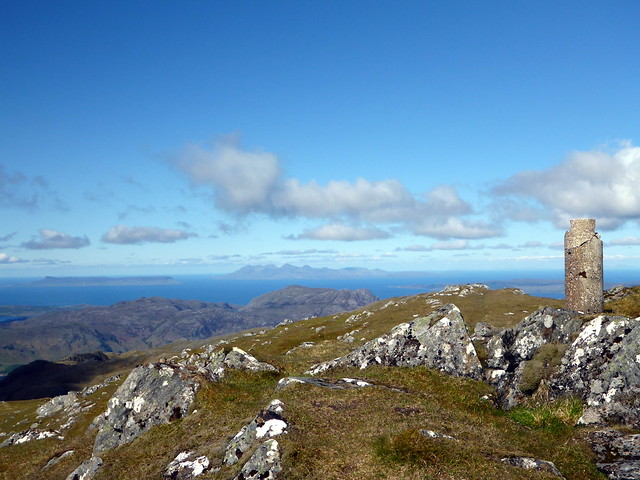
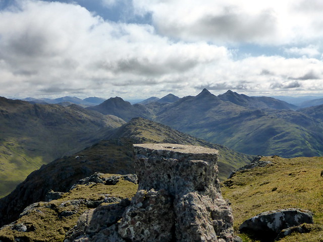
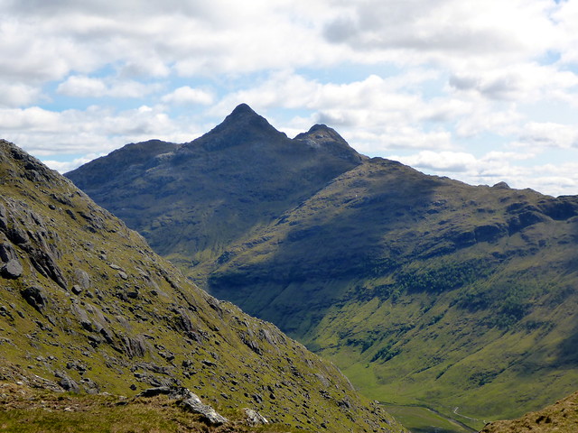
Up ahead we could see the narrow pointy top of the mountain, which looked alomst like the crest of a wave from this angle. Some small bits of scrambling up rocky/scree covered slopes and we were there - no views sadly, but a cracking hill. This was decision time - we could either head back down Meall na Sroine or we could continue along the crest of the ridge to Sgurr na h-Aide and onwards to Knoydart. Without much vacillation we continued on our way. Sgurr na h-Aide used to be the Corbett summit until re-measurement corrected matters. Getting over involves a little scramble, nothing particularly exposed, just a bit of fun. We could see Loch Morar to our left and Loch Nevis to our right, vaguely through the clag. Onwards for a short way we went - I had planned to trot over to Sgurr nam Meirleach and descend along it's shoulder, but the shorter option was to drop down into Coire Dubh - on the map it had looked rather steep, but - provided the gorge of the Allt a'Choire Dubh was avoided by heading over to the west, it looked serviceable. Quite painful on Allison's knees, mind. It's quite a long way down, to sea level. At the bottomwe crossed over Finiskaig where the ground was a bit marshy then nipped over the Finiskaig river to the fabled Sourlies bothy. Had to have a look in as we went past - 3 lads who had come up from Glenfinnan were making themselves comfortable. Chatted briefly then we pressed on.
Summit of Bidean
 P1080254
 by
Al, on Flickr
Another view of landslip
 P1080255
 by
Al, on Flickr
 P1080256
 by
Al, on Flickr
 P1080259
 by
Al, on Flickr
Nearing summit
 P1080261
 by
Al, on Flickr
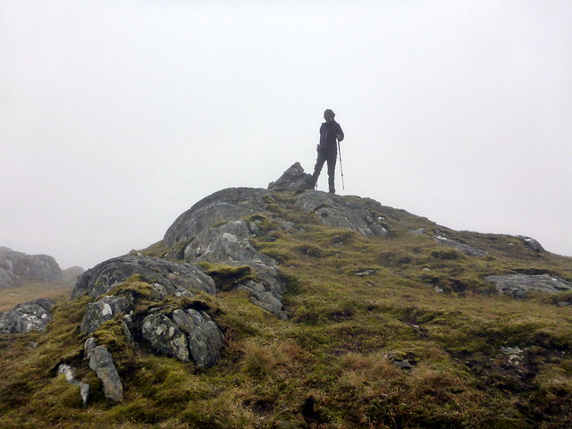
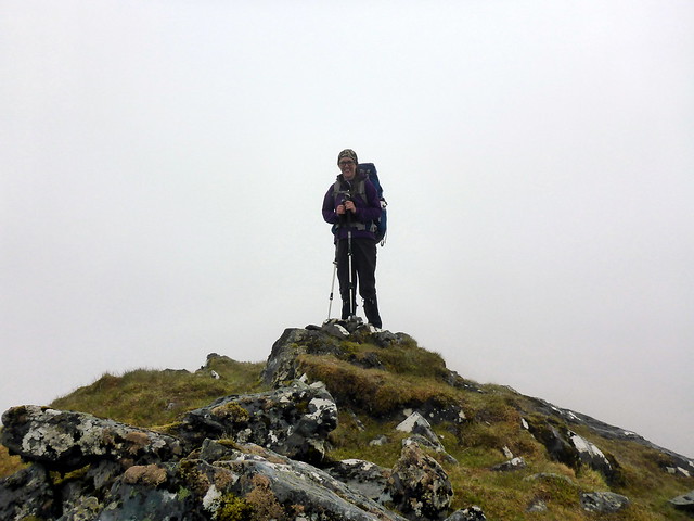
Summit Bidean
 P1080263
 by
Al, on Flickr
 P1080264
 by
Al, on Flickr
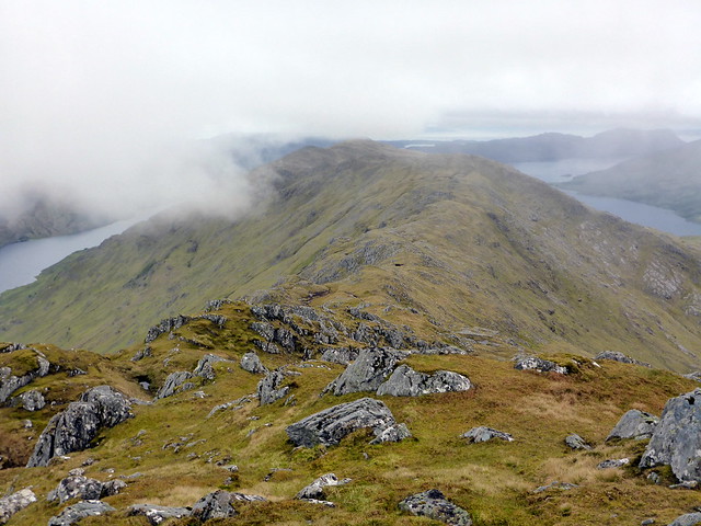
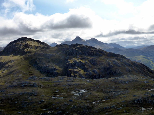
On towards Sgurr na h-Aide
 P1080266
 by
Al, on Flickr
 P1080268
 by
Al, on Flickr
Loch Morar
 P1080271
 by
Al, on Flickr
Loch Nevis
 P1080275
 by
Al, on Flickr
Final steep pull to summit
 P1080277
 by
Al, on Flickr
West from Summit Sgurr na h-Aide
 P1080280
 by
Al, on Flickr
West along the back of the mountain to meall na Meirleach
 P1080282
 by
Al, on Flickr
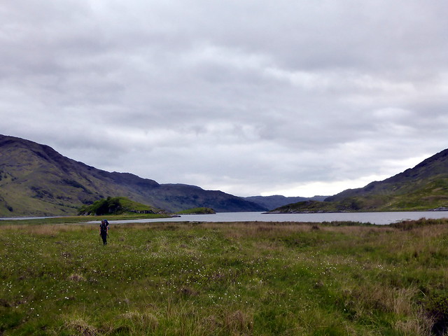
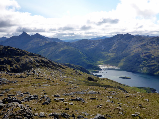
View to Sourlies
 P1080285
 by
Al, on Flickr
Ben Aden, Sgurr na Ciche
 P1080292
 by
Al, on Flickr
Descent
 P1080293
 by
Al, on Flickr
 P1080296
 by
Al, on Flickr
 P1080299
 by
Al, on Flickr
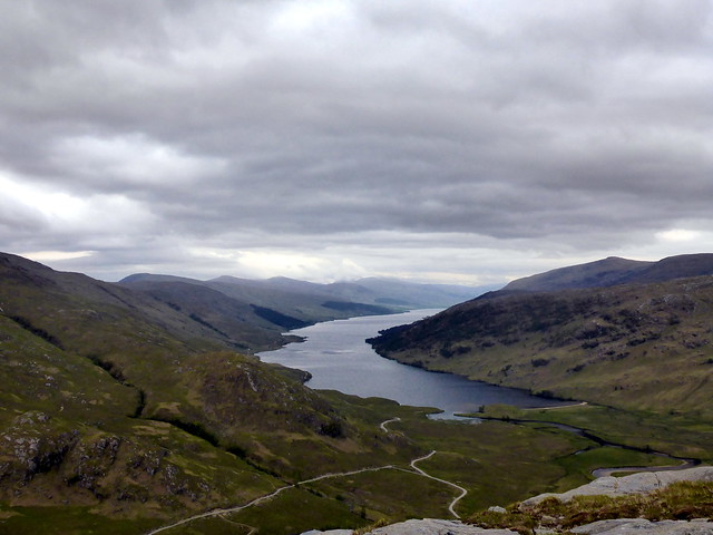
Sourlies, Beinn Bhuidhe behind
 P1080300
 by
Al, on Flickr
 P1080301
 by
Al, on Flickr
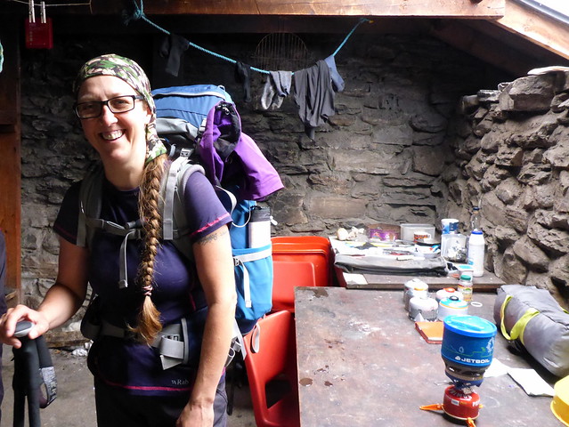
Brief pop inside
 P1080302
 by
Al, on Flickr
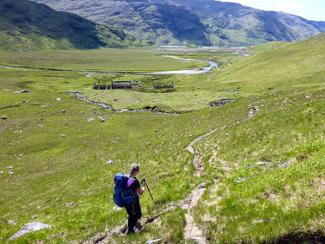
The tide was in so we had to come up onto the shoreline at Strone Sourlies and followed the marshy track towards Carnoch. This was swampy in places - I really think the MBA should improve the approach roads to their bothies

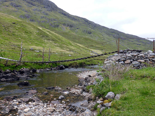
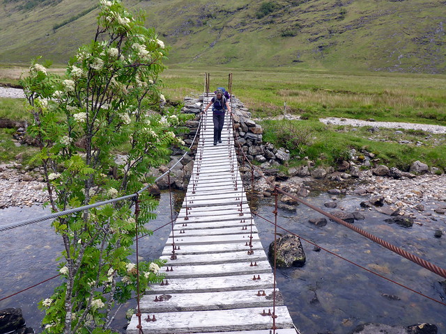
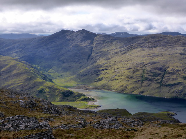
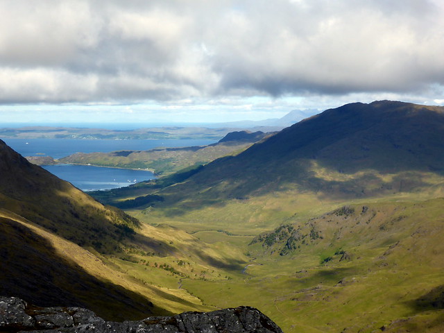
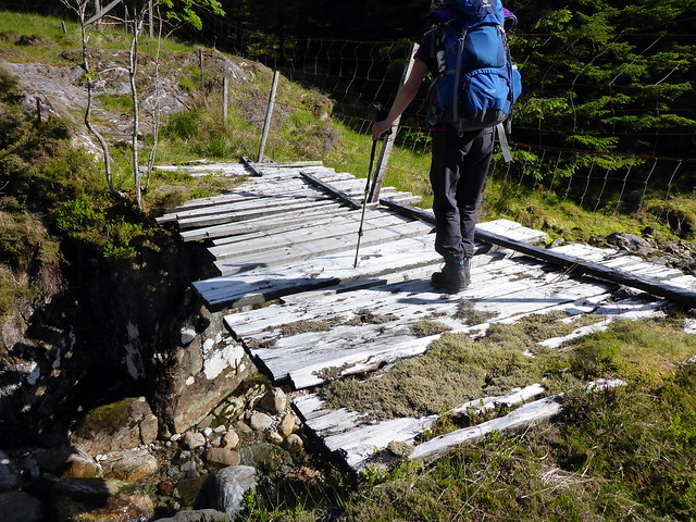
Crossing by means of the interesting bridge (not really necessary if you are weak of heart and the River Carnoch is as low as it was today). The views to Sgurr na Ciche (unfortunately still topped by cloud) and to Ben Aden were fantastic from here - I can only wonder what it might have been like to live in the (now ruined) cottages at Carnoch and have these hills for company in all weathers. We took ourselves into the smaller of the two ruins to cook our meal - the floor largely free from weeds although quite a lot of trash around, mostly half burnt, including a leather luggage tag from someone from Germany. What should we do? It was getting on for 7pm - we could camp down at this level, or we could make it up to the bealach between Sgurr Sgeithe and Mam Bhasiter at around 550m. Allison was tired and in pain - we'd been walking for 10 hours already, but I knew tomorrow was going to be a long day and didn't fancy starting with a 550m ascent... we'll go up tonight. The path is actually pretty good - once you find the start of it (hint - just about 100m after the dodgy bridge there's a large black pipe - path starts opposite it as a tiny track in the grass). We zigged and zagged as effortlessly as possible up to the bealach and scouted about for a place to pitch. The map suggests a flattish area just to the NE of the termination of the shoulder of Mam Bhasiter and indeed there were suitable spots there. It was windier than anticipated, still dry. We had a view down to Inverie Bay although clouds were down preventing a wider vista. Unfortunately, other than a yellowish tinge, there wansn't much of a sunset.
Along the shore from Sourlies
 P1080303
 by
Al, on Flickr
Ben Aden - steep from this side!
 P1080305
 by
Al, on Flickr
Across the bogfield
 P1080306
 by
Al, on Flickr
Ricketty bridge
 P1080308
 by
Al, on Flickr
You've been warned
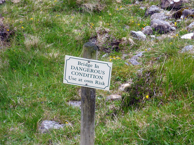 P1080309
 by
Al, on Flickr
 P1080311
 by
Al, on Flickr
Allison still not looking very convinced!
 P1080312
 by
Al, on Flickr
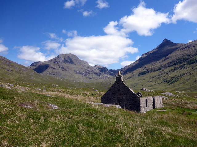
Ruined cottages at Carnoch
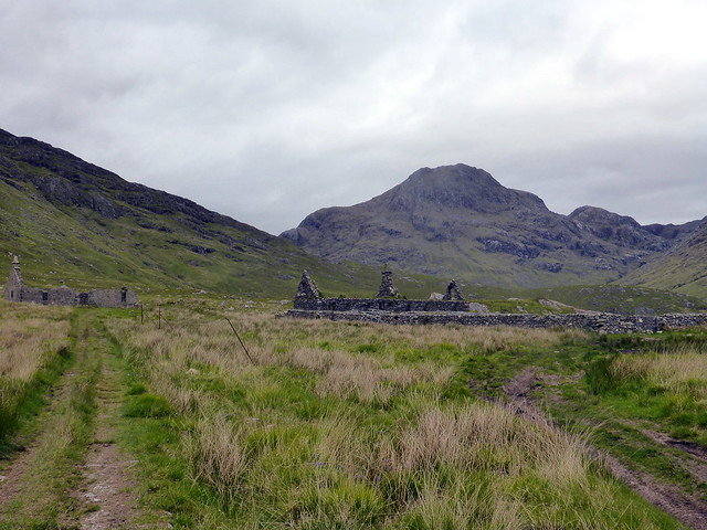 P1080313
 by
Al, on Flickr
Mealtime
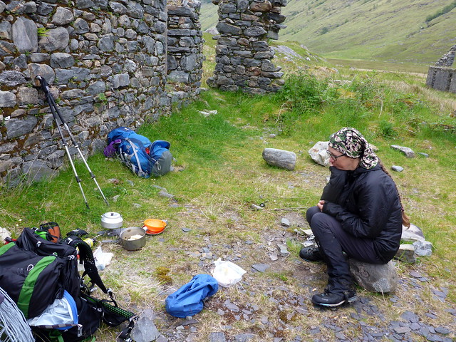 P1080314
 by
Al, on Flickr
Up towards the bealach
 P1080315
 by
Al, on Flickr
Good track
 P1080317
 by
Al, on Flickr
 P1080319
 by
Al, on Flickr
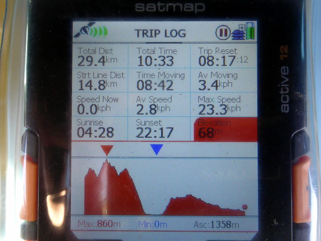
The day's stats (friday night's ascent missing)
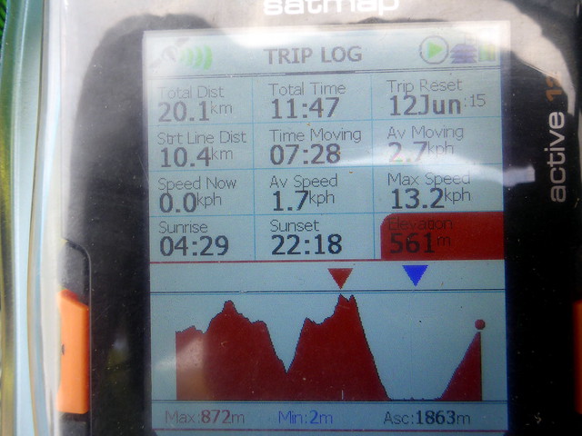 P1080320
 by
Al, on Flickr
Pitch, Inverie Bay ahead
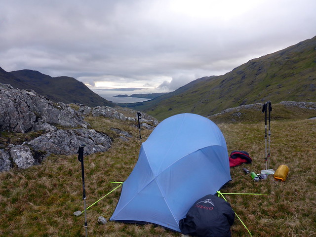 P1080322
 by
Al, on Flickr
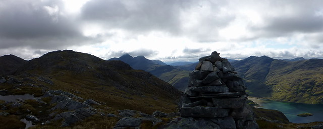
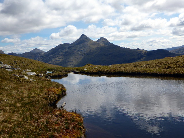
Bidean a'Chabhair
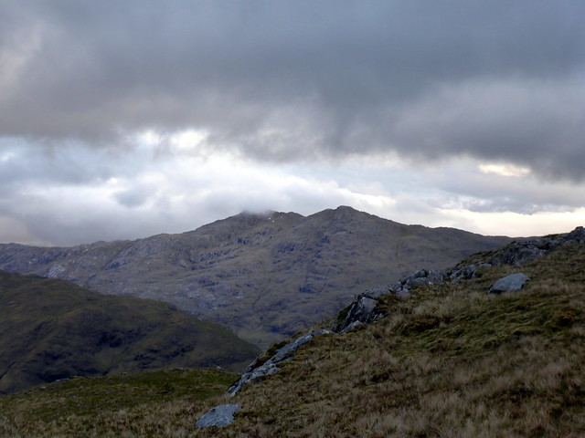 P1080324
 by
Al, on Flickr
The night was colder than the previous one and wooly hat in the sleeping bag was required. It also rained overnight which hadn't been forecast and I was rather worried that the fine weather predicted for Sunday wouldn't materialise. Up quite early around 7 - grey and cold. Bits of drizzle. Clouds not too low however. Chilly cutting wind meant belay jacket and gloves a necessity whilst cooking porridge. We decided to leave the tent pitched and take only essentials in our rucksacks. I'd looked at the map and reckoned that it should take us about 2 hours there and back - Beinn Bhuidhe was a grassy looking hill and we were already at 550 of the 855m ascent. But hey - this is Knoydart, I should have known better
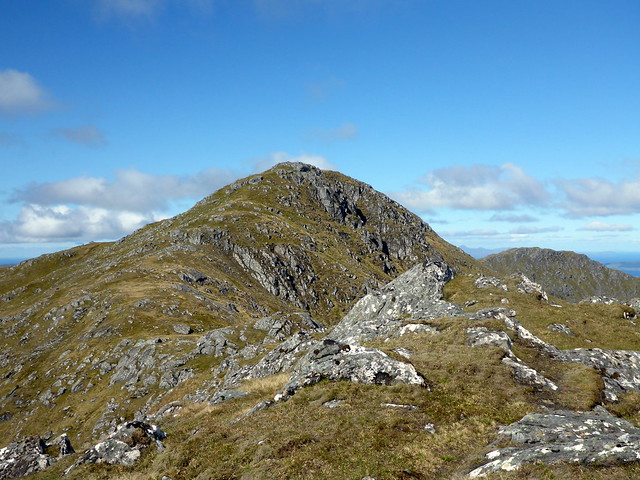
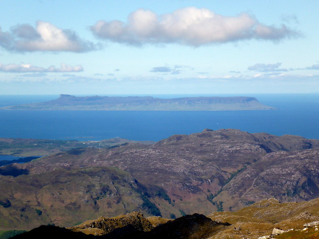
There's an almost Graham - Mam Bhasiter - in the way which rises to 714m and fails in Graham status by only around 4m of descent between it and Beinn Bhuidhe - so by the time the several rocky tops of Bhasiter have been negotiated you are right back down at 574m. And it's a longer way than it looks too! From Mam Uchd we climbed up Sgurr an t-Saigart which ends in a 50m bluff that looks quite tricky. We enjoyed a little scramble in taking this head on, but there's a path (which we used in descent) that is found round to the left and which avoids any difficulties. We'd dropped our rucksacks before going up here and it was further to the summit of Bhuidhe than I expected it to be. The weather was becoming increasingly summery as we walked on - now in baselayers - and the views went from breathtaking to stupifying. The whole of Skye lay before us, as did Eigg at her most elongated. Ceamreathahan and Cheesecake to the north, Ben More on Mull - ah - heaven

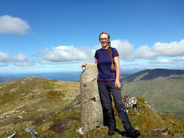
We spent a bit of time at the trig in the sun just enthusing about being here.
Morning sun on Beinn Bhuidhe
 P1080325
 by
Al, on Flickr
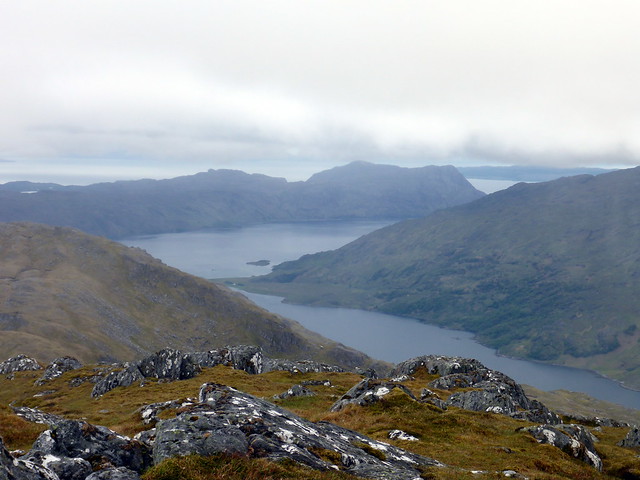
Bidean a'Chabhair
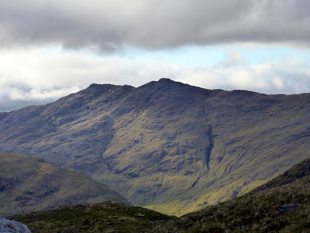 P1080327
 by
Al, on Flickr
Looking back down towards Sourlies
 P1080332
 by
Al, on Flickr
Mam Bhasiter
 P1080333
 by
Al, on Flickr
Aden, Sgurr na Ciche
 P1080334
 by
Al, on Flickr
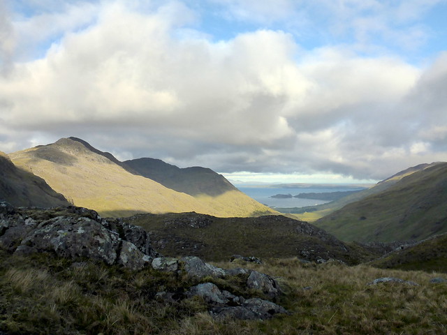
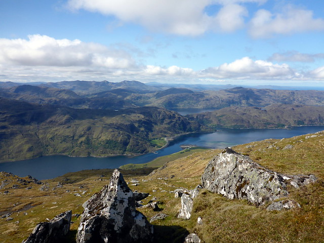
Inverie Bay, Skye just becoming visible
 P1080335
 by
Al, on Flickr
View back to Sgurr na Ciche
 P1080338
 by
Al, on Flickr
 P1080342
 by
Al, on Flickr
Beinn Bhuidhe - not just a wee grassy hill
 P1080343
 by
Al, on Flickr
Sgurr na Ciche, Mam Bhasiter in foreground
 P1080347
 by
Al, on Flickr
Loch Nevis
 P1080350
 by
Al, on Flickr
 P1080352
 by
Al, on Flickr
Rocky bluff
 P1080354
 by
Al, on Flickr
Aden, Dessarry Munros
 P1080357
 by
Al, on Flickr
Summit of Beinn Bhuidhe from top of the bluff
 P1080359
 by
Al, on Flickr
SW towards Mull
 P1080361
 by
Al, on Flickr
Trig with Rhum behind
 P1080362
 by
Al, on Flickr
 P1080364
 by
Al, on Flickr
Skye hills
 P1080365
 by
Al, on Flickr
 P1080366
 by
Al, on Flickr
 P1080368
 by
Al, on Flickr
 P1080369
 by
Al, on Flickr
Eigg
 P1080370
 by
Al, on Flickr
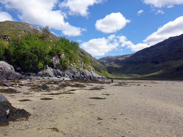
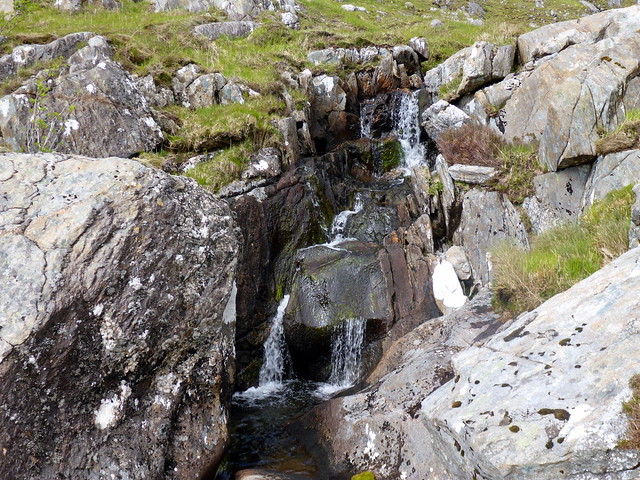
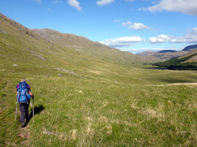
It was time to start the long descent - we headed back over Bhasiter then returned to break camp. My optimistic 2 hours had taken 3.5 and more time was used taking down the tent and packing the sacks. On our way down the track we met the lads from the bothy who were keen to get to Inverie for thier tea which they'd booked for 7.30. We walked along the sands towards Sourlies - the tide being out, meeting a flock of sheep on the beach which seemed a little weird. Sourlies was empty, but we stayed out in the sun on the boulders outside for our lunch. It was about 2pm when we finished, time to begin the return leg to Glen Dessarry. I wasn't quite sure how long this would take - not knowing the state of the track - but I knew we wouldn't be at the car anytime before 6.30pm. The first part of the track, along from Sourlies, is frequently boggy, then a better section takes you up into Mam na Cloiche Airde - passing several waterfalls on the way. More bogginess as you skirt by the two lochans - we encountered a couple of ladies who'd just been swimming in them, proper swimming cozzies and all. With the hot sun beating down on us the lure of cool refreshing water was considerable, but so was getting back home at a less than awful hour. Onwards through Bealach an Lagain Duibh with a fairly disappointing standard of track - rocky and boggy. Given the use this trail gets I was thinking it might be a bit more easy going. But again - it is Knoydart.
View back to Bhuidhe
 P1080375
 by
Al, on Flickr
 P1080376
 by
Al, on Flickr
Sgurr na Ciche
 P1080378
 by
Al, on Flickr
Descent to Carnach
 P1080382
 by
Al, on Flickr
A desirable view from this house
 P1080384
 by
Al, on Flickr
Sea pinks
 P1080387
 by
Al, on Flickr
Back towards Sourlies, tide out
 P1080389
 by
Al, on Flickr
Beach sheep
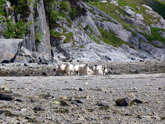 P1080390
 by
Al, on Flickr
Trail back from Sourlies
 P1080393
 by
Al, on Flickr
 P1080394
 by
Al, on Flickr
 P1080397
 by
Al, on Flickr
Beinn Bhuidhe
 P1080398
 by
Al, on Flickr
 P1080400
 by
Al, on Flickr
 P1080402
 by
Al, on Flickr
 P1080403
 by
Al, on Flickr
 P1080406
 by
Al, on Flickr
 P1080409
 by
Al, on Flickr
 P1080410
 by
Al, on Flickr
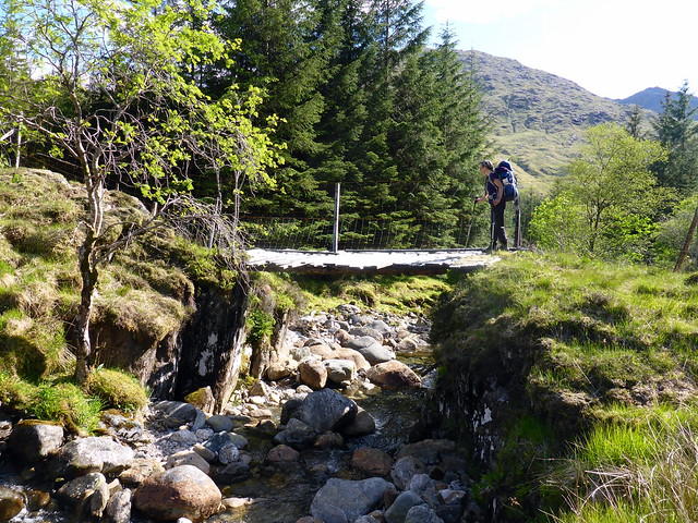
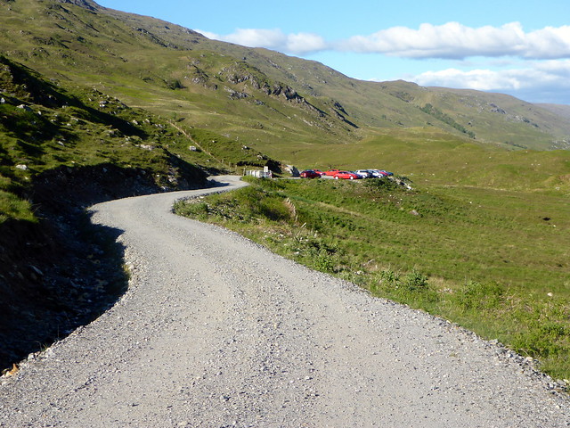
We got to the start of the trees and kept north of the treeline, with another interesting bridge to cross. It's easy to miss the way as the trail heads SW at Allt Coire nan Uth to this bridge. Finally the trees stop, Upper Glendessarry Lodge is reached and the track becomes a good quality surface, allowing us to improve our speed. Still another 4 or so km back to the carpark - a welcome sight. By this time it was almost 7pm and I knew we'd have to eat before starting back, so rustled up a veggie chilli in the boot of the Yeti which provided great shielding from the wind. Spoke to a gentleman who'd just come off the Dessarry 3 Munros then started back along the Loch Arkaig road. This is something probably best not done after hurredly consuming a large plate of chilli, as Allison was feeling quite queasy
Home just before 11pm - a great weekend out.
 P1080412
 by
Al, on Flickr
Another dodgy bridge
 P1080413
 by
Al, on Flickr
 P1080414
 by
Al, on Flickr
Glen Dessarry lodge in distance
 P1080415
 by
Al, on Flickr
A welcome sight!
 P1080416
 by
Al, on Flickr
Sunday's stats
 P1080417
 by
Al, on Flickr
Route
