free to be able to rate and comment on reports (as well as access 1:25000 mapping).
June is the month for bivouacs I read in another report here - yes I agree. Last year it was the Fisherfield, (
http://www.walkhighlands.co.uk/Forum/viewtopic.php?f=9&t=43303) this year Knoydart. Sgurr Mor is one of my last 3 Munros and I wanted to make it special. Ideally I had hoped to start at the Quoich dam and finish at Inverie, but the logistics proved impossible, so I decided to modify the standard route from Strathan by adding some Corbetts to the ascent.
The perils of the road along Loch Arkaig have been described by others - and some of the blind summits are truly scary - but on a sunny June morning the scenery was stunning: light green birch and oak forests, the blue loch and distant hills.
 Young Oak trees along loch Arkaig
  Looking up the loch to Sgurr na-h-Aide
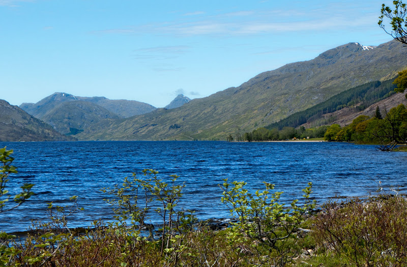 Further up the loch
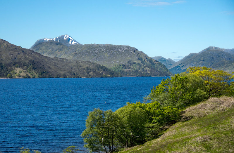 Sgurr Thuilm
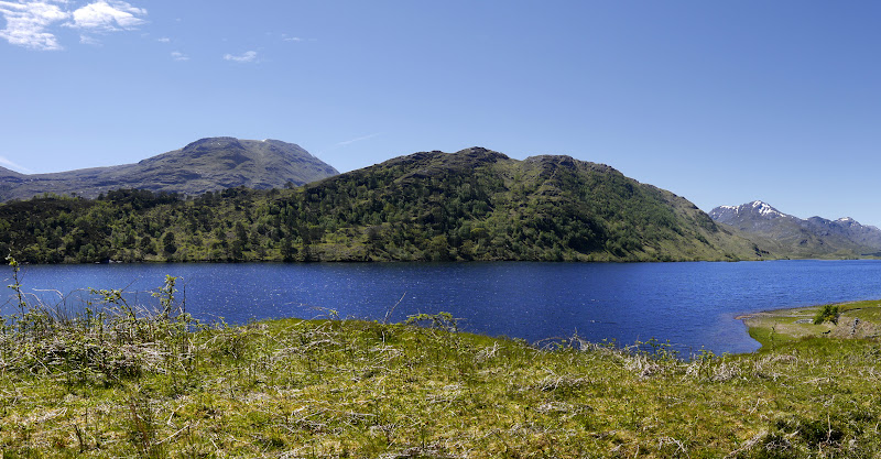 Gulvain to the South
 I reached the road end and set off about 1.00pm - with lightweight bivouac gear, my rucksack was down to about 5.5kg and I didn't really notice it. Some stags on a rock above the road stared down at me, but made no move to retreat - I doubt they will be so tame come August.
 Stags
Stags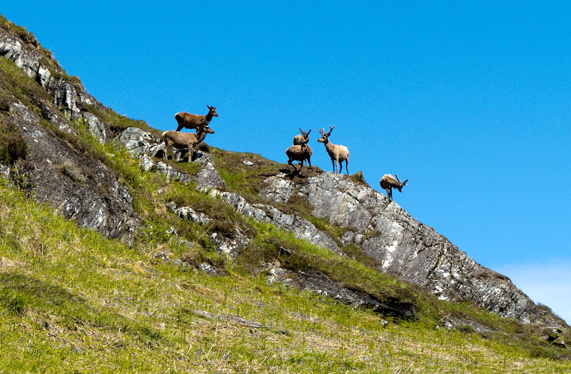 And hinds
I passed Strathan and headed up Glen Dessary
 Streap and Sgurr Thuilm from Strathan
 Looking up Glen Desssary to Sgurr na-h-Aide (often mistaken for Sgur na Ciche)
I like the new lodge - it's good to see investment in these remote Western glens, though a few trees around it would be an improvement, but I've always found the drab pine forests in this area depressing and out of place. Hopefully when they are finally harvested they won't be replaced - but according to the estate's "blurb" there are wild boar in them

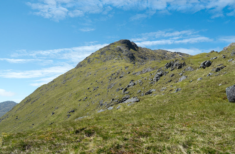
I turned R on the path over to Glen Kingie and Tomdoun, but as soon as I passed through the gap in the stock fence, I cut L across the burn and headed almost directly towards the summit of Sgurr Cos na Breachd laiogh my first Corbett.
 Looking up to Sgurr Cos na Breachd laiogh
 The going was very dry on this south facing slope - and I stopped for a rest around the 500m contour just below the flat part of the South East ridge.
 the top looks a bit closer now
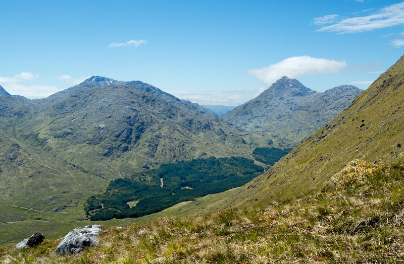 Sgurr na-h-Aide again beyond the pine forests
 looking back to the start - Gulvain behind
 The awful pine trees
  - the Corryhully hills behind
I pressed on beyond the level area and up the steep slopes to the summit ridge, and then North to the top - 3 hours - Starting so low - Loch Arkaig is only about 40m above sea level - these are big hills. I rested on the top for quite a while
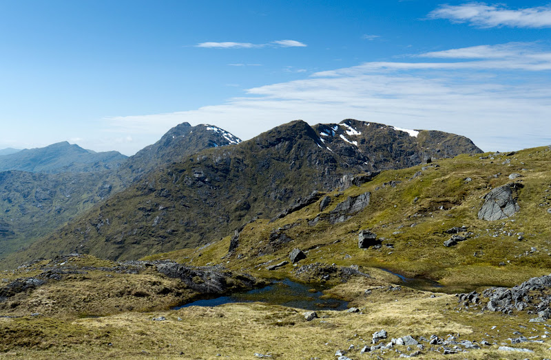 Sgurr nan Coireachan and beyond from the summit ridge
  A wider view from the same point
 Sgurr Mor, Sgurr an Fhurain and Gairich from the top
 The Ben beyond Gulvain
 The complex slopes leading up to Sgurr nan Coireachan - An Eag is just out of the picture R
I had found no water up to now and there was much less snow than I had expected - to run out of water in Knoydart - maybe the wettest place in the Highlands - would be bizarre indeed - but descending to the "famous" wall on the col I found a big snow patch wth a stream below.
After considerable thought, I decided to traverse under An Eag rather than climb over it. Routes like this can be time consuming if you encounter deep chasms, but a careful examination of the slope suggested it was OK. I could clearly see the stalkers path climbing up on the far side and it looked as if I could I could traverse below the large rock casting a shadow in the picture and reach it quite easily.
 Looking across to the traverse towards Sgurr Mor and Sgurr an Fhurain
In fact the natural line led me above this, but I reached the next col without difficulty in about 30 minutes. It was 6.0clock.
 Approximate line of my traverse - detail from the valley floor next day
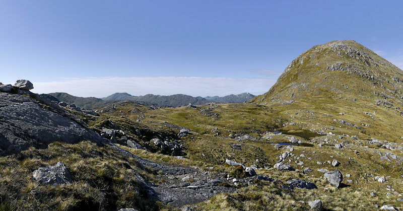 The route up Sgurr Mor from the col
 Looking West, the hills are becoming just silhouettes
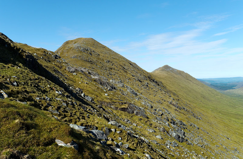
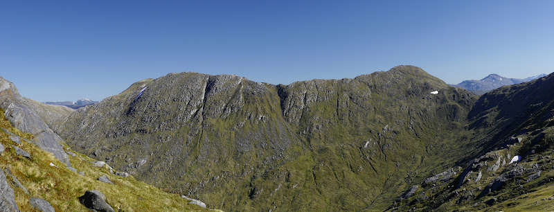 Looking back to Sgurr Cos na Breachd laiogh and it's Eastern ridge to Druim a Chuirn
 It's a full 450 m of ascent from this col to the top - including the sharp little drop beyond Sgurr Beag, but the easy angled zig-zags of the stalkers path rendered it relatively painless

. I reached Sgurr Beag at 6.30pm and rested for quite a while. I also found a big snow patch and topped up my water bottle with ice crystals.
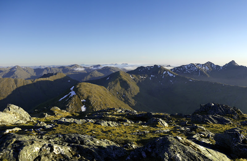
 Sgurr Mor from Sgurr Beag
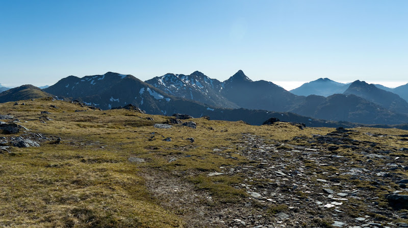 The view South of West - Sgurr na Ciche stands out: Ben Aden on the R
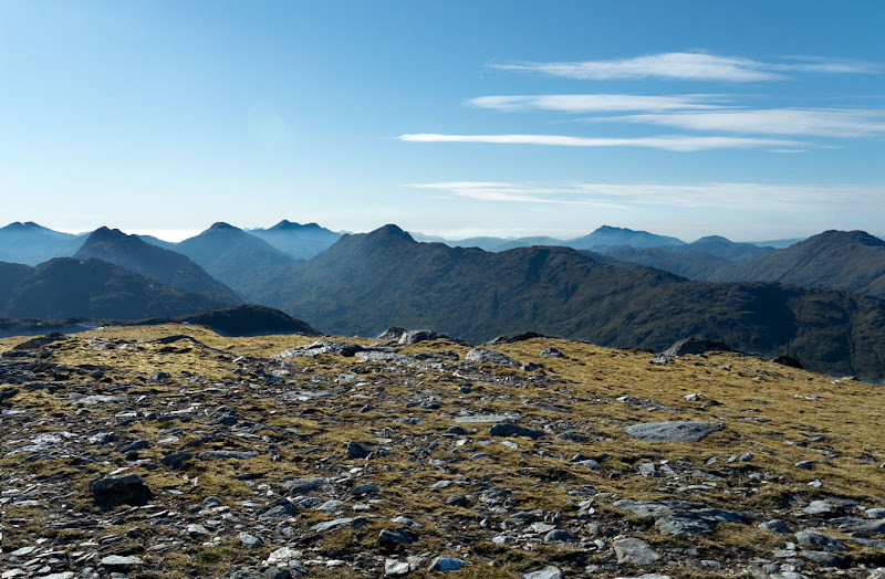 Ben Aden L to Beinn Sgritheall R
 North West, Beinn Sgritheall withThe Saddle and the South Cluanie ridge R of centre
 Sgurr Mor and Sgurr an Fhurain
 Gulvain
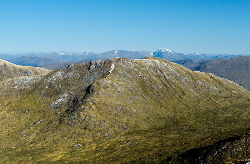 Fraoch Bheinn - Ben Nevis, Aonachs and Grey Corries behind
 Sgurr Mhurlagain
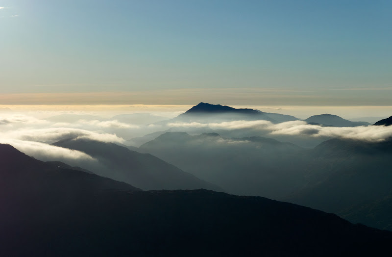
I left Sgurr Beag just before 7.00 and reached Sgurr Mor about 7.50. All the hills to the West were just Silhouettes and I sat by the Summit cairn and watched as the sun set and the mist slowly poured into the valleys.
 Looking West, Lochan nan Breac shines in the sun beyond Loch Quoich
 Silhouettes
I took a lot of photos - I couldn't decide which to leave out, so I've put most of them in with the times
7.50-8.00 .

 Garbh Chioch Mhor and Sgurr na Ciche
  Still sunny looking E to the other end of Loch Quoich
 I thought initially that this was The Saddle, but a few lines drawn on the map showed it to be Beinn Sgritheall one of the most Westerly Munros
 back the way I'd come
 A wider panorama
8.40 -8.45
 Sgurr Beag, An Eag and Sgurr nan Coireachan

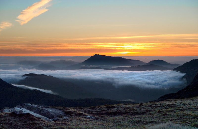
 Beinn Sgritheall floating in a sea of cloud
9.10.
9.25

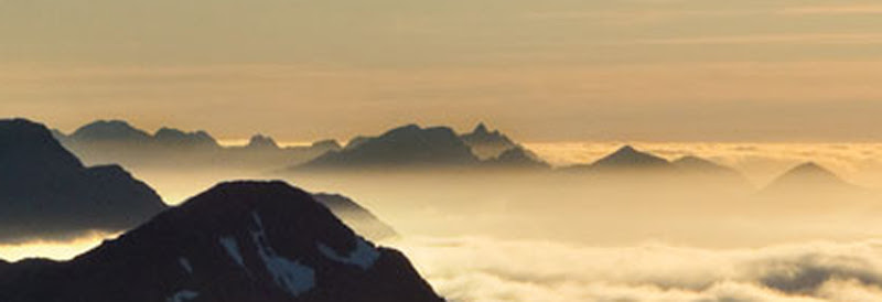 Detail of the Cuillins - Blaven and Clach Glas with the Pinnacle ridge behind
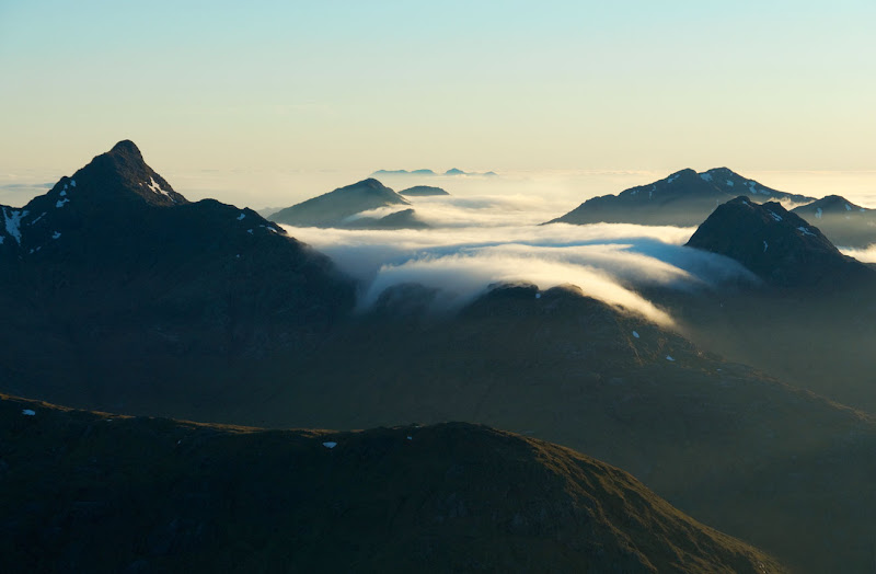 the mist creeps over the ridges
At this point it got a bit cold sitting by the cairn. I found a soft grassy hollow about 5 m below the summit and organised my bivouac. A cold wind kept blowing on my face but I put up my anorak hood which helped. There was a clear sky and I was several hundred feet higher than a year before - my Cumulus sleeping bag was just sufficient
But I kept sitting up to take more photos
10.10
10.20

I must have slept quite a bit as the next shot is at 3.20A.M
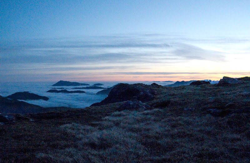 The afterglow of the sun has just moved North a bit.
I got up just after 4.00A.M. It was pretty chilly, but I packed everything away, put on overtrousers and gloves and walked the few yards back up to the cairn. To the West the hills were just greyish blue sitting on a sea of mist
4.10-4.15


 The twin peaks of The Saddle are on the extreme R
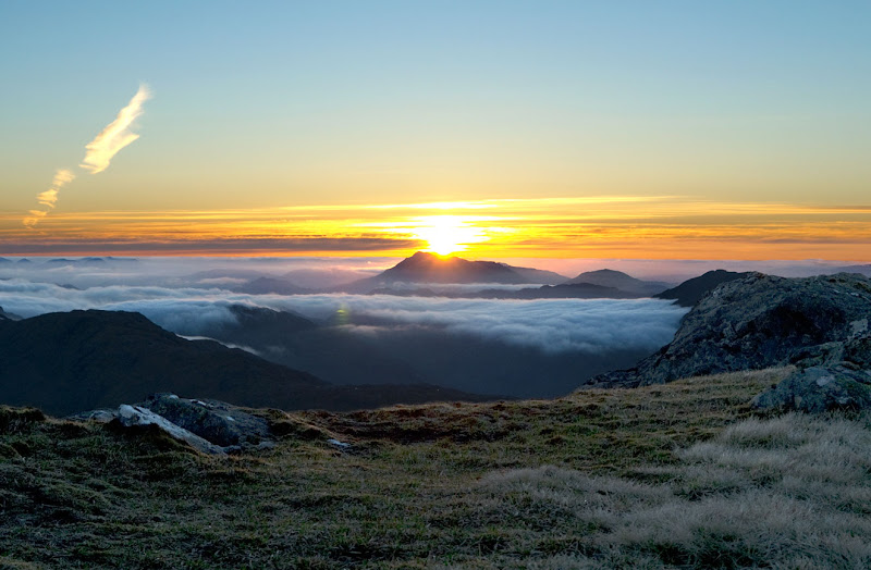
but further North the redness reappeared and the sun was just on the point of rising to the North
 the valleys were full of mist
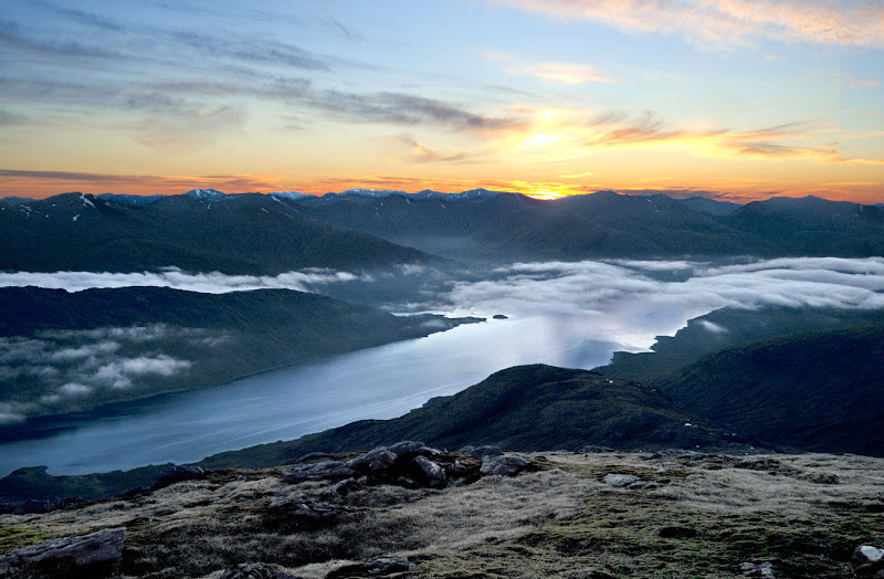
 A closer view
I set off down the path towards Sgurr an Fhurain, dumped my sack at the col and walked easily up to the top. I'm sure it has the necessary qualifications but this is a very painless Corbett from here.

5.30 - 5.40.
 looking back to Sgurr Mor
 a sea of mist
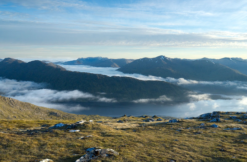 Part of Loch Quoich was clear
 Sgurr Mhurlagain - the mist appears to continue all the way up Glen Spean
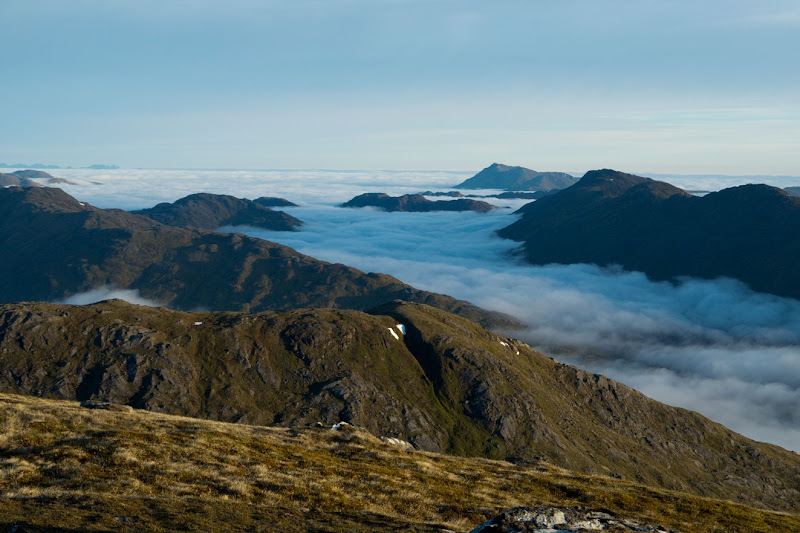
 a wider view West
 Fraoch Bheinn - mist spilling over from Glen Dessary
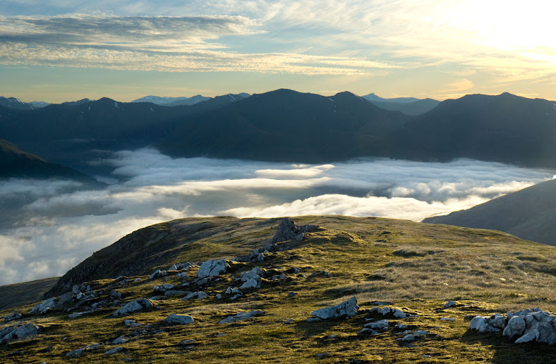 To the North East another sea of mist
 Early morning sun on Sgurr Mor
 A closer look at Sgurr na Ciche and its outliers. I've climbed it both from Glen Dessary and from the head of Loch Quoich - I don't remember it feeling as steep as it looks from here
 the mist extends right out to sea
 A wider view
 mist still spilling over from Glen Dessary
I walked back down and picked up my sack
6.15
 Looking North across Loch Quoich from the col
I set off straight down the hill aiming for the point where the Kingie looked crossable.
6.37
 The mist still hanging above the col leading to Glen Dessary
I had at one time entertained thoughts of doing Fraoch Bheinn and Mhurlagain on the way back - but it was just a pipe dream

These are big hills in tough country: I guess I could have forced myself over one of them, but they can be conveniently climbed together so there wasn't much point - well that's my story - and I'm sticking to it
I leave the full round to Weaselmaster, Black Panther or some other young blood.
Down in the valley the narrow little burns that descend this hillside were ringed in vegetation debris - one can imagine what they're like after heavy rain.
7.10
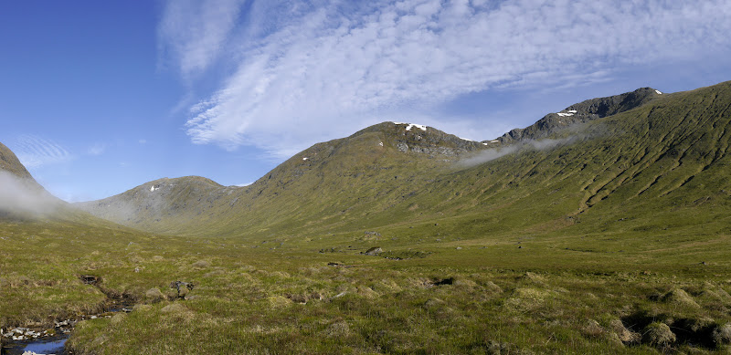 Looking up to the head of Glen Kingie - An Eag, Sgurr Beag and Sgurr Mor.
 People say this is a wonderful "wild" glen, but like so many other glens, to me it's a wasteland destroyed through overgrazing (by sheep and deer). How much nicer it would be if the river were fringed with Willow, Alder, Birch, Rowan, Hazel etc.
I crossed the river dryshod and noted all the remants of the ancient Caledonian forest in the peat bogs - It certainly would have been different then.
I didn't really want to return via Glen Dessary: if I went over the next col - between Fraoch Bheinn and Mhurlagan - I could drop straight down to the car: But the thought of walking the extra 2 Km to Kinbreak down the horrendously boggy floor of the valley dissuaded me. Those 2 Km would be much more easily walked on the track. So I set off up into the mist. The supposed path on this side is a figment of the imagination - just a different bit of bog, but after I struggled up to the flat section in the middle, the mist lifted a little and I found the reasonable path on the other side. I reached the track about 9.00 and I met several "early birds" setting off up Sgurr Mor - I was able to assure them that the rivercrossing was no problem. Back at the car 9.30 - just two to go
