free to be able to rate and comment on reports (as well as access 1:25000 mapping).
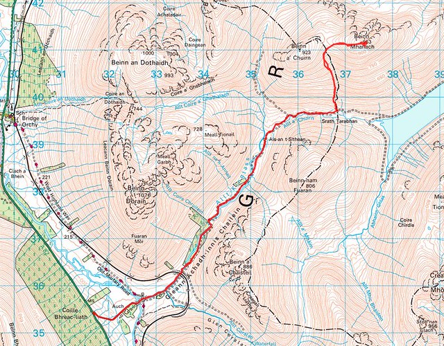 Route map
 by
Iain Cameron, on Flickr
On the evening of Saturday the 4th July, and with a weary dread, I opened up the MWIS forecast page for the whole of Scotland. It didn’t look marvellous for the west, with the east looking the best option for a day on the hill. However, upon waking the next day the weather looked decent, and after checking the marvellous Ben More webcam page I decided that I’d head to one of the most underrated hills in the Southern Highlands: Beinn Mhanach.
ChionophileNoun
1. any animal that thrives in winter conditions, especially one that thrives in snowFrom Ancient Greek χιών (khiṓn, “snow”) + -phile
Anyone with eyes that has walked in the hills recently can’t have failed to notice the very large splodges of snow still present. Although we’re in to July, and the creamy-looking vestiges of winter are waning, huge amounts of it persist above 3000ft. I mention this only because a large part of my motivation for virtually all my walks involves snow. It’s also one of the reasons I’ll probably never do all the Munros. Recording the amount of snow that lies on the hills of Britain during spring, summer and autumn is a time-consuming and – frankly – expensive past-time. I could go into the reasons for it in more detail here, but that’s a diversion from the trip.* Onward…
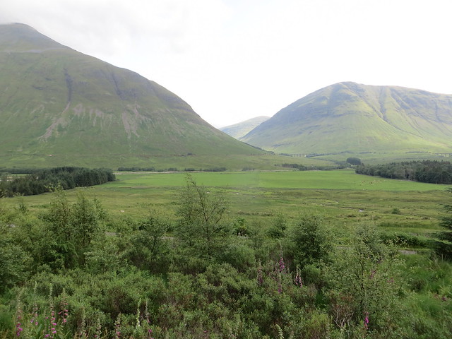 View from the road
 by
Iain Cameron, on Flickr
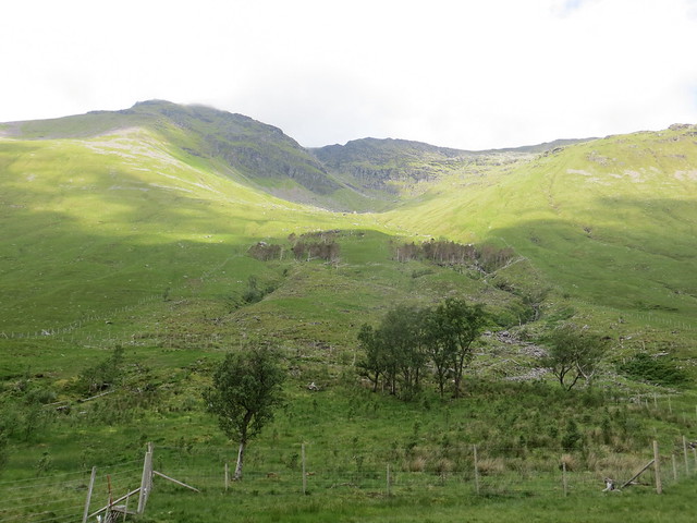
The viaduct and the entrance to Glenn Achadh-innis Chailein
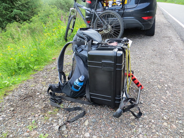 My backpack and drone
 by
Iain Cameron, on Flickr
The bike, the rucksack, and the drone.
Beinn Mhanach, as you can see from the map, involves a 5-mile approach from the A82. Five miles may not seem an awful lot when lightly laden, but when you’re carrying a drone and a backpack (total weight 15kg) it makes a difference to how mobile you are, and how far a day’s walking can be undertaken comfortably. I had decided beforehand that taking the bike would be a good idea, especially given the track to the foot of the hill is a pretty good one, and
relatively benign in terms of gradient. Also, taking the bike would prove useful later in the trip.
I set off in good weather, and blue skies were breaking out all over the place as I whistled down the Auch estate approach road. The first half a mile was dealt with without even pedalling a full cycle of the gear cogs. Fabulous.
Right from the off, Beinn Dòrain dominated the view to my left, and it’s easy to see why the local poet Duncan Ban Macintyre eulogised when he wrote his famous poem
Moladh Beinn Dòbhrain (English: "Praise of Ben Doran")An t-urram thar gach beinn
Aig Beinn Dòbhrain;
De na chunnaic mi fon ghrèin,
'S i bu bhòidhche leam…
Honour beyond each ben
for Beinn Dorain;
Of all I have seen beneath the sun,
the most glorious...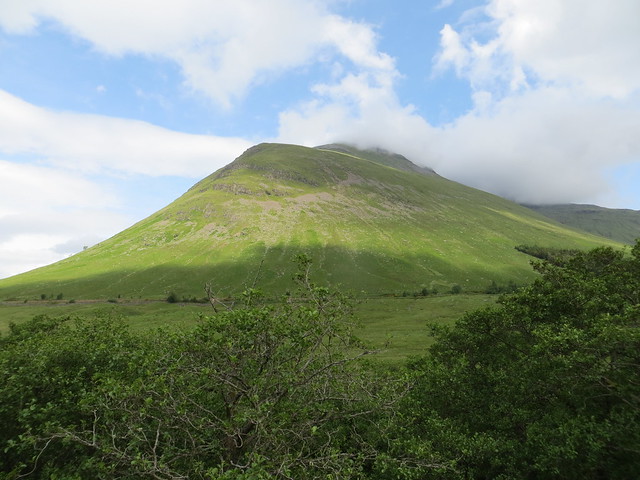 Beinn Dorain
 by
Iain Cameron, on Flickr
 Beinn Dorain
 by
Iain Cameron, on Flickr
The view of Beinn Dòrain’s Coire Chruitein from the glen below
Using the bike the first couple of miles past quickly, and with a following tailwind it made the heavy load on my back seem somewhat inconsequential. Also, the weather was improving all the while, and the views started to get better and better.
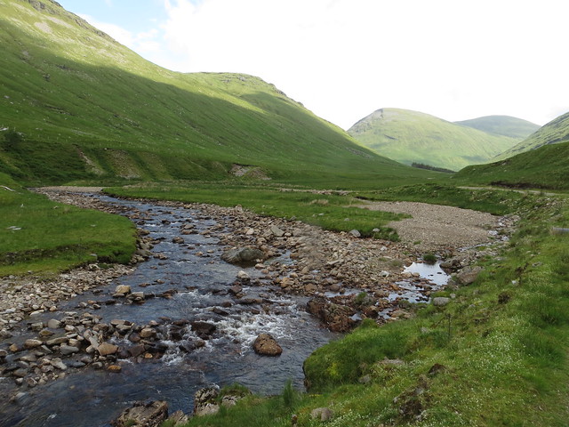 Allt Kinglass
 by
Iain Cameron, on Flickr
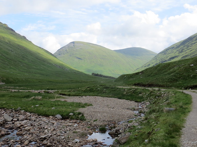 Approach to Beinn Mhanach
 by
Iain Cameron, on Flickr
Beinn Mhanach on the right
 Beinn Mhanach (right)
 by
Iain Cameron, on Flickr
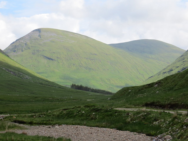
Close-up of Beinn a’ Chuirn and Beinn Mhanach
One of the unexpected bonuses of using the bike, particularly when there hadn’t been an awful lot of rain, was that fording the many river-crossings on this track became far less arduous. Normally I pack a pair of flip-flops when I’m in country like this, but the shallow(ish) streams meant I could just splash through the otherwise troublesome crossings
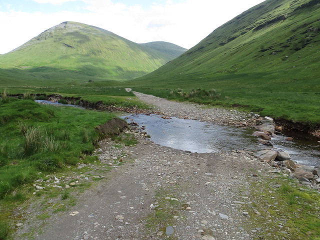 Ford
Ford by
Iain Cameron, on Flickr
One of the many water-crossings, easily dealt with by the bike.
After about 4 miles it was getting
hot. Fortunately for me, though, it coincided with the approach to Ais-an t-Sithean. This is the place where the aforementioned Duncan Ban MacIntyre lived for a time. I alighted to see if I could absorb any of the great man’s presence in the ruins of the old stone buildings. Alas, the adoption of the buildings into sheep-pens and dosing areas for the hated bah-ing ones removed any trace of Gaelic ambience that might have persisted.
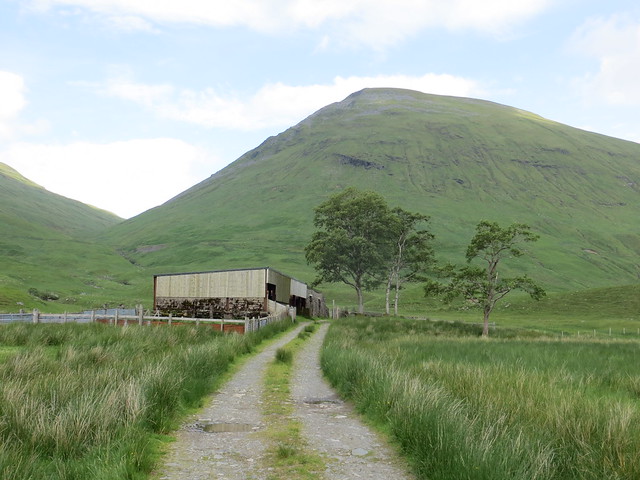 Approach to Ais-an t-Sithean
 by
Iain Cameron, on Flickr
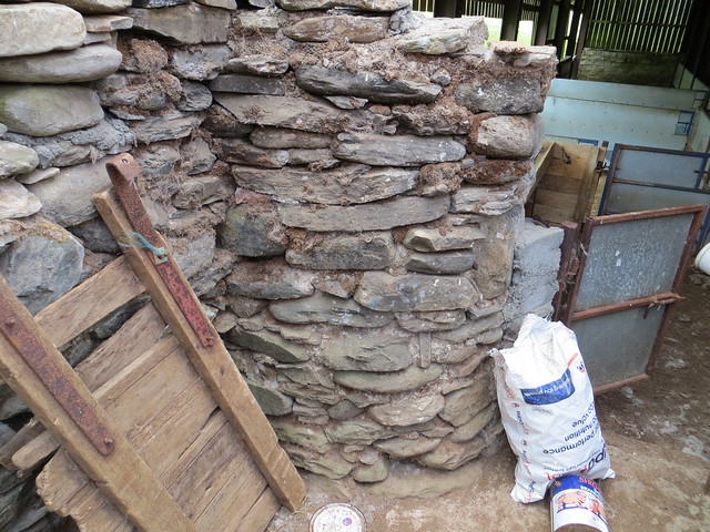
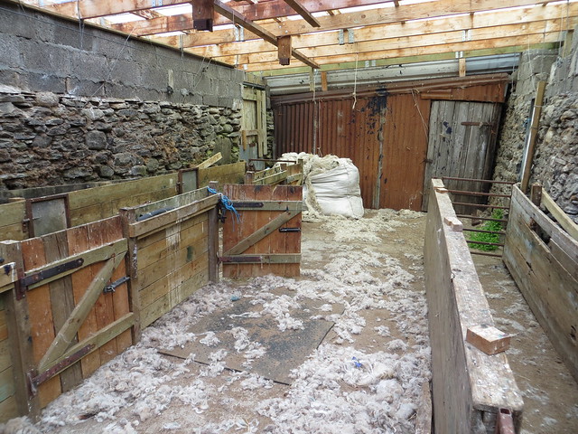 Ais-an t-Sithean
 by
Iain Cameron, on Flickr
The only bits of the original house that might have housed the poet were to be found in the rounded corners of the building, which give away its age.
 Ais-an t-Sithean
 by
Iain Cameron, on Flickr
Unable to contend with the flies that were now gathering, I jumped on the bike and started upon the final mile climb to the bealach of Srath Tarabhan, which was to be where the walk began.
The departure point from the track is impossible to miss. It is at the highest point of the glen, and if you start to descend towards the lovely Loch Lyon then you’ve gone too far. A fence running uphill towards some curious, semi-industrial water features was a perfect place for me to deposit the bike, and an obvious path running up the left-hand side of the chatty Allt a’ Chuirn was my target.
 The gully up the hill
 by
Iain Cameron, on Flickr
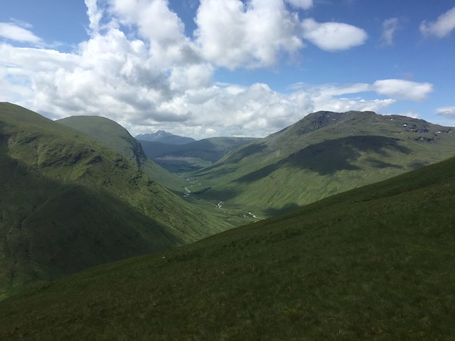
The walk started well, but the steepness of the slope (it is unremitting), the heat, and the weight of the pack and drone meant that progress was slow. However, this meant I could stop often and take in the increasingly beautiful views that were opening around me. In the distance, Ben Lui had now shaken its jacket of cloud and looked amazing. Across Loch Lyon the wonderfully photogenic Creag Mhor was blowing the cotton-wool clouds to one side. As well as this the view down Glenn Achadh-innis Chailein, with Beinn Dòrain on the right, got better and better.
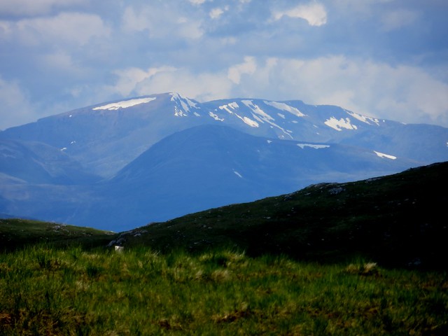
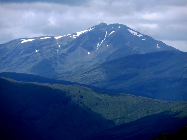 Ben Lui
 by
Iain Cameron, on Flickr
 Creag Mhor
 by
Iain Cameron, on Flickr
 https://flic.kr/p/vD34yY
 by
Iain Cameron, on Flickr
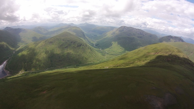
The slow ascent continued, but before too long I was emerging onto the flattish plateau between Beinn a’Chuirn and Beinn Mhanach. A welcome breeze greeted me, as well as some magnificent views to the north. Before me I could see Ben Nevis, the Aonachs and Ben Alder. In the extreme distance – masked by the blue heat-haze of the afternoon – was Braeriach and its environs. Magnificent!
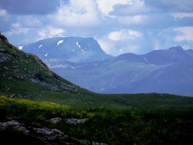 Ben Nevis
 by
Iain Cameron, on Flickr
 Aonach Beag & Mor
 by
Iain Cameron, on Flickr
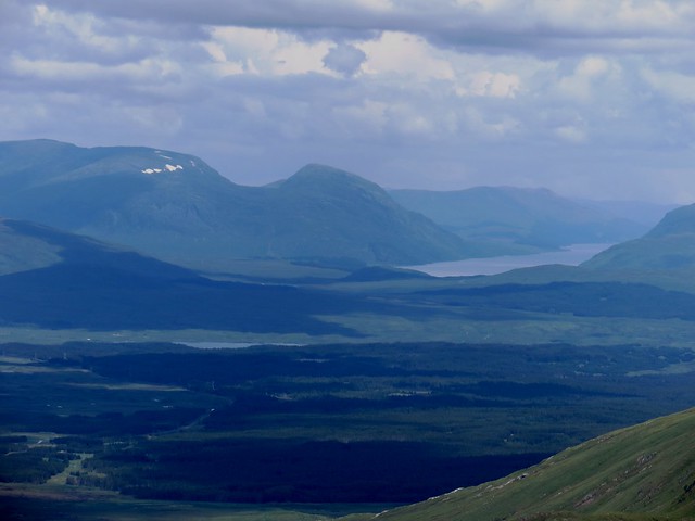 Loch Ericht & Ben Alder
 by
Iain Cameron, on Flickr
Creag Mhor by
Iain Cameron, on Flickr
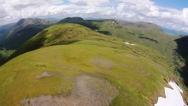
A short walk to the summit cone of the hill and I was fit for lunch. And what a place to have it! The central location of the hill meant that I had marvellous views in every direction. I picked out every hill in a 360 degree sweep as I munched my sandwiches and flapjack. Unencumbered by the weight of the pack I strolled around the plateau looking at each hill and how much snow it carried. ‘Lots’ was my assessment.
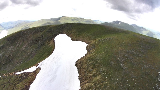
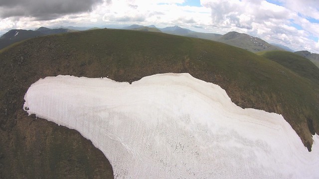
But now it was to business. Beinn Mhanach has, in common with many hills in the Highlands, a corrie with the word ‘sneachda’ in it. Those with any knowledge of Gaelic will know that this means ‘snow’. The Gaels, always canny with their names, obviously knew that this part of the world holds onto snow longer than other areas. And so it proved! Despite the hill being a good deal lower than the ones that surround it, it has more than possibly all of the Bridge of Orchy hills combined (in terms of volume). Not for nothing was Coir an t-Sneachda so called. Pictures would be required, and preferably from height…
Carrying the drone up a hill is always a gamble. Although it will fly in the wind it is not happy to do so. Luckily there was only a 5-10mph breeze blowing, which was no trouble whatsoever. The results were most pleasing.
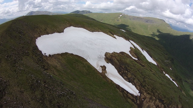 Coir an t-Sneachda (looking south west)
 by
Iain Cameron, on Flickr
 Towards Ben Lui
 by
Iain Cameron, on Flickr
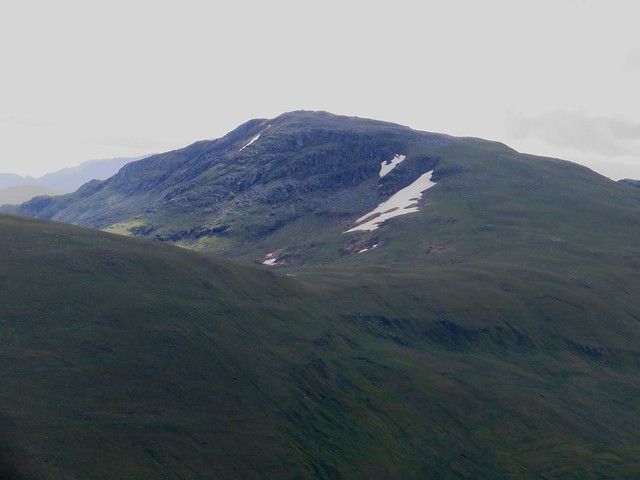
 Looking towards Beinn Heasgarnich
 by
Iain Cameron, on Flickr
 Overhead 2
 by
Iain Cameron, on Flickr
 Creag Mhor & Beinn Challum
 by
Iain Cameron, on Flickr
 Coir an t-Sneachda
 by
Iain Cameron, on Flickr
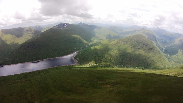
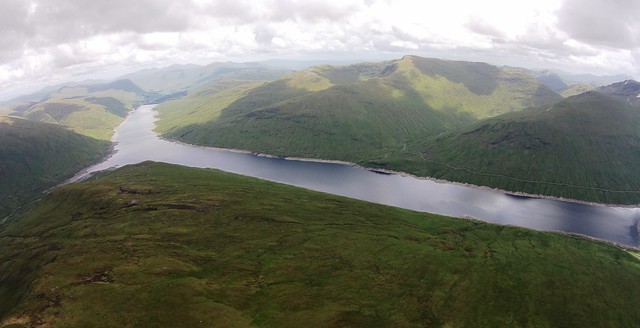 Loch Lyon
 by
Iain Cameron, on Flickr
The main patch of snow was well in excess of 150 metres long, and deep. I expect this to last a good while yet. Almost certainly into August, which for a 953m hill is remarkable. There was even enough for me to attempt a boot-ski!
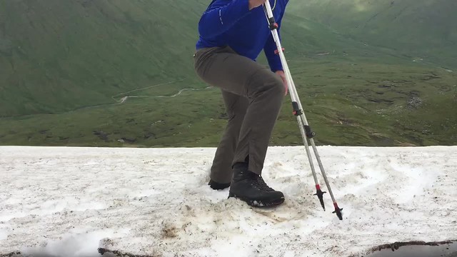 Boot skiing
 by
Iain Cameron, on Flickr
After all the fun was had, and the drone was safely packed away, I donned the rucksack and started to head back down the hill to the awaiting bike. Not a moment too soon, as it happens. The weather was not starting to close, and I could see approaching from the south a rather sharp looking shower coming in from the hills around Crianlarich. Hastening down the hill the rain started, but only lightly. By the time I had got back to the car it was starting to
really come down. However, feeling good at the day’s results, a soggy pair of underpants didn’t seem like too much of a penance.
Drone video from the trip,
here.
Full suite of pictures
https://www.flickr.com/photos/28183399@N03/sets/72157655076373320* Have a look at my Twitter feed: @theiaincameron
