free to be able to rate and comment on reports (as well as access 1:25000 mapping).
This was a superb walk for the first day of our stay at Kinlochewe. The first ever Munros for two of our party - and, as it turned out, it was also to be my last Munro walk, before the medics agreed that my left knee needed replacing as a matter of urgency. (Update: my post-operation Munro count is now standing at 11, after a great week staying in Ballater).
The shore of Loch Torridon was bright and calm - a perfect April day.
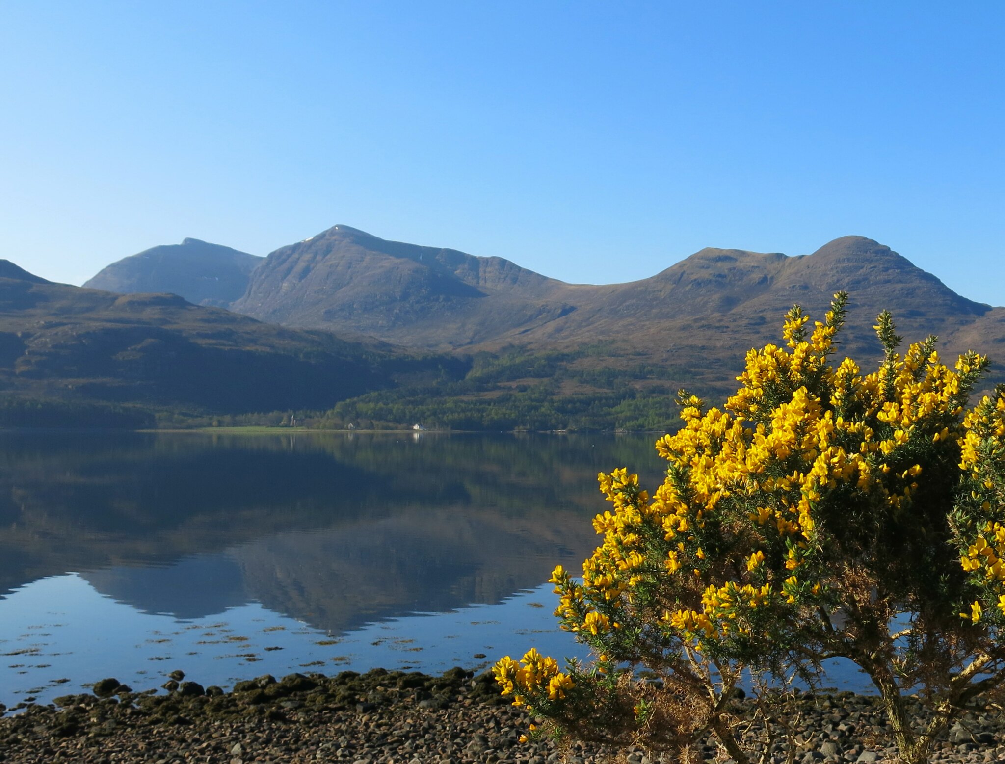 IMG_0962
 by
Tim Pearce, on Flickr
We set of up the path towards Coir'an Laiogh. Looking back, the mirror-like appearance of the loch was even more evident. My son, aged 14 at the time, was enjoying the view on this, his first Munro. (According to Peter Barton, author of a guidebook to this area, Tom na Gruagaich means "Hill of the Fair Young Person" so that's appropriate). The "blue remembered hills" from left to right are Beinn na Eaglaise with Maol Chean-Dearg behind it, then An Ruadh Stac, then the Beinn Damh summits of Spidean Coire an Laiogh and Spidean Toll nam Biast, with the outlier of Sgurr na Bana Mhoraire to the right of the deerstalker (don't know why he was wearing that...)
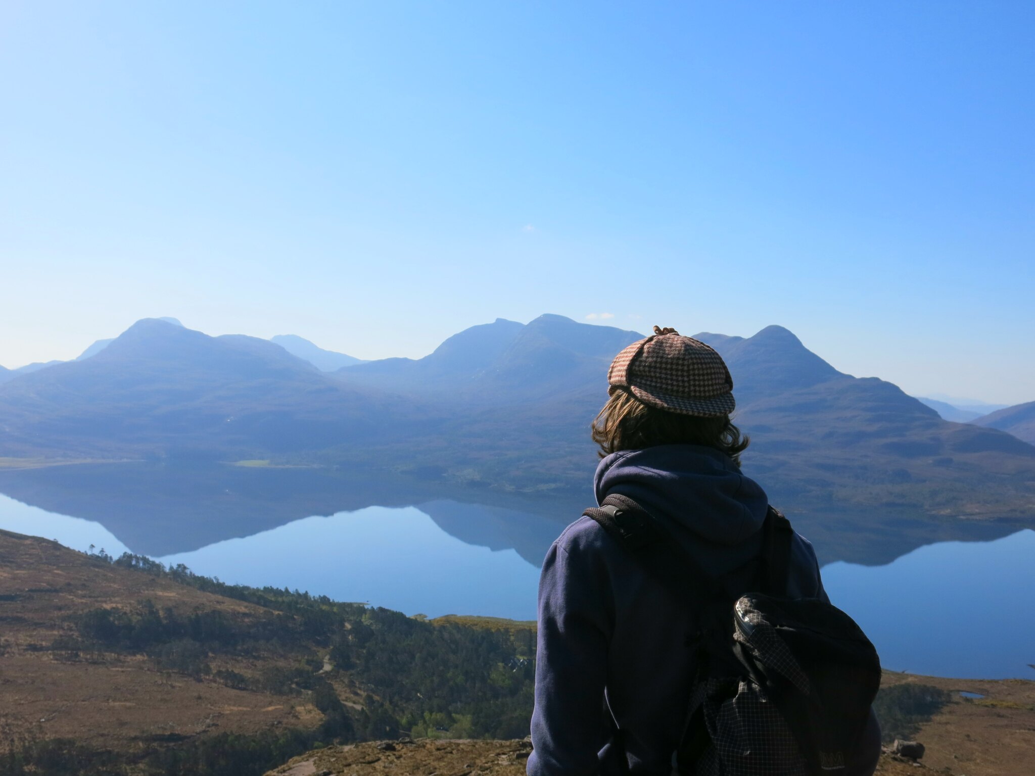 IMG_0978
 by
Tim Pearce, on Flickr
The nearby views of Alligin from the mouth of the corrie were great too -
 IMG_0990
 by
Tim Pearce, on Flickr
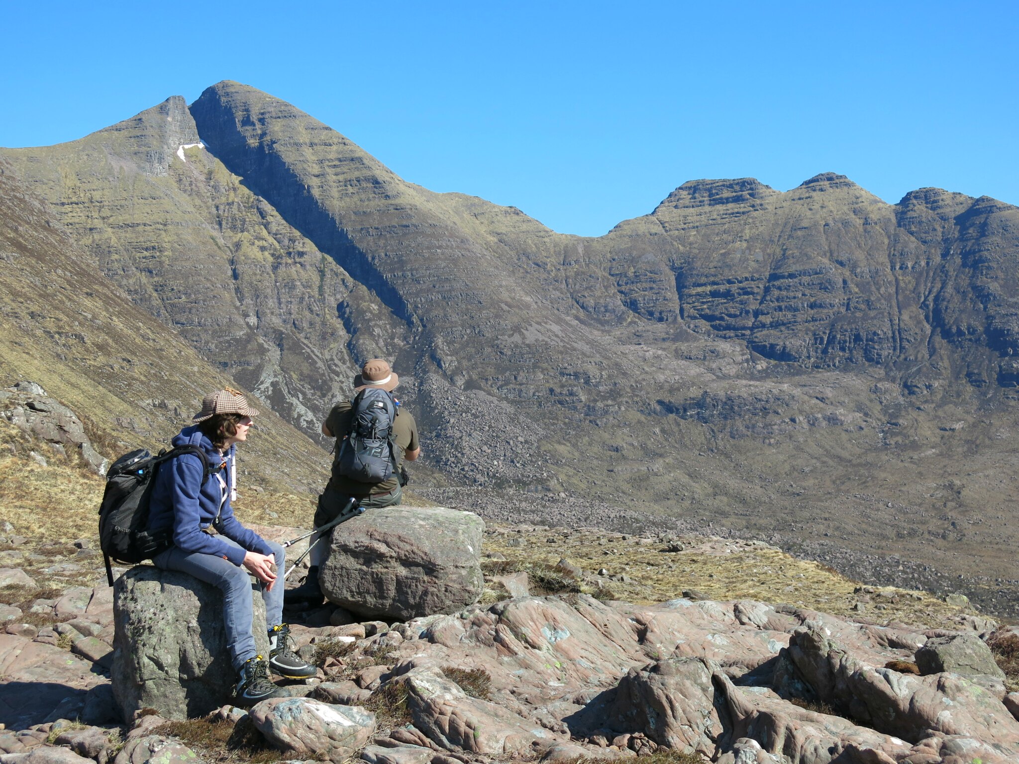
Close up of the three Alligin Horns across Toll a'Mhadhaidh. The "sub-pimple making a smaller fourth Horn" (Barton again) can be seen on the far right immediately above Stephen's hat.
 IMG_0991
 by
Tim Pearce, on Flickr
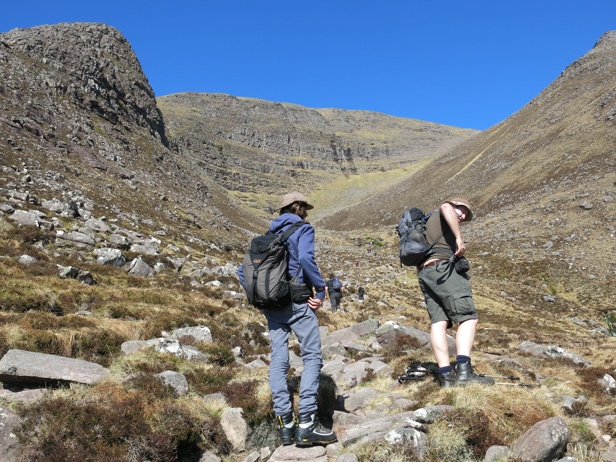
Then we turned to the task in hand. It was a steady plod up into Coir'an Laiogh. The path is really well-constructed. Even though I was walking with one knee that was practically stripped of cartilage, I found it a suprisingly easy way to gain height fast. And the little stream in the corrie is a nice companion. But next time (with the advantage of a pain-free metal knee) I think I would try something different and follow the lead of another Beinn Alligin WH report, scrambling up the left-hand corrie edge (marked on the map as Na Fasreidhnean.)
 IMG_1016
 by
Tim Pearce, on Flickr
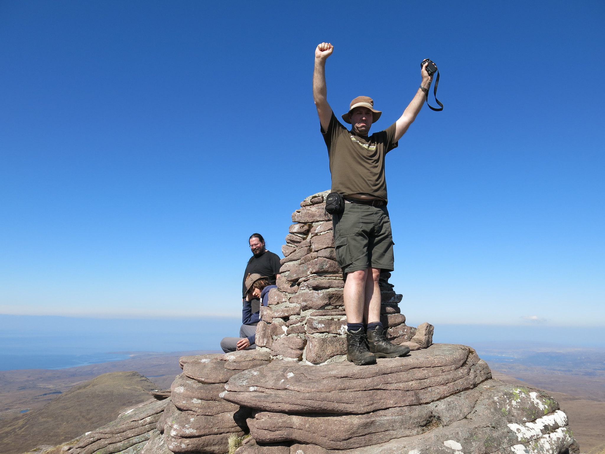
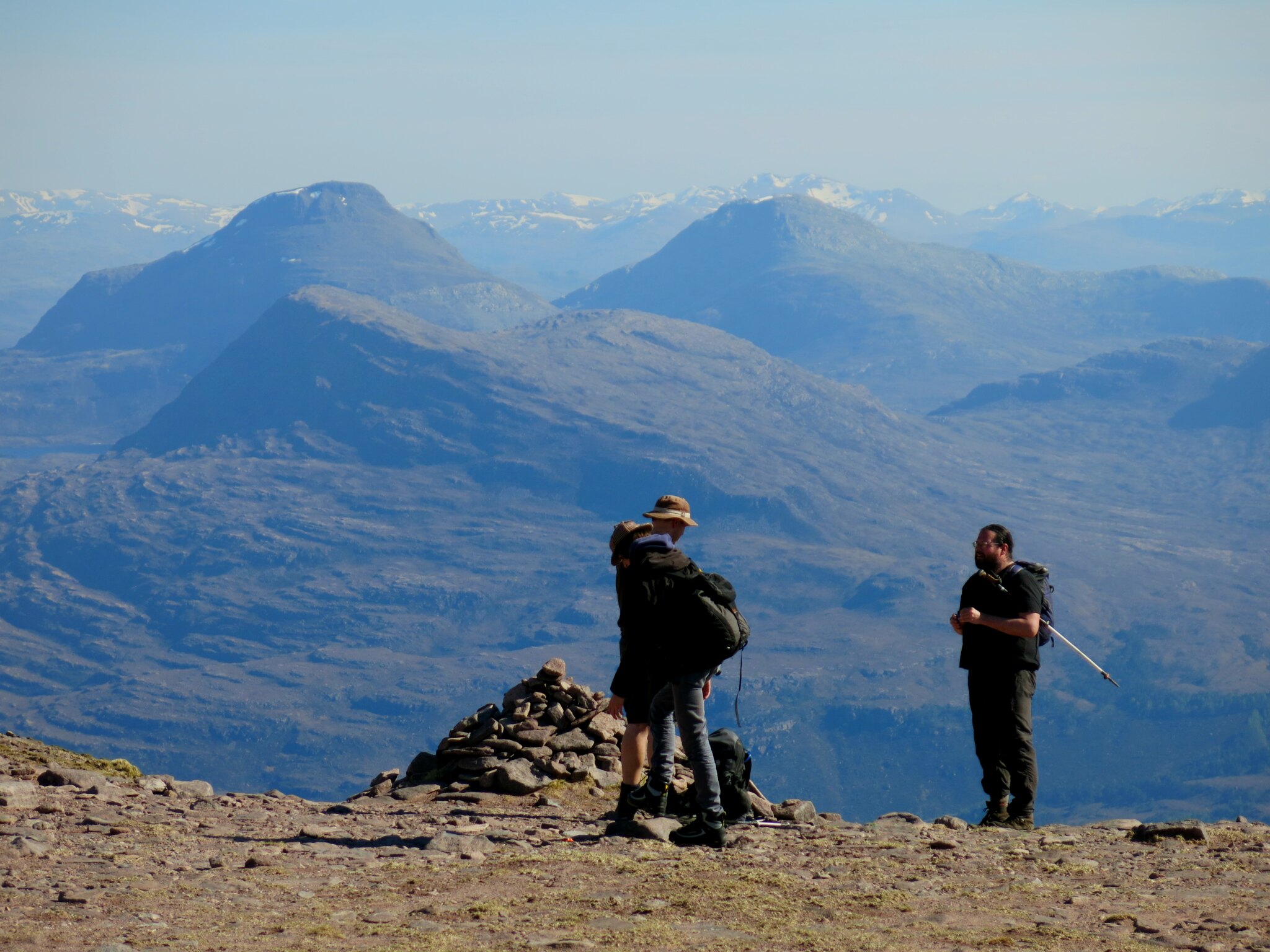
We reached the summit of Tom na Gruagaich much sooner and more easily than I had expected. A great moment, and Huw and Stephen's first Munro!
 IMG_1067
 by
Tim Pearce, on Flickr
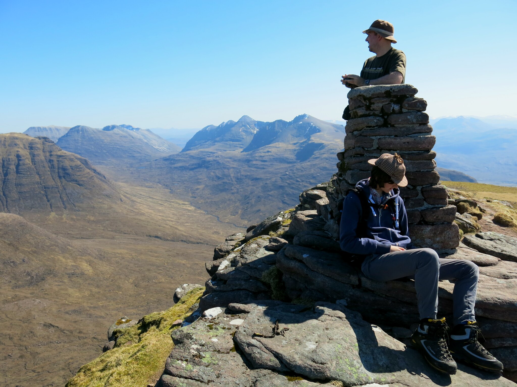
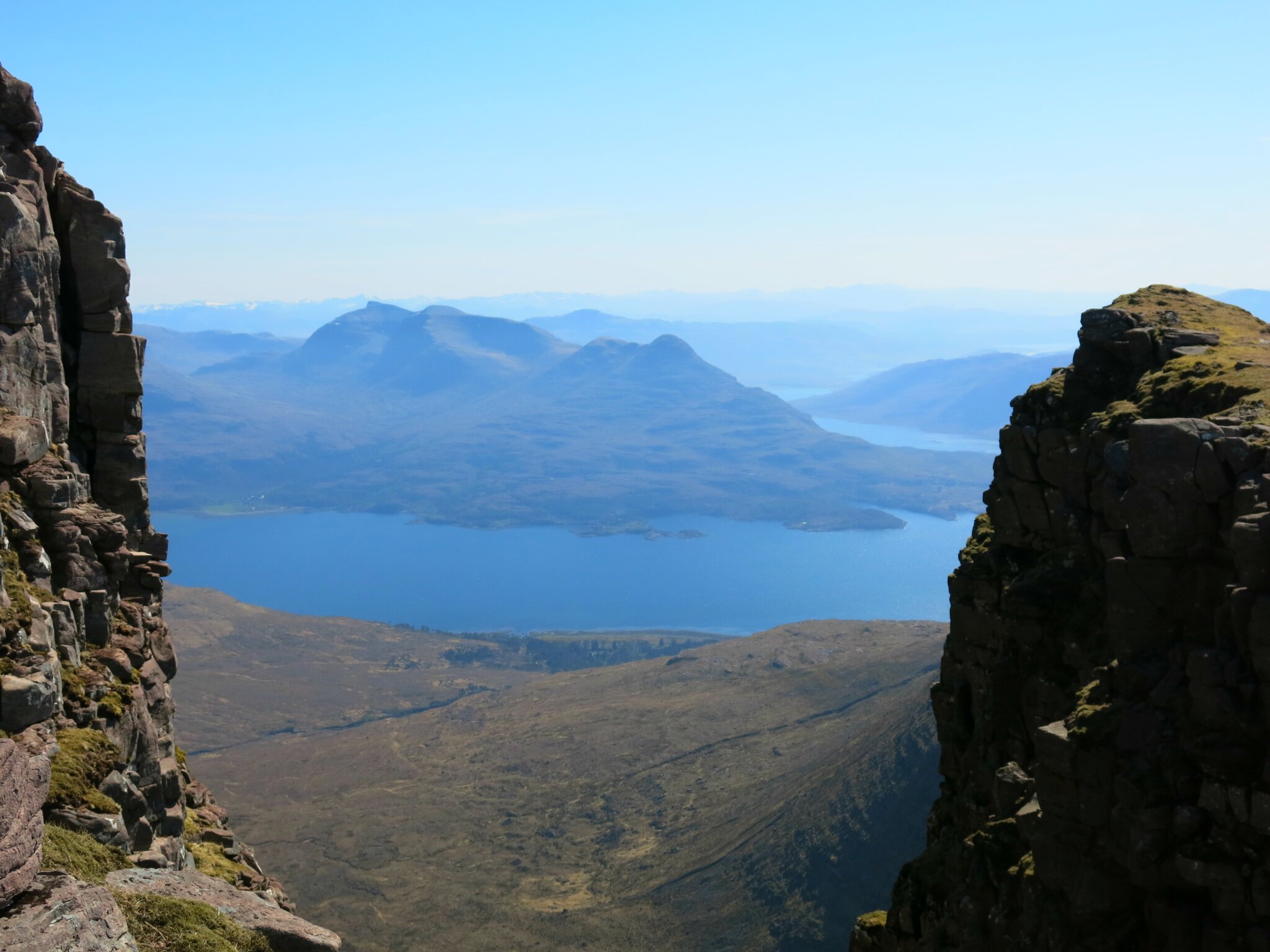
Having gained height so quickly, we reaped the benefit and spent a long time just contemplating the stunning view. The skyline of the photo below is Beinn Eighe (Ruadh Stac Mor, Sail Mhor, A'Choinneach Mhor, Spidean Coire nan Clach) and then the serrated ridge of Liathach with its two Munro summits prominent. To the right of the trig column is Sgor Ruadh hiding most of Fuar Tholl, with some of the snowy Loch Monar peaks beyond - the skyline might, I guess, be the long level An Riabhachan, with An Socach to its right. NB you might need to click the Flickr link to see all that!
 IMG_1068
 by
Tim Pearce, on Flickr
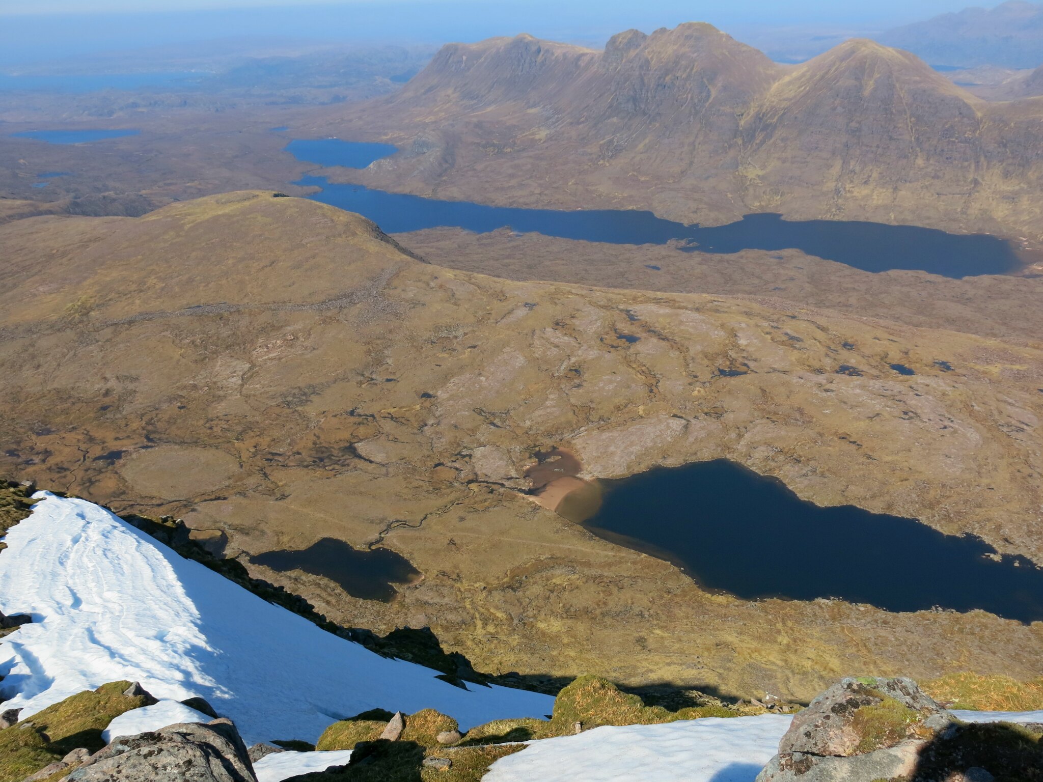
Most impressive of all was the closer view into the gulf of Toll a'Mhadhaidh and the deep slash of Eag Dubh. Further away is Beinn an Eoin, then above is a skyline of Beinn Lair, A'Mhaighdean, Beinn Tarsuinn, Sgurr Ban, Mullach Coire Mhic Fhearchair and Slioch, then possibly a super-distant glimpse of the Ullapool Beinn Dearg just right of Sgurr an Tuill Bhan, then various Fannaich peaks to the right of the Torridon Beinn Dearg's northern summit.
 IMG_1069
 by
Tim Pearce, on Flickr
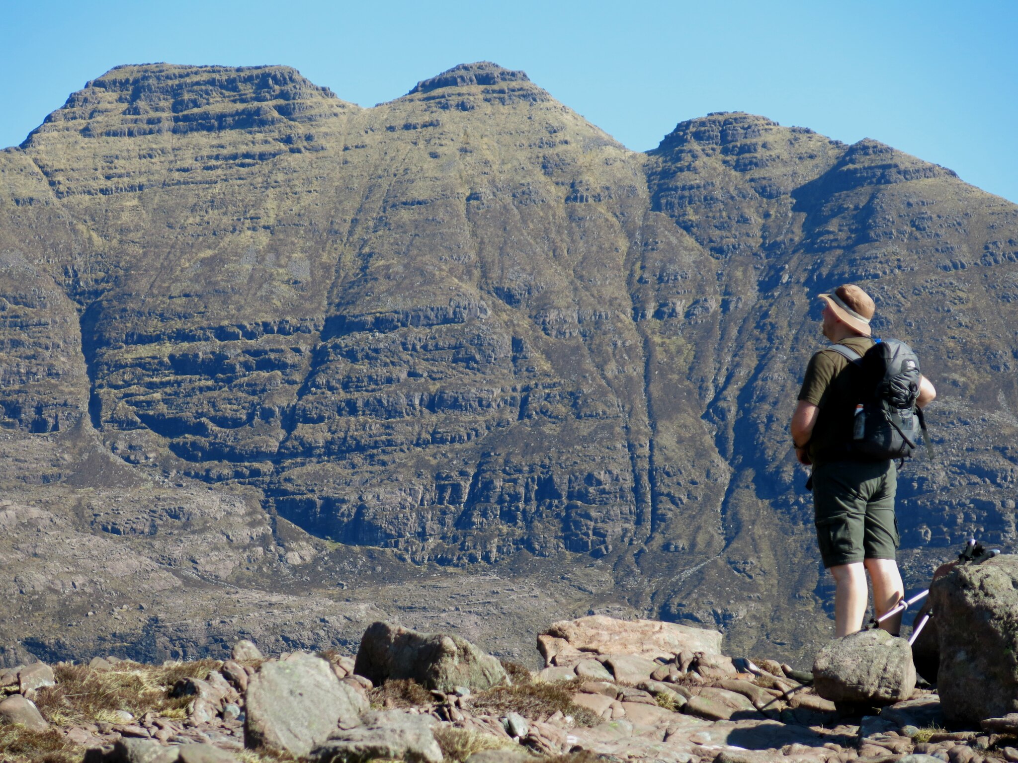
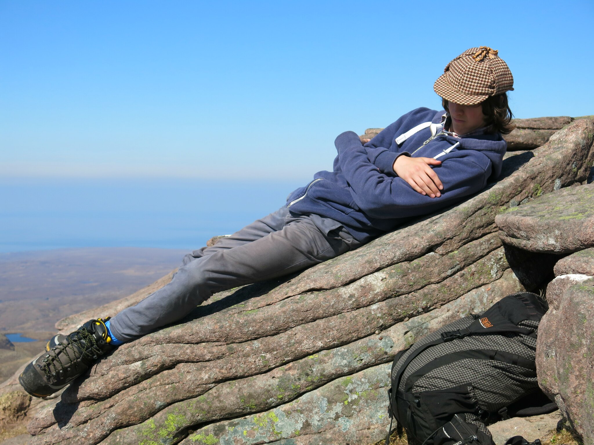
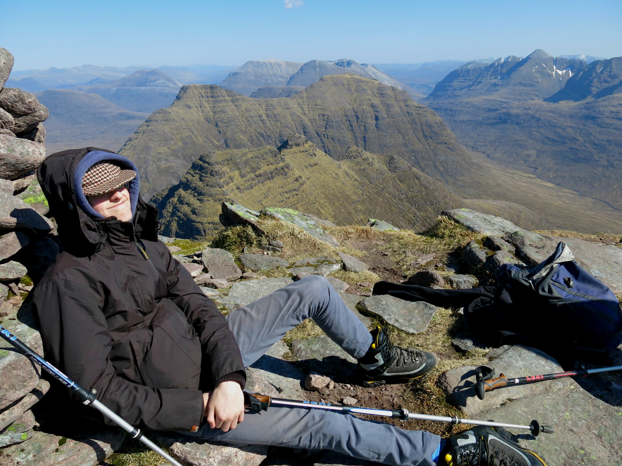
All that hill-spotting can be tiring, even for Sherlock Holmes' masterful forensic intellect...
 IMG_1101
 by
Tim Pearce, on Flickr
Eventually, it had to be done. After maybe an hour contemplating Wonderland from the summit, we set off on the pleasing ridge to Sgurr Mor. The initial descent is stony, but after that the ridge is a delight.
 IMG_1134
 by
Tim Pearce, on Flickr
Liathach from the ridge - living up to its Alpha Mountain billing in the Jo Hamilton song (trivia: Prince has done a cover version)
 IMG_1138
 by
Tim Pearce, on Flickr
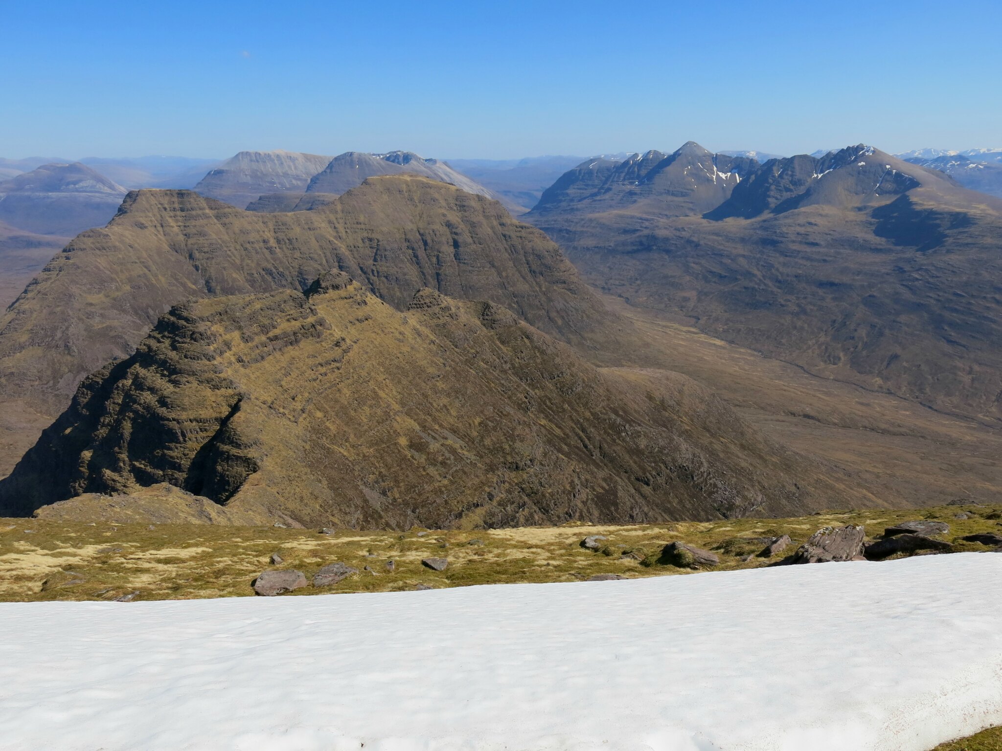
A grassy slope leads up the cone of Sgurr Mor, then "the ridge is interrupted in startling fashion" (SMC Munros guidebook) by the slice of Eag Dubh. Maol Chean-Dearg appears through the gunsights.
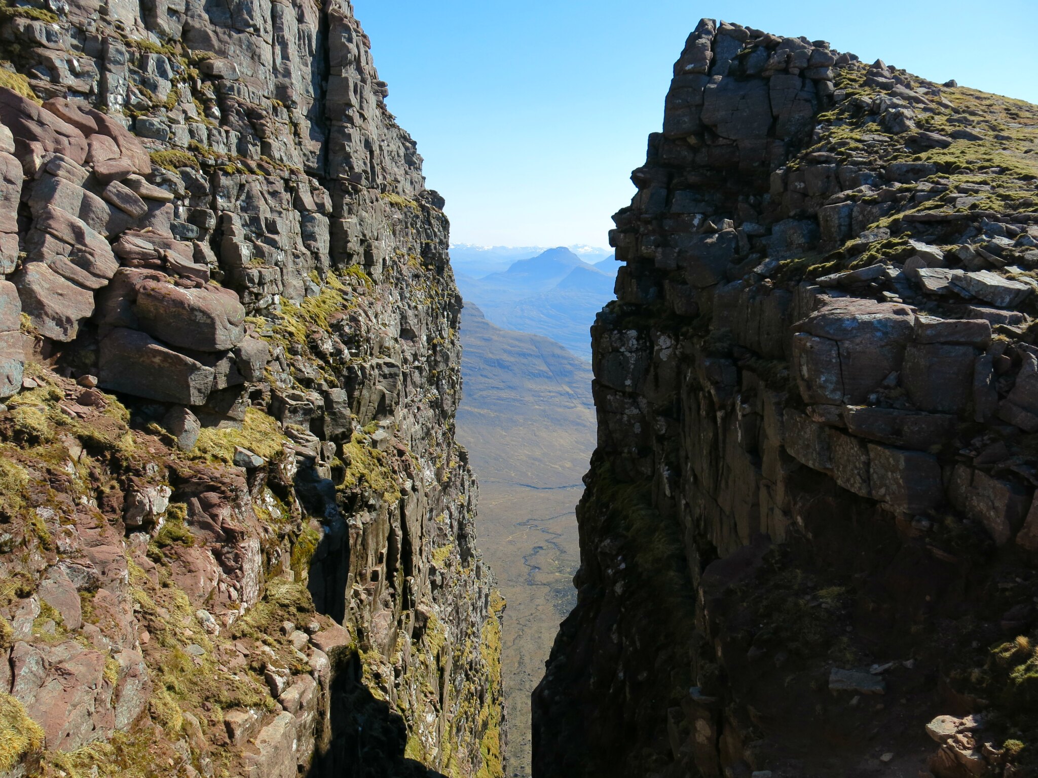 IMG_1173
 by
Tim Pearce, on Flickr
A closer view though the slot, with Sgurr nan Ceathreamhnan appearing directly above Beinn na Eaglaise, and Sgurr Fhuaran on the extreme right above Beinn Damh's Spidean Coire an Laiogh.
 IMG_1182
 by
Tim Pearce, on Flickr
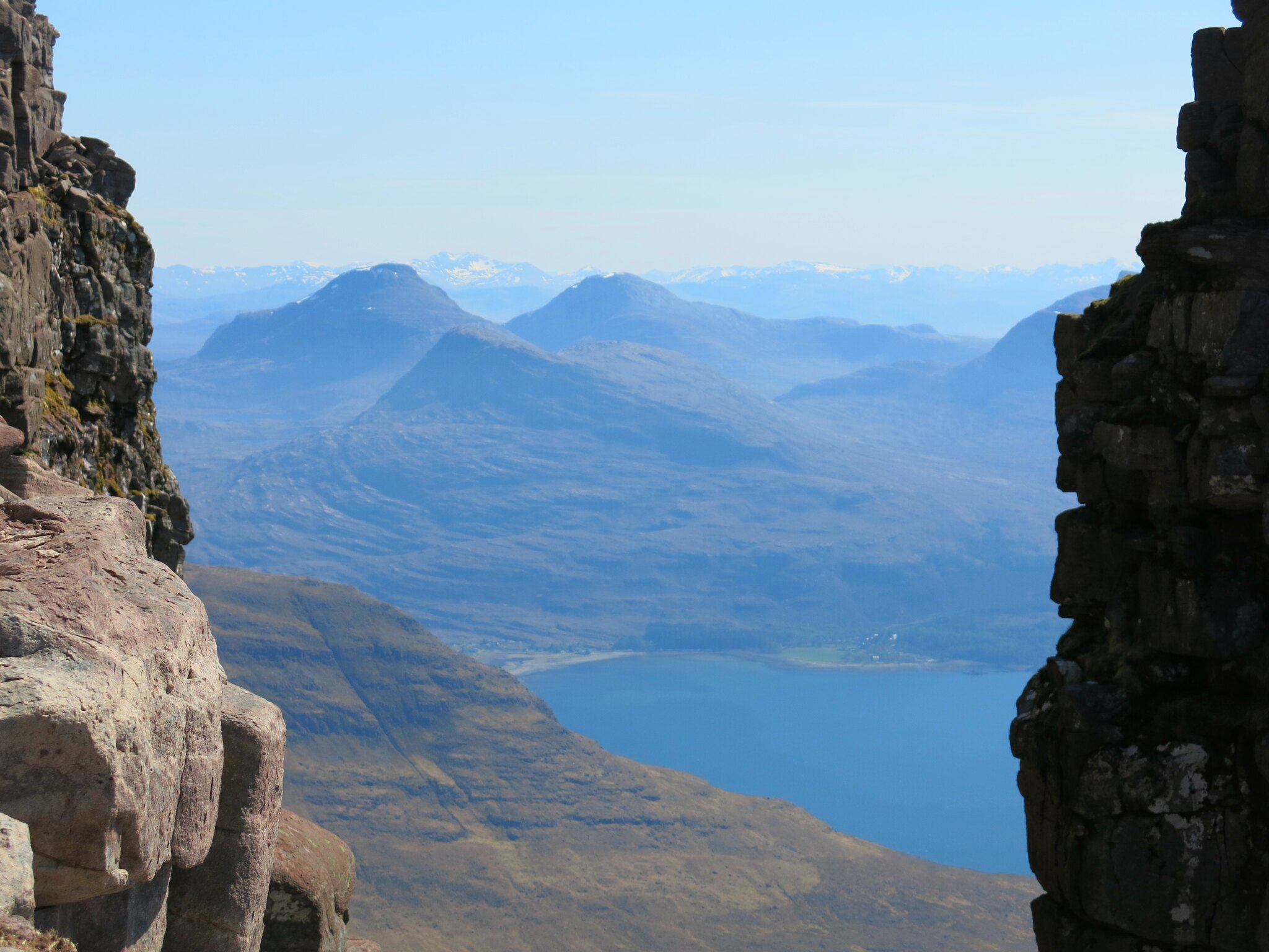
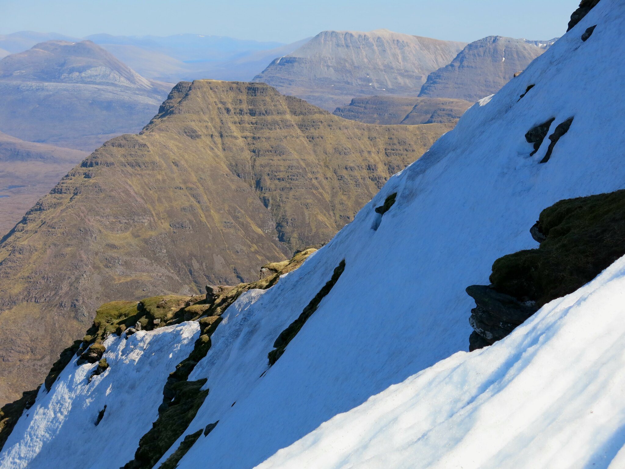
A slight climb above the Eag gave a different view, with Lochs Torridon and Damh, and Beinn Damh between them. Not only the regular, horizontal rock strata, but the scale of this place, reminded me of my visit to the Grand Canyon.
 IMG_1186
 by
Tim Pearce, on Flickr
The summit of Sgurr Mor followed soon. The view was just too good to be true. I've wanted to see this since first seeing a black-and-white photo of it in my old W.A. Poucher book, 40 years ago. A lingering patch of snow made a nice foreground.
 IMG_1197
 by
Tim Pearce, on Flickr
We spent a long time just taking in the scenery - here's a view from the north end of the little summit ridge, over Loch Toll nam Biast to Loch a'Bhealaich, with Baosbheinn rising out of the wilds of the Shieldaig and Flowerdale Forests. One touch of civilisation - Gairloch visible in the distance.
 IMG_1206
 by
Tim Pearce, on Flickr
A short descent of the north slopes gave a nice snowy foreground for a view across the northern edges of the Torridon hills.
 IMG_1211
 by
Tim Pearce, on Flickr
Then back to the cairn for a last bit of a sit down and enjoyment of the view.
 IMG_1187
 by
Tim Pearce, on Flickr
Oh well, we had to head on down in the end.
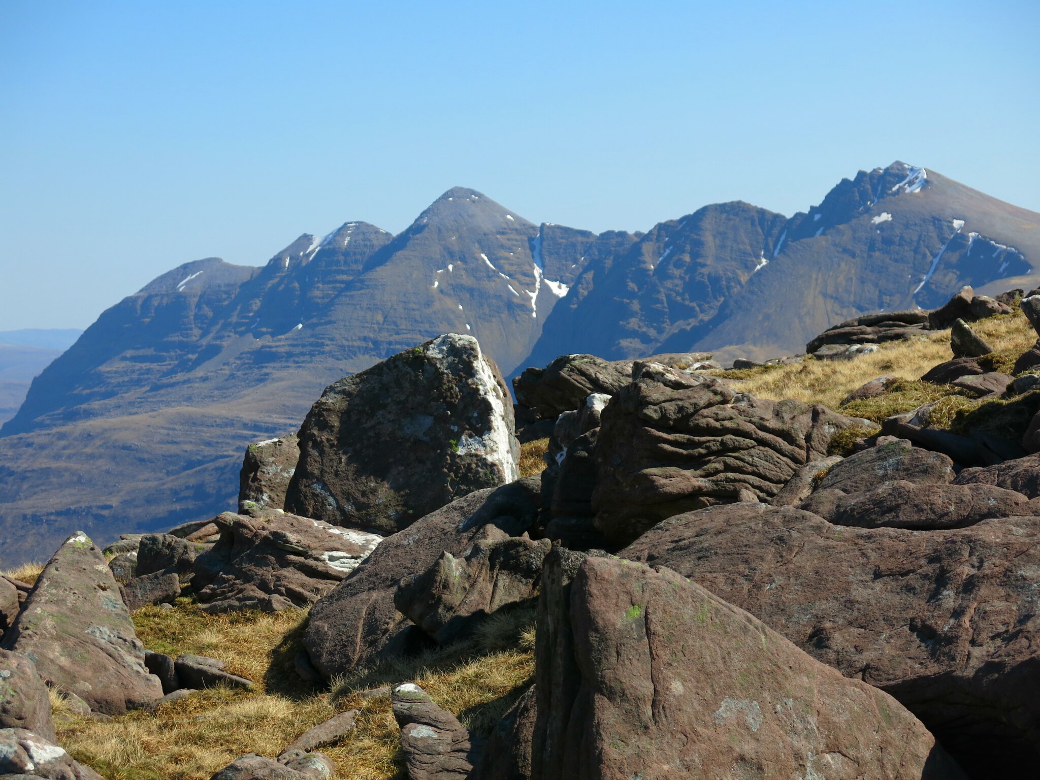
Here's a cairn on Tom na Gruagaich, marking the start of the path back down in Coir'an Laiogh. Sgurr nan Ceathreamhnan looking snowy and massive as before, this time appearing above An Ruadh Stac. The pointy peak to its right is I think Ciste Dubh. Although there are so many big hills in the Monar to Affric area (book knowledge - I've never been there - would love to go) it was funny how throughout the day Sgurr nan Ceathreamhnan stood out head and shoulders from the other summits on the horizon.
 IMG_1266
 by
Tim Pearce, on Flickr
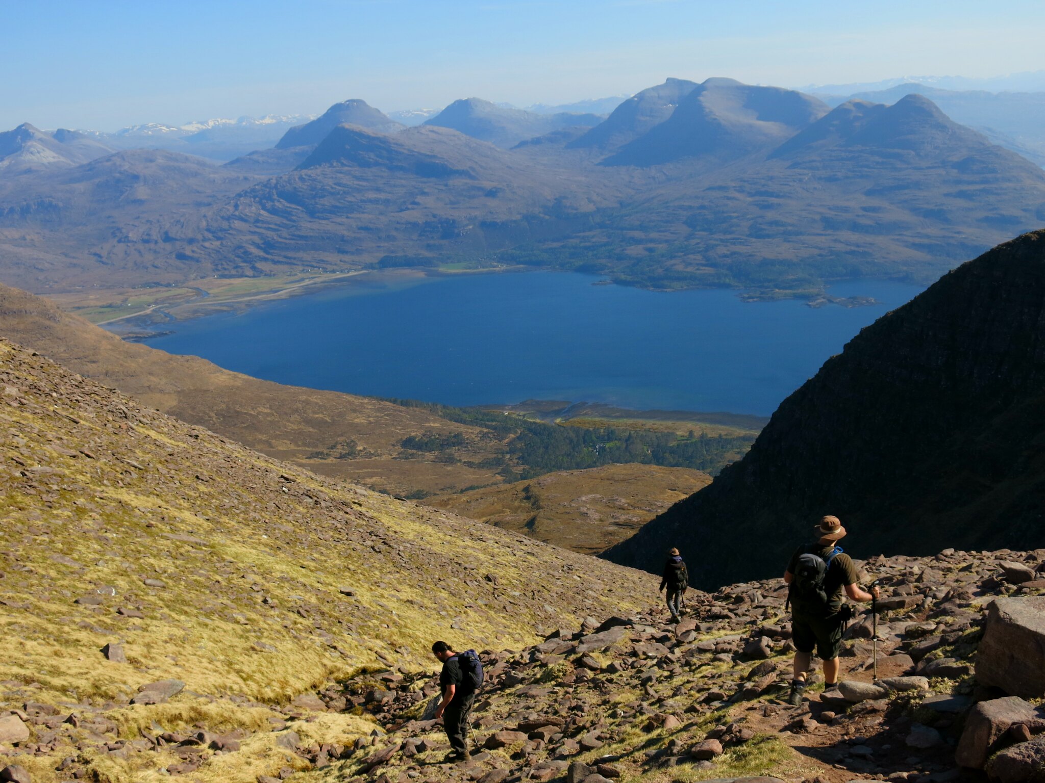
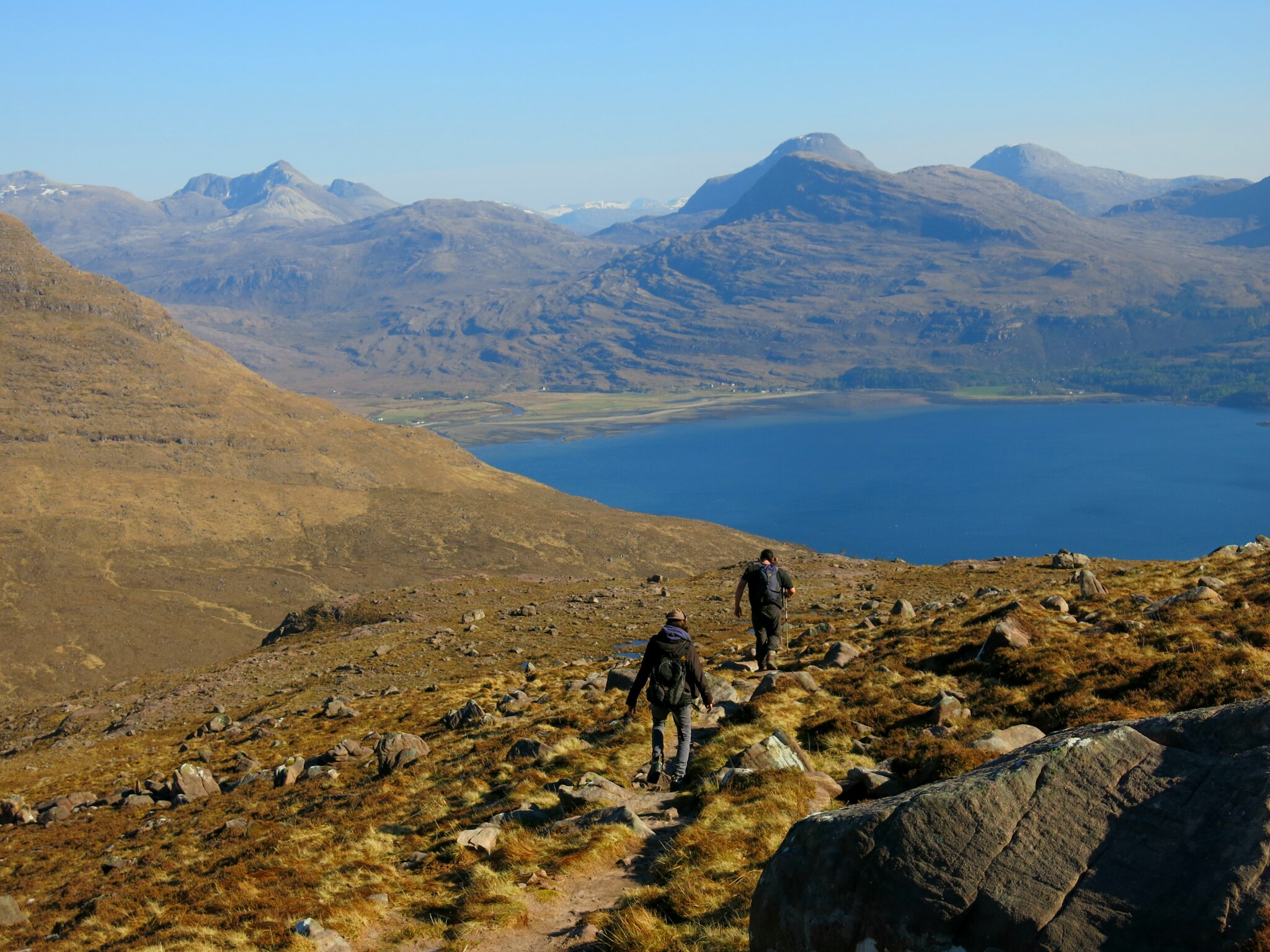
Originally we had intended to do the horseshoe route over the Horns in descent (entertaining scrambling + less total descent - might have been easier for my knee) but the decision to retrace our steps over the Tom paid dividends in terms of the view - Loch Torridon and the Coulin/Damh Forests ahead of us, lit by golden afternoon light, all the way back to the car park. Pain in the knee was now pretty much incandescent, but the view was the best possible distraction.
 IMG_1281
 by
Tim Pearce, on Flickr
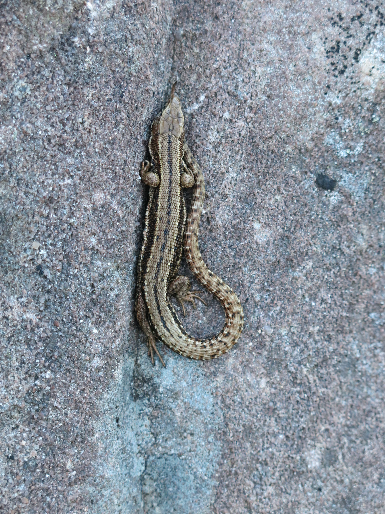
Another interesting distraction was this lizard basking in the sun -
 IMG_1307
 by
Tim Pearce, on Flickr
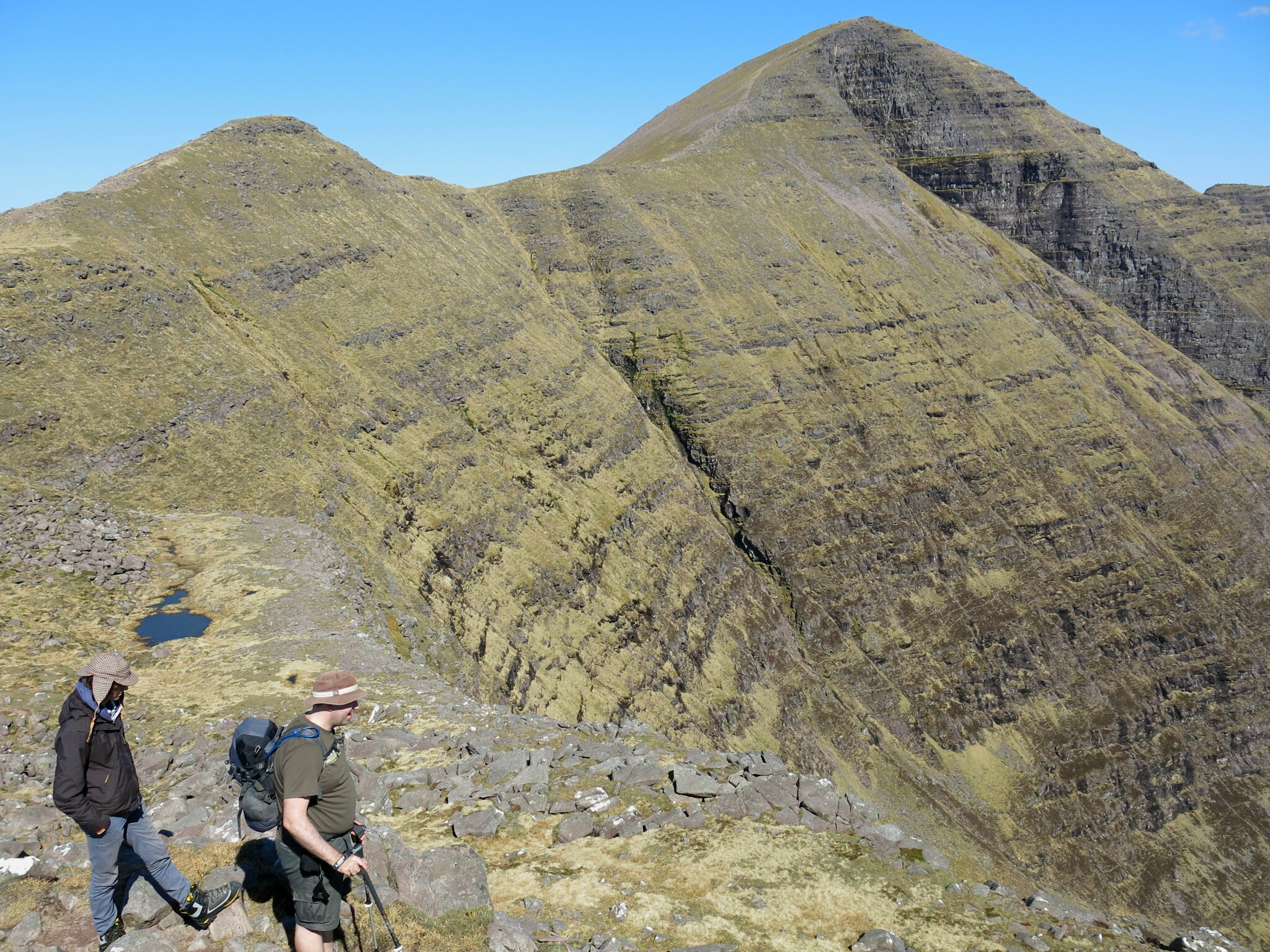
A nice little pond on the way down.
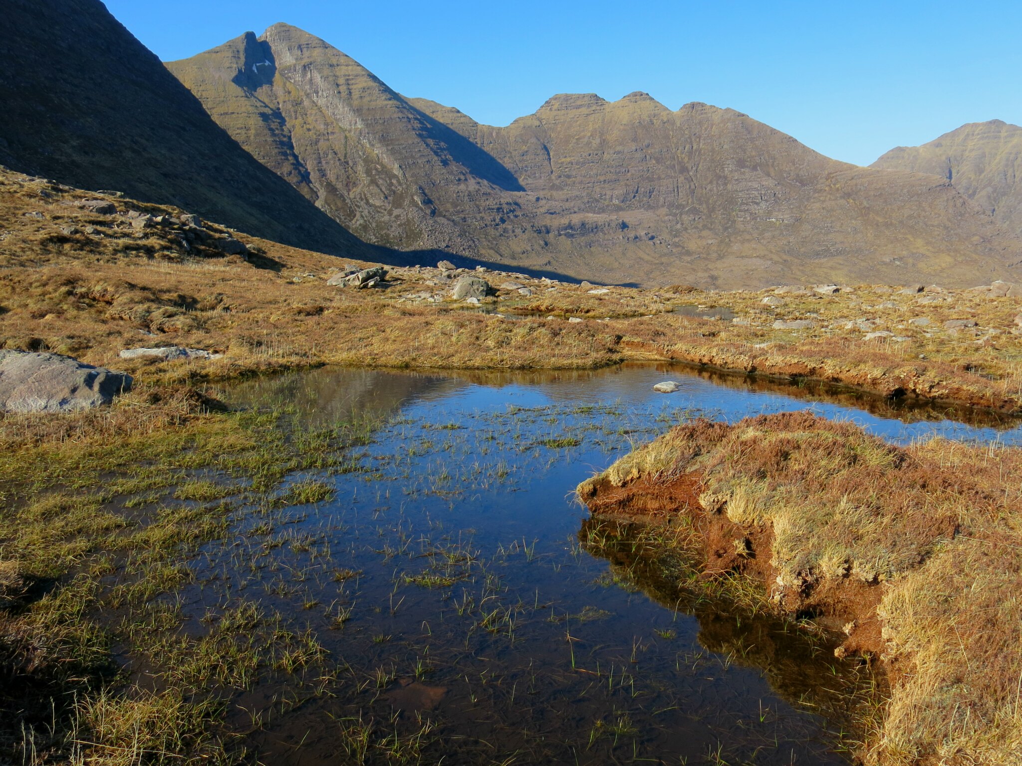 IMG_1309
 by
Tim Pearce, on Flickr
Last views over Loch Torridon...
 IMG_1310
 by
Tim Pearce, on Flickr
After a well-deserved pint at the Loch Torridon Hotel (Legal Disclaimer: blackcurrant juice for the 14 year old) we soaked in the evening colours on Mullach an Rathain -
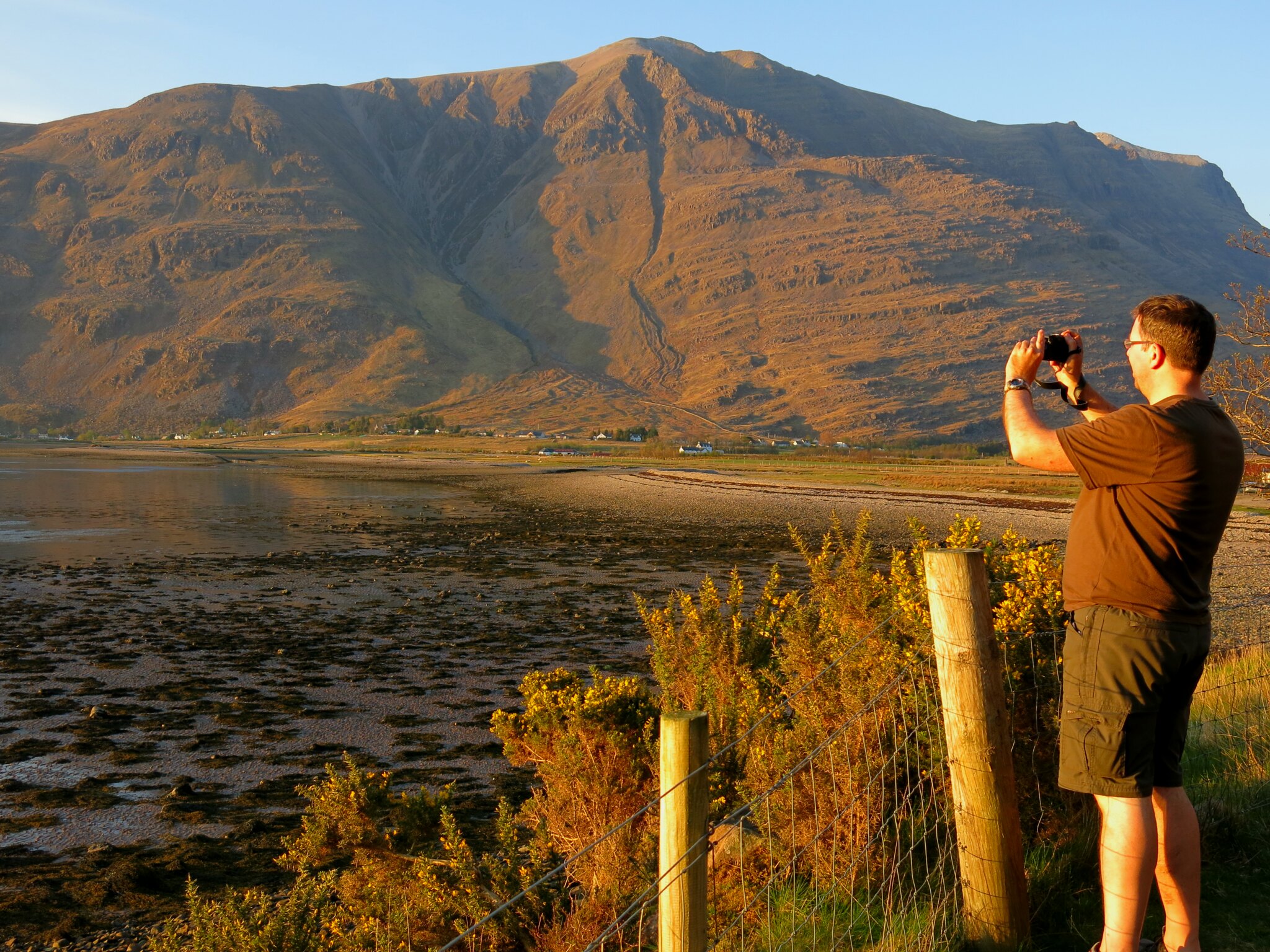 IMG_1359
 by
Tim Pearce, on Flickr
and, looking the opposite direction from the same spot, the lowering sun over Loch Torridon - the perfect end to a perfect day in stunning Wester Ross.
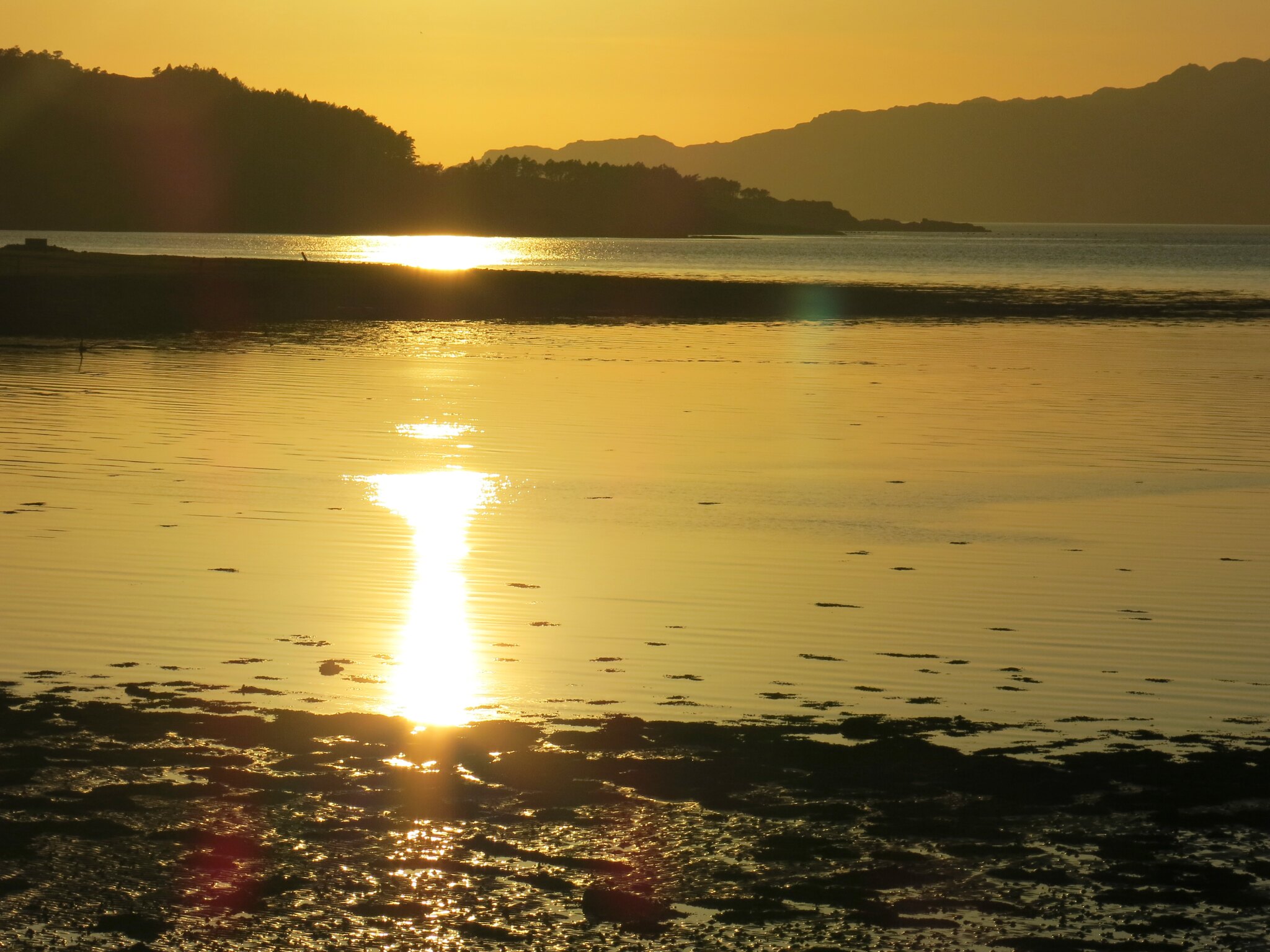 IMG_1357
 by
Tim Pearce, on Flickr
