free to be able to rate and comment on reports (as well as access 1:25000 mapping).
After missing out on the chance to go hillwalking on one of the hottest days of the year, I quickly scrambled all my gear a couple of days later to take advantage of more favourable weather. What an inspired decision. I needed light and good visiblity to go and climb my last unclimbed Munro of the Cairngorms and one of the most remote: Sgor an Lochan Uaine. Back in the summer of 2000, two friends and I undertook the long trek by bike and on foot from the Linn of Dee to reach the Lairig Ghru and the Corrour Bothy. From there we nipped up to the Devil's Point and then Cairn Toul. It was getting on a bit so we turned back, happy with what we thought was a job well done. Except that when we got back to Glasgow, we realised that we had inadvertently missed out a third Munro - Sgor an Lochan Uaine, promoted to mountain status only 3 years before. I remember seeing people walking back from the direction of the hill then, and I wondered why and it all became clear. I have been kicking myself and scratching my head ever since about how I was going to rectify this mistake without having to schlep all the way back from the Linn of Dee. Until my friend Alan told me I could do it from Glen Feshie... This little plan has been brewing slowly in my head and the run of exceptional weather we've had of late persuaded me that my time had come. This walk would be long and take me across a vast expanse of fairly featureless terrain, so I needed plenty of daylight and good visibility.
I left my car not long after 8am and strode confidently towards the Auchlean farm. It was a bit nippy but the sky was pristine although still a wee bit washed out in the early morning light. I suffered from the over-confidence that comes from a misapprehension (a misreading) of the glen from which I was going to make my entry into the Moine Mhor, the high plateau which connects Sgor Gaoith and Mullach Clach a'Bhlair and spills west towards Monadh Mor to the south, and Cairn Toul and Sgor an Lochan Uaine (SaLU from now on) to the west. I also misunderstood the path on the map. In fact I made a basic mistake of map interpretation - I didn't 'see' the wooded shoulder which shields Glen Fhearnagan from view on the map, I just saw a bend, and in the process I spurned the offer of a very good path. Twice

When I realised my mistake, I had walked behind and past the farm. I figured that there was no need to retrace my steps and, with a good compass bearing, I could cut across the heather and surely I would meet the path. Not so. I walked up alongside the Allt Fhearnagan, which was a promising move, crossed it (why?) and eventually came out the trees to see, to my left, the long Glen Fhearnagan, with an unmissable path running eastwards toward Carn Ban Mor. I was only 50 yards out, which in clag would have led to a trudge up on the wrong side of the glen through heather and a landing on Moine Mhor south of Carn Ban Mor. I would have missed the handy cairn which marks the point at which several routes meet. I rushed across the heather to rejoin the real path - in floods of sweat - and welcomed its easy angle, gravelled surface easy on the weary walker's leg and the culverts which no doubt keep it nice and dry in wet weather.
I reached the cairn at around 11am and looked for Carn Ban Mor. I mean, it's a 1050m high so I'd expect something substantial or remarkable, like a prominent peak. Nothing of the kind. I kept looking behind me, where I thought it was and all I could see was some vaguely raised ground and nothing much else. With some trepidation and guessing that I was at about 900+ m in altitude I got my new GPS out to confirm my hunch but the reading I got really threw me out - 860m!

Whit?
On such occasions I start talking to myself, then I pore over the map trying to work out the meaning of the cairn, then I curse whoever put the cairn here without any explanation that I understand, etc etc etc until I regain a sense of proportion and confidence. I figured that the unassuming rise was Carn Ban Mor and that in a SW direction this other rise was the 957m top towards which I should be heading. Ergo the path that led towards it was the right one. And indeed it was. From then on, the rest of the way was the proverbial doddle. I had already picked out Sgorr Gaoith from a couple of angles northwards and as I sauntered down the jeep track, suddenly SaLU and Cairn Toul just stood there, smaller than I imagined but clearly recognisable. The quality of the light made them look velvety, it sort of softened their appearance. In any case viewed from this side, the side gouged by the glacier which carved the Lairig Ghru is out of view. Nevertheless it was striking how different they looked in this light from my previous visit in the area only 4 weeks previously when I climbed Beinn Bhrotain and Monadh Mor. On that day, under an overcast sky they looked brooding and massive. Today, they looked almost squashed and tame. I was still a good two hours away from the summit!
 Sgorr Gaoith
 by
Emmanuelle Tulle, on Flickr
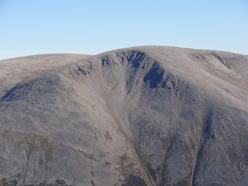
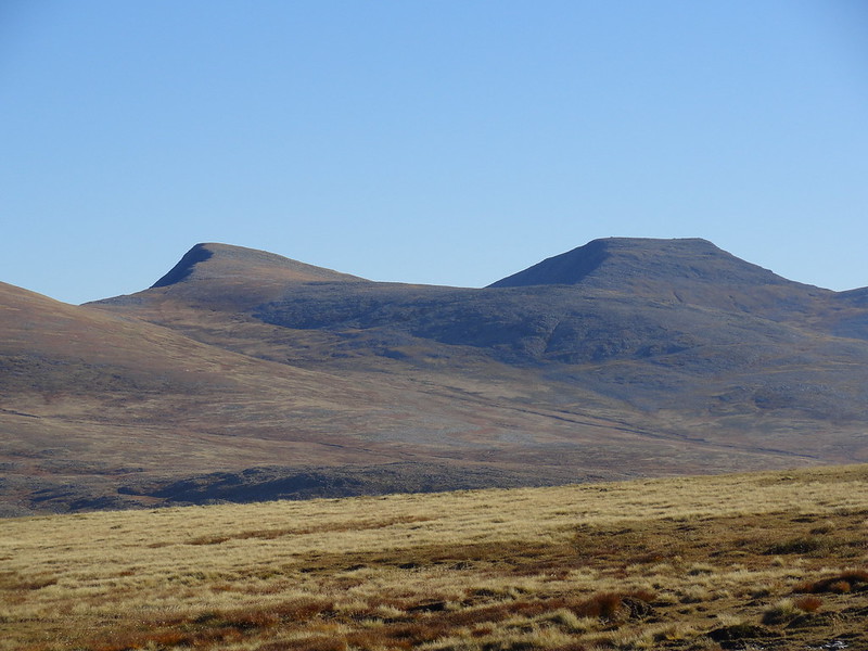 Sgorr an Lochain Uaine and Cairn Toul
 by
Emmanuelle Tulle, on Flickr
On a warm sunny day, the plateau is pleasant and offers tantalising views of the western cliffs of Sgor Gaoith but one can only guess at Loch Eunaich which lies at their feet. The southern whaleback of Braeriach also beckons. But it is the small and larger lochans - Loch na Cnapan being the largest one - which drew my attention, glistening and sky blue to match the blue of the sky. Underfoot, the bog had dried out for lack of rain and the going was easy, not too squelchy. As I got closer to my target, I noticed the shallow glen which rises to the col that separates the western ridge of SaLU from Carn na Criche, part of the Braeriach complex and this seemed an easier way to access the summit than the rocky slopes I had identified on the map. But I wanted to stay airy to get any views of Cairn Toul that would offer themselves to me so I chose the awkward way over the easy way. Story of my life

I saw three folk picking their way towards the glen I had spurned and later, as I started the final stretch of the ascent, I passed a chap who either didn't see me or ignored me. Fine
These were my first human encounters of the day! I soon made it to the summit and the views were so exceptional that I remained there for an hour. i also calibrated the altimeter of my GPS which was still completely out! I had never seen the summit of Braeriach or its cliffs, buttresses and hanging valleys in such conditions. In fact I had never seen them full stop. All I ever saw in the past was a brooding presence in swirls of thick cloud and on the day I climbed it, a cairn! Today there were still patches of snow tucked away in its remote corries but otherwise the overall impression was of dryness, an arid, almost lifeless landscape, with only the constant rush of water from the Falls of Dee to break the silence. It was very disconcerting, albeit pleasing. Moving my gaze in an arc north and east of Braeriach, I picked out the summit of Cairngorm with its large structure on the summit, Bynack More in the far distance, and closer a surprisingly tame looking Ben Macdui! In fact I had to work hard at hill spotting because the aspects of all the hills were softened by the light. Even Cairn Toul, from such close proximity didn't seem as impressive as it does from the other side although its north-facing cliffs still partly shaded looked mighty. Still scanning in an arc, I recognised Bhrotain and Monadh Mor and beyond them, rose Carn Ealar and An Sgarsoch. They appeared only as outlines shaded in a palette of blues, which in this odd light made them seem taller despite the distance! and as my gaze veered south and west I noticed the gathering clouds, creating an inversion through which only the very tip of one distant mountain emerged and it might have been Ben Nevis! What a series of contrasts! Bringing my gaze closer, I swivelled and looked down towards the Lairig Ghru and caught sight of the hanging lochan Uaine, a deep blue in this grey brown landscape.
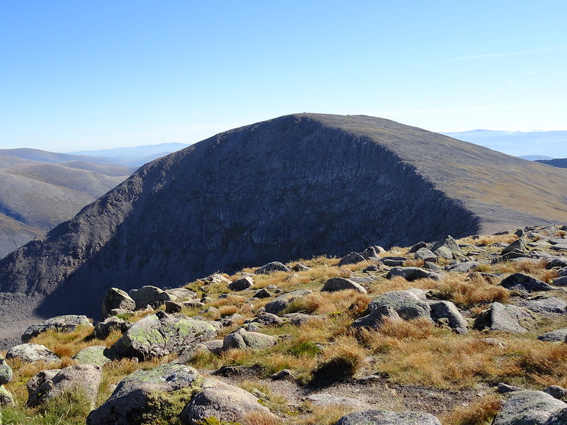 Cairn Toul
 by
Emmanuelle Tulle, on Flickr
 Braeriach and Falls of Dee
 by
Emmanuelle Tulle, on Flickr
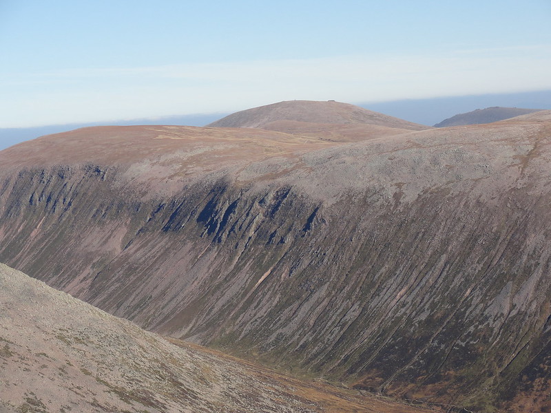 Cairn Gorm
 by
Emmanuelle Tulle, on Flickr
 2015-10-02 12.57.27
 by
Emmanuelle Tulle, on Flickr
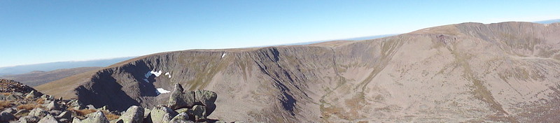
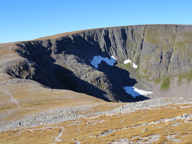
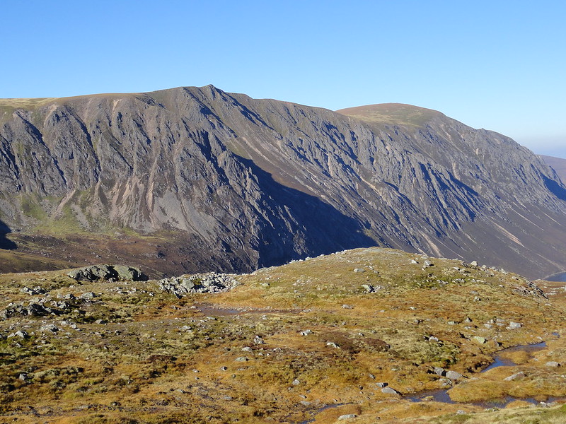
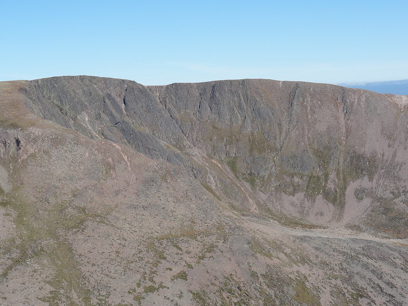 Braeriach summit and Coire Bhrochain
 by
Emmanuelle Tulle, on Flickr
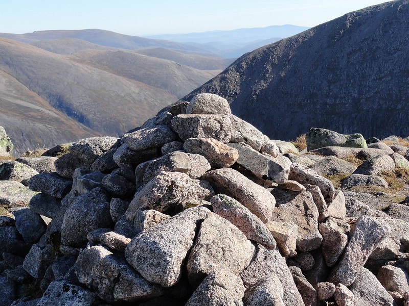 Summit cairn
 by
Emmanuelle Tulle, on Flickr
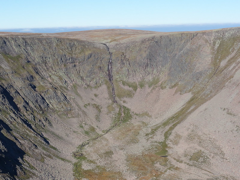 Falls of Dee
 by
Emmanuelle Tulle, on Flickr
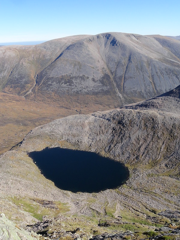 Lochan Uaine (and Ben Macdui)
 by
Emmanuelle Tulle, on Flickr
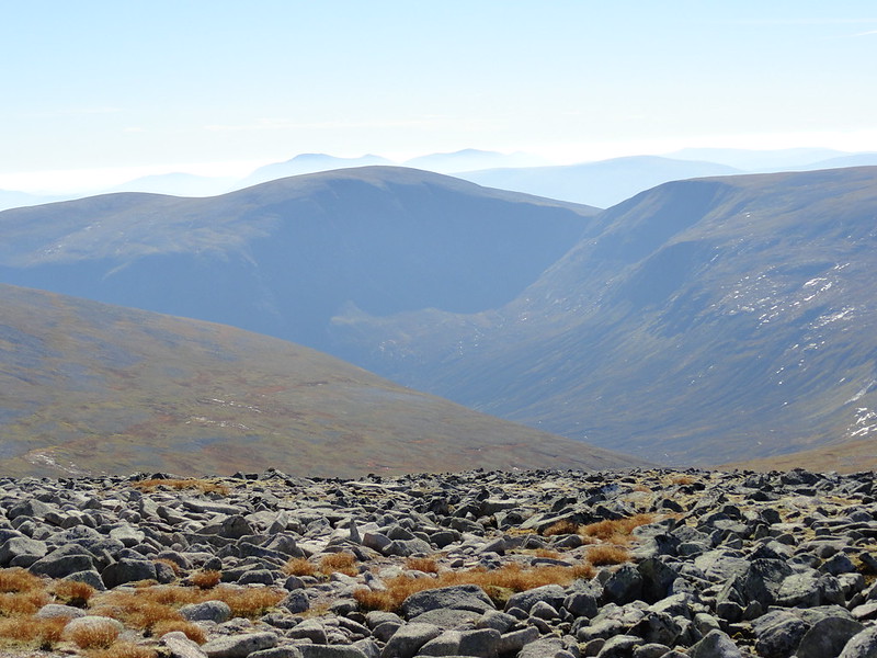 Beinn Bhrotainn, with Carn Ealar and An Sgarsoch
 by
Emmanuelle Tulle, on Flickr
Various people and midges
had converged on the summit by then and I chatted to a couple who had just come from Cairn Toul. Then we all parted ways and I decided to return by a slightly different route. I wanted to stay high for as long as possible. I had noticed a path high on the southern slopes of the Braeriach complex and I figured this might be a good plan. Just a few hundred metres from the summit, I talked to a chap who was heading up and he mentioned he'd cycled in with his dad from Rothiemurchus to Loch Eanaich and then walked up from there. This information proved very precious as I figured that I could head towards the Coire Odhar and take a look at this well hidden loch.
 Allt Luibeag and Coire Mharconaich
 by
Emmanuelle Tulle, on Flickr
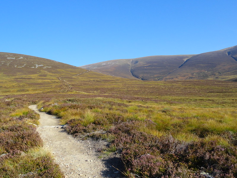
 The path to Carn na Criche and An Garbh Choire
 by
Emmanuelle Tulle, on Flickr
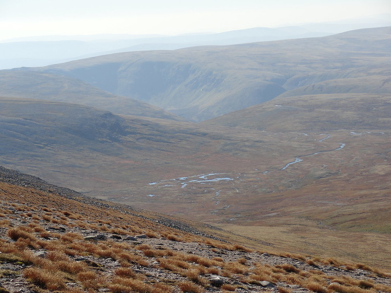
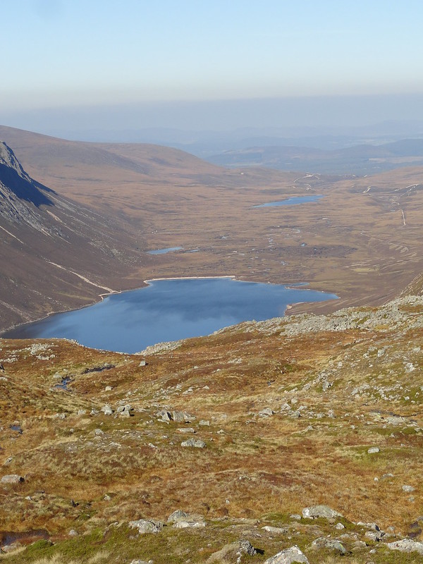 Loch and Glean Eanaich
 by
Emmanuelle Tulle, on Flickr
 Sgor Gaoith and Sgoran Dubh Mor
 by
Emmanuelle Tulle, on Flickr
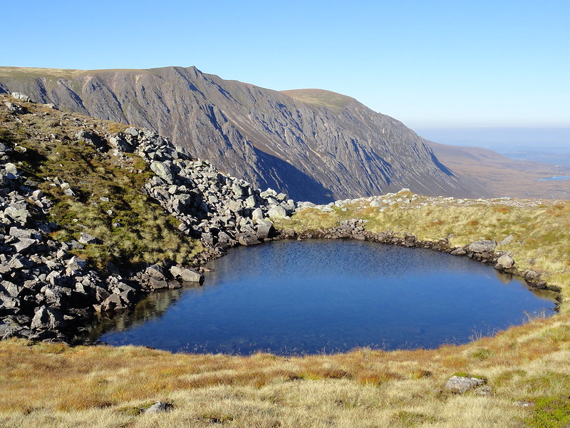 Lochan
 by
Emmanuelle Tulle, on Flickr
This was an inspired decision: I didn't go to the edge but I got close enough to see the loch and get a sense of this steep sided horseshoe. But I also got to see all the way to Rothiemurchus, the view punctuated by lochans, a deeper blue in the mid-afternoon sunshine. Just then, an engine noise broke through the silence and I saw a small aircraft hug the cliffs of Sgorr Gaoith, one of the tugs which takes off with gliders from the Feshie airfield! After a few minutes, silence reclaimed its place and I resumed my walk up and over grassy and rocky mounds, around lochans and across patches of firm peat dotted with bog cotton and white rock splinters. I made swift progress and soon rejoined the path which easily took me back to the cairn that had caused me such consternation a few hours before. I have to say that it took me a while to recognise the path because Carn Ban Mor was just as featureless as earlier in the day! My compass bearing was taking me in a direction which I didn't quite comprehend. Just then I saw the well groomed path and the penny dropped
This is a very disorientating environment and I'm glad I chose a day with perfect visibility as in cloud stress levels would have risen with each moment of uncertainty.
 Looking back up Glen Fhearnagan
 by
Emmanuelle Tulle, on Flickr
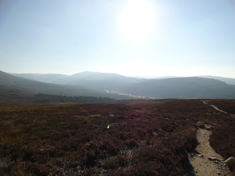 Glen Feshie
 by
Emmanuelle Tulle, on Flickr
I sauntered back down the path and sat down for a while before entering the woods. Here I discovered what I missed in the morning - a lovely, restful woodland path, in dappled sunlight. Back at the car 9 hours after setting off. A job well done and some heard earned lessons about learning to 'read' the Cairngorms.
