free to be able to rate and comment on reports (as well as access 1:25000 mapping).
On my own today - Allison and Craig away for a week's holiday in Ardgour with proper mountains. So I had a think about what would be the most efficient use of time - I'd looked at a nice circuit around the Culter Fell hills that came in just shy of 30km - a bit outwith the range of the Sick Kid at the moment anyway. So that would net me 5 Donalds. Or 8 New Donalds. Or 8 Simms - however you wished to count them it would be a good day out

Left at 7 and had a hassle free drive down the M74 despite some sections of roadworks - the forecast overnight snow didn't appear to have materialised. i did not want to be tramping through deep soft snow for 30km, of that I was sure. Turned off at Abingdon then up the A702 to Coulter, where I turned right and followed a narrower road to Culterallers Farm - the road splits and there's a parking space or two by the verge. It had clouded over somewhat and snow looked like it was on the way. I had decided to do the circuit clockwise - this proved very sensible.
Start
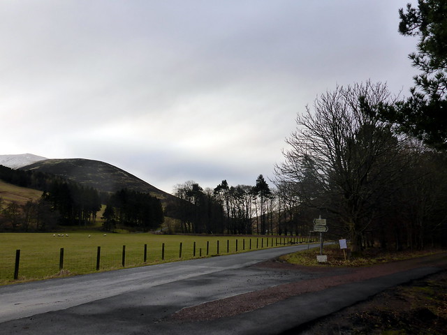 P1120159
 by
Al, on Flickr
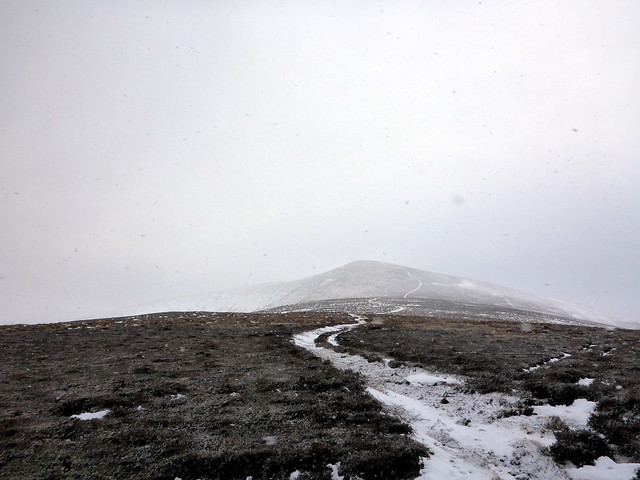
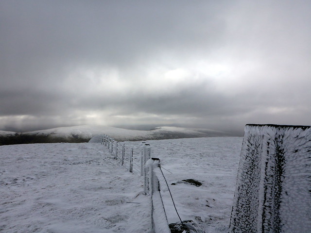
I took the left hand fork in the road that heads due south and trotted along past inquisitive sheep and onto a rough track that leads up Fell Shin, past some stone grouse butts. Before I got to 500m the path was picked out in snow, and a little icy - I hoped this meant frozen bogs on the wetter parts of the route (unfortunately not). It's a steady pull of just under 500m onto the summit of Culter Fell. By this time the wind is quite strong, blowing snow into my face and I'm a little chilly. The sky is dark to the NE, where the wind is coming from and it looks like being snowy for at least an hour or more. Over to my left I can make out the beacon of Tinto Hill through the snowflakes. Cardon Hill and its buddy Chapelgill Hill appear quite distant - plus I have to climb back up to Culter Fell on my return.
Up Fell Shin
 P1120160
 by
Al, on Flickr
Culter Fell ahead
 P1120162
 by
Al, on Flickr
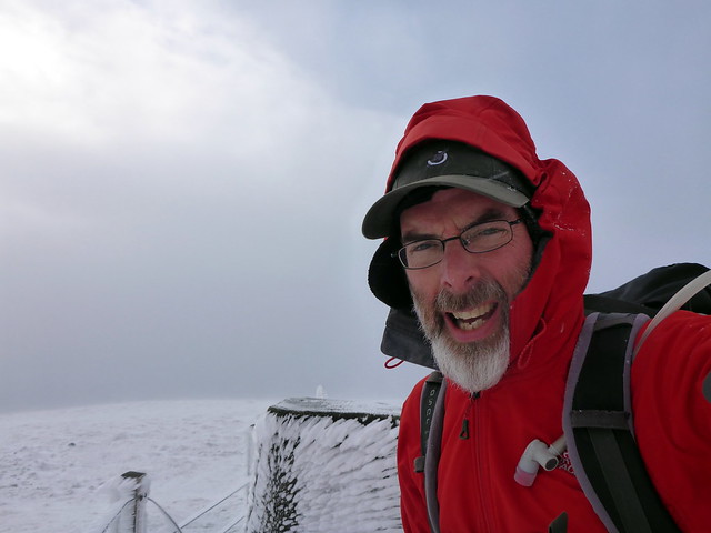
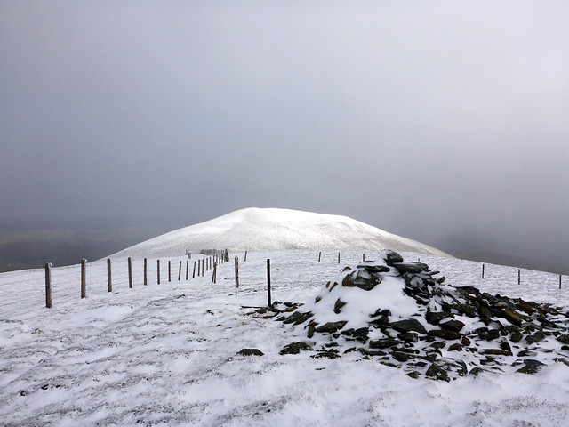
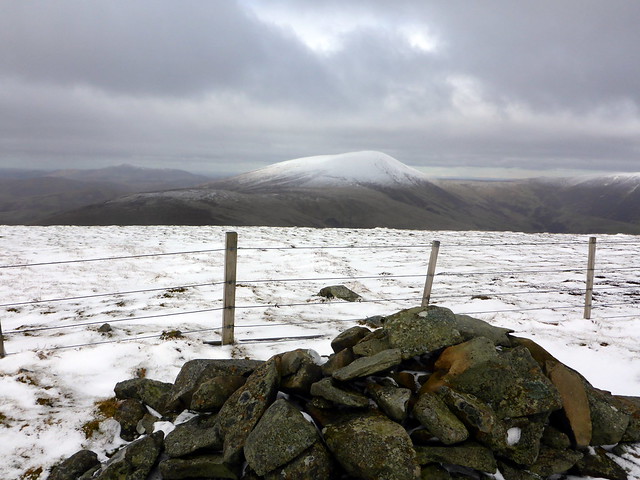
Summit CF
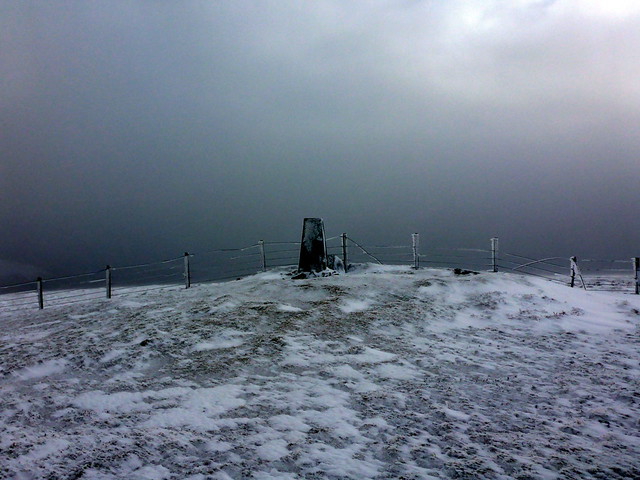 P1120164
 by
Al, on Flickr
No very warm up here
 P1120165
 by
Al, on Flickr
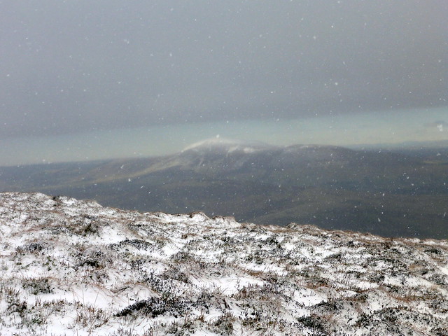
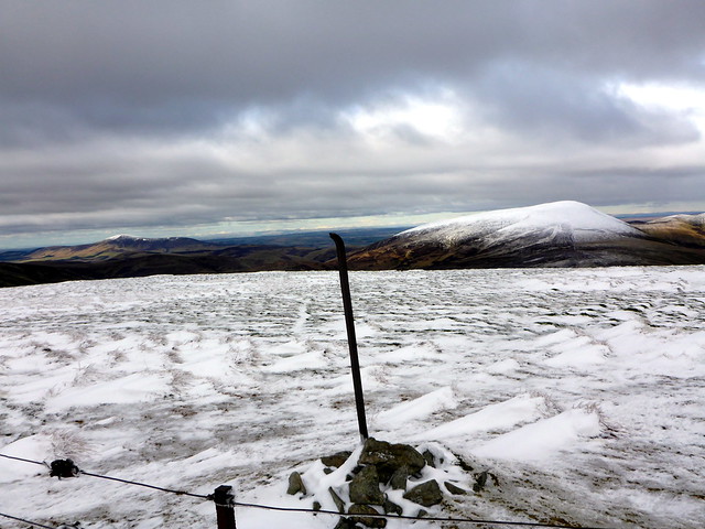
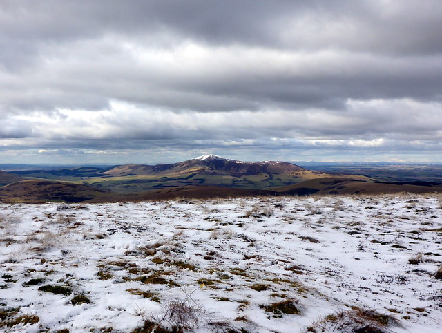
Tinto amidst the snow
 P1120167
 by
Al, on Flickr
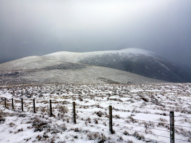
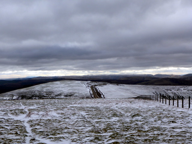
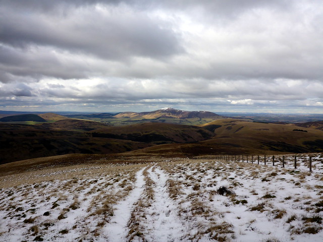
The route ahead to Cardon & Chapelgill
 P1120168
 by
Al, on Flickr
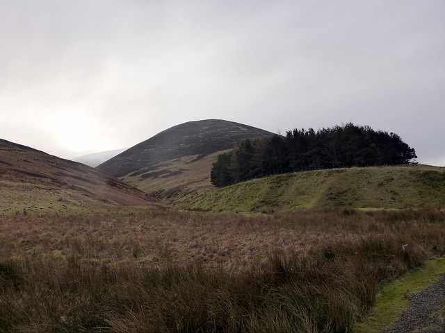
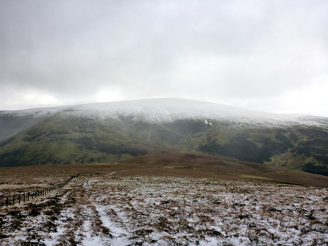
I set off north down the fence line to King Bank Head, losing about 150m in the process. The lower sections of Glenharvie Moss are boggy, but the pools are avoidable. Terrain is heathery tussocks with a rudimentary path - maybe animal. Once I start ascending again up to Birnies Bowrock I pick up and ATV track which leads to Cardon Hill. Good views northwest to Tinto. Touching the cairn I turn around and follow my tracks for a bit then head directly for the summit of Chapelgill Hill - the fenceline drops away 20 or 30 metres, so I didn't follow that. A pile of stones marks the top - to the south I can see wind turbines. I don't mind them as much in this landscape for some reason. I follow a trail and end up back at the fenceline heading to King Bank Head, then back up to Culter Fell. It's just gone 11am - 2.5 hours walking and I've done almost 11km - reasonable progress. I stop for a bag of crisps and look at the map. The section I'm concerned about is that which leads from Hillshaw Head to Hudderstone - looks like it might be trackless heathery bog and take a while.
Looking back at Culter Fell from Birnies Bowrock
 P1120169
 by
Al, on Flickr
Cardon Hill
 P1120170
 by
Al, on Flickr
Cardon Summit to Tinto
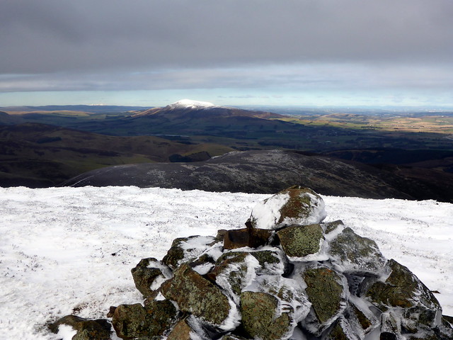 P1120171
 by
Al, on Flickr
The route to Chapelgill
 P1120172
 by
Al, on Flickr
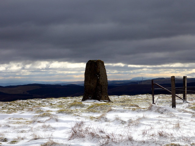
Chapelgill Summit
 P1120174
 by
Al, on Flickr
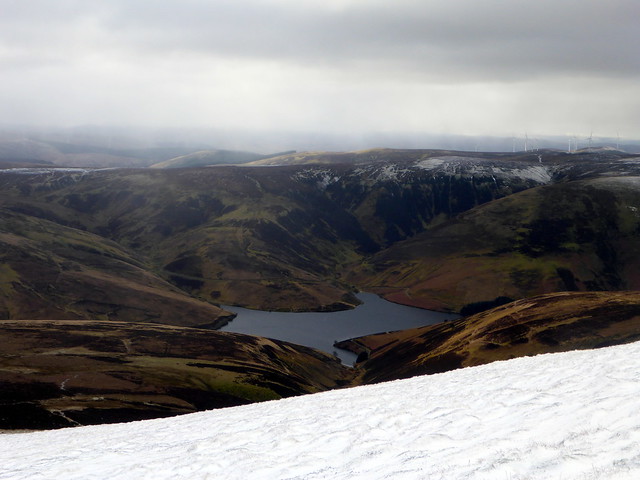
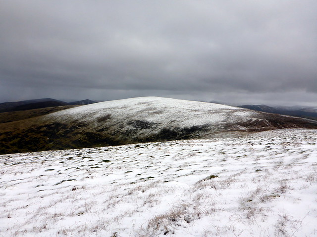
Pressing on, I descend south from Culter Fell over the insignificant summit of Moss Law - boggy with green pools of moss, funnily enough - then head down to Holm Nick. To my left is the asymetrical shaped Coulter Reservoir. Again following the fence line to the SE I climb another 150m across to the top of Coomb Hill, back down over Glenwhappen Rig where a pair of Raven croak their greetings and onto Gathersnow Hill, which - to be honest, hasn't gathered much more snow than its neighbours. The wind is bitter, and although it's about 12.30 I press on to the SW to find a more sheltered spot for lunch.
Looking South from Culter Fell
 P1120175
 by
Al, on Flickr
Culter Reservoir
 P1120176
 by
Al, on Flickr
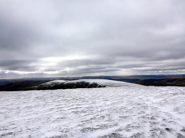
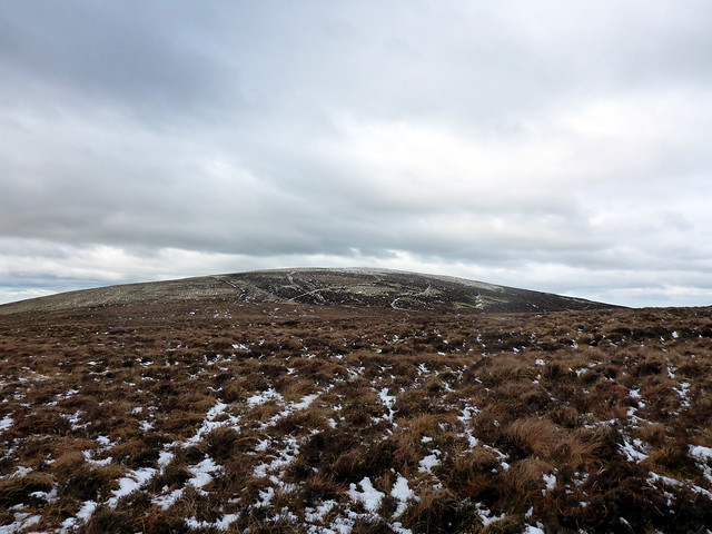
Gathersnow from Moss Law
 P1120178
 by
Al, on Flickr
Coomb Hill
 P1120180
 by
Al, on Flickr
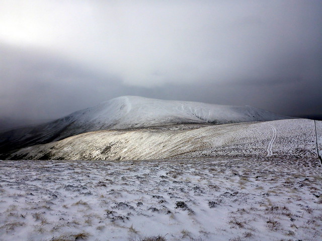
Culter Fell from Coomb Hill
 P1120182
 by
Al, on Flickr
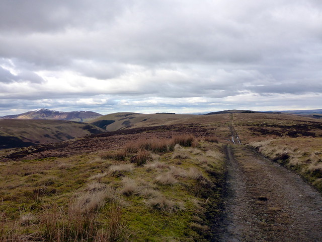
Tinto, Culter Fell from Gathersnow
 P1120184
 by
Al, on Flickr
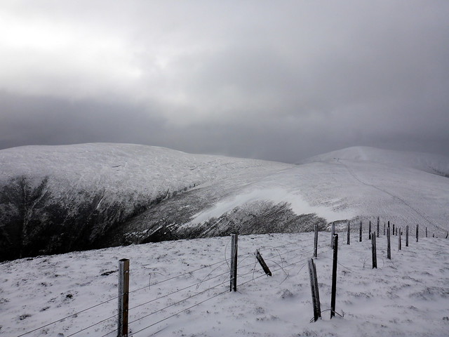
The route south over Hillshaw Head and Coomb Dod from Gathersnow
 P1120185
 by
Al, on Flickr
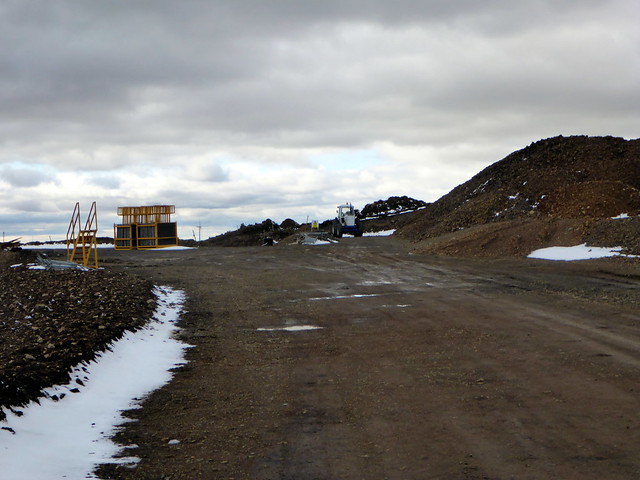
I'm hungry as I locate a wee dip along the route and pull out my sandwiches. Over to my right I can see a motorway-sized construction road has been built that looks as if it will take me from Coomb Dod to Hudderstone - that will make progress a lot easier than rough heather. My pleasure is cut short when I find my coffee is at best lukewarm. A hot cup of coffee and a wee bar of chocolate is always one of the anchoring moments I look forward to when I'm out, and this was not part of the script. I've no idea what has gone wrong with the thermos, or whether I filled it with an incompletely boiled kettle. Lacking the warmth of coffee inside, I kept my belay jacket on, but had to stop after another 10 minutes and put on my "serious" gloves - it was absolutely Baltic.
The route to Hillshaw Head is fairly low-energy expending. From the top I was rewarded with views to the Fruid Reservoir. Looking back over my route, Culter Fell looks an impressive hill with its white top just glimmering in the sunshine. I continue on to the top of Coomb Dod. There's a dark coloured trig point which looks as if trilobites have been nibbling away at it. I retrace my steps for a bit then cut left onto the road. It is muddy and ugly but it sure helps propel me forward. A workman in a van pulls up and cheerfully asks me to take care as there's a couple of machines working up ahead. I press on along this unexpectedly good surface, not minding at all that it undulates a bit. Near where the machines were working (putting down cables) I took a right fork in the road that led me almost to the top of Dod Hill, where the construction work currently peters out. From here it was only a hop skip and jump to the final objective of the day, Hudderstone Hill. The summit was marked by two tiny flags, removed from the construction site.
Hillshaw, looking to Fruid Reservoir
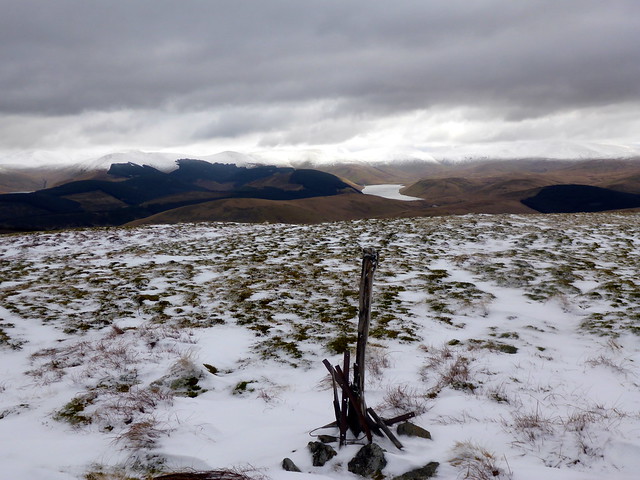 P1120186
 by
Al, on Flickr
Coomb Dod with the new road
 P1120187
 by
Al, on Flickr
Trig, Coomb Dod
 P1120188
 by
Al, on Flickr
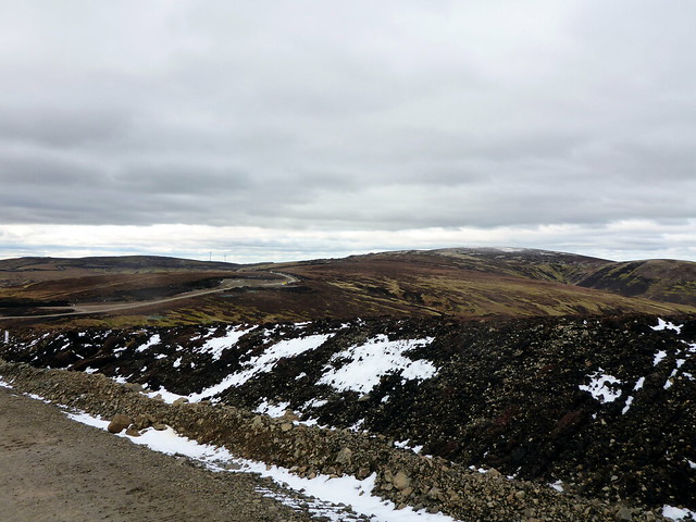
Not pretty
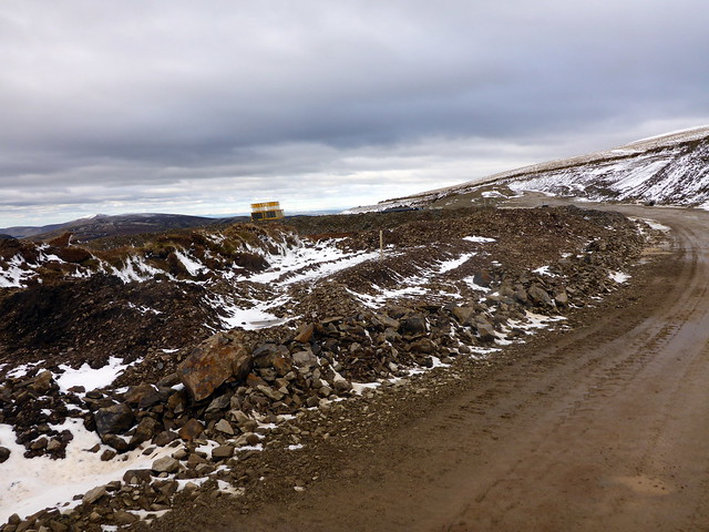 P1120191
 by
Al, on Flickr
Huge storage vaults for the souls of animals disturbed during the construction process
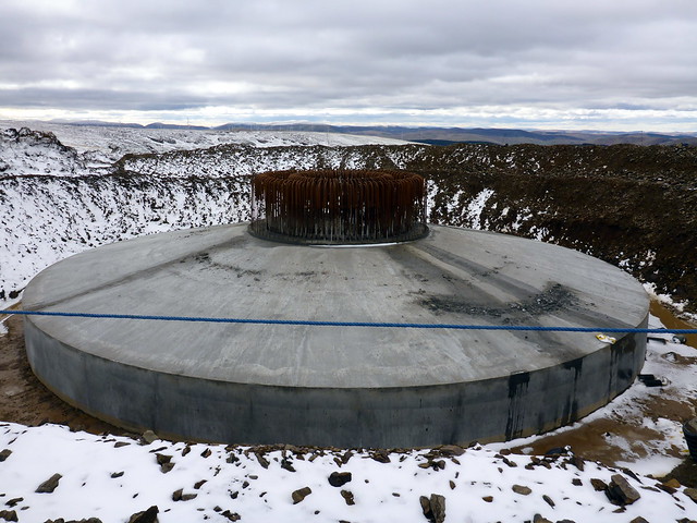 P1120192
 by
Al, on Flickr
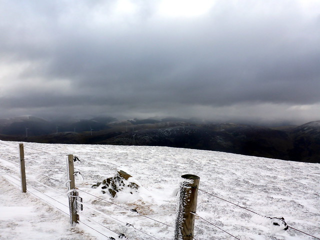
It's going my way

 P1120193
 by
Al, on Flickr
Camps reservoir
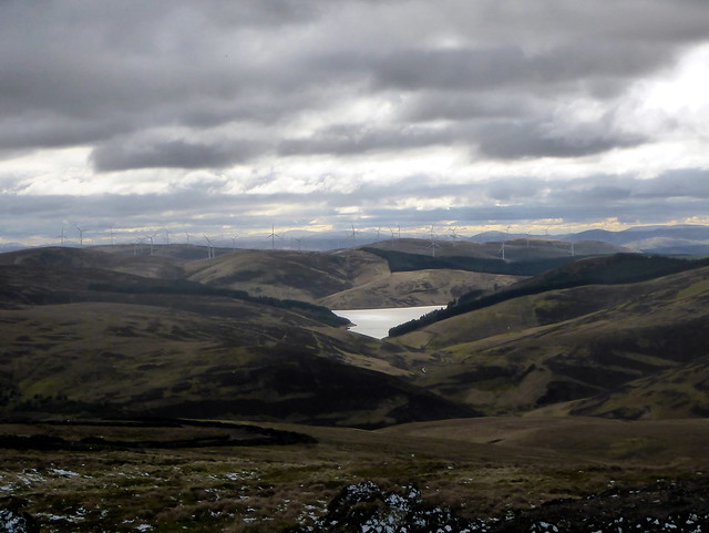 P1120195
 by
Al, on Flickr
Near the top of Dod Hill
 P1120196
 by
Al, on Flickr
Hudderstone
 P1120197
 by
Al, on Flickr
Tiny summit flags and Tinto in the distance
 P1120198
 by
Al, on Flickr
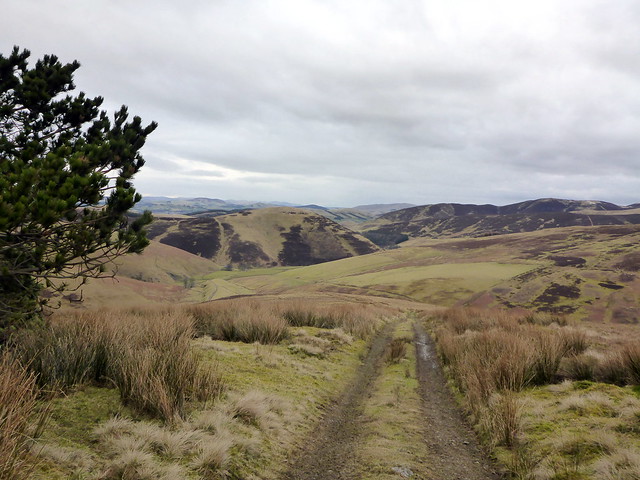
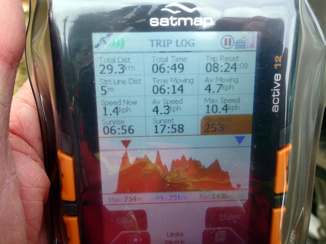
From here it's a gentle return to the starting point - initially NW along a faint trail then onto a proper track down Cowgill Rig. There are footprints in the snow of several folk who have come up this way although I've seen no-one except the van driver all day. In places the track is waterlogged, needing a step round the rushes, but it is an easy romp back to the tarred road from Cowgill and thence just over a km back to the car. A pleasant afternoon now, past grazing sheep and small flocks of starlings and crows milling in the air over the fields. It's not yet 3.30 which means home by 5pm.
Descent from Hudderstone
 P1120200
 by
Al, on Flickr
 P1120201
 by
Al, on Flickr
 P1120202
 by
Al, on Flickr
 P1120204
 by
Al, on Flickr
