free to be able to rate and comment on reports (as well as access 1:25000 mapping).
In March 2013 we visited the remote village of Arnisdale to climb Beinn Sgritheall. It was very exhilarating, if painful experience and when describing it a few days later, I gave the report a suggestive title
The steepest Munro ever. We knew well enough, having ticked off Sgriol, that one day we would come back to this God forsaken place on the western coast of Scotland to climb the two neighbouring Corbetts. Somehow, doing them all in one go always seemed beyond me

But a circuit involving only Beinn na h-Eaglaise and Beinn nan Caorach, as described in SMC Guide and by Waklhighlands, always looked interesting. OK, I'm not afraid of steep slopes. My knees may hurt afterwards, but let's take the challenge!
So here comes the second part of Arnisdale story, called, not surprisingly, The steepest Corbetts ever. Having only done about 40% of C's I can't say for sure if they are the very steepy-steepish-steepest in all Scotland

, but definitely the steepest of those I've done so far. My knees and my feet agree.
Our route mostly follows the WH description, with a slight variation on the descent (made no difference, it's just as painful everywhere

).
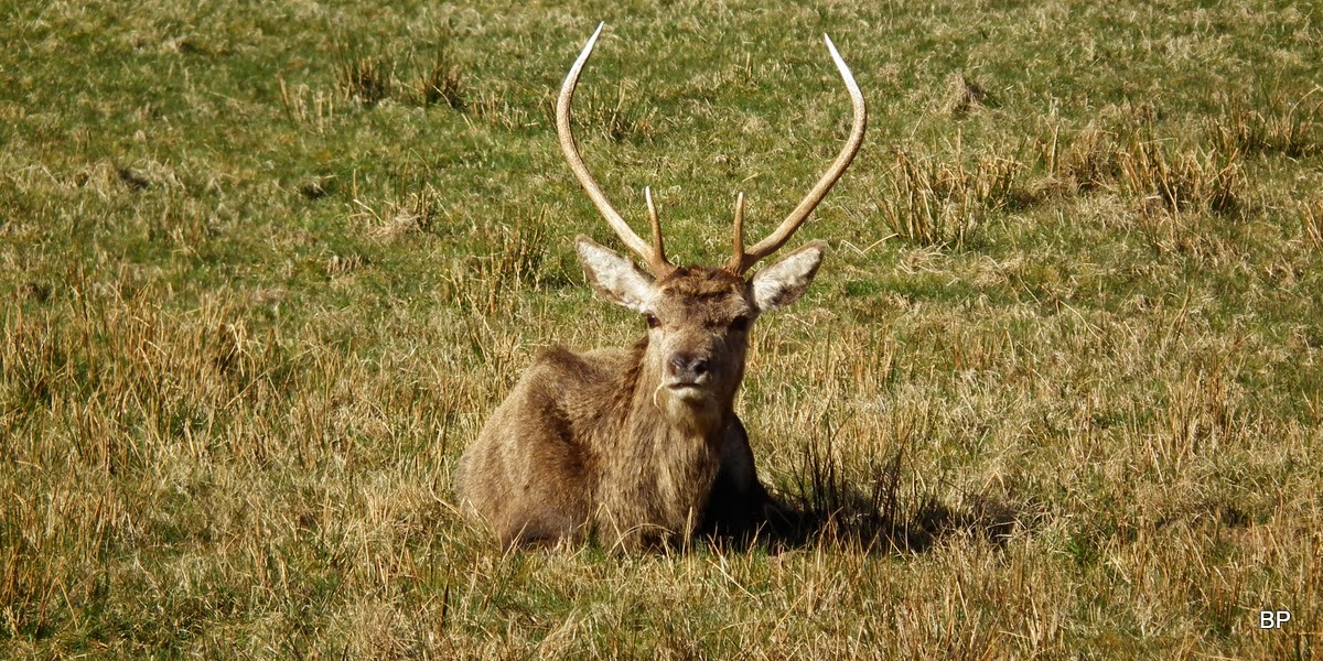
The new car park at Corran offers superb views even from sea level, the visitors centre has clean toilets and a few deer were busy chewing grass in the field nearby, so plenty to entertain a casual walker
Bon apetite!
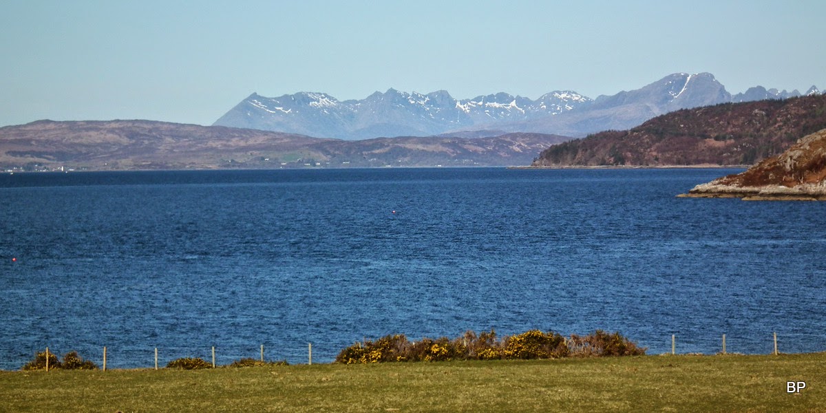
Isle of Skye - Cuillin Ridge and Blaven on the western horizon:
Weather was just as good as the day before and we felt ready for something more challenging. Saturday's climb to Ghlas Bheinn, with all the beautiful panoramas it offered, somehow felt like cheating. Now we had something much more tackling to try!
At least there was a slight consolation - we knew that a good stalkers path/track goes half way up Beinn nan Caorach, so maybe, just maybe, it is going to be tad easier than Sgriol!
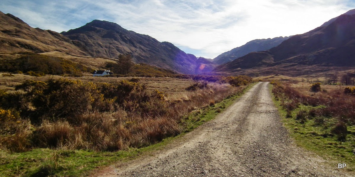
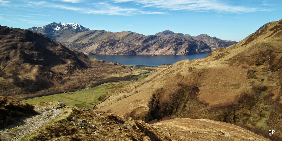
We started from Corran and turned onto a private road to Glenfield Cottage before reaching Arnisdale.
Take this track:
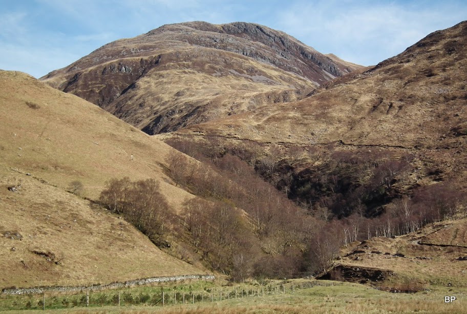
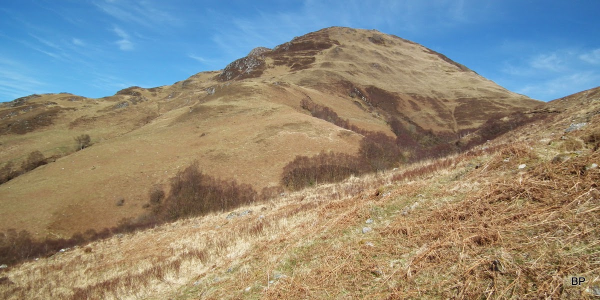
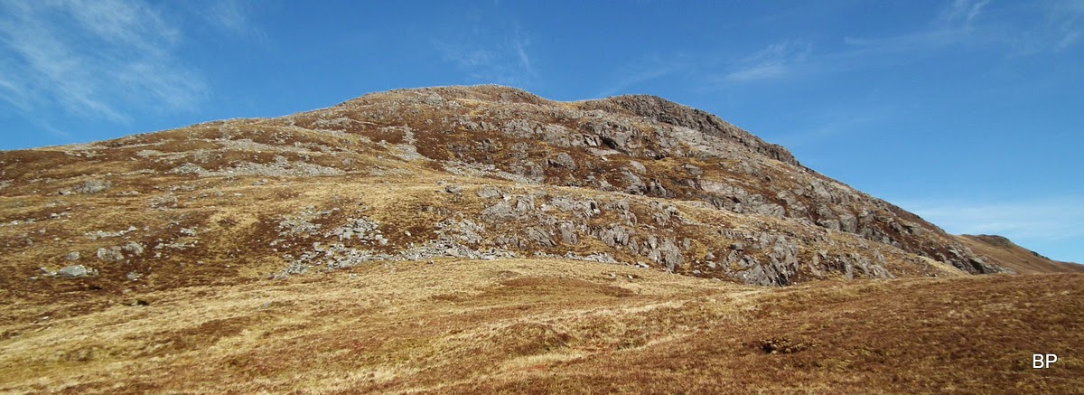
We walked past a house and a few pastures (more deer grazing here, completely ignoring us) and reached the point where the road crosses River Arnisdale. From this point, we aimed across the meadow towards a ruined shed and teh start of the stalkers path. Zig-zags of this path can be clearly seen in this photo. The summit of Beinn nan Caorach in the middle:
We crossed a small, wobbly footbridge over Allt Utha and found the path, which was more a wide track. I had a good look at the SE slopes of Beinn na h-Eaglaise, making a mental note - this could be our descent route. It looked steep but very grassy and as the day was dry, I thought it could be a good option:
I admit we cut corners on the ziggy-zaggy track...
...took some breaks for photographing, especially the view behind us to Ladhar Bheinn...
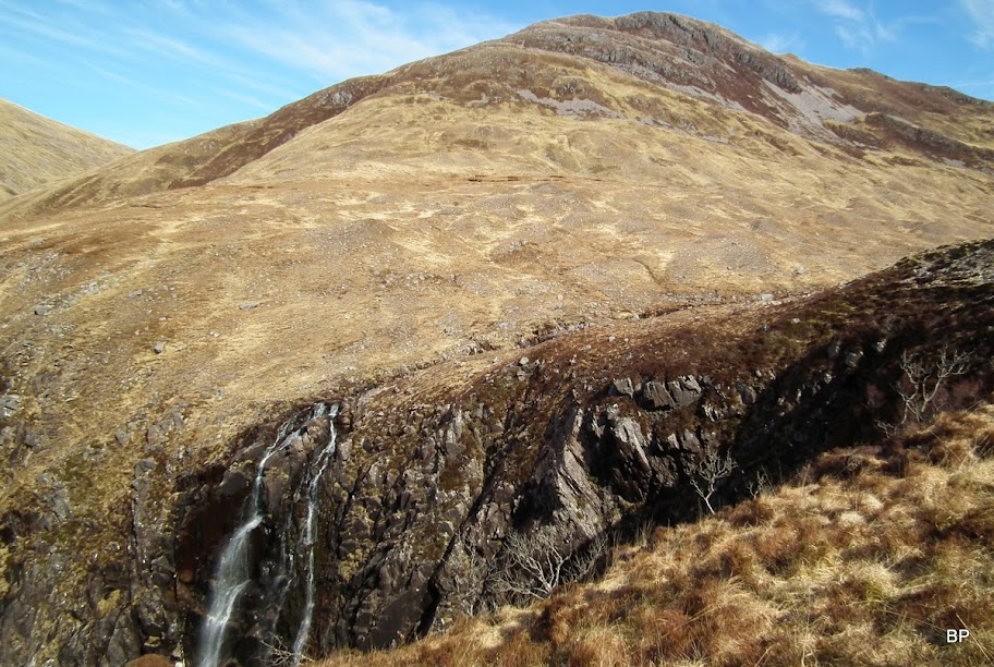
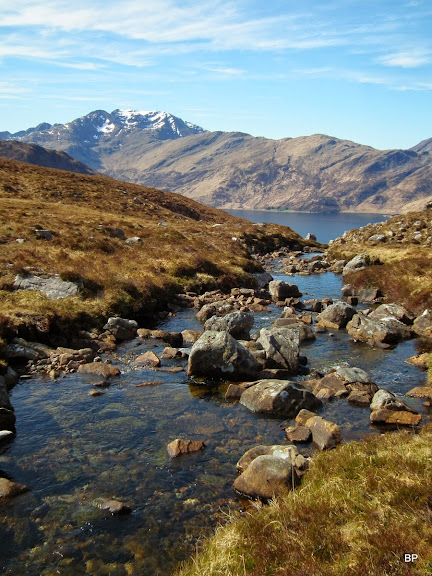
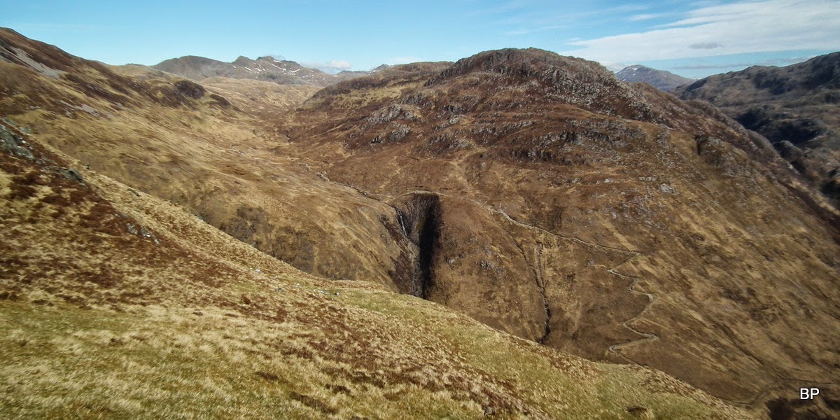
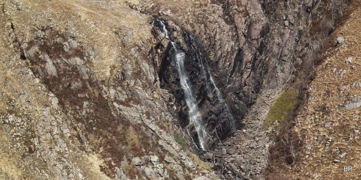
...and relatively quickly, we arrived by Eas an Cuingid waterfall. This would be a spectacular feature in spate or in winter time (with icicles hanging from the rocks) but due to dry conditions recently, the fall was hardly more than a dripping burn:

We could now see the next stage of our route - pathless it was but looked very green, so hopefully dry grass rather than bogfeast... Some rocky outcrops higher up:
Ladhar Bheinn from just above the waterfall:
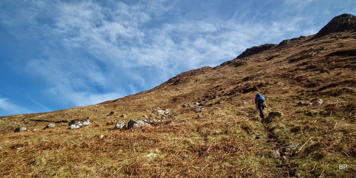
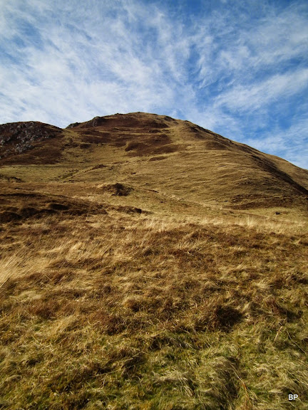
The stream was easy to cross and then the painful part of the ascent began! I was so glad we came here on a warm, dry day! In wet conditions these slopes would be a nightmare!
The worst part is, I think, about a 100m of ascent at a very acute angle, on pathless ground covered in scratchy heather and scattered boulders. This really squeezed sweat out of me!
Looking down... Ehmmm... Steep... But what a view
We took a short break about 200m below the summit, to swallow some chocolate and HobNobs (our bodies were crying for sugar!). We carried extra bottles of water today and this proved a wise idea, too!
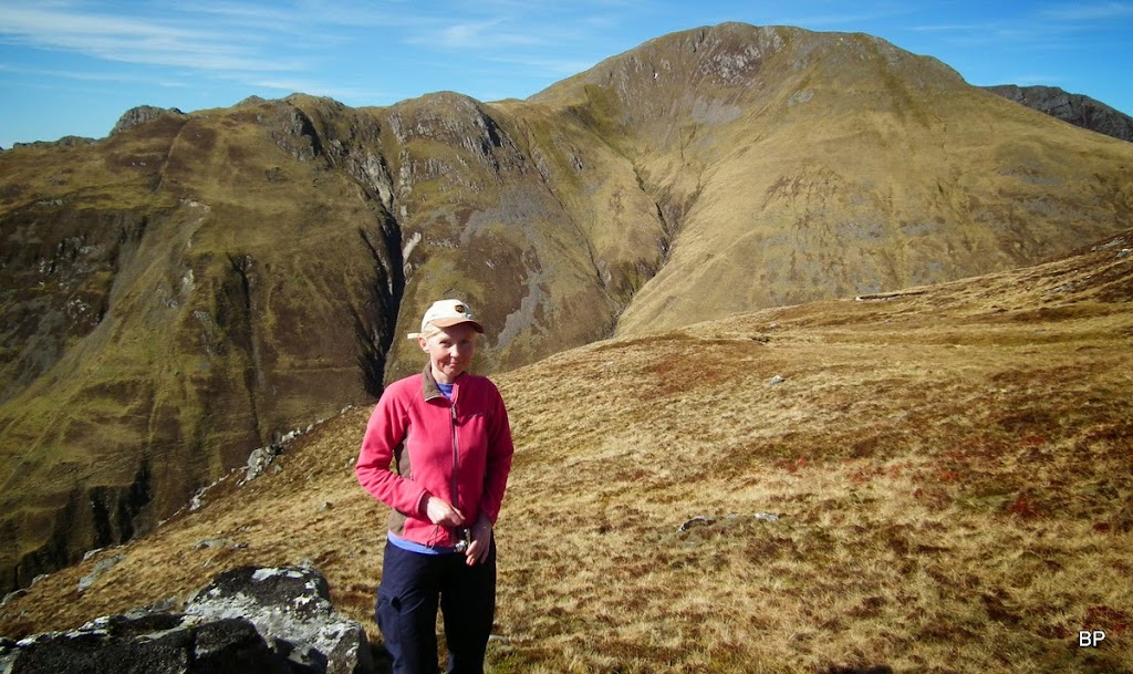
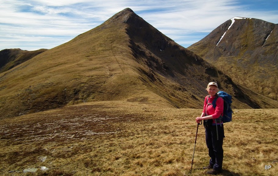
Posing with the Beinn Buidhe ridge behind:
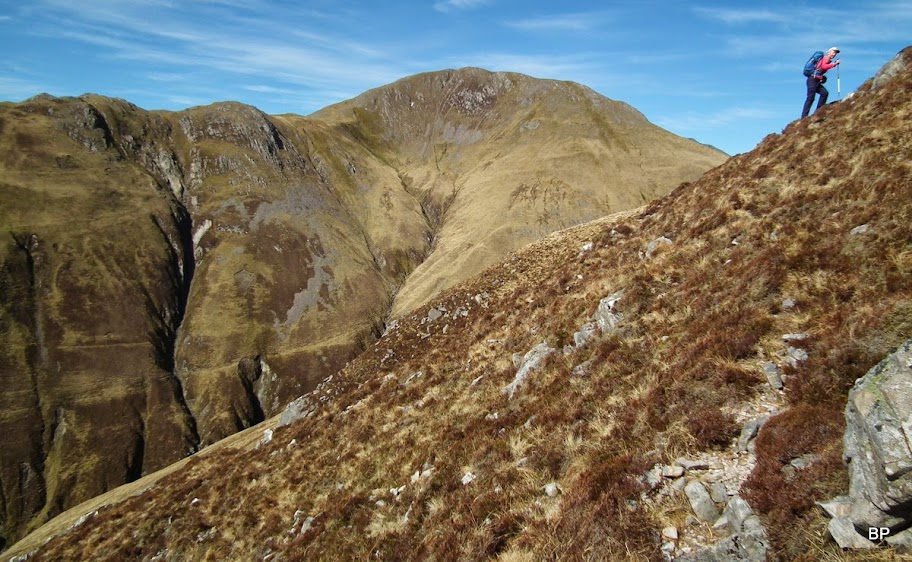
The final climb didn't look too bad, a few short, steep sections, but I hoped the worst was already done!
Continuing up after refreshments, we found the higher slopes much less painful indeed, and soon the best views of the day started to emerge...
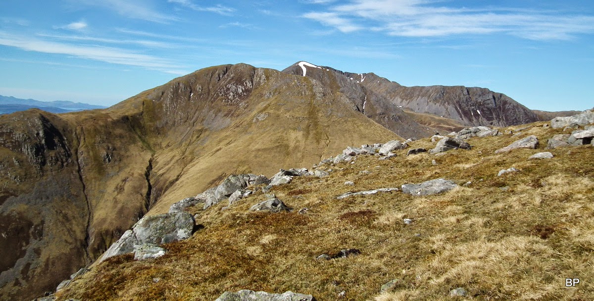
Beinn na h-Eaglaise and Sgriol behind:
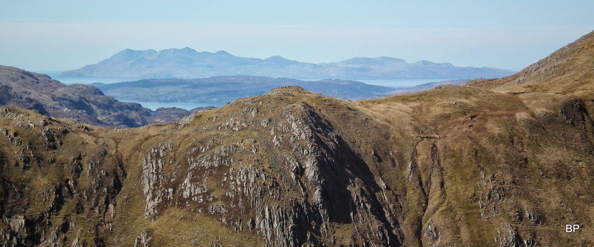
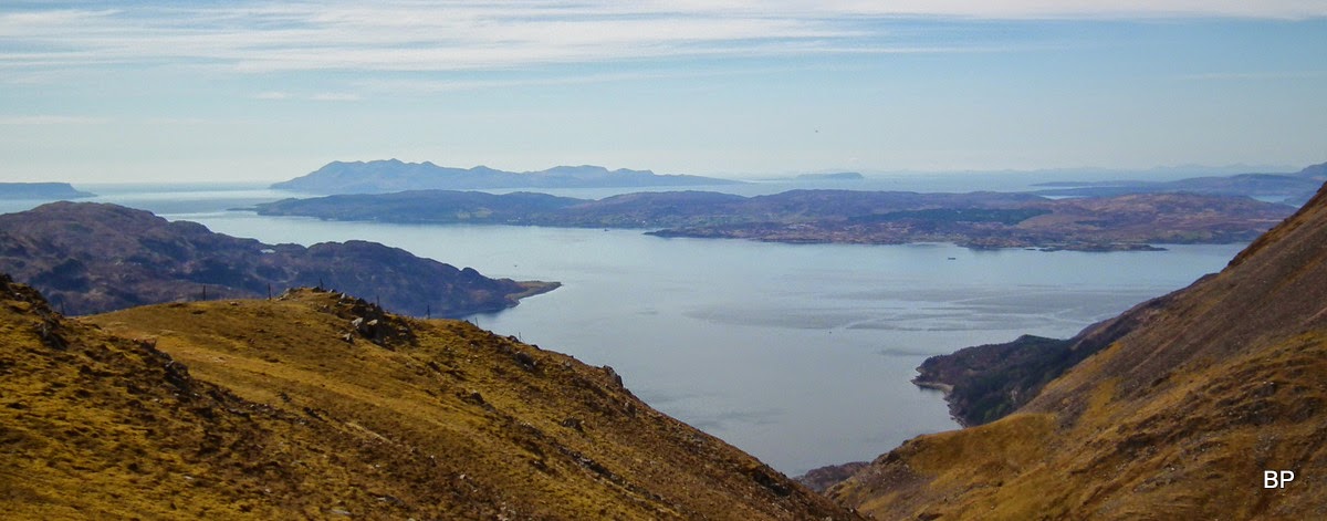
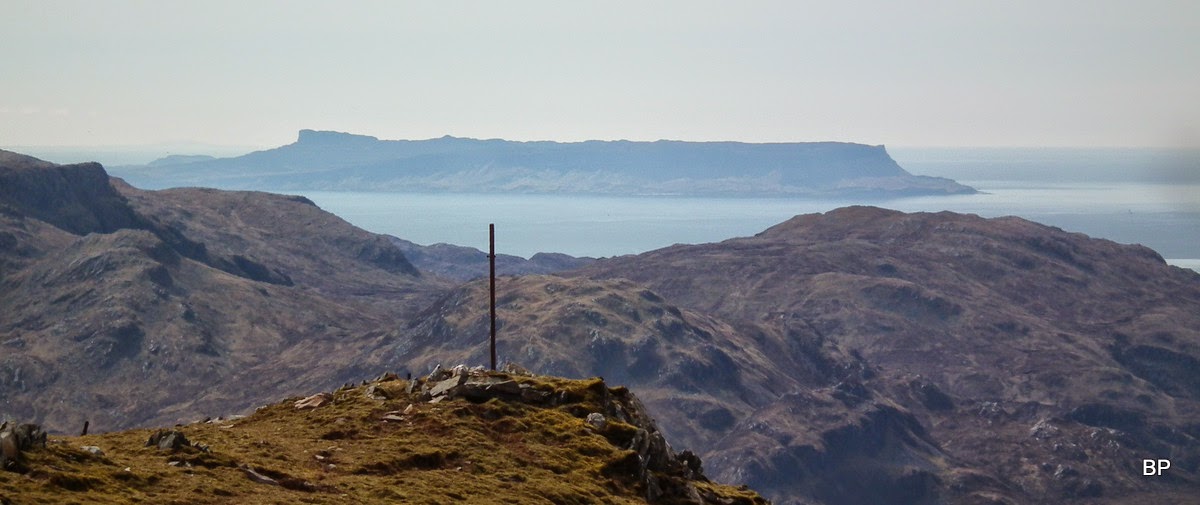
Isle of Rum showed up:
Sadly, Cuillin Ridge was hidden behind the bulk of Sgritheall, but we caught a glimpse of the northern end of Trotternish Ridge:
Just below the summit we scared off a pair of ptarmigan (to be honest, they scared us just as much
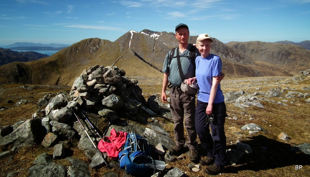
). By the cairn, we met another walker, the only person we saw on this route that day. He was doing the Corbetts from Glenelg side. After helping us with a summit photo, he set off to climb Beinn na h-Eaglaise straight away, but we decided to stay behind for a few minutes, have a cuppa by the cairn and enjoy the beautiful vistas.
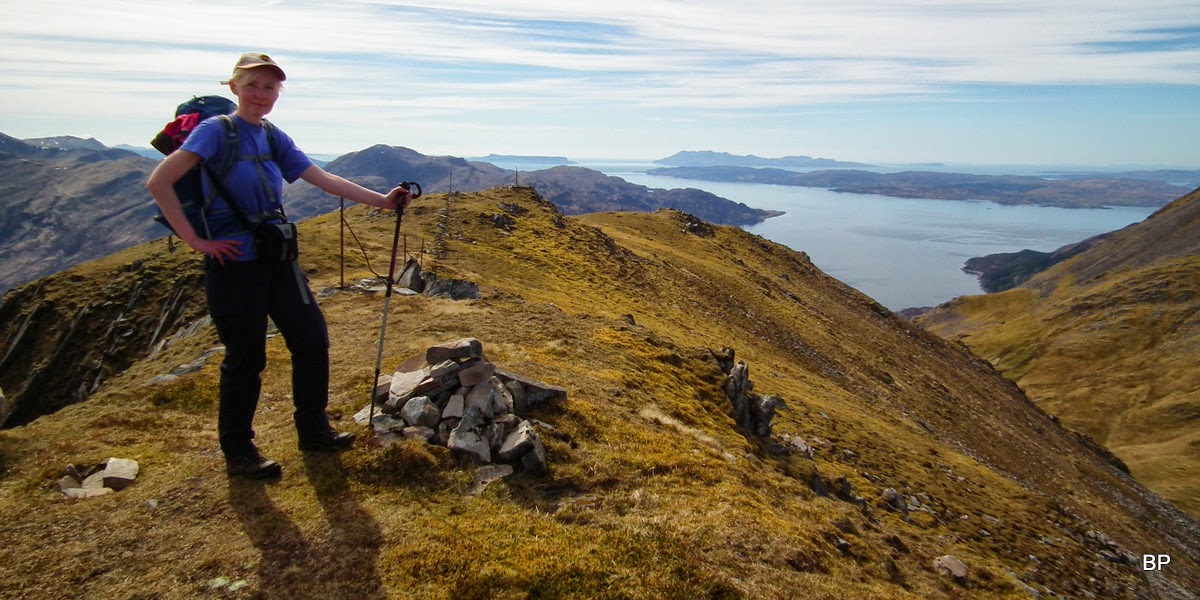
Another Corbett done:
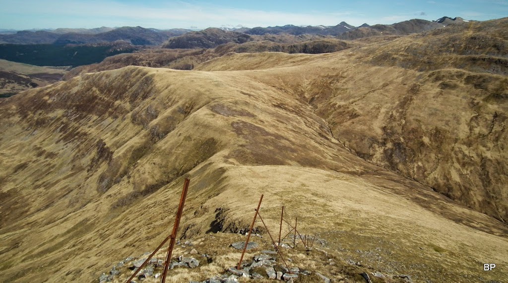
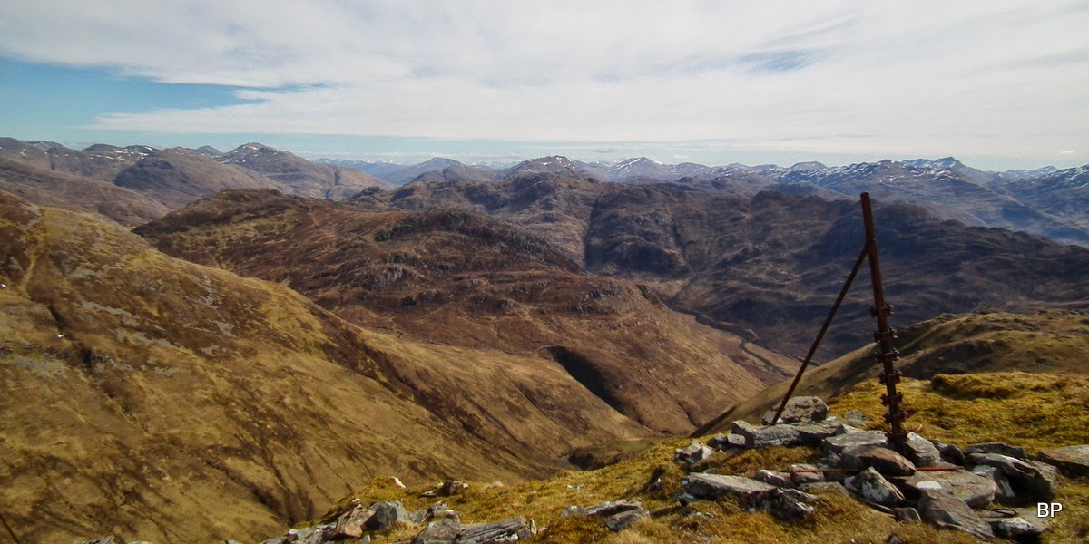
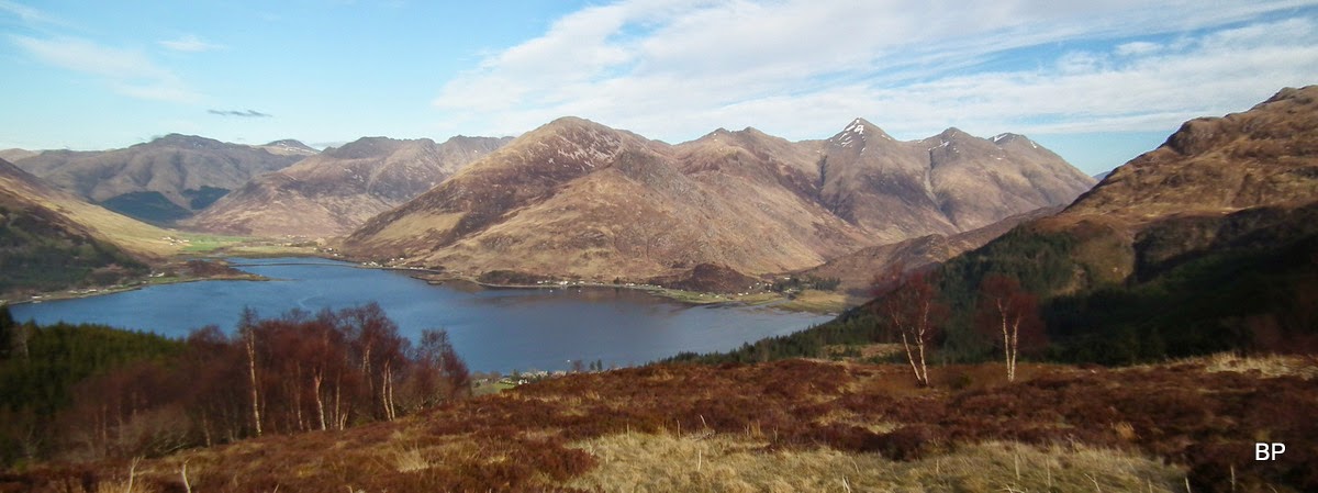
Beinn nan Caorach is a great viewpoint. To the north and east, Glen Shiel peaks dominate the view, with The Saddle being the most prominent:
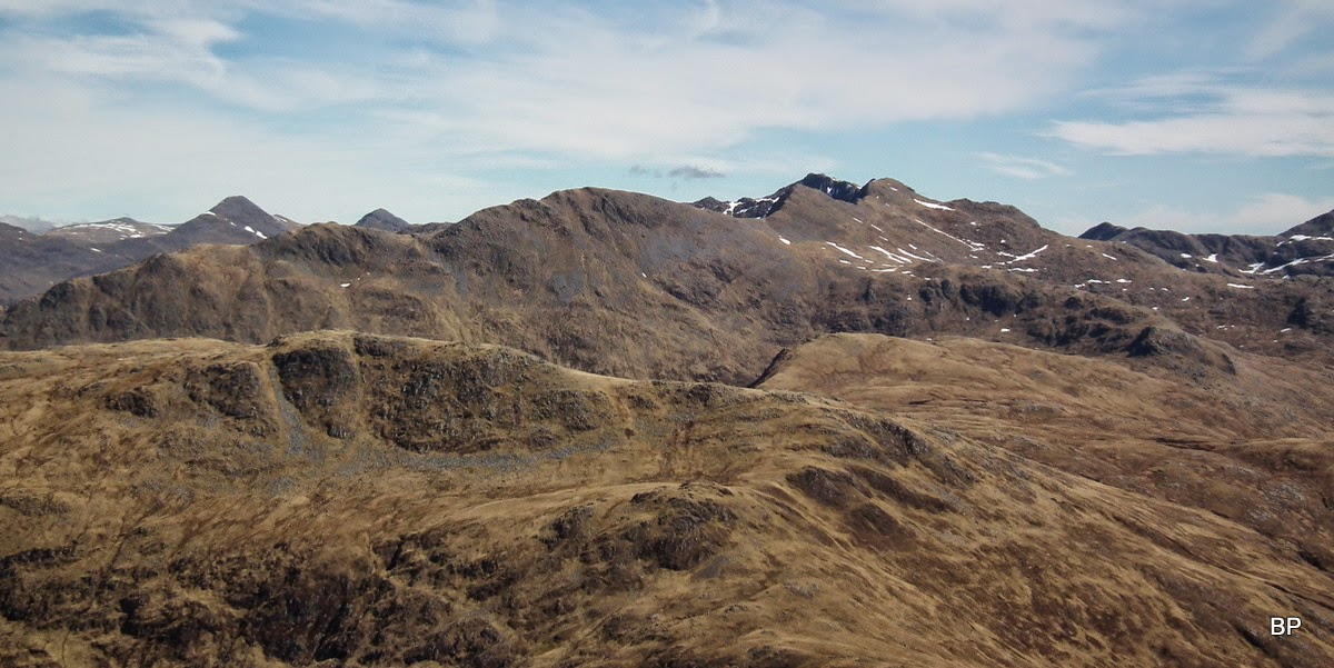
The sisters peeking out from behind:
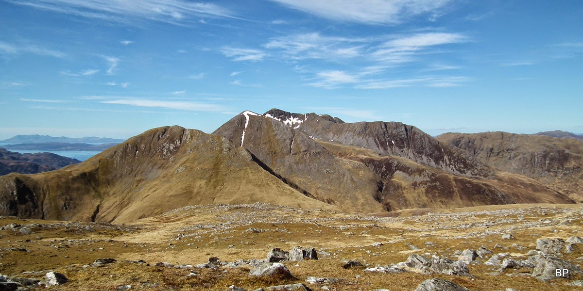
The grand vista to the west, Beinn na h-Eaglaise and Beinn Sgritheall form a very shapely ridge:
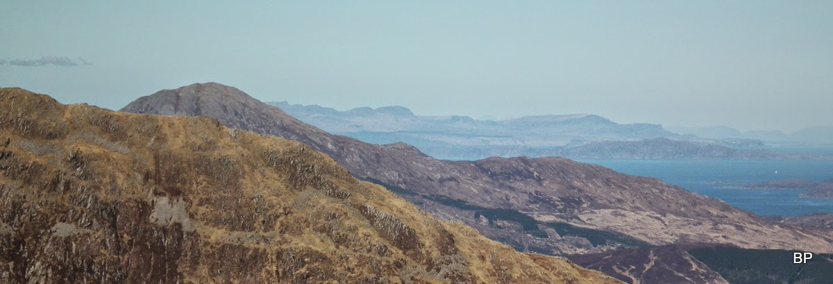
Distant Torridon:
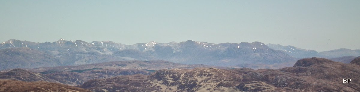
Zoomed Beinn Alligin:
There was much, much more but I have to put some restrictions on myself, otherwise this TR would be a mile long!!!
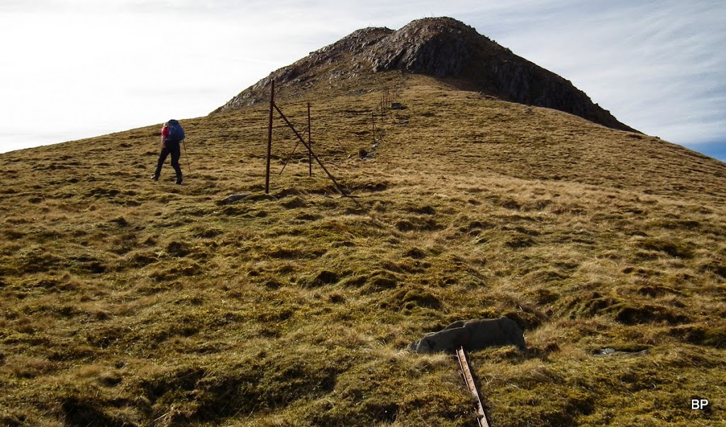
Having had a good rest, we gathered up our stuff and started descending to the high col between the two Corbetts, Bealach Dhruim nam Bo. The ground was not too steep here and my feet appreciated this:
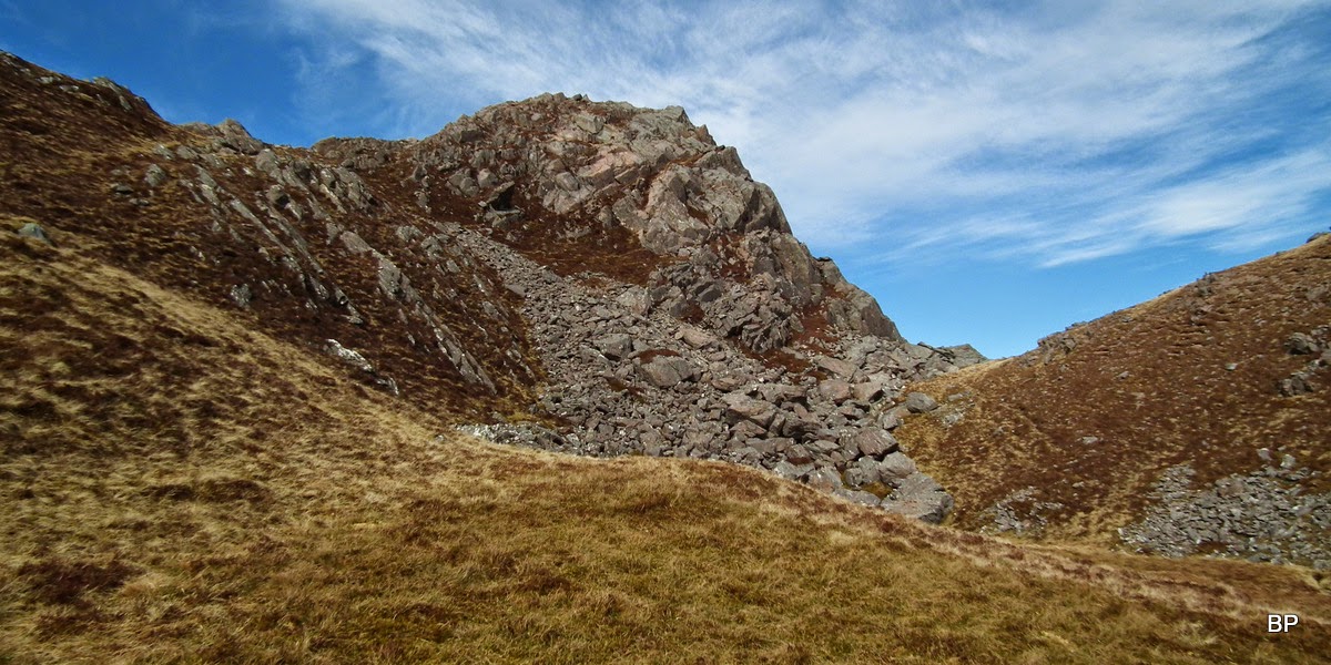
...though they would NOT appreciate what was to come next! The 200m stiff, very steep climb to the summit of the second Corbett:
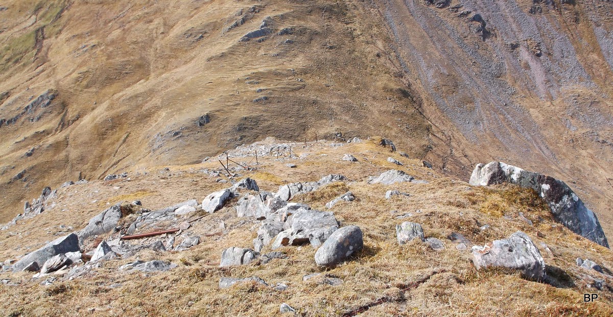
All right, let's go. There is a line of fenceposts to follow if weather plays up (no danger for this in our case
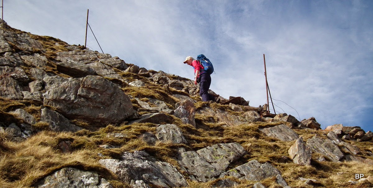
). The dangerous looking crags above can be easily avoided to the left hand side. There is a well-worn path all the way:
The first 100m are very grassy, but later the ground becomes more rocky. I was looking around for some scrambling maybe, but no luck here, just steep. Thankfully not slippery!
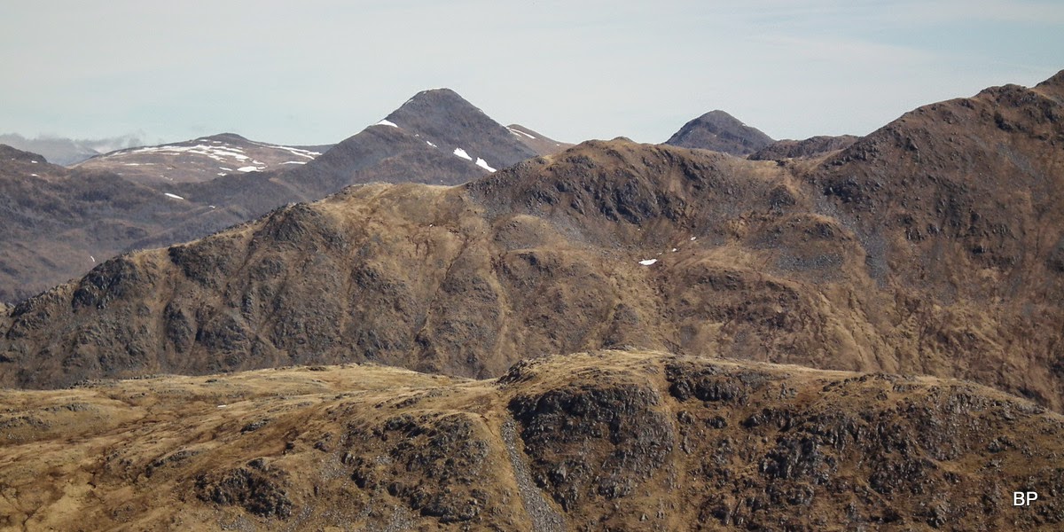
Looking down the ridge with The Saddle and The Sisters seen to the right:
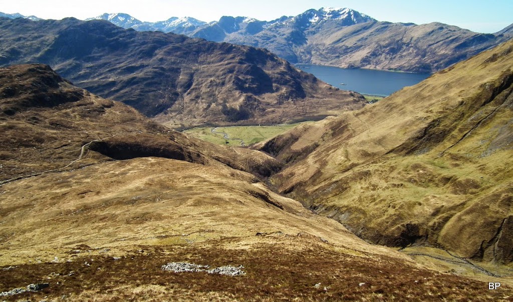
Glen Rosdail looking like seen from the plane, with Torridon giants on the horizon:
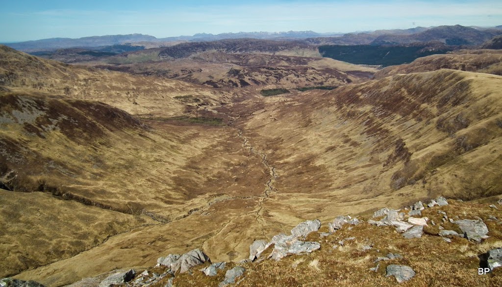
Loch Quoich and Knoydart peaks. In the foreground, two Grahams, Druim Fada and Beinn Clachach. They must be just as steep as anything in this area, but now I'm "into" climbing them, too! On a good day, of course. Not hills for bad weather, these.
Close to the summit, we spotted Rum again:

Looking down to the ridge of Beinn Buidhe, by now we decided this would be our descent route:
Summit of Corbett no. 87 and I had the satisfaction of bagging 2 C's in one day. As I have come to discover during my Scottish climbs, it is more difficult sometimes to climb 2 Corbetts in one walk, than two or three Munros!
Beinn na h-Eaglaise offers just as good vistas as its twin brother, especially to the west. Isle of Rum is very prominent:
And so is Eigg:
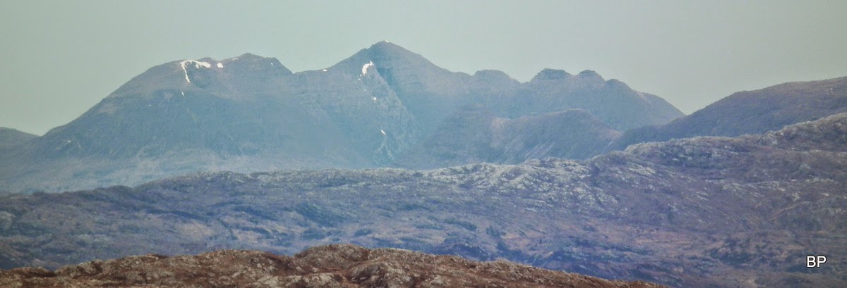
To the north, Liathach:
Beinn Bhan, the cliffs of Applecross:
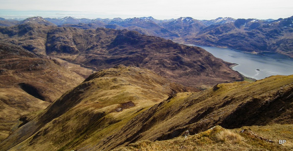
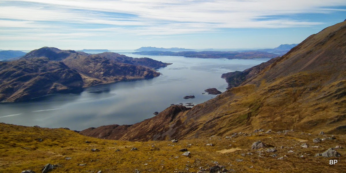
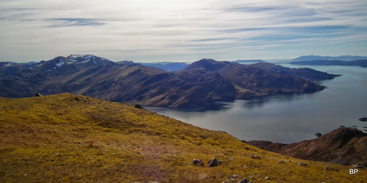
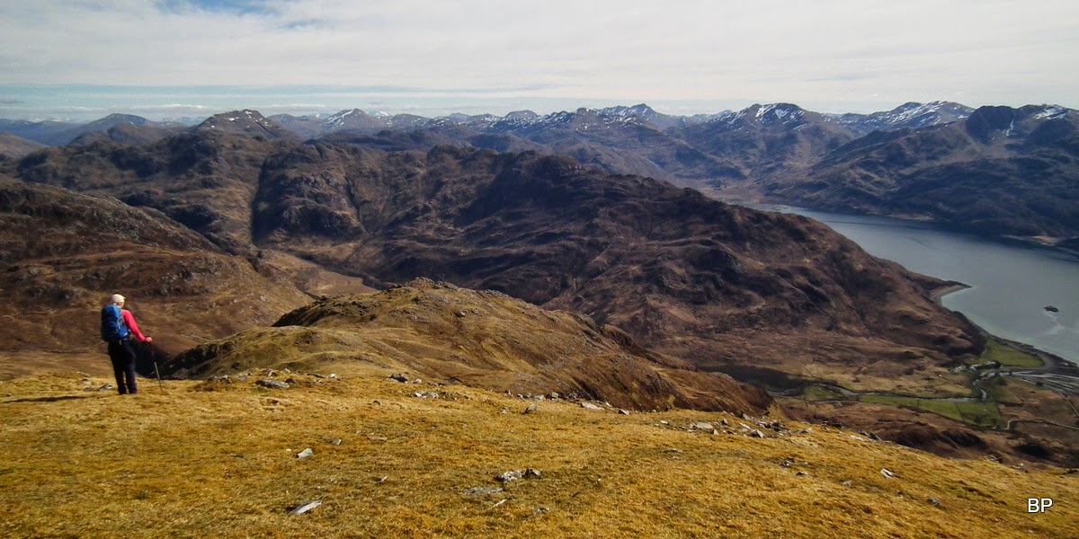
We traversed along the summit ridge and found a good spot to sit, facing the best view, west to Loch Hourn, the sea and the islands:
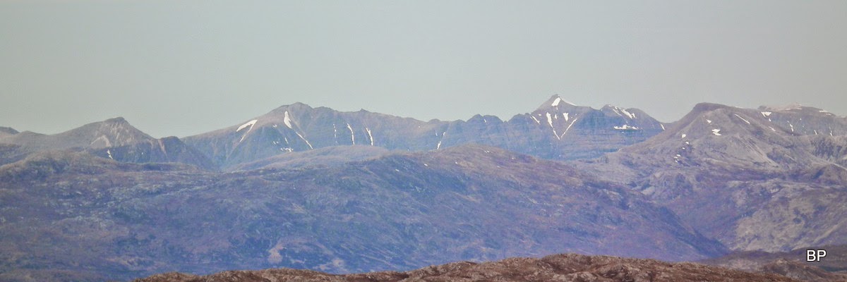
Cuillin Ridge - as much as we could see:
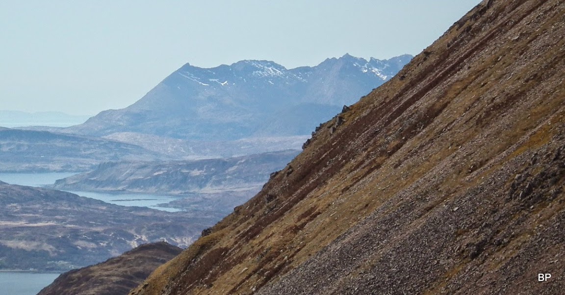
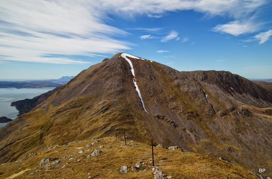
Beinn Sgritheall's east top (906m) and its almost perfect, conical shape. It's a very stiff, knee-jerking climb, higher up on loose scree
I'm glad I've already done it and to be honest, i don't fancy doing it again! But it makes a good material for mountain porn
The main summit of Sgrioll just visible behind the lower top, to the right:
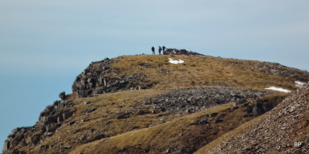
Sgrioll summit zoomed and no surprise, there were walkers on top!
Ladhar Bheinn and Beinn na Caillich, on the edge of land and sea...
Brave walkers combine the Corbetts with the Munro by descending along this ridge, following the fenceposts. Doable on a dry day, but I think I'll give this route a miss... Will be doing my knees a favour.
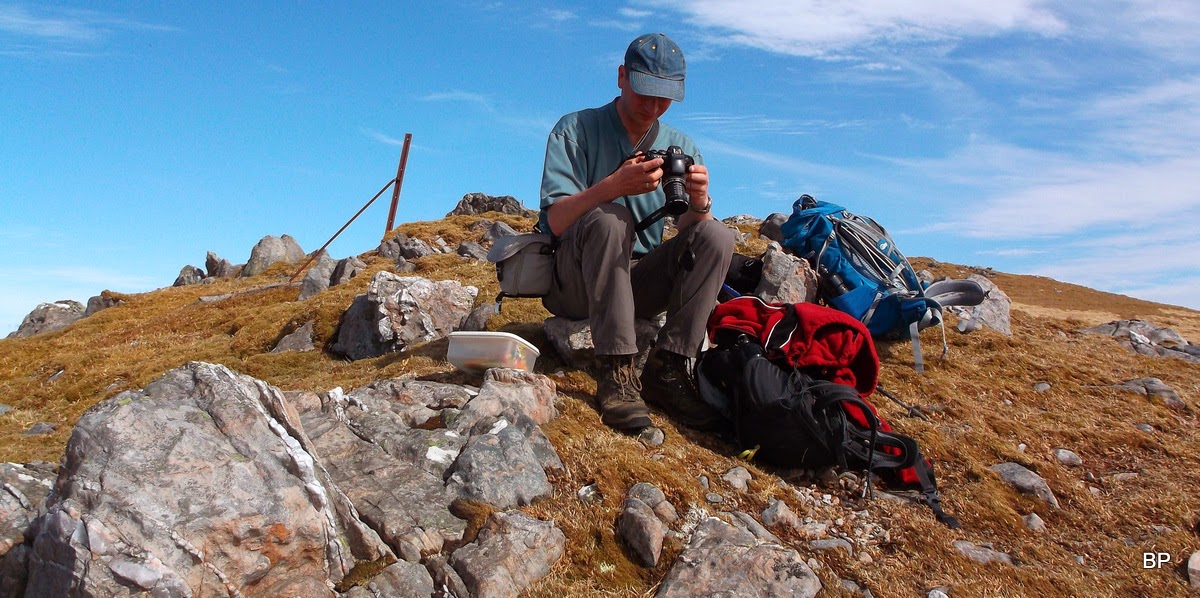
Kevin playing with his camera... He had enough time for such games and more than enough landscape to photograph
For the descent, we chose the Beinn Buidhe ridge. This is suggested as an option by WH walk description, the main route descends into a suspiciously looking gully. We had a good look at it from above and unanimously decided, we didn't fancy it. At least we had seen the lower slopes of BB ridge on our way up Beinn nan Caorach, so we knew it was mostly grassy and hopefully dry.
As we started walking down, we were still accompanied by the breathtaking panorama of Knoydart.
On the way down:
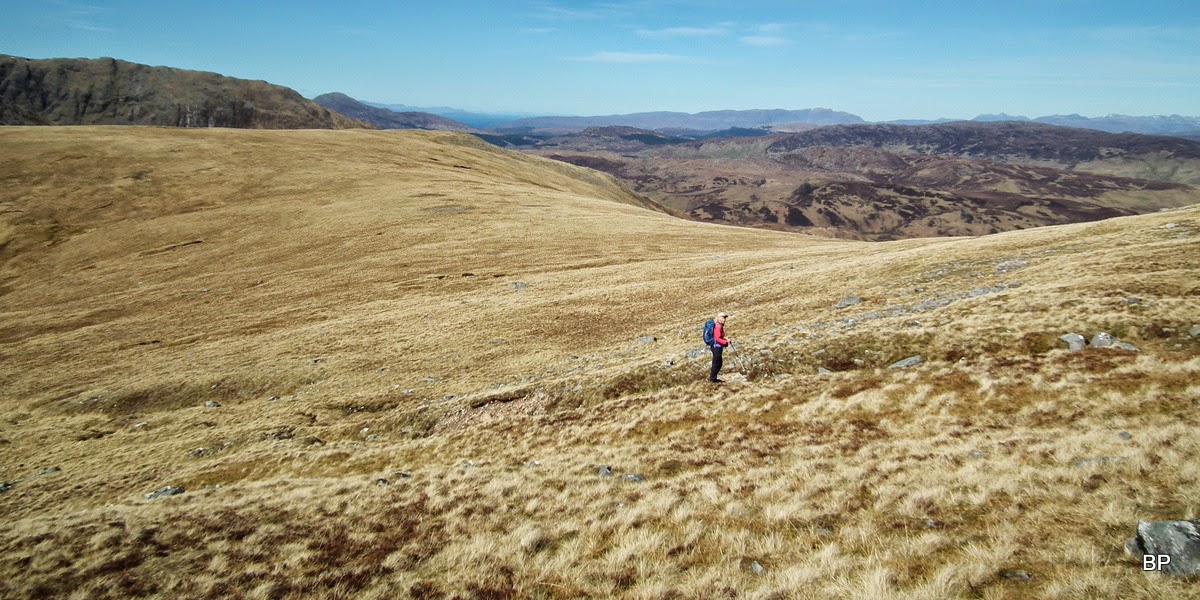
The first 200m of descent, though steep, were easy enough and we even found a sketchy path to follow. Then, the angle eased off for a short distance, as we traversed a few grassy lumps and bumps. A few very nice spots for wild camping high on the ridge if one wanted to

Countless newts in every lochan and puddle, must be their mating season!
The 611m "top" marked on 1-25k map is not really a top, but a rocky outcrop. We reached it and looked down, only to discover a vertical drop below... Luckily, it is possible to descend on more friendly terrain to the right hand side, which we did. The outcrop seen from below looked very imposing:
Beyond this point the ground steepened again and Kevin gave the slopes below him a suspicious look.
"Is it even descendable?" he asked.
"It has to be, otherwise WH would not suggest is as an option" I answered "Seems it's just as bad everywhere anyway. Want to go back and try that gully?"
"No, thanks. I think we can do it."
At least we had some nice views still to admire and sweeten the pain:
Zoom to Eas an Cuingid waterfall:
We took a deep breath and tackled the final stage. The slopes were steep, all right, and my knees soon started sending me their first signals of disapproval (especially the right one, courtesy of an old injury). I discovered a new technique of dealing with acute angles by zig-zagging 10 steps left, then 10 steps right, then left again, kicking the sides of my boots into the grass when it was necessary. We ended up manoeuvring a lot, just to pick the easiest ground. Painful, but entertaining in an odd way. At least I can say, I have a sense of achievement after completing this circuit.
We aimed for the little bridge over Allt Utha, at the height of about 200m we came across a path, which we then followed down to the field.
The descent line from below, looks less steep than it felt
Now it was a only matter of a short walk back to the car... and two and a half hours drive home!
Back in the car, I took off my boots and discovered that a nasty blood blister has grown on my left foot, obviously as a result of the downhill torture. Luckily, it was on the outer side of my heel rather than on the very back, so I hoped it wouldn't stop me from doing more hillwalking in days to follow...
On the way back home we couldn't resist a short stop at the viewpoint...
The Sisters of Kintail from Bealach Ratagain:
The circuit took 7 hours and it can't really be rushed too much unless you are superfit or very desperate to finish quickly
Even putting aside the fantastic scenery to admire, the amount of steep up and down must make these twins one of the most painful mountains in Scotland. I'm glad I faced them and emerged victorious. But a word of warning - Beinn na h-Eaglaise and Beinn nan Caorach should not be underestimated, especially on a wet day. Whichever way you decide to descend, in wet conditions these slopes would be potential ankle-twisters.
My next story will, hopefully, advertise a relatively unknown, neglected Corbett of Sutherland
