free to be able to rate and comment on reports (as well as access 1:25000 mapping).
Bit of a rubbishy forecast this weekend after all the fine weather recently. swithered about where to go and eventually decided to head up to Roy Bridge to Bunroy Campsite (always a favourite though less enjoyable when The Midge is out and about). We'd tackle Binnien Shios and Binnien Shuas on Saturday then head to Newtonmore and take on Creag Dhubh and Creag Liath on the Sunday. I managed to forget my camera, so this will be an unillustrated blog (Allison did take her phone on the Sunday however).
We got pitched in the campsite in a fine drizzle. The midges were indeed in abundance - quite a shock to the system after recent midge free weeks. We watched a group of young people from the North of England pitch a motley collection of tents, responding to midge bombardment in typical fashion - quite funny to watch when it isn't happening to you

It continued to drizzle overnight and the morning found the cloud down to around 600m. Not the best day for the hills, but been out on worse.
Drove along Gleann Spean to the parking space just past Moy and set off across the concrete walkway to the southern shores of Loch Laggan. We continued along the shore path, noticing the water level, much lower than usual, revealing a mass of golden sand. Continuing on til just before Eilean na Tunnag we cut up right into the trees, heading up before the tree density increased. We came to a fence and crossed, contouring round the crags at the extreme north of Binnien Shuas and finding the flat grassy area in the bealach between the two hills. A little boggy not bad. So far we'd been walking for a while and gained less than 100m. Easy grassy slopes permitted the ascent of Binnien Shios. As we gained height we came to veins of pink and white pegmatite. It's quite a long stroll to the summit cairn, crossing some peat hags at the topmost section. We paused for lunch near the cairn, noise from traffic on the A86 intruding on the moment.
Descending the same way as we'd climbed we reached the bealach and pondered the best line to take up Shuas. Described in the SMC book as a "complex mountain", it's probably best avoided in poor visibility due to crags and slabs. We decided on a grassy runnel to the northern side of the face, climbing from right to left. This proved straighforward and we simply continued on the same line through the knobbles at the crest of the hill until we reached the summit. Descending, I would have headed right down a gully, but the instructions were to follow the NW shoulder of the hill. IN any case we cut a bit too northward and encountered crags below those marked on the 1:50k map - beware in bad visibility. After some threading round the worst of the crags we regained the track and romped back to the car. The sun briefly threatened to make an appearance as we drove back to the campsite for a refreshing shower and a three-course meal (Beetroot falafel & hummus; vegan chili (hot!) and apple pie & custard). Rounded off with a wee Highland Park.
This is what we did
This might be a more efficient way to do them:
Sunday dawned drier and warmer, with a faint breeze to dissuade the more feeble midges. We packed up and drove to Newtonmore, parking in the village centre and walking along the road to the cemetary to start the walk up An Torr. The route was a hybrid of malky's and the SMC suggested route, although I think I would have started and finished at the parking place by the old township and saved about 7km

This walk does rely on being able to cross the River Banchor which you have to do twice (and the Allt Fionndrigh) so not one for time of spate. Today was fine as yesterday's rain had made little impact on the water level and the river was little more than ankle deep. The next section was through woodlands and proved tiring - boggy underfoot, various deer tracks to follow through the trees and uncertainty about quite which way to go. Eventually we reached the ridge line and pressed on through heather steeply up to the 480 point then easily on to the Simm of An Torr and onto a good footpath (so good that some Munros would be outdone by it
) that leads to the summit of Creag Dhubh. The clouds remained below 800m, restricting the views of the hills around. We stopped for lunch and looked over at Creag Liath. A lot of drop and re-ascent - although these hills have a high starting point (over 250m above sea level, there's a drop and re-ascent of nearly 400m between them). We continued along the ridge until we came to a col then headed north towards the gate in a fence.
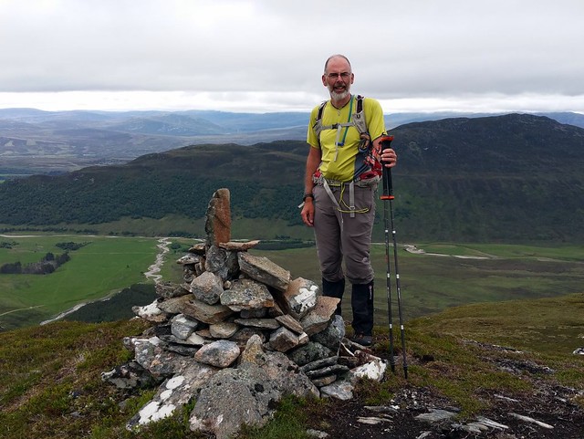
Summit Dhubh
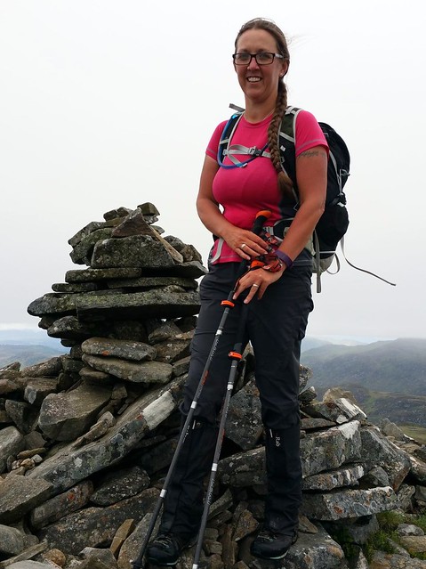 13405154_1378841748798591_467701089_o
 by
Al, on Flickr
 13410524_1378841615465271_1735216352_o
 by
Al, on Flickr
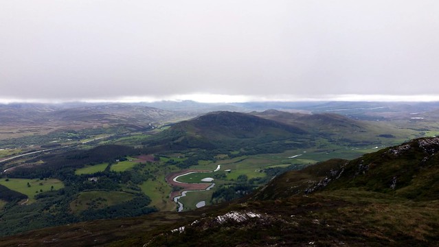
Liath from Dhubh
 13441784_1378841438798622_1947551425_o
 by
Al, on Flickr
From here we crossed Coire Shiaraidh, heading for the River Calder. in the process we disturbed a large herd of deer who had been resting in the coire - quite a few little fawns amongst them. They ran off, white rears bobbing as they fled in a line to a quieter part of the hillside. The river was broad and shallow. Crossing over, we watched colonies of sand martins swarm and swoop around steep sandy cliffs on the other side of the river, emerging and disappearing into their burrows high in the cliff side. We continued on over flat grass then boggier terrain making for the south end of Creag Liath. A straightforward pull up the back of the hill brought us out at the summit cairn. From here we had a choice - malky's route continued on NE to meet the track running alongside the Allt Fionndrigh, the SMC book retraced steps and headed east down Cas Bhuidhe. Shorter but over boggy ground - we settled for the longer tracked route. Once on the track we recalled that this was the site of our first wild camp, after climbing the 3 Monadhliath Munros. I remember the river being extremely cold as we washed our dishes (
http://www.walkhighlands.co.uk/Forum/viewtopic.php?f=9&t=29655) Ah - a lot has happened in the three and a quarter years since that escapade

Continuing along the track we finally arrived at the car park we used that time - however we still have about 4 km to walk back into Newtonmore.
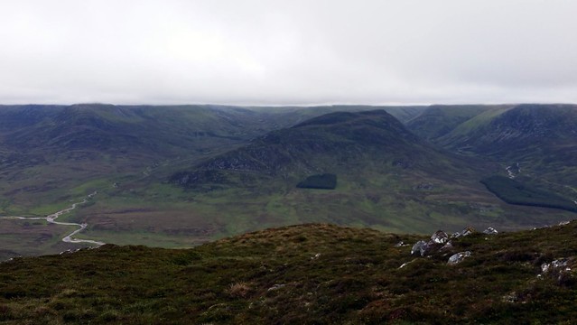
Liath
 13441696_1378841855465247_568169231_o
 by
Al, on Flickr
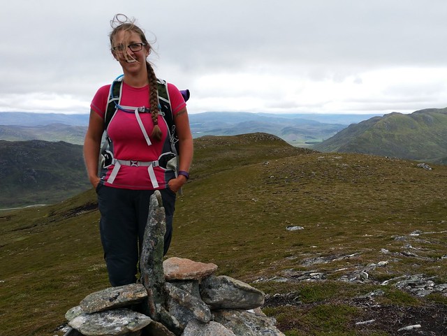
summit Liath
 13445916_1378841098798656_1288254553_o
 by
Al, on Flickr
 13445938_1378840992132000_638086870_o
 by
Al, on Flickr
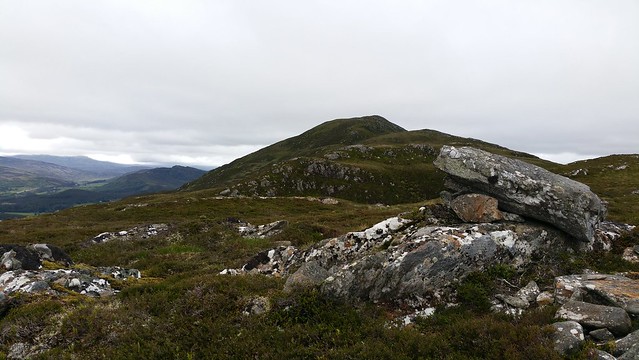
Liath from the track
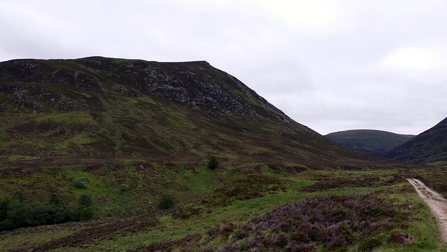 13453089_1378840885465344_934720102_o
 by
Al, on Flickr
