free to be able to rate and comment on reports (as well as access 1:25000 mapping).
Day 1 – Skye – Beinn Dearg Mhor
Day 2 – Skye – Marsco
Day 3 & 4 – Skye – Trotternish Ridge
Day 5 – Harris – Uisgebhal Mhor
Day 6 – Harris – Oirebhal and Tiogra Mor
Day 7 – Harris/Lewis – Rest Day
Day 8 – South Uist – Beinn Mhor & TheclaDay 9 – Skye – Glas Bheinn Mhor and Belig
Day 10 – Skye – Skye – Sgurr a’Bhasteir, Sgurr a’Fionn Choire, Bruath Na Frithe
Day 11 – Raasay – Dun Caan
Day 12 – Skye – Kylerhea Hills
Day 13 – Skye – Sgurr Beag
Day 14 – Skye – Sgurr nan Eag
Day 15 – Skye – Beinn Dearg Mhor & Beinn na Caillich
Day 16 – Skye – Sgurr nan Each
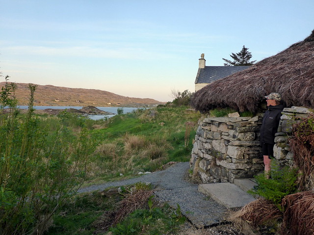
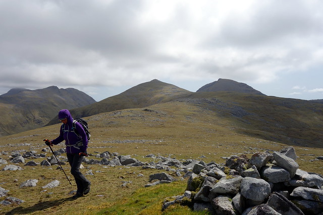
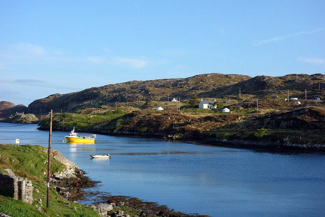
We left Uig on Tuesday afternoon and arrived at Tarbert at 8pm. Last time we'd been here was to do The Clisham and we'd been on foot - this trip I'd brought the car which would allow us to see a bit of the island as well as the hills. I'd spent a fortnight's holiday on Lewis about 15 years ago and had only come down to Harris once to the beaches - so it was ripe for exploration if we had time. I'd originally planned the Harris/Uist trip for the second week of our holiday, but the good weather was such an unexpected boon that I wanted to maximise the chance of sunshine on Harris - it did feel somewhat treacherous to be leaving Skye in such fine conditions. That meant that I'd not researched where to pitch the tent - I had a vague idea that we could camp on the beach at Losgaintir or maybe somewhere up nearer the hills we planned to do. On the road out of Tarbert we passed a sign for Lickisto Campsite and decided to take a chance on that. This turned out to be a rather fine gamble - it's an unusual eco campsite on what's been a few crofts/blackhouses and has a couple of luxury Yurts, a bothy, showers etc as well as an opportunity to pitch well away from anyone else in what would have been the vegetable beds of the croft. Not the cheapest (£12 pppn) but we were to enjoy it.
https://www.coolcamping.co.uk/campsites ... blackhouse
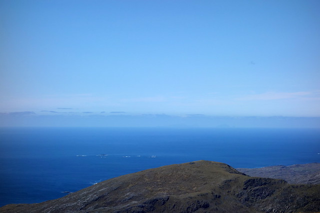
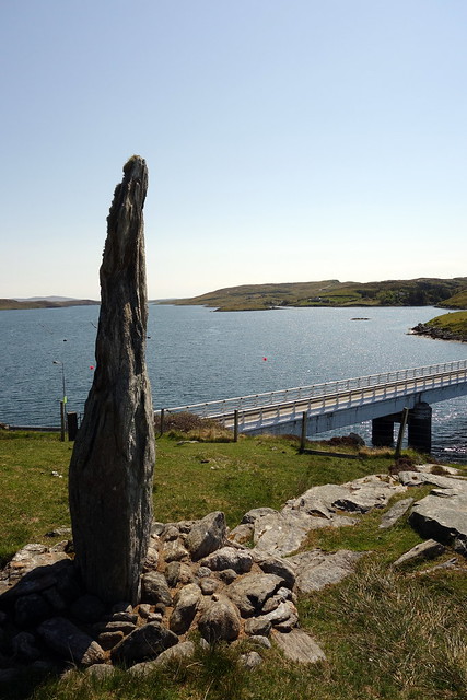
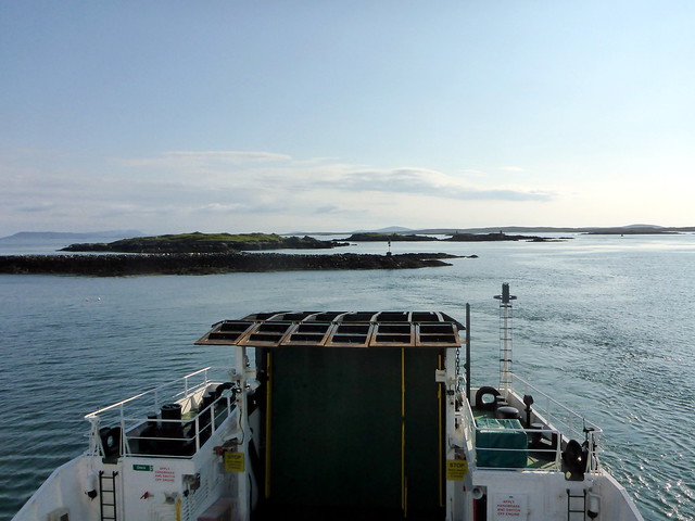
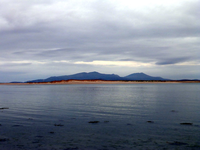
Over the sea from Skye
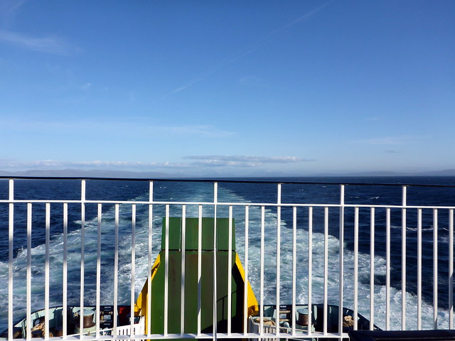 P1130106
 by
Al, on Flickr
Lickisto Campsite
 P1130107
 by
Al, on Flickr
The Shower Block
 P1130112
 by
Al, on Flickr
Regimented campsite...not!
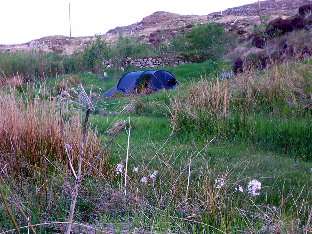 P1130113
 by
Al, on Flickr
We got the tent set up and enjoyed an al fresco feast of wild garlic tofu fillets with fresh asparagus and mediteranean couscous - delicious! We planned our route for the following day then hit the hay.
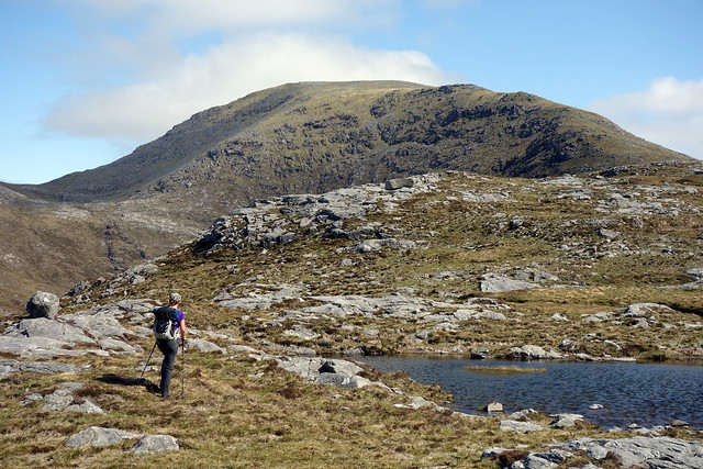
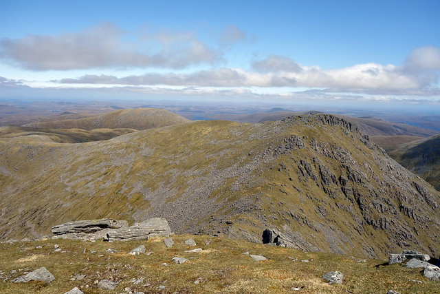
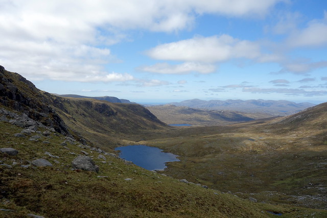
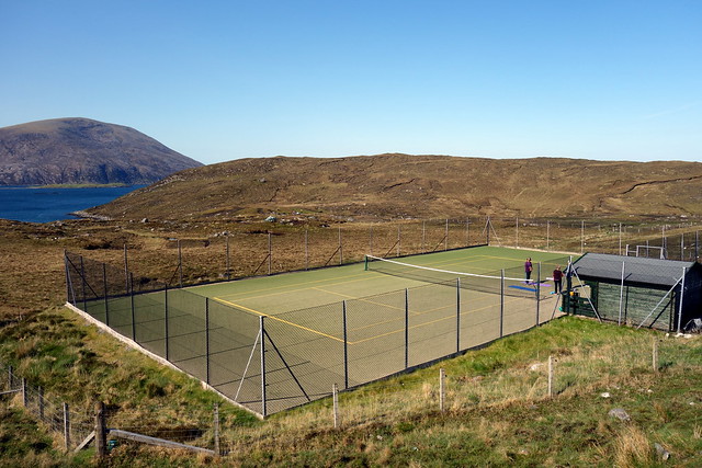
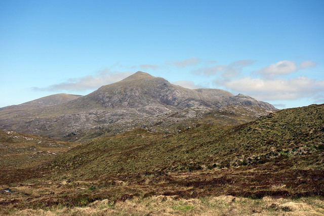
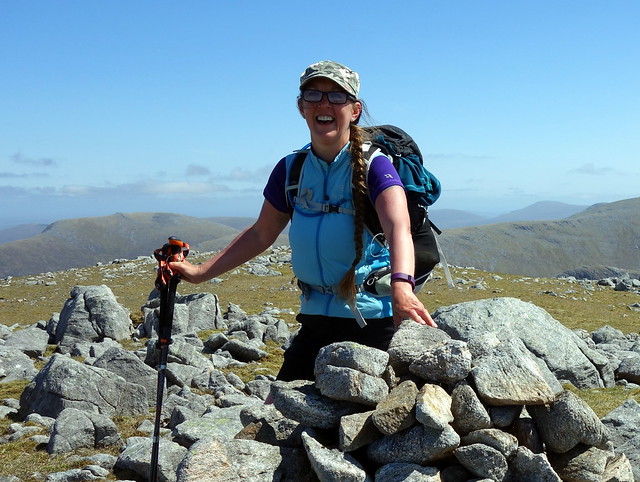
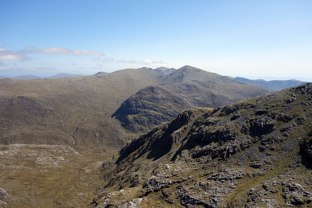
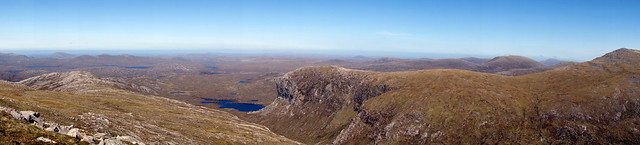
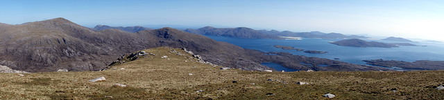
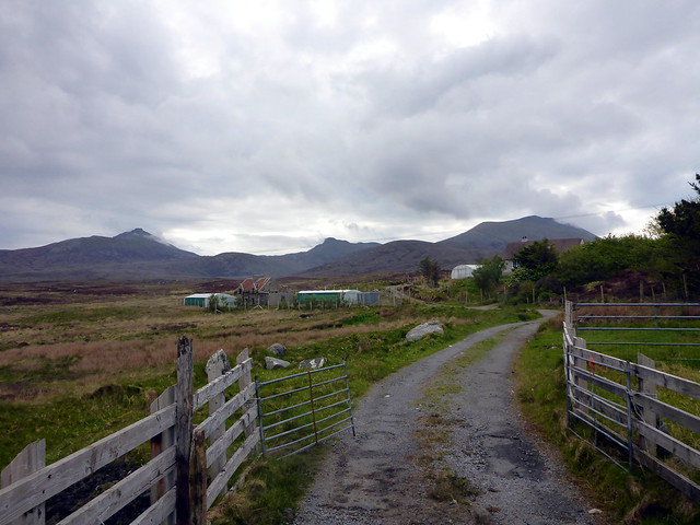
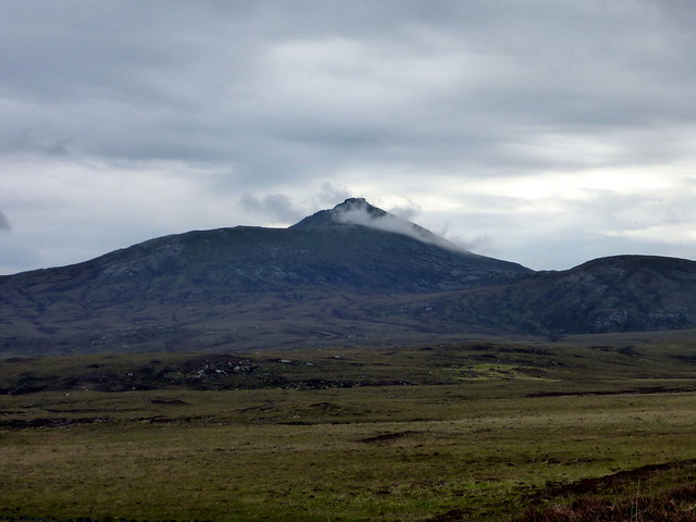
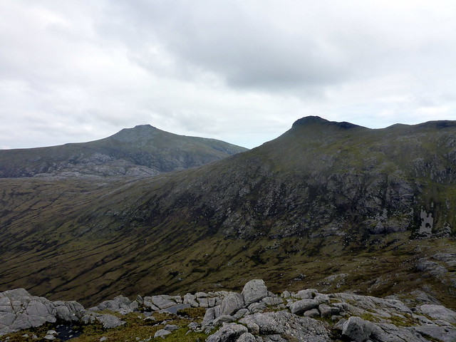
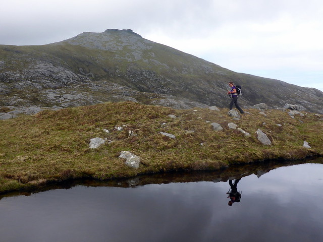
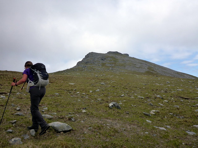
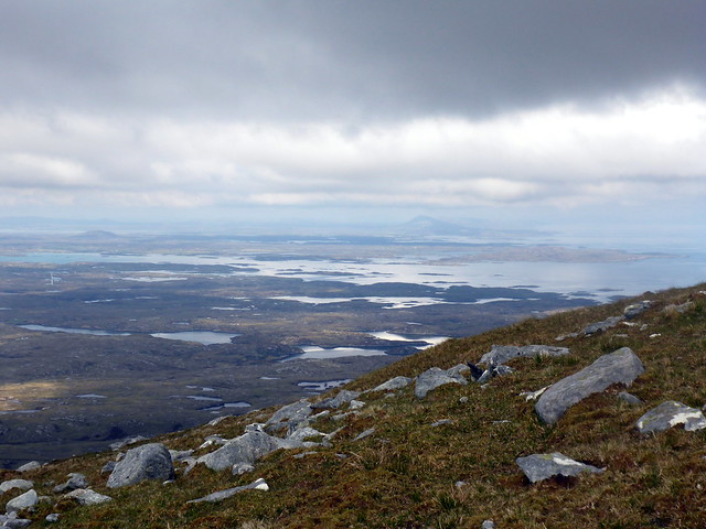
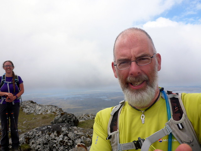
Uisgnebhal Mor was our first target. We drove along the single track road from Glen Skeaudale, passing what has to be the strangest tennis court in the world, isolated on a hillside and parked by the bridge at Miabhaig. We walked back over the bridge and onto rough pasture land then steeply up heathery hillside to Creag na Speirig. Looking back, the sea shone blue and the beaches of Losgaintir and Horgabost glowed golden yellow. There was a chill wind blowing which made it cold despite the bright sunshine. As we climbed the shoulder of Uisgnebhal Mor we had good views to The Clisham horseshoe. Arriving at the summit we nestled into a rocky shelter to escape the wind and had lunch, gazing out to sea. Out to the west were the St Kilda islands, first time I've seen them. As we were leaving the top we noticed a strange cannister - turned out to be a (used) distress flare. Wonder what the story was there...
Our hills for the day
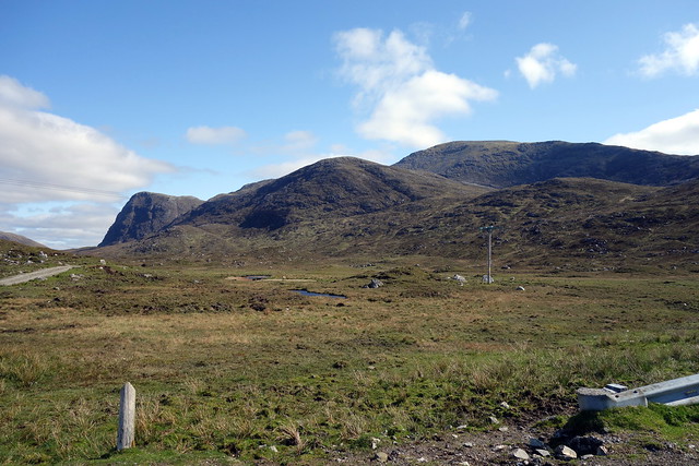 DSC00551
 by
Al, on Flickr
Uisgneabhal Mhor
 DSC00557
 by
Al, on Flickr
 DSC00558
 by
Al, on Flickr
Clisham hills in backdrop
 DSC00560
 by
Al, on Flickr
Summit view
 DSC00562
 by
Al, on Flickr
St Kilda just visible on horizon
 DSC00564
 by
Al, on Flickr
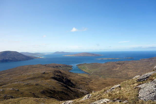
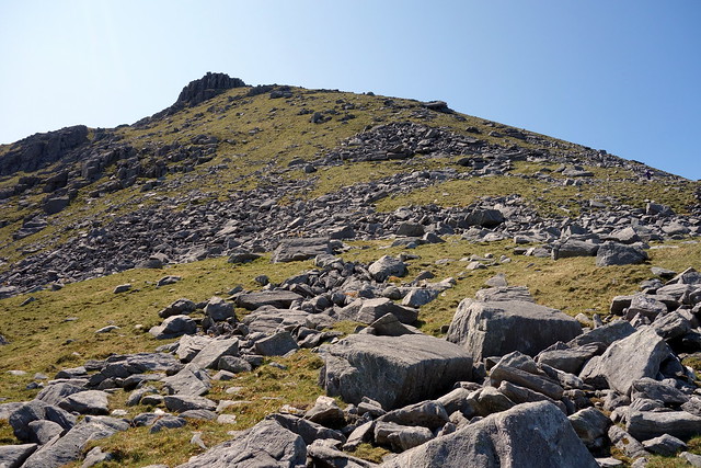
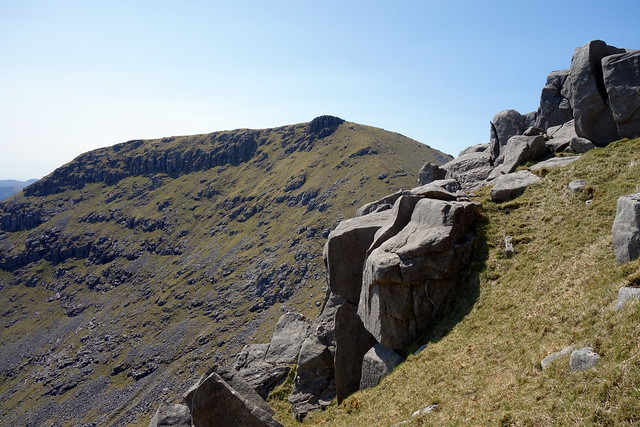
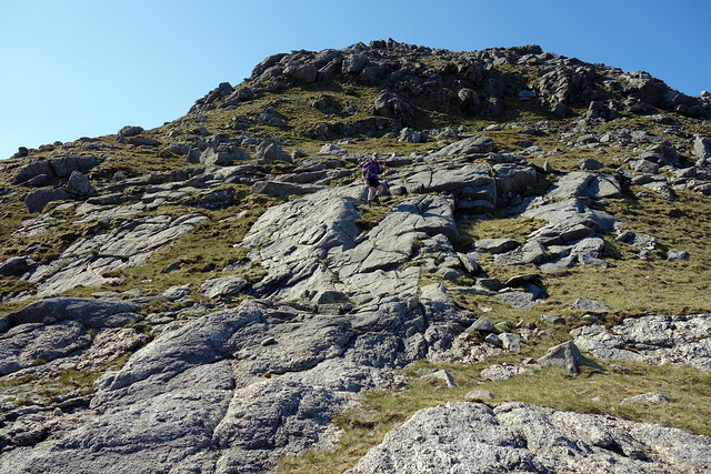
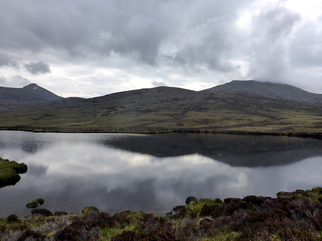
A steep descent through a boulder field follows to get to the next hill, Teileasbhal (a simm) then a sharp rise to the summit. A broad grassy ridge takes you north to Creag Stulabhal then a sharp easterly turn heads along the top of crags. I had thought of adding inStulabhal (a Marilyn) but the drop and re-ascent were considerable and we decided to head down towards Loch Stuladail and pick up the track leading to Loch Bhoisimid. This proved quite tough going - boggy in places despite the dry weather and difficult to locate the path on the other side of the loch, however we did eventually get there. Our return route was down the long - very long - road heading due south to Glean Mhiabhaig. There was work going on at a new wooden building then we passed the impressive nose of Sron Scourst. Further down the track we met a woman wild camping then an oler couple who'd walked up to the eagle hide (without seeing any feathered friends) - we walked back to the car with them chatting.
Down to Teileasbhal
 DSC00565
 by
Al, on Flickr
steep and stony
 DSC00567
 by
Al, on Flickr
view back to Uisgneabhal
 DSC00568
 by
Al, on Flickr
Clisham hills
 DSC00572
 by
Al, on Flickr
Descent route to right of the loch
 DSC00573
 by
Al, on Flickr
Stulabhal
 DSC00574
 by
Al, on Flickr
Sron Scourst
 DSC00575
 by
Al, on Flickr
Impressive crags
 DSC00577
 by
Al, on Flickr
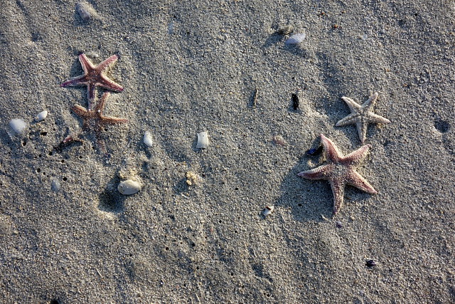
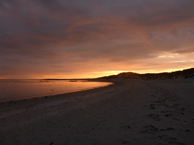
It had been a long day and it was good to get back to the tent and replenish our stomachs. Another lovely evening followed and it seemed a shame not to head to the beach, so we drove to Losgaintir around 9pm and had a walk along the sands as the sun gradually set over the sea. From the beach we looked over at the hills we'd been climbing today, and their neighbours we'd do tomorrow. The beach had many interesting shells/starfish/sea urchin skeletons. The strong wind made sitting down uncomfortable and although we had a paddle, the sand being blown along the surface of the beach did a fair job of sandblasting our ankles. We returned to the car as the sun glowed its last and finished the evening off with a Talisker or two back at the campsite.
Campsite across the water - you can see the 2 yurts
 DSC00579
 by
Al, on Flickr
Losgaintir beach
 DSC00584
 by
Al, on Flickr
 DSC00585
 by
Al, on Flickr
 DSC00586
 by
Al, on Flickr
 DSC00589
 by
Al, on Flickr
 DSC00594
 by
Al, on Flickr
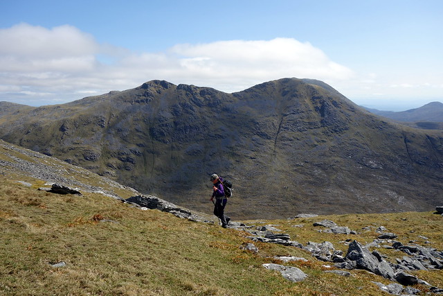
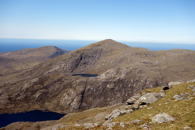
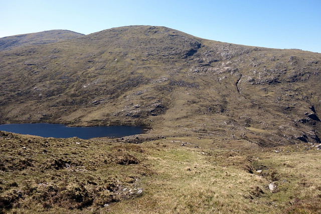
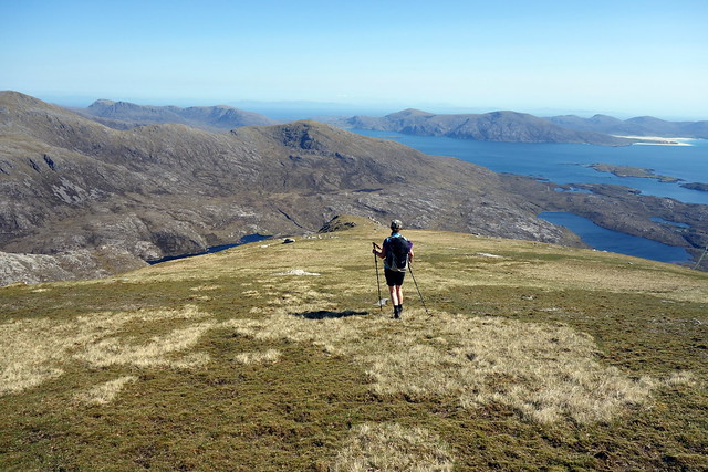
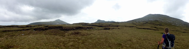
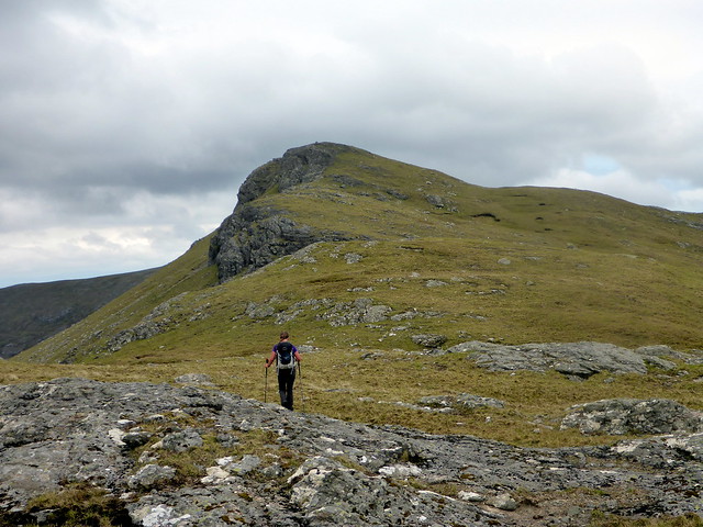
Thursday dawned without it ever getting particularly dark - strange when it's still almost a month til the longest day. We drove back along the same road, going a bit further this time with the intention of climbing Oireabhal and Tiorga Mor, the next hills along from Uisgnebhal. This meant parking at the start of the access track to the power station and walking a couple of kms along the road to a bend in the road with a wee quarry. We set off up the side of Cleiseabhal. A hazier day today, but much warmer and with less breeze. From the summit of Cleiseabhal there's a nice little ridge across Bidigidh, with a rocky outcrop at its middle. We looked down upon Sron Scourst then continued on towards the summit of Oireabhal. Over to our left the high level Loch Maolaig, embraced by the arms of Tiogra Mor, glittered at us. We continued northwards over easy grass slopes to Ulabhal, dropping down to Loch Aiseabhat from the bealach with Muladal - the guide book had mentioned that it was good to continue on and come off the eastern flank of Muladal then walk round the crags of Sron Uladail, but we decided to keep it manageable. We found a strange wee wall just above the loch then descended to the track.
Tennis anyone?
 DSC00598
 by
Al, on Flickr
Tiogra Mor
 DSC00601
 by
Al, on Flickr
Oireabhal Summit
 DSC00607
 by
Al, on Flickr
Tiogra Mor
 DSC00609
 by
Al, on Flickr
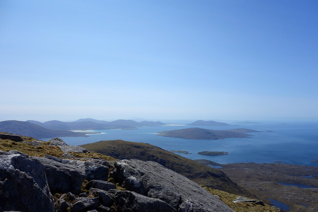
View to Taransay
 DSC00610
 by
Al, on Flickr
View to Sron Scourt/Uisgneabhal
 DSC00613
 by
Al, on Flickr
Ascent route to Tiogra Beag
 DSC00620
 by
Al, on Flickr
Gnome on wall
 DSC00621
 by
Al, on Flickr
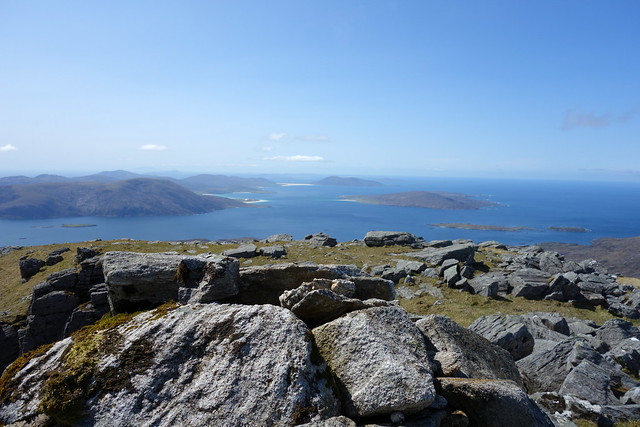
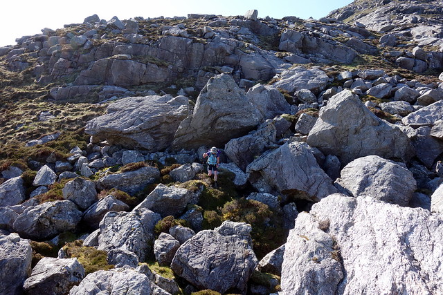
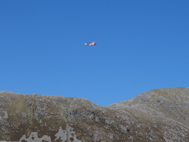
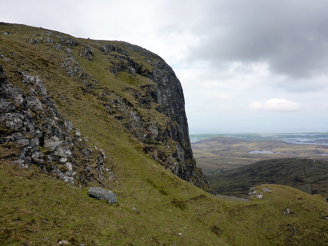
We ascended Tiogra Beag directly - not as steep as it appeared coming down from Muladal. Big boulders adorn the crown of Beag and from here we had views over to Lewis. We continued on to Tiogra Mor and its airy summit. There were a number of options for descent as the book commented that the usual line down the NE shoulder was quite demanding. After some consideration we decided to go that way anyway. The first section is fine - smooth grassy slopes. it then goes onto slabs and crags - easy enough in dry conditions with good visability. A valley filled with giant boulders is reached then more bouldery terrain until the lower slopes are gained. We made for the dam and joined the track down to the power station. The coastguard helicopter passed overhead - not sure what it was up to.
 DSC00622
 by
Al, on Flickr
 DSC00626
 by
Al, on Flickr
Summit Tiogra Mor
 DSC00629
 by
Al, on Flickr
sweet beaches
 DSC00631
 by
Al, on Flickr
Descent
 DSC00634
 by
Al, on Flickr
 DSC00636
 by
Al, on Flickr
Slabs
 DSC00637
 by
Al, on Flickr
Giant boulders
 DSC00639
 by
Al, on Flickr
 DSC00642
 by
Al, on Flickr
Dam
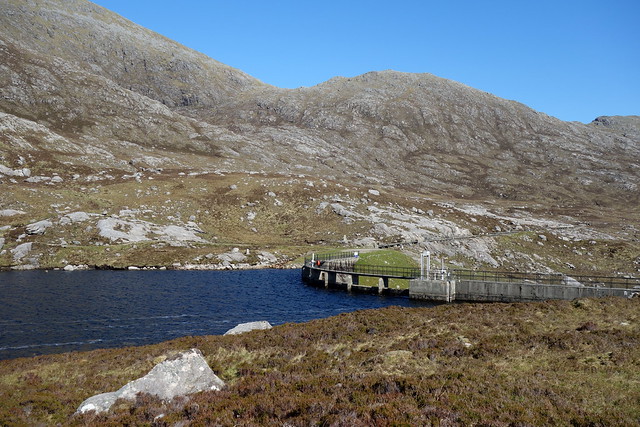 DSC00645
 by
Al, on Flickr
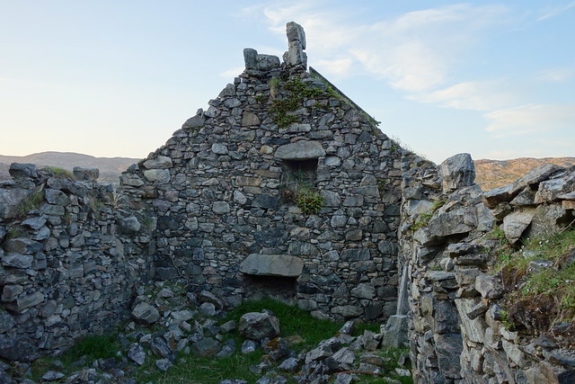
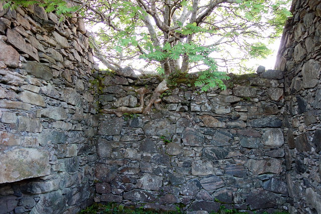
It was a glorious day now - getting a little too hot for comfort especially as the wind had died away. I was glad we hadn't followed the option of coming down the southern slopes of the hill - the terrain was man-eating bog at the bottom of the slopes. We headed back to the car and drove to the campsite. in the evening we went for a walk to Geocrab after exploring the ruins of numerous crofts in the vicinity of Liceasto - must have been a busy wee community at one time - sad to see the empty shells of houses.
 DSC00649
 by
Al, on Flickr
 DSC00651
 by
Al, on Flickr
 DSC00653
 by
Al, on Flickr
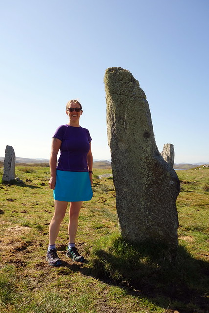
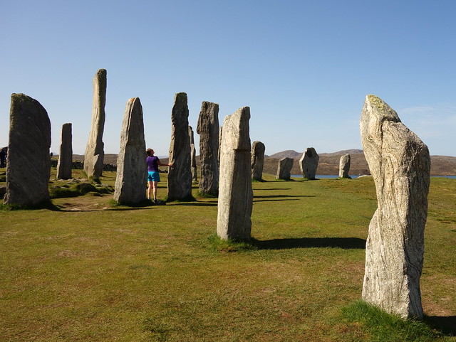
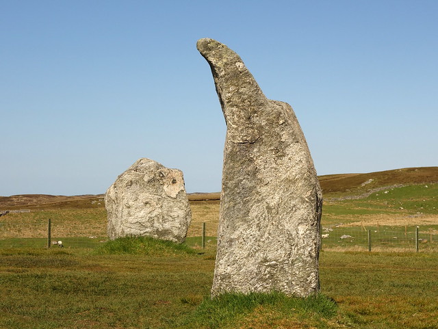
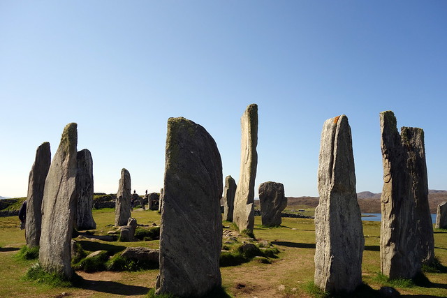
Friday had been designated a rest day - partly to avoid exacerbating Allison's injuries, partly as we wanted to visit Calanais on Lewis and the Harris beaches and partly cos of the need to get to our next port of call - South Uist - involved a ferry crossing. I visited John in the campsite house to settle up - found him very - shall we say - herbally informed maan... but very friendly. We packed up at leisure and set off for the long drive to Calanais. There's a noticeable change in the landscape as you cross from Harris to Lewis- the rough hills of Harris are left behind and the flatter, rather featureless landscape of Lewis predominates. I can't say I care much for Lewis- I didn't like the wee free vibe when I visited before - something I didn't notice on Harris to anything like the same extent. It does have superb standing stones, however. We neared Calanais and stopped at the two smaller circles (Calanais 2 and 3) on the way to the main circle. 3 is my favourite - with an inner ring of 4 stones (phallic stone addressing the 3 phases of the lunar goddess) and an outer ring. The stones were covered with lichen which hid their features - that's new from when I was here before. We wandered round for a while then drove on to the main circle. A new visitor centre has been built since I was here last and there were the inevitable coach parties milling around along with a couple of stone huggers. The smell of weed was pungent. We spent some time looking at the stones then drove out to Great Bernera where there's another semi-ruined circle. After visiting there we had our lunch by the Bernera bridge, watching the water.
 DSC00657
 by
Al, on Flickr
 DSC00666
 by
Al, on Flickr
 DSC00670
 by
Al, on Flickr
 DSC00672
 by
Al, on Flickr
Bernera Bridge
 DSC00677
 by
Al, on Flickr
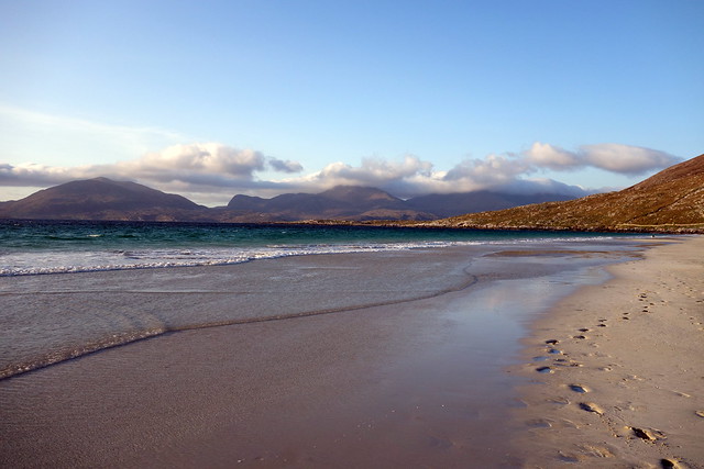
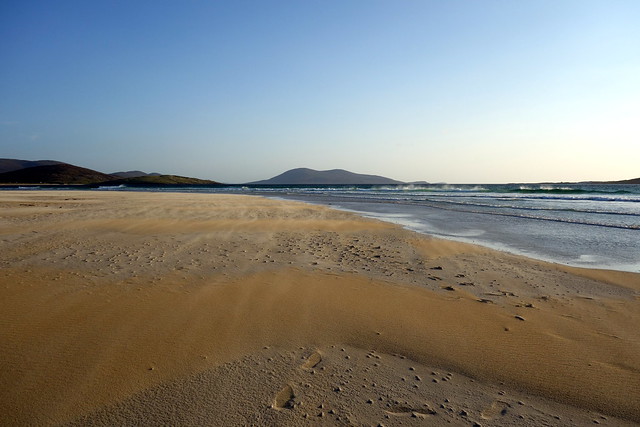
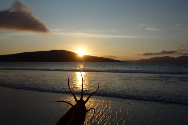
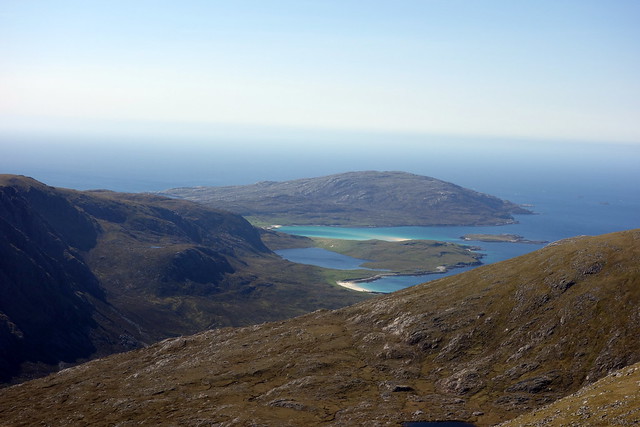
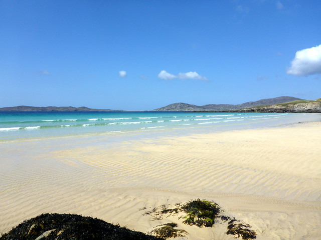
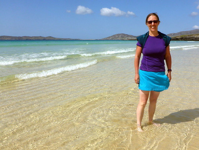
We drove down to Stornoway for provisions and petrol before heading out for Leverburgh. It was good to be returning to the roughness of the Harris scenery. It was also still very hot. We drove past Losganitir admiring the sands, but as we drove on to Horgabost we were really forced to stop by the sight of golden sand and turquoise water. Paradise! We parked by the roadside and decided to have a couple of hours just lazing on the beach before the ferry. The sand was hot underfoot, the water cool and clear. There were maybe half a dozen other folk the entire length of the beach. we paddled in the shallows along to the far end of the beach and back again, feeling our skin burn through the limpid water
We sat and read for a bit, gathered shells, marvelling at the predatory work of the dog whelk drilling tiny holes in other shellfish to feast on their insides.
Horgabost beach
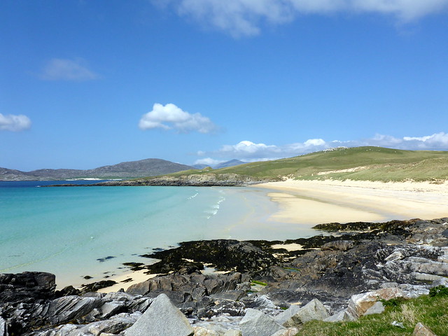 P1130114
 by
Al, on Flickr
 P1130115
 by
Al, on Flickr
 P1130117
 by
Al, on Flickr
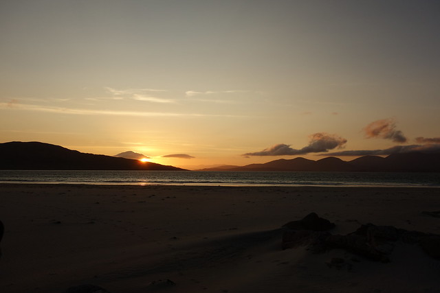
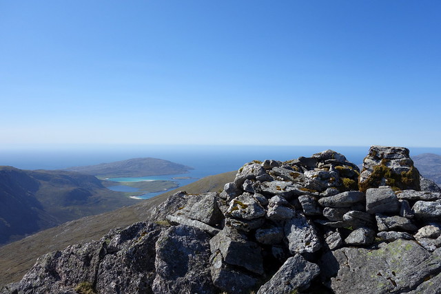
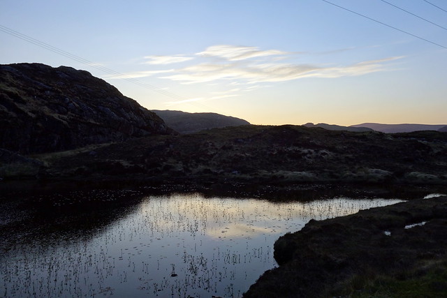
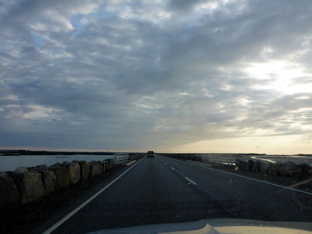
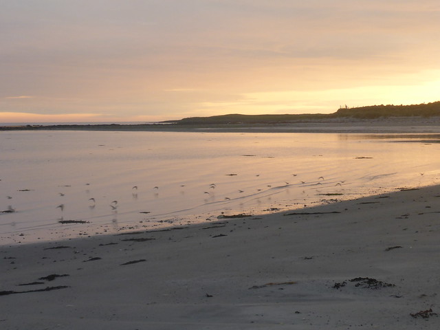
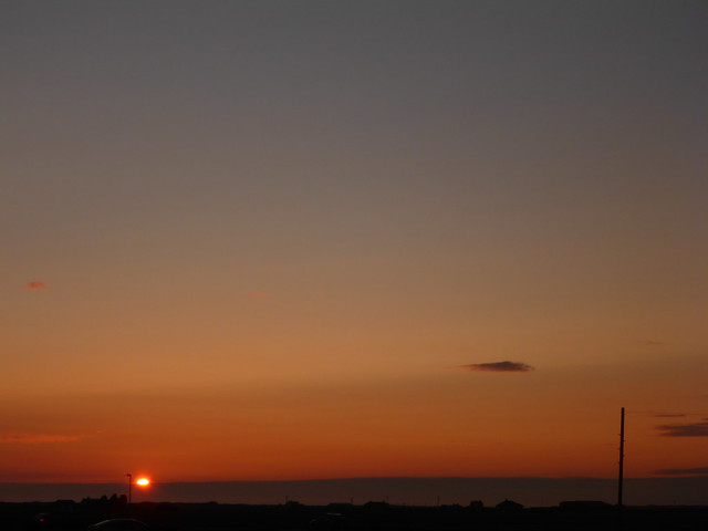
It was time to drive round to Leverburgh / An T-Ob to get the wee ferry to Berneray. We passed amazing houses at Scarasta - no place to stop and gawp or take photos. Arriving at the slipway with plenty time to spare we ate our tea in the car and waited for the boat to come in. The sky was clear blue, the water calm. As we set off and headed up to the observation deck the sun glittered on a steel blue sea. The ferry weaves and wends its way through a miscellany of islands and islets in the Sound of Harris. Looking back gave some heartwarming views of the Harris hills we were leaving behind. After an hour we approached Berneray and docked, driving off to North Uist in a convoy of half a dozen or so vehicles, which made progress along the sometimes single, sometimes dual tracked road rapid. We crossed several causeways, hit fast road after Loch Maddy and turned right off the main thrust when we got to Benbecula. I'd noted a campsite marked on the OS map and it seemed a reasonable option for the couple of nights. Sure enough, Shell Bay campsite was there, just past the community school. Flat site - perhaps on an old army/raf base? Anyway, friendly lady who runs it and lives on the house at the far end of the site suggested a couple of good spots to pitch and we set up then headed off for a walk along the beach. In the distance we could make out the hills we'd climb tomorrow. The sky turned fiery reds and golds as the sun sank - there's a tremendous sense of space here - nothing on the western horizon, big skies. We passed a pleasant, quiet night.
Heading to Uists
 P1130120
 by
Al, on Flickr
 P1130122
 by
Al, on Flickr
Causeway
 P1130128
 by
Al, on Flickr
Sandpipers on the beach
 P1130137
 by
Al, on Flickr
Beinn Mhor
 P1130138
 by
Al, on Flickr
 P1130141
 by
Al, on Flickr
 P1130142
 by
Al, on Flickr
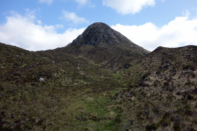
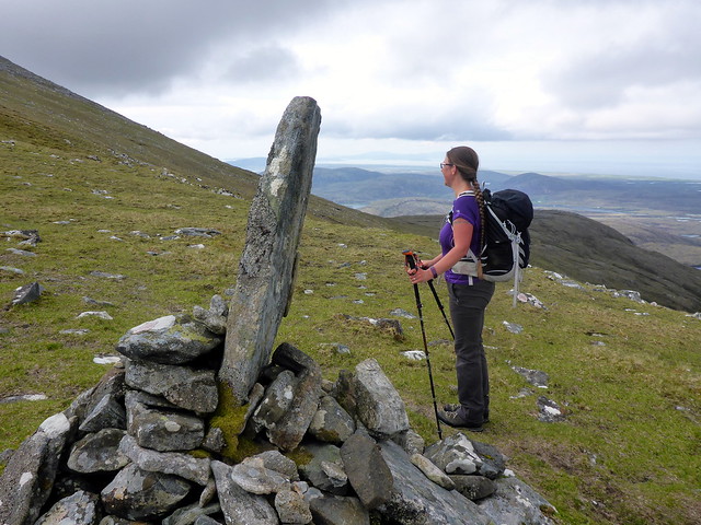
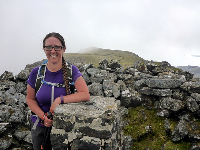
Saturday morning was overcast and even threatened a little drizzle. The hill tops were in clag. This was not what I wanted - perhaps my only trip to South Uist and the weather was turning against us? Damn. We drove the dozen miles to Mill Croft and parked up on the verge across the road from the house. One other car was there already. We started off down the peat track which begins well but quickly turns boggy. Then the track disappears and re-appears. We wlaked past the wee lochans and started up the gentle grassy slopes of Beinn Mhor. Over to our left the crest of Thecla appeared like the head of a bearded dragon, with a scarf of cloud. Closer, the knobbly form of Beinn Choradail sat, squat on the horizon. About halfway up Mhor is a large cairn with a large - almost standing-stone sized rock erect. We continued up to our right onto the crest of the ridge. From here it's a full kilometre to the summit, along an entertaining - but never challenging - rocky ridge. Mist swept and swirled along the eastern side of the crest lending atmosphere. We arrived at the trig, enclosed by a rock wall and headed over to a cairn to the SE, where we met an older man in sweater and sensible trousers coming back - presumably the other car driver. His weatehrbeaten face suggested a lifetime on the hills, but he was a man of few words. We sat by the cairn and ate lunch watching the various boats out on the Sea of the Hebrides - glassy calm.
Peat Track
 P1130144
 by
Al, on Flickr
Thacla
 P1130145
 by
Al, on Flickr
 P1130149
 by
Al, on Flickr
 P1130151
 by
Al, on Flickr
Giant halfway cairn
 P1130155
 by
Al, on Flickr
Ridge Beinn Mhor
 P1130160
 by
Al, on Flickr
 P1130162
 by
Al, on Flickr
 P1130164
 by
Al, on Flickr
Hebridean Sea
 P1130167
 by
Al, on Flickr
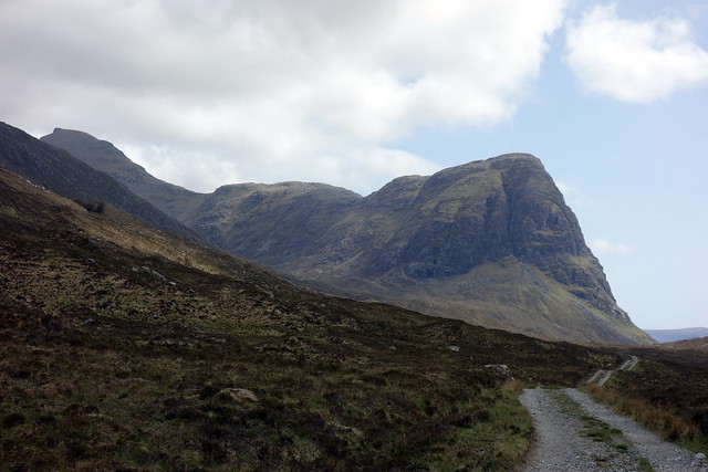
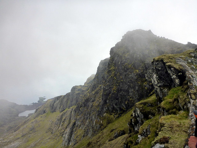
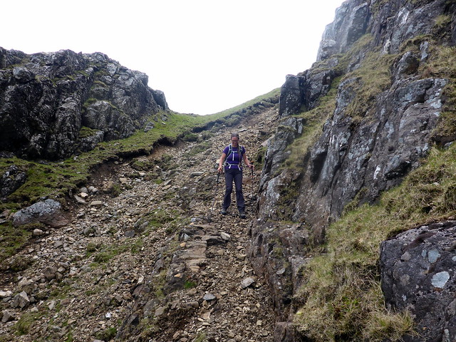
Returning the way we'd come we walked to the end of the northern shoulder of Mhor and descended to Bealach Heileasdail. Beinn Choredail rises steeply up - easy to pick a path through the heather and rock which leads to a fine grassy plateau, the summit rocky plug appearing insubstantial from this direction. Care is needed on the descent however as there are sheer cliffs on the northern side, the way one wants to continue to Thacla/Hecla . We followed a path due east for a short way then turned left into a gully that took us under the cliff face. Bit of scree but nothing too uncomfortable. We continued down the NW shoulder towards the level bealach with Thacla. I dislodged a rock which tumbled and span a long long way into the bealach - good job no-one else around out in these parts!
Choredail & Thacla
 P1130173
 by
Al, on Flickr
 P1130177
 by
Al, on Flickr
Crags on N side of Choredail
 P1130180
 by
Al, on Flickr
Scree gully
 P1130181
 by
Al, on Flickr
On to Thacla
 P1130185
 by
Al, on Flickr
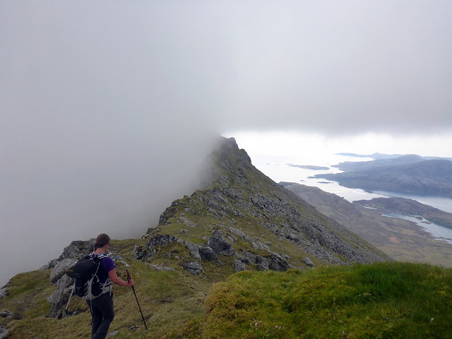
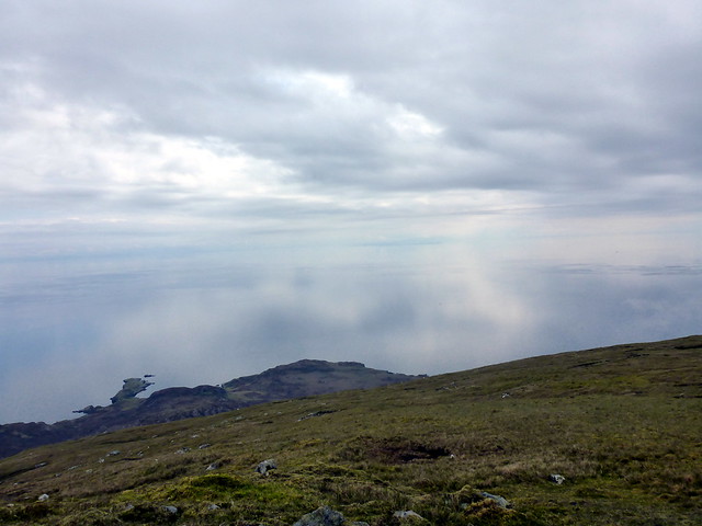
We steeled ourselves for the final ascent up Thacla - deer tracks through heather then fine short grass to follow the ridge to the stony summit. There were fine views back over to Beinn Mhor and out over the sea. Looking north towards Benbecula the land is just flat, with countless lochans and sea indents, resembling a Swiss cheese slice. We descended along the northern slopes of Maoladh Creag nam Fitheach - a long trackless return. The ground flattens out into Gleann Dorchaidh and it became a relentless plod over grassy/boggy terrain, interspersed with streams. After several eternities we reached the outward track and returned to the peat track. I would not like to do that return route after several weeks of rain

Final push
 P1130189
 by
Al, on Flickr
View to Benbecula
 P1130191
 by
Al, on Flickr
Summit Thacla
 P1130196
 by
Al, on Flickr
stats
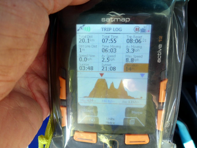 P1130198
 by
Al, on Flickr
We drove back to Benbecula stopping at the Co-Op (yes, a Co-Op here!) for some beer and pie. Feasted on curry back at the campsite and enjoyed another special sunset. over in the fields we watched the young animals at play - a crazy lamb dashing hither and thither around its fellows; two calves pretend fighting, butting their heads together then skipping away before anything got too serious. A glorious evening after a long day.
 P1130200
 by
Al, on Flickr
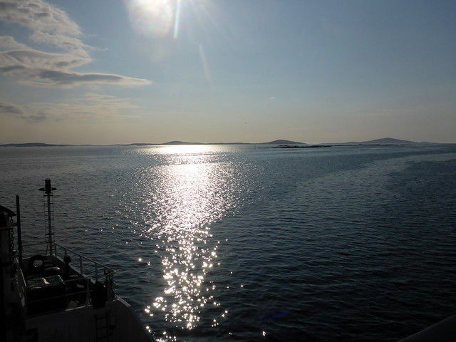
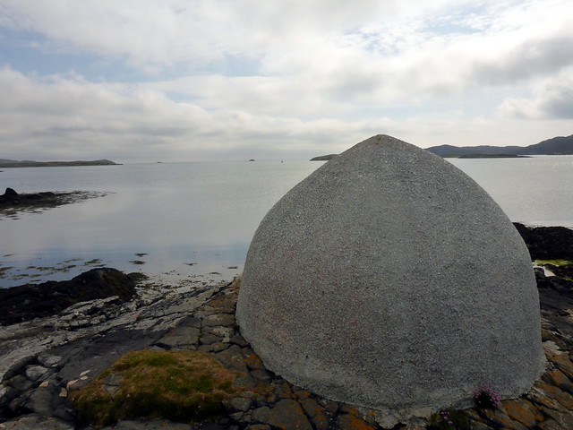
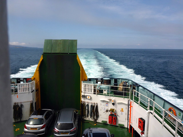
We were up at a modest hour, leaving an almost deserted campsite to drive the few miles to Loch Maddy. Being Sunday, everything was shut (museum, shop, gallery) but we did get a personalised and cheery welcome from the Calmac shore team which was heartening. we took a wander around the sea front, spotting several strange concrete creations whicl we waited for the boat. Another completely calm sea, we watched the ferry glide in on time and embarked for our shortish crossing back to Skye. The sun still shining, the forecast good for at least the next few days - what more could we ask for

 P1130203
 by
Al, on Flickr
 P1130204
 by
Al, on Flickr
 P1130205
 by
Al, on Flickr
Over the sea to Skye
 P1130207
 by
Al, on Flickr
