free to be able to rate and comment on reports (as well as access 1:25000 mapping).
Day 1 – Reaching 200, but feeling my ageDistance: 26.7km
Ascent: 2534m
Time: 11.40
Munros: Carn nan Gobhar, Sgurr na Lapaich, An Riabhachan, An Socach, Mullach nan Dheiragain
As the date drew closer for our annual summer sojourn to Scotland I was a little apprehensive about my hill fitness having only been up one mountain since last October (and knowing that Neil as always was in peak fitness). One might have thought that this lack of confidence in my ability may have caused me to err on the side of caution with the plan for the week, but I continued to use the same principle; choose a series of long days with multiple climbs, and take no account of the increase in age since the last trip, an increase in the amount of weight carried for overnight trips, or the potential for poor weather. As a result we drove up to Cannich with the intention of bagging the Mullardoch munros in two days then heading to Knoydart for a three day monster trek, and a weather forecast for the week was pretty poor.
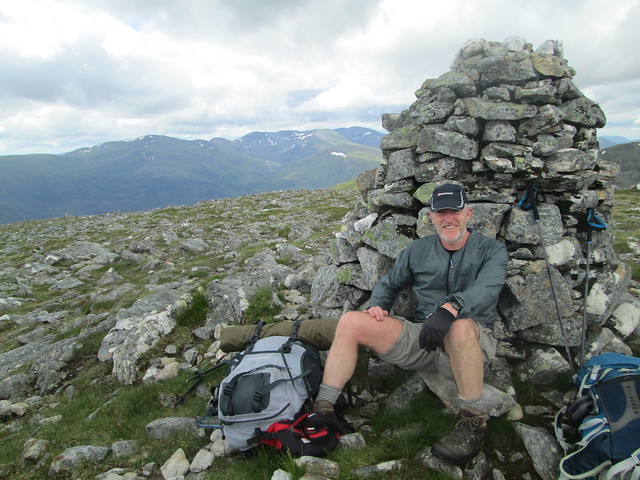
As it was we started out from the dam at Mullardoch just before 10am under blue skies, although I was soon feeling less than sunny when Neil said “My pack feels surprisingly light”, and I envisaged the next few days struggling to keep sight of him as he disappeared into the distance. We followed the path along the lochside before heading north on the path along Allt Mullardoch (there is construction work going on at the lochside and the path is now more of a road). Once this path/road finished we climbed north over moorland, we didn’t see any defined tracks. Neil must have been taking it easy early in the day and didn’t push too hard on this climb, and we reached the Bealach na Creige Duibhe pretty much together and followed the eastern shoulder of Carn nan Gobhar to the summit. As has become something of a tradition on the last few trips Neil had brought a hip flask filled with Sloe gin, and we enjoyed a top-out tipple.
After a brief stop we set off descending west, although sadly for me there didn’t feel like any respite on level ground before we were climbing again to Sgurr na Lapaich. Now I did begin to fall behind, and started to dwell on how unfit I was. Fortunately Neil stopped to talk to a couple and I was able to catch him up and start walking ahead, but all too quickly he overtook and reached the summit a few minutes before me.
We stayed a little longer here, initially talking to two guys who had been camping for the last week, much of which had been in the rain. As thet bounded off down the hill I reflected on how much easier munro bagging had been even six years ago, and began to fear that my plan for a two day round of Mullardoch may have been a little ambitious.
There was little of note on the next leg, suffice to say that for me it was a slow and tiring trudge to the summit of An Riabhachan,, there was at least another shot of sloe gin to brighten things up. I'm not sure what proof this was, but as I usually don't drink at all I felt each mouthful going straight to my head.

As the distance over the ground to our next summit was greater I hoped that my legs might benefit from a break from what had felt like continual ascending and descending over the last couple of hours; however, it seemed that by now the damage had been done and I struggled to the summit of An Socach; well at least it wasn’t raining.

Our initial plan had been to climb as high up towards Mullach nan Dheiragain on day one, to reduce the distance and height gain for day two. However, looking ahead at the route; in particular the amount of height loss required this didn’t seem like such a good plan anymore. The descent via Meall Shuas felt long and tiresome, and I was mightily relieved when we reached the fords over the river just after 6pm and sat down (collapsed) to cook up some dinner. In fact by this time the weather had brightened up ,and as long as didn’t think about the climb to come it was almost idyllic. However, based on my form I estimated that the climb to Mullach nan Dheiragain would take about two hours, and as we didn’t want to arrive too late we needed to set off by 7.30, which came around too quickly for my liking.
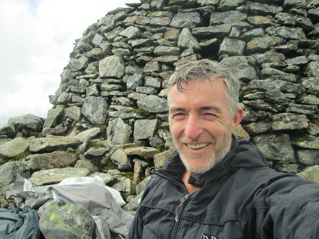
We set off and initially followed the path that contours at about 280 metres, but as this eventually led back down to the lochside we had to leave it and start upwards roughly along the line of the Allt Cam. I always find there is something psychologically beneficial about being on a path; it usually follows the line of least resistance, and prevents the need for high knee lifts over grass and heather. So in my state of mind (and body) the trudge up the hillside with no path seemed interminable and as we neared the top I broke. I told Neil I couldn’t go on and suggested we would have to make camp, even though I knew we were close to the summit. Neil would have none of it and started taking bits of kit from me to lessen the load (2 litres of water and the tent). He even resorted to taking my entire pack on carried this, proppedon top of his own for about 50 metres of ascent. Maybe the rest as I walked this section unemcumbered helped, maybe it was the shame of seeing Neil toiling under the weight of two packs, or possibly it was the fact that the little bit of climb brought the southern summit into view so I knew how close we were, but whatever the reason I was able to take my pack back from Neil and press on to the summit. We arrived at the top at about 9.30, and for both of us this was munro number 200 (of which we had done 185 together), which raised a smile.
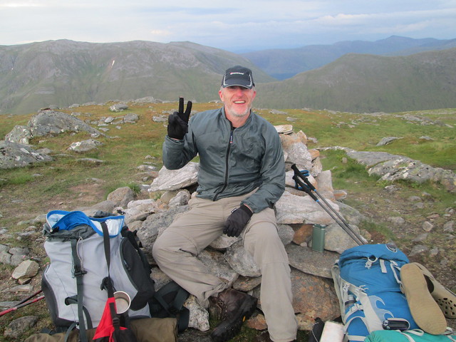
After the celebratory slug of gin we pitched the tent just below the summit with a lovely view out of the doors, although I didn’t hang around to appreciate it and quickly climbed exhausted into my sleeping bag.
Day 2 - Lightning, floods and forced wild campDistance: 23.3km
Ascent: 1794m
Time: 10.00
Munros: An Socach (Affric), Mam Sodhail, Beinn Fhionnlaidh, Carn Eige
Whilst it rained pretty heavily overnight, we woke to dry conditions; broke camp and headed north. Neil mentioned that he was really low on food, and I said that I had a sandwhich for lunch and a tin of mackerel for a “**** or bust” situation (watch this space). Fortunately we had previously bagged Sgurr nan Ceathreamhnan, so at the Bealach nan Daoine we descended east towards Loch Coire nan Dearcag, where Neil was able to replenish his water supplies. We then followed the same line to the bealach at the end of the long westerly shoulder of An Socach (Affric), leaving what felt like a fairly easy first climb for the day.
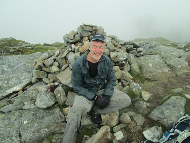
After leaving the summit there was a clear path for the next couple of kilometres contouring around Ciste Dubh before the final short pull to Mam Sodhail.
We paused at the substantial summit cairn to rest and discuss how to tackle the next section – I was keen to minimize the amount of time I would have to carry my pack. We decided to contour round Carn Eige, staying as high as possible before dropping our packs and heading for Beinn Fhionnlaidh. This seemed to work out okay, although there was no track and we were contouring mainly amongst boulders, but we were able to drop our packs about 100 metres below the summit of Carn Eige. It was with some relief that we then headed down through the rocks towards Stob Coire Lochan and then on the Beinn Fhionnlaidh, and as the climb felt quite easy my hopes for the rest of the day rose.
However, my optimism was to be pretty short-lived as I started to struggle on the climb back up to Carn Eige and had to rest a couple of times before I even reached my pack. Once I picked it up the last 100 metres of climb seemed to take forever, and I collapsed inside the summit shelter.
By now it was well after 1pm and I wolfed down my sandwich, then as I was still hungry I polished off my tin of mackerel (keep watching!). Then exhausted I climbed into my bivvy bag to grab 40 winks. I did in fact doze off and during this time the heavens opened and I woke to find I was lying in a puddle with the realization that my 1980s bivvy bag was probably past its best in terms of weatherproofing.
Reluctantly, and still exhausted (and wet) we set of eastwards towards our next objective of Tom a’ Choinich. The ridge becomes a little sharper over this section, with a couple of steps up and down requiring you to put your hands down. With legs like Bambi and a heavy pack I was more than a little wobbly and quite relieved to reach the firmer footing of Sron Garbh. The sky further east was extremely dark, and we heard a few big rumbles of thunder, and thought it was probably coming our way. From Sron Garbh I could see the descent and ascent required before our next summit and was sure I couldn’t make it without another long stop, and I was positive I wouldn’t be able to make Toll Creagach. As I tried to summon the energy to continue, the skies were lit up by lightning. There was quite a few flashes, at least one of which Neil saw strike Tom a’ Choinich, so we decided to get down off the hill (hurray!).
We started to descend north westerly into the Coire Domhain, and headed towards the loch following the line of the Allt a Choire Dhomain. The ground was completely sodden and we were continually ankle deep in water, but we were on the way back to the car and dry clothes so it didn’t matter (or so I thought!).
As we got lower the Allt was a raging torrent and we commented that it was lucky we didn’t have to cross it, as it was impassible. When we neared the loch we decided to head for the lochside with the aim of following that back to the dam. However, when we arrived at the loch we found that there was no hoped-for sandy shoreline, rather a mass of boulders on a steep ankle-breaking angle. So we reluctantly headed back upwards following a deer track through thick heather. The path soon petered out, and we contnued to plod on stumbling through the heather getting more and more tired until we reached the Allt Lub nam Meann, although this was even more violent than the Allt a Choire Dhomain, and clearly impassible. We walked exhaustedly up and down to try and identify a crossing point, but there were none. We even walked down to the loch, but even here the outflow was a raging and promised to sweep anyone placing a foot in the water out into the loch. There was no way I could ascend the 500 metres up the hillside in the hope that we could find a crossing point (and I think that was the case for Neil also), so we resigned to having to set up camp. We were completely soaked, we had no food (what I would have given for that tin of makeral) and were plagued by midges. Frustratingly, only a few metres from where we pitched the tent there were two wooden shacks fully kitted out with beds and cooking utensils (I bet there was even some food). However, the doors were padlocked and we had not yet reached the risk to life stage that would justify forcing entry (although I did think about it). We quickly put up the tent in a cloud of midges and hurredly crawled in, it was perhaps about 8pm, and I soon dropped off.
Day 3 - BeachcombingDistance: 5.7km
Ascent: 232m
Time: 2.00
It wasn't a great nights sleep, so by the time we decided to get up I was fairly sure that it hadn't rained during the night, and we were hopeful that we could now ford the Allt. So after a breakfast of water (at least we had plenty of that), and pulling on wet clothes we set off as quickly as possible to escape the midges. Sure enough we could now cross the allt, and we started the long trudge back along the loch side. With legs a little less tired and wobbly then the previous evening it was easier to step from boulder to boulder. However, it still took two hours to cover the 6 km back to the car, where despite the presence of more annoying midges Neil prepared a big pan of scrambled eggs, which felt well-earned and tasted amazing. Then after driving back to the campsite at Cannich we hung our clothing up to dry and rested before watching Wales beat Northern Ireland at the Euros, and soon forgot about the tribulations of the last co0uple of days

