free to be able to rate and comment on reports (as well as access 1:25000 mapping).
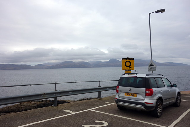
Arran - August 2012 - Goatfell was the start of our mountain adventures. A life transforming four and a bit years later it was to be Arran again for the last of our Grahams. Seemed a fitting full circle and as the numbers of Grahams remaining were whittled down there was no doubt it would be our last one. I had thought about delaying completion til we returned from Ireland in June, of maybe having some folk along to be with us - but in the end, I just decided to go for it at the earliest opportunity. Allison had managed to secure getting away from work on time Thursday afternoon with her boss - 2 hours to get to Ardrossan and onto the ferry seemed likely to be ok - however when I phoned to book a place on Wednesday evening, the boat was full. Now what to do? A look at timetables and maps - the Claonaig-Lochranza boat sailed at 7pm, should be plenty time to drive the 120 miles to Skipness. I had no idea how busy that ferry might be (having never taken a car to Arran on either of my 2 visits there my knowledge of the island was poor). It looked like there were plenty of spots for wildcamping near the jetty, according to google street view, if the ferry was full by the time we arrived- we'd get over the next day. As it transpired, I needn't have worried as there was only one other car on our sailing.
 DSC03181
 by
Al, on Flickr
 DSC03182
 by
Al, on Flickr
 DSC03183
 by
Al, on Flickr
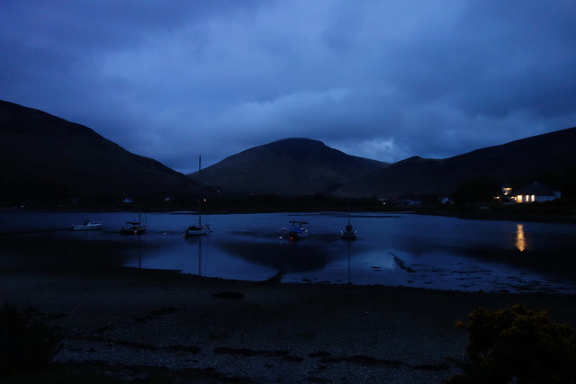
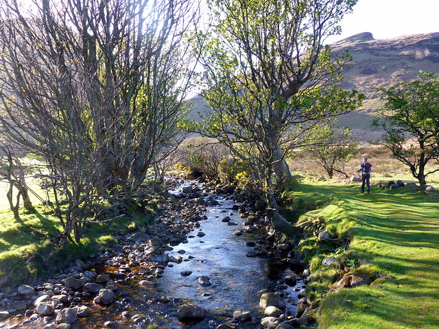
Got into Lochranza at 7.30 and headed for the campsite. Pitched and ate, then set off for a wander in the gloaming to the ruined castle, waves lapping peacefully on the shingle. settled down for what was a windy night in the tent - campsite nice and quiet. Friday morning - dry but windy, clag down over the tops. The forecast wasn't great, but I hoped that it might lift when we got up there.
 DSC03184
 by
Al, on Flickr
 DSC03185
 by
Al, on Flickr
 DSC03188
 by
Al, on Flickr
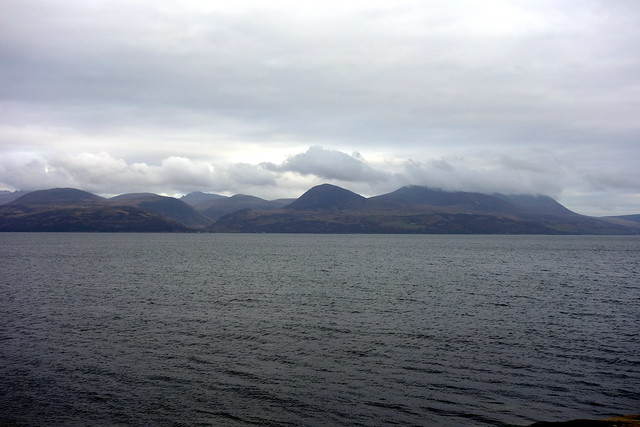
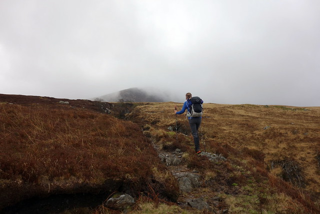
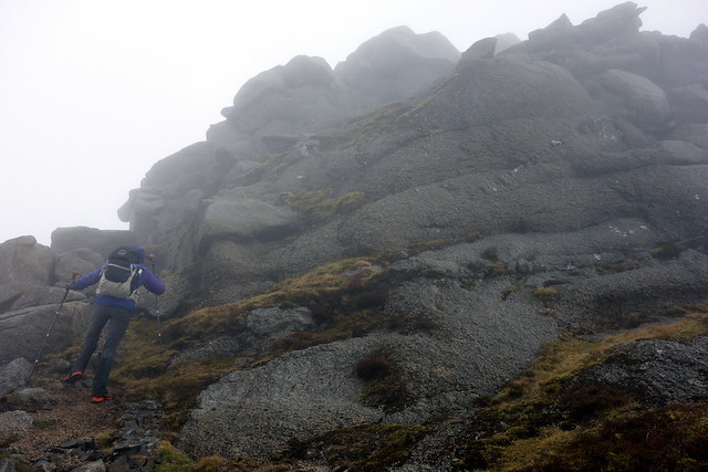
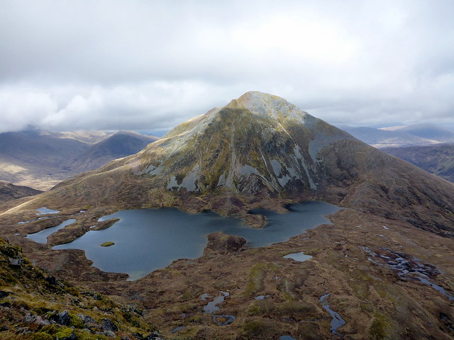
We'd glimpsed Beinn Bharrain coming over on the boat - a long lump of a mountain dominating Arran's northwest coast, We'd read about the choice of approaches and had decided to take the left-hand ridge that promised a wee scramble then make a full traverse of the hill and finish up with the Marilyn Meall nan Damh at the northernmost end. We drove to Pirnmill and parked outside the school then set off to the start of the track. There is a concrete surfaced track for a short while that cuts off to the right through trees and becomes increasingly sinuous and muddy before opening out onto the hillside and following the Allt Gobhlach to a small weir. We could see the outlines of the two ridges enclosing Coire Roinn peeking out of the clag from time to time and made for the left hand one.
 DSC03190
 by
Al, on Flickr
 DSC03191
 by
Al, on Flickr
 DSC03194
 by
Al, on Flickr
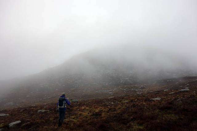
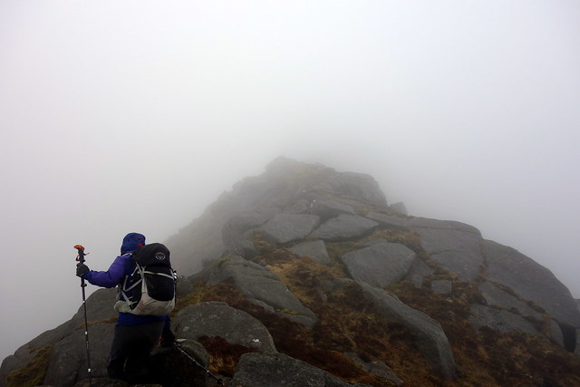
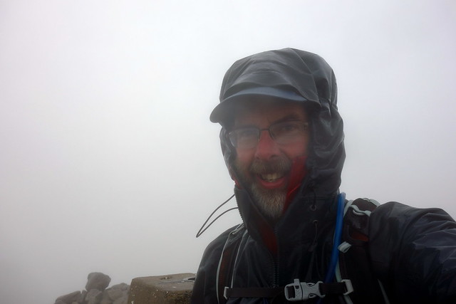
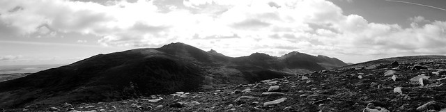
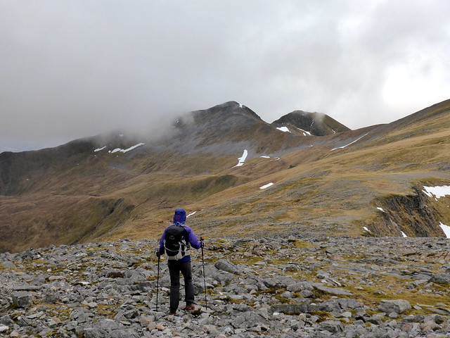
As we gained height the boulders/heather gave way to blocks of granite and we were on the ridge proper. Steep in places and also narrow - not ideal with a strong crosswind buffeting you. Anyway we progressed along without undue difficulty - there was only one slightly awkward scramble over a couple of rounded boulders with little in the way of holds, but the exposure wasn't great. It was unfortunate to have the experience hampered by clag and wind as it appeared that you could amuse yourself taking a variety of routes to the top - if you could see what you were doing. The terrain eased as we neared the summit of Mullach Buidhe (the Graham). I decided we'd head to the Simm top of Beinn Bharrain first in the hope that when we returned to Mullach Buidhe the clag would have cleared - unfortunately all that happened was that the rain started

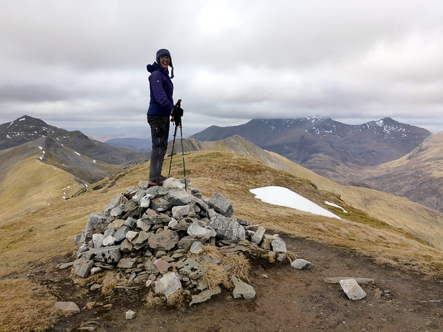
We trotted along to claim the Simm - I was feeling quite satisfied that we'd be completing our Grahams at last in a few minutes.
 DSC03196
 by
Al, on Flickr
 DSC03198
 by
Al, on Flickr
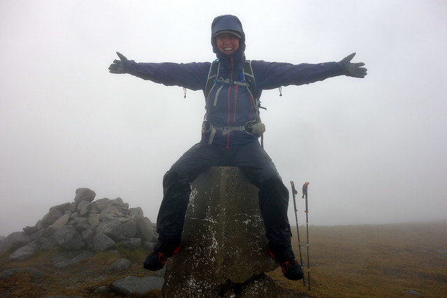
Beinn Bharrain summit
 DSC03200
 by
Al, on Flickr
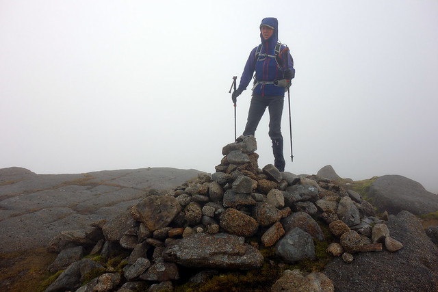
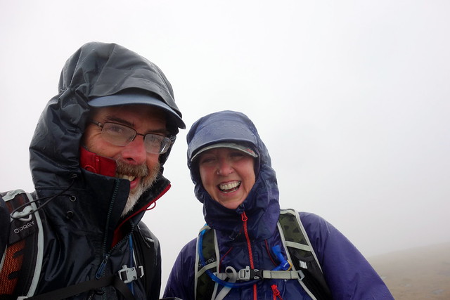
Returning along the ridge to our Graham summit the weather worsened, annoying claggy rain that mists up your glasses. It was a bit of a scunner, but I've not had good weather yet when completing Munros, Munro Tops, Corbetts or Donalds, so why should it be any different. Snapped some photos of us at the trig point, then my camera drowned in the rain, so no more photos of our hill exploits I'm afraid. We walked northwards along the ridge, dropping into Bealach an Fharaidh where we found a little shelter from rain and wind to have our lunch. From here we continued along the ridge back to Beinn Bhreac and along to the east of Coirein Lochain down to the bump of Meall Bhig. Up ahead I could see our Marilyn rising steeply across Lodan Ruadh - I set off and waited for Allison at the summit cairn - her back was giving her a bit of gyp again which wasn't great.
Completion
 DSC03203
 by
Al, on Flickr
 DSC03204
 by
Al, on Flickr
 DSC03207
 by
Al, on Flickr
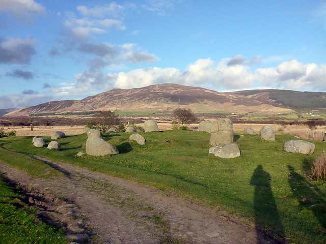
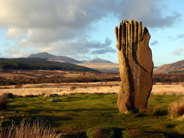
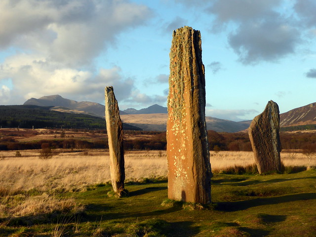
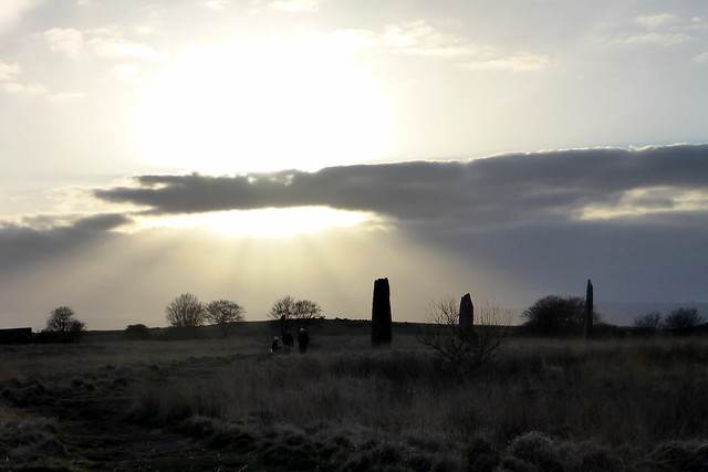
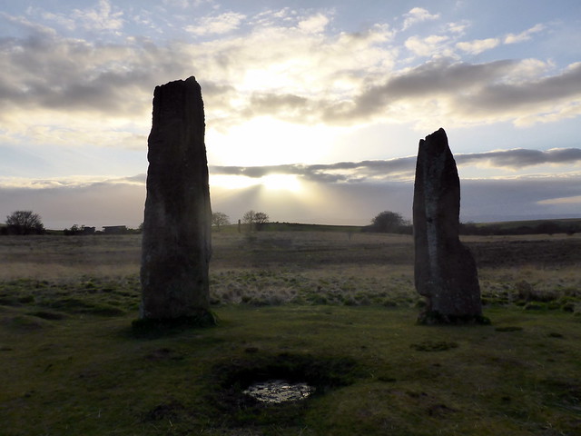
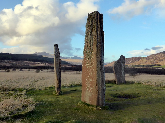
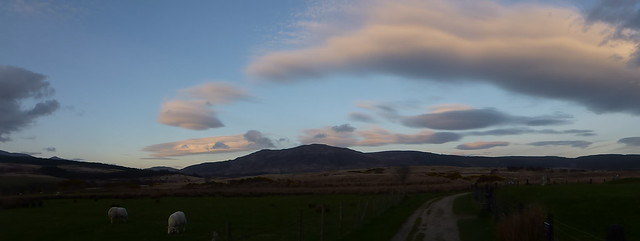
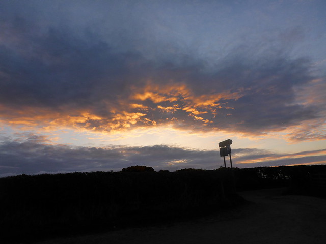
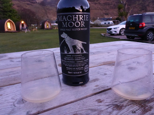
We retraced our steps to the Meall Bhig then joined the footpath descending alongside the Uisge Soluis Mhoir down to Mid Thundergay. By this time it was sunny and blue skies - bloody typical. We walked the couple of miles back to the car, stopping for a celebratory go on the swings, rather randomly sited beside the road. Drove back to Lochranza and made a visit to the distillery to get a suitable bottle to mark our occasion. We were both hungry and set about an early tea. It was a lovely looking evening and I decided we'd take a drive down to the standing stones at Machrie Moor - Allison had been before, but I hadn't seen them. A fabulous place - there are so many sets of stone circles in a concentrated space. The stones themselves looked superb bathed in the low evening sunlight, the various mountains (Bharrain, Ard Bheinn and of course the wonderful cluster of Corbetts) surrounding us. The sky had some pyrotechnics to send our way in the shape of psychedelic clouds and glowing afterlight. I really warmed to Arran on this visit, won't be too long before we're back I think.
 P1150351
 by
Al, on Flickr
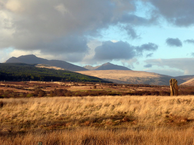
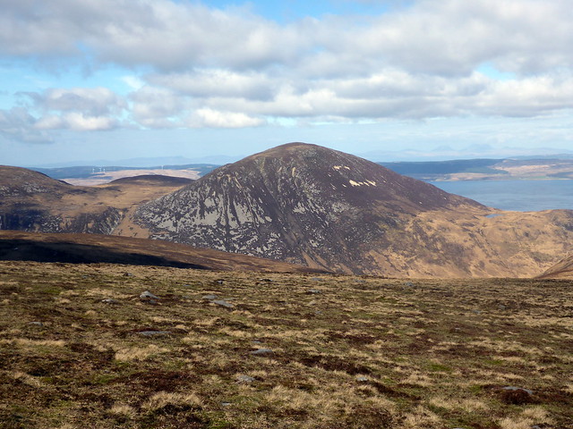
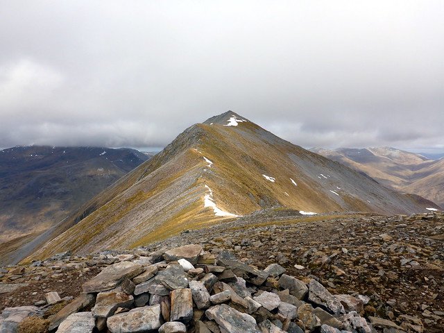
The two ridges leading to Beinn Bharrain - fine weather now we're back at the car!
 P1150352
 by
Al, on Flickr
On the way to Machrie Moor
 P1150354
 by
Al, on Flickr
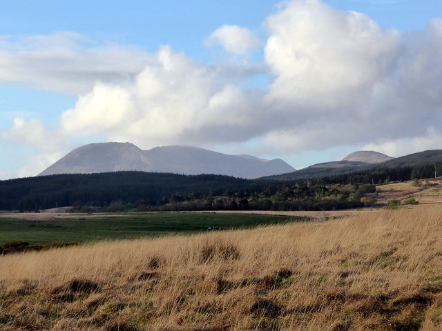
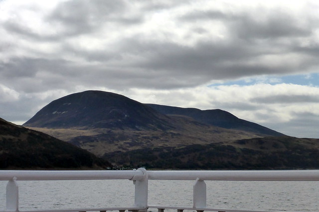
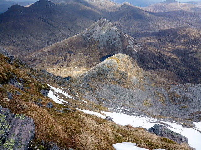
Beinn Bharrain from the south
 P1150359
 by
Al, on Flickr
Fingal's Cauldron
 P1150362
 by
Al, on Flickr
 P1150363
 by
Al, on Flickr
 P1150366
 by
Al, on Flickr
 P1150368
 by
Al, on Flickr
 P1150371
 by
Al, on Flickr
 P1150373
 by
Al, on Flickr
 P1150376
 by
Al, on Flickr
 P1150380
 by
Al, on Flickr
 P1150383
 by
Al, on Flickr
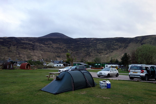
Back to the campsite, no other cars on the road. Time to crack open the whisky and have a couple to round off our day. I reckoned that we'd do another hill in the morning then set off in the early afternoon for Kinlochleven - although had it not been for the WH Meet there, I'd have stayed on Arran til the Sunday. A chilly night bit no wind, and fine sunshine when we woke. First cuckoo of the year.
 P1150384
 by
Al, on Flickr
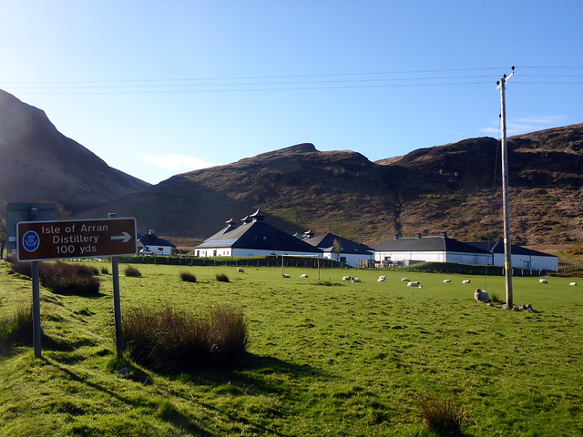
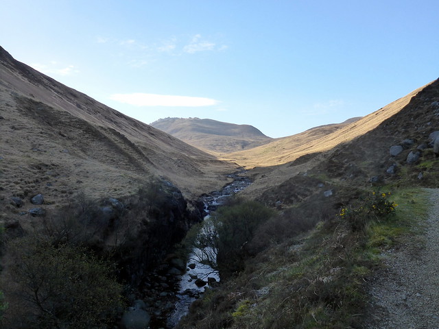
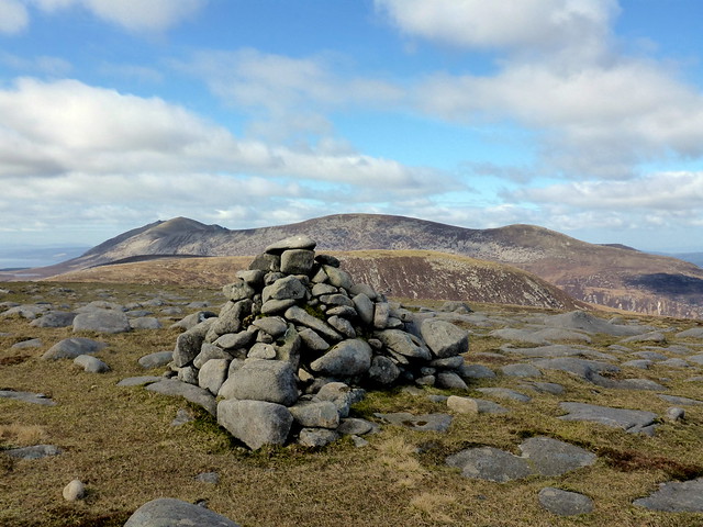
Packed up the tent and set off from the campsite, just past the distillery where a footpath leads into Gleann Easan Biorach. This follows the western bank of the Allt which I assume is where the distillery draws its water from - the river runs noisily through a deep channel. Our target was Beinn Bhreac (another one) which isn't visible initially walking down the glen - it's Caisteal Abhail which catches the eye. The footpath becomes wet and boggy - we cut up onto higher ground and Beinn Bhreac, speckled with lumps of granite in amongst the heather - came into view. Would be a fine spot for a summit camp - great vista of the jagged Corbetts ahead.
 P1150385
 by
Al, on Flickr
 P1150387
 by
Al, on Flickr
Caisteal Abhail
 P1150388
 by
Al, on Flickr
Beinn Bhreac
 P1150390
 by
Al, on Flickr
 P1150394
 by
Al, on Flickr
 P1150395
 by
Al, on Flickr
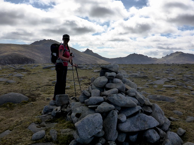
Summit Bhreac, looking to Beinn Bharrain
 P1150398
 by
Al, on Flickr
 P1150400
 by
Al, on Flickr
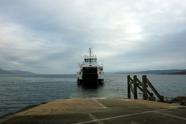
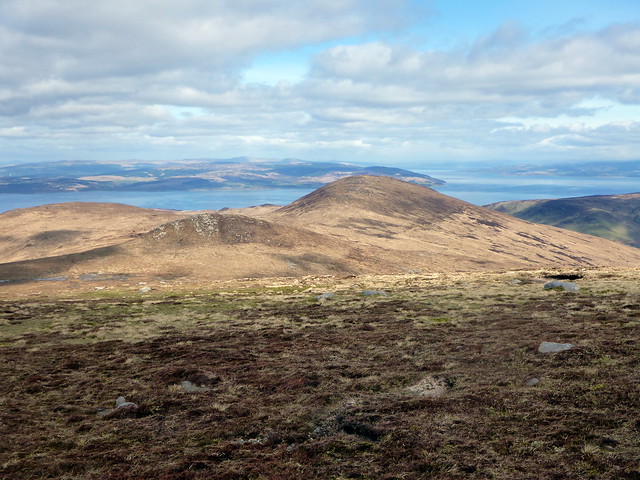
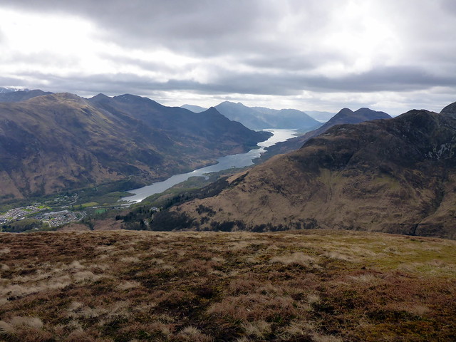
We headed off the north of Bhreac, making for Beinn Biorach and Meall Mor which gave a very enjoyable short circuit. Good views of Loch Ranza from Meall Mor, including of the ferry coming over the smooth sea. We descended steeply from Meall Mor to rejoin the footpath. Back to the campsite, collected the car and drove to the ferry terminal to wait for the next crossing. Sat in the sunshine and ate our lunch looking out over the waters.
Beinn Biorach & Meall Mor
 P1150401
 by
Al, on Flickr
Yesterday's Marilyn - Meall nan Damh
 P1150402
 by
Al, on Flickr
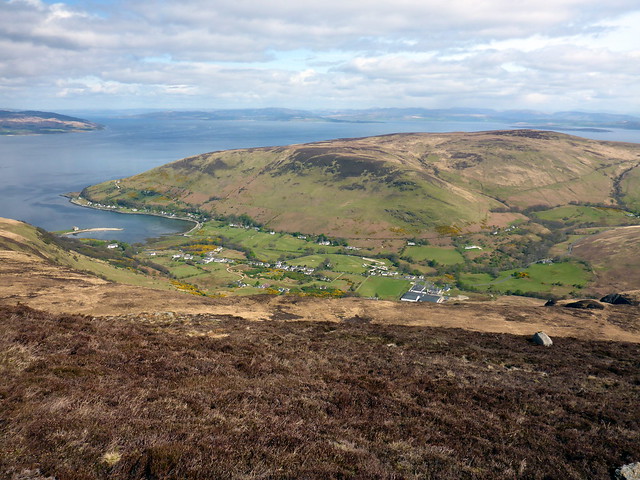
Lochranza
 P1150406
 by
Al, on Flickr
 P1150407
 by
Al, on Flickr
 P1150410
 by
Al, on Flickr
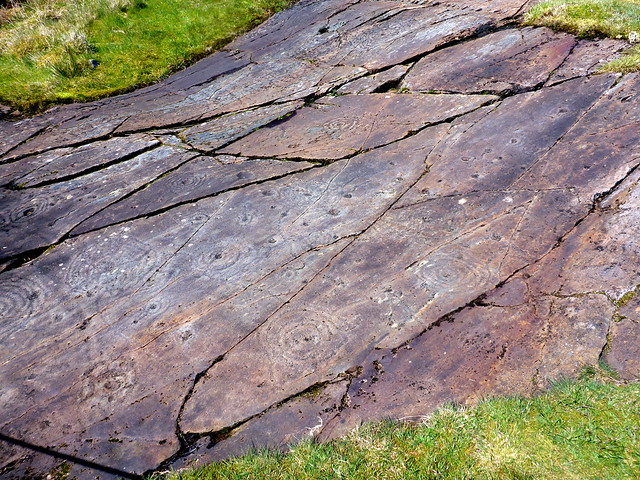
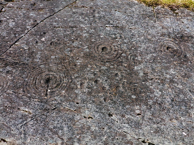
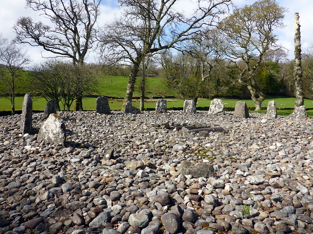
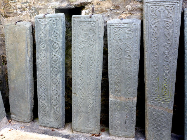
The route to Oban took us along Kilmartin Glen, which Allison hadn't visited, so we made some stops - the wonderful cup and ring marked sandstone slabs at Achnabreck which have a special kind of cosmic resonance and remind me of looking out into deep space; then Temple Wood and the adjacent standing stones and linear chambered cairns; then finally Kilmartin Church with its Knights Templar engraved stones and carved ancient crosses inside the church. Well worth a visit.
Achnabreck slabs
 P1150413
 by
Al, on Flickr
 P1150414
 by
Al, on Flickr
Temple Wood
 P1150416
 by
Al, on Flickr
Kilmartin Stones
 P1150417
 by
Al, on Flickr
We arrived at a busy Kinlochleven at around 5.30, made our tea then ventured into the bunkhouse to spend an enjoyable, not very sober evening with the usual suspects. Didn't get to bed til almost 2am - far too late for an old yin like me. As a result had a lie in til after 9, getting us as most folk were leaving. The forecast seemed to be for rain from the afternoon, with most folk we spoke to doing no hills or something short. Not driving for a couple of hours after last night was probably wise, so our hill selection was made for us - Na Gruagaichean's west Top for Allison, which we could walk from the campsite to.
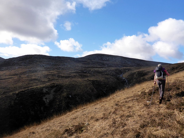
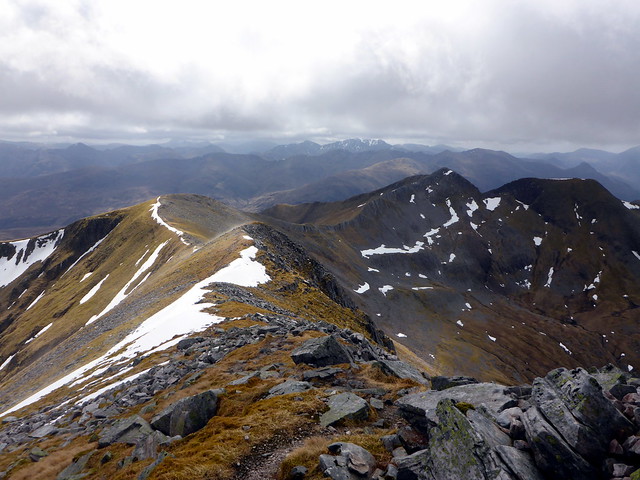
The tops of the hills were in clag and it was a bit of a plod for me initially - we had considered a direct assault of the southern flank, but that seemed rather steep, so an easier way - along the track towards Coire an Lochain then cutting up onto Sgurr Eilde Beag was sensibly selected instead. The wind was strong and chill, but the tops gradually cleared, and we ended up having a good weather experience.
Sgurr Eilde Mor
 P1150422
 by
Al, on Flickr
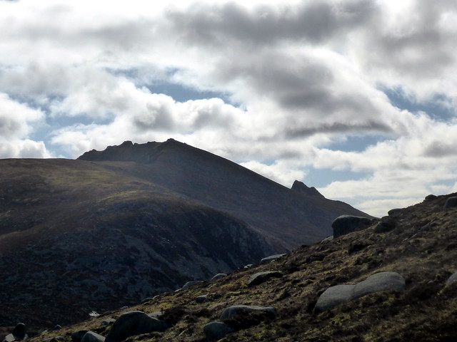
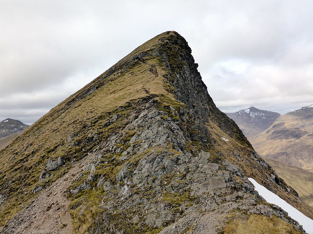
From Sgurr eilde beag we went to the southern Top of Binnien Mor. It seemed positively rude not to nip along to the summit of Binnien Mor from here, so we did, then returned and set off along the ridge to Na Gruagaichean. First time we did this (at WH Meet in Nov 13) it was serious snow and cornicing to be negotiated - today it was an amble. Down from the summit onto loose scree to climb the west Top of na Gruagaichean and back before heading off in the standard manner and making for the track to Mamore Lodge thence back to Kinlochleven. Passed a number of foreign folk on the WHW, which I'm supposed to be walking next weekend....we'll see. A pleasant drive down the road, without a backlog of traffic on Loch Lomond shores.
 P1150426
 by
Al, on Flickr
Binnien Mor
 P1150427
 by
Al, on Flickr
Binnien Beag
 P1150430
 by
Al, on Flickr
Na Gruagaichean
 P1150432
 by
Al, on Flickr
West Top
 P1150434
 by
Al, on Flickr
 P1150436
 by
Al, on Flickr
 P1150439
 by
Al, on Flickr
 P1150440
 by
Al, on Flickr
So that's the Grahams done - have to say they've been my favourite class of hill out of those climbed so far. Although I am enjoying getting up Munros again, there was something very appealing about these smaller hills with bucketloads of attitude.
