free to be able to rate and comment on reports (as well as access 1:25000 mapping).
Munros: Eididh nan Clach Geala, Meall nan Ceapraichean, Cona' Mheall, Am Faochagach.
Date: 06/05/2017.
Distance: 31km.
Ascent: 2010m.
Time: 8 hours, 50 minutes.
Weather: Sunny and warm, slightly hazy.
For once, the good weather outside my office window all week looked certain to hold into the weekend

. I probably could have negotiated the car from Gill if I'd really wanted, but I thought I'd try a linear walk somewhere. Although I've taken the bus to Ullapool before to get the ferry, I've never tried doing any walking from it. There were a number of possibilities in the hills around Beinn Dearg that beckoned, and my preference was a traverse from Inverlael to Altguish. Even within this there were options - should I take in the Famine wall over Beinn Dearg or should I head further north over Eididh nan Clach Geala?
There was just one thing that could scupper my plan, so I dropped a couple of other maps into my bag just in case I had to rethink. Unlike the other Citylink bus routes that leave Inverness, I suspected that the Ullapool one only stopped at the listed stops. When I went to buy a ticket, it turned out I was right - and Inverlael was not an official stop. However the driver said he'd drop me there anyway, so plan A was on

.
Where I’m going later, from the bus:
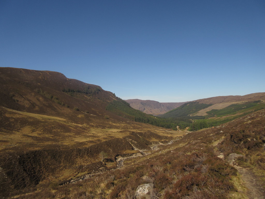
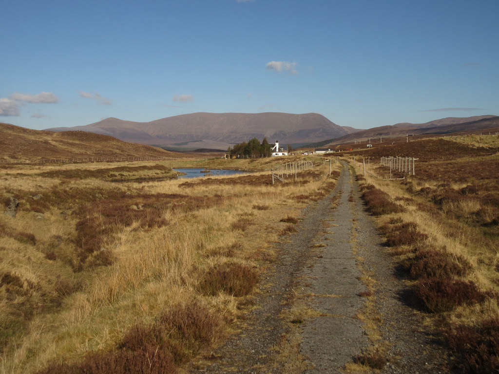
We overshot the Inverlael carpark by a couple of hundred meters, but it was just a few minutes wander along the verge of the A835 to correct this. The grey cloud of the Moray Firth had long burnt away to a beautiful morning, and I was on my way up Gleann na Sguaib a little before 9:30am. I had already decided by this point that I was going to head for Eididh nan Clach Geala rather than Beinn Dearg.
A few other folk were also on their way up the glen, and they passed me when I decided that I was going the wrong way, and went back to investigate a path through the woods just before the ruin of Glensguaib (turned out it just went to the intake for Ullapool water works). I had no confidence in my map (last updated 1976, and older than me) in this section of forestry, but it turned out to be pretty much bang on. Before long, I passed a couple of other folk again, and after the end of the forestry track fell in with a guy called Ian who had just abandoned his bike. He was heading for Seana Bhraigh via Eididh Clach nan Geala, and we ended up walking to the first summit together, and having quite a natter. As an occasional user (but not poster) on Walkhighlands, I hope I may have persuaded him to join up and come on a meet sometime.
Gleann na Sguaib:
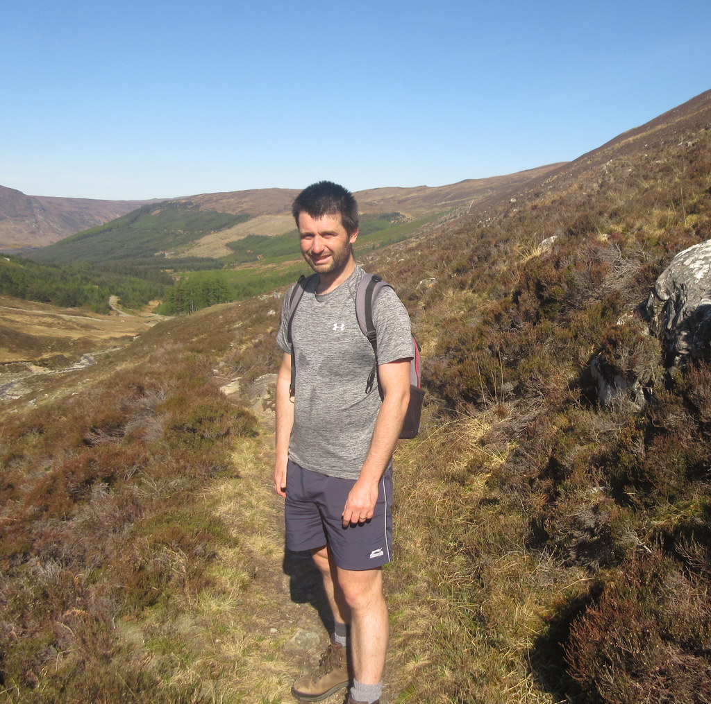
Sweaty already:
It was a pleasant walk up the glen, and the path was really good - one of the reasons I fancied this route is that I'd always (well, twice) approached this group of hills from the head of Loch Glascarnoch before.
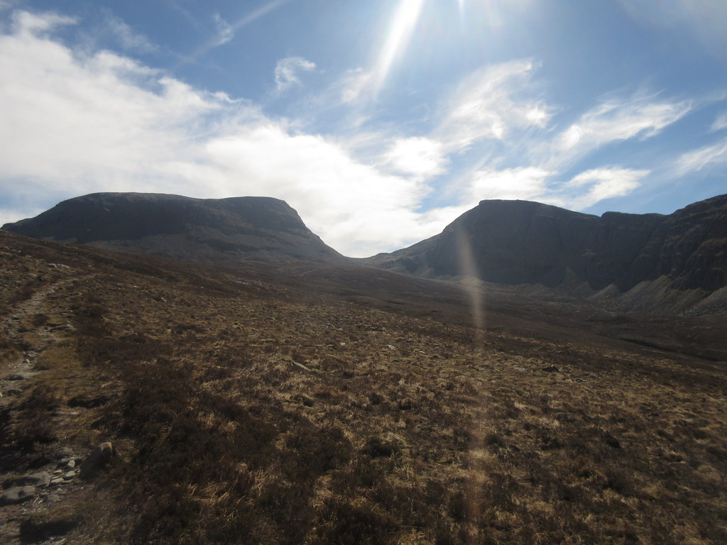
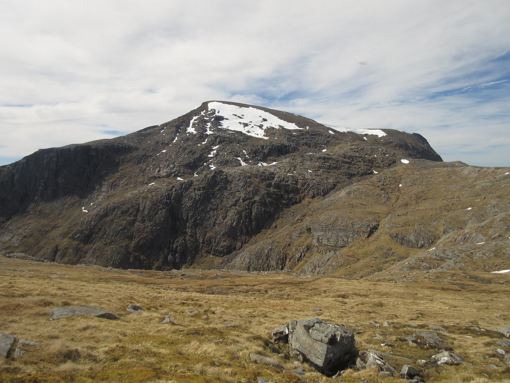
Meall nan Ceapraichean and Beinn Dearg:
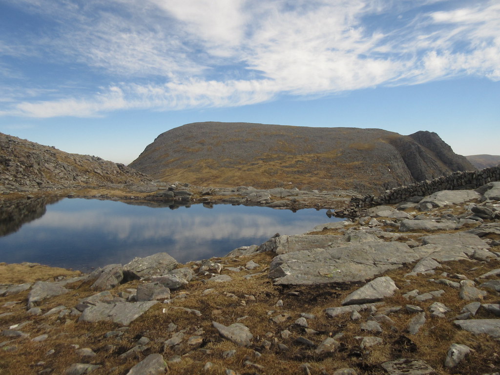
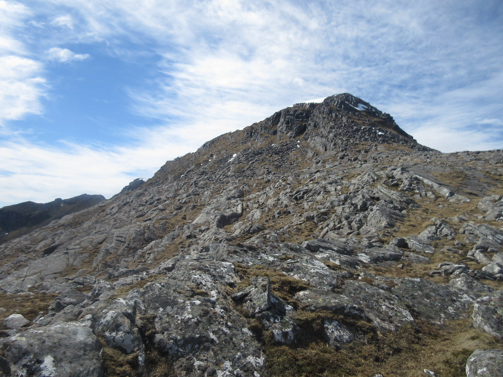
At Lochan a' Chnapaich, it was a quick bash up onto the W ridge of Eididh nan Clach Geala, before arriving at the summit. I found this approach more scenic than my last one, contouring round the back of Meall nan Ceaprichean from Cnap Coire Loch Tuath.
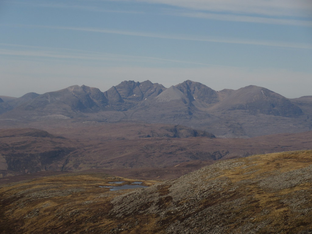
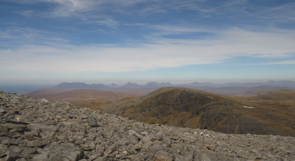
An Teallach:
Lochan a’ Chnapaich:
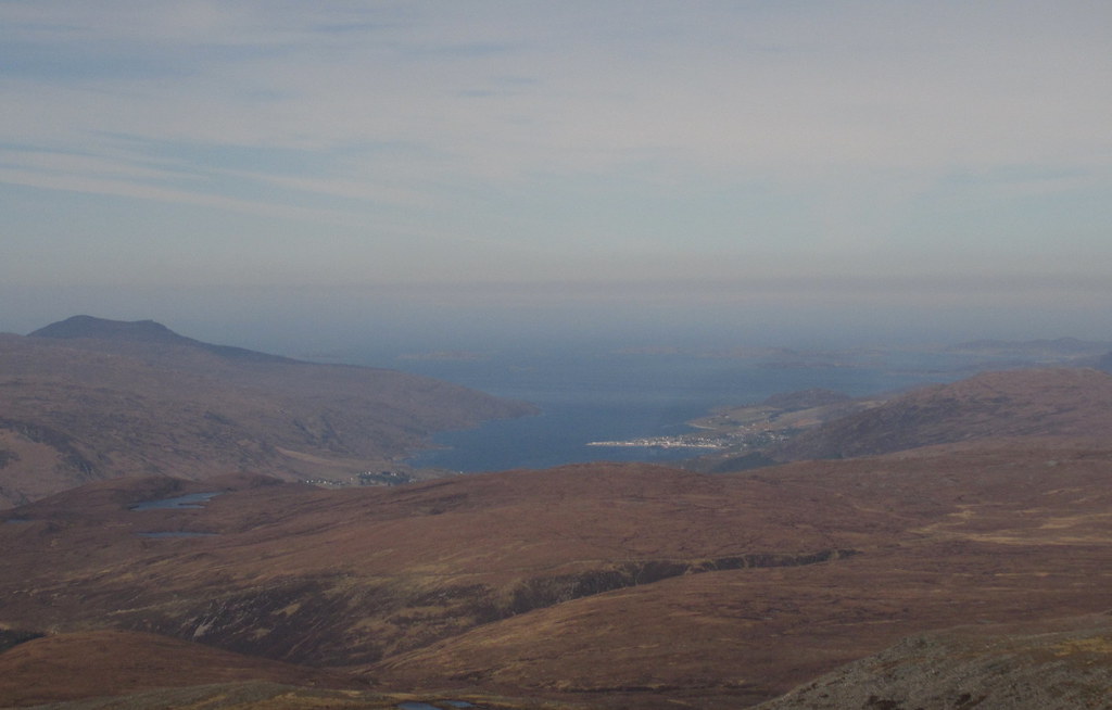
An Teallach to Loch Broom:
Beinn Dearg and the Fannaichs:
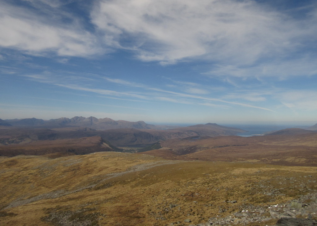
At the summit, Ian was off on the long cross-country traverse to Seana Bhraigh (although I was to bump into him again as he was staying at the Altguish), and I had a nice first lunch break. There was a bit of a haze in the air, but I was just able to make out Clisham on Harris, and everything closer looked fantastic.
Ian heading off to Seana Bhraigh:
An Teallach:
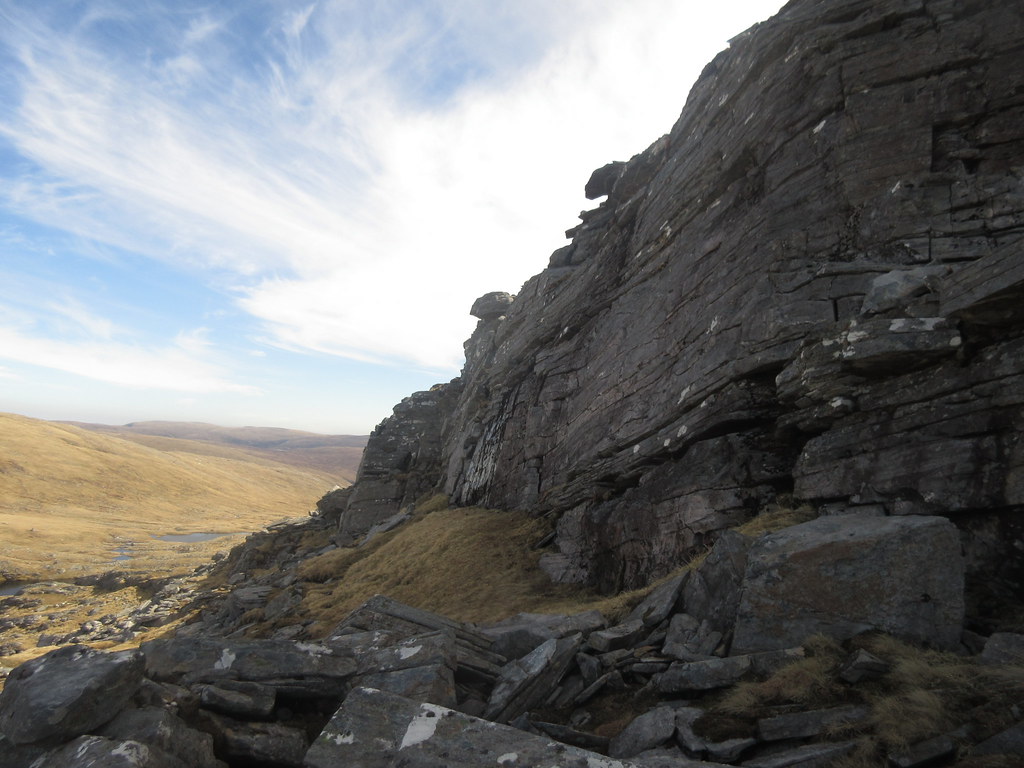
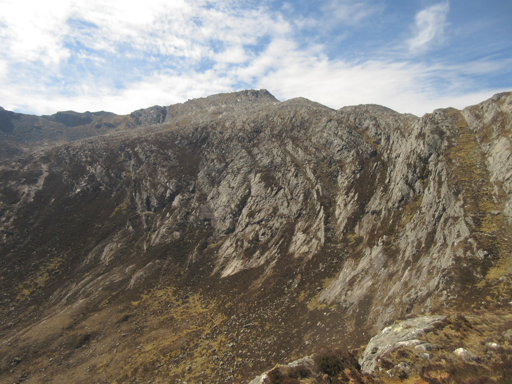
I stuck close to the edge of the crags overlooking Lochan a' Chnapaich for the descent to the col, then found a weaving, occasionally scrambly line up onto Ceann Garbh. The rock in this area is brilliant to look at, with lots of horizontal strata and sloping terraces up through the bands of crag. I met the majority of the people I passed today between this ascent and Bealach an Lochain Uaine below Beinn Dearg.
Loch a’ Chnapaich and the crags of Diollaid a Mhill Bhric:
Outcrops on the ascent of Meall nan Ceapraichean:
Creag an Duine of Seana Bhraigh:
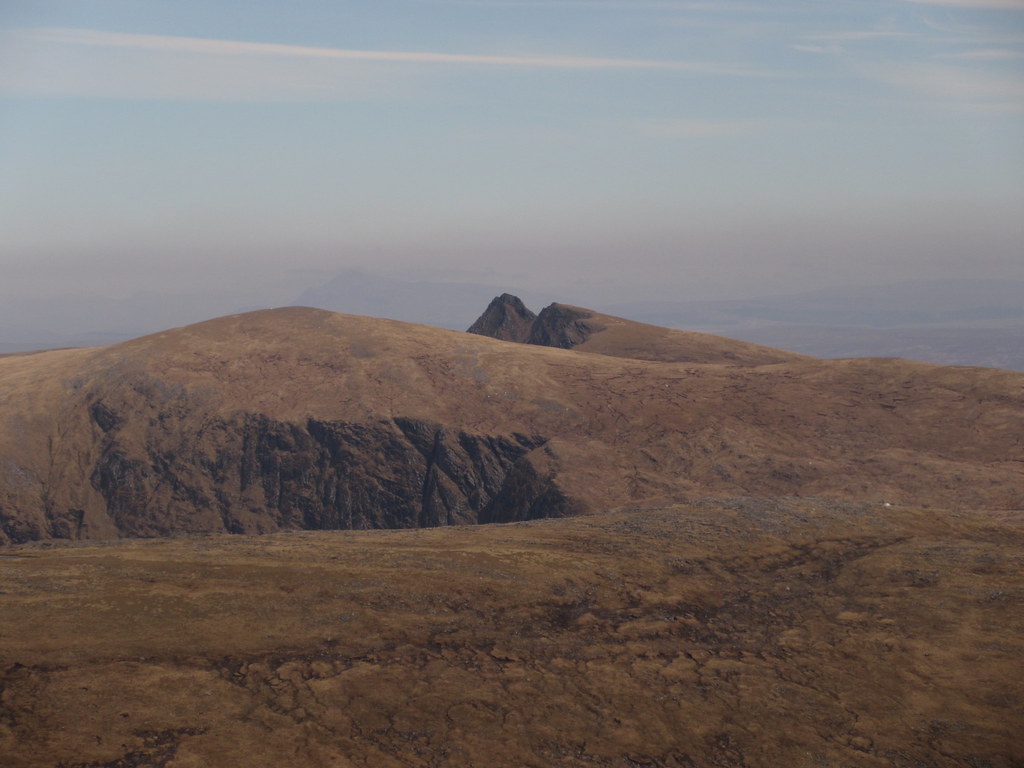
Coigach and Assynt:
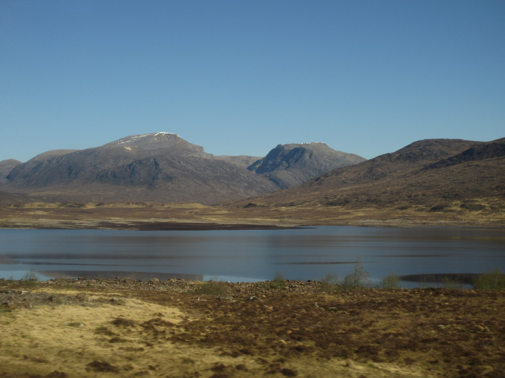
Ullapool and Loch Broom:
An Teallach to Sail Mhor:

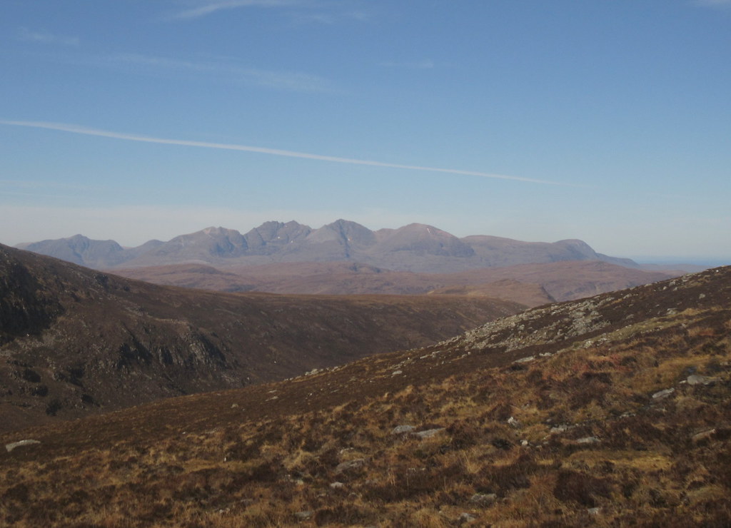
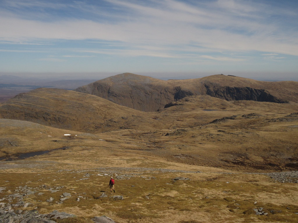
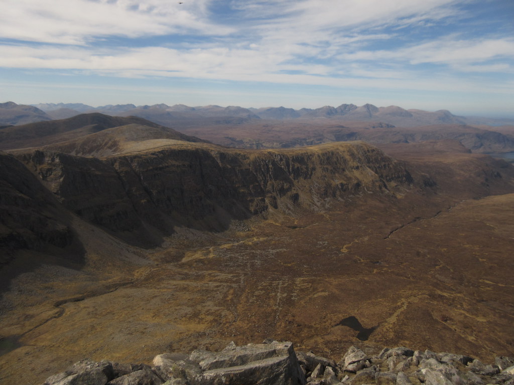
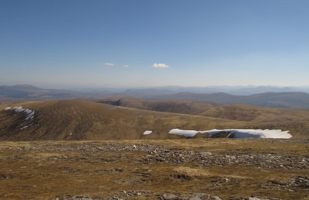
Meall nan Ceapraichean can seem like a bit of a non-hill when approached from Beinn Dearg, but an ascent of the northern flanks certainly increases appreciation of it. Also the views into the top of Gleann na Sguaib are good. The trouble with this area is that there are more good approach routes than it is possible to take in on a single walk.
Beinn Dearg and Lochan Lathail:
Crossing the summit of Meall nan Ceapraichean, I met a couple of guys who had camped out the previous night at Bealach an Lochain Uaine. I was a bit envious, as I had briefly considered a Friday night camp out somewhere, but had been far too slack to gather all of my overnight kit together.
Down Gleann na Sguaib:
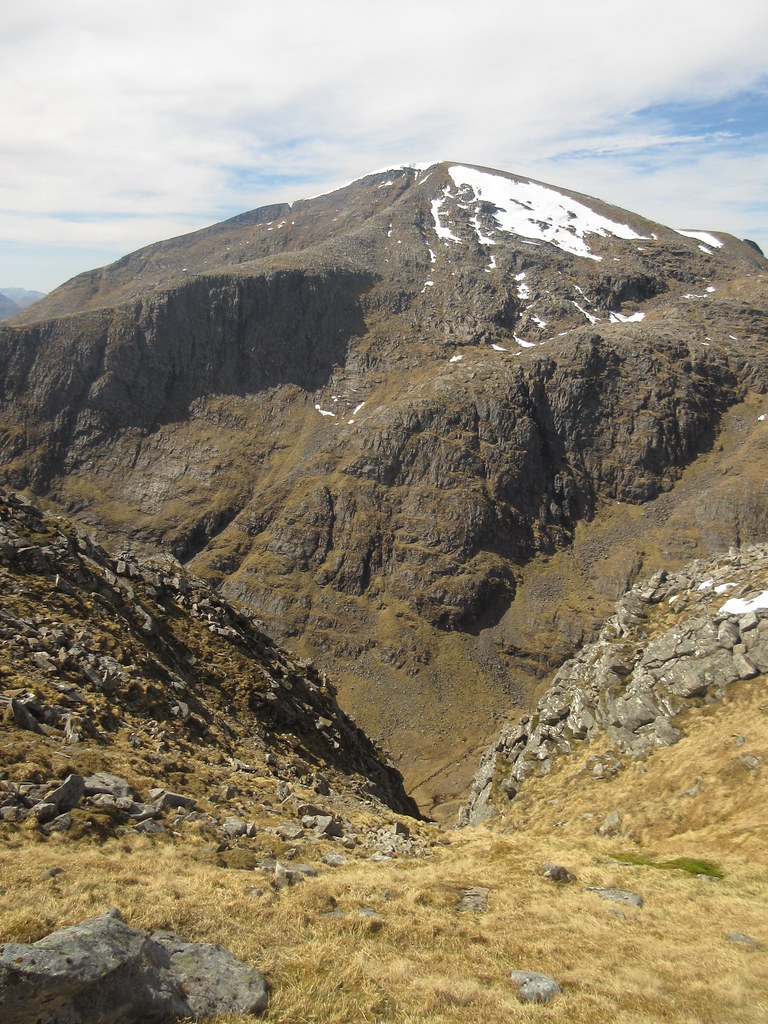
Beinn Dearg from Meall nan Ceapraichean:
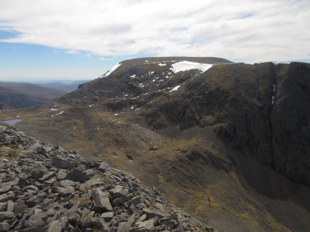
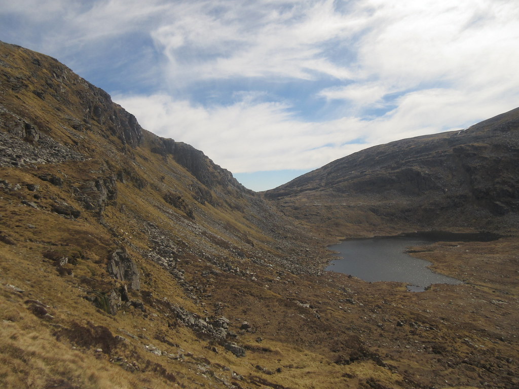
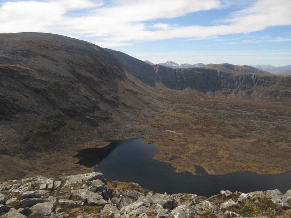
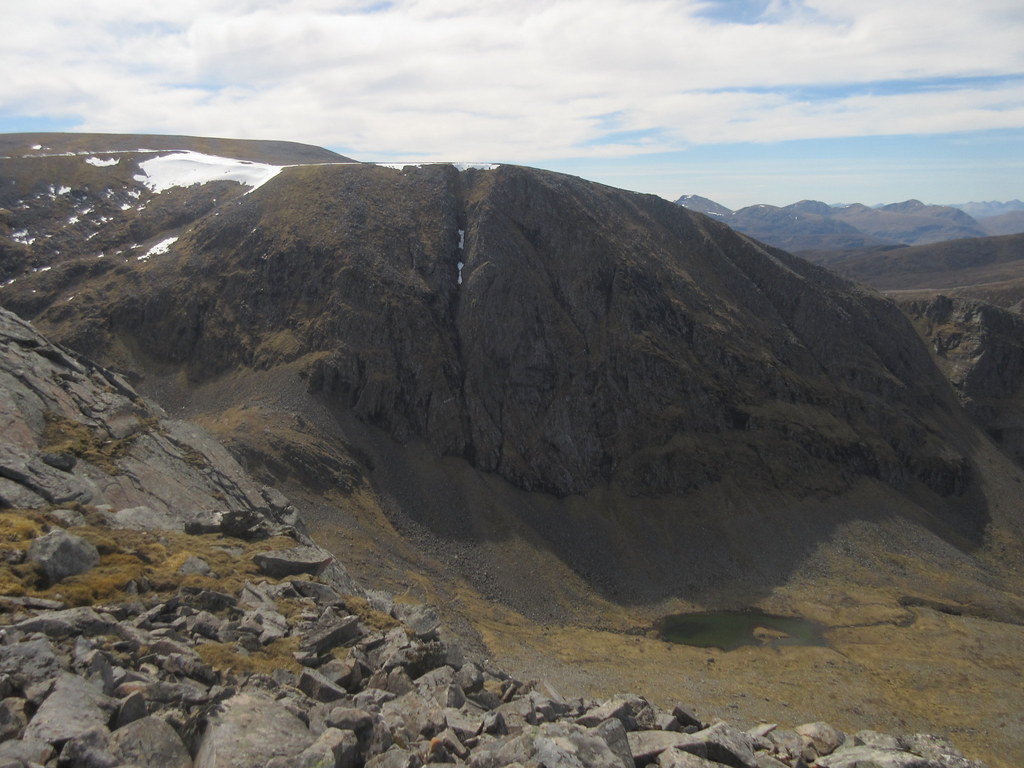
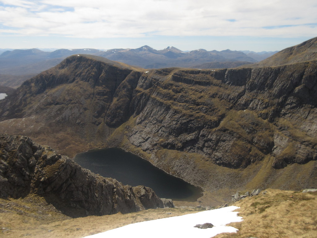
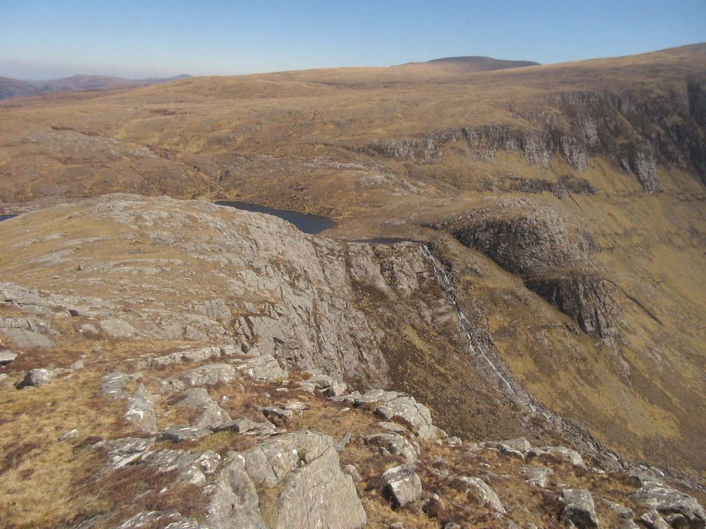
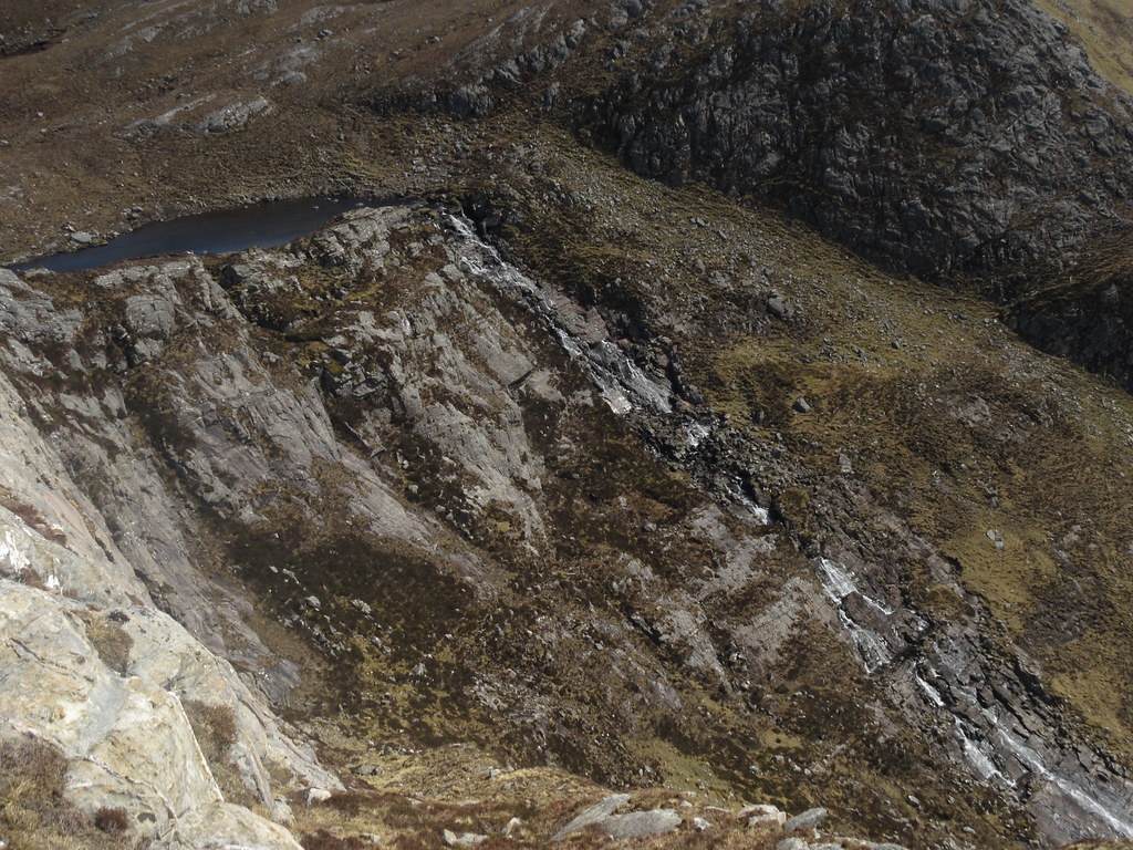
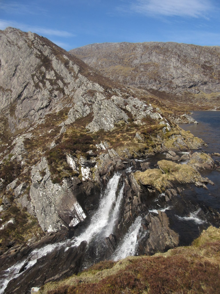
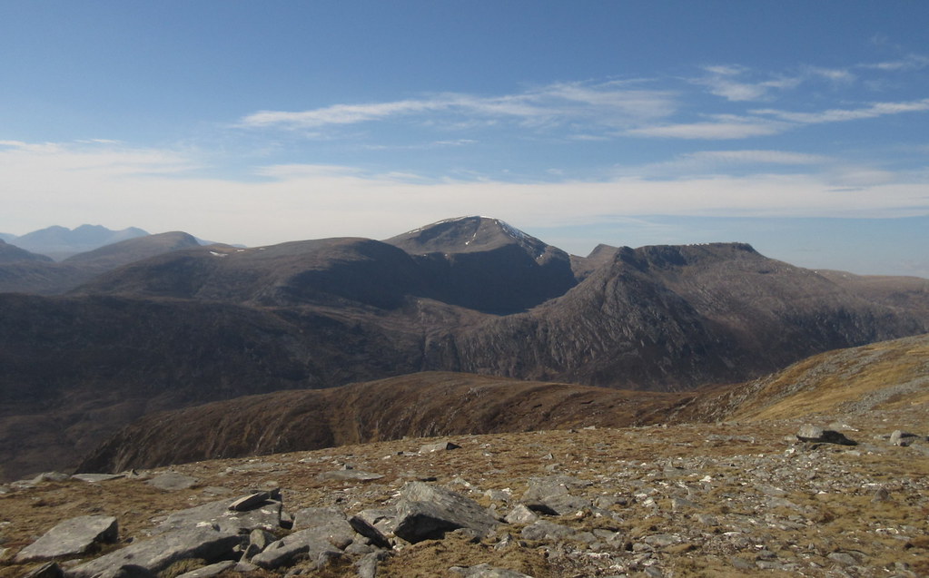
Down to Lochan Uaine, and it was time for one of the highlights of the range - Coire Ghranda. Definitely up there in the list of spectacular Scottish corries.
Cona Mheall:
Choire Ghranda:
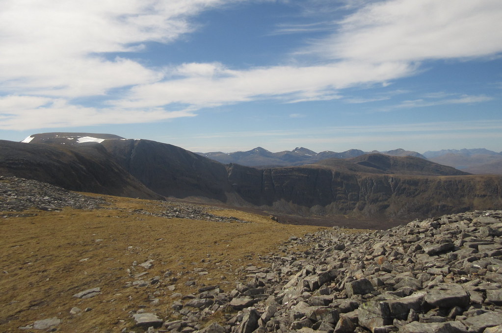
Given the margin of time I had when I got back to Altguish, I probably could have nipped up Beinn Dearg as well, but without knowing how long the rest of the day would take, it was too risky to consider at the time. On the ascent of Cona' Mheall, I made a rising traverse SE along a grassy rake, which kept me closer to the edge of Coire Ghranda. Where I hit the summit ridge was just where it narrows down into an arête, and was a spectacular place for another quick break. I came up this arête about 10 years ago and found it to be pretty straightforward. However the weather was pants, so it's one to add to the 'do again' list.
Beinn Dearg from Cona Mheall:
Coire Ghranda:
SE ridge of Cona Mheall:
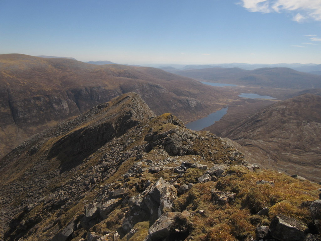
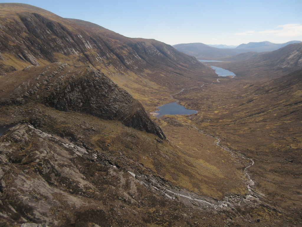
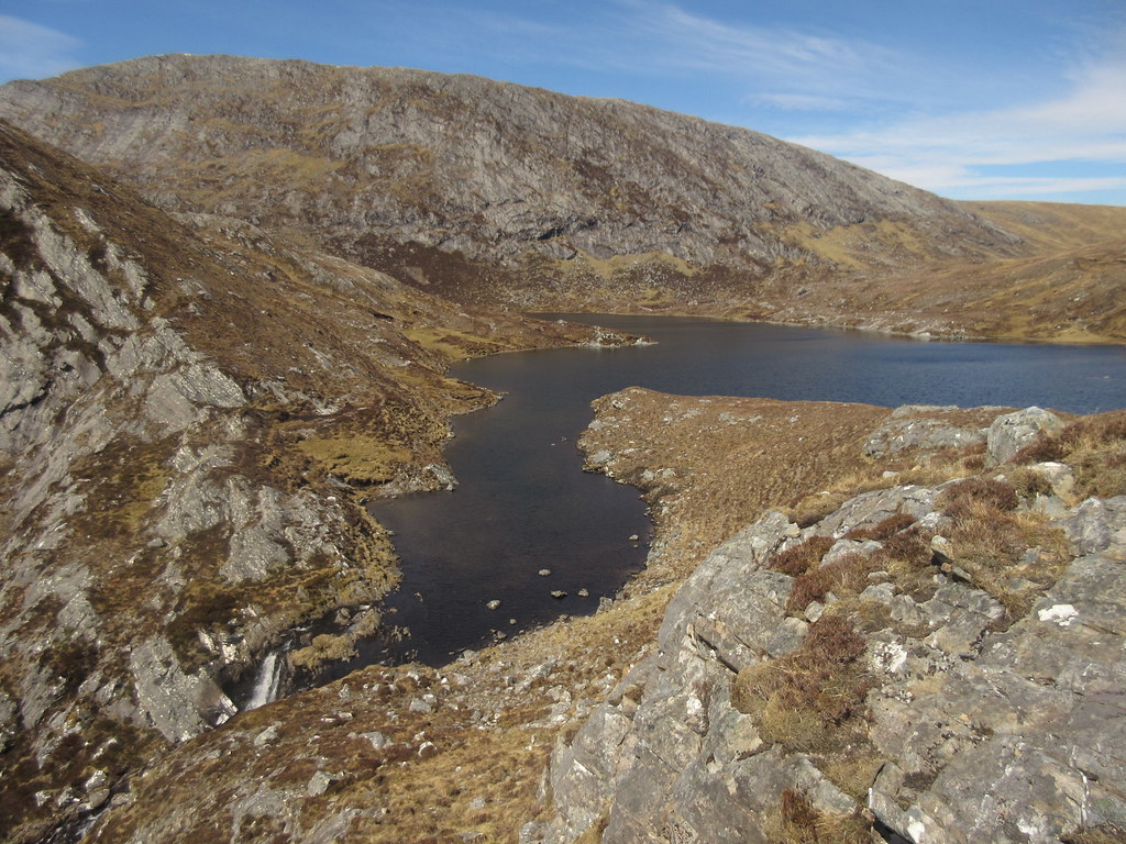
The next highlight of the day was to be the descent down the E ridge of Cona' Mheall to the outflow of Loch Prille. You can tell just from looking at the map that this is going to be worth it. The ridge was a bit slow higher up, weaving backwards and forwards to avoid crags, but lower down there was lots of strolling across bare slabs, until the outflow was reached.
Looking back up the E ridge of Cona Mheall:
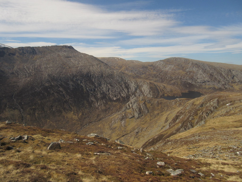
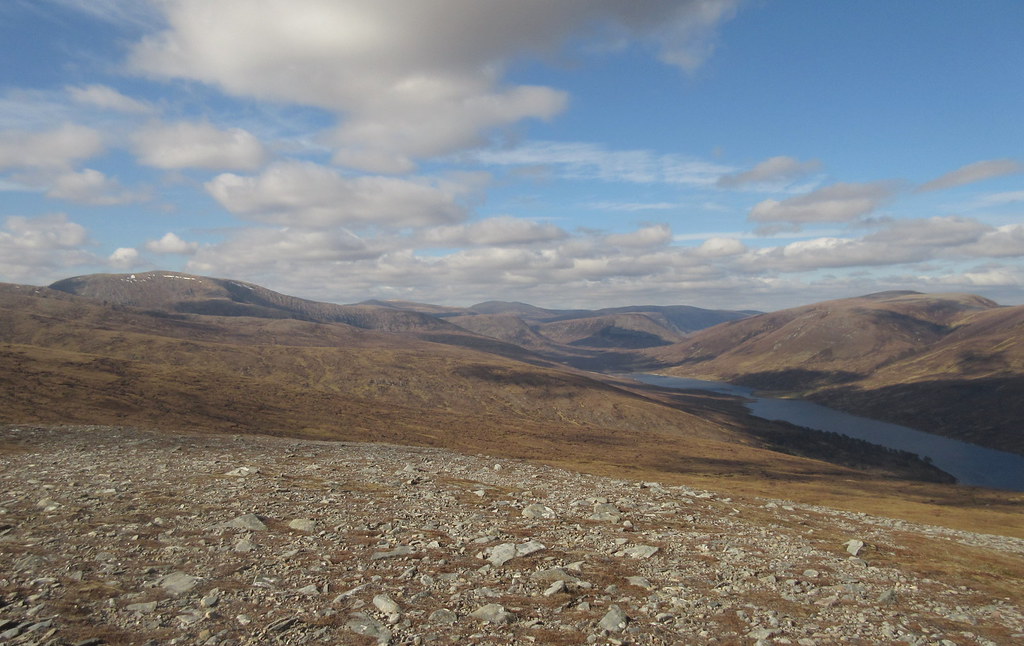
I had a good long stop on a sunny ledge here, overlooking the first waterfall dropping into Coire Lair. Given that most people seem to ascend Am Faochagach on a separate walk, the traverse between it and Cona' Mheall doesn't see that much traffic, and this spot is a nice remote and hidden gem.
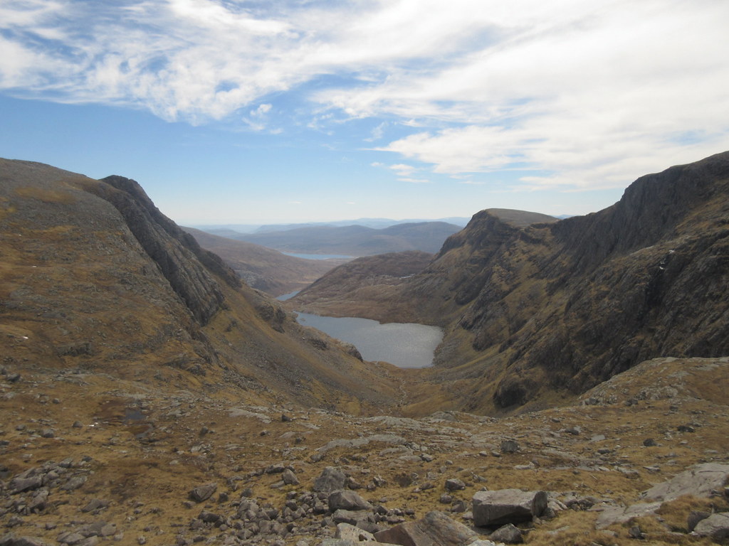
Loch Prille and Coire Lair:
Loch na Still and Loch Coire Lair:
Head of Coire Lair and Cona Mheall:
Loch Prille outflow:
Loch Prille:
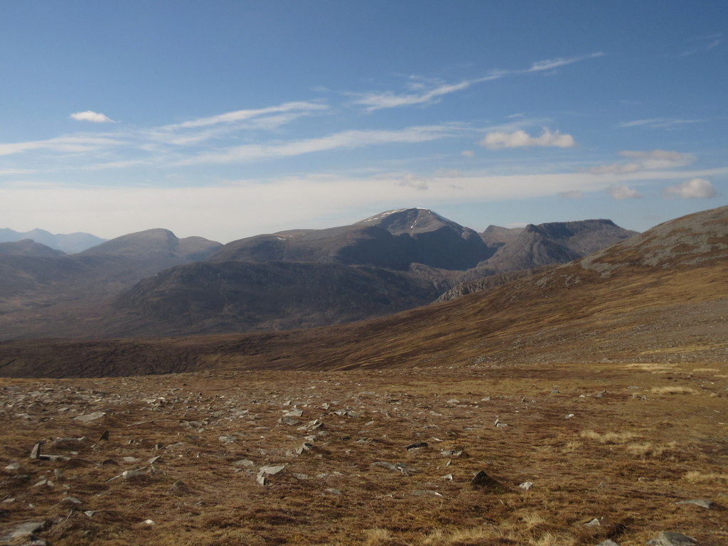
If I could have swapped any hills on today's route, I would have taken in Beinn Dearg and left out Am Faochagach, but logistically this wasn't an option. Am Faochagach was always going to be on the route home. It's not actually a bad hill, and it certainly has great views into Coire Ghranda, but after the fun of the more western summits, it feels a bit bland.
Cona Mheall and Cnap Coire Loch Tuath:
Still, the walking was easy and the sun was out, so the going was pleasant enough. On the descent towards Loch Glascarnoch, I passed one last person. While he dropped down to Loch a' Gharbhrain, I carried on along the high route across Sron Liath, Creag Rainich, Tom Ban Mor and Meall Coire nan Laogh. I had done this before when dropping down to Strathvaich Lodge, but with cloud on the ridge back then, I couldn't really remember any of it. Not surprising - it offers lovely easy going underfoot, but is fairly forgettable in a hills-around-Glenshee kind of way.
Beinn Dearg from Meallan Ban:

East across Meall Gorm and Tom Ban Mor:
Last looks at Beinn Dearg and Coire Ghranda:
Stopping for another break on Tom Ban Mor, I understood the problem. By now, Beinn Dearg had completely disappeared over the horizon, and suddenly I was able to tune into the less spectacular landscape. The folds of hill away to Ben Wyvis and Beinn a’ Chaisteil suddenly appeared to have more features, as the lengthening shadows and patches of cloud shadow moved over them, and standing on Meall Coire nan Laogh looking down Strath Vaich, I realized I was enjoying the scenery again.
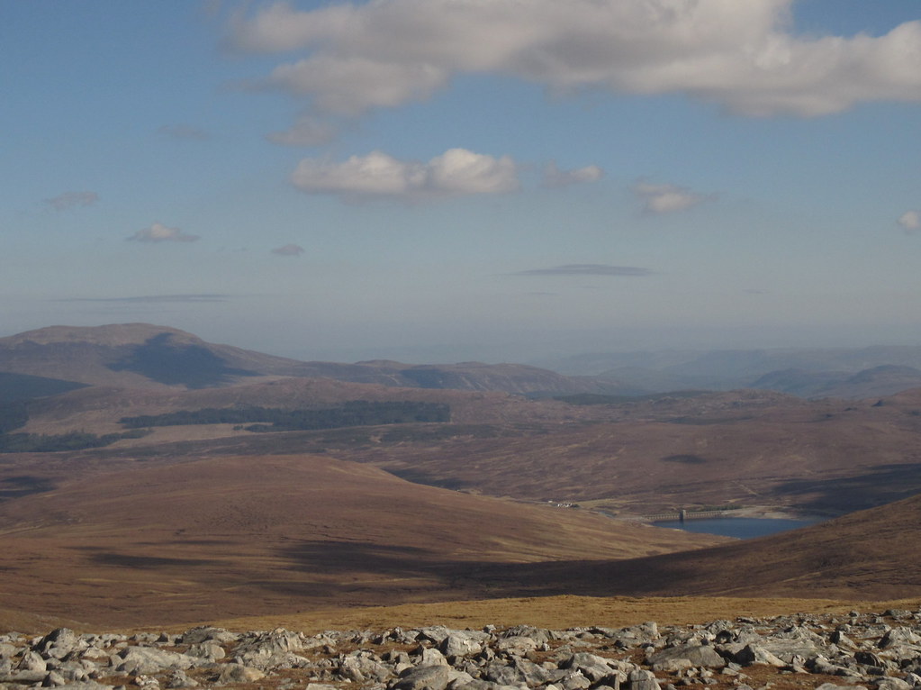
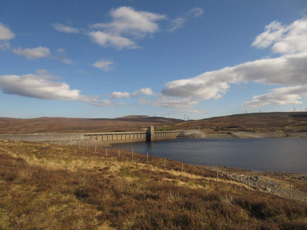
Glascarnoch dam with Altguish just visible:
Loch Vaich and Beinn a’ Chaisteil:
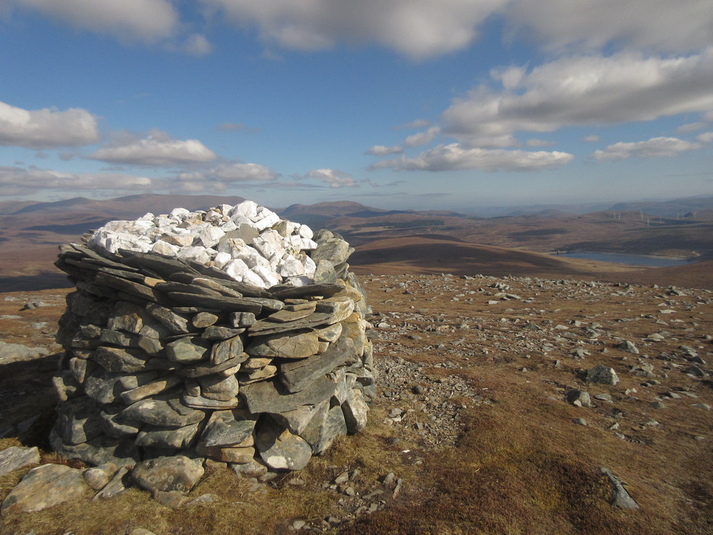
Cairn on Meall Coire nan Laogh:
I'm not sure what the ideal route down to the shores of Loch Glascarnoch is - perhaps it is to go over Meal an Torcain and drop straight down to the prominent radio mast on the shore. By this point, I was keeping an eve on the time, and thinking about the possibility of food and a pint, so I just made a beeline down the Allt na Feithe Luachraich. It was OK I suppose - typical Graham terrain, you could say, but if I was reversing my route, I doubt it would be a great deal of fun to go up. Once within the deer fence, the vegetation levels increased and there were those annoying excavations where new trees have been planted. It will look great in years to come, but it was a bit of a pain to walk over.
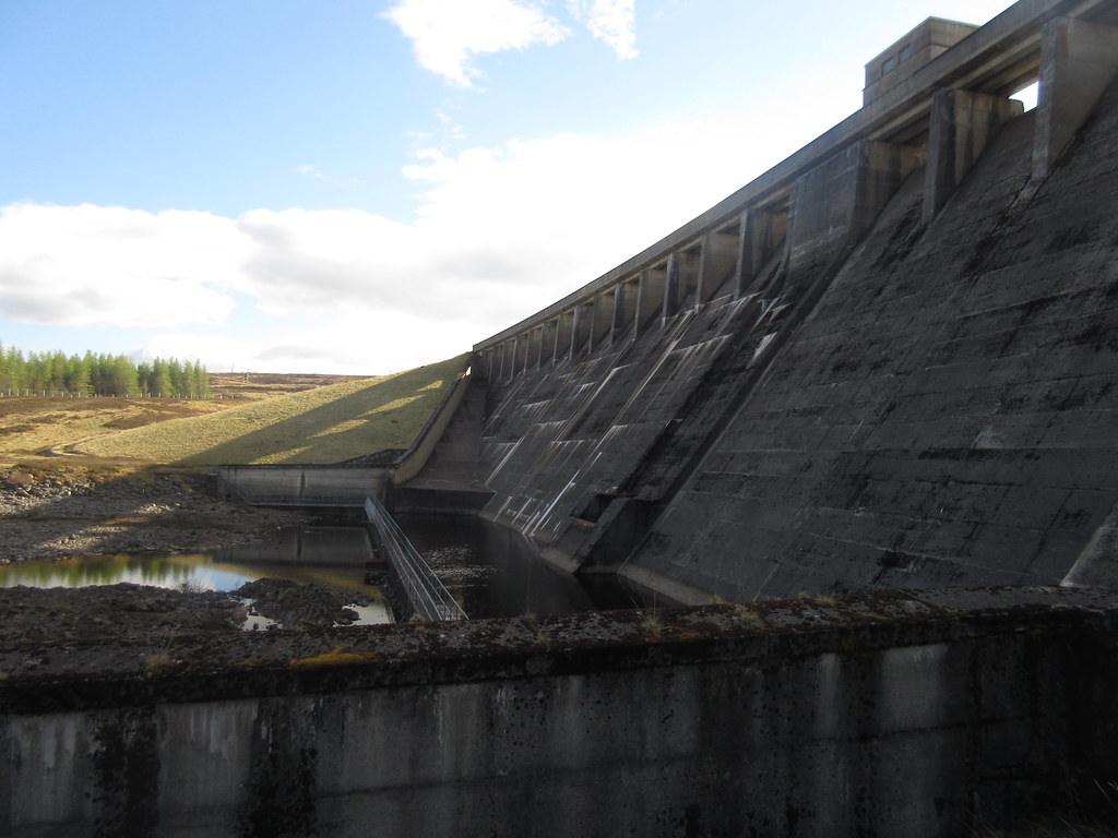
No matter, I was soon on a good track making for the dam. I started crossing the dam wall, then dropped down the grassy face of it to cross the completely dry Glascarnoch River.
Glascarnoch dam:
On the far side, it was a quick change into less sweaty clothes before the last couple of minutes along the old Ullapool road (bypassed when the glen was flooded). The sun was out and it was a satisfying end to the day, even if the approaches on foot to Altguish are much less inspiring than, say, the Cluanie Inn.
The old road to Altguish:
It had taken slightly longer than expected from Am Faochagach, but overall I had been faster than my estimate. Just enough time for some dinner, I reckoned. The Altguish has a mixed reputation, with all sorts of funny stories about their inability to serve meals without about a month's worth of notice going around, but this evening they were fine. As I only had 45 minutes before my bus was due, I checked that they would be able to feed me in this timecale - they could and did. Quite a few other people came in over that time, and everyone seemed to get decent service - so they get a thumbs-up from me.
Worth arriving slightly earlier than expected for:
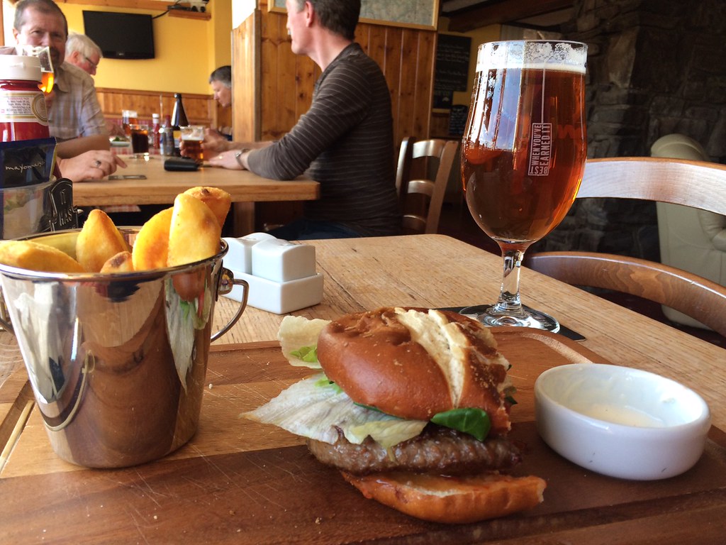
Good food, and as I sat with a couple of pints and my venison burger, I was able to watch the venison on the other side of the road having a boxing match - never actually seen stags boxing before, and I wish I could have got the camera out fast enough!
Ian, who I'd met on the hill earlier appeared, and if it wasn't for the bus coming round the corner a few minutes later, I probably could have settled in for a nice evening in the bar. It was handy having a seat where I could see the bus coming down the hill from Loch Glascarnoch, so I was able to leg it out of the bar (mid-conversation, unfortunately, but at least not mid-pint) and flag it down.
A top day out - although one that I would have preferred to do east to west. However due to the logistics (low chance of the bus stopping to pick me up at Inverlael), this way worked better, and I don't think it really made the day any less enjoyable. If I can just find the right bus driver again, I'll no doubt be back out along this road for another traverse of some description.
