free to be able to rate and comment on reports (as well as access 1:25000 mapping).
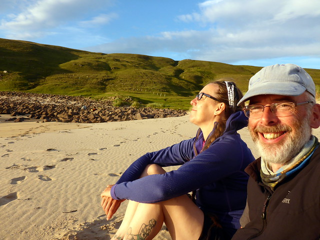
For the next 2 months, we're going to be reduced to 2 day weekends as Allison has a Mindfulness course to attend on Fridays over that period. So this was to be our last long weekend for a while. I'd managed to get the Monday off which gave us 4 days. With a reasonably positive weather forecast especially for the far north west. Where could we possibly go, I wonder...
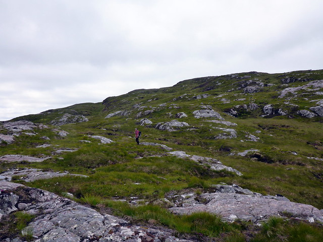
I'd looked at the clutch of Marilyns up in the Cape Wrath area when I was researching routes for my yet-to-happen CWT saunter. There are 8 of the little darlings peppered all over the Parph territory and I worked out a route that would combine them and allow a visit to Kearvaig, on my wish list and to The Cape, on Allison's. The main concern was the terrain - trackless (apart from the route the minibus takes from the Durness ferry to the lighthouse) and likely to be wild and boggy. I have clear memories of returning from climbing Foinaven back to Gualin House over a sea of marshes and bog-lagoons, menaced my midges. I wasn't sure I could handle 3 days of that

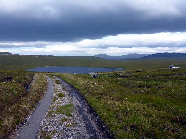
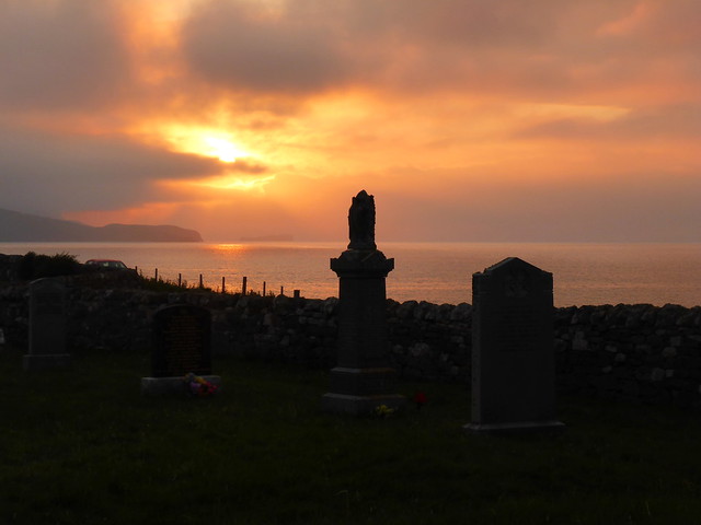
We had a lovely drive up on Thursday night - the roads were surprisingly quiet and the visibility was superb - we got to see mountains on the way that are usually obscured by cloud anytime we drive up. Stopped at Ardvreck Castle to camp for the night - arrived about 9.30. Some folk were camping by the ruins - we simply found a spot just by the car park, braved the midges and get pitched.
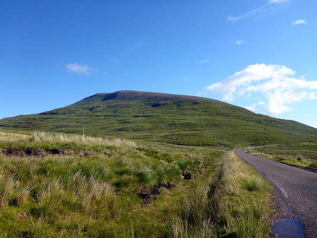
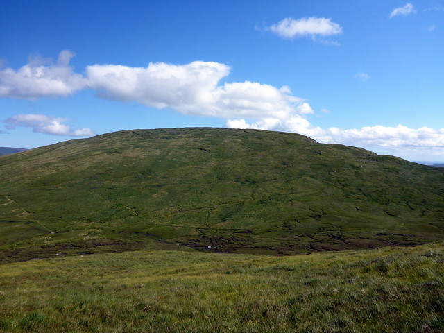
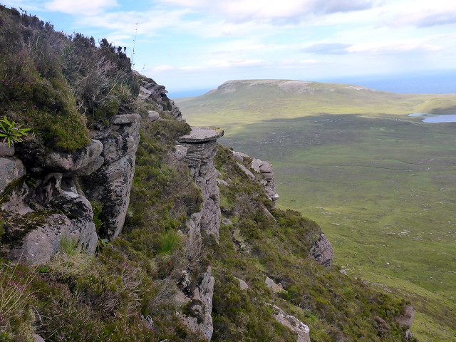
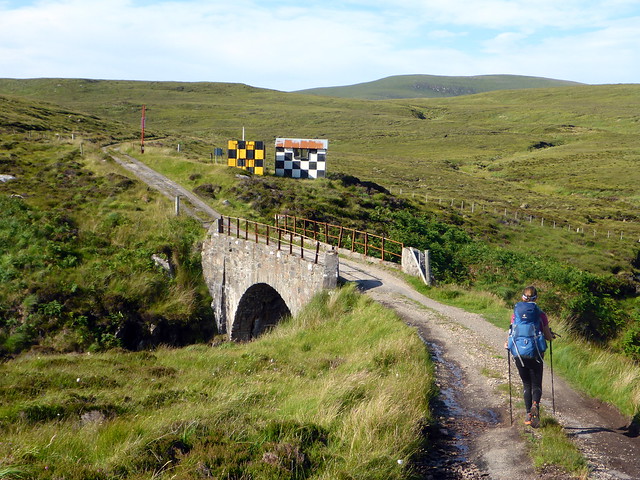
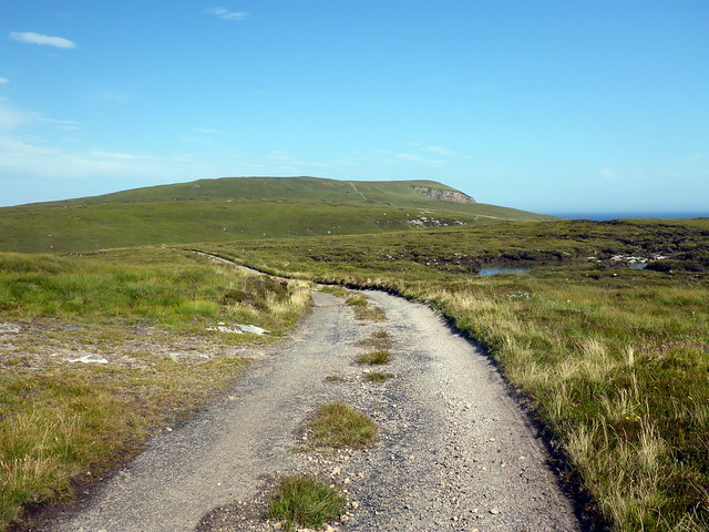
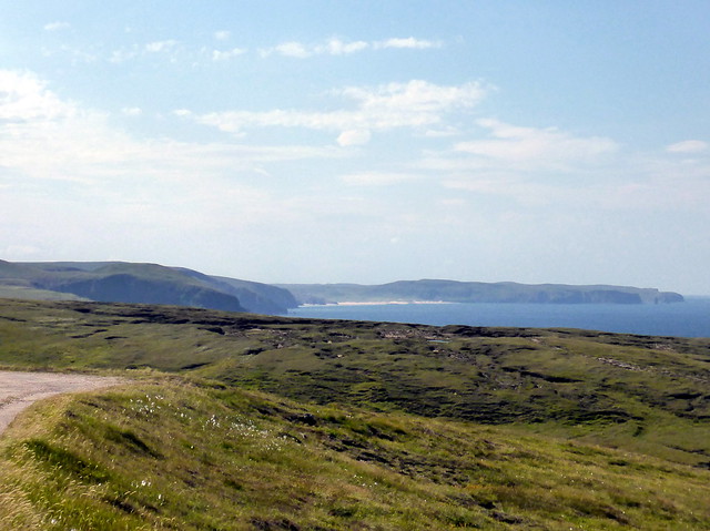
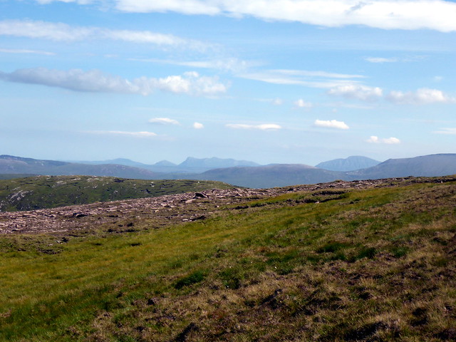
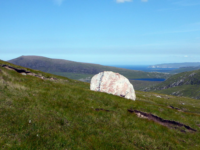
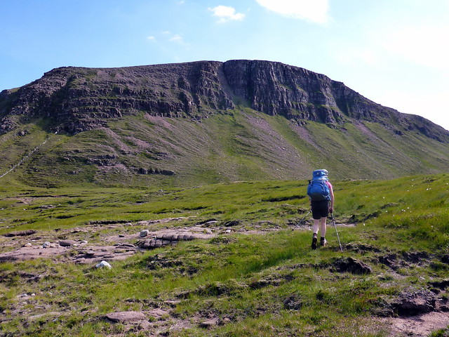
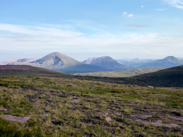
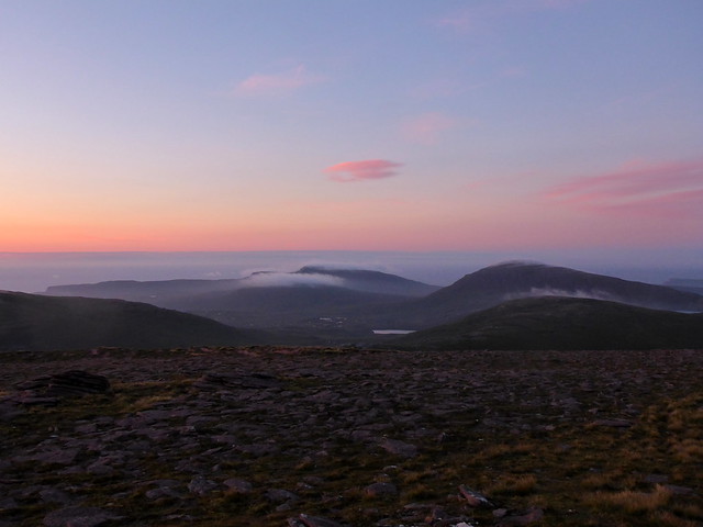
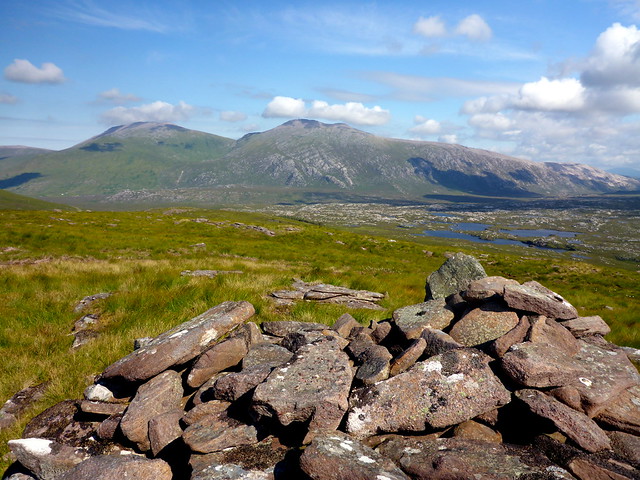
Day 1 was going to be the hardest - 30km would be required to get us to Kearvaig over the top of 5 or 6 mountains. We rose early, packed up and drove up to Gualin House, about 9 miles short of Durness. There's a layby that will allow 3 or 4 cars to be parked. We strapped on the big packs and set off before 9. Our first hill was Farrmheall, which is just by the roadside - an easy one to pick off if you're driving by. We walked along the road to a small bridge then set off up the side of the mountain. Across the way Foinaven, Cranstackie and Beinn Spionnaidh lay basking in the morning sunshine. Most of our hills were to have a similar structure - soggy bottoms and stony tops. Farrmheall was no exception. We did find some traffic cones on the hillside which we thought unusual

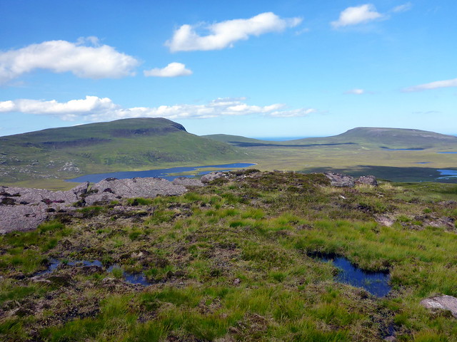
Reaching the summit we were watched by a band of sheep. We enjoyed the views then headed northeast for the next hill, Ghlas-bheinn. A smaller proposition at 333m it has a lochan ornamenting its top. First, however, there were some bogs to cross.
Foinaven
 P1160440
 by
Al, on Flickr
Farrmheall
 P1160441
 by
Al, on Flickr
Summit Farrmheall
 P1160444
 by
Al, on Flickr
Ghlas-bheinn with summit lochan
 P1160447
 by
Al, on Flickr
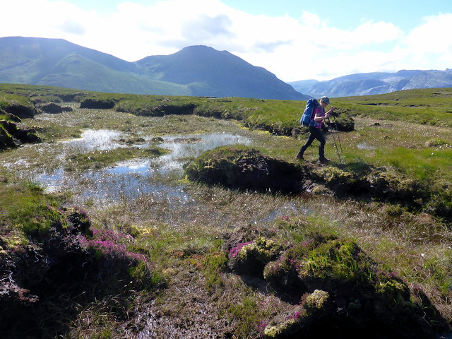
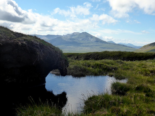
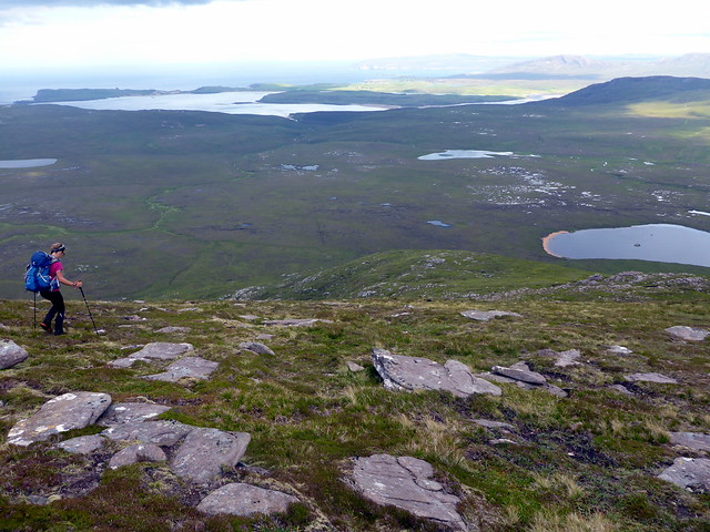
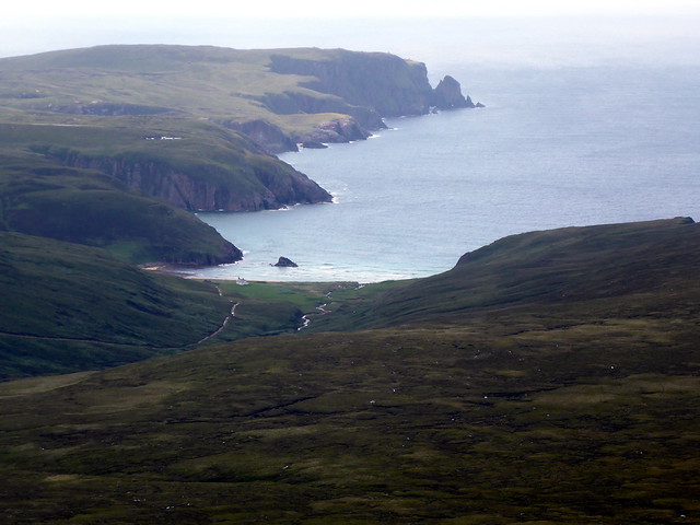
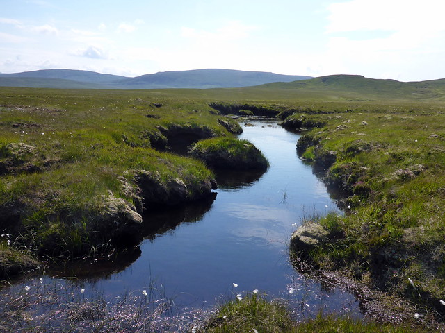
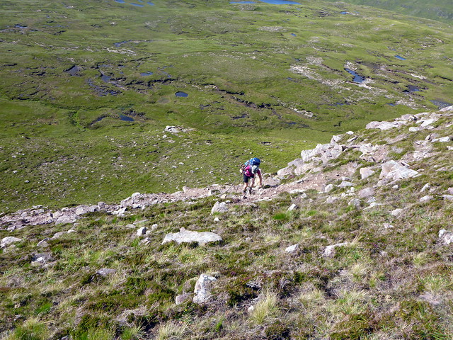
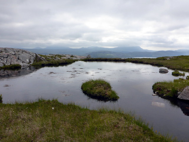
As we dropped off the end of Cnoc an Fhreiceadain to the bealach the bog became quite challenging, requiring careful route planning in places to avoid a watery death. Once we started climbing the grassy slopes of Ghlas-bheinn the going was much easier and the top was reached with its own special views - we could see the long sandy tongue of the Kyle of Durness to the north. My plan was to head off NW making for a footbridge marked on the map crossing the confluence at Bun na Tri-Allt. The descent was craggy in places. As I turned a corner I disturbed a Golden Eagle which flew off to my left maybe 5 feet away, close enough to feel the downdraft from her wings and hear the wind stream through her feathers. A couple of downy feathers fluttered to the ground as she rose into the air and flew towards Maovally More. Marvellous. Now for the bridge...um well the bad news was that it was not there - not even remnants. So it was a wade. Fortunately the water level wasn't that high and we both managed to cross without water ingress over gaiters. More rather soggy ground and an ATV track took us to Maovally More where we paused for lunch.
Bogs to be negotiated off Farrmheall - Cranstackie/Spionnaidh in backdrop
 P1160451
 by
Al, on Flickr
Ghlas-bheinn
 P1160453
 by
Al, on Flickr
Foinaven
 P1160455
 by
Al, on Flickr
The cliffs of creag Riabhach to the north from Ghlas-bheinn
 P1160456
 by
Al, on Flickr
Fashven and Sgribhis-bheinn
 P1160458
 by
Al, on Flickr
Kyle of Durness (zoomed) from Ghlas-bheinn
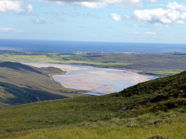 P1160460
 by
Al, on Flickr
No bridge!!
 P1160461
 by
Al, on Flickr
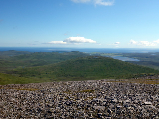
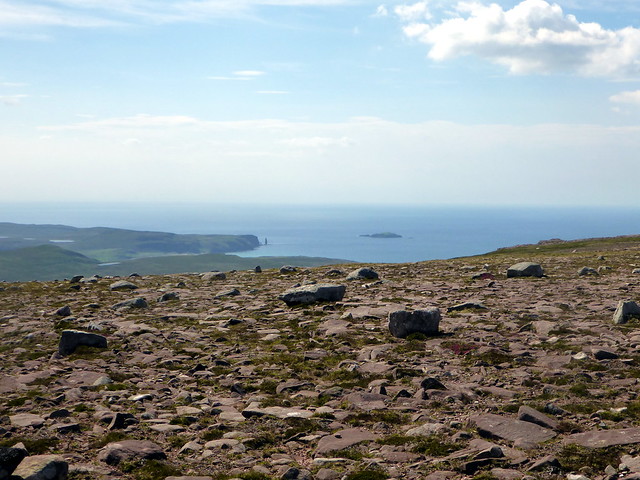
I was a little concerned as to whether we'd manage the rest of the day's agenda due to the terrain. Our next target, Ben Akie, was an out-and-back job and looked quite far away from where we sat. I contemplated excising it from the route but then snapped myself out of such foolish thinking. We set off down once more into the valley and then up the slopes of Ben Akie. Over to our left rose the whaleback of Fashven, next on the list, with Loch Airidh na Beinne before it. The summit of Akie is on a rocky promontory over a boggy plain. When reached it provided good views of Durness, Faraid Head and the endless ocean beyond. We returned to our sacks which were left in the valley and turned our attention to Fashven.
Ben Akie looks far away from here...
 P1160464
 by
Al, on Flickr
Summit Akie, Faradh Head beyond
 P1160468
 by
Al, on Flickr
Fashven & Sgribhis-bheinn from Akie
 P1160469
 by
Al, on Flickr
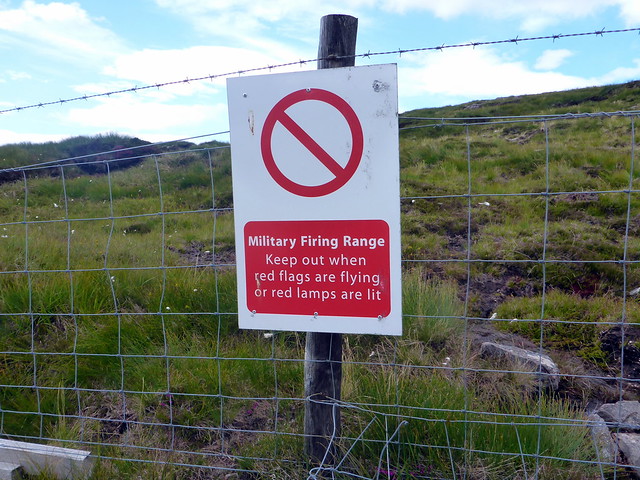
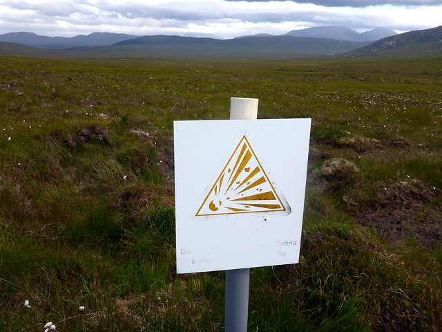
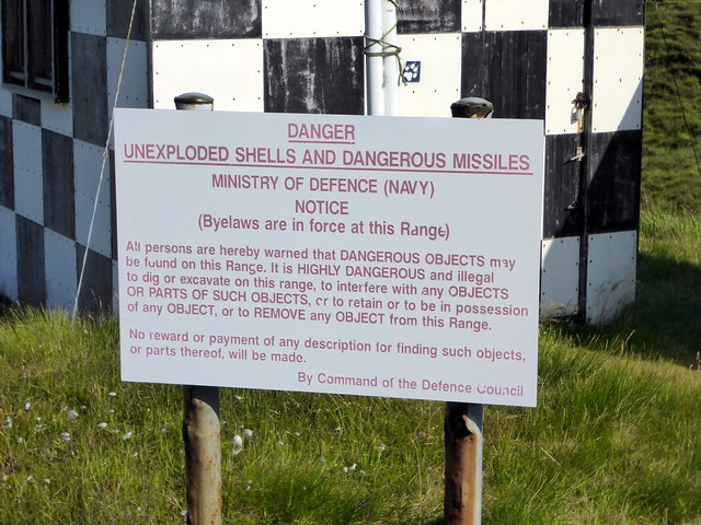
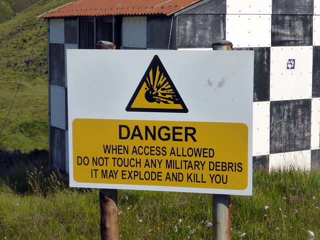
It was around 2.30pm by this time - I reckoned we should summit Fashven around 4, with maybe 3 hours walking to do after that. The ascent is one long slow climb, a steady gradient. We reached Loch na Gainmhich and set off up the back of Fashven proper, crossing over into the Danger Zone in the process. I had checked on the MOD website that there was no bombardment scheduled when we were there (none for the whole of July actually) but it didn't stop me from speculating what we'd do if a few shells suddenly came our way. Not really much you could do but hope you weren't hit

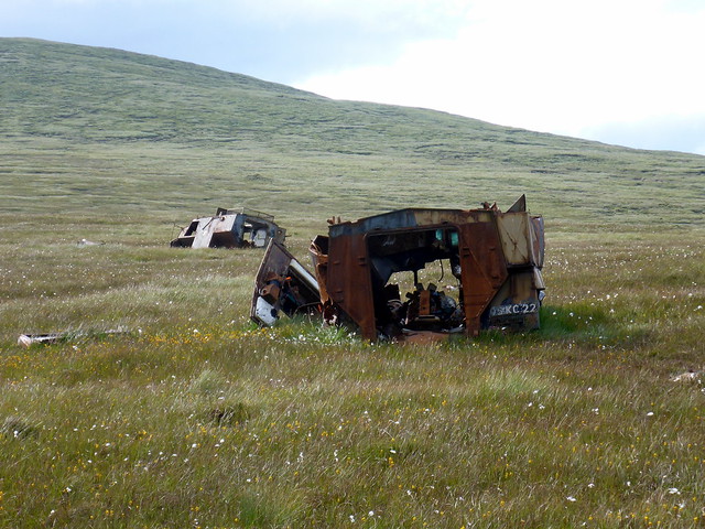
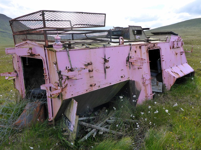
We reached the summit and feasted on the vista to the north. We could see our final hill of the day, Sgribhis-bheinn sitting to the north, separated by a wide expanse of flat ground on which we could make out a few haphazardly placed vehicles, presumably targets for the bombardments. I had originally intended to come off Fashven to the NW, where it looked possible to creep down a steep gully, but this was always a provisional option to be amended if required when we could see the lie of the land. Although the initial descent looked OK it appeared that crags would have to be negotiated thereafter - not the ideal option for tired legs and big packs. So plan B was to head NE off the shoulder, missing out on an ascent of Maovally and aim for Inshore, then joining the track.
Into the danger zone
 P1160474
 by
Al, on Flickr
Ascending Fashven
 P1160475
 by
Al, on Flickr
Summit Fashven
 P1160476
 by
Al, on Flickr
Steepish descent
 P1160479
 by
Al, on Flickr
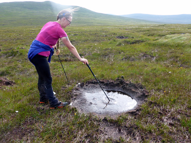
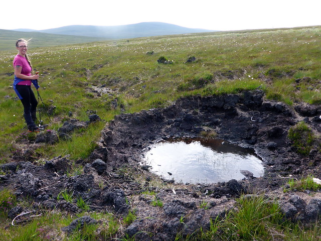
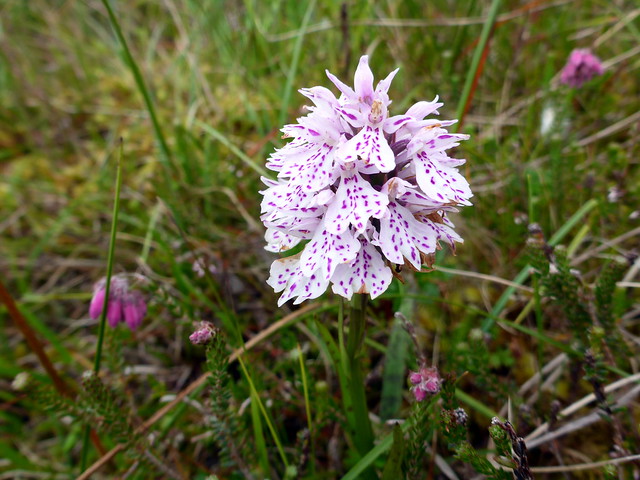
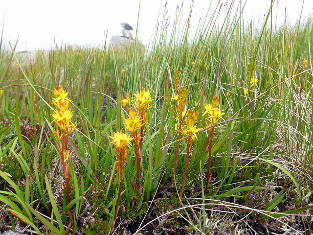
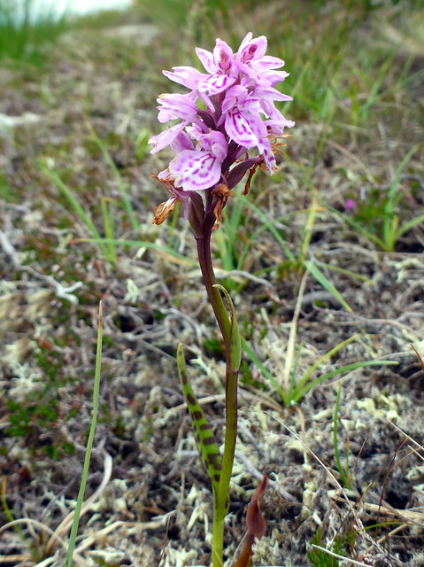
So that's what we did - steep in places but not a difficult descent. Again a bit of bog in the flat lands, wildflowers everywhere - yellow spears of bog ashphodel, sundews, so many sundews, the rattling purple heather bells, white flags of bog cotton and what I think might be frog orchids. Onwards towards the abandoned vehicles with various bits of debris arond them, presumably where they've been hit. Sgribhis-bheinn rose before us - we reached the track and progressed more swiftly than crossing the bogland, we turned up the hillside after a small bridge and followed faint ATV tracks that led towards the summit. Frequent shell craters pocked the ground on either side of the track, giving the impression that the targets had been Marilyn baggers
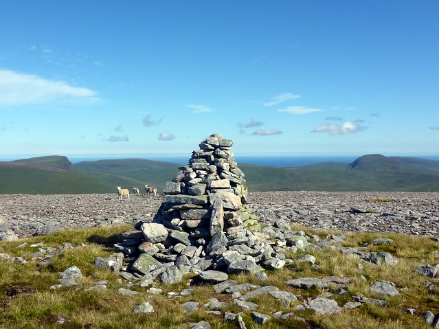
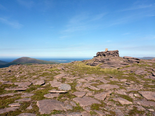
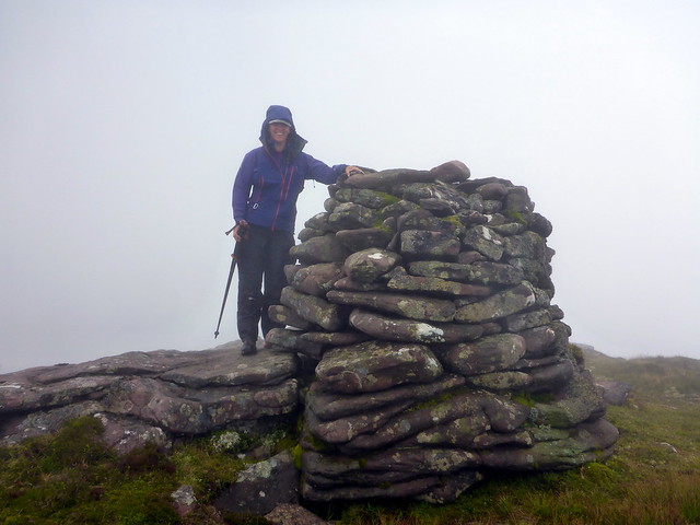
These were very deep indeed - woe betide you if you stumbled into one of those on a dark night. Onwards to the top where a trig point awaited and some grand views, including down to Kearvaig Bay where we could make out the bothy.
Sgribhis-bheinn from Fashven
 P1160480
 by
Al, on Flickr
Fashven
 P1160482
 by
Al, on Flickr
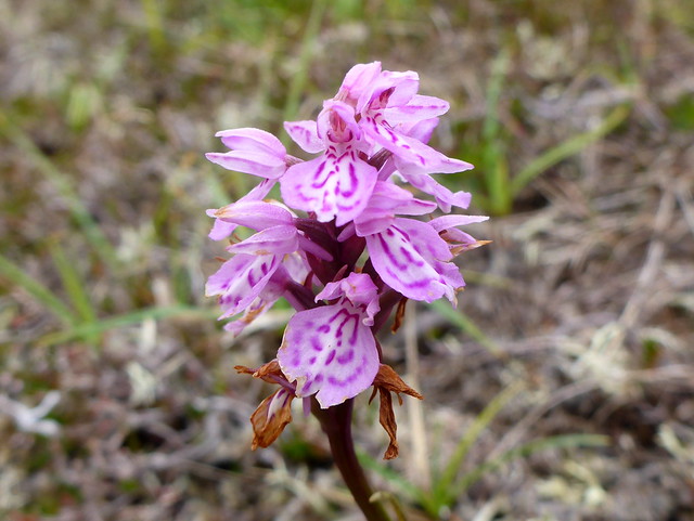
Frog orchid?
 P1160483
 by
Al, on Flickr
 P1160485
 by
Al, on Flickr
 P1160486
 by
Al, on Flickr
On the track, looking back to Inshore
 P1160489
 by
Al, on Flickr
Beware meteorites!
 P1160490
 by
Al, on Flickr
Sgribhis-bheinn
 P1160491
 by
Al, on Flickr
Allison probing shell craters
 P1160492
 by
Al, on Flickr
This one's deeper - just take it from me!
 P1160493
 by
Al, on Flickr
Summit Sgribhis-bheinn
 P1160495
 by
Al, on Flickr
 P1160497
 by
Al, on Flickr
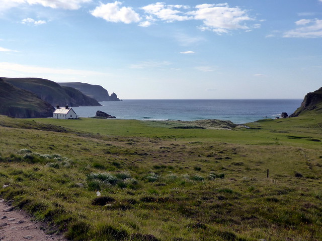
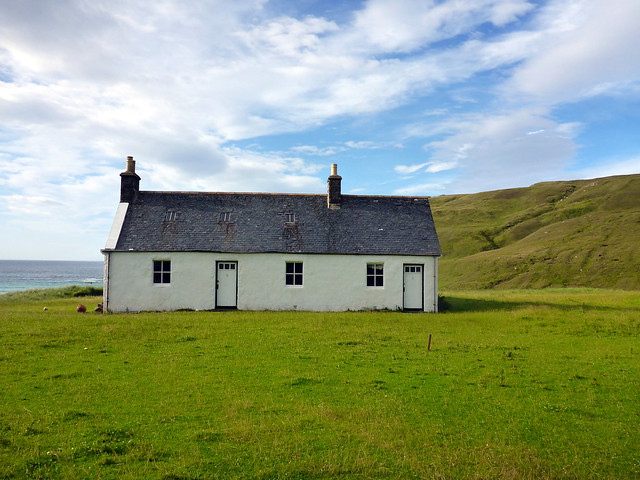
Kearvaig Bay & bothy
 P1160499
 by
Al, on Flickr
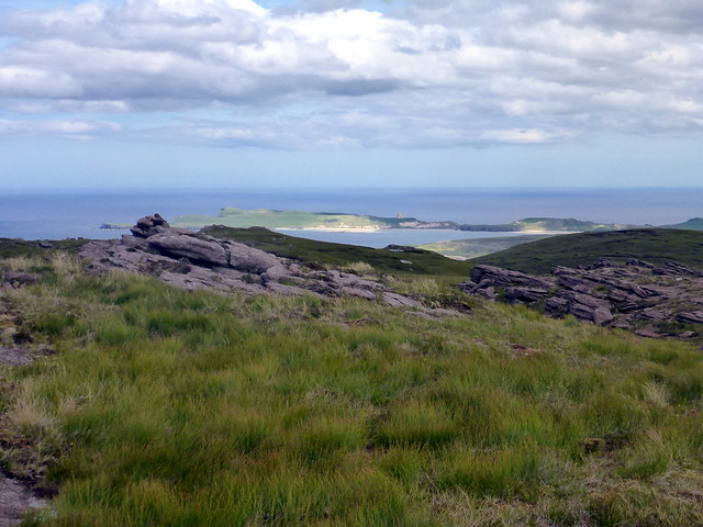
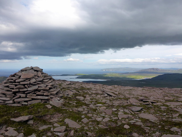
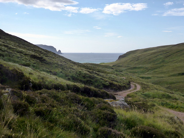
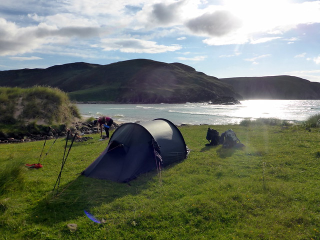
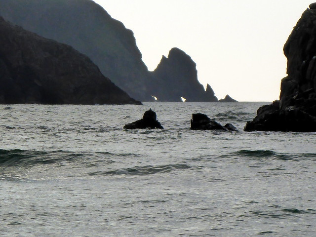
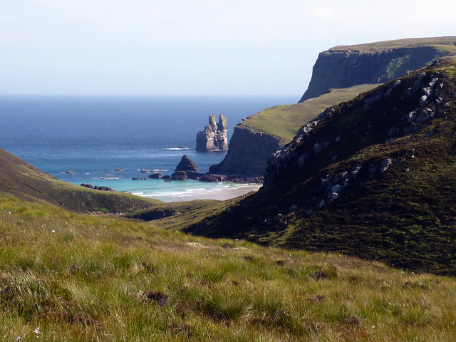
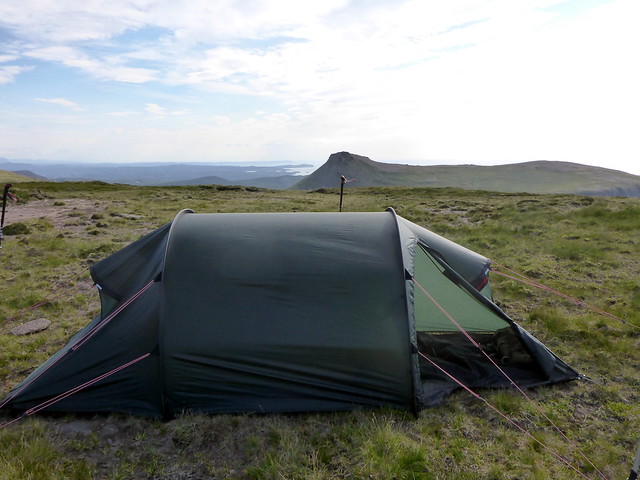
My plan had been to continue along the top ridge of Sgribhis-bheinn, following the coastline to Kearvaig which would allow us to see the Cathedral Stack before we got to the bothy. However it was quicker and easier to return to the track - it had been a long day and backs & feet were weary. We collected our packs once down and set off on the final few km to the bothy. I half hoped that it would be empty, but I thought this unlikely given the time of year. We'd use the tent if we needed to - would be no hardship to camp alongside Kearvaig Bay. Tiredness evaporated from the muscles as we descended the rough track to the bay and caught sight of the sea. By this time it was getting on for 7 and we wanted to get settled, have some grub and then a paddle. As we drew nearer to the bothy, tell-tale smoke rising from the chimney confirmed the lack of solitude. But no matter. We continued down to the bay and found a superb spot to pitch by the burn. The only drawback were large numbers of clegs who also seemed to like the location. Some Smidge was called for as we put the tent up. I have little regard for Smidge as a midge repellant, but it seemed to dissuade clegs from landing.
Track down to Kearvaig
 P1160504
 by
Al, on Flickr
 P1160505
 by
Al, on Flickr
 P1160506
 by
Al, on Flickr
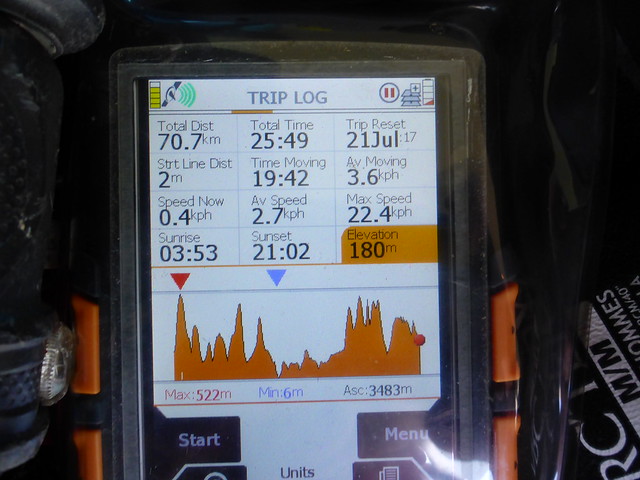
Day 1 stats
 P1160508
 by
Al, on Flickr
 P1160511
 by
Al, on Flickr
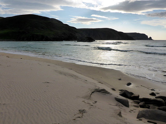
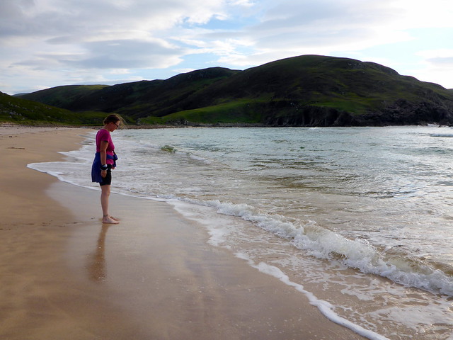
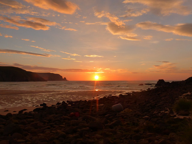
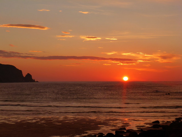
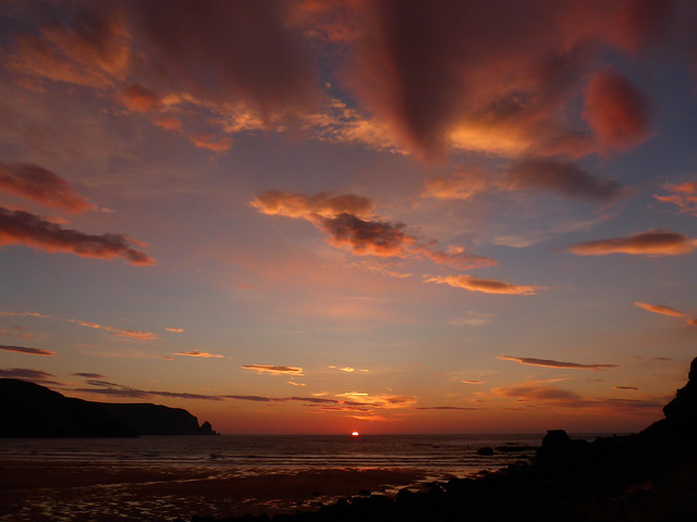
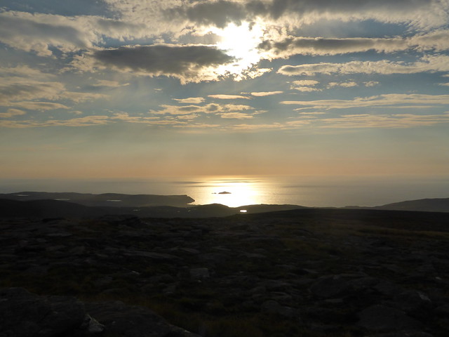
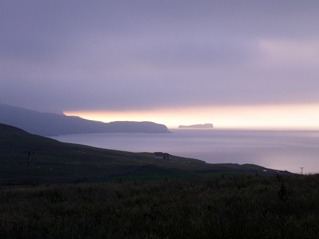
Tea was made and eaten, shorts were donned and a paddle was had walking along the beautiful white sands of Kearvaig. I'm tending to favour this bay over the better known Sandwood, although it's a lot smaller (and probably not even haunted). I'd love to be here in mid-winter with the stormy sea crashing in, to walk on the beach then retreat to a peat fire in the bothy...Some of the other folk from the bothy were out to enjoy the sun too - we counted 7 folk altogether, there may have been more inside. Tent was a good idea. Sitting with a wee 12 year old Malt, basking in the late evening sunshine, watching puffins fly down with jittery short-winged flight to dive in the sea for fish and return to the cliffs - what could be a better way to spend a Friday evening? The sun slowly sank, and we witnessed a glorious sunset around 10pm, the sand turned to red gold.
 P1160513
 by
Al, on Flickr
 P1160514
 by
Al, on Flickr
 P1160516
 by
Al, on Flickr
 P1160518
 by
Al, on Flickr
 P1160521
 by
Al, on Flickr
 P1160523
 by
Al, on Flickr
 P1160528
 by
Al, on Flickr
 P1160533
 by
Al, on Flickr
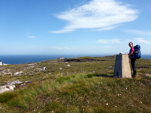
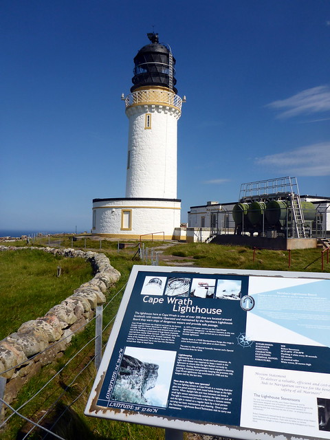
Up earlyish on Saturday morning to find another fine day in prospect. We sat in the sunshine having our chocolate porridge and were entertained by the antics of a weasel which darted around the rocks in the stream beside us, every so often pausing upright in that quizzical and endearing way that weasels have. Then we packed up and set off back up the hillside track to the main track. We'd walk out to the lighthouse and have a nosey around there, climbing the wee hill Dunan Mor at the Cape itself (presumably the most north-westerly trig point on the mainland). It was easy enough going although we were assailed by multitudes of flying things. Although the Smidge kept clegs from skin they simply chose to bite through our tee shirts
Ach well.
Weasel frolics
 P1160537
 by
Al, on Flickr
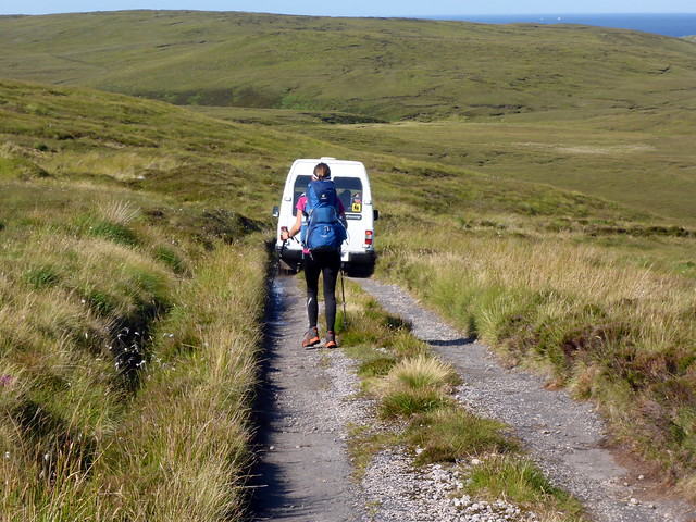
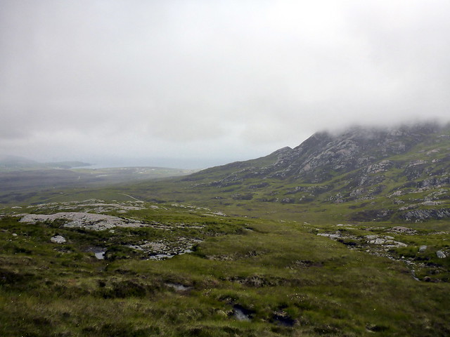
We passed a check point/barrier with warning signs then got a view of the Cathedral Stack as we continued on our trail. Around 10.15 we were passed by 2 minibuses on their way to the Cape. Up to Dunan Mor and a fine view of the dramatic coastline then down towards the Ozone Cafe (which looked run down - we didn't visit) and out to the lighthouse. There were a number of folk milling around from the minibuses and even more walking in when we left, including a big party heading towards Sandwood Bay (maybe they got the minibus in?) After all the solitude of the past 24 hours it was a bit weird. We quickly left the other folk behind as we retraced our way back along the track, looking along the coastline to the south, Snadwood Bay and Am Buachaille were visible. One of the minibuses stopped to see if we wanted a lift back to the ferry ("no thank you Sir!"). We cut off the track to the south just past Cnoc na Tri-mile. We were making for Beinn Dearg, a subMarilyn on our way to Creag Riabhach where I thought we might spend the night.
 P1160541
 by
Al, on Flickr
 P1160542
 by
Al, on Flickr
 P1160543
 by
Al, on Flickr
Cathedral Stack
 P1160544
 by
Al, on Flickr
Dunan Mor
 P1160545
 by
Al, on Flickr
 P1160546
 by
Al, on Flickr
 P1160549
 by
Al, on Flickr
 P1160552
 by
Al, on Flickr
 P1160555
 by
Al, on Flickr
Sandwood Bay
 P1160556
 by
Al, on Flickr
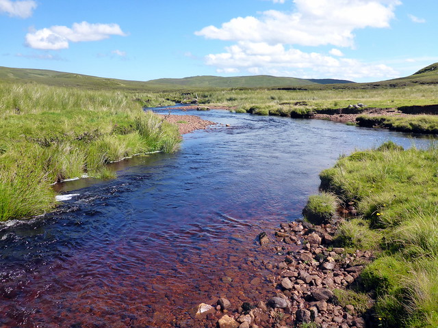
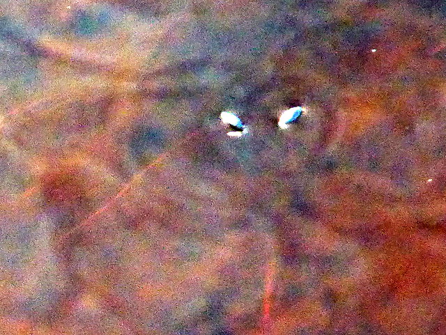
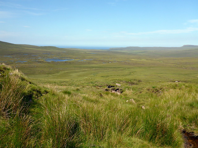
The next section was another bog trot, although not as wet as I feared it might be. Little lochans and large shell craters abounded, deer kept a wary distance from us and after some further naviataional practice around the deeper bogs we reached the edge of the danger area fence. It was hot, our water was running low and I was feeling kinda tired after the long day yesterday. In some of the lochans we spotted tiny white creatures on the surface, zipping about at a fair rate of knots, creating their own wavelets, dancing when two or more of them met. I couldn't see them clearly enough to know what they were - beetles or larvae of some kind maybe, not pond skaters as they and no legs. Attempts to capture them on film failed on account of their small size and great speed. We continued on to Beinn Dearg, selecting a gully with a stream to ascend. This was a glorious mountain spring, with tumbling tresses of crystal clear water, moss lined rocks, dragonflies and damselflies whirring in and out of the spray. We paused to drink deep and refill our packs then continued up to the summit.
Beinn Dearg
 P1160559
 by
Al, on Flickr
 P1160561
 by
Al, on Flickr
The water scooters...
 P1160569
 by
Al, on Flickr
 P1160572
 by
Al, on Flickr
Looking back north
 P1160573
 by
Al, on Flickr
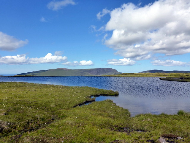
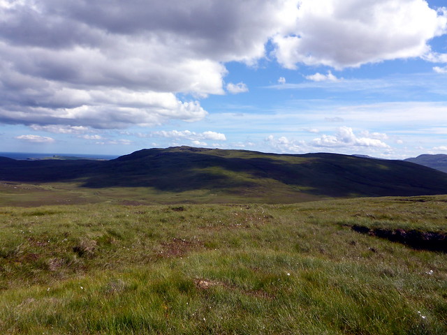
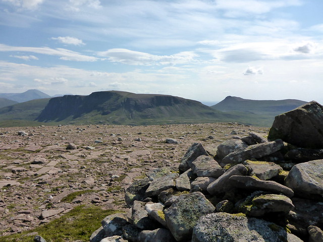
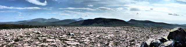
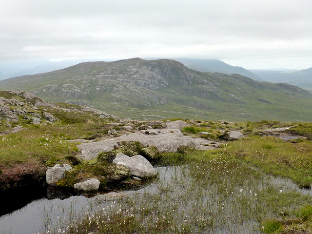
From here the views were extensive - Ben Loyal and Hope to the east, Am Buachaille to the west and the large mass of Creag Riabhach, our next target, to the south. We descended grassy slopes, past some huge erratic boulders and steeply down into Bealach Coir' a' Choin. New fencing was in evidence, reaching high up the side of Creag Riabhach. We continued SW under the impressive cliffs then following deer tracks to climb steeply up rocky terracing to the summit plateau. I was torn between a summit camp and pitching down by Loch a'Phuill Buidhe, which would allow us to climb An Grianan at sunset - in the end I decided we'd just camp on Creag Riabhach (a good plan as it turned out as the ground around the pretty loch is very wet and lumpy).
Ben Loyal/Hope from summit Beinn Dearg
 P1160575
 by
Al, on Flickr
Am Buaichaille
 P1160576
 by
Al, on Flickr
Creag Riabhach & An Grianan
 P1160577
 by
Al, on Flickr
 P1160578
 by
Al, on Flickr
Erratic, Sgribhis-bheinn behind
 P1160580
 by
Al, on Flickr
Creag Riabhach
 P1160582
 by
Al, on Flickr
 P1160584
 by
Al, on Flickr
An Grianan, Loch a'Phuill Bhuidhe
 P1160586
 by
Al, on Flickr
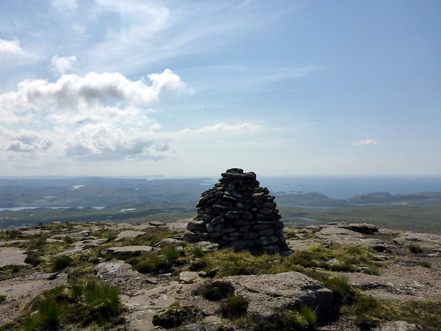
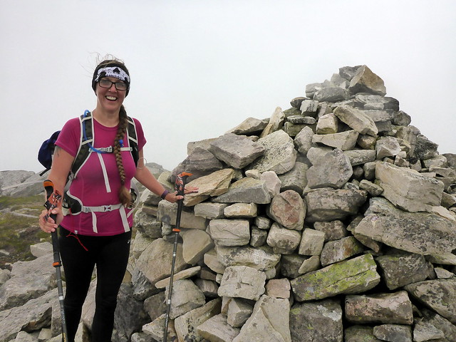
Summit Creag Riabhach
 P1160589
 by
Al, on Flickr
Day 1&2 stats
 P1160594
 by
Al, on Flickr
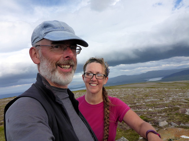
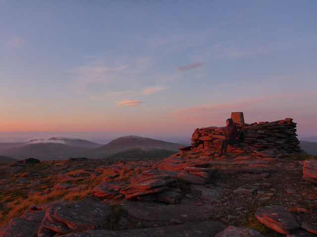
We wandered to the summit, passing some suspicious sheep and scoping suitable places to pitch finding a flattish dry spot not far from the summit cairn. From here we could see Foinaven and Cranstackie, Kinlochbervie and down towards Scourie. Oh what a beautiful day - sun reflected on a silvery sea. We had our meal, read for a bit, waiting for the sun to start to slip into the sea. That took a long time to happen! Actually, sunset was a good 10 minutes later from up here (at almost 500m) than it had been from sea level the night before. The hillside turned a glorious copper as the sun sank below the waves, leaving some pink afterglow in the northern sky. Fashvan and Sgribhis-bheinn started to gather white blankets for the evening. We retreated to the tent to get some sleep.
Pitch
 P1160595
 by
Al, on Flickr
Foinaven & Arkle
 P1160599
 by
Al, on Flickr
 P1160607
 by
Al, on Flickr
 P1160610
 by
Al, on Flickr
 P1160611
 by
Al, on Flickr
 P1160617
 by
Al, on Flickr
It was quite a windy night, but the tent was robustly pitched, so I had no concerns. When morning came there was a surprise however - thick clag. The tent was saturated, droplets condensed immediately on clothes and hair and breakfast was less fun than the previous day. We packed up and got the compass out to navigate down to the loch. Navigating banks of bog is difficult enough when you can se where you're going but altogether more challenging in thick fog. We planned to leave our sacks whilst we ascended to the rocky top of An Grianan ("The Sunny Place" ironic, given the weather today) but feared we'd not find them again - so we headed to the loch and left them at the intersection with the Allt. It's a little disconcerting setting off to climb a hill that is less than 500m away and being able to see nothing of it at all, not even a vague outline in the murk. But the compass is a handy tool.
Morning
 P1160619
 by
Al, on Flickr
Climbing An Grianan
 P1160622
 by
Al, on Flickr
 P1160624
 by
Al, on Flickr
Rocky boulders, a crest of crags and we were at the top. Would have been a fine view point usually, but not today. We descended back to the loch, reunited with our packs and set off uphill again over Meall Dearg and its partner Meall Moine where we stopped for lunch. Glimpses of sun above gave the strong impression we were in a cloud inversion and hopefully it would lift soon. Sure enough as we set off vaguely along the line of the Allt a'Choin Dhuibhe the clag burned off and we were in hot sunshine, which brought a return of the clegs. Every silver lining has a cloud.
An Socach from Meall Moine
 P1160627
 by
Al, on Flickr
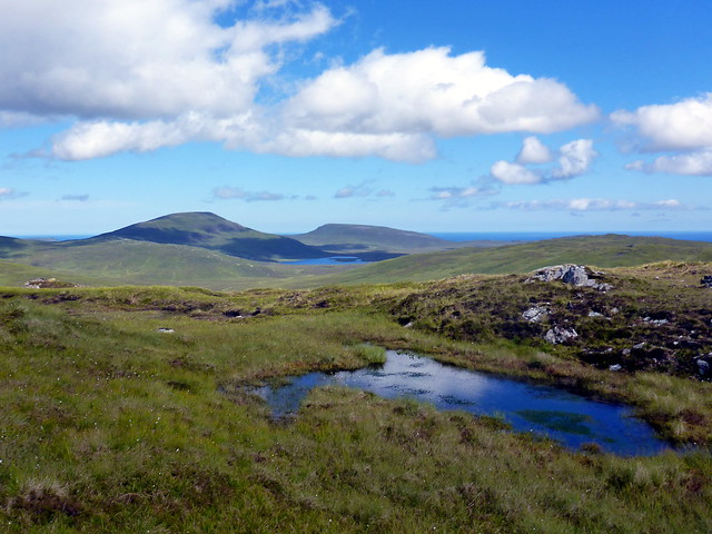
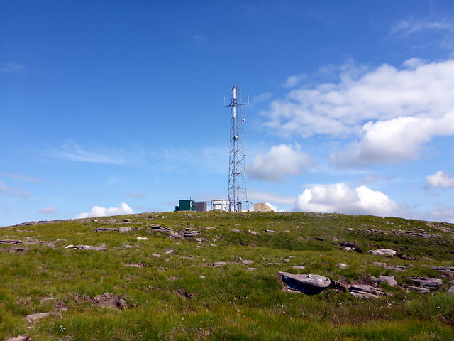
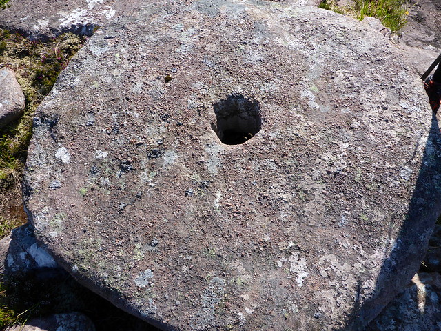
It's a long way up to An Socach, our final Marilyn. It's also a complex hill having several summits. We humphed our way to the bealach west of Meall Meadhonach and left our bags as we went to the rocky spur of An Socach, given as 358m on the map. Hmm - there was no cairn, but a cairn to the finger sitting to the south - we went over there and decided the highest point was actually to the north, not named on the map. This is a bald stony summit and close scrutiny of the map reveals one additional contour ring over the named summit of An Socach (not that I'm obsessional or anything - though I did check on Hill-Bagging when we got home and this 362m peak is indeed the summit - just a caution should you venture up this hill). Back to the packs, up Meall Mheadhonach and then time for the final hill of the day - Meall na Moine, with its transmitter mast just before the road. This hill had served as a beacon of hope on that long trek from Foinaven, keeping us right on a difficult day and I felt it fair to climb the hill in return. On the way down from the summit we spotted what appeared to be a large stone wheel - it had a clearly cut out central hole. But what was it doing on the top of a hill? Weird
 P1160632
 by
Al, on Flickr
 P1160636
 by
Al, on Flickr
True summit An Socach, An Grianan in backdrop
 P1160641
 by
Al, on Flickr
 P1160646
 by
Al, on Flickr
Meall na Moine
 P1160649
 by
Al, on Flickr
The long ridge of Cranstackie - one day!
 P1160651
 by
Al, on Flickr
huh?
 P1160653
 by
Al, on Flickr
 P1160654
 by
Al, on Flickr
Final stata
 P1160655
 by
Al, on Flickr
A final push returned us to the car at around 5pm, hungry but replete with wildness after our three days. What a fine circuit. Would we wild camp somewhere near Balnakeil or go for civilization at Sango Sands? The latter won out (a shower sounded nice) and we pulled into a busy campsite and pitched on sloping but perfectly flat grass and pitched. Proper food was a boon after two days of dried rations (although the onion bhajiis were sporting a few spots of white mould after 3 days in the "cool-box" - didn't adversely affect their taste
Together with a homemade chana masala and some rice and followed by apple pie & custard this was a feast. We chatted to some of the other campers, watched an obsessional NC500er get down on his knees with a rag to clean the 4 exhausts of his Audi S5 and generally enjoyed a bit of sunshine. Later on we walked down to Balnakeil as the sun was setting, all misty and ethereal. Visited the craft village at Balnakeil and spotted a man with his pet wolf - an incredibly beautiful dog which he said was half Wolf, half Malamute. Wow! A peaceful night back at the site, despite being next to the bar.
 P1160658
 by
Al, on Flickr
 P1160662
 by
Al, on Flickr
 P1160664
 by
Al, on Flickr
For Monday I had thought we'd have an easy day and climb Meall Mheadhonach which sits just to the east of Durness with its more shapely partner Beinn Ceannabeinne. Allison fancied a traverse which seemed a better idea than my route up the central track to the bealach. Unfortunately the day was cloudy but we couldn't complain after the weather we'd had thus far. We packed up the tent, left the car at the Tourist Information Centre and walked along the road through Durness towards the ruined settlement of Ceannabeinne. This took us past Smoo Cave. I was struck by just how busy the road (and indeed the village) was - I remember being here in July in the mid 80s and everything being so much quieter. The success of NC500 I suppose. But endless lines of motorhomes can't be much fun for the locals. Anyway we started up the hillside at the top end of the hill and had a pleasant walk up the eastern shoulder of Ceannabeinne, replete with many wildflowers. Raven flew overhead. Ben Loyal was capped by cloud unfortunately. Some of the rocks bore signs of being tormented by huge forces - convoluted upon themselves. I meditated on the kind of power it takes to fold sheets of rock in two.
Our hills for the day
 P1160665
 by
Al, on Flickr
 P1160668
 by
Al, on Flickr
 P1160671
 by
Al, on Flickr
 P1160672
 by
Al, on Flickr
 P1160674
 by
Al, on Flickr
 P1160677
 by
Al, on Flickr
Convoluted rock
 P1160678
 by
Al, on Flickr
 P1160679
 by
Al, on Flickr
Loyal undercover
 P1160680
 by
Al, on Flickr
 P1160681
 by
Al, on Flickr
 P1160682
 by
Al, on Flickr
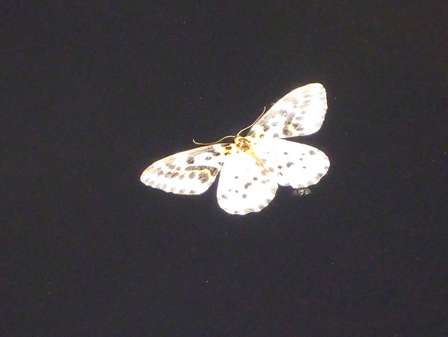
Floating moth (actually it was still alive and was rescued)
 P1160683
 by
Al, on Flickr
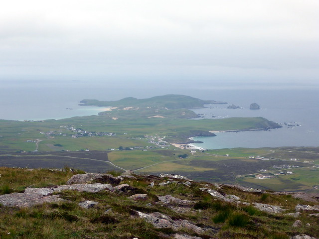
Durness
 P1160684
 by
Al, on Flickr
View back to the Cape Wrath hills from summit Ceannabeinne
 P1160686
 by
Al, on Flickr
Reaching the trig on Ceannabeinne the weather began to falter, clag and some drizzle coming in from the sea. We still had a way to go to reach the top of Meall Mheadhonach so set off after lunch down to the bealach and up the slopes of Mheadhonach, initially following an ATV track from the end of the path up the bealach then cutting a more direct line to the craggy top. No views unfortunately. We descended towards the bealach and joined the rough track towards Loch Meadaidh then turning north to hit the road and the car.
Meall Mheadhonach
 P1160688
 by
Al, on Flickr
 P1160693
 by
Al, on Flickr
 P1160694
 by
Al, on Flickr
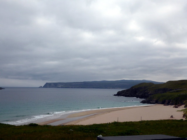
Sands at Durness
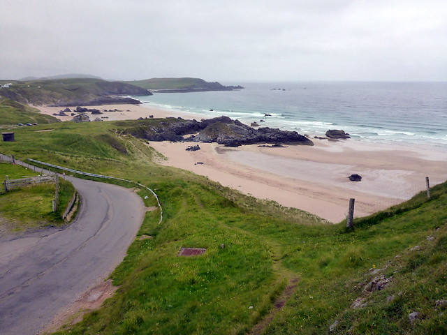 P1160695
 by
Al, on Flickr
3pm - a long drive back awaited. Clag continued to be present until we got past Laxford Bridge - by the time we drove through Assynt we were in glorious sunshine, Sail Garbh, Cul Mor and Suilven all imploring us to stay. I did suggest to Allison that we did just that, but she - unlike me- had work in the morning. We made it home before 10pm, having stopped to cook tea at Ralia. A very fine weekend, so grateful that the weather gave us a chance to enjoy Parph at its best.
