free to be able to rate and comment on reports (as well as access 1:25000 mapping).
I've been away from Walkhighlands for some time, enjoying the great Scottish outdoors to the full! No less than 7 new TR's (plus 2 still pending from June) - I'll be very busy writing this week!

This particular story comes out of chronological order, but it was such a fantastic trip that I can't wait to share it!
We had this trip planned in June but weather was simply too rubbish for overnighting, at least by our standards. I don't see the point in visiting Fisherfields in pouring rain or 50mph winds, especially when we live only an hour drive away from the area. So we waited patiently for high pressure to settle down over northern Scotland... and it did, just in time!
We spent Sunday strolling over some windy ridges above Bridge of Orchy. Back home in the evening, we checked the forecast for Monday and Tuesday (17-18 July). It was perfect: sunny, cloud-free, warm. A bit breezy maybe, but we didn't mind a bit of wind, it would keep midges away. So, with hopes high, we planned to tackle our last 2 Munros in the Fisherfield zone: A' Mhaighdean and Ruadh Stac Mor.
A couple of year ago, sitting on the summit of Beinn an Eoin, I gazed north into the sheer wilderness of the Fisherfields, dotted with countless mountain peaks still alien to us... The Maiden looked formidable, impenetrable, elusive. So far away, so remote, that reaching the summit seemed impossible. I knew somehow, it might take sweat and tears (and maybe blood-blisters, too
) to finally defeat this mountain and claim her summit. And at that very moment, the nickname "Armageddon" was born. One has to survive armageddon to climb The Maiden!
Since that day on Beinn an Eoin, we successfully bagged the other 3 Munros in the Fisherfields, so the great wilderness felt a bit less impenetrable - there were cracks in that hard shell! Now it was time to finish the business and face Armageddon

We planned to tackle this in three stages. Stage 1 - walk in from Poolewe to Carnmore and overnight camping somewhere near Dubh Loch. Stage 2 - early morning climb to A' Mhaighdean and its sidekick Ruadh Stac Mor, returning to the tent for mid-day meal. Stage 3 - late afternoon walk back to Poolewe. The schedule worked as planned. Technically, we could have stayed for a second night and walk out the following morning, but weather forecast for Wednesday was wet and we didn't fancy trudging 18km through the wilderness in pouring rain.
I sub-divided my report into stages, as described above. Walking stats are given separately at the beginning of each stage, the main stats of the TR give the overall distance, number of hours and ascent.
STAGE 1. WALK IN. 17/07/2017
Distance: 18.7km
Ascent: 407m
Time: 5h50min
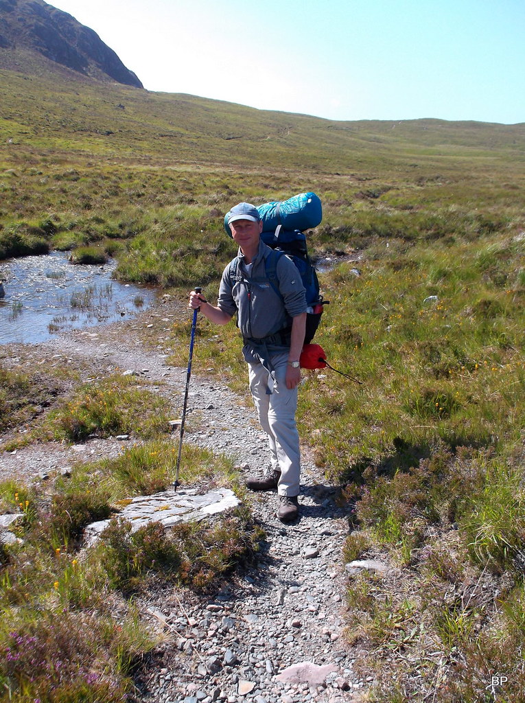
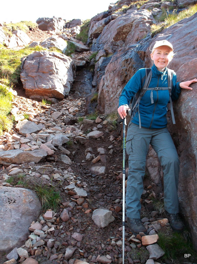
Having spent the morning packing our rucksacks, we arrived in Poolewe about midday. Weather was already good - and improving, the last remnants of cloud burning off. We started from the car park by the bridge in the blazing sun, with heavy backpacks. Kevin was carrying our tent so he decided to leave his bulky bridge camera at home, it was all about saving weight. Therefore, all photos in this TR were taken with a small pocket compact Fuji Finepix AX650.
River Ewe in the morning
Our route followed the track to Kernsary and then the famous Carnmore path:
Some early afternoon cloud still burning off in the sky, Black Panther ready to tackle the 18km walk-in:
The first 5km were straightforward, on tarmac then later on good dirt track. We passed many people walking the circuit but nobody aiming for an overnighter on the hills. From the farm in Kernsary, we continued past a gate with "climbers welcome" sign
The day was warming up and yes! We were mentally and physically ready for adventure!
The track soon disappears in the forest - I was glad to have some shadow for a change:
The track divides just before entering the forest, the right branch is signposted "Carnmore". So far, so good. A few hundred meters further on, we encountered the first obstacle - not much of a problem:
A word of warning for future users of this track - it has a few problematic, boggy stretches, nothing that can't be negotiated, but as I discovered, balancing on the mud is much harder with extra weight on your back!
The track deteriorates to a path at some point but at least it becomes dry. A few clegs buzzed around but apart from that, the day felt fantastic!
The path emerges out of the forest only to continue across the moorland with sensational views all around. To begin with, it's Beinn Airigh Charr that steals the show:
About half way down the path we decided to take a short break for a sandwich and a layer of sunscreen - the sun was really getting aggressive!
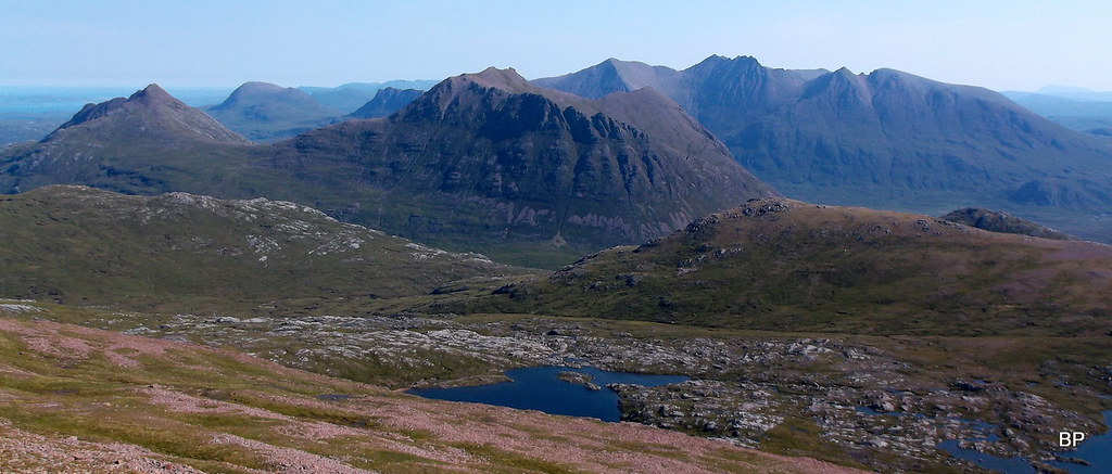
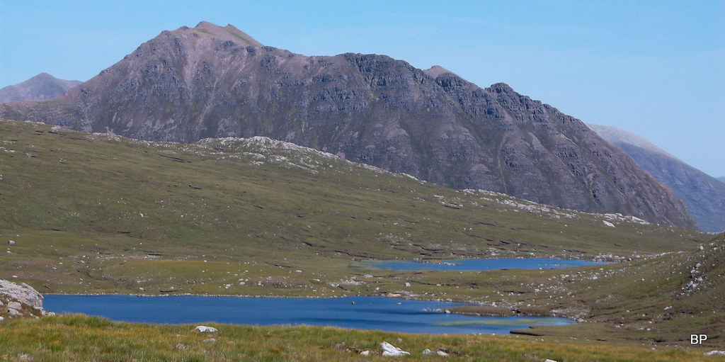
Twenty minutes later, as we continued on the path and into the wilderness, we saw our target hills for the first time. I recognized Ruadh Stac Mor first - the red, pointy top (left in photo below) was unmistakable! Just next to it, The Maiden proudly presented her steep slopes, and to the right, the sharp line of Beinn Lair reminded us, that the Fisherfield zone is famous for hardcore Corbetts, too!
It is simply impossible to describe how one does feel when entering this wild, unspoiled country. It's like touching the very heart of the nature. The green and purple shades of the moorland below, the grey and red colours of the rocks, in contrast with the light blue tint of the clear sky and darker blue colour of the lochs and lochans... Something unique sleeps in the landscape here, the true ghosts of the wild... And we were invited for a sleepover!
Kevin enjoying the walk in at the moment... But the first problem was just about to hit him!
 DSCF9169
 by
Ewa Dalziel, on Flickr
We marched below the majestic flanks of Beinn Airigh Charr, towards the next hill "in line", a Graham called Meall Mheinnidh. The name means Grassy Hill, but to my eyes, it was made of sheer rock and nothing more:
We dropped down to cross Abhainn an t-Strathan Mhoir. There is a bridge higher up the glen, but there wasn't much water in the river so we decided to cross it on steeping stones. Sadly, as we hopped across, Kevin's foot slipped of the rock and landed down in the stream

He wasn't wearing his gaiters (wow, it was far too hot for that!) so as a result, water poured into his boot

We climbed out onto the path on the other side and my poor chum spent the next 10 minutes moaning as he squeezed water out of his wet sock. Thankfully, he's used to incidents like that and one wet boot shouldn't stop him from completing this fantastic trip!
OK, so that was the first step closer to Armageddon, at least for Kevin
We took a detour to the ruins of Strathanmore, where we sat again for a few minutes, resting and enjoying the view (me) or moaning and pulling sour faces (Kevin). I must admit, that in this area, the views are so amazing that one quickly forgets about any mishaps en route, so I hoped my husband would shut up eventually
Instead of returning to the path by the river, we decided to contour around the 257m lump, to join the path a bit further on. I wouldn't recommend this shortcut though, especially in wet conditions: the ground is boggy, so not a great experience with heavy weight on your shoulders!
Contouring around:
Panorama of the western Fisherfields, from Beinn a'Chaisgein Beag to Beinn Lair:
 DSCF9190
 by
Ewa Dalziel, on Flickr
After about half a mile of bog trotting, we returned to the path and the rest of the walk was uneventful... Well, it would have been if not for the constant "aaahs" and "ohhhhs" from me... Kevin forgot about his wet foot and was busy photographing. I had a tough choice picking the best photos for this report!
The mighty cliffs of Creag Poll Fraochain:
The geology here is fantastic: Lewisian gneiss, Cambrian quartzite and Toridonian red sandstone create a unique mixture of different shapes and colours - I couldn't resist a closer examination:
Eventually, we reached the upper end of Fionn Loch, a great spot with lovely, rocky beaches:
Panorama of Fionn Loch and Beinn a'Chaisgein Mor behind. Carnmore bothy is hidden behind a rocky hillock:
 DSCF9210
 by
Ewa Dalziel, on Flickr
Fionn Loch and Dubh Loch are separated by a man-made causeway, I wonder if the two lochs were once one body of water?
Panoramic shot taken from the causeway, looking across Dubh Loch to Beinn a'Chaisgein Mhor:
 DSCF9223
 by
Ewa Dalziel, on Flickr
The path continues past the causeway. There is a good spot to camp by Dubh Loch, but we couldn't see any fresh streams nearby and taking water out of the loch was not really to our taste
so we decided to continue on the path and look for a better spot further on.
The causeway and the two lochs, Beinn Lair peeking out from behind the lower cliffs:
Panorama of the wildest spot in the country:
 DSCF9239
 by
Ewa Dalziel, on Flickr
There were people in the bothy, I saw a few silhouettes moving around the barn, but we had our own accommodation for the night, it was just a matter of finding a flat, grassy spot to pitch! Which turned out to be much harder than we thought. We climbed past the bothy and continued on the path along Dubh Loch, gaining steadily height. At some point I asked Kevin, did he intend to go all the way up and camp on the summit of A' Mhaighdean?
Not easy to find a camping spot...
But when you do eventually, you have a room with the best view in Scotland!
Our pitch was about 300m up the path from the bothy, on a small, flat, grassy area near a big rock. The ground was a but lumpy, but it was the best we could find. Nearby, we located a small stream coming straight down from the cliffs above, a good supply of fresh water. Soon we agreed, we had found the best spot we have ever camped! Just above our heads, loomed the vertical cliffs of Sgurr na Laocainn:
 DSCF9257
 by
Ewa Dalziel, on Flickr
...and down below our feet, Dubh Loch was framed by the surrounding mountains. Lucy was happy, too!
We pitched the tent, cooked our meal (gazing at the landscape constantly):
 DSCF9264
 by
Ewa Dalziel, on Flickr
...and prepared for the night. The sun was just about to set and the red sandstone was even redder:
 DSCF9273
 by
Ewa Dalziel, on Flickr
Amazing!!!!
We wanted to wait for the proper sunset to take more photos, but tiredness won - we retired to the tent for a good night sleep before climbing the two Munros in the morning
STAGE 2. CLIMBING THE MOUNTAINS. 18/07/2017
Distance: 14.7km
Ascent: 1005m
Time: 7hrs 30min
Lucy was up first, she was so excited about climbing such a famous duo of mountains first thing in the morning!
The morning was lovely indeed, our camping spot still in the shadows of surrounding cliffs, the first rays of sun softly caressed the slopes of Beinn Lair:
On the walk-in day we had a nice, refreshing breeze all the way, but Tuesday morning was windless - of course midges took the opportunity and attacked us as soon as we emerged from the tent. We had to be quick with our deet
Getting ready for the climb:
We set off eventually, walking up the well worn path, in the shadows of the giants...
7 o'clock sharp, we were ready to go, but Kevin loitered around with the camera, taking photos of the tent from different angles - I bet it was just to show off later, look where I camped!
Our planned route followed the path all the way to the bealach between the two Munros and visits to both summits. We changed it slightly as we went, simply to avoid loose rock and "sh*tty slopes" as Kevin said
We didn't meet very many people. Some folks were behind us on the path (probably walking from the bothy) but they vanished after we passed the triple lochans (maybe went on to climb Beinn a'Chaisgein Mor). We also saw three other climbers on the main ridge. Weather was splendid all the time, even too splendid for my taste (I'm UV-allergic). In the morning, before the sun became too aggressive, it was an enjoyable walk up the path, passing cliffs, gorges, lochs and lochans
Looking south along the cleft of Allt Bruthach an Easain to the cliffs of Beinn Lair:
Morning glory by Lochan Feith Mhic'-illean:
Fording Allt Bruthach an Easain could be problematic in spate but with current dry conditions we had no issue:
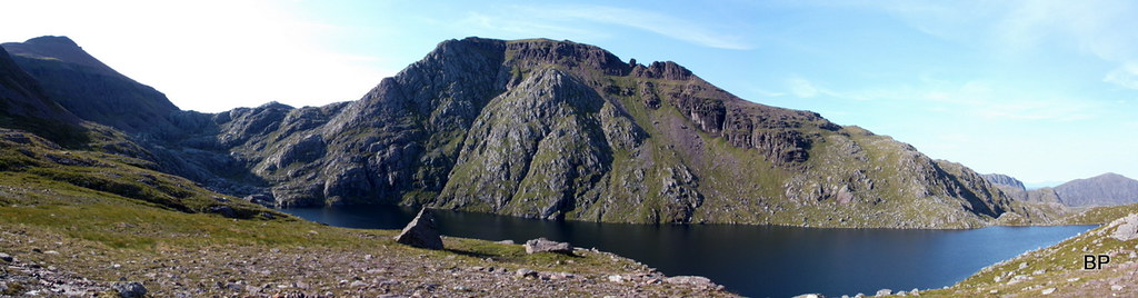
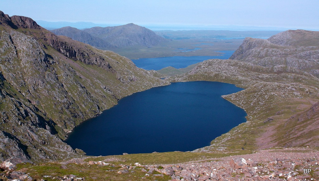
The path meanders through moorland and scattered boulders, steadily gaining height. The ridges of our two target mountains could now be seen above us and we pondered over different routes up the steep slopes, but at some point we just stopped speechless... It was the moment we reached Fuar Loch Mor and the full extent of views was revealed... The Armageddon Revelation
Indeed the view into the Corrie of Fuar Loch Mor is simply stunning. the warm morning sunlight just added to the pure magic of this place. This is the "sanctuary" for Fisherfield Pilgrims. Such a shame, that the majority of Munro baggers just walk the round of 6, merely passing by this mind-boggling place and not exploring it properly. I was so thankful to Kevin and Myself
for splitting the Fisherfield round into 3 separate walks!
Panorama of the corrie, Armageddon taking center stage:
 DSCF9340
 by
Ewa Dalziel, on Flickr
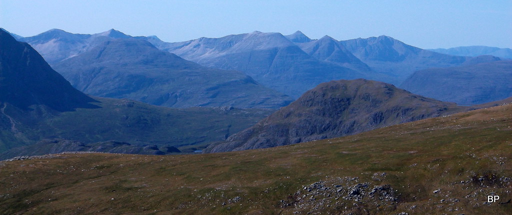
Beinn Dearg Mor and An Teallach in the morning glory:
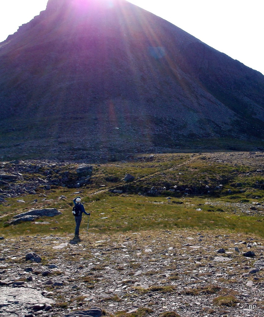
Having done the research before the trip, I knew it was possible to scramble straight up the NW end of Ruadh Stac Mor, but the sun was right behind the ridge and gazing up, I could hardly see what lay above - it seemed very steep so we decided not to risk it:
 DSCF9337
 by
Ewa Dalziel, on Flickr
The path continues across the corrie, albeit a bit less obvious in places, but the target is easy to spot, it's a tumbly traverse below the vertical slopes of Ruadh Stac Mor to the high col. As soon as Kevin saw the traverse in front of us, he called it "sh*te path" and sat on a rock, officially to adjust his boots, but it was a silent protest against eroded slopes
"Sh*ite path" to the left of the picture:
I took the opportunity to snap another pano across Fuar Loch Mhor...
 DSCF9350
 by
Ewa Dalziel, on Flickr
...studied the map and came up with a good solution: we could avoid the eroded traverse altogether, if we climbed the straightforward slopes to our left. The new route looked steep but mostly grassy and Kevin jumped at my suggestion with a biiiig smile!
Five minutes later we were clambering up the steep slope:
 DSCF9353
 by
Ewa Dalziel, on Flickr
The Maiden looming behind us:
The climb might look airy from the photos, but it was really easy, most of the stony sections could be avoided and the vegetation was steady underfoot (might be slippery though in wet conditions). It takes about 150m of steep ascent to land one on the wide, flat ridge of Ruadh Stac Mor, about 100m below the summit, with views to kill for!
Couldn't resist a pose...
Looking down to Fuar Loch Mor:
The final climb to the summit is easy, much less steep and mostly on grass and large boulders (a sketchy path leads the way):
It may look intimidating from below, but the traverse along the ridge to the summit requires no real scrambling, a couple of places where one might grab a rock to steady themselves, but nothing scary... The scary bits were yet to come
I reached the summit first and jumped about for a few seconds to celebrate my 215th Munro
before settling down to a traditional photo with wee Lucy (her 55th M):
 DSCF9394
 by
Ewa Dalziel, on Flickr
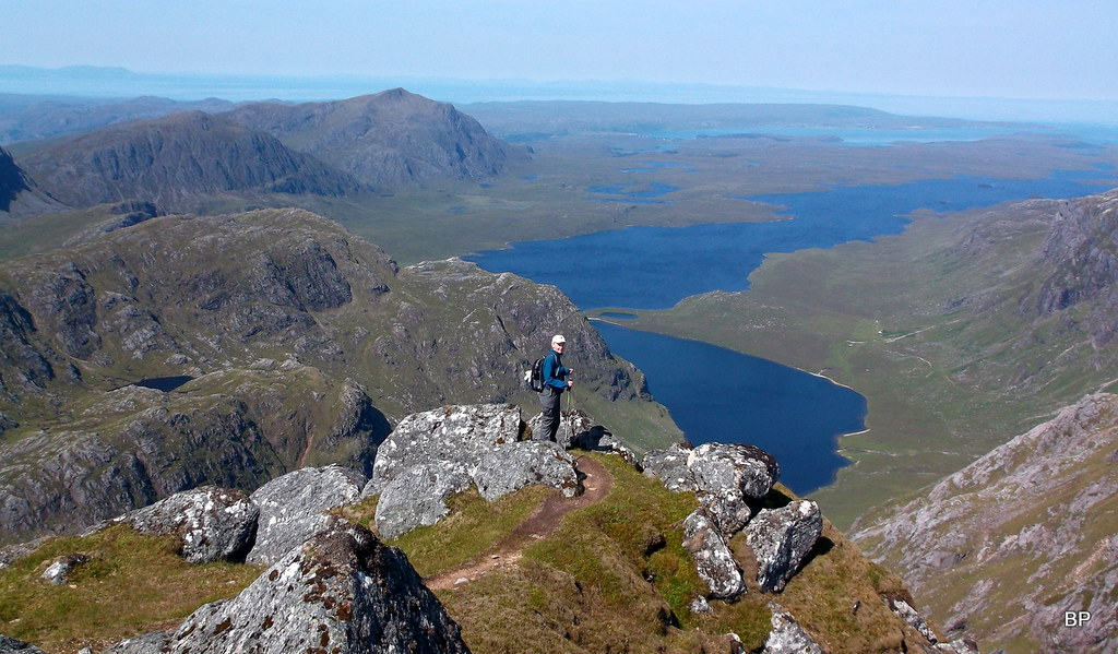
Ruadh Stac Mor is a fantastic viewpoint. Well, all Fisherfield hills have to be by definition
but this one offers a fantastic pano north-east to the long, rocky ridge of An Teallach and the Beinn Deargs:
 DSCF9388
 by
Ewa Dalziel, on Flickr
The view down to Fuar Loch Mor is also worth mentioning again:
 DSCF9376
 by
Ewa Dalziel, on Flickr
As for more distant hills, Torrdon's Beinn Eighe can be seen clearly:
 DSCF9405
 by
Ewa Dalziel, on Flickr
The rest of the round, if you're doing all 6:
 DSCF9407
 by
Ewa Dalziel, on Flickr
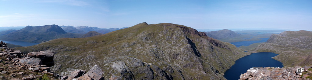
The Armageddon Panorama. Slioch to the left:
 DSCF9418
 by
Ewa Dalziel, on Flickr
Veni, vidi, vici, miaow. We are officially 3/4 of our way through the Munros. Still over 60 mountains to do, including the mighty Ladhar Bheinn and the Inaccessible Vertical Rock of Brown Pants

but we are getting closer!
 DSCF9423
 by
Ewa Dalziel, on Flickr
After a lengthy break on the summit of Ruadh Stac Mor, we started our descent to the bealach. First, it was steep and scrambly, but we didn't have any problems getting down the rocky sections:
 DSCF9429
 by
Ewa Dalziel, on Flickr
Later, steep rock gave way to quite unstable, stony slopes and gazing down, it seemed very vertical below us:
 DSCF9433
 by
Ewa Dalziel, on Flickr
Fuar Loch Mor and to the very right of this photo, our route up the first Munro: looks steeper than it felt! You can also see the obvious difference in the colour of the rock, where red sandstone is replaced by gneiss:
 DSCF9437
 by
Ewa Dalziel, on Flickr
Care is needed on the wobbly rocks... Slioch and Beinn Eighe on the horizon:
 DSCF9438
 by
Ewa Dalziel, on Flickr
After about 100m of descent, we came to the edge of the boulderfield and below us was a very steep chimney-like section, badly eroded and, despite blazing sun, looking very wet and slippery. We lowered ourselves down into the shadows, slowly checking every foothold, trying not to dislodge any loose rocks. It took us some time to fight that eroded gully, but we emerged triumphant
Looks less steep in pictures...
 DSCF9443
 by
Ewa Dalziel, on Flickr
...but it is quite bad

Had it been dry, scrambling would be much easier (even downhill). Hard to believe this is supposedly the easiest way up/down from the bealach
 DSCF9447
 by
Ewa Dalziel, on Flickr
The easiest way up and down Ruadh Stac Mor

 DSCF9461
 by
Ewa Dalziel, on Flickr
Having spent some time on the col taking photos, we picked an obvious path up The Maiden - this is a part of the full 6 traverse and we saw some other walkers, most likely doing the whole round. The sun was getting stronger as it has gone 11 am and walking uphill, even up easy slopes, became a bit of a slog. We huffed and puffed our way up, stopping only for a minute or two to have a sip of water and take a few snaps...
The "southern sh*tface" of Ruadh Stac Mor as Kevin called it (poor RSM suffered a lot of verbal abuse from my husband that day!):
 DSCF9474
 by
Ewa Dalziel, on Flickr
...and another shot of the slope we went up earlier - looks impossible from this angle!
 DSCF9475
 by
Ewa Dalziel, on Flickr
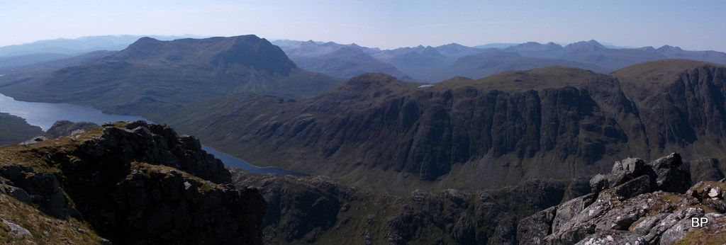
The Fisherfields from Beinn Tarsuinn to Clammy:
 DSCF9476
 by
Ewa Dalziel, on Flickr
Rock pinnacles just below the summit of A' Mhaighdean:
 DSCF9482
 by
Ewa Dalziel, on Flickr
We reached the summit just before midday, so the sun was really strong, but thankfully, there are large boulders to provide some well deserved shadow. But first, posing on the edge of the famous 650m cliffs of Coire Breac:
 DSCF9491
 by
Ewa Dalziel, on Flickr
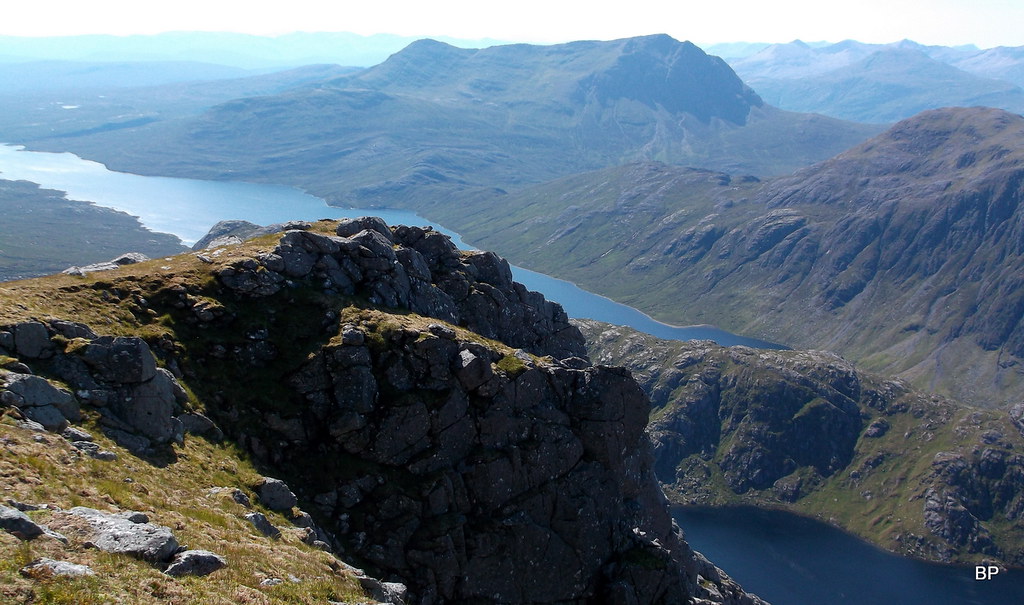
A few snaps from the summit - The Maiden offers some very special panoramas. This was true Armageddon - the end of the world as we knew it. From now on, it would be life with memories from this unique place. Enjoy the panos with us.
The upper end of Dubh Loch seen from above:
 DSCF9516
 by
Ewa Dalziel, on Flickr
Cliffs, cliffs and even more cliffs!
 DSCF9517
 by
Ewa Dalziel, on Flickr
Happy Kevin and the western ridge of Armageddon:
 DSCF9522
 by
Ewa Dalziel, on Flickr
Munro no. 216 (Lucy's 56):
 DSCF9513
 by
Ewa Dalziel, on Flickr
Slioch, Lochan Fhada and Gorm Loch Mor:
 DSCF9526
 by
Ewa Dalziel, on Flickr
Beinn Lair:
 DSCF9530
 by
Ewa Dalziel, on Flickr
Southern pano:
 DSCF9542
 by
Ewa Dalziel, on Flickr
Miaowwww! What a day! I think the strong sun was getting to me, I was behaving irrationally!
 DSCF9545
 by
Ewa Dalziel, on Flickr
Wish we could lurk around even more, but we still had to get down to the camp, pack up and walk back to civilization. on the way down, Kevin insisted on avoiding the "sh*te path" again and as a result we downclimbed a wide, grassy gully - to the left in picture below:
 DSCF9557
 by
Ewa Dalziel, on Flickr
We ended up just above Fuar Loch Mor, where we spent some time photographing the crags. At some point, I lost sight of Kevin and had to scramble up a large rock to have a better view of the corrie. I shouted - hop, hop, where are you? and trying to spot him among the crags below me... while he stood about 10 m above my head, laughing his head out
Fuar Loch Mor - so blue...
 DSCF9568
 by
Ewa Dalziel, on Flickr
Lost among rocks...
 DSCF9569
 by
Ewa Dalziel, on Flickr
We joined the path below the eroded section and now it was an easy return to the camp, retracing our steps back down. We enjoyed the surrounding landscape once more:
 DSCF9572
 by
Ewa Dalziel, on Flickr
Beinn Dearg Mhor is next on the list!
 DSCF9579
 by
Ewa Dalziel, on Flickr
Descending back to Dubh Loch:
 DSCF9596
 by
Ewa Dalziel, on Flickr
The traverse of both hills took us over 7 hours, but we spent an awful lot of time photographing, lurking, exploring... It's a fascinating corner of Scotland, so remote, so beautiful, that given the perfect, sunny conditions, it would be a sin to leave early... We reached the campsite tired but smiling. Kevin boiled water and prepared noodles for lunch while I started to pack up our sacks for the walk out. After a hot meal we fancied some sugar, but we discovered our chocolate has melted despite being hidden in the tent.
Thankfully, it was still sealed or the tent would end up sticky all over
We rested a bit before leaving the camp at about 4 pm. I spent the last moments just enjoying the lovely views. It was hard to wave good bye to the red and white mountains, the dark blue lochs, the green grass, the humming stream that supplied us with water, even to the swarm of blood thirsty midges
We felt a bit sentimental and agreed, we would return here some time in the future, wild camp again and climb Beinn a'Chaisgein Mor and Beinn a'Chaisgein Beag. Despite ticking off all Fisherfield Munros in three trips exploring different parts of this area, I still feel like we have a lot to discover left here... And I can't wait for more adventures in the wilderness.
Beware Fisherfields... I'll be back!!!
 DSCF9627
 by
Ewa Dalziel, on Flickr
STAGE 3. WALK OUT. 18/07/2017
Distance: 18.3km
Ascent: 403m
Time: 4hrs 30min
(route identical as for stage 1)
We started at 4 o'clock in the afternoon. The sun was really strong and soon we became sticky from re-applying sunscreen, but we kept a good pace and in four and a half ours we covered the distance of over 18km back to the car park in Poolewe. Didn't take any photos on the way back, just to save time. When we reached the car, I discovered a nasty blister on my right heel... Funny I never felt anything as we walked! Well, one blood blister is a small price to pay for all the delights of the wild Fisherfields... I survived Armageddon. And I'll be back for more.
We drove home and went straight to bed - walking with heavy packs really sucks energy out of muscles! We decided to take the next day off, to rest and cure our blistered feet, but you will be wrong if you think I could be kept off the hills! Expect more stories to come from yours truly... Some still pending from late June, some from July. Some obvious hills and a few very obscure. Watch this space.
