free to be able to rate and comment on reports (as well as access 1:25000 mapping).
Late 1997 I did a walk over Suilven starting from the east. I was with a friend who I knew was generally a good bit fitter than me and who had recently completed a long cycling tour so I did anticipate trailing behind a bit and even more than I normally would have.
However, to my pleasant surprise I managed to keep pace over the first two hours that saw us onto the foot of the ridge. Thereafter though I did pretty much struggle for energy.
After the first top there was an interesting nervy descent on steep ground to the right of the ridge crest and into the first notch along the ridge. Probably the most tricky part.
We'd started a bit before sunrise (6am or 7am if I recall correctly) and the weather was very good -clear skies and little wind though the usual November chill. The main ridge was a pleasure to traverse and looked great with the autumn/winter sun throwing long shadows across the moorland. So I'd say we got very fine views from each end of the main ridge. We'd been dropped off for the start of the walk in so the route back was a choice between the west/east path out or a more ambitious route over Canisp that would take us directly back to Inchnadamph.
Canisp it was then, as we'd estimated that we might be able to get to the top before sunset at 4.20pm (again, if I recall correctly). As it turned out we were some way below Canisp's summit whilst we admired the setting sun and I was by then cramped up with sciatica. Still, I struggled on and I was grateful for my companion's patience as they were obviously still full of energy and could probably have jogged up the rest of the way. I kept going though and eventually got a second wind of sorts (probably once we were on our way downwards again!). At least we had the lights of Inchnadamph as a landmark and occasional car lights on the road to give an indication of our whereabouts without too much recourse to map and compass.
Back down at Inchnadamph for 7pm I reckon.
 img080
 by
John Little, on Flickr
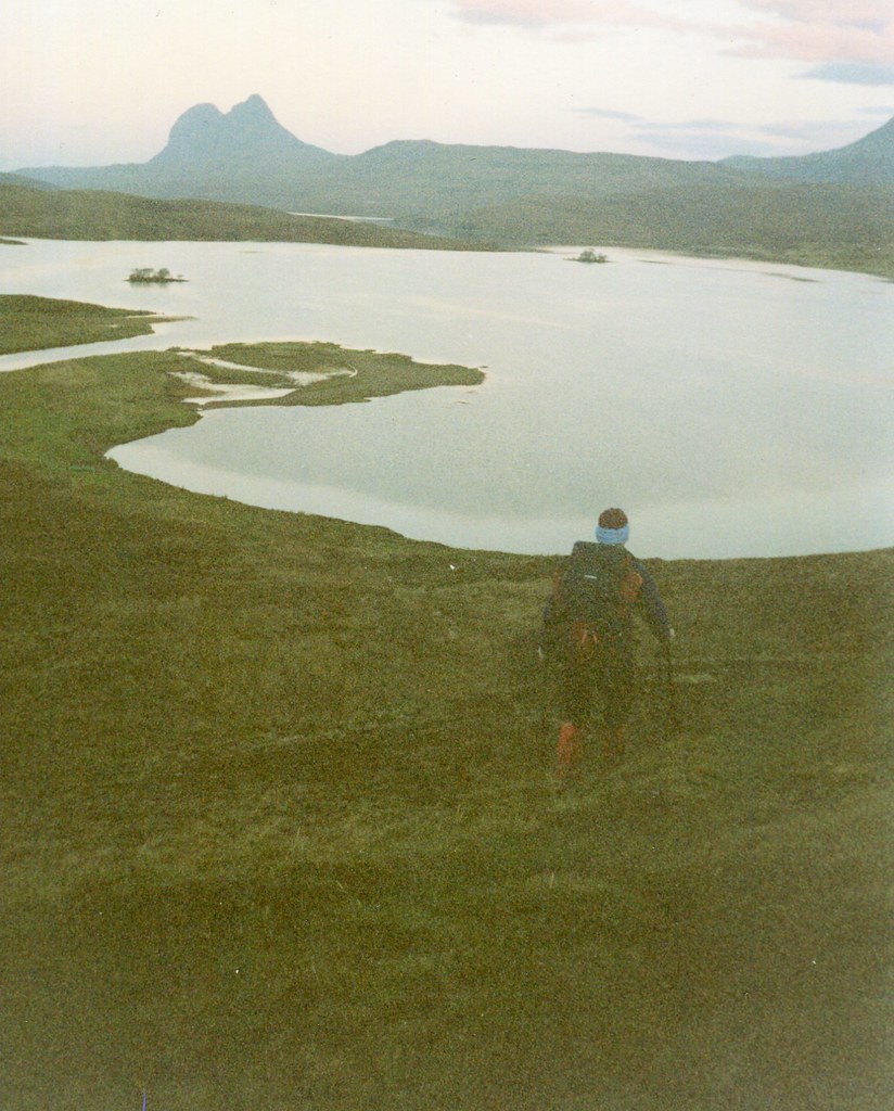
A 6am start or thereabouts sees us starting out on the Cam Loch path for the first 5km. Might have been better to stay on the path longer but we got to the foot of the east top in two and a half hours I think.
 img081
 by
John Little, on Flickr
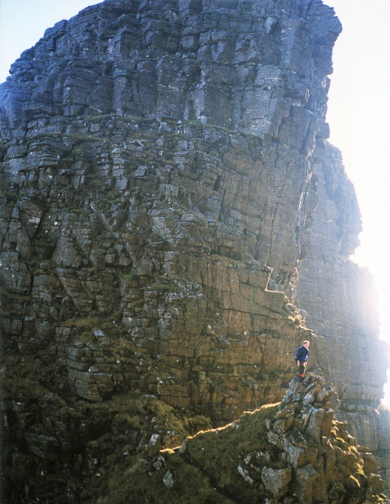
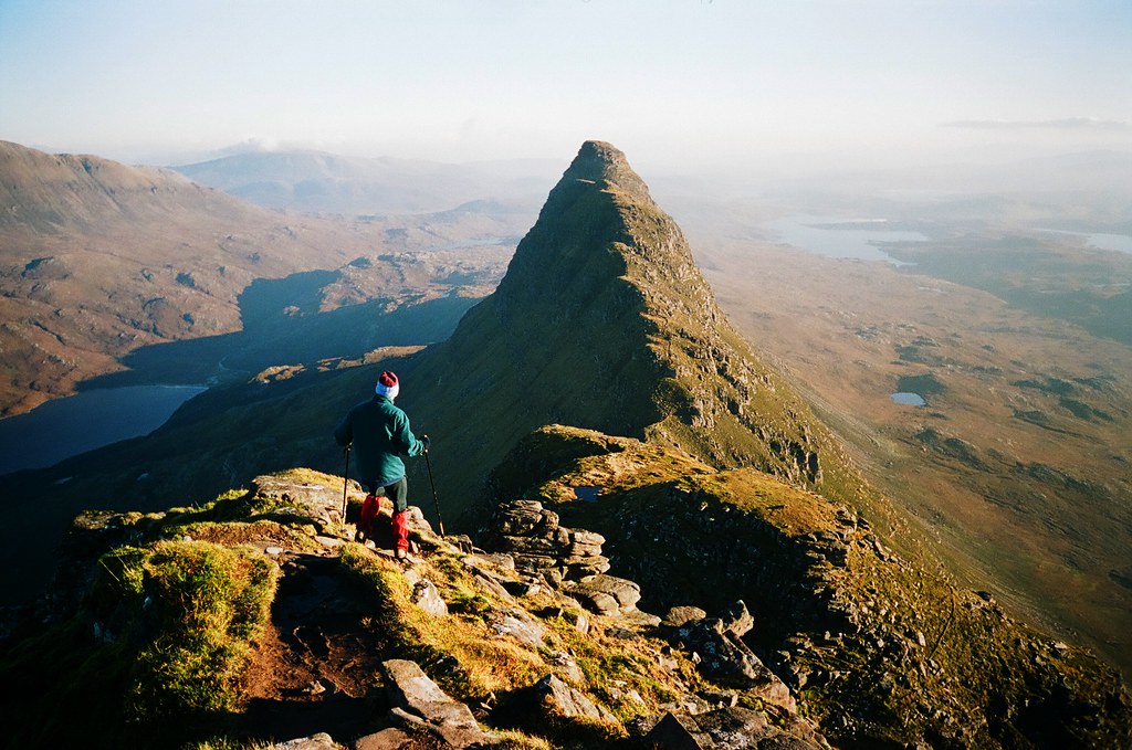
Off the path and cross country to the foot of the ridge. An easy but steep ascent to the first top follows. We sidled down the north side of the first top, still steep and straight forward but more exposed -pretty much following the shaded slope in this photo.
 img082
 by
John Little, on Flickr
 img083
 by
John Little, on Flickr
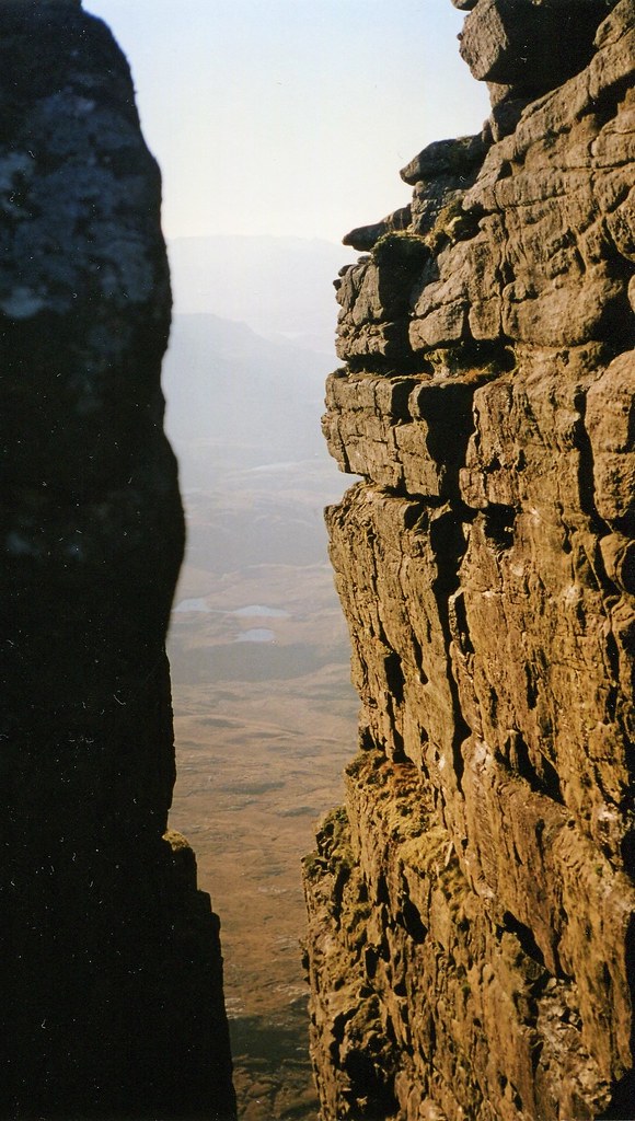
A notch in the ridge.
 img084 (4)
 by
John Little, on Flickr
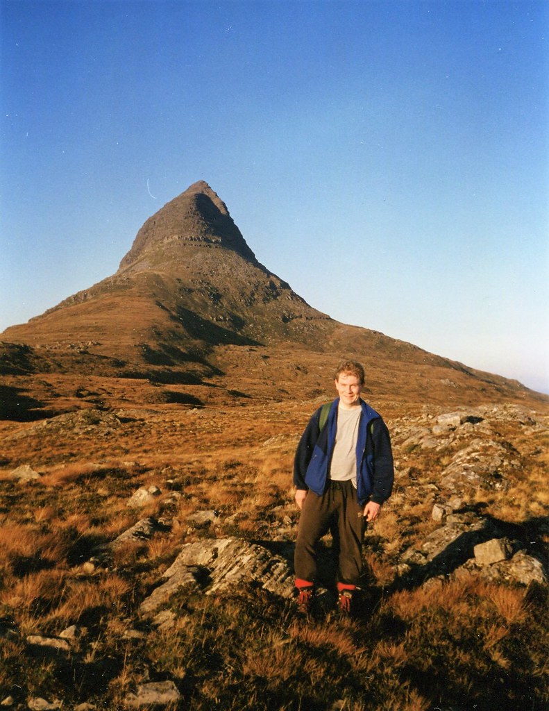
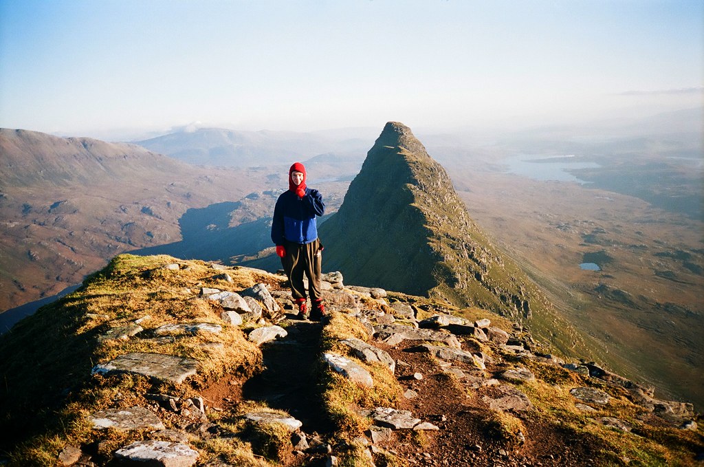
Me posing and contemplating the gap between the first and second peaks. We descended easier slopes left of pic.
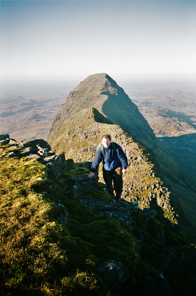 80990023c
 by
John Little, on Flickr
Not sure why I've chosen to stoop awkwardly here rather than find a nice flat spot to stand on but this must be Meall Meadhonach.
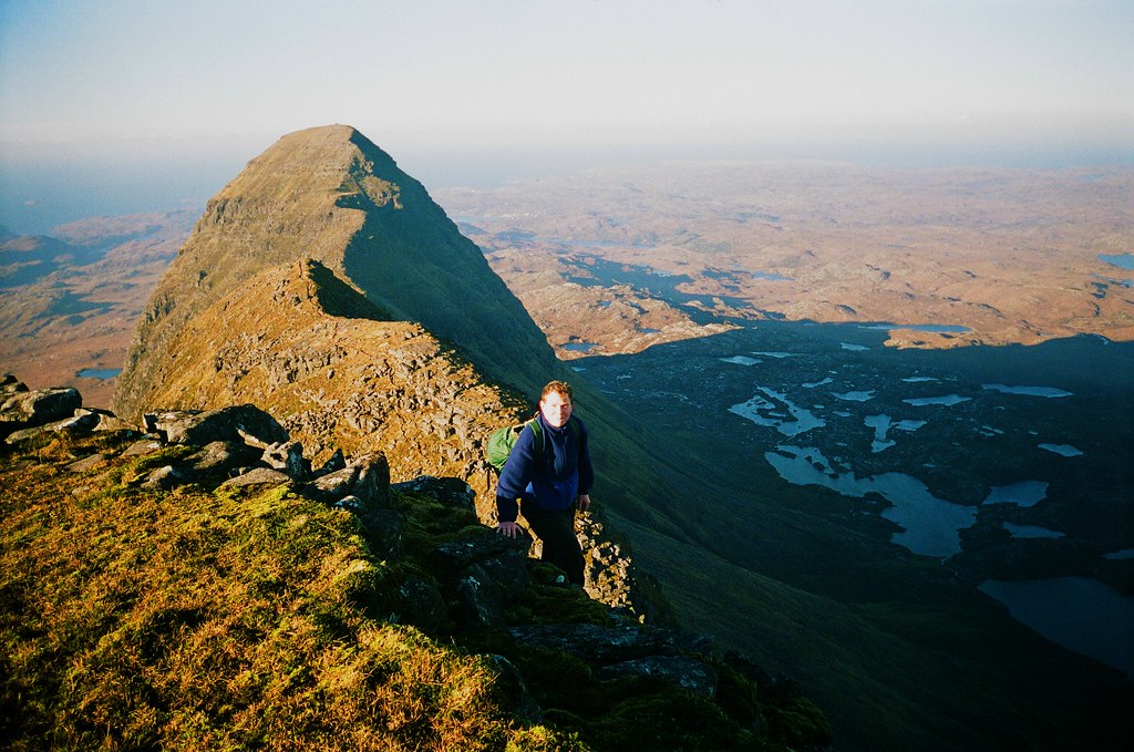 80990024 - Copy
 by
John Little, on Flickr
 80990021c
 by
John Little, on Flickr
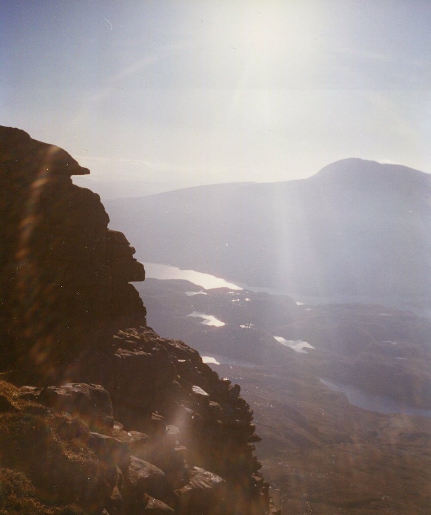
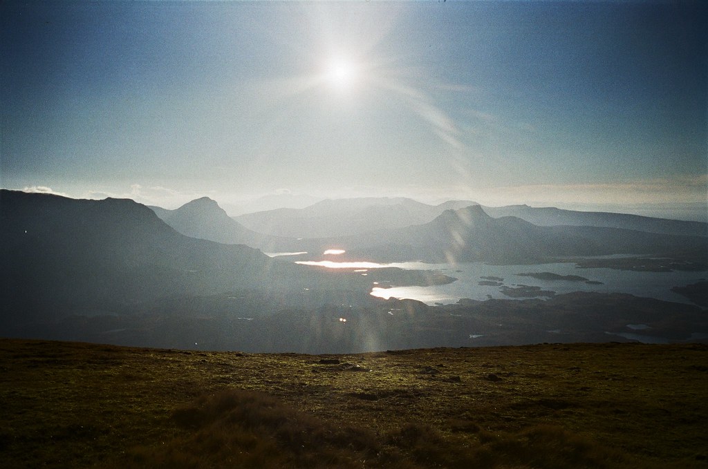
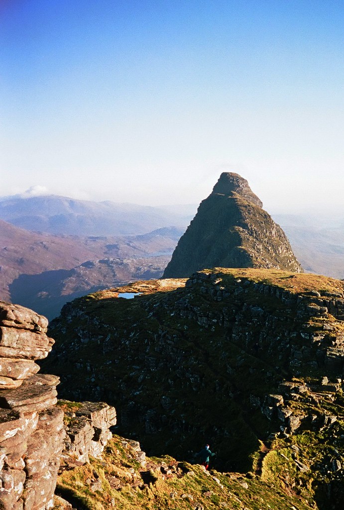
Probably the view south from the western summit, Caisteal Liath.
 52080030v2
 by
John Little, on Flickr
On the way down from the western summit.
 52080031v2
 by
John Little, on Flickr
Getting chilly now.
 52080029v2
 by
John Little, on Flickr
 img085
 by
John Little, on Flickr
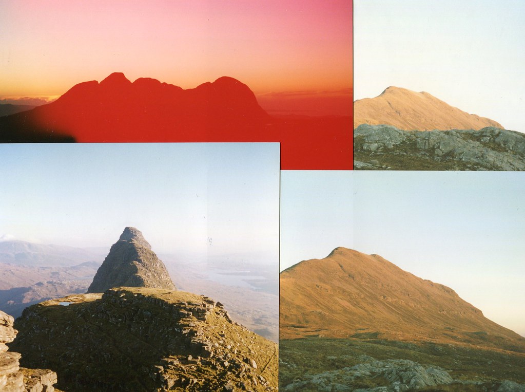
Something went wrong with the film here -probably tried to remove without it being fully wound in as folk of a certain age will realise. Anyway, a couple of pics of the awaiting Canisp and one outline of Suilven from near the summit, shortky before sunset.
