free to be able to rate and comment on reports (as well as access 1:25000 mapping).
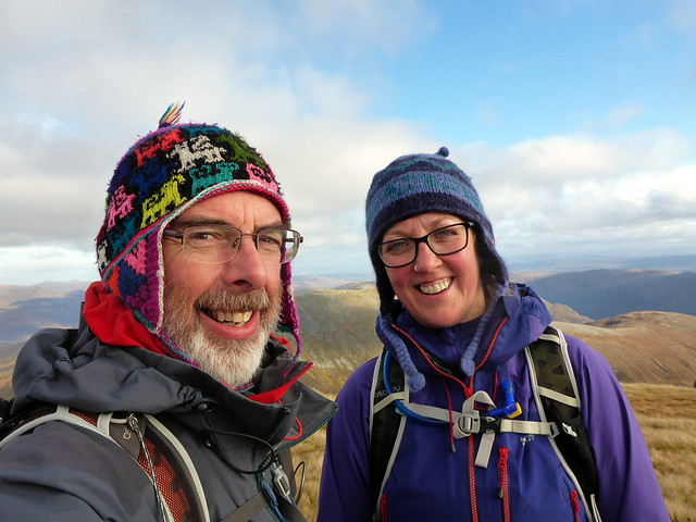
A good weather forecast for a change - time to head North for some "proper hills" after our walk in the Pentlands last weekend. Back on the trail of more Munro Tops for Allison - a small cluster sat within the Mullardoch Hills. For a variety of reasons a full round of these wonderful hills wasn't on the cards at present, but i reckoned it would be possible to pick off the 4 Tops on mam Sodhail from Glen Affric, affording an opportunity to climb the mighty Sgurr na Lapaich from the southern side. Then another smash-and-grab on the northern side of Loch Mullardoch, picking up Tops on carn nan Gobhar and the other Sgurr na Lapaich. I drew out some satisfying circular routes for both and reckoned we should have a smaller day in between doing Marilyns as the forecast suggested up to gale force winds that day

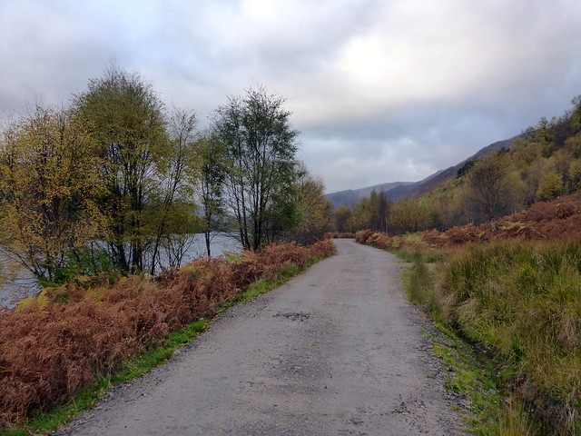
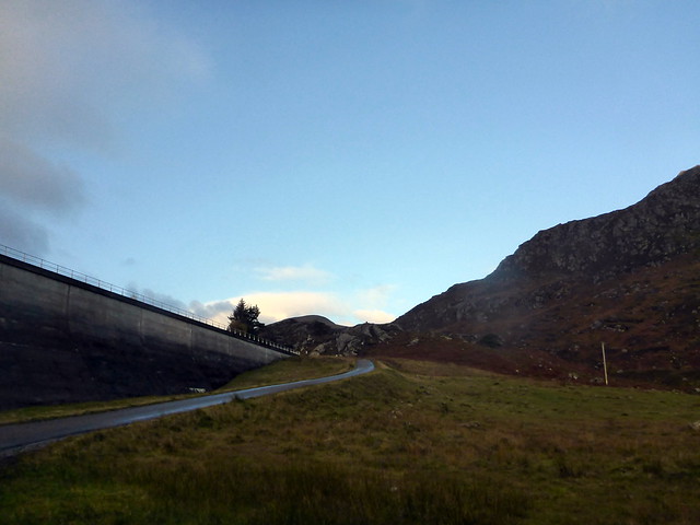
Drove up on Thursday night to Cannaich campsite, arriving about 9pm after shenanigans on the A82 south of Fort William where a lorry had shed its load, closing the road for a time. Fortunately, we know the campsite well and found our usual pitch amidst the trees. A fine quiet night, if on the chilly side for a change. Friday morning appeared a bit cloudy as we set off down Glen Affric. Be warned - there are lots of road repairs going on there at present with roadsigns warning drivers to expect long delays. no such problems today though - a few workmen repairing the tarmac over the final bridge, who cheerily waved us through. A lot of cars already at the car park for 9.15am.
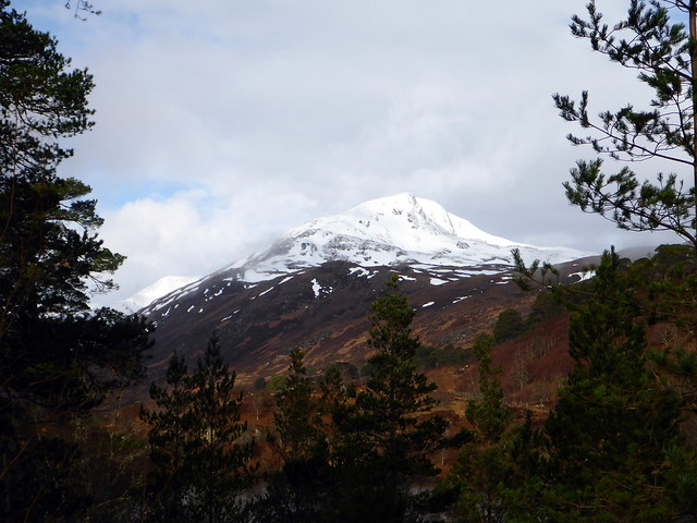
I remember my first sight of Sgurr na Lapaich from Affric, a couple of springs ago when on our way to the Corbett of Aonach Shasuinn and deciding I really wanted to climb it from here, not just as a scamper down from Mam Sodhail. On that fine morning snow capped its upper reaches, inviting and icy.
Spring 15
 P1060553
 by
Al, on Flickr
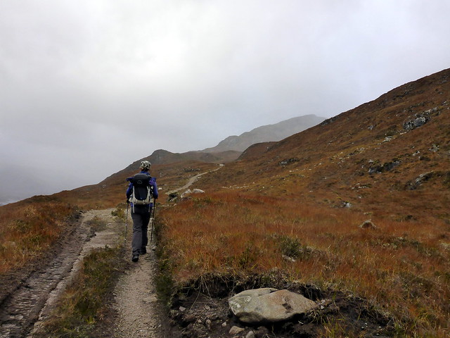
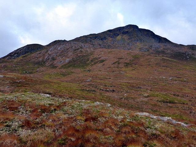
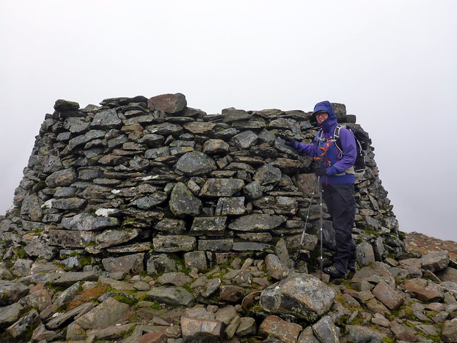
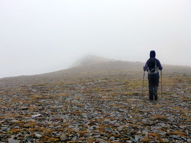
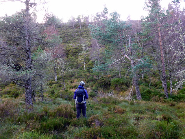
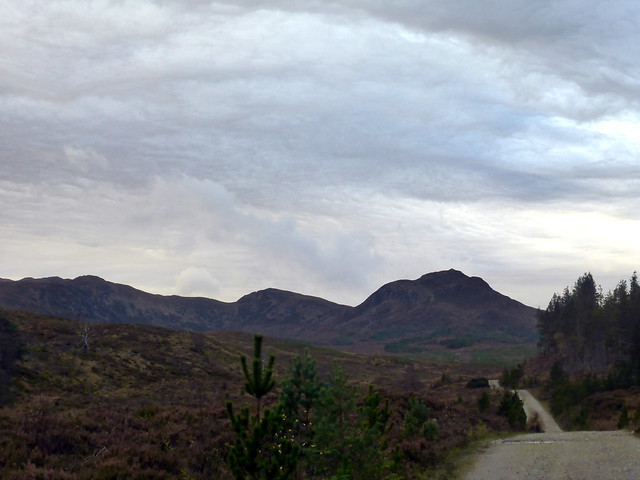
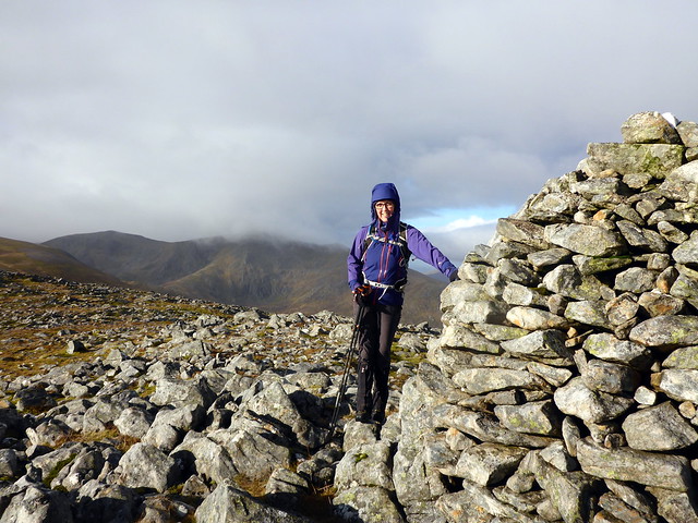
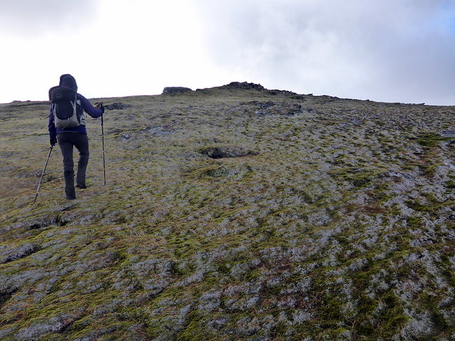
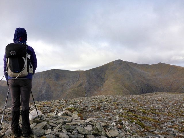
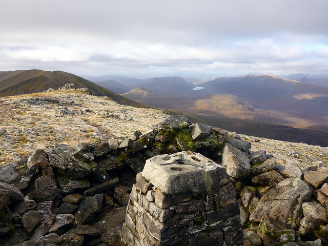
My original plan had been to begin with the Simm of Am Meallan, but this was shelved largely out of concern that it would make an already long walk for this time of year overlong. Walking along good track by the eastern reaches of Loch Affric, the trees bearing their autumnal robes, we came to the stalkers path that would take us up, just before Affric Lodge. Widened and bulldosed this allowed rapid progress to be made. Around 500m we parted company from the track, which continued northwards, and stepped onto boggy hillside, making for the shoulder of Lapaich. We found a walkers' path as we clambered up the narrowing shoulder, reaching a fine cairn. wind was considerable here, chill and blustery. Before us the long "finger" that reaches up to Mam Sodhail stretched out - almost two and a half miles to the parent summit, which was, sadly, cloaked in fog. I thought back to that fine afternoon when I had last been here, my round of all the Tops in the Mullardochs - a high camp on the bealach between mam Sodhail and Carn Eighe, cloud inversions - ah!
 P1170892
 by
Al, on Flickr
 P1170895
 by
Al, on Flickr
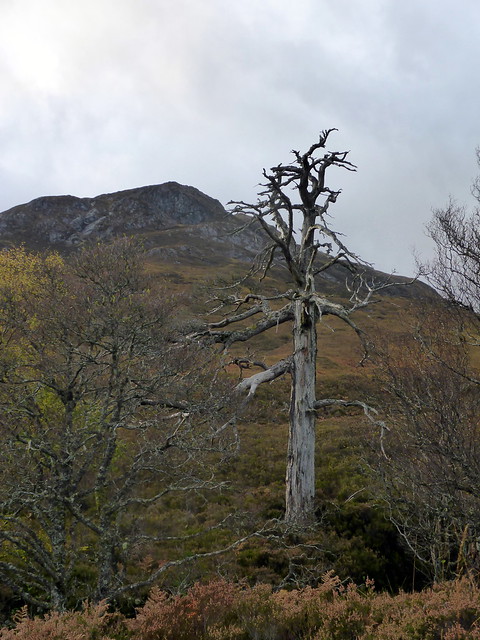
Lapaich
 P1170894
 by
Al, on Flickr
 P1170897
 by
Al, on Flickr
 P1170899
 by
Al, on Flickr
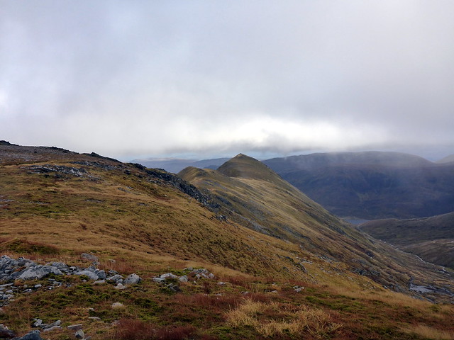
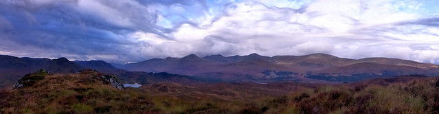
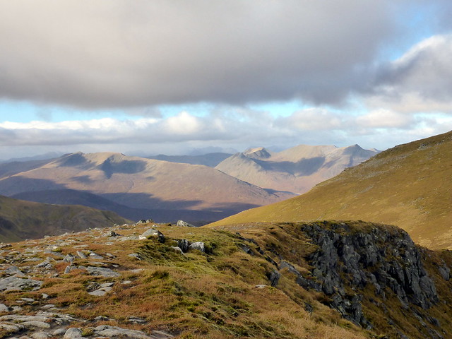
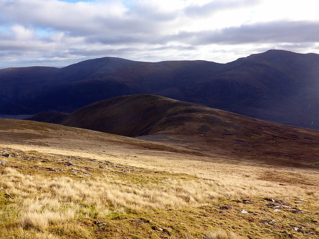
Looking towards Mullach Cahda Rainich & Mam Sodhail
 P1170901
 by
Al, on Flickr
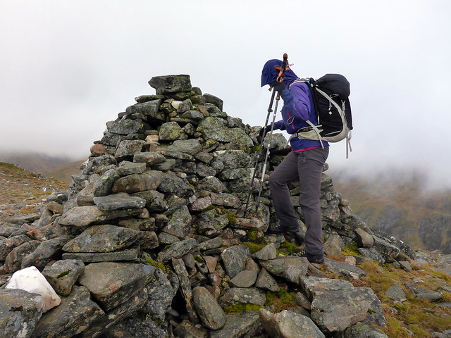
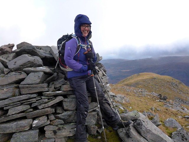
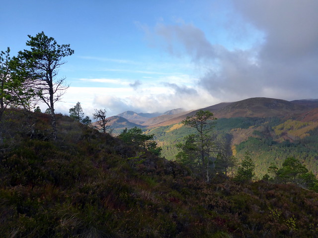
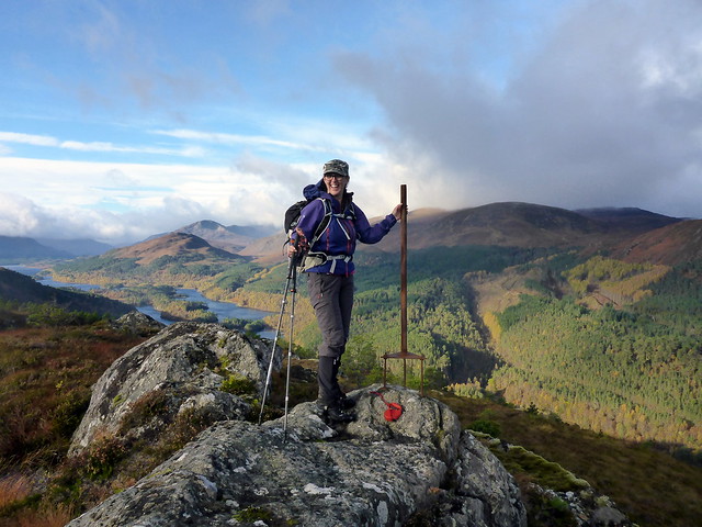
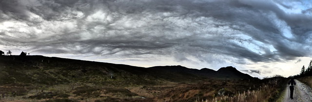
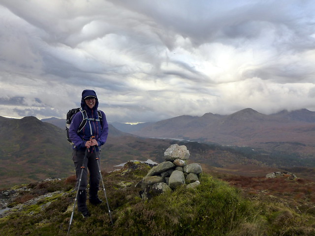
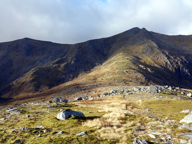
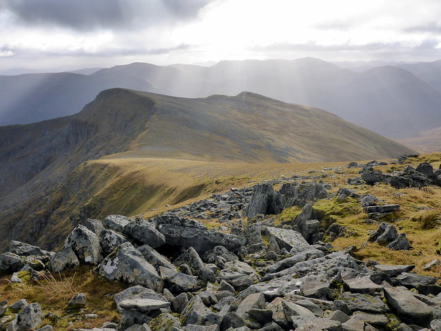
Anyway, we pressed on over the second Top of Mullach Cadha Rainich and the climbed more steeply to the enormous cairn on Mam Sodhail. Wind was now fierce and cold, freezing any exposed skin. Clag made the next part a little difficult - there's a rocky descent to the start of the next "finger" down to An Tudair and we missed it a couple of times

Finally, after compass and some sweary words, we set off to the shapely form of An Tudair (which I think translates as "little stinker") - navigation made easier by lifting of the clag
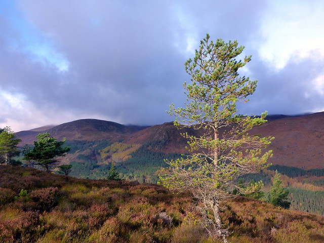
We had some protection from the worst of the wind as we walked along the ridge, good views across to Sgurr na Lapaich.
 P1170902
 by
Al, on Flickr
Mam Sodhail
 P1170904
 by
Al, on Flickr
An Tudair
 P1170906
 by
Al, on Flickr
The "fingers" to Sgurr na Lapaich and An Tudair
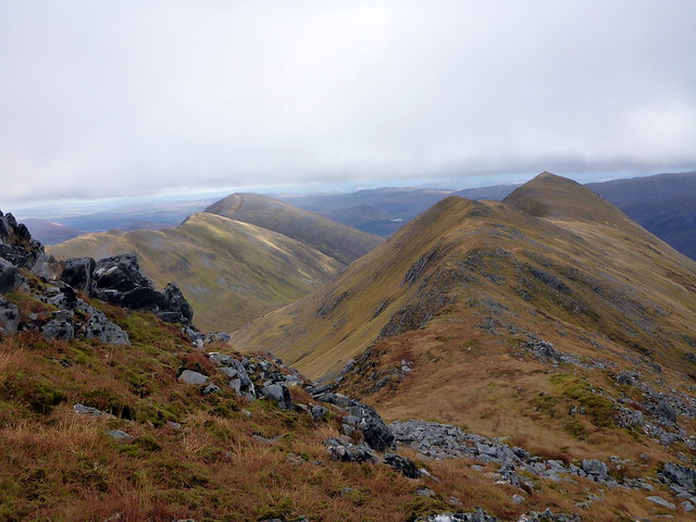 P1170908
 by
Al, on Flickr
An Tudair
 P1170910
 by
Al, on Flickr
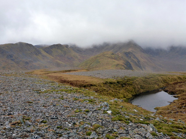
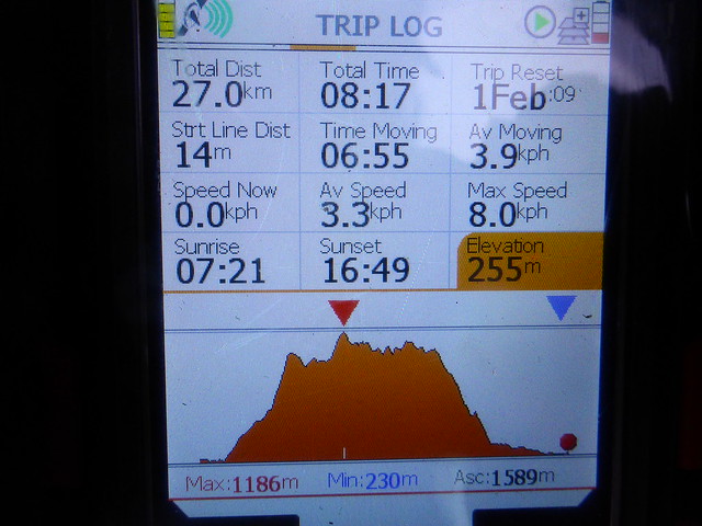
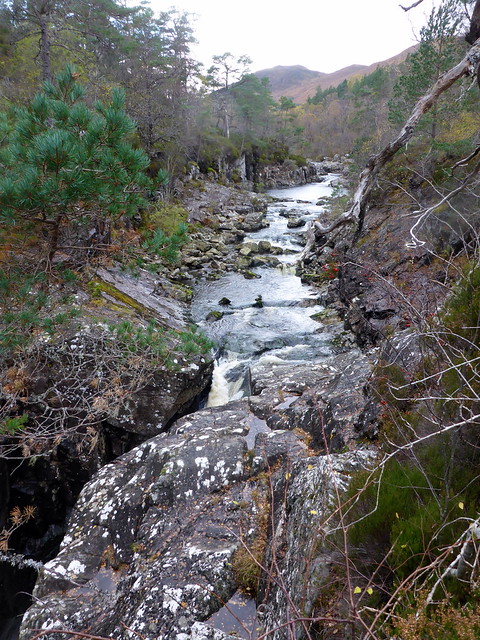
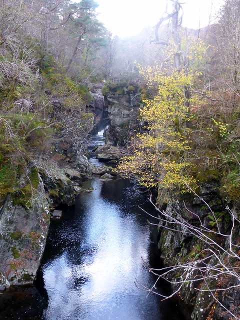
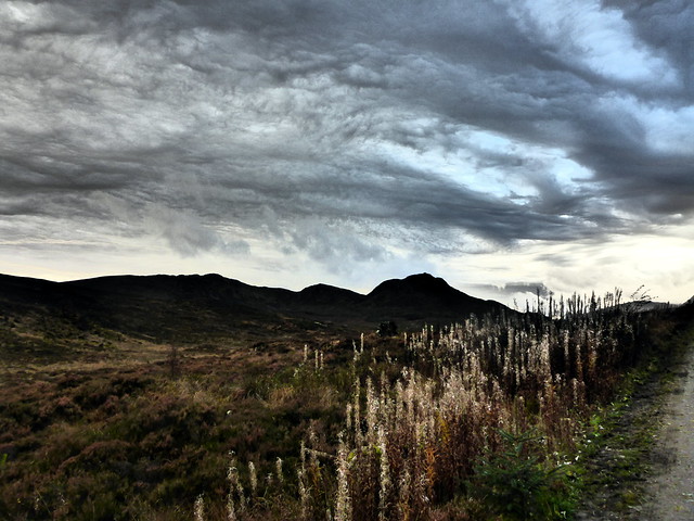
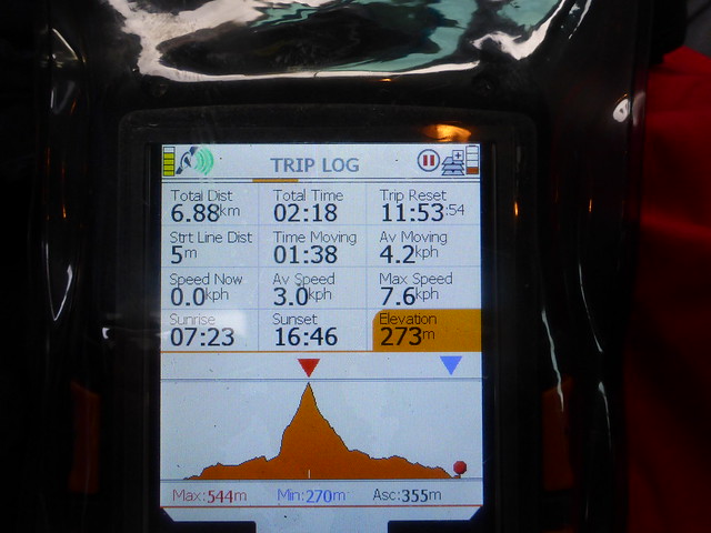
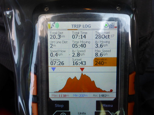
From here we regained the parent ridge and made our way to the last "finger" of Creag Coire na Each. Cloaked in fog once again we crossed bouldery ground to the small mossy cairn then began our descent along the curving ridge of Creag a'Chaorainn. Through the mist, the river gleamed like a sacred serpent or a carven white horse on chalk downs. We met with some sunshine as we lost height, making for the track we could see skirting to the south of An Tudair Beag. Crossing the Allt Coulavie was trouble free, a short ascent then onto narrow track. A long way ahead we could see the end of Loch Affric, about 5 miles to go to the car. But 5 miles in sunshine, out of the wind and in one of the lovely glens - not much of a chore. We slowly lost height then joined the broader Affric Way. Autumnal colours abounded, ochres, siennas, umbers. Bracken withering to rusty brown, vibrant greens of the Caledonian pines, whites of the silver birch saplings. My GPS told me we'd covered 27km in just over 8 hours, which seemed reasonable, Allison admitted to some aches and pains and was ready for some food. We returned to the car and drove back along Glen Affric, the roadworkers long gone home. The sky burned with an infernal glow as we sat outside the tent eating our meal.
Creag Coire nan Each
 P1170912
 by
Al, on Flickr
Silver serpent
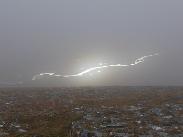 P1170914
 by
Al, on Flickr
 P1170917
 by
Al, on Flickr
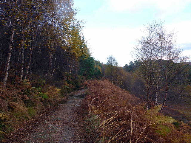
It's a long way back
 P1170920
 by
Al, on Flickr
 P1170922
 by
Al, on Flickr
 P1170923
 by
Al, on Flickr
 P1170924
 by
Al, on Flickr
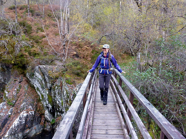
Another peaceful night, but wind whispering ever louder in the treetops over the tent. Saturday's forecast was for very strong winds and with this in mind I'd selected two smaller hills - Carn Fiaclach beside Dog Falls in Affric and Creag Dhubh down by Cougie. With no particular time pressure today we rose late and breakfasted at leisure. Drove down to the car park at Dog Falls where lots of "normal" folk were out for walks with their dogs and kids. I'd read Malky's report on this hill which noted the steep and slippy nature of the pathless ascent through the trees. I had also looke dot see if it was viable to join the two hills together into one walk, but this would have been extremely challenging through forestry and also very long - so much as I dislike "there and back again" routes, I did submit.
We took the forest path initially, enjoying views across to the north of Loch Affric through the trees. After a short while we left the path and set off up steep heather-clad hillside making our way slowly through the trees. The heather provided good holds up the stiffer parts. After some time we came out to a more level area, trees were less crowded together and the top of the hill was finally visible. The summit is adorned by a skeleton trig point and provides very fine views all down Glen Affric. Mouthwatering. We dallied for a time, although even at this modest altitude the wind was strong enough at times to buffet us almost off our feet. Descent was easier and we were soon back on the forest trail. I suggested we walk along to see the Falls and have lunch there. The falls are a little underwhelming, not least because you cannot actually see the waterfall from the viewpoint as the water slices deep into a rocky cleft which hides it from sight. But a pleasant enough amble anyway.
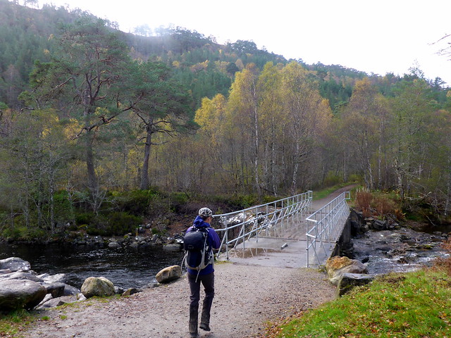
Bridge near Dog Falls
 P1170925
 by
Al, on Flickr
 P1170928
 by
Al, on Flickr
 P1170929
 by
Al, on Flickr
 P1170931
 by
Al, on Flickr
 P1170932
 by
Al, on Flickr
Carn Fiaclach
 P1170935
 by
Al, on Flickr
Dog Falls
 P1170939
 by
Al, on Flickr
 P1170941
 by
Al, on Flickr
 P1170943
 by
Al, on Flickr
 P1170944
 by
Al, on Flickr
Fed and refreshed we drove along what must be one of the most pot-holed roads in Scotland, to Cougie. We'd last been here when climbing the Graham Carn a'Chaochain last December. Road hasn't improved any and indeed the concrete "bridge" at Drochaid na Luib is a bit hairy. Not a journey for a car with low slung suspension anyway. We parked at the outbuildings and walked past the "pony trekking and camping" centre which looks as if it has seen better days. I note from their website that they offer "slay rides" in addition to pony trekking, which sounds moderately worrying.
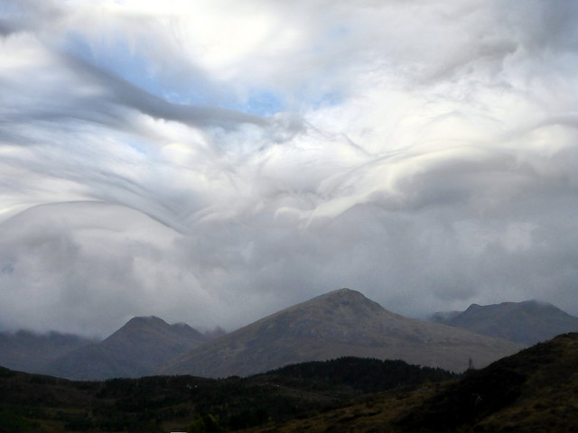
As we walked along the track there's an unusual barrier in the form of an electric fence wire that can be stepped over if you are brave, or opened by means of an insulated handle. We chose the latter and set off up the forestry track towards our target, the 539m Creag Dhubh. I'd routed us to ascend through a fire break in the trees - however when we reached this spot the fire break was well and truly broken, with collapsed and recumbent trees everywhere. Not fancying a stumble in the stumps we continued further along the track til the plantation ended. Another steep pull up heather clad hillside then a tentative trek through the overgrown remains of felled forestry, with plenty of rotting branches and holes to catch you unawares. I was most taken with the sky today - the clouds were most unusual and gave the sense of us being underwater looking up at breakers from beneath. Creag Dhubh
is actually a fine montecule and like Fiaclach earlier, has some fine views to offer. From the windswept summit we continued to enjoy the phantasmagorical shapes in the sky.
Creag Dhubh from Cougie
 P1170945
 by
Al, on Flickr
 P1170948
 by
Al, on Flickr
 P1170949
 by
Al, on Flickr
 P1170950
 by
Al, on Flickr
Creag Dhubh
 P1170952
 by
Al, on Flickr
 P1170962
 by
Al, on Flickr
Summit
 P1170963
 by
Al, on Flickr
More strange clouds
 P1170971
 by
Al, on Flickr
 P1170975
 by
Al, on Flickr
We journeyed back to Cannaich with the threat of rain in the air, but it came to nothing. A shower, hot food and an early night was the plan - sleep however was banished from about 9pm by live music - I'm assuming from the nearby Slater's Arms. Like, rock music that went on for the next three and a half hours. Not what I was anticipating up here in the quiet countryside, but there you go. So the extra hour in bed with the clocks going back failed to refresh.
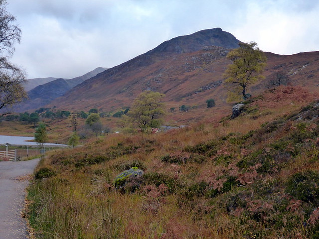
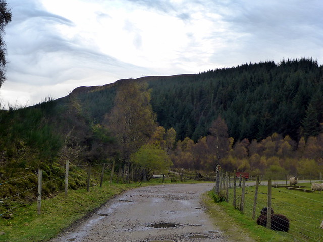
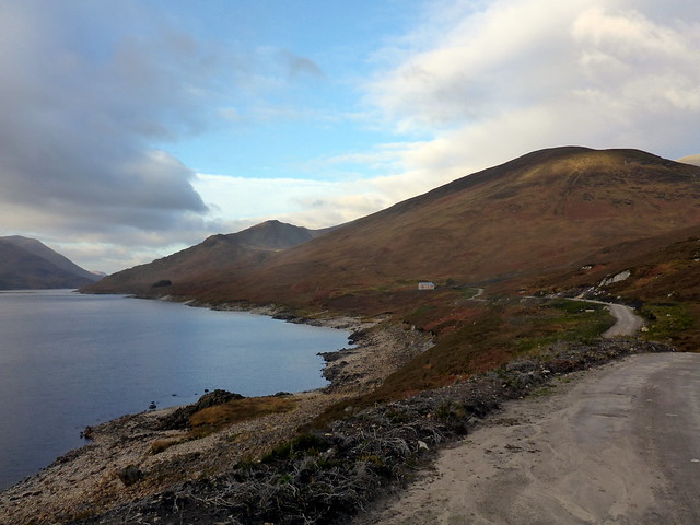
We had an earlyish start the following day, lack of sleep or not - a route of around 20km to the north of Loch Mullardoch then the lengthy drive home in the dark. We packed up - nice when the tent's dry - and reached the car park by Mullardoch dam before 9am. A lovely clear morning driving along the road, several royal stags bellowing as we passed, walking on and by the roadside with an air of lofty indifference to our doings. No other cars in the car park - that was a bit surprising. We set off along the track noticing how it had been widened since our first visit with heavy packs 4 years ago. We reached a pumping station or some such Hyrdo building and set off to our right into Coire an t-Sith. The hydro track goes quite a way up here too, until it reaches an inlet and we're returned to old fashioned boggy stalkers' path. We folloed this for a time then broke off to our right and made up the gentle slopes of Creag Dhubh, Carn na Gobhar's eastern Top. As we climbed we were met by an intensely cold north wind and by the time we reached the summit cairn we were frozen. Fond memories of camping up here on my last visit on a balmy night were banished by the frost.
 P1170976
 by
Al, on Flickr
 P1170978
 by
Al, on Flickr
Good track up by the Allt Mullardoch
 P1170979
 by
Al, on Flickr
 P1170980
 by
Al, on Flickr
Creag Dhubh
 P1170981
 by
Al, on Flickr
 P1170986
 by
Al, on Flickr
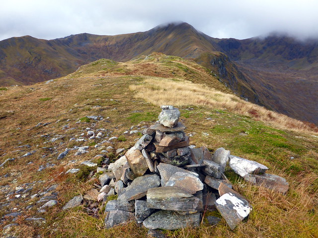
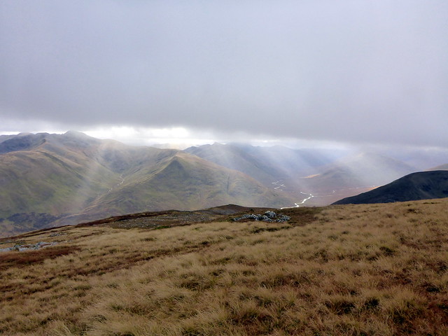
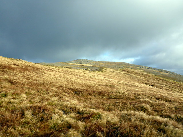
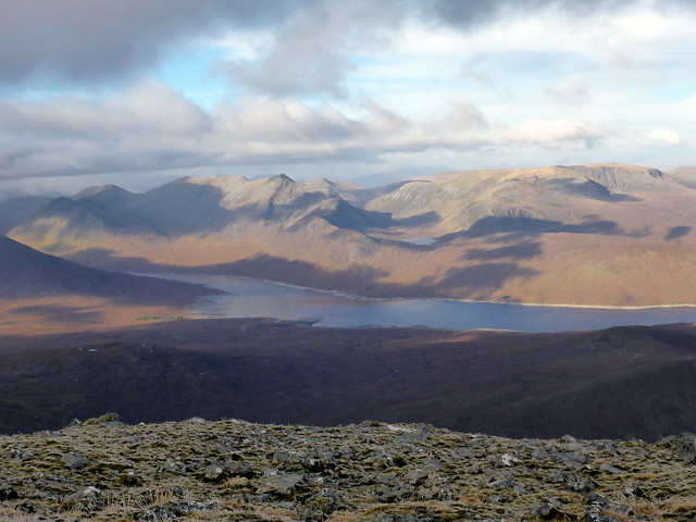
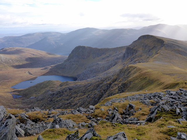
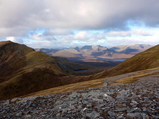
Pressing quickly on to the summit of Carn na Gobhar I had to stop and layer up, including donning my thickest winter gloves. Happed up like a pair of Esquimaux we got to the cairn and decided to descend a bit in search of shelter for lunch. Ahead loomed Sgurr na Lapaich - a mighty 350m of re-ascent, with the beautiful Loch Tuill Bearnach glowering at its foot. Ascent seems much easier when there's a path to follow and so it was to the scrambly boulder-strewn upper reaches of Lapaich. Views from the top were special - Strathfarrar to our right, Achnashellach then Torridon to the left with Slioch and An Teallach beyond. Nearer at hand, the little heap of An Cruachan sat, in the centre of the loch valleys. What a fine place this is.
Carn nan Gobhar - frosty underfoot
 P1170987
 by
Al, on Flickr
Looking at Lapaich
 P1170988
 by
Al, on Flickr
 P1170990
 by
Al, on Flickr
 P1170993
 by
Al, on Flickr
Sgurr nan Clachan Geala
 P1170994
 by
Al, on Flickr
Looking NW
 P1170997
 by
Al, on Flickr
Our way ahead
 P1170999
 by
Al, on Flickr
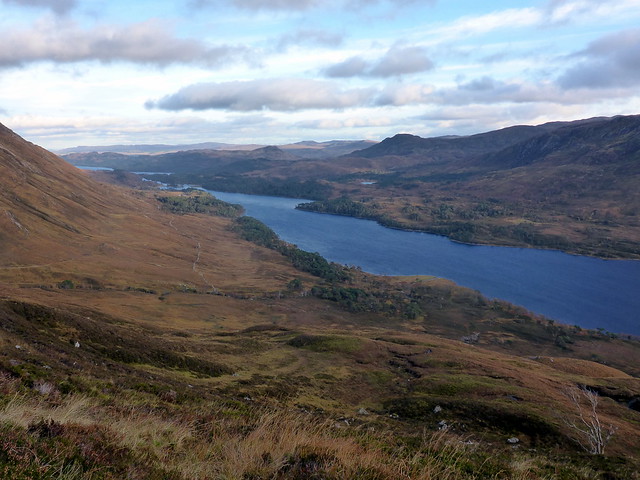
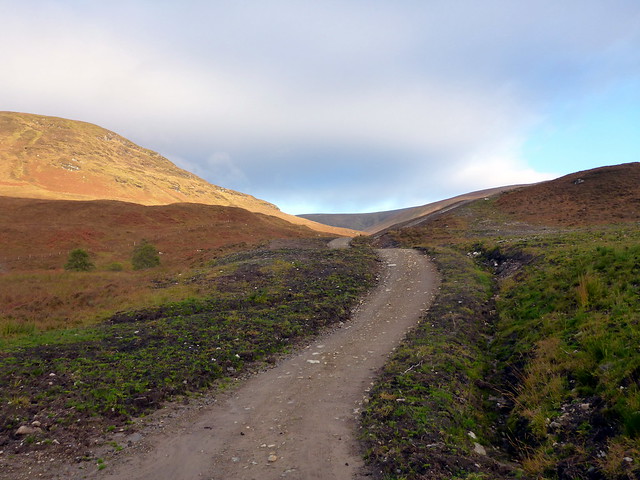
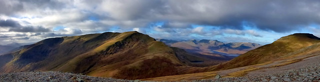
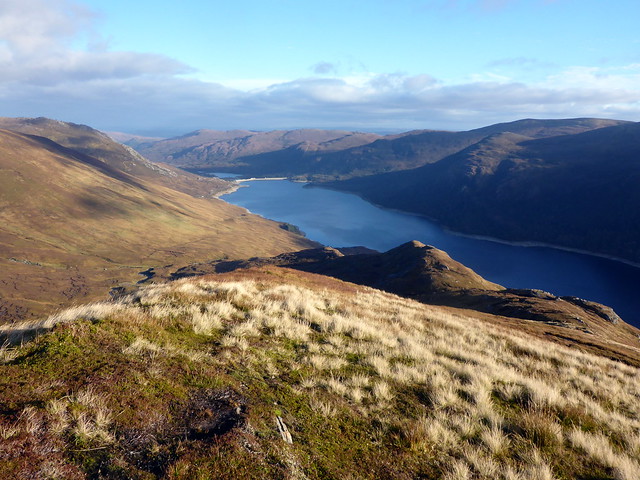
Not a sound disturbed our walk - no planes, persons or even bird call. Continuing down to the Top of Sgurr nan Clachan Geala the views continued to inspire - the mighty bulk of An Riabhachan to the west - oh for another day to be camped out in these hills. Continuing down the shoulder we passed the explosion of white rocks that give the Top its name on our way to the Simm of Mullach a'Ghlas Thuill. Thius is really a fine walk and a good venture into Mullardoch if time is limited. Coming off the eastern tail we scooted down over boggy ground aiming for the stalkers' path we could see across the Allt Taige. This was definitly an old-time path - ATV tracks evident but boggy and squelchy for much of its length. Back onto solid track for the final section we passed a recumbent black bull looking sad and lonely - we noticed later that his cows were some miles away on the road east of the dam. A last look along the loch as the sun started to sink, we regained the car around 4pm.
 P1180002
 by
Al, on Flickr
Summit Clachan Geala
 P1180004
 by
Al, on Flickr
These'll be the clachan geala
 P1180005
 by
Al, on Flickr
An Riabhachan and beyond
 P1180008
 by
Al, on Flickr
 P1180009
 by
Al, on Flickr
Mullach a' Ghlas thuill
 P1180011
 by
Al, on Flickr
 P1180014
 by
Al, on Flickr
 P1180017
 by
Al, on Flickr
 P1180018
 by
Al, on Flickr
