free to be able to rate and comment on reports (as well as access 1:25000 mapping).
Oh dear - not quite the weekend I'd hoped for. After last weekend's sunny weather I was keen to give the Strathfarrar Four a try, but the forecast was increasingly unsuitable. Undeterred from that part of the world, I'd been having a look at Marilyns on the east side of Loch Ness and found a group of 4 that could be tackled in one walk (or so I had hoped

) and another couple of pairs that would make for goodish days out. By the time Thursday came around and the grim forecast, I was already mentally committed to going up that way and didn't care to do a rethink. I had planned to stay in the campsite in Fort Augustus (not Cumberlands), but phoned to find it had closed down - I tried Inver Coille who were open, although the woman on the phone told me she thought we were mental camping in this weather. She said there was no snow there at present (ie 11am Thursday morning) so I reckoned we'd be alright

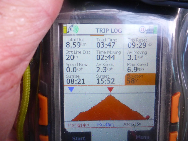
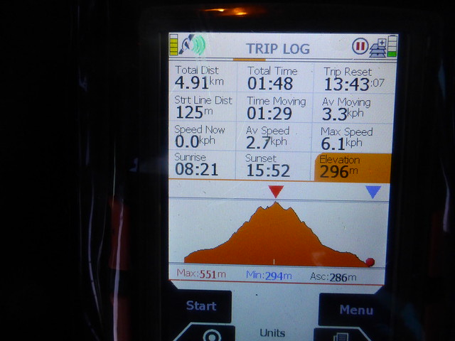
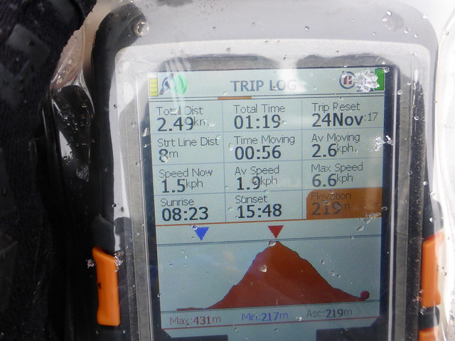
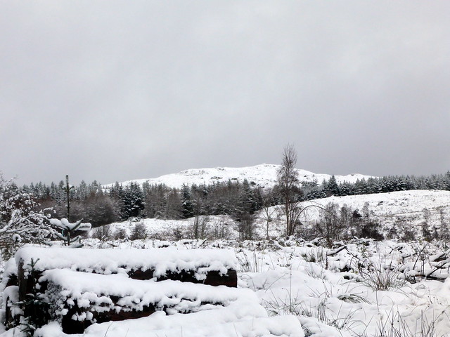
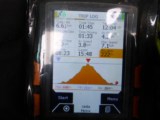
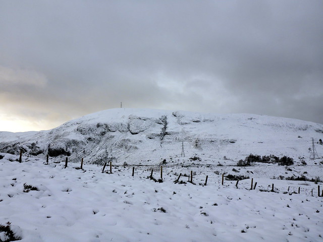
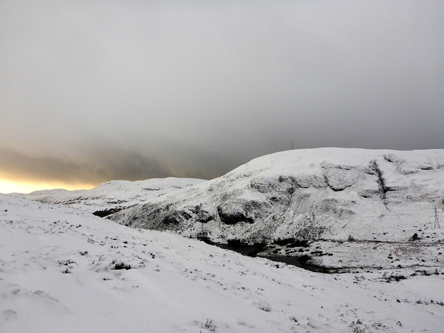
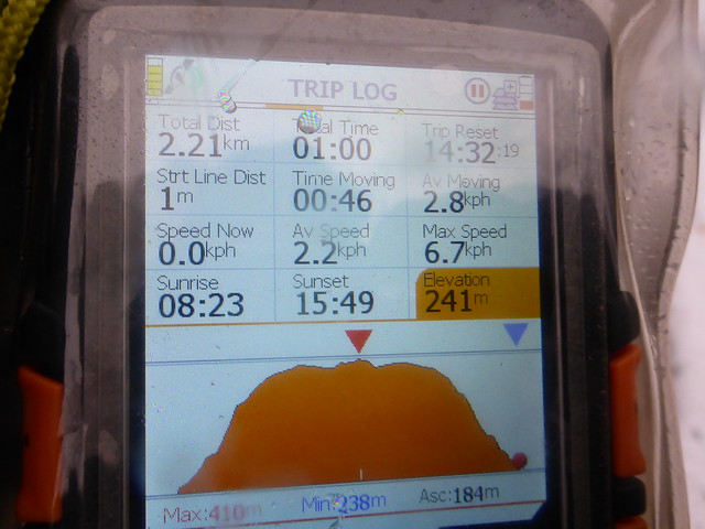
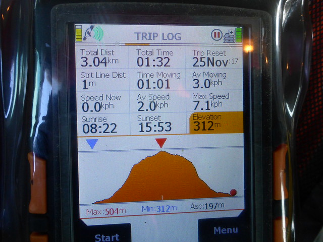
We set off after Allison finished work and hit the first of the snow as we drove into Fort Augustus. Too wet to lie, thinks me. We get the tent set up in the dark and settle down for the night - to be woken with a big load of snow on the tent roof in the middle of the night. Everything is very white. My plans to head round the east side of the loch take a blow as I really don't want to drive little roads in this much snow. We settle instead for Burach, the start point for which is just 2 miles south of the campsite. It's one of that select number of hills that are more than 600m with 150m drop but are not Grahams. There's 13 of them in Scotland, 19 in Britain and I think I'll claim them as "Weasels" once I get them climbed.
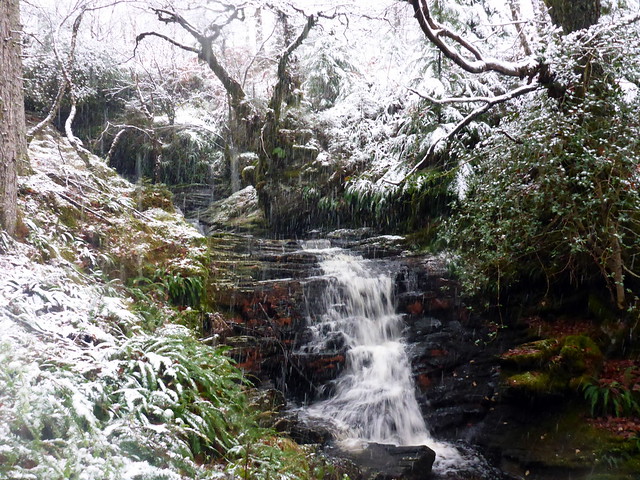
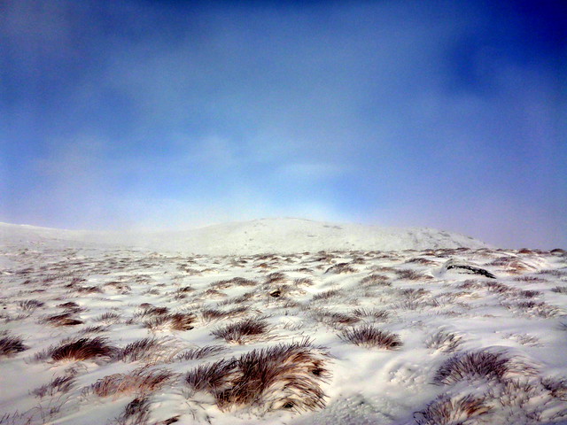
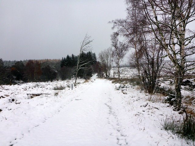
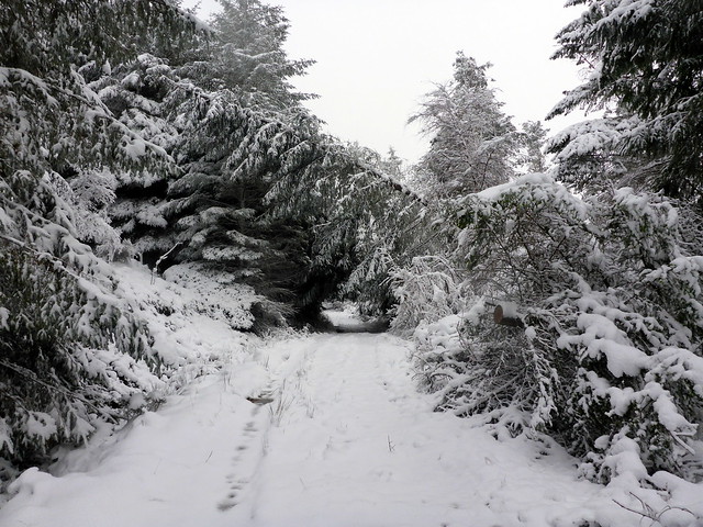
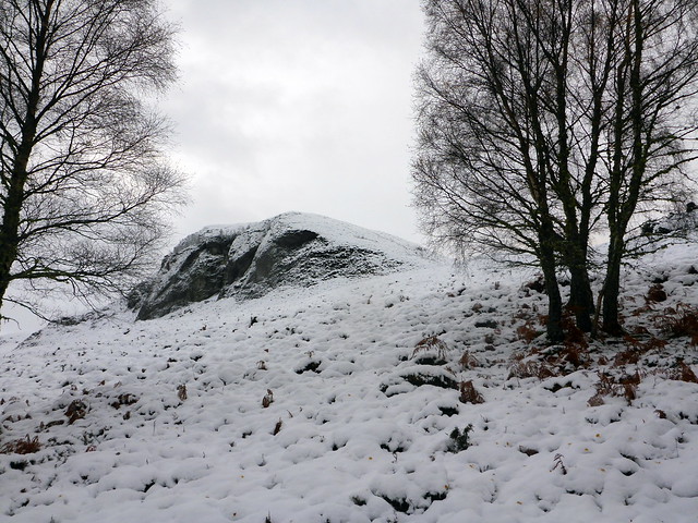
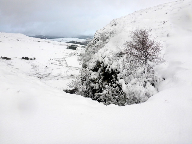
We parked in a Forestry Commission parking area at Allt na Criche and set off through the woods. I hadn't intended to do this hill over the weekend, I'd just loaded a route I found on WH in case it was needed. So I'd little idea what we were in for. The name "Burach" can mean "small hill" or it can also mean a fankle or mess. Hmmm. At least the beginnings of the walk were pleasant, along forest tracks, the tree branches heavy with snow. We came out of the treeline and continued along a track heading NE - this was a mistake, rectified once I spotted it - we should of course have plunged into the tussocky heather topped with 6 inches or so of snow

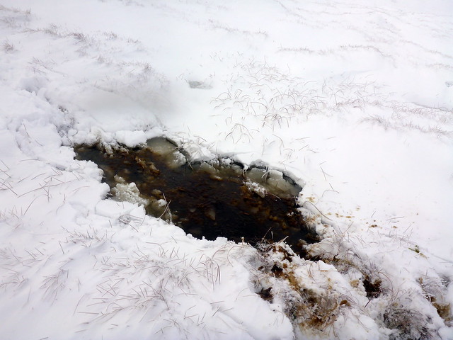
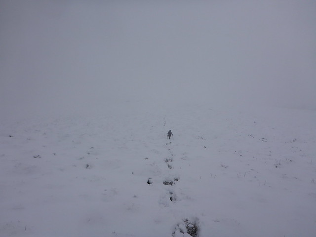
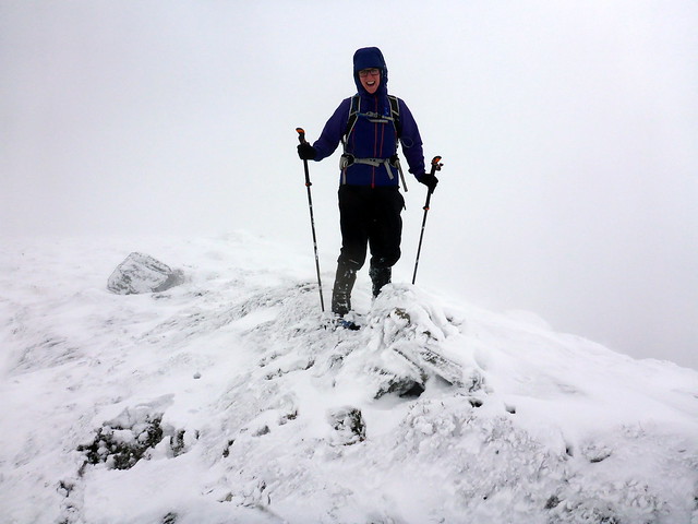
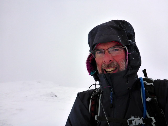
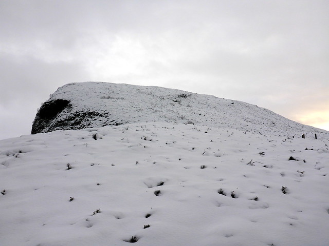
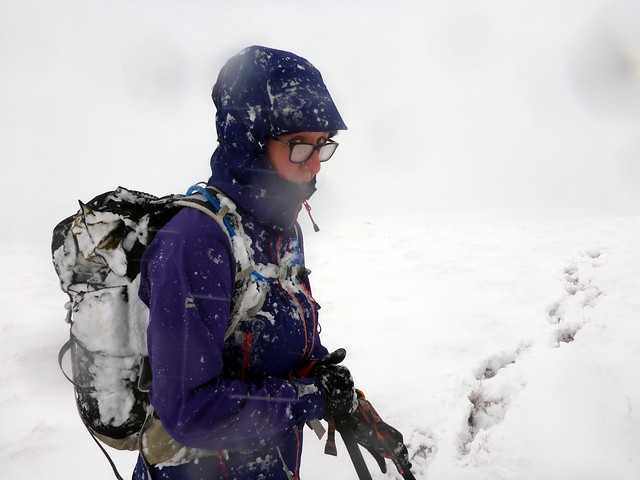
Oh well. We ploughed on through what seemed like miles of this stuff, without being able to see where we were going, endless whiteness ahead. Sometimes a glimpse of blue sky, then back to clag with patterings of snow. As I got near the top I had another surprise - I fell into a deep bog beautifully hidden under a snowdrift. Freezing black water up to my waist - fortunately the combination of my Paramo Cascade trousers, gaiters and winter boots kept me virtually dry - it would have been quite another matter wearing ordinary winter trousers given the wind chill. I proceeded to the summit a little cautiously, managing to avoid any further drookings. Was reasonably good weather on the way back as we trod in our own footprints.
 P1180204
 by
Al, on Flickr
 P1180207
 by
Al, on Flickr
 P1180208
 by
Al, on Flickr
 P1180209
 by
Al, on Flickr
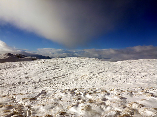
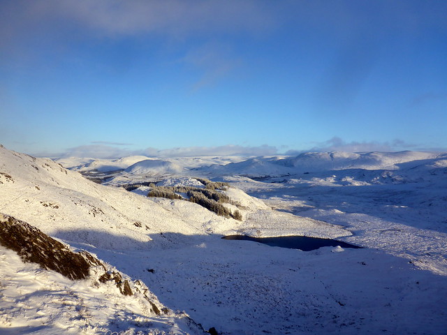
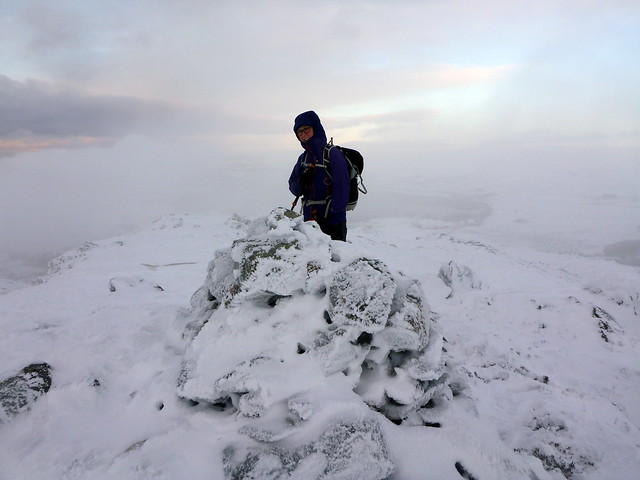
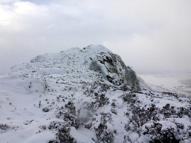
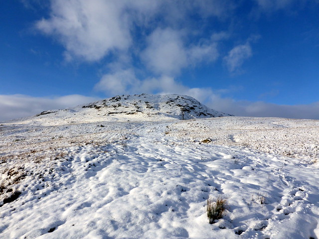
A glimpse of the summit
 P1180211
 by
Al, on Flickr
Deep dark bog

 P1180212
 by
Al, on Flickr
 P1180215
 by
Al, on Flickr
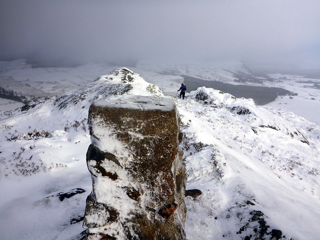
Hard work this!
 P1180216
 by
Al, on Flickr
 P1180219
 by
Al, on Flickr
Easier on the way down
 P1180220
 by
Al, on Flickr
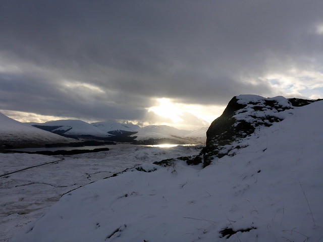
Towards Ft Augustus
 P1180221
 by
Al, on Flickr
 P1180224
 by
Al, on Flickr
 P1180225
 by
Al, on Flickr
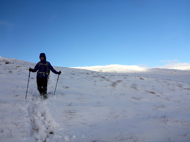
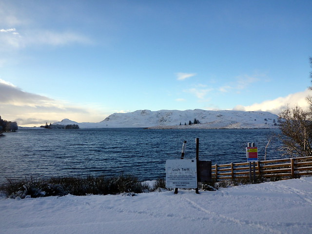
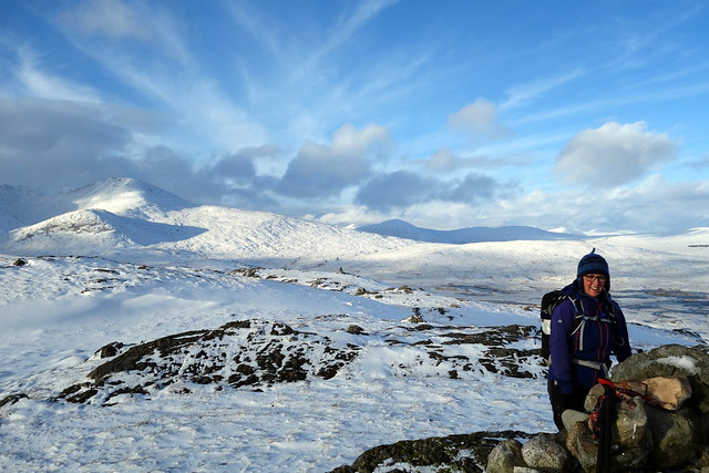
Back at the car I reckoned it was too early to go back to the tent so we puttered around to the nearest of the hills on the east side of the loch, Beinn a'Bhacaidh. My route went from a wee road to the north of the hill, which I was not keen on taking, even with the glimmerings of a thaw. We drove by Loch Tarff and could see the hill quite close - having a quick look at the map I decided we should just go up from here. It was only just gone 2pm, so plenty time to cover the 4-5km return trip. We set off on a track leading to Carn an t-Suidhe before striking off over more snowy tussocks for the southern flanks of our hill. Steep and rocky in places, lots of deep snow in hollows and some flase summits before the craggy summit was reached. Mist prevented what would have been fine views down to Loch Ness - the western side of the hill falls steeply down to the waterside. Again returned over our outward tracks, getting back to the campsite for a hot shower not long after 4. There are 2 glamping geodesic pods on the site with log burners - have to admit the sight of those glowing red and warm was a little tempting.
Parking beside the loch
 P1180226
 by
Al, on Flickr
 P1180227
 by
Al, on Flickr
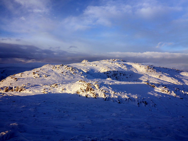
Bhacaidh
 P1180230
 by
Al, on Flickr
 P1180232
 by
Al, on Flickr
Summit
 P1180233
 by
Al, on Flickr
 P1180234
 by
Al, on Flickr
 P1180236
 by
Al, on Flickr
 P1180237
 by
Al, on Flickr
Loch Tarff
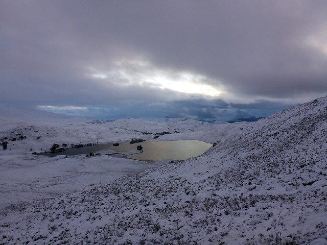 P1180239
 by
Al, on Flickr
 P1180241
 by
Al, on Flickr
My intended route for today
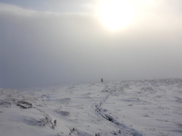
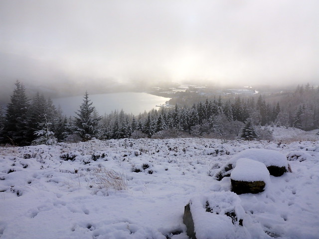
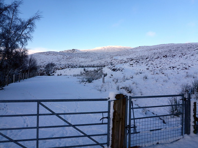
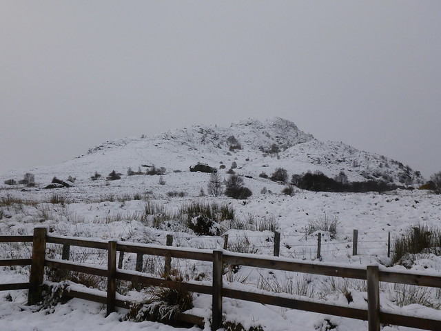
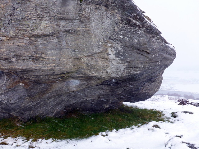
More snow overnight and a blizzard in the morning whilst we were waiting to set out - I had decided to leave after 9 in the hope that other drivers (or maybe a snow plough) would have gone along the road first. I'd decided to drive along to Tullich which is about 25 miles from Fort Augustus along the B851. This was a questionable decision - although other cars were on the road it rises up to over 300m in places and was white for a lot of the way. There was also the likelihood of more snow during the day and of getting stuck. Hmmm. We got to the RSPB centre at Tullich, Stac Gorm our first objective sits little more than 1km from the car park. My route took us to the RSPB hide then through trees and up a steep heathery slope - there is - as we discovered on the way back - a perfectly good path of sorts that leads up fro the car park and would have given us a more comfortable ascent. Ah well. Anyway it was hard going at first til we reached the rocky spine of the hill. Grand views from the stone trig point, a fine little hill this one. We spotted the path under the snow and followed this back to the car park, past a huge erratic boulder with a patch of green grass beneath it where the wind was shielded. Back at the car sat and had lunch indoors - wimps!
Morning blizzard, from the safety of the tent
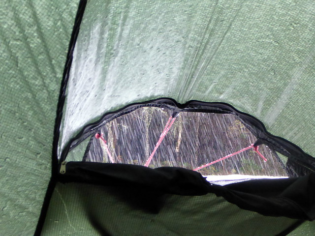 P1180244
 by
Al, on Flickr
Campsite
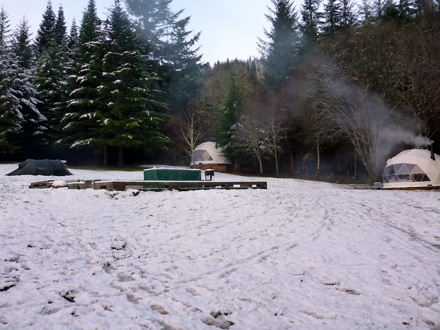 P1180245
 by
Al, on Flickr
Stac Gorm, from the car park
 P1180246
 by
Al, on Flickr
 P1180248
 by
Al, on Flickr
 P1180250
 by
Al, on Flickr
 P1180253
 by
Al, on Flickr
 P1180254
 by
Al, on Flickr
 P1180256
 by
Al, on Flickr
 P1180257
 by
Al, on Flickr
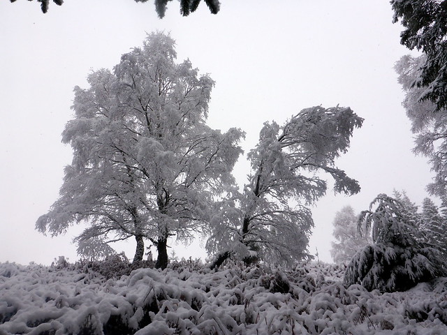
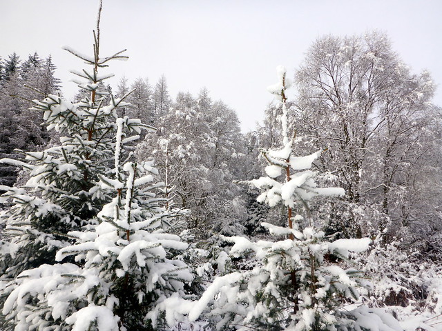
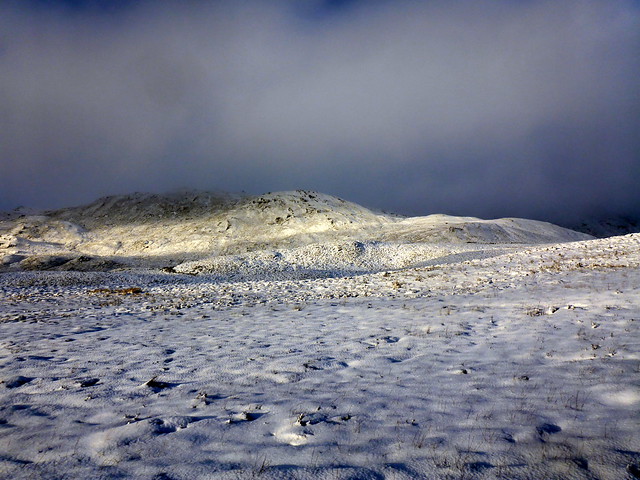
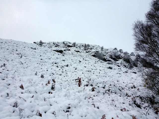
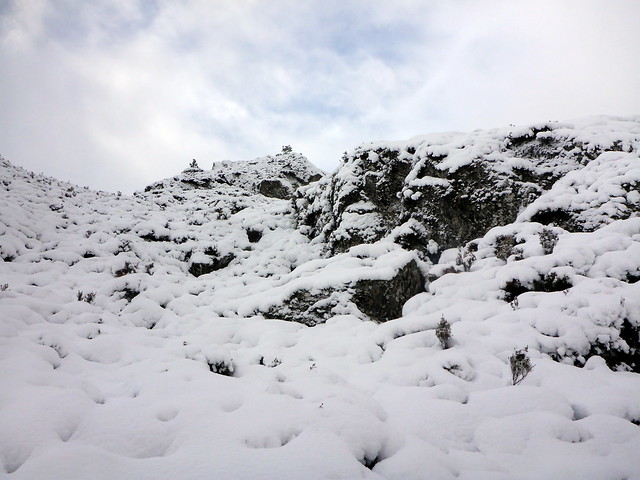
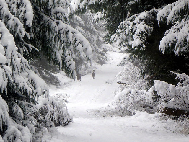
Next was Stac na Cathaig which is located just a couple of km from Stac Gorm -although was not visible on account of low lying cloud. We just walked from the carpark to the start of a forestry track that runs alongside the Allt Baille Mhuilin. This leads into the trees and i'd routed us up a firebreak on the map that would hopefully lead to the open hillside. Trees had a magical wintry appearance - we halted when we saw a couple of deer up through the white arch of a fallen tree on the path ahead - there's something almost storybook about seeing wild creatures amid such scenery, hushed and secret. The firebreak on the map turned out - for once- to be a firebreak in reality and we made good progress to the end of the treeline. The good news was that all bar 30m of ascent had been achieved already, walking through the forest - the not so good news was that we had no sight of our hill - just half a kilometre of wandering over featureless snowy tussocks under a leaden sky. Managing to avoid hidden bog this time, we made it to a cairn...i was about to turn and go back when I checked the GPS - nope, not the summit - there was another slightly higher cairn a hundred metres away (somewhere in the clag). After managing to scale it we returned along the road to the car.
 P1180259
 by
Al, on Flickr
 P1180260
 by
Al, on Flickr
 P1180261
 by
Al, on Flickr
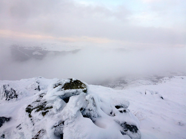
err - where's the hill?
 P1180262
 by
Al, on Flickr
 P1180265
 by
Al, on Flickr
 P1180264
 by
Al, on Flickr
Managed to see the hill on the way back
 P1180267
 by
Al, on Flickr
 P1180270
 by
Al, on Flickr
Our original plan had been to climb the two hills - Creag nan Clag and Tom Bailgeann - over to the west of Stac Gorm. Time was slipping by and the sky looked as if it was holding a lot more snow - probably time for one just. To get there from where we were parked involved either going back round on the B roads (around 10 miles) or risking a very minor road (dotted yellow on the OS map) that went directly there. A little thaw seemed to have set in - the snow was wetter on the road than before - so I decided to risk the minor option. I'm not a very confident driver on snow and was somewhat ratty by the time we got towards Creag nan Clag. Also, finding a place to park on snowcovered minor roads isn't that easy - not knowing if the snow hides a ditch or swamp...anyway we found a spot to park beside a cattle grid just below the bulging crags of Creag nan Clag and set off up the hillside. Initially the weather was benign, but as we got towards the summit plateau a vicious wind whipped up, clag came down and a blizzard began. I cursed having left my goggles in the car and pressed on to an uncertain summit - we walked over the summit "dot" on the map without evidence of cairn - either buried under the snow or Alan Dawson's been up and removed the cairn. Either way, we set about getting down again as quick as possible although the snow did abate. My 100th Sub

Creag nan Clag
 P1180271
 by
Al, on Flickr
Tom Bailgeann, across the way
 P1180272
 by
Al, on Flickr
 P1180273
 by
Al, on Flickr
More snow on the way
 P1180275
 by
Al, on Flickr
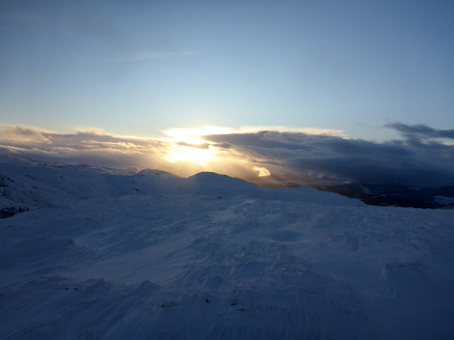
Probably at the summit
 P1180277
 by
Al, on Flickr
 P1180279
 by
Al, on Flickr
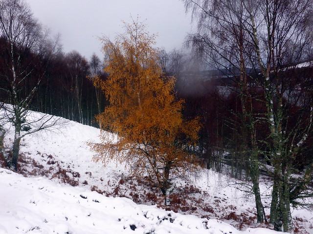
Splash of colour
 P1180280
 by
Al, on Flickr
 P1180281
 by
Al, on Flickr
By this time it was 3.30 and too late to start up the companion hill across the road - which looked as if it had a track going up to the mast on top, although covered with a fair quantity of snow. Rather than risk driving the way we'd come, we agreed to drive back via Inverness, which added maybe 20 miles to the journey but meant coming back via the A82 rather than dodgy B roads. Strangely, when we reached Dores there was no snow at road level at all and this continued all the way into Inverness. The drive back was unpleasant, lashed with rain in the dark, but at least the road was clear of snow.
Back at the campsite the owners came over to check how we were doing - ie that we hadn't frozen to death yet - and said that one of the couples in the geodesic, log-burner heated dome had complained they were too cold! Poor things - our sympathy didn't amount to much
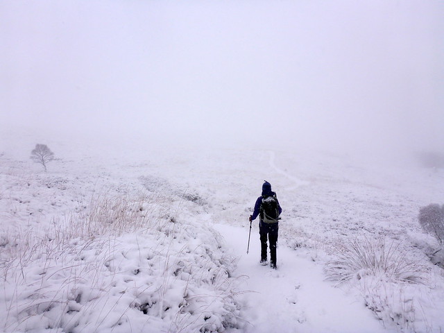
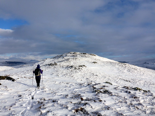
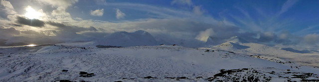
I was at a bit of a loss what to do on the Sunday. The parking lot of the campsite was like a skating rink as we prepared to leave and I decided there was no way I was going back along the east side of Loch Ness in those road conditions. I had considered heading to Kintail and climbing the Top of A'Chralaig, which we'd tried last month and been beaten back by wind. However, the sheer amount of snow on the hillsides was a disincentive and I really didn't fancy another drive home in the dark. Instead I thought we could do the two Marilyns that straddle the A82 on Rannoach Moor - I'd done them before but Allison hadn't. Nice wee hills that can be climbed in an hour or less.
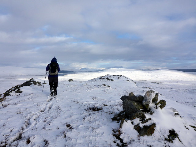
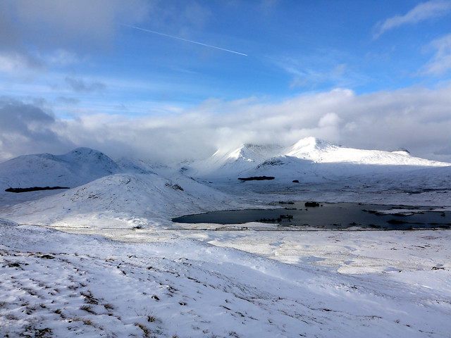
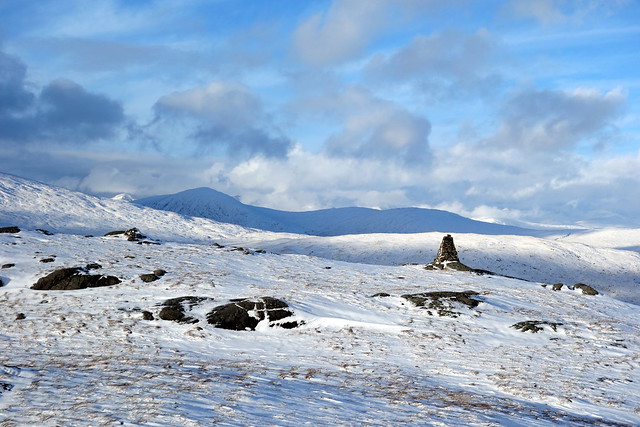
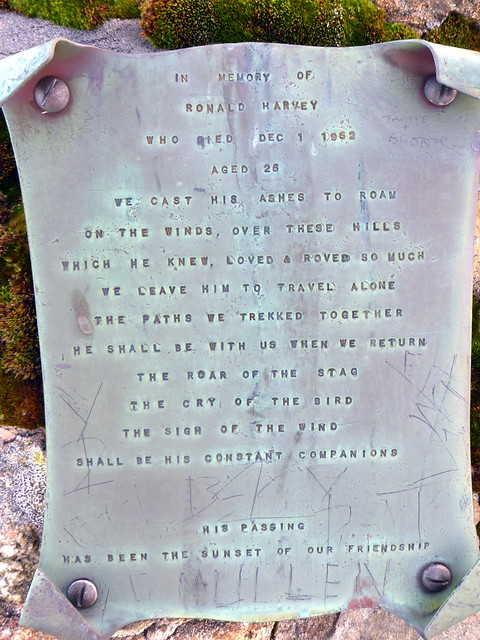
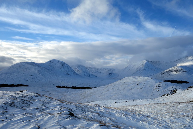
There was still a lot of snow on the way down the road, the hills in Glencoe not so plastered as higher up, but rannaoch Moor was pretty white. We decided on Glas Bheinn first and parked in the nearby layby. A bit of a boggy field to cross then up onto the back of a nice humpy hill. Good views to the Achallader Munros and to Creise/ Meall a'Bhuiridh, some blue sky to offset the snow. Lunched at the summit then returned to the car and drove the few hundred yards to the bottom of Meall Mor, where there's a track going up to a telecoms mast. A pleasant wee daunder up the snow clad slopes to the summit cairn with expansive views to the Black Mount. On impulse we walked over to the nicely constructed memorial cairn to Ronald Harvey, a climber who died age 26 in winter 1962 complete with touching inscription. We meandered down to the car and were back in Glasgow before dark.
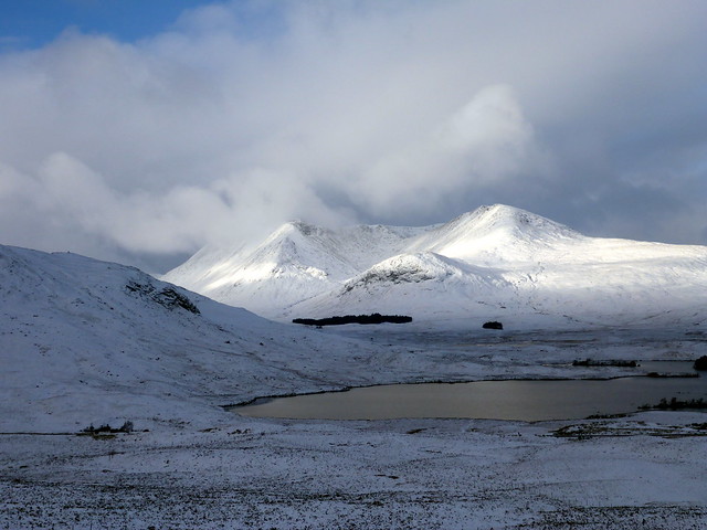
Creise/Meall a'Bhuiridh
 P1180284
 by
Al, on Flickr
Approaching summit Glas Bheinn
 P1180288
 by
Al, on Flickr
 P1180289
 by
Al, on Flickr
 P1180290
 by
Al, on Flickr
 P1180292
 by
Al, on Flickr
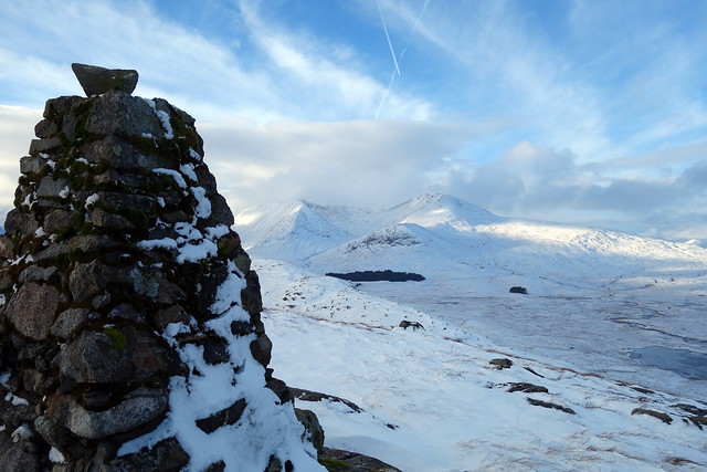
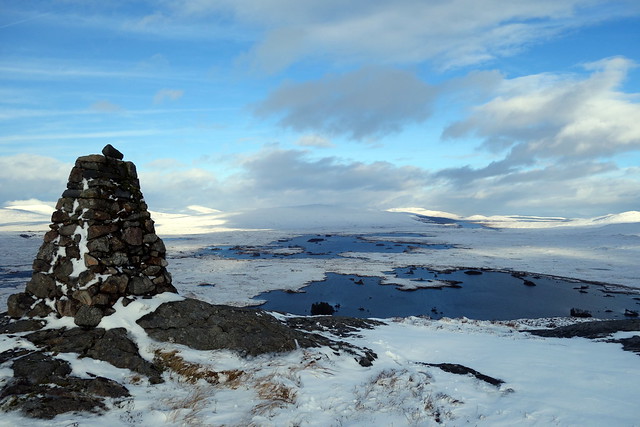
Meall Mor
 P1180293
 by
Al, on Flickr
 P1180296
 by
Al, on Flickr
 DSC00083
 by
Al, on Flickr
 P1180300
 by
Al, on Flickr
 DSC00085
 by
Al, on Flickr
 P1180301
 by
Al, on Flickr
 DSC00086
 by
Al, on Flickr
 DSC00088
 by
Al, on Flickr
 DSC00090
 by
Al, on Flickr
