free to be able to rate and comment on reports (as well as access 1:25000 mapping).
Map: OS 1:50,000 no. 79.
Attendees: Me, Big Dog, Small Dog.
Time taken: 4hr 30 mins.
I’ve been tardy with this report. Tardy to the point that I thought twice about posting it. Then again, I’d almost finished a draft at the time and when I look back I see that there have been no recent write-ups for these hills. Additionally, only a handful of site users appear to have climbed them since. I figured there might be some merit in persevering.
To business. Why these less frequented hills?
For me there were 3 reasons. First, they sit closely enough together either side of the A7 south of Hawick to make a logical choice as a day’s outing.
Second, I’m fond of Eskdale. In fact, I’m fond of this part of the country as a whole. It’s rough, rugged, remote terrain where steep-sided hills and glens compress in on themselves like the pages of as child’s pop-up book. It’s perfectly feasible you won’t meet another soul all day.
The third reason was a bit unusual – this poem.
ON ELLSON FELL
The Solway wind
Cavorting in throwe the Ewes Doors
Coosts white clouds afore it:
An the sun etches
Its ain picturs o licht and shadow
On the braid face o Tudhope.
Aneth my feet
The heather lifts its brash tang
An the cotton grass nods in quiet converse
Wi the scarlet cloudberries
Clustering in shy conclave
In the soggy turf.
Line upon line
Stand the distant heichts, traced oot
In purple and blue and grey.
The far streak o siller in the sand:
An nerr at hand only the sheeps’ cry
An the burn’s soft bicker.
Alang the turnpike road
The restless traffic scuttles bye Mosspaul,
Nor whence ken I, nor whither
But doun in Penangus Hope
A clocks hae stoppit an the world is still,
Still in the quiet o the hills.
William LandlesI’d stumbled across it whilst flicking through Hamish Brown’s anthology ‘Poems of the Scottish Hills’. I was particularly taken with the last 2 lines.
As it transpired, I did get a sense of the stillness Landles describes. But it wasn’t a day of complete quiet.
Ellson FellDistance: 5k. Ascent: 351m. Time: 1hr 30m.
Initial plans had been to tackle all three hills in a loop route from the Mosspaul Inn. I remember reading somewhere that the Mosspaul dates back to the 17th century. It was once frequented by Wordsworth and Walter Scott. Nowadays it’s only available for private let. Marketing blurb describes it as an ‘…excellent party house’. I can’t help but think it - the great names of literature to the dulled end of contemporary culture in less than 300 years.
Anyway, for reasons unconnected to partying, I decided to drop the loop idea in favour of two separate walks. I found my way to the unclassified road running between the A7 at Findleton and the B6399 at Hermitage. My start point for Ellson Fell was a grassy turning circle (GR 398967), just east of Glenrief cottage. There’s space for two or three cars here, with other rough parking nearby.
The drive south had been pleasant enough but a bank of grey cloud was scudding in from the north as I set off.
Passing through a gate opposite, I followed a path steeply up the southwest slopes of Castlewink. Soft at the start, the ground soon became firm and height was quickly gained. There were decent views south over the Carewoodrig Burn to Wether Law, and west to Pikethaw Hill, which looked beefier than its modest height suggested.
Start/finish for Ellson Fell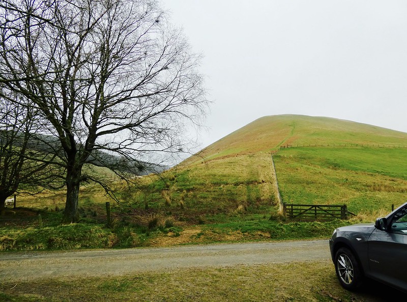 fullsizeoutput_3587
 by
NDM, on Flickr
Views south and west from ascent of Ellson Fell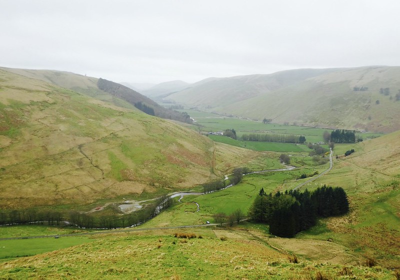 fullsizeoutput_3588
 by
NDM, on Flickr
The gradient eased after ¾ km, with the path folding seamlessly into an ATV track. This continued northeast along the narrowing ridgeline to the cairn-marked south top at 494m. A raven flew off on our approach, its gurgling call catching in the wind.
By now the cloud had swallowed up much of the surrounding area. There were little of Landles’s ‘…distant heichts’ to be seen. Still, I enjoyed this part of the walk very much. The spine of the hill gives an airy feeling and makes for easy going.
Easier gradient on ascent of Ellson Fell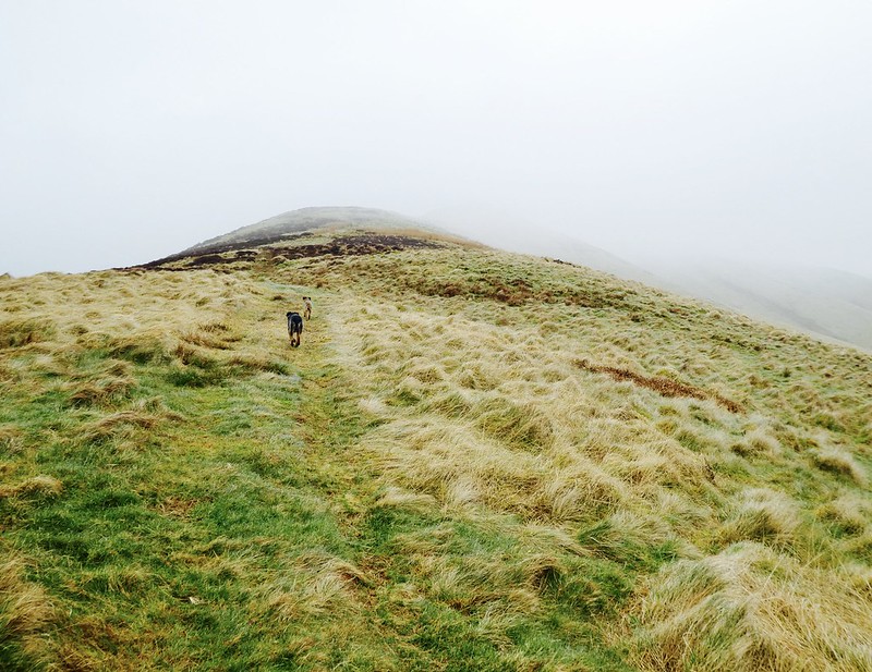 fullsizeoutput_3589
 by
NDM, on Flickr
Stone cairn at Ellson's 494m top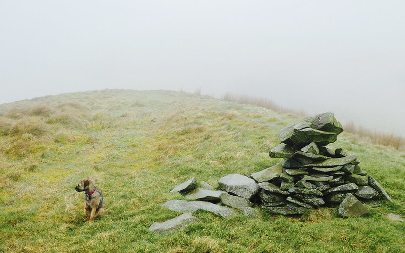 fullsizeoutput_358a
 by
NDM, on Flickr
Further on, the ridge widened again and the summit of Ellson Fell came in to view. The ATV track continued across a dip and split as the ground rose. The right fork veered off towards the eastern shoulder of the hill. I took the left fork, following the track uphill until it became apparent it too steered away eastwards from the highest ground.
I then swung northwest, crossing 200-300m of uneven ground to arrive at the summit. It’s a small dollop of short-cropped grass and moss. There’s no cairn. On a good day, I’d imagine the views to be extensive. Alas nothing today; the cloud remained stuckfast below.
Final section ascent of Ellson Fell 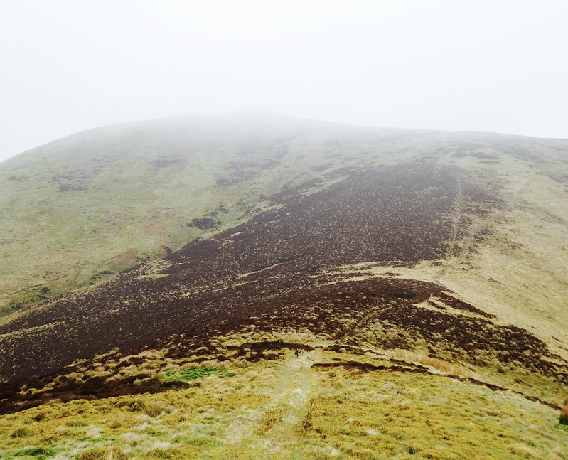 fullsizeoutput_358b
 by
NDM, on Flickr
Having double-checked my ‘phone for the 537m spot height, I returned the same way I came up. At one point, I snatched a glimpse of ‘…the braid face of Tudhope’ to the east.
View east from descent of Ellson Fell – Tudhope Hill to rear 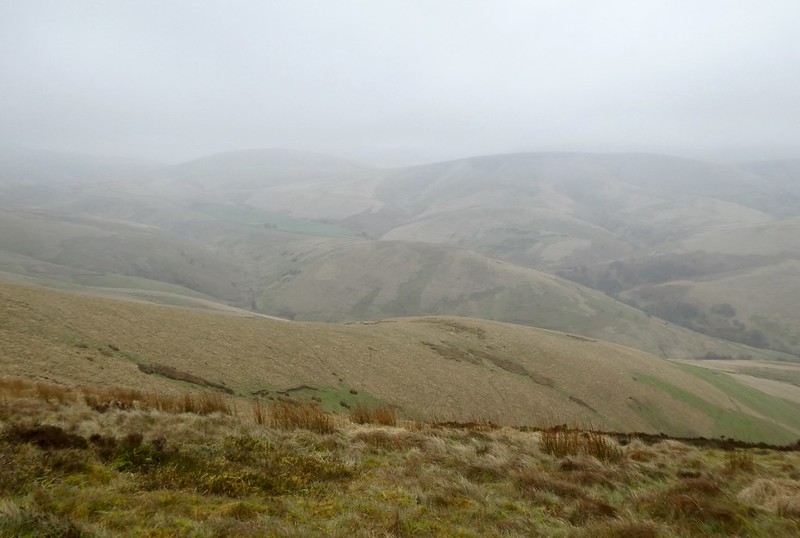 fullsizeoutput_365d
 by
NDM, on Flickr
Pikethaw Hill and Wisp Hill Distance: 8k. Ascent: 629m. Time: 3hr.
25 minutes later and I was questioning the wisdom of splitting the day into two parts. I’d intended to use a lay-by on the A7 for parking. At GR 392976, it was only 600m north of the access track to Eweslees Farm. Background reading suggested a straightforward roadside walk from one to the other.
It didn’t prove that simple. Bends in the road restricted visibility to traffic and grassy verges on both sides of the road were lumpy and overgrown. There were crash barriers that afforded some measure of safety, however progress alongside them was difficult. I found myself corralled by the one on the northbound side of the road after it abruptly turned at right angles into a rock. The one beside the southbound lane was heavily littered with broken glass. Not good for me of course but worse for the dogs - they were already flinching as a succession of HGVs thundered by.
In the end, I gave up and took a different tack. Travelling back down the A7, I nestled the car on to the southbound parapet of the concrete bridge (GR 388973) over the Eweslees Burn. The space there’s just big enough for one car. Not perfect, but being opposite the farm it removed the road walk hazard.
It was only when I was locking the car that I saw a notice on the parapet opposite. Politely worded, it referenced previous road accidents and requested motorists not to park ‘here’. Looking up and down the road, I could understand a visibility problem for vehicles emerging from Ewesless on to the A7. However, I couldn’t see the same difficulty on the southbound side of the road. I concluded that ‘here’ meant one side of the bridge only.
Parking and access track to Eweslees 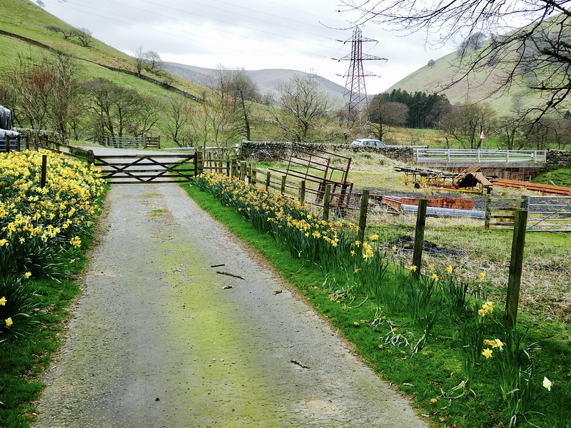 fullsizeoutput_358e
 by
NDM, on Flickr
Walking down the daffodil lined track to Eweslees, I began to have second thoughts. A newspaper headline floated before me: Hillwalker Causes Road Chaos. Aghast I read on: An Edinburgh man flagrantly ignored a safety sign not to park on A7 bridge. The result was inevitable. Police reported multiple accidents and gridlock across the Scottish Borders….
Once caught, catastrophic thinking’s hard to shake. The obvious person to check with was the farmer at Eweslees. I knocked the door. No-one answered.
It’d be fair to say the occupant/s at Eweslees are…well...collectors. There were numerous old cars, fuel containers, portacabins and rusting pieces of farm machinery scattered around. I walked through to the rear of the farm, passing through three gates. The first had a guard dog warning sign attached to it. Instinctively, I gripped the dogs leads more tightly. I needn’t have. An old Border Collie glanced at us disinterestedly from an outbuilding.
Nearing the second gate, something happened that I had never experienced before. And doubt I will again. The dogs and I were rushed by turkeys. Two of them to be specific. I suppose that sounds bizarre. It was bizarre. Large birds, they appeared from behind a wall, all feathers, bustle and attitude. It occurred to me afterwards that perhaps they lie in wait for unwary walkers. Their routine seemed well-practiced. Darting towards us, gobble volume high, they split at the last second so that one went left, the other right. The dogs looked on curiously – not flustered, heads tilted to one side. I pushed through the final two gates before the turkeys could complete a pincer movement.
The 'Guard Turkeys'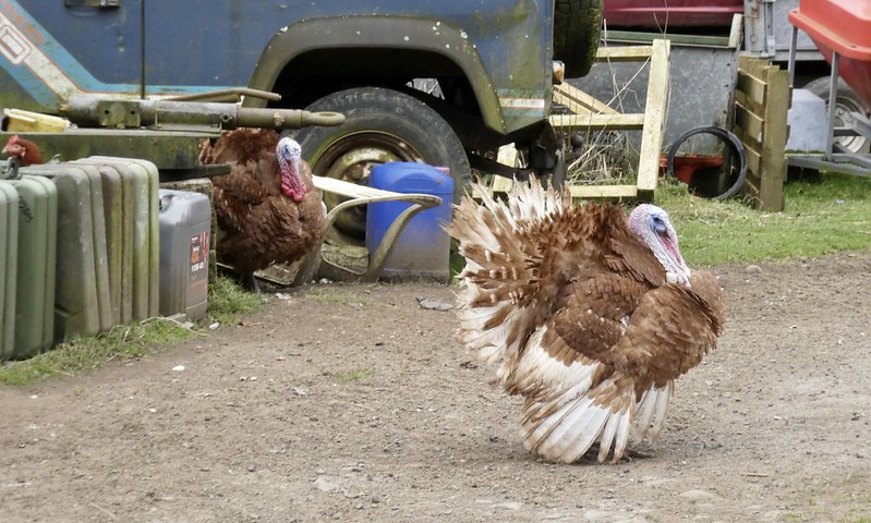 fullsizeoutput_358f
 by
NDM, on Flickr
Out of the farmyard, I followed a track which dropped left and across a wooden footbridge over the burn. A squadron of ducks was landing on an adjacent pond.
I hadn’t had a set plan from this point onwards. One option would have been to follow the west bank of the Ewesless Burn all the way to the col at Ewes Doors. From there, Pikethaw and Wisp Hill could have been tackled as two out and back routes. But the cloud had lifted by now and a fine circular walk presented itself.
A couple of hundred metres along the fading track, I set off westwards up the slopes of Frodaw Height. The angle of ascent went from gentle to acute and back to gentle again. The ground was firm and short-grassed. Progress was more rapid than I’d anticipated and the views much improved. I could see over to the ridge walk I’d just completed on Ellson Fell.
Nearing the flattish top of Frodaw Height, the ground became wetter and tussocky. The summit of Pikethaw Hill was visible to the northwest.
From Frodaw Height back towards Eweslees and Ellson Fell 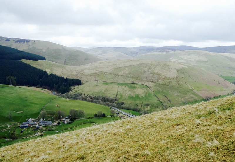 fullsizeoutput_3590
 by
NDM, on Flickr
Frodaw Height looking towards Pikethaw Hill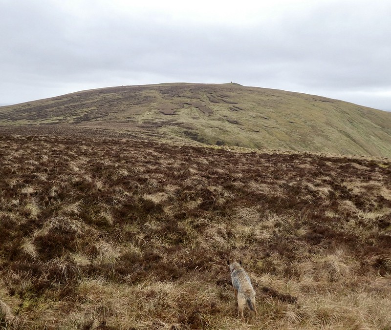 fullsizeoutput_3591
 by
NDM, on Flickr
I took a more-or-less diagonal line in the above picture towards Pikethaw. The tussocks weren’t the worst I’ve encountered. Nor were they the easiest. I decided to ascend further west and found better ground alongside a fence line. As it turned out, this fence headed to the summit.
On route, I heard a distinctive roar. Seconds later a jet fighter hurtled passed me. It was tilted at a 45-degree angle to the horizon, following a southbound course parallel to the A7. Military green, it was so close I could see the top of the pilot’s head. I fumbled for my camera but the moment was gone. I stopped for a few minutes, wondering if another might come along. None did.
The summit of Pikethaw came as a surprise. The Walk Highlands thumbnail description is accurate but I’d missed that beforehand. Instead, I’d read wjshaw’s stravaiging report of these hills from 2013. A picture there shows a jumbled stone cairn of moderate height. Several other stones are lying on the ground. What I found was much more substantial, the cairn clearly having been rebuilt in the intervening period.
Summit cairn at Pikethaw Hill. Wisp Hill in background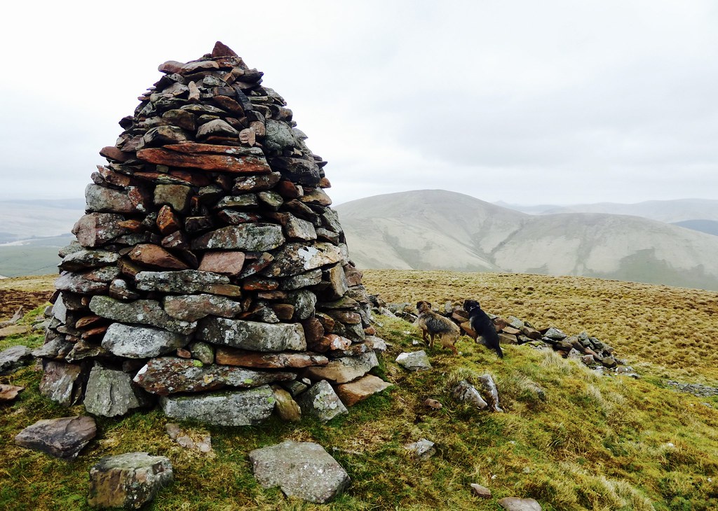 fullsizeoutput_3592
 by
NDM, on Flickr
Wisp Hill from Pikethaw Hill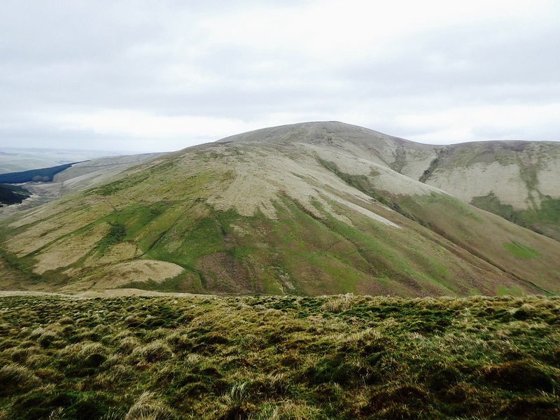 fullsizeoutput_37a1
 by
NDM, on Flickr
The views were good, particularly towards Wisp Hill. I noticed that the fence line ran directly there, a useful aid in poor visibility.
A blustery wind chased me off the summit after a few minutes. I dropped north down the right-hand side of the fence to arrive at Ewes Doors. Here there was a small gate of no apparent purpose. Off to the left, a rusting shed of little apparent use. History tells of a simmering clan feud between the Elliots and Scotts that erupted here in 1566. It was an apparently bloody encounter, with many Scotts slain. It must have been a lonely place to die.
Ewes Doors and the gate to nowhere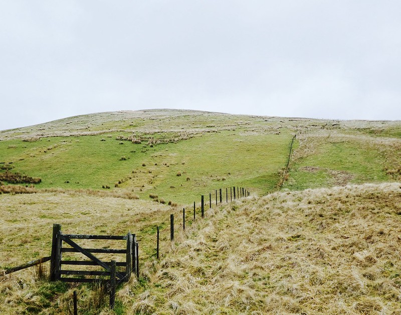 fullsizeoutput_3593
 by
NDM, on Flickr
I pressed on northeast, climbing Ewenshope Fell before arriving at the trig point on Wisp Hill. From a distance, this had looked like a steep ascent however it proved straightforward enough. Pikethaw presented as impressive from this angle, with deep gulleys cut into its eastern flanks. To the north was Comb Hill and Langhope Height, the former with a conspicuous radio mast.
Wisp Hill trig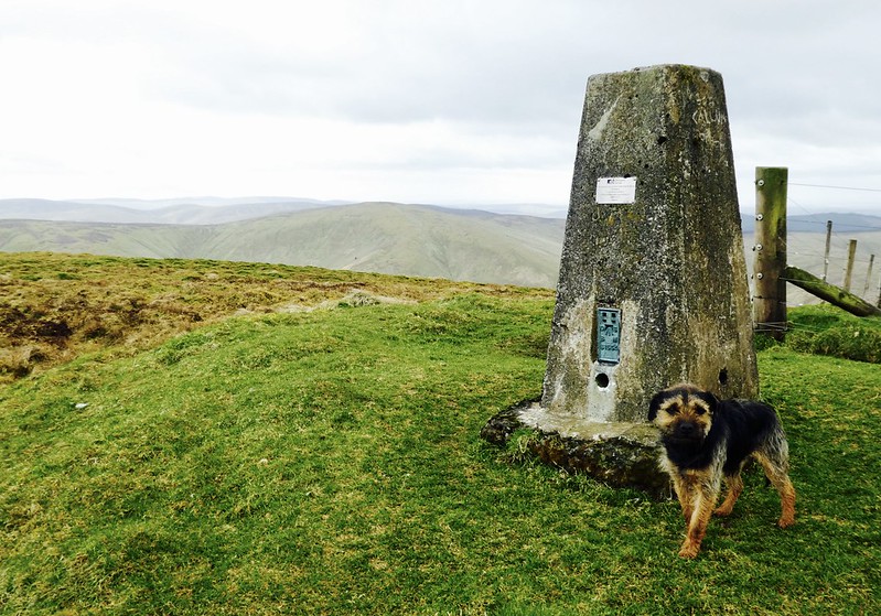 fullsizeoutput_3595
 by
NDM, on Flickr
Pikethaw Hill from Wisp Hill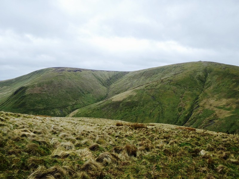 fullsizeoutput_37a3
 by
NDM, on Flickr
Return route over Whin Fell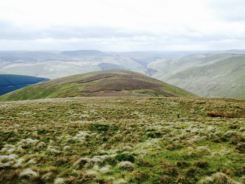 fullsizeoutput_3596
 by
NDM, on Flickr
I left the fence line and turned south towards Whin Fell. I had thought about contouring round its 517m top but decided to just go over it instead. The ground was rough but firm. I could see the farm at Eweslees again and dropped south-southwest to reach fields to its rear. There were no dramas –turkeys or otherwise- as I returned through the farmyard.
All in all, a good day out on the hills. Not one without incident but none the worse for that.
Finishing this report some time later, I have two thoughts -
Would I have done anything differently? Perhaps. Faffing about for separate parking for Pikethaw and Wisp hills cost me half an hour. A loop route leaving the car near Mosspaul, Glenrief, or elsewhere, would have been do-able. On the other hand, it would certainly have added more than half an hour to total walking time.
Would I go back to these hills? Yes, I would. I’d particularly like to climb Ellson Fell again. On a cloudless summer day maybe. I saw virtually nothing from it on this occasion. I’d very much like to see it through the eyes of the poet whose work took me there.
