free to be able to rate and comment on reports (as well as access 1:25000 mapping).
Oh the Easter Long Weekend. This has often been a great adventure for us - past trips include our first multi-day back pack around the Loch Ossian Munros and a similar jaunt around the Achnashellach hills. An anxious eye was kept on the weather forecast, which didn't seem to be sharing our enthusiasm for sunshine and clear skies...more bleedin' snew forecast

Trying to make the best of it I thought we might spend a couple of days in Strathfarrar then migrate north either to Torridon or Ullapool.
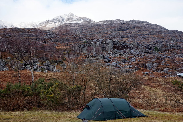
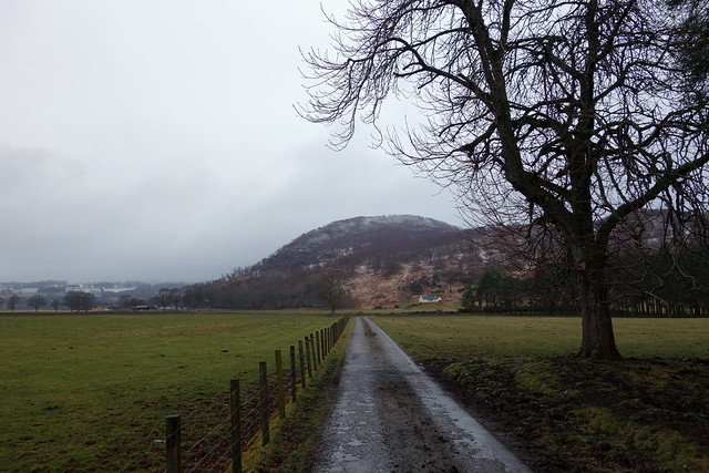
Drove up to Cannich on Thursday night and pitched in our usual spot amongst the trees. Noticed scattered cow pats, which we assumed had come from a wayward cow and thought no more about it. Settled down to a quiet night in the knowledge that we could start quite late the next day: the Gate wouldn't open til 9 am. This would be the first time we'd encountered the Gate Keeper - on previous trips to Strathfarrar we'd either walked in or gone during the winter months and opened the gate ourselves.
During the night there was a definite sound of cow passing close by the tent...
Friday morning was overcast but dry. We drove the few miles from the campsite to Struy and parked up waiting for 9am and the Gate to open...at precisely 9am the Gate Lady emerged and put up the Glen Open sign. We chatted briefly and were warned to be back before 6pm. In fantasy, I would have preferred a Monty Python & the Holy Grail approach of being asked to answer Three Questions before being let in..."What is your name? What is your Quest? What is the number of Sims in the Strathfarrar region?

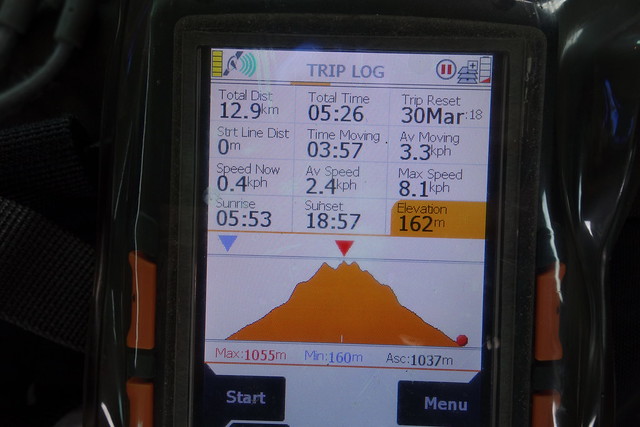
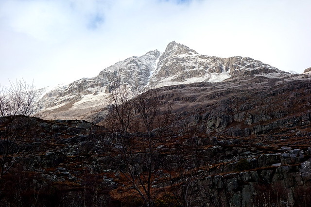
Anyway, we drove off up lovely Strathfarrar. I reckoned that 9 hours was not long enough to do the 4 Munros and drive to and from the gate - I dislike feeling under time pressure when I'm out walking, so had devised a route that took in a Sim on the way up to Sgurr na Ruaidhe and another on the descent from Sgurr a'Choire Ghlais, leaving us with various options for the most western Munro of Sgurr Fhuar-thuill the following day.
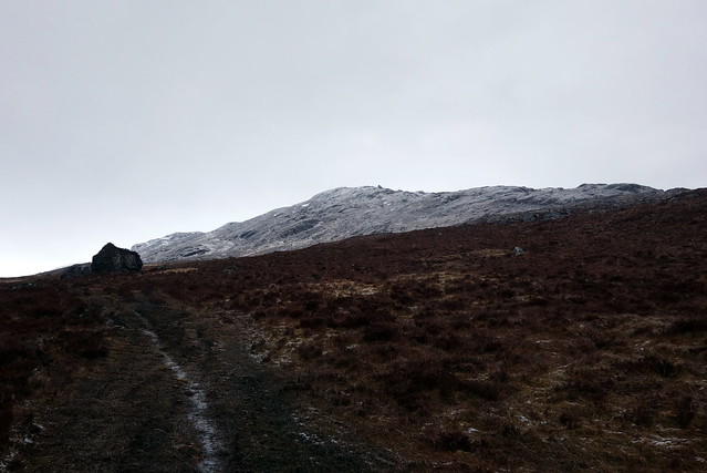
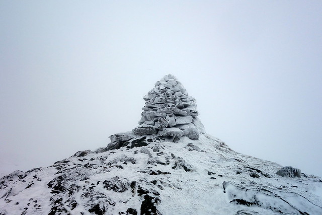
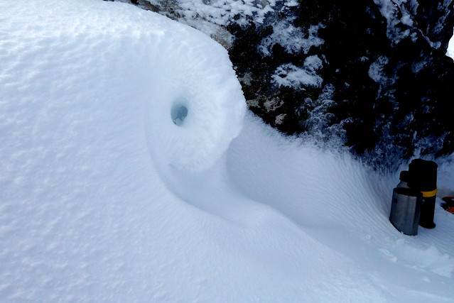
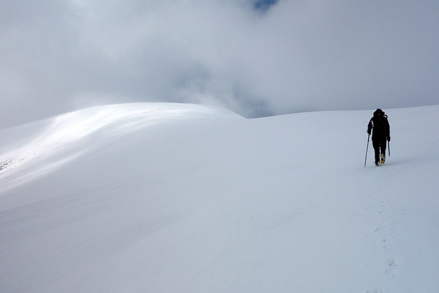
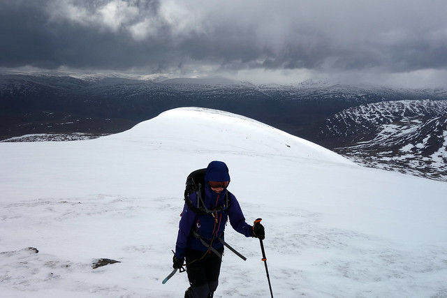
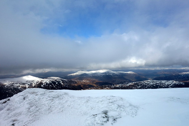
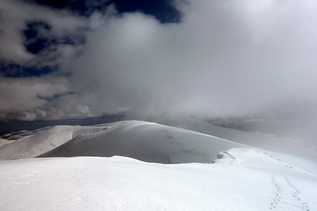
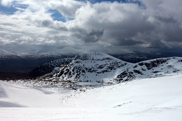
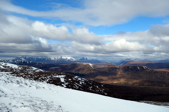
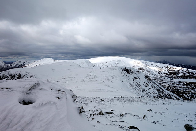
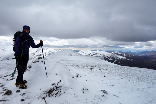
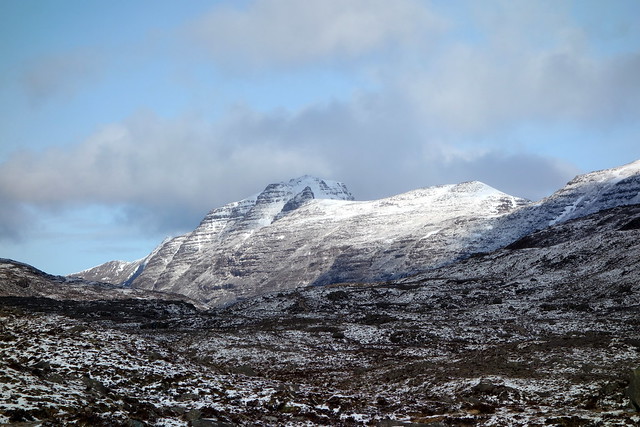
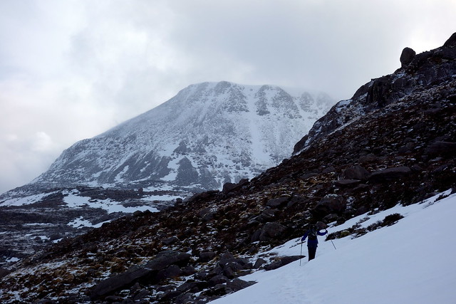
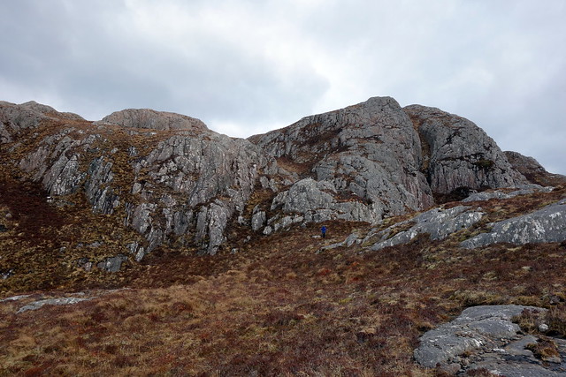
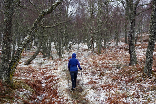
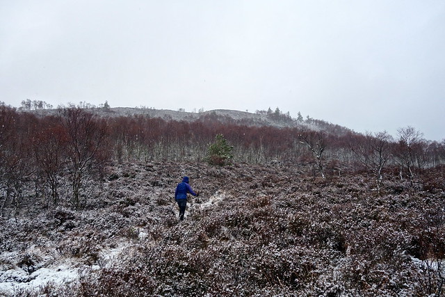
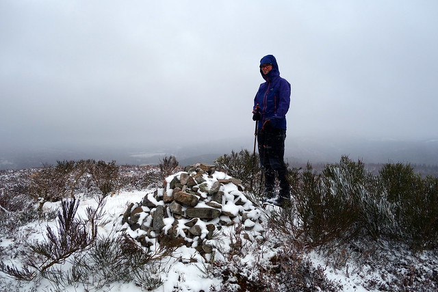
We parked in the usual place just past Deanie Power Station and set off up the track following the Allt Coire Mhuillaidh, past the Intake and on over increasingly boggy terrain. We cut up to our right towards the outline of Garbh Charn, the top of which was hidden in mist. Clag was sitting on the snowy tops of the Munros, blue sky tantalizingly above. A fine stone built cairn awaited us at the top of the Sim, sitting in a sea of white. We continued on down hill searching for the beginning of Sgurr na Ruaidhe. Soaring up, white with dark pock marks of rock we saw it - decided what line to take and headed through the clag for the summit. We paused for lunch beside a curious snow-feature. I was a bit concerned at the time - it was 12.30 and we still had a fair way to go (time pressure for The Gate).
 DSC01071
 by
Al, on Flickr
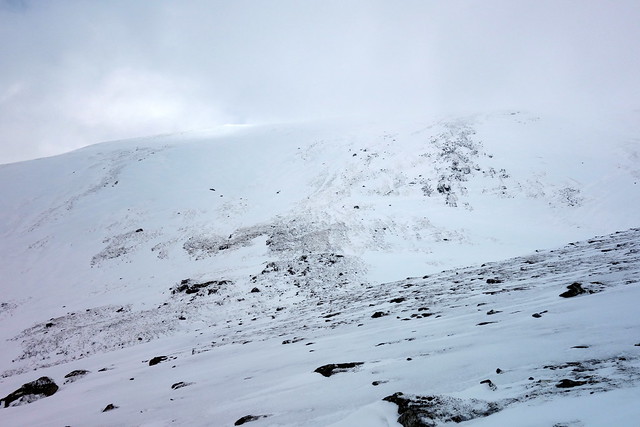
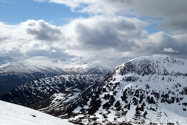
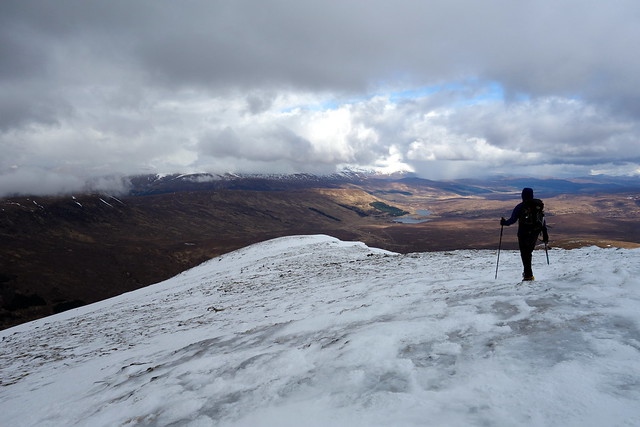
The shoulder down from Sgurr a'Choire Ghlais
 DSC01073
 by
Al, on Flickr
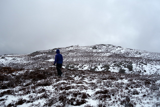
Hard going up Garbh Charn
 DSC01074
 by
Al, on Flickr
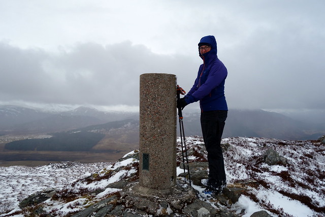
Summit Garbh Charn
 DSC01075
 by
Al, on Flickr
Sgurr na Ruaidhe
 DSC01077
 by
Al, on Flickr
 DSC01078
 by
Al, on Flickr
Snow/wind sculpture
 DSC01079
 by
Al, on Flickr
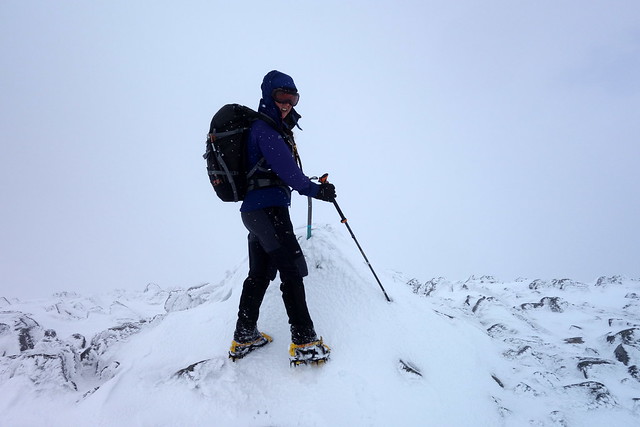
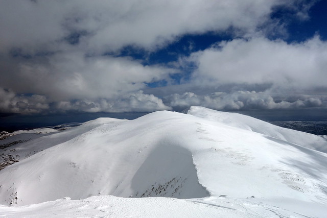
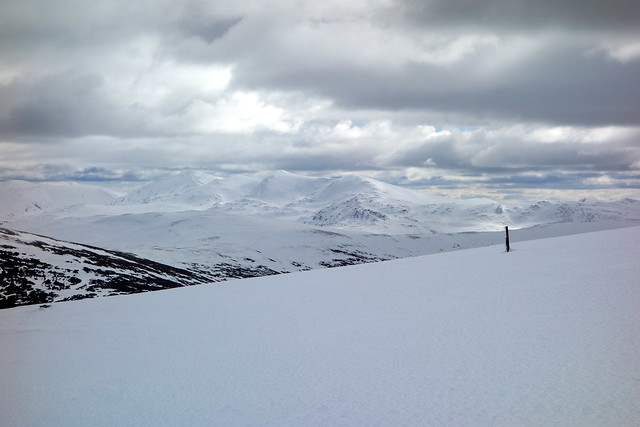
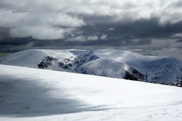
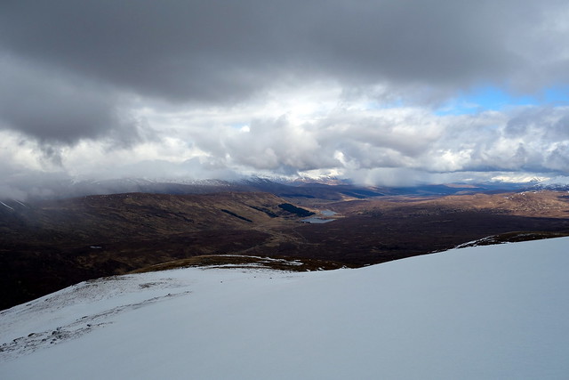
A descent to Bealach nam Botaichean followed then a steady climb up to Carn nan Gobhar which was easily reached and my time anxiety lessened. The top was very white and we descended into clag - the next section of the walk to Sgurr a'Choire Ghlais done mostly in whiteout conditions with frequent reference to the GPS. The final steep section to the summit was mildly alarming, though frozen footprints of previous ascenders helped where they were visible. We reached the half-buried trig point amidst flurries of new snow. Now the task was to head south, down the shoulder to the Sim of Meall a'Gheur-fheadain. The conditions cleared as we descended, then snow began again, winds blasting us with wet flakes as we slogged up the 90m or so to the summit. I'd originally planned to continue right down the ridge-line to An Carnais, but thought it looked somewhat craggy when we walked past on the way up - much easier to cut back down towards the Allt and rejoin our upwards track. Back at the car by just gone 4pm - no worries about the Gate

Carn Gobhar
 DSC01082
 by
Al, on Flickr
 DSC01084
 by
Al, on Flickr
 DSC01085
 by
Al, on Flickr
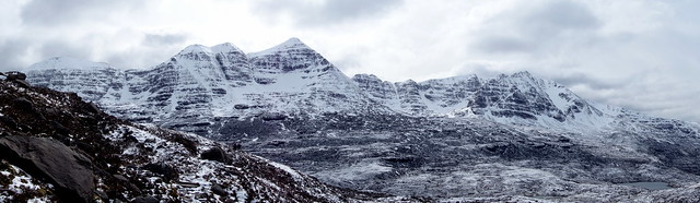
Sgurr a'Choire Ghlais
 DSC01086
 by
Al, on Flickr
Descent
 DSC01088
 by
Al, on Flickr
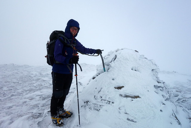
Hmmmphh - Sim Summit
 DSC01091
 by
Al, on Flickr
 DSC01092
 by
Al, on Flickr
 DSC01093
 by
Al, on Flickr
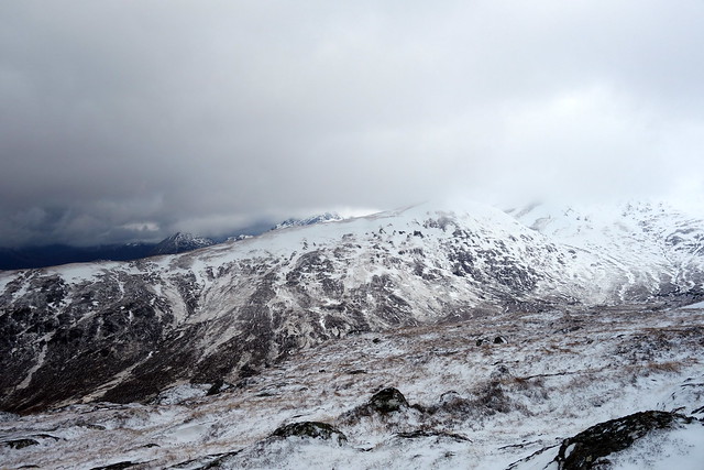
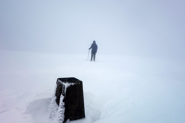
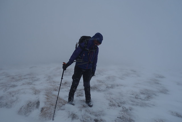
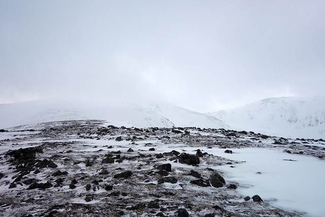
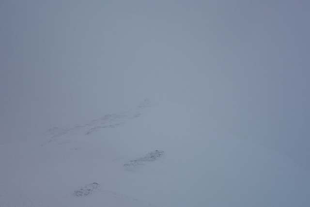
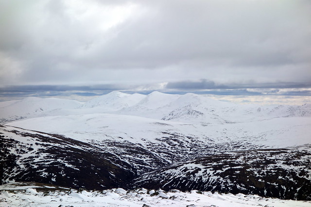
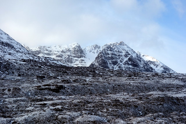
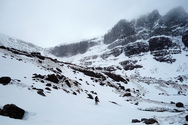
We spent another quiet night at Cannich til about midnight, when there was an almighty bellow and another bovine rush past the tent. This had Allison in something of a panic and didn't assist in returning to sleep. We had a re-run of the previous day in terms of getting to the Gate for 9am then driving right up the glen past Braulin Lodge. Lots of stags in boisterous groups along the way, some having lost their antlers already. Starting up the track past Beinn na Muice then the impressive Sim Sgurr na Muice appeared. One of the options for today would be to go over the Top of Sgurr na Fearstaig and descend off Sgurr na Muice. However it did look very craggy on the southern side, and the whole south ridge was heavily corniced, making a descent from Cadha Raineach "interesting" as in chopping through cornice and doing some vertical descending. Neither was I very happy about taking the standard way off Fhuar-thuill - I remembered that being a narrow and steep descent hugging the coire wall under Fearstaig which would be hazardous in today's conditions, particularly if there was whiteout as well.
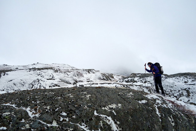
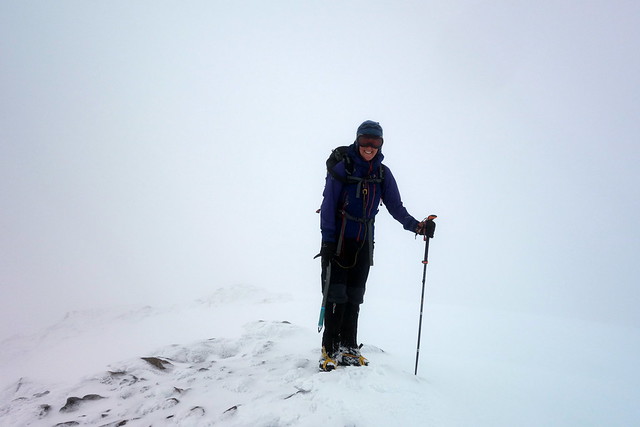
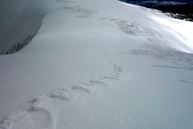
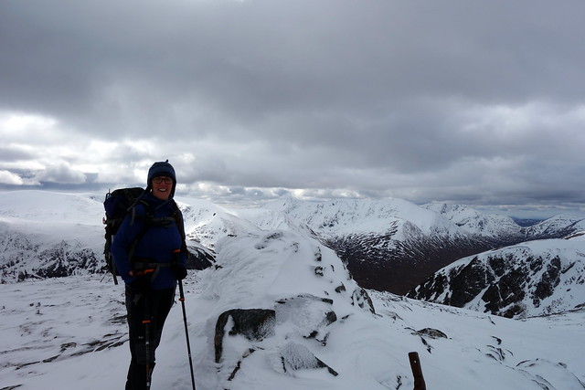
We chose to ascend by the safest route, up Gob a'Chairn and worry about how to conclude our route later. This proved straightforward until the last 150m up to Creag Gorm a'Bhealaich which was completed in whiteout. I really do not like the experience of just stepping out into nothingness, whatever the GPS or compass say. An anxious navigate over to Sgurr Fhuar-thuill followed, knowing that there was a substantial drop of the northern side. A line of frozen, wind-carved footsteps proved invaluable in keeping to the right side of the cornice. Summit reached, the next challenge was to get to the final Munro Top of Sgurr nan Fearstaig - I knew this involved crossing over a narrow-ish ridge which would be corniced in virtually zero visibility. I was not feeling very happy at this prospect. We sat in the clag and had lunch whilst we considered our options. I looked at the map - the more I looked, the less I liked what I saw. We decided to retreat under the circumstances and head back the way we'd come.
Up Gob a'Chairn
 DSC01097
 by
Al, on Flickr
 DSC01098
 by
Al, on Flickr
Near the top of Creag Gorm a'Bhealaich
 DSC01100
 by
Al, on Flickr
Summit!
 DSC01101
 by
Al, on Flickr
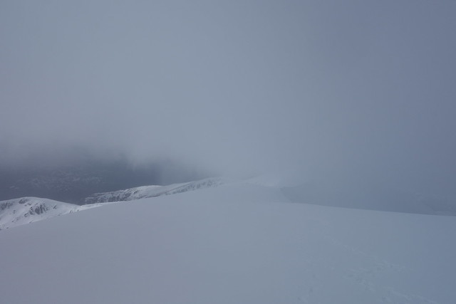
The narrow section to Fearstaig, clag lifting
 DSC01102
 by
Al, on Flickr
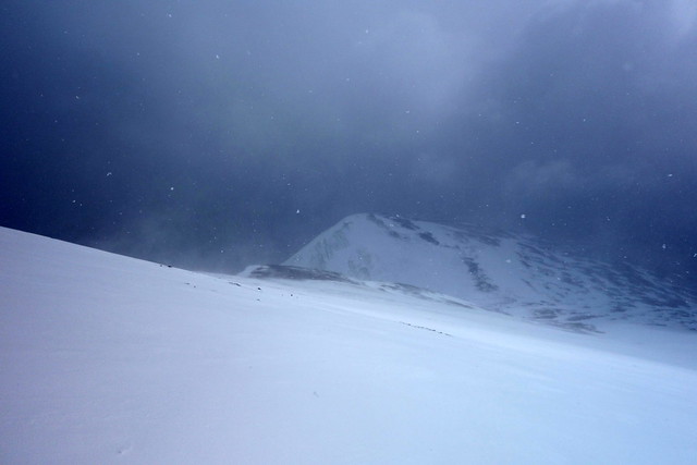
Not more than 3 minutes after we turned around the clag started to lift. We could now see the narrow section to Fearstaig, which was actually double-corniced. Should we go or not...my worry was that the clag descended again whilst we were crossing. No- enough for today
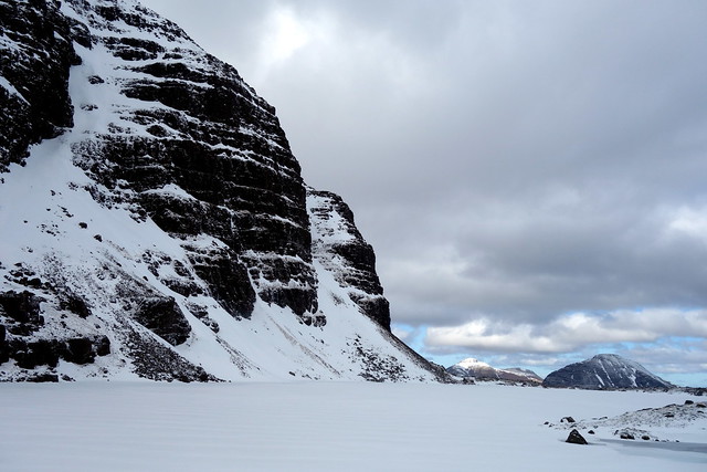
Relentlessly the clag continued to lift, blue sky emerged, sun shone - oh t'was mocking us! Anyway we were not going to change our minds. Coming down off Fhuar-thuill we noted just how narrow one of the sections near the summit had been, how close our footprints were to cornice/edge. We thanked the frozen footprints - which now resembled the fossilised vertebrae of some ice-bound plesiosaur - once again and enjoyed a romp down the crisp snowy slopes back to Gob a'Chairn. The views along the ridge, and out west towards Maoille Lunndaidh/Achnashellach hills were superb now that the clag had lifted. Sgurr na Muice continued to look superb - that's one for another visit, for sure.
Back on Fhuar-thuill - with views this time
 DSC01104
 by
Al, on Flickr
Heading back towards Creag Gorm
 DSC01107
 by
Al, on Flickr
 DSC01108
 by
Al, on Flickr
Ice footprints
 DSC01109
 by
Al, on Flickr
Sgurr na Muice
 DSC01111
 by
Al, on Flickr
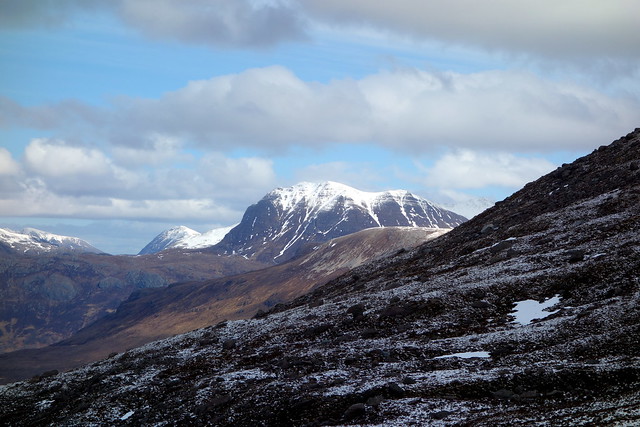
View out towards Maoile Lunndaidh
 DSC01113
 by
Al, on Flickr
 DSC01116
 by
Al, on Flickr
 DSC01119
 by
Al, on Flickr
Sgurr na Lapaich (North Mullardoch)
 DSC01122
 by
Al, on Flickr
 DSC01123
 by
Al, on Flickr
We returned to the campsite in the sunshine, had a shower, spoke to a couple of guys who were walking from Morvich to Drumnadrochit and who had pitched their tents near ours. 2 guys - 2 moderately sized tents - huh? Allison suggested maybe one of them was a snorer, which turned out to be the case

Anyway, we had more than snoring to worry
about that night... Around 11 there was what I can only describe as a thunderous stampede past the tent - no mere cow on its own but a whole herd. Allison was terrified. I, on the other hand, decided that if they hadn't crushed us to death the last 2 nights they were unlikely to do so tonight
Mr Snorer, incidentally, slept - or at least continued to snore - throughout the whole event.
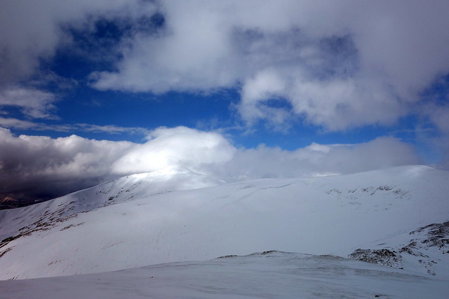
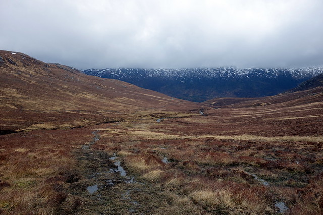
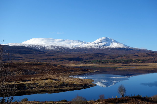
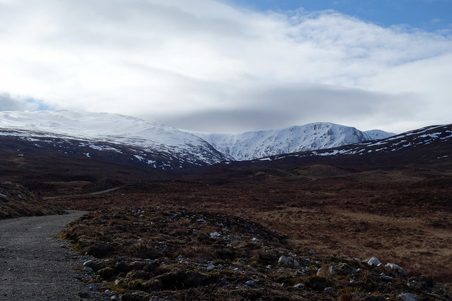
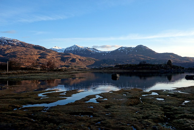
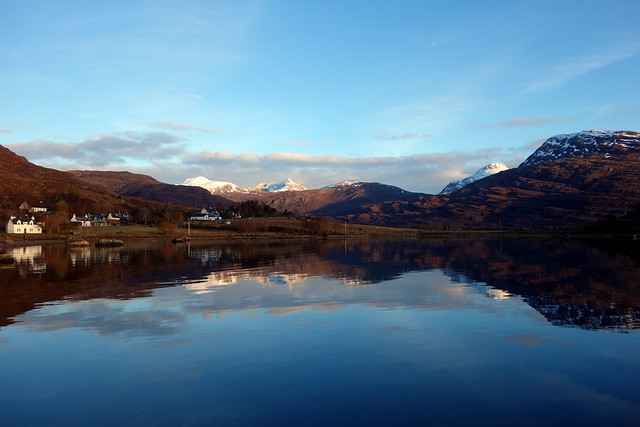
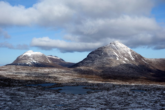
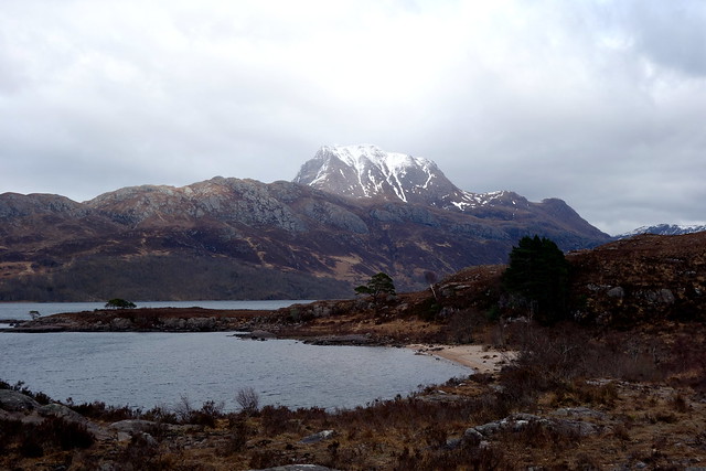
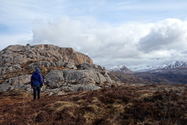
Easter Sunday - I'd thought we might do Moruisg today then travel further north. The forecast was better for Torridon than further up, so that seemed a plan - we could bide in the community campsite at Torridon and see what to do on Monday/Tuesday. First, there was Moruisg. Last time round Moruisg had been the last hill on a big round comprising Cheesecake, Lurg Mhor, Sgurr Choinnich, Sgurr a'Chaorainn and a camp on Maoile Lunndaidh, approached from Coire Beithe it had been no more than a big shapeless lump. This time I wanted to do a horseshoe, taking in 4 Sims and hopefully giving a much better sense of the mountain than previously. On the drive to Achnasheen the Strathconon hills were mirrored in Loch a'Chuillin against a clear blue sky. Looked a marvelous day.
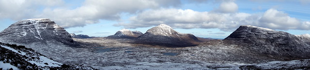
Strathconon Hills
 DSC01124
 by
Al, on Flickr
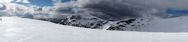
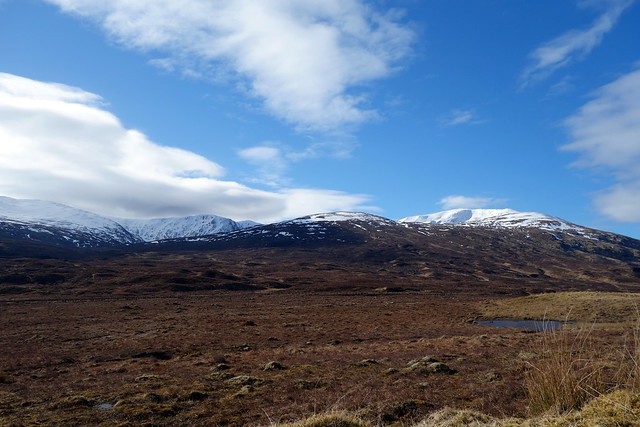
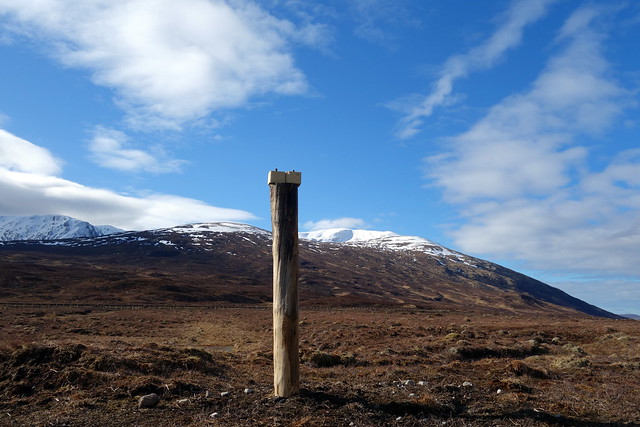
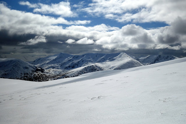
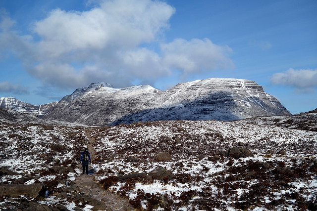
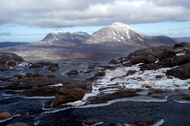
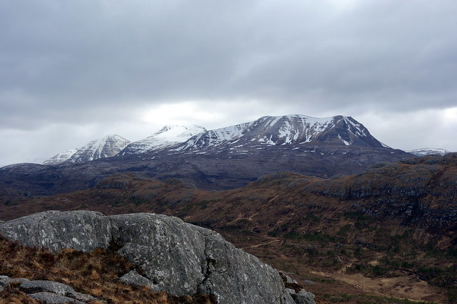
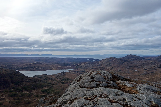
We parked by the opening of a hydro track opposite a transmitter mast. As this was not the "standard" route up Moruisg I was surprised to see 2 cars already parked and a third stopping hot on our heels. There's parking along the verge here. We got ready and set off, a short way behind an English dad and his two grown children, up on holiday, ourselves pursued by the occupants of the car that arrived shortly after we did. Passing the highest salt-lick blocks I've ever seen (maybe the minerals seep down into the post in the rain?) we walked along surfaced track past a noisy whirring hydro plant and onto more soggy ATV track. I wasn't sure where the track would lead - I'd planned to head left up the shoulder of Carn Liath, thus allowing a gentle ascent - however the track seemed to be following the Allt Gharagain. Seduced by the promise of easier walking, we followed...til it led to a hydro intake in the coire. The threesome before us had also gone this way - we met them resting on the hillside as we started up the flank of Carn Liath. Soon we were on crisp snow, deep in places with new powder. Steadfast in our progress we reached the ice-decorated cairn and paused for lunch. All around were white hills - the fluted curves of Maoile Lunndaidh, the pert points of the Strathfarrar Four and the long crenelated plateau leading inexorably to Moruisg.
The Moruisg horseshoe
 DSC01126
 by
Al, on Flickr
 DSC01127
 by
Al, on Flickr
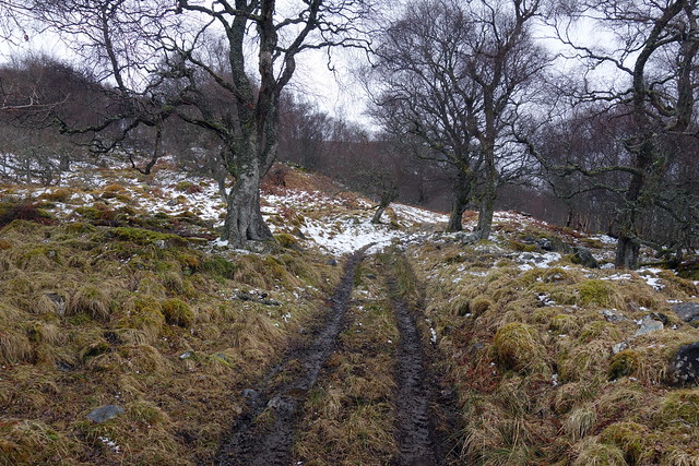
Winding track
 DSC01128
 by
Al, on Flickr
 DSC01131
 by
Al, on Flickr
Heading up Carn Liath
 DSC01134
 by
Al, on Flickr
North towards Slioch
 DSC01137
 by
Al, on Flickr
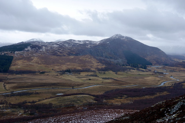
Strathconon hills
 DSC01138
 by
Al, on Flickr
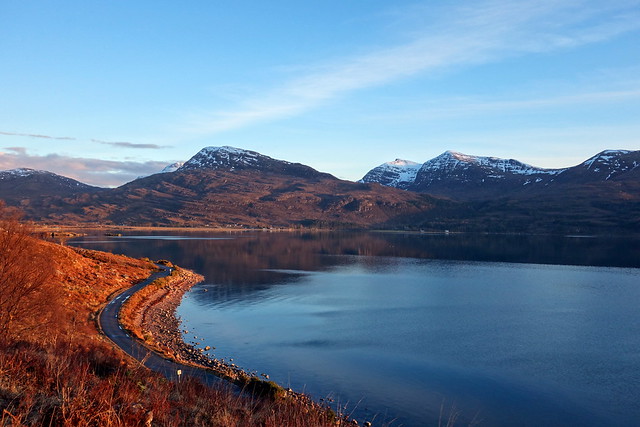
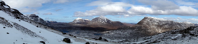
Strathfarrar hills
 DSC01141
 by
Al, on Flickr
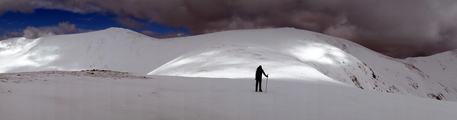
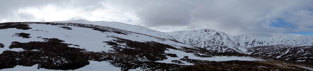
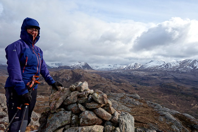
From here it was a joy to walk to each of the Sims in turn - minimal drop between the tops and some opportunity for glissades. A note of caution - don't try a fast bumslide over fresh powder snow when you have your jacket open at the front
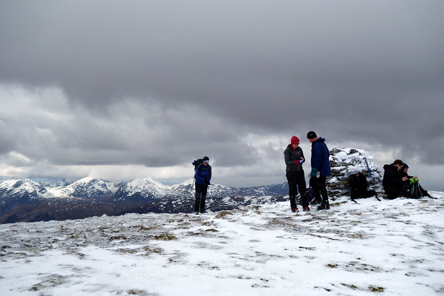
a good way to cool down quickly though. We watched bands of snow sweep along the valley. Mighty Slioch sat squat to the North with glimpses of the Fisherfields beyond. The long plateau from Sgurr a'Chaorainn to its distant Munro Top of Bidean an Eoin Deirg had a finely defined edge of crisp snow. Finally we reached the northern cairn of Moruisg, meeting up with our three English walkers and a Scots couple who had "just come straight up". The surface was glazed and it was apparent that crampons would be required for the descent. We fitted up accordingly and headed over to the summit proper, remembering our last visit here when it was such an unexpectedly warm day that we both stripped down to underpants for the final section to the summit

Sgurr na Ceannaichean wasn't on the cards for us today, although I believe some of the others headed that way.
Second Sim
 DSC01143
 by
Al, on Flickr
Our way ahead
 DSC01145
 by
Al, on Flickr
Maoile Lunndaidh
 DSC01160
 by
Al, on Flickr
Sgurr a'Chaorainn
 DSC01159
 by
Al, on Flickr
Moruisg Northern Cairn
 DSC01162
 by
Al, on Flickr
Summit
 DSC01164
 by
Al, on Flickr
I had planned to head off the northern shoulder, curling back round to the track we'd used for the initial walk in. The beginning was a mite disconcerting - hard glazed snow underfoot and no sign of what was below us as we set off. Soon enough the ridge line came into view and the descent was easy enough - we kept crampons on til the end of the snowline, musing on the difference in the snow's crustiness on this aspect of the hill. As we descended the clag came down with us, and I was glad we'd given the Corbett a miss. Once onto heather, it was a case of heading around the loch and making for the hydro track. We regained the car as the weather deteriorated.
Descent
 DSC01166
 by
Al, on Flickr
More weather acoming in
 DSC01168
 by
Al, on Flickr
 DSC01169
 by
Al, on Flickr
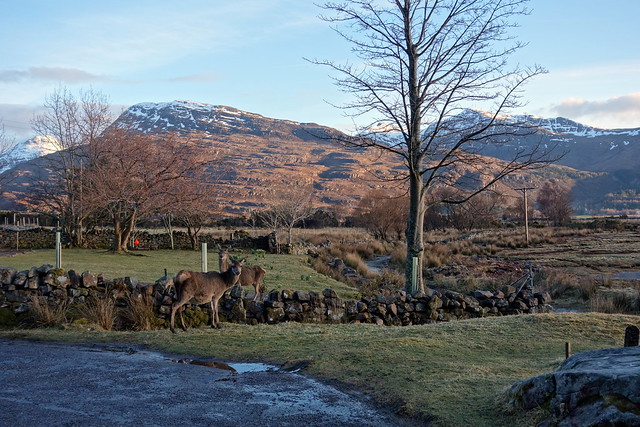
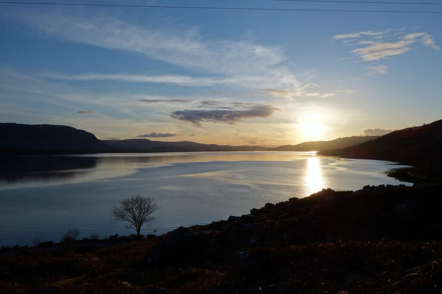
Deciding on Torridon we drove along through Kinlochewe in heavy rain showers and arrived at a rather dreich campsite with another half dozen or so tents already in occupation. Hoping the rain would clear we stayed in the car for a bit - luckily we didn't have to wait too long. We set up tent, had our tea then enjoyed a lovely sunny evening, heading along through the village basking in the view of the surrounding mountains. As the sun began to slide into the sea, Sgurr Ruadh and Beinn Liath Mhor pulled on their cotton-wool caps.
 DSC01170
 by
Al, on Flickr
 DSC01171
 by
Al, on Flickr
Deer in the village
 DSC01175
 by
Al, on Flickr
Ben Damph
 DSC01177
 by
Al, on Flickr
 DSC01178
 by
Al, on Flickr
 DSC01182
 by
Al, on Flickr
 DSC01183
 by
Al, on Flickr
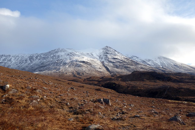
Monday dawned cold but with blue sky high over the hills and some vestiges of cloud hugging the tops. We had decided to head up Coire Mhic Fhearchair and attempt Ruadh Stac Mor, ideally adding in Coinneach Mhor and Sail Mhor. I remembered there was a "bad step" from the triple buttress down to Sail Mhor although I couldn't recall the detail and thought we might end up climbing the coire wall as we had done last time. Oh if only it had been that easy...
The car park was already half full by 8am when we arrived. Another couple who'd been in the campsite were setting off too - aiming to get to the coire and then decide if they'd do any more. The forecast had been for strong winds increasing as the day went on. Up ahead of us rose the wall of The Ice Mountain - aptly named today. On our left jutted mighty Liathach, frostily imperious. A glorious walk in along Coire Dubh Mor was reward in itself today- we could see the jagged peaks of Meall Dearg and the Northern Pinnacles of Liathach, then the massif of Beinn Dearg sprawled ahead of us. Beinn an Eoin and Basobheinn appeared liked beached leviathans and finally the steep tower of Beinn a'Chearcaill hove into view. This was sheer bliss.
The Ice Mountain awaits
 DSC01191
 by
Al, on Flickr
Liathach
 DSC01192
 by
Al, on Flickr
Beinn Dearg
 DSC01196
 by
Al, on Flickr
Northern Pinnacles
 DSC01200
 by
Al, on Flickr
Beinn an Eoin/ Baosbheinn
 DSC01205
 by
Al, on Flickr
Ruadh-stac Mor
 DSC01208
 by
Al, on Flickr
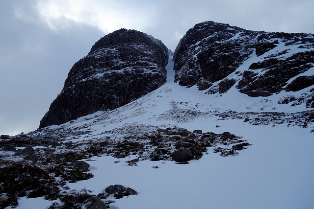
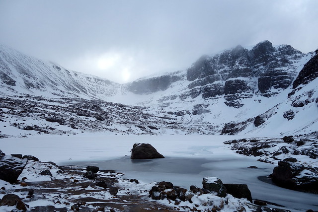
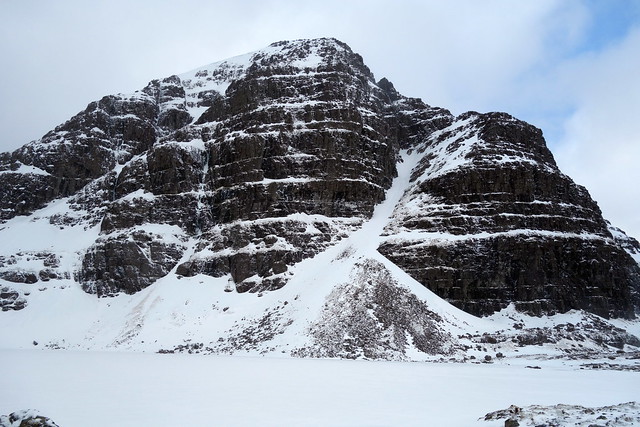
Rounding the stacked buttresses of Sail Mhor into Coire Mhic Fhearchair we glimpsed Ruadh-stac Mor ahead. I had naively assumed that with a wind coming from the east, the coire would be shielded from icy blasts - but could not have been further from the fact. The bowl of the coire was one vast ice-bucket within which glacial blasts of spindrift and new snow encircled and hemmed us in. Goggles were deemed an essential and we ventured onwards towards the petrified loch. At the end of the coire we could see the gully normally used to gain Ruadh-stac Mor. It looked uncomfortably full of new snow and hazardous. Of course it might have had all the new snow blasted off it - we'd have to make a closer inspection. Getting round the loch was a challenge in itself. Deep spindrift covered a multitude of holes between rocks. Sometimes you walked on soft snow drifted feet thick, at others there was a thin cloak of soft snow over ice. Reaching the blocky end of the coire and ascending steeply I decided I did not really like this mix of unpredictable snow. Windslabbing was considerable. Backing down from an uncomfortable scramble I had a look at our options. The gully was out due to avalanche risk. It appeared feasible to head up the scree slopes to the west of the gully but these would be both mobile and glazed in places and Allison was far from keen on scree ascents anyway. We decided to abandon plans for going any higher and return the way we'd come. As the views were so outstanding this didn't seem to matter much today. We met a number of families coming up the path towards the coire, children looking generally miserable and cold despite parents' enthusiasm.
Dearg to Chearcaill
 DSC01209
 by
Al, on Flickr
Sail Mhor buttress
 DSC01210
 by
Al, on Flickr
 DSC01213
 by
Al, on Flickr
into the freezer...
 DSC01214
 by
Al, on Flickr
Sail Mhor
 DSC01215
 by
Al, on Flickr
Towards the coire end
 DSC01217
 by
Al, on Flickr
 DSC01220
 by
Al, on Flickr
 DSC01225
 by
Al, on Flickr
Slioch
 DSC01229
 by
Al, on Flickr
Liathach
 DSC01234
 by
Al, on Flickr
 DSC01236
 by
Al, on Flickr
We returned to the car around 2.30. Too early to return to the tent, especially on such a cold day, we considered what we might do. I fancied a drive up towards Gairloch to have a look over Loch Maree - I remembered there was a Marilyn up there that would give brief sport. Keeping our kit on we drove past the monumental Slioch towards Slattadale, parking beside a cattle grid for a walk up Meall Lochan a'Chleirich. This hill isn't easily visible from the road and the initial approach is through new planted forest - fortunately not close-packed. Beyond the trees there are some delightful craggy scrambles over granite that provide diversion. As we gained height we could look at the Torridon hills from the north - Baosbheinn in particular lay stretched out like a wizard's cat. Out to sea lay the tip of the Trotternish peninsula, with a wildfire burning and sending much smoke heavenwards. A fine rocky top crowned our little hill. Taking roughly the same path down we returned to the car delighted with the day.
Slioch
 DSC01238
 by
Al, on Flickr
Meall Lochan a'Chleirich - start
 DSC01239
 by
Al, on Flickr
 DSC01240
 by
Al, on Flickr
Baosbheinn
 DSC01241
 by
Al, on Flickr
 DSC01243
 by
Al, on Flickr
 DSC01245
 by
Al, on Flickr
 DSC01246
 by
Al, on Flickr
Skye
 DSC01247
 by
Al, on Flickr
Winds rose and the air chilled - no saunter along the shores of Loch Torridon tonight. We knew snow was forecast for the following day and had virtually written off any big hills - Fionn Bheinn had been origianlly on the cards but with so much new snow having fallen I thought this would be another avalanche hazard. When we woke the mist was down anyway, which crystallised our earlier decision. I wanted to drive down the A9 in case there was snow at road level down the A82, so we thought about some Marilyns close to the road. We settled on Tor Achilty at Contin and drove off. Considerable snowfall throughout Strath Bran, a weak sun trying pitifully to break through the mist.
We pulled up at Achilty Quarry, just as we drove into Contin and decided to leave the kit in the car - it was only a short walk after all. Along a farm track,past some cows with new calves (Allison having flashbacks to nights of cow-trample terror) then into some woods at the base of the hill. Followed a deer track initially through the trees, then onto lush and springy heather, steeply to the flat summit of the wee hill. Nice - if misty - views south into Strathconon. Back the same way amidst snow flurries.
Track to Tor Achilty
 DSC01249
 by
Al, on Flickr
 DSC01251
 by
Al, on Flickr
 DSC01252
 by
Al, on Flickr
 DSC01253
 by
Al, on Flickr
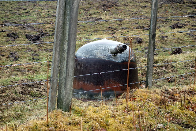
Decapitated Dalek?
 DSC01254
 by
Al, on Flickr
 DSC01255
 by
Al, on Flickr
We could get another hill in on the way down - Cruban Beag, just to the north of Dalwhinnie, presented itself as a likely option, being short and near to the road. We drove through horrible sleet across the Kessock Bridge, less snow as we came south - I had fears that Slochd would be snowbound. Stopped at a busy Ralia to eat lunch, surrounded by a bustling selection of small birds. A leggy young thrush gave short shrift to chaffinch and robins, whilst a pair of blackbirds sprang through the bushes, energetically rummaging through the undergrowth with chiseled beaks.
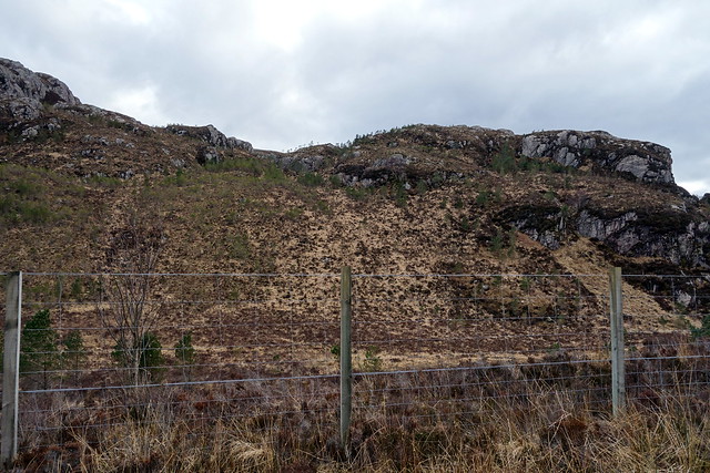
We took the little road towards Catlodge and parked on the verge not far from a track leading between Cruban Beag and Creag Sanais. More cows, wet and boggy underfoot initially then onto a stonier track. Left the track to cut through heather, across a stream and over deer fencing (twice) to reach the Vanessa Trig pillar. To our north sat the Graham of Creag Dhubh, rising from the windings of the nascent River Spey. Rather than hurdle the deer fence, we followed it back down the shoulder of the hill and to the car. After that, no more hills, just a wet and dismal drive back to Inverclyde.
 DSC01256
 by
Al, on Flickr
 DSC01257
 by
Al, on Flickr
 DSC01260
 by
Al, on Flickr
 DSC01261
 by
Al, on Flickr
Creag Dhubh
 DSC01262
 by
Al, on Flickr
 DSC01264
 by
Al, on Flickr
