walkhighlands

Share your personal walking route experiences in Scotland, and comment on other peoples' reports.
Warning Please note that hillwalking when there is snow lying requires an ice-axe, crampons and the knowledge, experience and skill to use them correctly. Summer routes may not be viable or appropriate in winter. See winter information on our skills and safety pages for more information.

How do I get down from here?

How do I get down from here?


Postby Bmg99 » Sun May 13, 2018 11:18 pm

Route description: Bidean nam Bian

Munros included on this walk: Bidean nam Bian, Stob Coire Sgreamhach

Date walked: 12/05/2018

Time taken: 6.5 hours

Distance: 12.2 km

Ascent: 1662m

4 people think this report is great.
Register or Login
free to be able to rate and comment on reports (as well as access 1:25000 mapping).

After a stressful week at work I needed to get out on the hills and clear my head. I decided to head to Glen Coe.

On the way up the road I stopped off at The Real Food Cafe in Tyndrum. Their food is great, but the service is slow, which is not great if you are in a rush. I was keen to get to the car park at the Pass of Glen Coe before it filled up with tourists.

Image
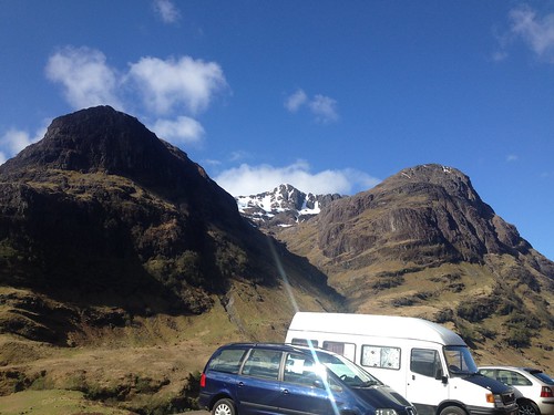
The weather was great and as I put my boots on three other pairs of walkes headed off before me.
Once across the river Coe the path rises quickly and it was not long before I'd passed the people who had set out just before me.

Image

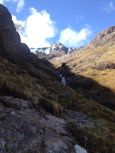
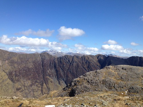
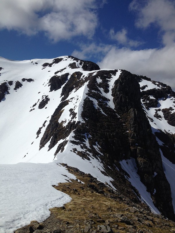
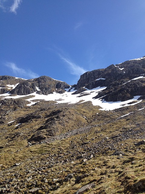
Despite over night rain and snow melt the rives was not too bad and was easily crossed. Once over a short rise the magnificent butresses of Stob Coire nan Lochan came into view.

Image

The ground hear was a little boggy and the path became very indistinct. I picked a spot to head for at the end of the butresses and found my own route there.

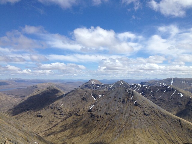
Once one the shoulder of the hill the views down Loch Leven started to open up to the West.

Image

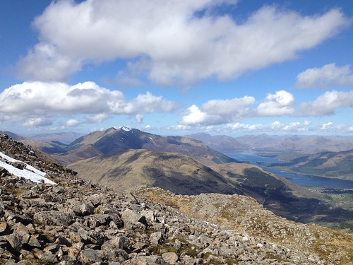
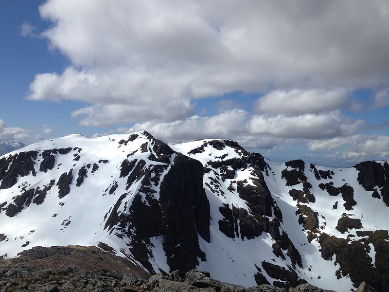
The view North was equally fansastic and Ben Nevis looked so close that you could reach out and touch it (the photograph does not do it justice).
Image

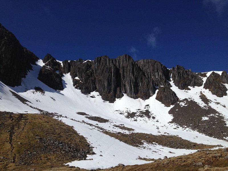
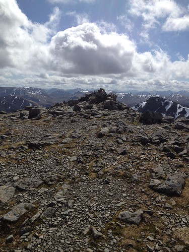
The summit cairn of Stob Coire nan Lochan was clear of snow, and to the west Stob Coire Sgreamhach could be seen,
Image

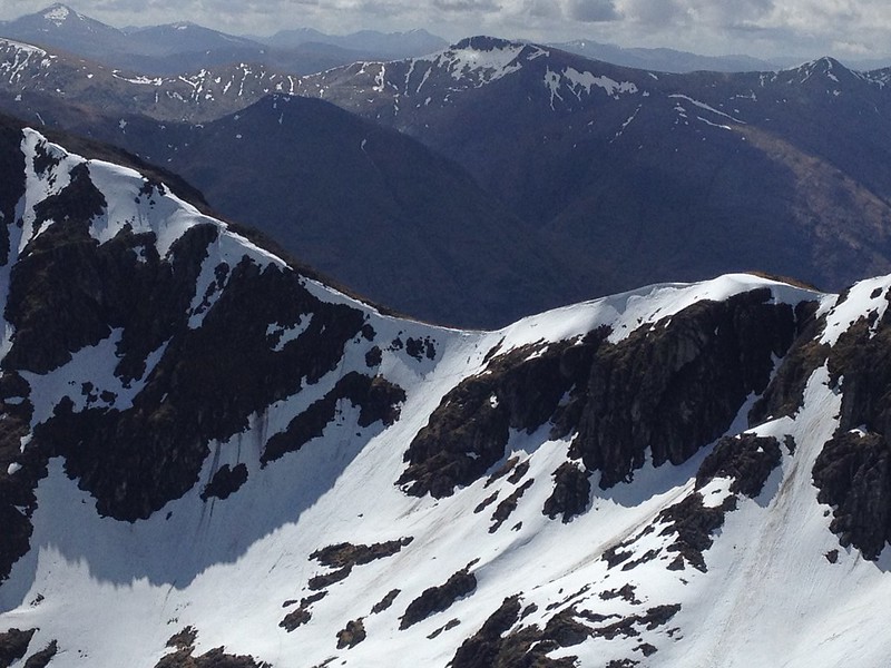
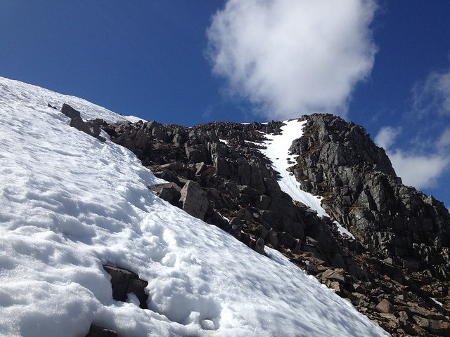
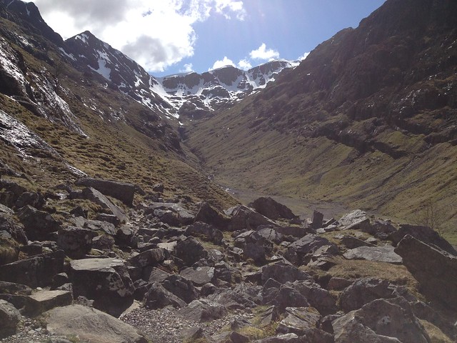
The route up to Bidean nam Bian looked imposing. The path before the snow was clear to be seen, but from the summit of Lochan it was hard to see how to proceed once you started to ascend again.

Image

The descent down Corie Gabhail had been on my mind and I stopped to watch small black dots, which must have been people), slowly make their way up.
Image

However, my attendtion quicked turned back to what was in front of me and the ascent to the summit of Bidean nam Biam.
Image

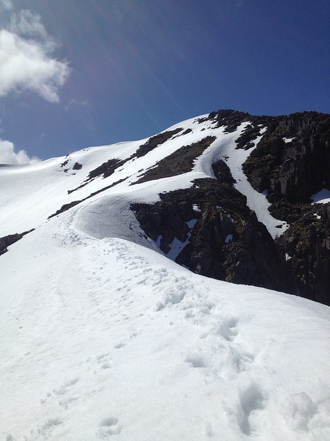
The obvious route was to scrabmle up between the large rocks to the right of the snow. The rocks were like sand paper which was great for feeling secure in my footing but was hard on the hands.
Image

I was glad of having the taken my ice axe with me to cross the snow were is was exposed.
Image

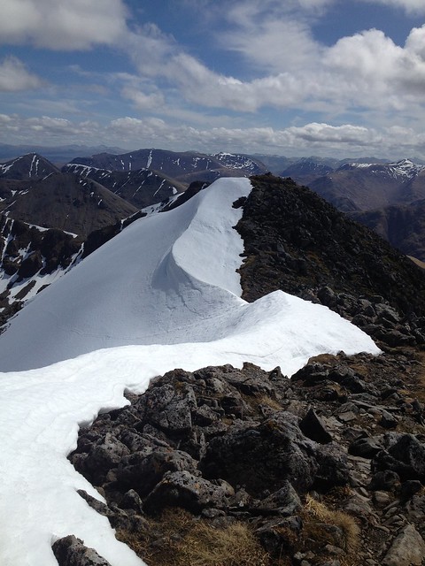
Sumit cairn of Bidean nam Biam.
Image

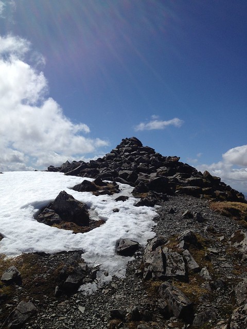
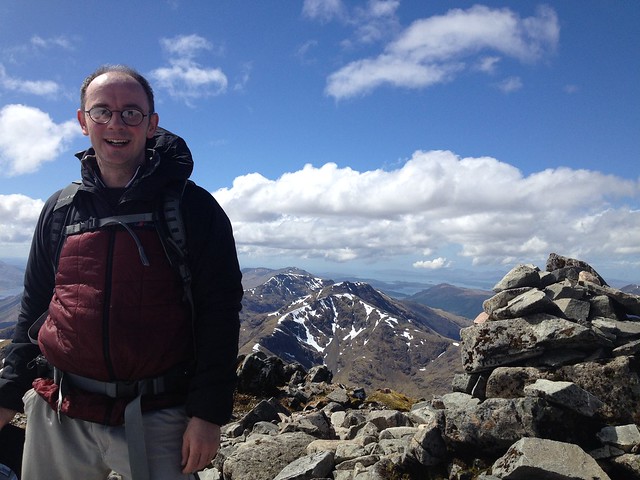
Two guys who had not been far behind me joined me on the summit and one kindly took a photo of me.
Image

Image

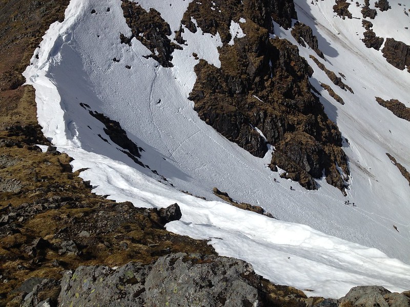
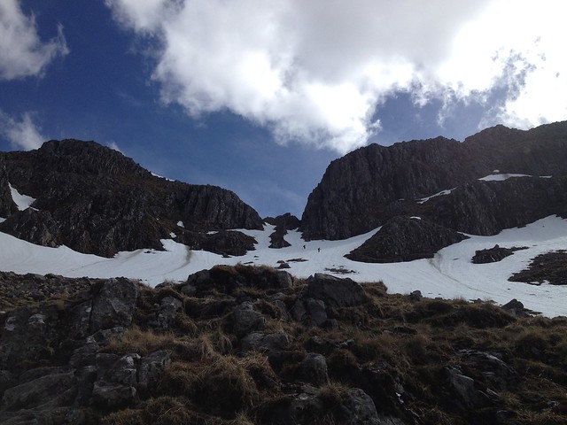
I stopped just after Bealach Dearg to watch people make their way up the coire. I watched as one guy poceeded kicking into the snow for his feet and clining onto the snow with this hands for dear life. Once at the lip the threw one leg over and the did a sort of sausage roll to get over the cornice. My concern primarily getting over the lip of the cornice as the first section is very streep.
Image

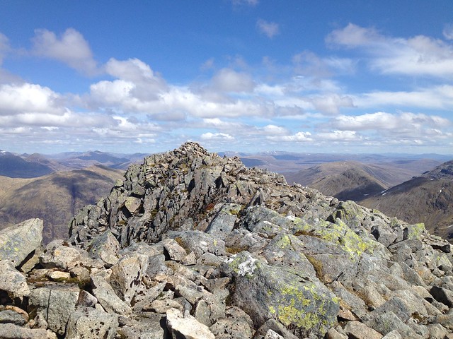
Summit of Stob Coire Sgreamhach.
Image

The two younger guys who had been on the summit of Bidean nam Bian joined me on the summit of Sgreamhach and we discussed how we were going to get down. The guy how I'd watched roll over the cornice also joined us on the summit. His description of coming up that was convinced me I was not going down by that route.

I decided to heaf toward Beinn Fhada and drop down into the Lost Valley from one of it's gullys. Plan B was to dropp down the less steep side of Fhada into Lairig Eilde and walk back to the A82 from there.

Image
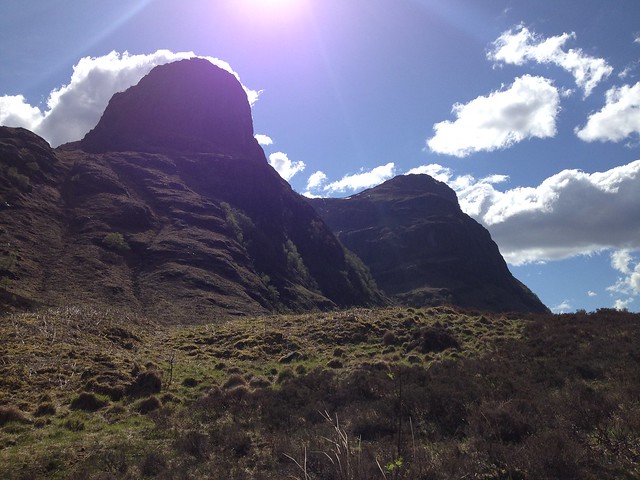
[The view over to Buachaille Etive Beag and Buachaille Etive Mor.

Image
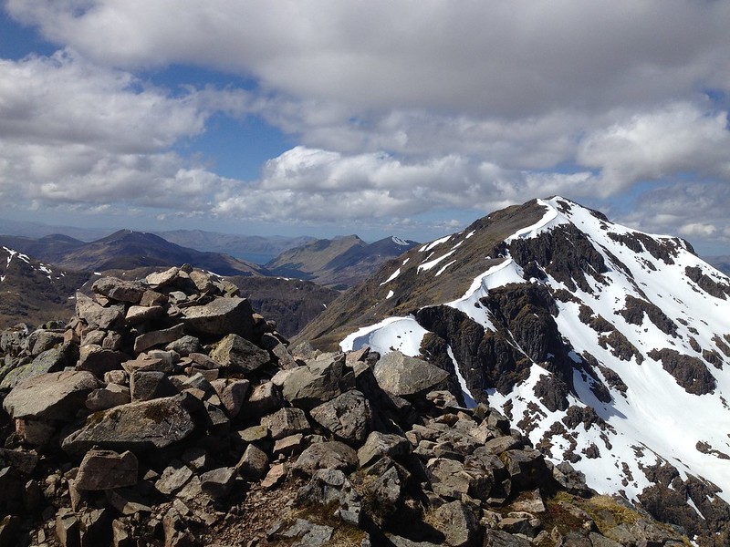
[The view back to Bidean nam Bian].

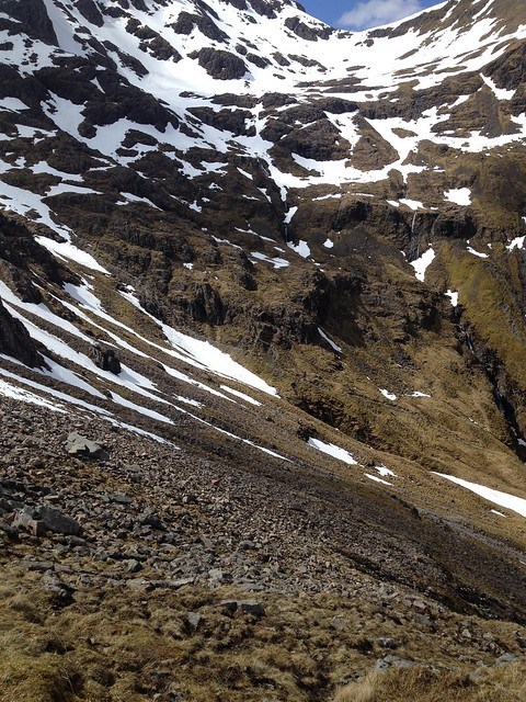
I decided not to go for plan B, which really would have been plan C, and after scrambling down some rocks I found a spot where I decided to decend. The ground was very soft so it was hard to get a secure footing. Once I reached the snow it was still very steep so went down the snow backwards using my ice axe as an anchor.

Image
The younger guys also decided to descend the same route as myself. You can seem them against the snow.

I decided to head to the snow you can see in the right hand corner of the photo below as this bridged the river and allowed me to join the main path in the Lost Valley.
Image

Image
Looking back to where I'd come down from.

Image
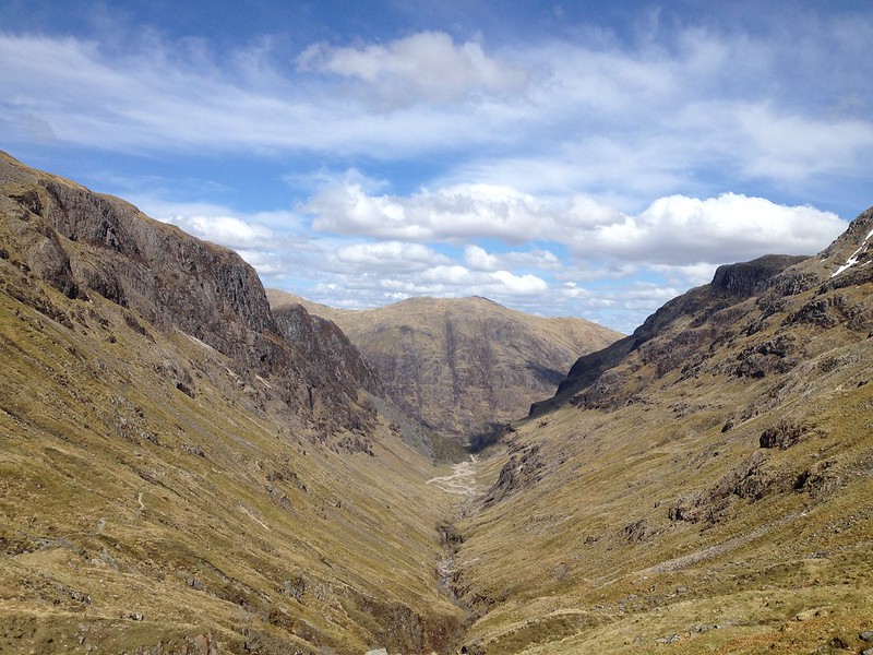
Looking North down the Lost Valley.

Image
Looking back up the Lost Valley.

Image
Nearly back at the car park looking back at two of the three sisters.

It has been a great day out, just what I needed. You really can't ask for anywhere better than Scotland on a sunny day.
User avatar
Bmg99
Munro compleatist
 
Posts: 68
Munros:87   Corbetts:3
Fionas:2   Donalds:1
Sub 2000:5   Hewitts:3
Joined: May 31, 2016

Re: How do I get down from here?

Postby Jaxter » Mon May 14, 2018 7:40 am

You really can't ask for anywhere better than Scotland on a sunny day.


Can’t agree more! Great photos of a good day. It’S such a great hill isn’t it 8)
User avatar
Jaxter
Wanderer
 
Posts: 1486
Munros:217   Corbetts:141
Fionas:91   Donalds:49+13
Sub 2000:131   Hewitts:69
Wainwrights:81   Islands:35
Joined: Aug 8, 2011
Location: Glasgow/Inverness

Re: How do I get down from here?

Postby Bmg99 » Mon May 14, 2018 12:45 pm

Jaxter, Thanks for the comment. Yes, it is a great hill; I loved that it is hidden away from the road, so you only get to see its beauty if you make the effort.
User avatar
Bmg99
Munro compleatist
 
Posts: 68
Munros:87   Corbetts:3
Fionas:2   Donalds:1
Sub 2000:5   Hewitts:3
Joined: May 31, 2016

Re: How do I get down from here?

Postby jmarkb » Mon May 14, 2018 2:06 pm

Great report! Well done on the improvised route finding: I think it is quite common for folk to find themselves in the same situation at this time of year. For the benefit of other readers, the most straightforward solution (especially if you have no axe) is to descend the SE ridge of Sgreamach to the 741m col and thence NE to join the Lairig Eilde path.
User avatar
jmarkb
Mountaineer
 
Posts: 5882
Munros:246   Corbetts:105
Fionas:91   Donalds:32
Sub 2000:46   
Joined: Oct 28, 2011
Location: Edinburgh

Re: How do I get down from here?

Postby Bmg99 » Mon May 14, 2018 2:51 pm

jmarkb - thanks for the comment. The path in the Lairig Eilde was clearly visible and as I noted in my report I did ponder trying to head for it. However, I didn't think to take the NE ridge of Sgreamach as you suggest, which sounds a good option.
User avatar
Bmg99
Munro compleatist
 
Posts: 68
Munros:87   Corbetts:3
Fionas:2   Donalds:1
Sub 2000:5   Hewitts:3
Joined: May 31, 2016

Re: How do I get down from here?

Postby Dunblane Bagger » Mon May 14, 2018 7:01 pm

Thanks BMG,

Got the day off on Wednesday and taking an inexperienced guy with me using the same ascent route as you did so thanks for sharing what the conditions will more than likely mirror for us.

Looking forward to it as not climbed BNB for a long time ! Too long as she is a beauty !

Thanks for sharing. :wink: :clap:
User avatar
Dunblane Bagger
Munro compleatist
 
Posts: 105
Munros:146   Corbetts:33
Fionas:3   Donalds:5
Sub 2000:8   Hewitts:22
Wainwrights:6   
Joined: Mar 13, 2015
Location: Hopefully up a mountain somewhere

Re: How do I get down from here?

Postby Bmg99 » Tue May 15, 2018 8:32 am

DB - Glad to be of some help. Hope you get weather as fair as I had.
User avatar
Bmg99
Munro compleatist
 
Posts: 68
Munros:87   Corbetts:3
Fionas:2   Donalds:1
Sub 2000:5   Hewitts:3
Joined: May 31, 2016

Re: How do I get down from here?

Postby katyhills » Tue May 15, 2018 5:43 pm

Lovely stuff :D
Your photos are great - you're right though, they often don't do a location justice! A day to remember for a very long time. It's a fabulous walk.
You had a lovely day for it too - the views are spectacular from that ridge. The summit wasn't clear when I was there many years ago, but it was the only bit that wasn't.
I agree with you too that it's so tucked away and hidden, you only get to see how stunning it is when you're actually in there. :)
katyhills
Walker
 
Posts: 375
Munros:120   Corbetts:28
Fionas:7   Donalds:2
Sub 2000:3   
Joined: Jul 7, 2015

Re: How do I get down from here?

Postby Marco83 » Wed May 16, 2018 11:59 pm

This is a very informative post, thank you!

I will head on the Bidean nam Bian this Sunday. First time in Scotland! I will be with a fit but inexperienced hiker.

Looking at the pictures, I am a bit discouraged though. Is it safe to do this walk without an axe and crampons? I have been considering at renting the equipment but I won't have time as all shops seem to open 9.30-5 on Sundays. I am unsure I will have the time to return what I rented on the same day, and I will have to leave the area by the evening to head to my next stop (already booked)

I cannot post a direct link, but another website suggests the opposite route. "[...] take the path up the Lairig Eilde [...] From a cairn marking the high point of the Lairig Eilde go roughly west-southwest over boggy, lumpy ground. Trend left to climb into a shallow grassy corrie that leads steeply to a col between Stob Coire Sgreamhach and an unnamed minor top (spot height 778m). [...] Then Sgreamhach's summit [...] Bealach Dearg [...] Now follow the continuation ridge above the Lost Valley Buttresses before a final uphill stretch to the twin tops of Bidean nam Bian [...].

Would this route be easier in terms that by doing that I will avoid the steep descent in the snow that Bmg99 did?

What would you recommend guys? Shall I do another hike instead (and if so which one)?
Marco83
 
Posts: 3
Joined: May 16, 2018

Re: How do I get down from here?

Postby jmarkb » Thu May 17, 2018 10:36 am

Marco83 wrote:I cannot post a direct link, but another website suggests the opposite route. "[...] take the path up the Lairig Eilde [...] From a cairn marking the high point of the Lairig Eilde go roughly west-southwest over boggy, lumpy ground. Trend left to climb into a shallow grassy corrie that leads steeply to a col between Stob Coire Sgreamhach and an unnamed minor top (spot height 778m). [...] Then Sgreamhach's summit [...] Bealach Dearg [...] Now follow the continuation ridge above the Lost Valley Buttresses before a final uphill stretch to the twin tops of Bidean nam Bian [...].

Would this route be easier in terms that by doing that I will avoid the steep descent in the snow that Bmg99 did?

What would you recommend guys? Shall I do another hike instead (and if so which one)?


I can post the link for you: https://www.ukhillwalking.com/logbook/r/?i=100

The reverse of this route is what I recommended as an alternative descent in my post above. It should avoid most of the steep snow at this time of year, though the north side of the main summit of Bidean may still require some care, and so the reverse direction from the link above would mean you do this in ascent, as Bmg99 did, which may be preferable. Either way, it does mean (to get back to your starting point) walking a short stretch of the main road in Glencoe which is busy and unpleasant, though most of it can be avoided by using the old road (marked as a track on the map).

Unfortunately the forecast for this Sunday is pretty bad - you may want to have alternative plans, or pick another day.
User avatar
jmarkb
Mountaineer
 
Posts: 5882
Munros:246   Corbetts:105
Fionas:91   Donalds:32
Sub 2000:46   
Joined: Oct 28, 2011
Location: Edinburgh

Re: How do I get down from here?

Postby Marco83 » Thu May 17, 2018 12:27 pm

jmarkb wrote:...


Thank you jmarkb. I would definitely prefer walking the snow in ascent so I guess that would be the route I'd take.

But as you said, the forecast for this Sunday is pretty grim. I will have to seriously consider another plan, maybe moving further east, or doing a shorter hike at a lower altitude in Glencoe. The problem is, I have only Sunday as in the evening I will be already sleeping at the Isle of Skye (going deep into the rain front, I'm so **** off!!)
Marco83
 
Posts: 3
Joined: May 16, 2018

Re: How do I get down from here?

Postby jmarkb » Thu May 17, 2018 4:00 pm

Marco83 wrote: will have to seriously consider another plan, maybe moving further east, or doing a shorter hike at a lower altitude in Glencoe.


I would keep an eye on the forecast but be prepared to go east!
User avatar
jmarkb
Mountaineer
 
Posts: 5882
Munros:246   Corbetts:105
Fionas:91   Donalds:32
Sub 2000:46   
Joined: Oct 28, 2011
Location: Edinburgh

Re: How do I get down from here?

Postby Bmg99 » Thu May 17, 2018 11:46 pm

Marco83 wrote:This is a very informative post, thank you!

I will head on the Bidean nam Bian this Sunday. First time in Scotland! I will be with a fit but inexperienced hiker.

Looking at the pictures, I am a bit discouraged though. Is it safe to do this walk without an axe and crampons? I have been considering at renting the equipment but I won't have time as all shops seem to open 9.30-5 on Sundays. I am unsure I will have the time to return what I rented on the same day, and I will have to leave the area by the evening to head to my next stop (already booked)

I cannot post a direct link, but another website suggests the opposite route. "[...] take the path up the Lairig Eilde [...] From a cairn marking the high point of the Lairig Eilde go roughly west-southwest over boggy, lumpy ground. Trend left to climb into a shallow grassy corrie that leads steeply to a col between Stob Coire Sgreamhach and an unnamed minor top (spot height 778m). [...] Then Sgreamhach's summit [...] Bealach Dearg [...] Now follow the continuation ridge above the Lost Valley Buttresses before a final uphill stretch to the twin tops of Bidean nam Bian [...].

Would this route be easier in terms that by doing that I will avoid the steep descent in the snow that Bmg99 did?

What would you recommend guys? Shall I do another hike instead (and if so which one)?


Marco - the snow was so soft that crampons would have been of little benefit, but I was walking in boots with a B2 sole so was able to kick steps in the snow easily. As I pointed out in my post the majority of the people on the hill that day I was there did not have an axe with them. I would not have been comfortable being on the hill with no axe, but others were.

Doing up the Lairig Eilde is a good option, but it is still very steep - even with no snow. There is also the challenge of getting through or over the cornice.

My advice, for what it is worth would be to have a plan B or do a low level walk. The hills will be there another day, make sure you are as well!
User avatar
Bmg99
Munro compleatist
 
Posts: 68
Munros:87   Corbetts:3
Fionas:2   Donalds:1
Sub 2000:5   Hewitts:3
Joined: May 31, 2016

Re: How do I get down from here?

Postby Bmg99 » Thu May 17, 2018 11:48 pm

katyhills wrote:Lovely stuff :D
Your photos are great - you're right though, they often don't do a location justice! A day to remember for a very long time. It's a fabulous walk.
You had a lovely day for it too - the views are spectacular from that ridge. The summit wasn't clear when I was there many years ago, but it was the only bit that wasn't.
I agree with you too that it's so tucked away and hidden, you only get to see how stunning it is when you're actually in there. :)


Katyhills - thanks for the comment and complement on my photos.
User avatar
Bmg99
Munro compleatist
 
Posts: 68
Munros:87   Corbetts:3
Fionas:2   Donalds:1
Sub 2000:5   Hewitts:3
Joined: May 31, 2016

Re: How do I get down from here?

Postby naepace » Fri May 18, 2018 11:04 am

Great report and fantastic photos. Bidean is still my favourite Munro. Thanks for sharing.
User avatar
naepace
Munro compleatist
 
Posts: 155
Munros:124   Corbetts:10
Fionas:3   Donalds:4
Sub 2000:10   
Joined: Oct 8, 2012
Location: Perth

4 people think this report is great.
Register or Login
free to be able to rate and comment on reports (as well as access 1:25000 mapping).

Next


Can you help support Walkhighlands?


Our forum is free from adverts - your generosity keeps it running.
Can you help support Walkhighlands and this community by donating by direct debit?


Return to Walk reports - Scotland

Who is online

Users browsing this forum: No registered users and 45 guests