free to be able to rate and comment on reports (as well as access 1:25000 mapping).
The weekend of the summer WH meet on Skye

.
Skye is the best place on the planet, and boy had I been looking forward to this. But after the long dry hot June and early July, the forecast showed wet wet wet for Saturday and Sunday

.
However, my experience so far has been that the forecasts tend to be on the pessimistic side; and the Thursday and Friday looked pretty damned good, so I figured if I went up early, I'd hopefully get at least some good weather.
Setting off from the West Midlands just before 05.00 on the Thursday, I made pretty good time - 9 hours to Kylescu.
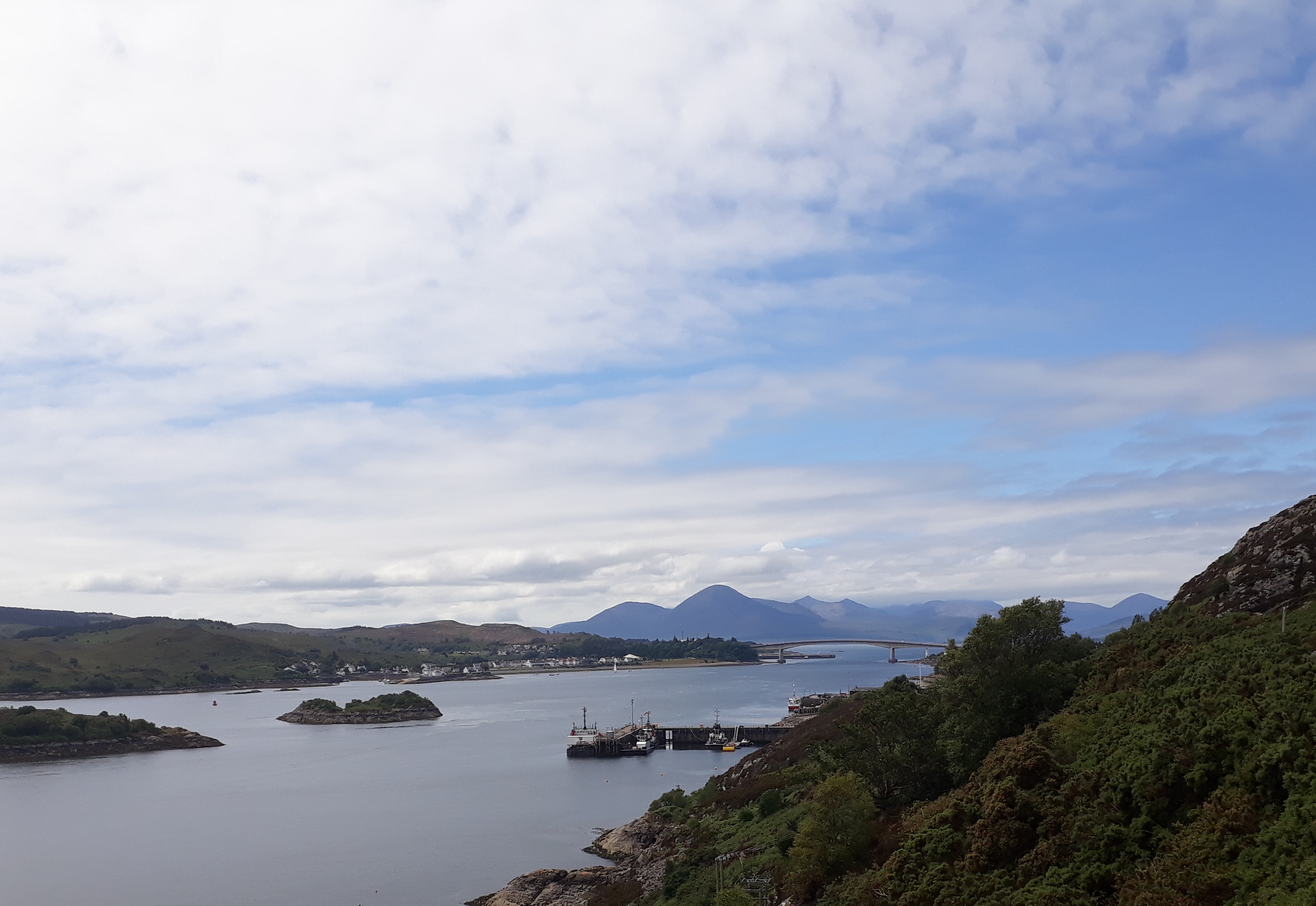
20180712_135406. I can never resist taking this photo as I approach the Skye Bridge.
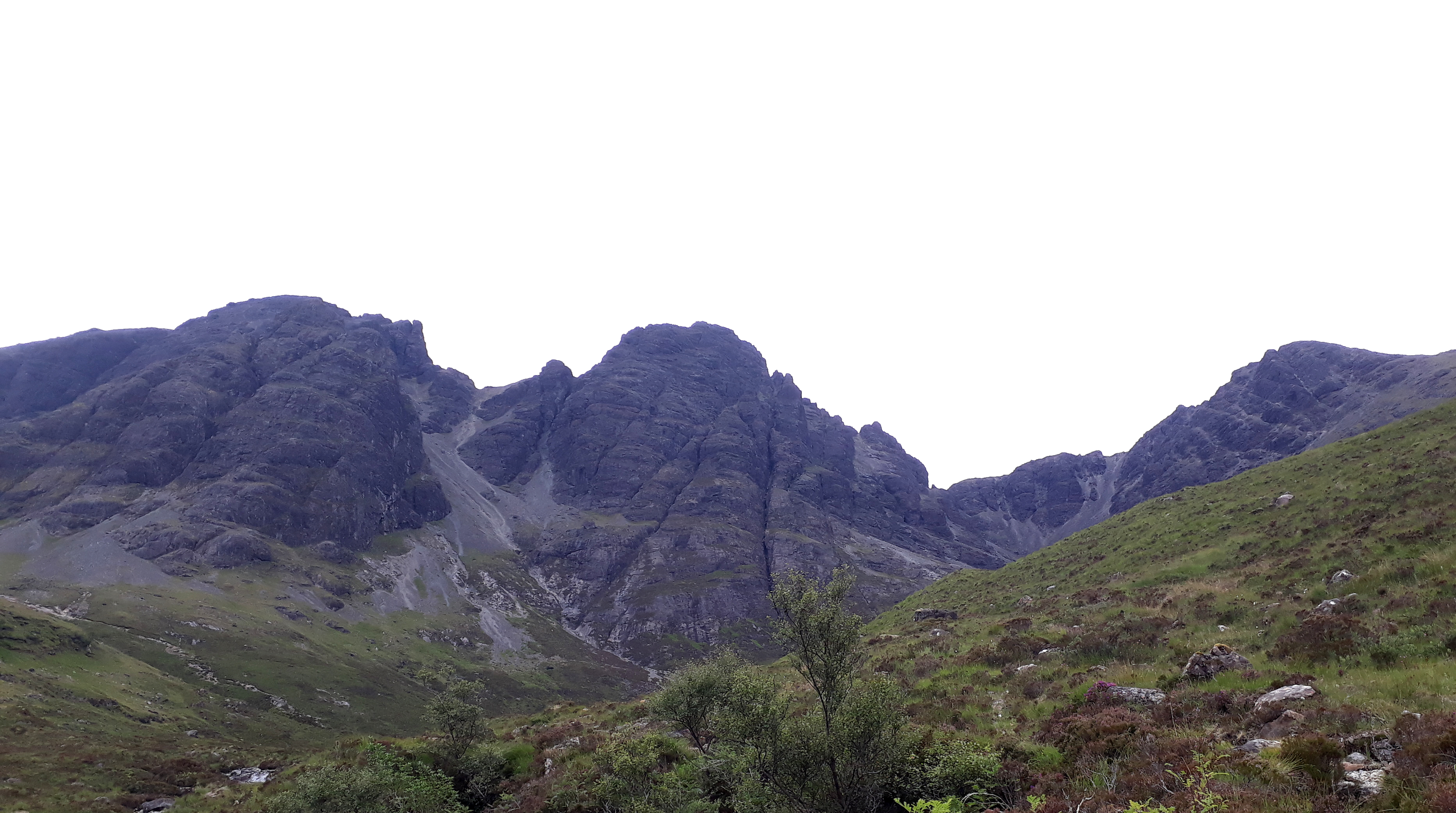
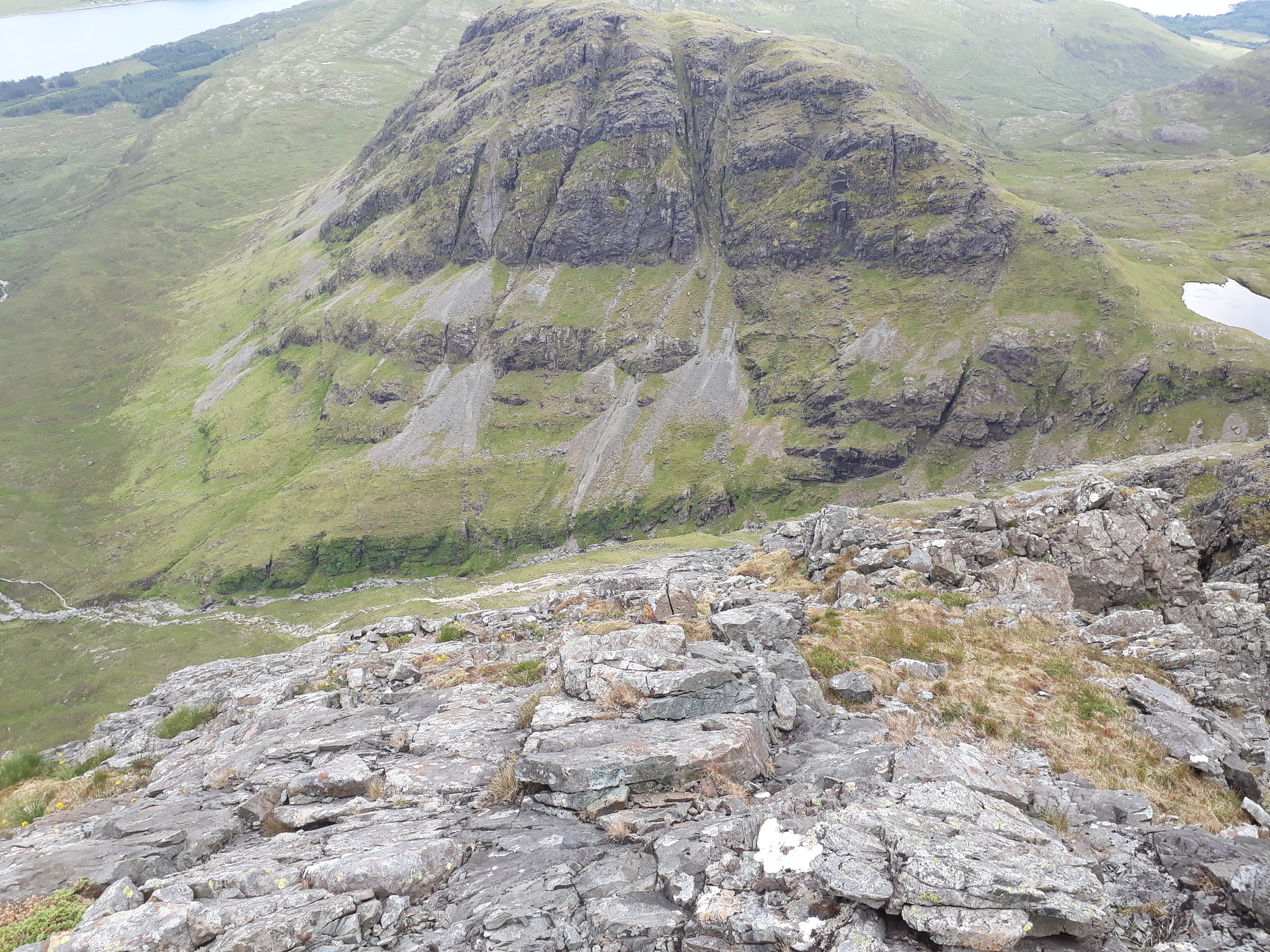
I'd originally thought of messing about on the Cuillin Ridge on Thursday afternoon, but quite late on I'd fixed up with Leithysuburbs to tackle Pinnacle Ridge on the Friday, so I decided to play about on Bla Bheinn on the Thursday afternoon. What scrambling enthusiast can look at the eastern aspect of Bla Bheinn without wanting to get into those seductive cliffs!
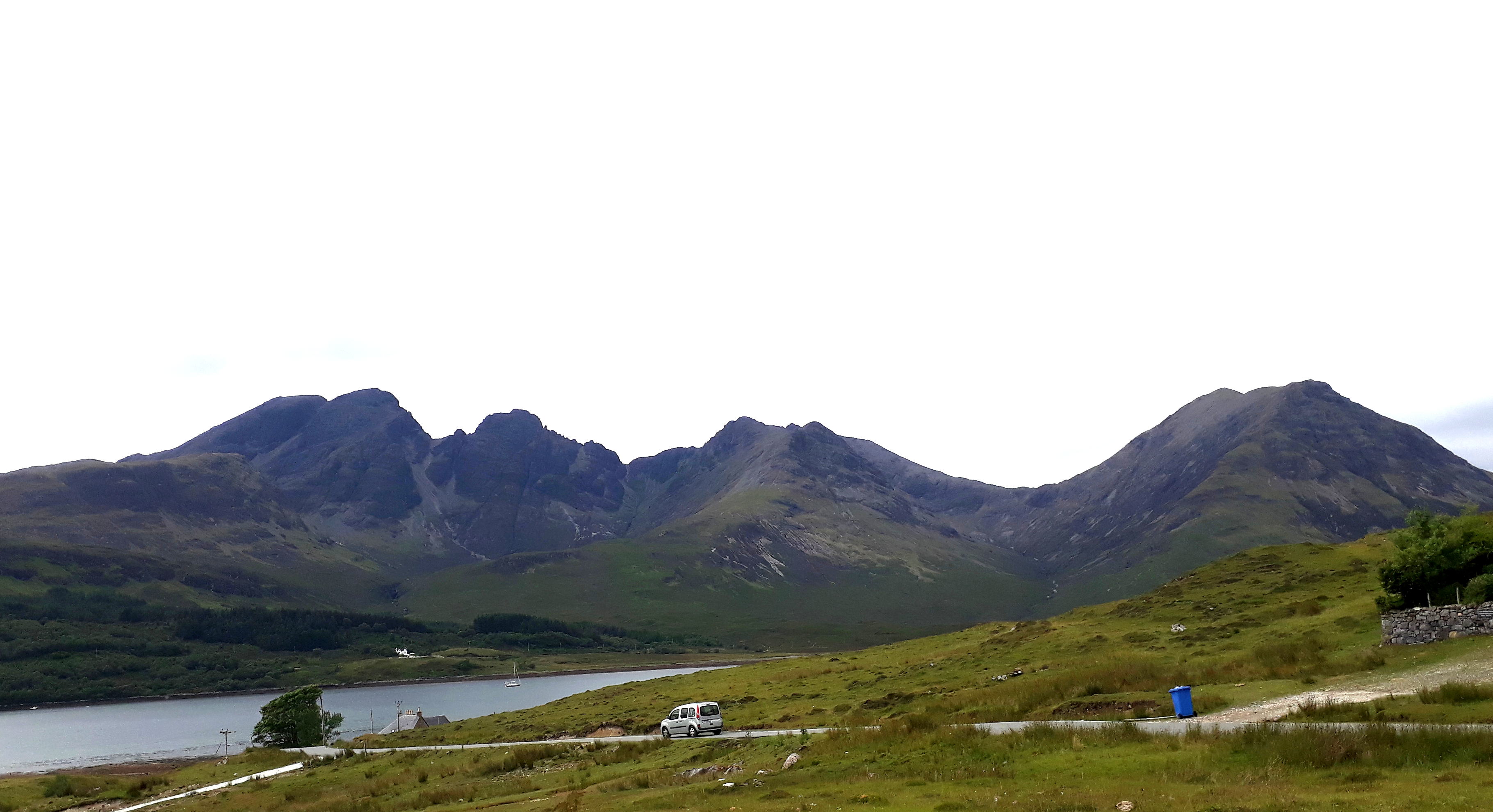
20180712_143316. As with the bridge, I can never resist this view of Bla Bheinn, at its most iconic.
I stop at the cafe at Na Torrin for a pot of tea, a piece of cake, and a review of the route. I've more or less fixed on the East Ridge, mainly because it looks long - about 350m of sustained scrambled ascent - rocky, steep and challenging - enough to fill a full afternoon (it was a toss up between this and Sid's Rake on Clach Glas).
I can't really understand the one star rating for this route in SMC's "Skye Scrambles", because it looks as if the views have to be spectacular. But when I check the definitions later, I see I haven't read the description of the star rating properly: the number of stars "...
generally refers to the quality of the activity itself, but the soundness of the rock, and the situation, sustainedness and escapability or the route all contribute to the quality rating." After I've finished, I try to assess the route on this basis, and my conclusion is that the rating is a bit niggardly. (see later)
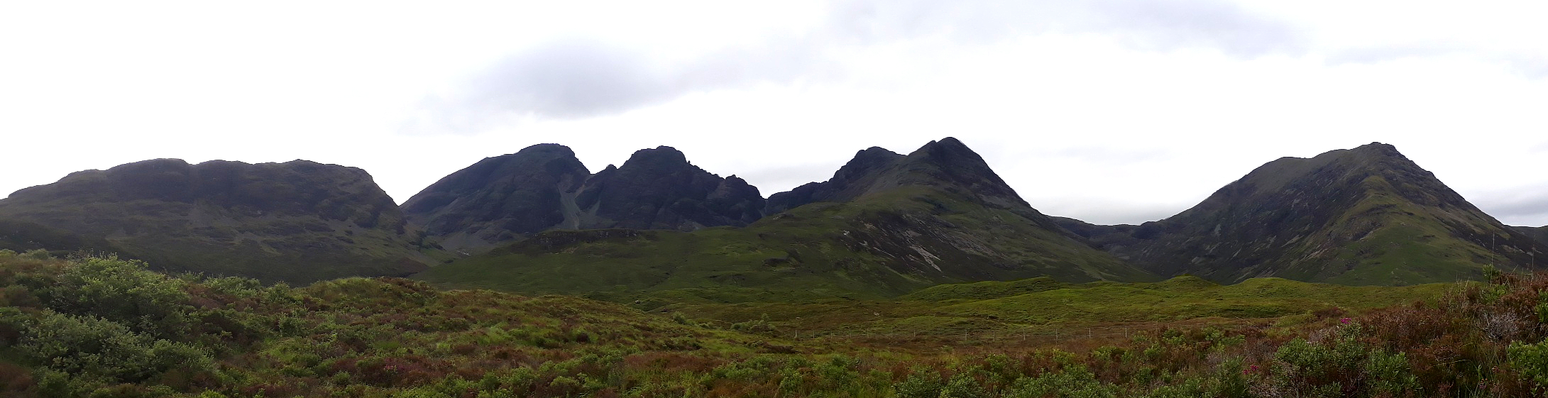
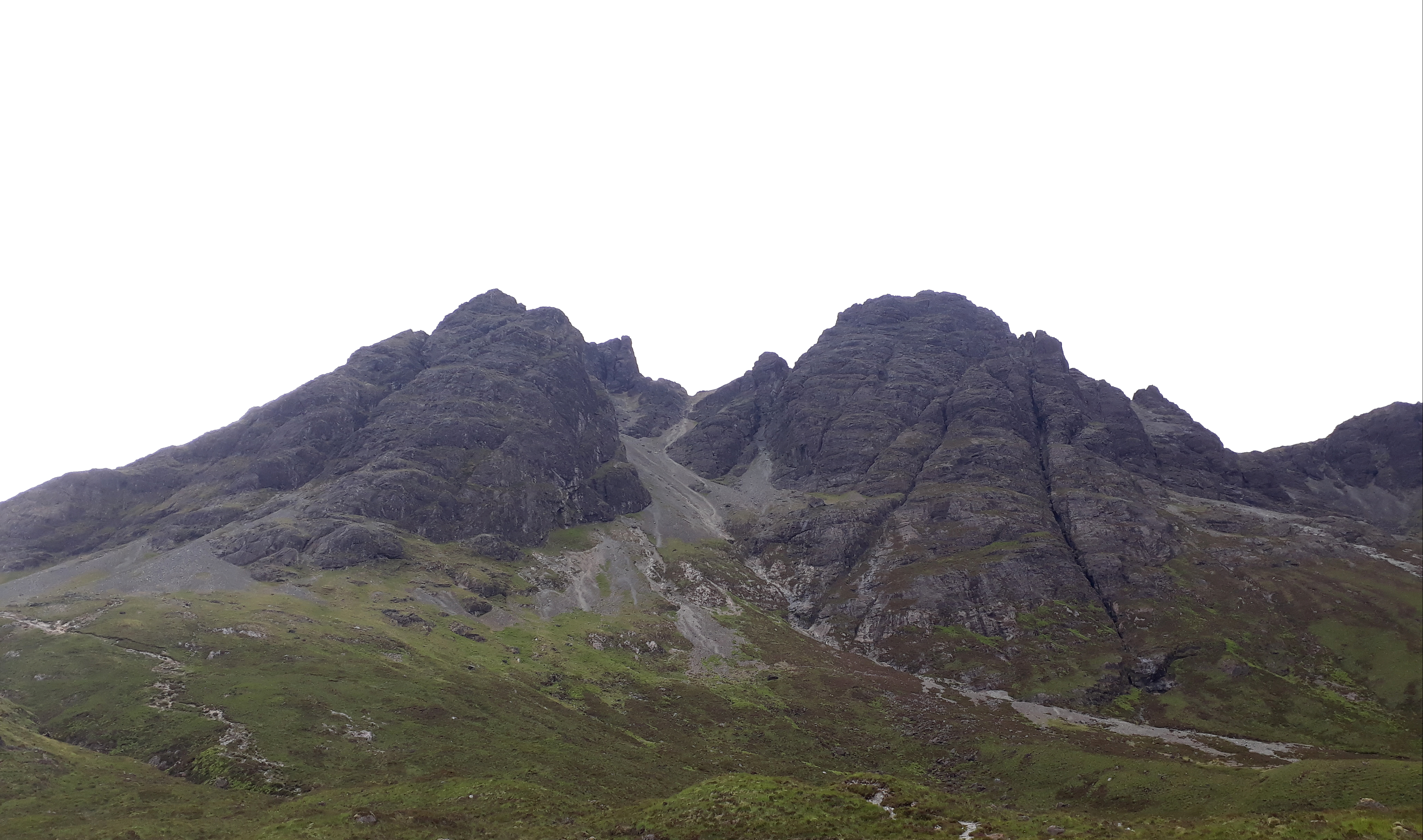
20180712_153631. Starting on the "tourist path" just after the car park, I can't resist yet another pic of the ridge from the east - more than enough to set the blood racing!
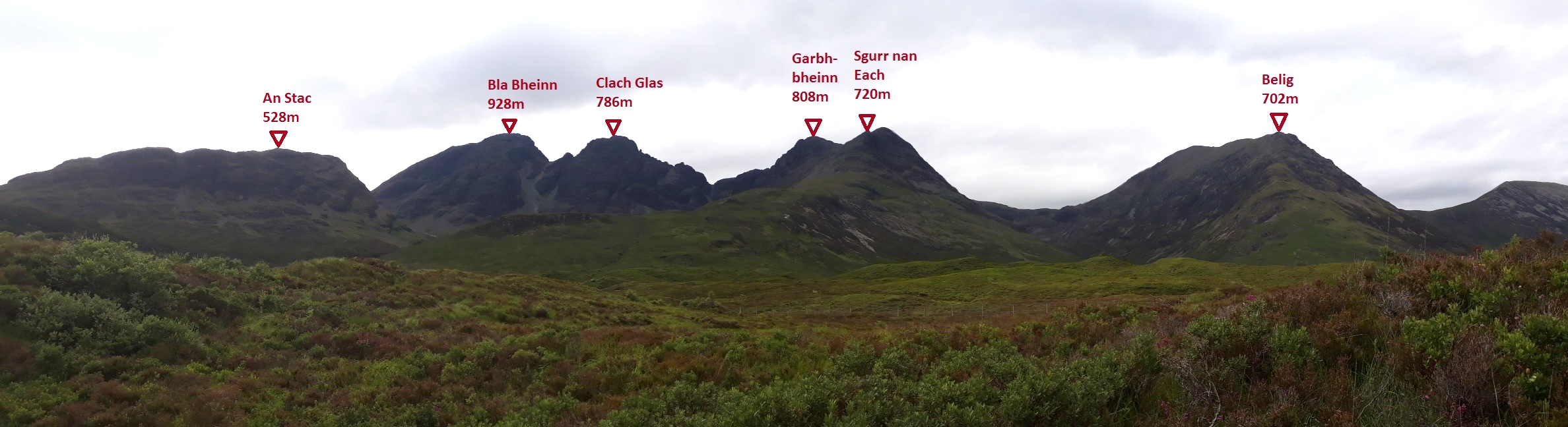
20180712_153601 Labelled.
20180712_155517. There's enough breeze for there to be no beasties or clegs, and soon I'm approaching the start of the route at about +350m
20180712_160341.
This is very approximately the route I take to the top of the first pinnacle. Essentially I simply look for lines that appear to be both interesting and challenging, but also reasonably doable; so I don't follow the route in "Skye Scrambles". From what I can see, there are many many options.
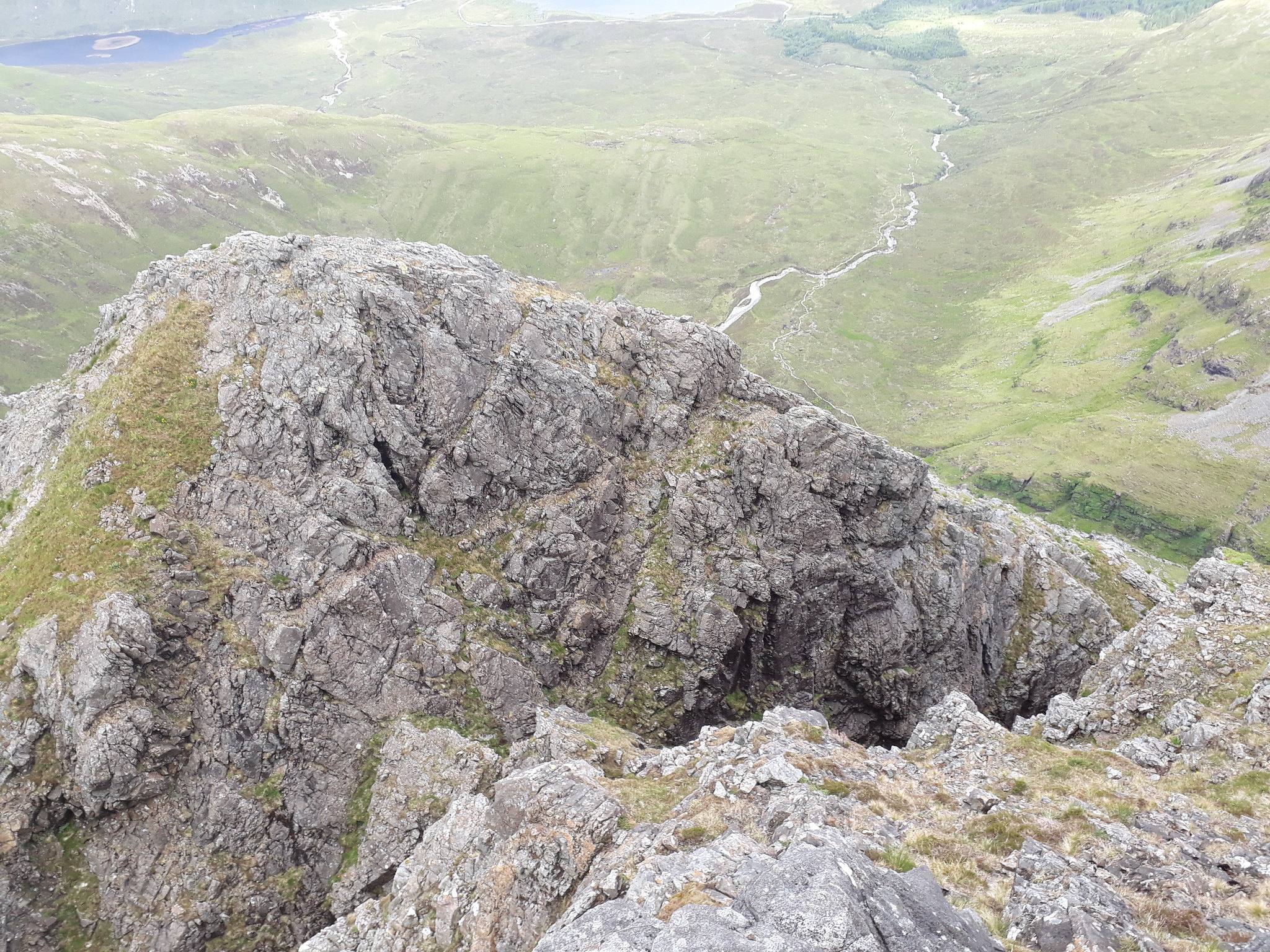
20180712_162726. Looking back down after about 15 minutes scrambling, and about a quarter of the way up to Pinnacle 1.
So far the scrambling has been pretty straightforward - about Grade 2 perhaps; but there is a lot of loose blocky rock, so it takes somewhat longer than it would have on, say, Gabbro, as I seek secure foot and hand placements. This pic gives an idea of what the rock is like.
20180712_163308.
20180712_164141. Looking back east towards An Stac (528m) and the head of Loch Slapin.
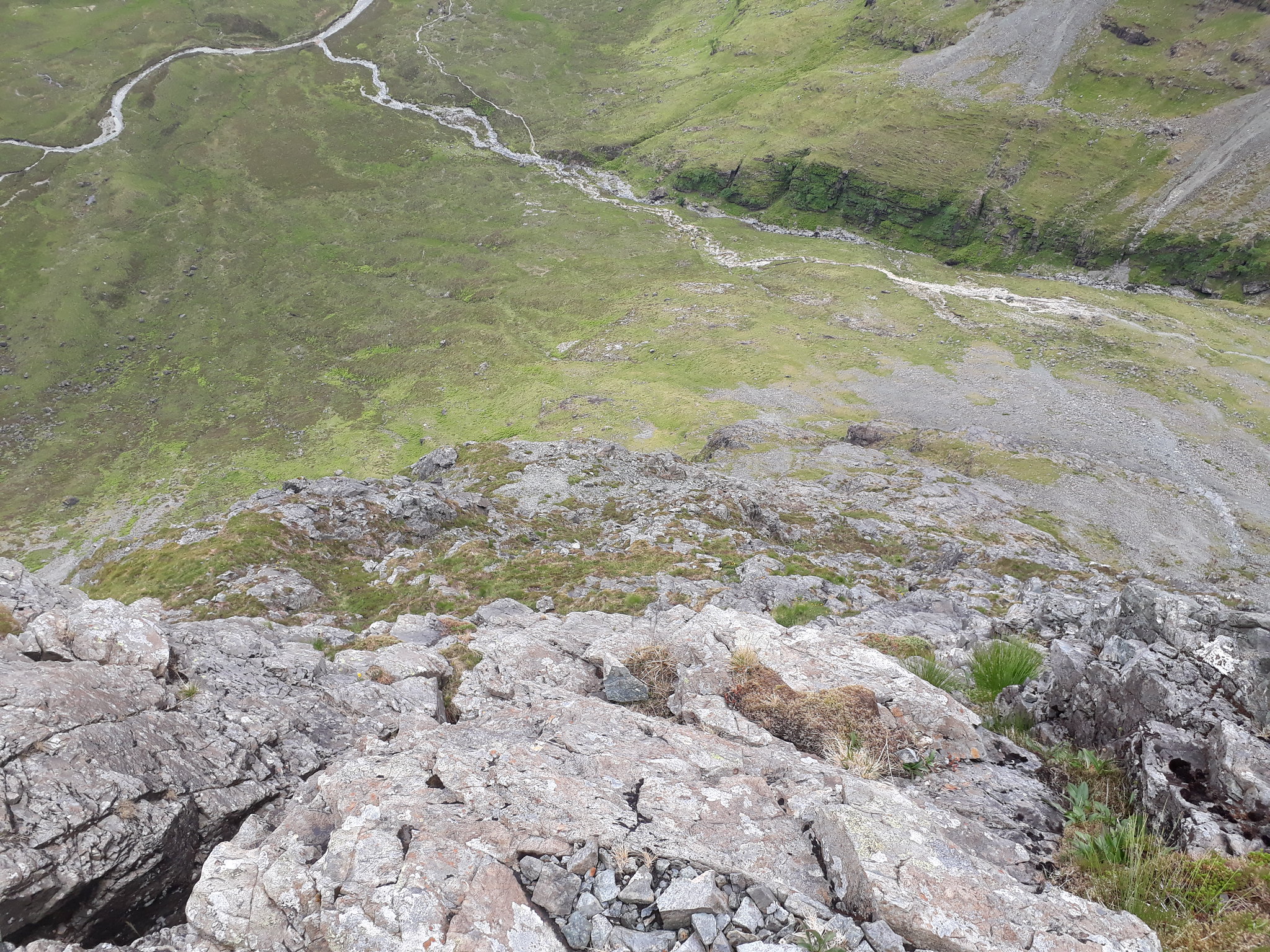
20180712_165130. And back down the way I've come (from here it looks greener than in practice it is).
20180712_165412. Looking north, Sgurr nan Each looks pretty attractive in its own right from here - much cliff on the south face that looks as if it might be susceptible to a scrambling assault or two...
20180712_165535. Gully just before the top of the first pinnacle. I follow a route to the right of the gully.
20180712_165556. Looking back down the slope.
20180712_170102. Ascent is quite speedy...
20180712_170234. Looking at the south side of the gully on the last stages of the ascent of the first pinnacle.
20180712_170837. Looking back east from the top of the first pinnacle.
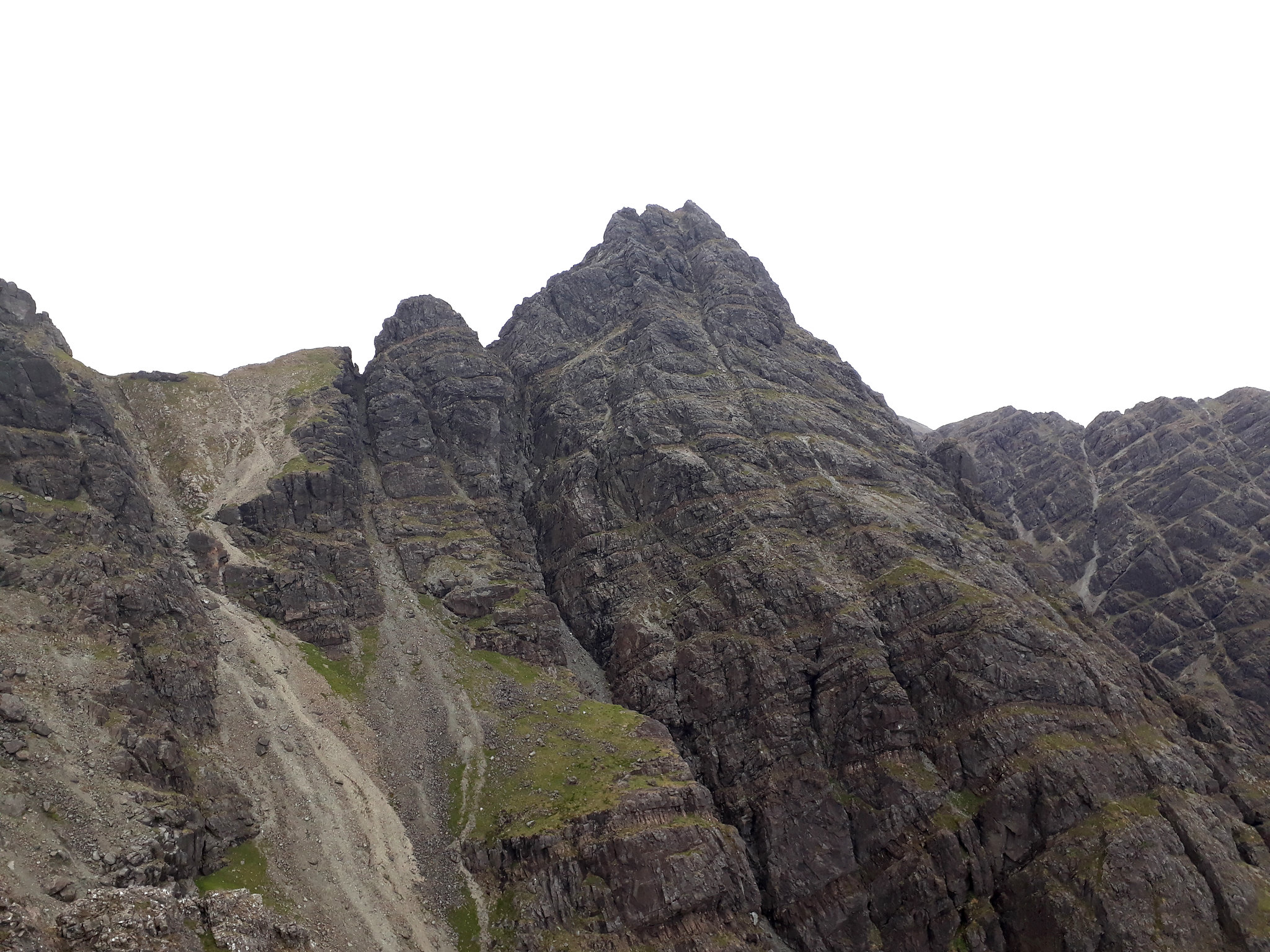
20180712_170851. And looking approximately north west from more or less the same location towards the south east face of Clach Glas. Wow and wow! Definitely another few days scrambling available there!!!

Mouthwatering, or what .... ????
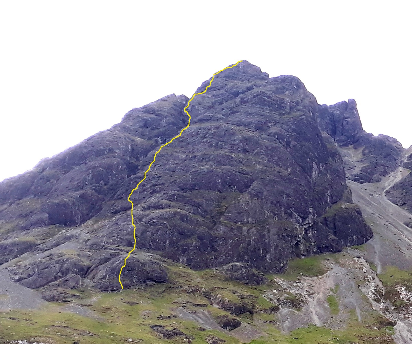
From this point on I'm climbing more or less on the North Face of the East Ridge until the top of the 2nd Pinnacle.
This is the route described by SMC.
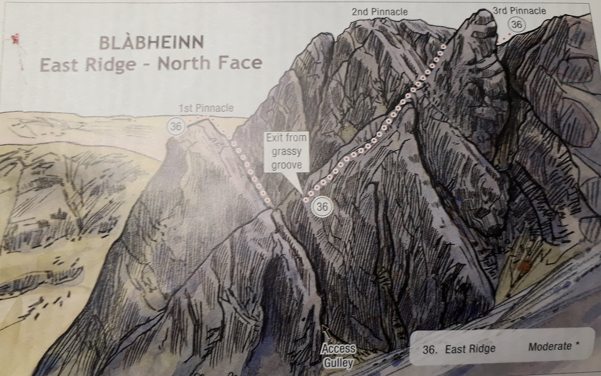
SMC East Ridge Route.
I don't really like the look of the diagonal route rising to the right - which looks like it will miss out some good rock - and prefer the idea of trying to force a route more directly up the face.
Looking down into the cleft to the SW of the summit, I see a line running to the left, and decide to go for that.
20180712_170921. It looks quite doable from the top.
I don't recall anything about the downclimb into the cleft, which I suppose means there was nothing of particular note or especially hairy...
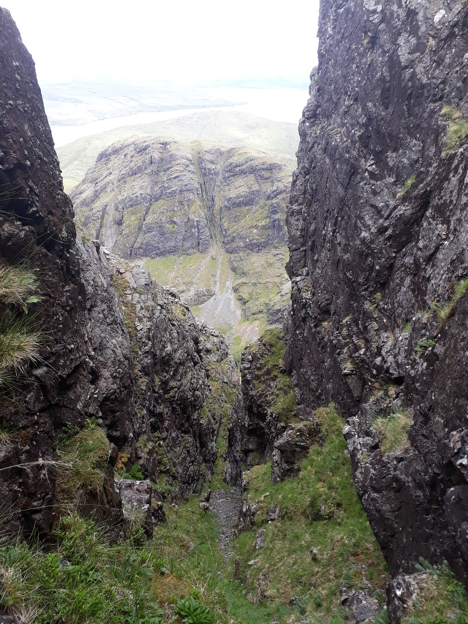
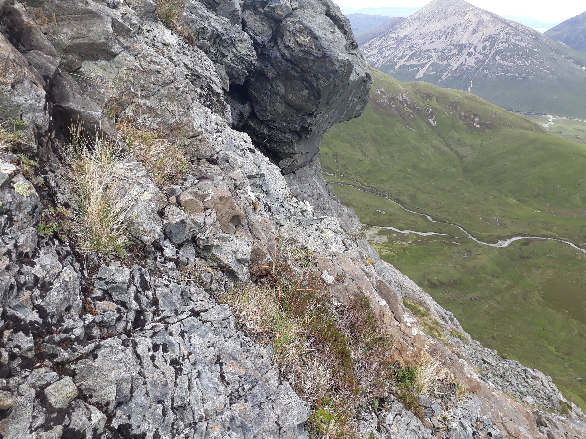
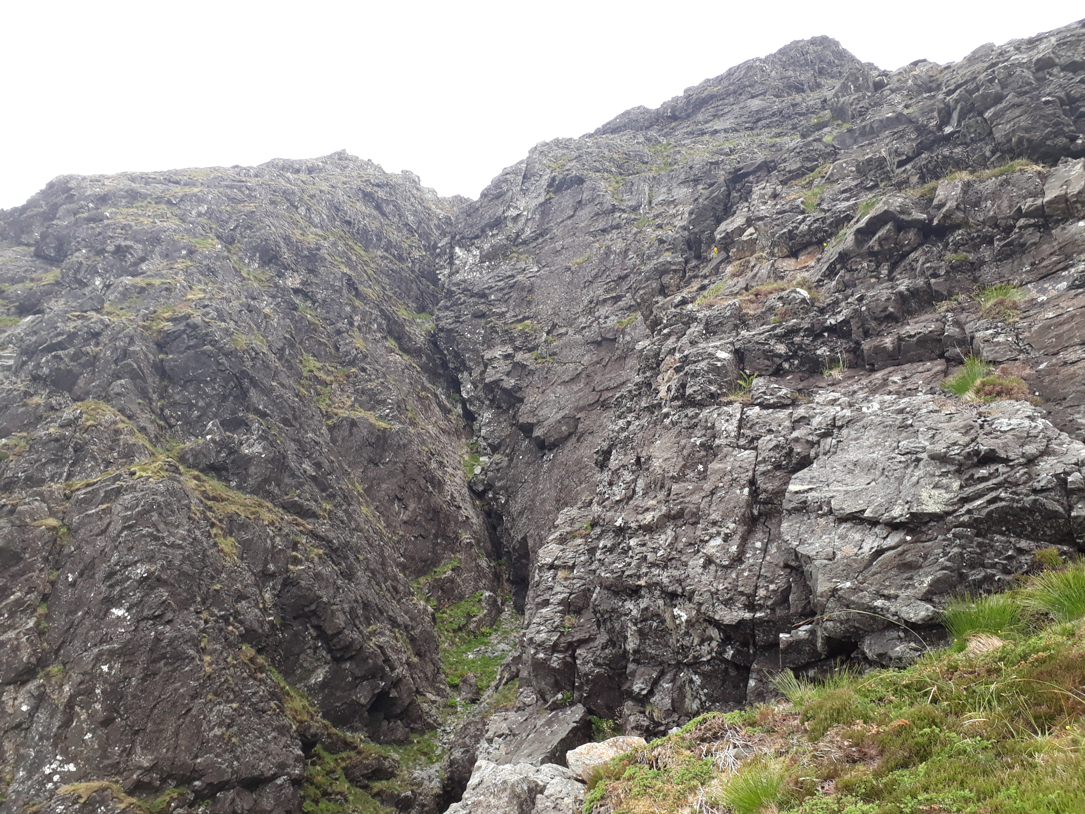
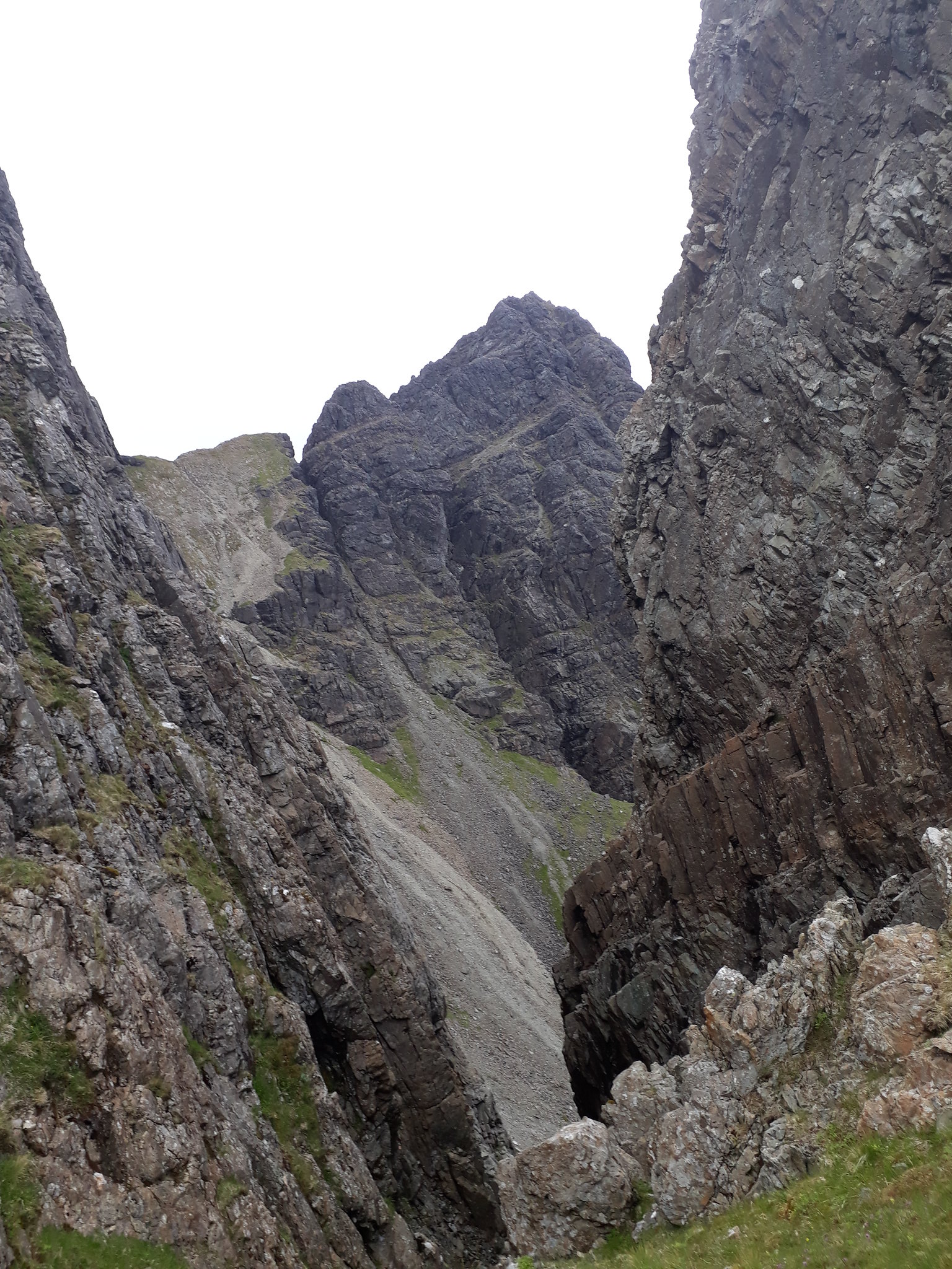
20180712_171811. Down in the cleft it's quite dramatic - very steep sides, and a sensational view out east into D Gully (barely visible) and down to the bottom of the cliff.
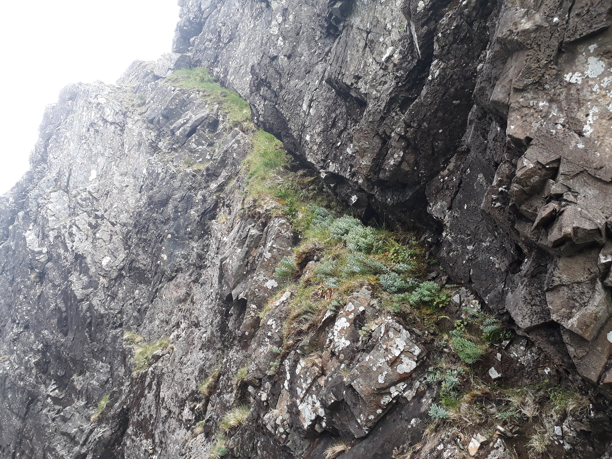
20180712_171925. However, what does become apparent is that the leftwards slanting traverse on grass is not as straightforward as it appeared from the top. The view from the top masked the fact that there is rock overhanging the ledge, and I would have to crawl on my belly to clear it, pushing my sac ahead of me.

No - it definitely looks too hairy!
So I revert to the route recommended in Skye Scrambles ...
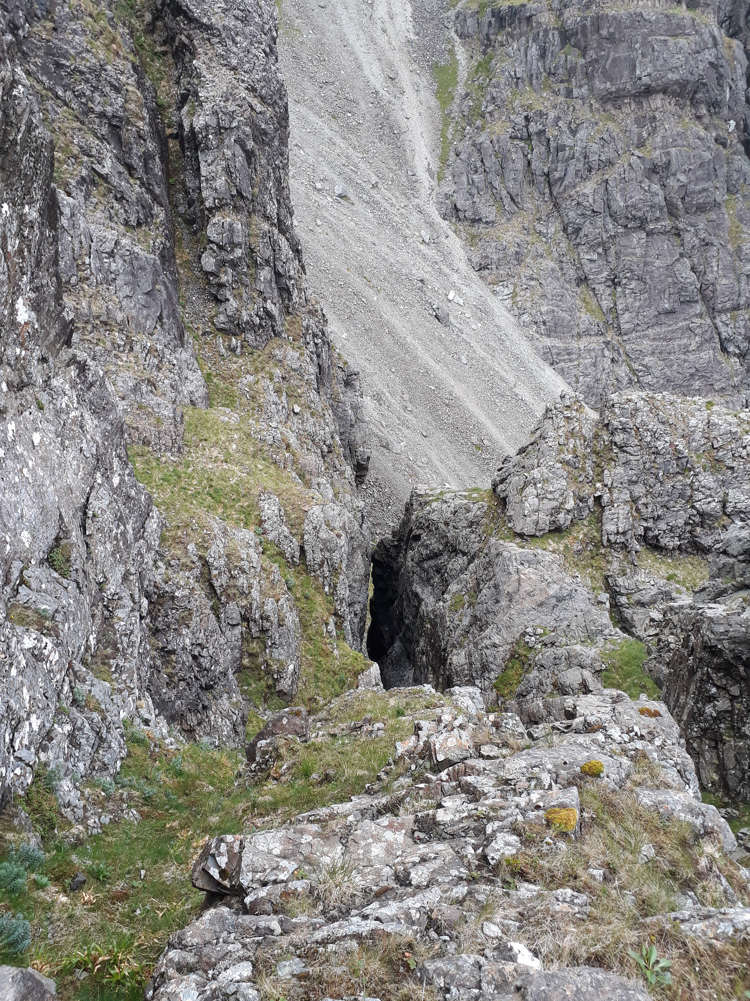
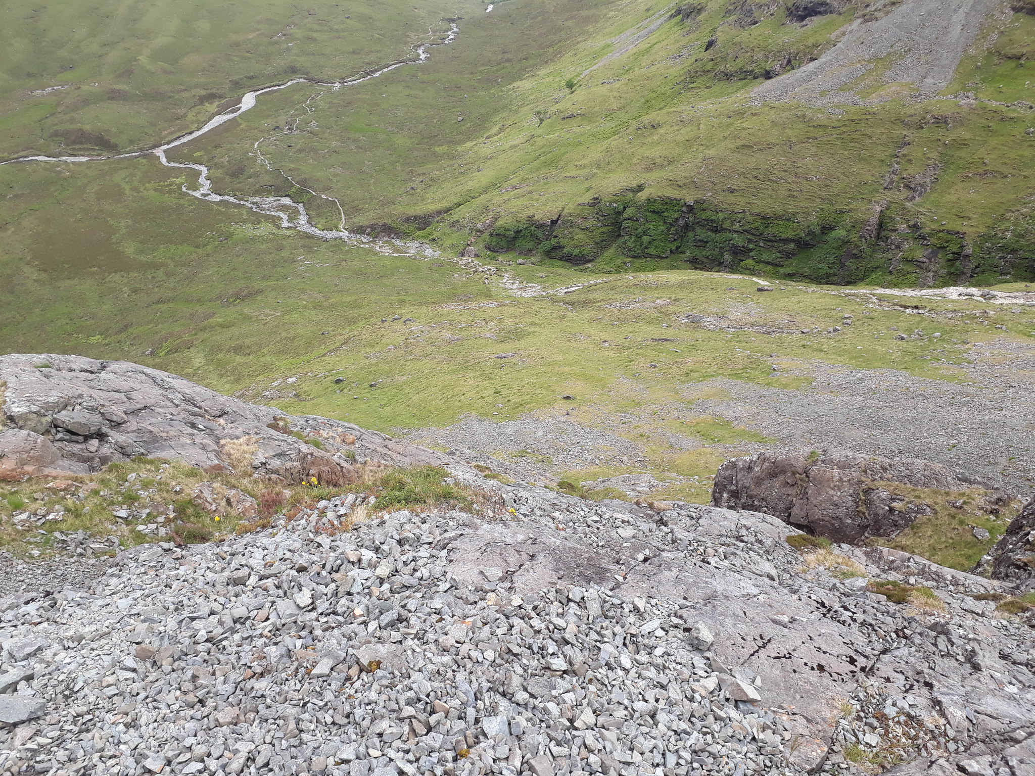
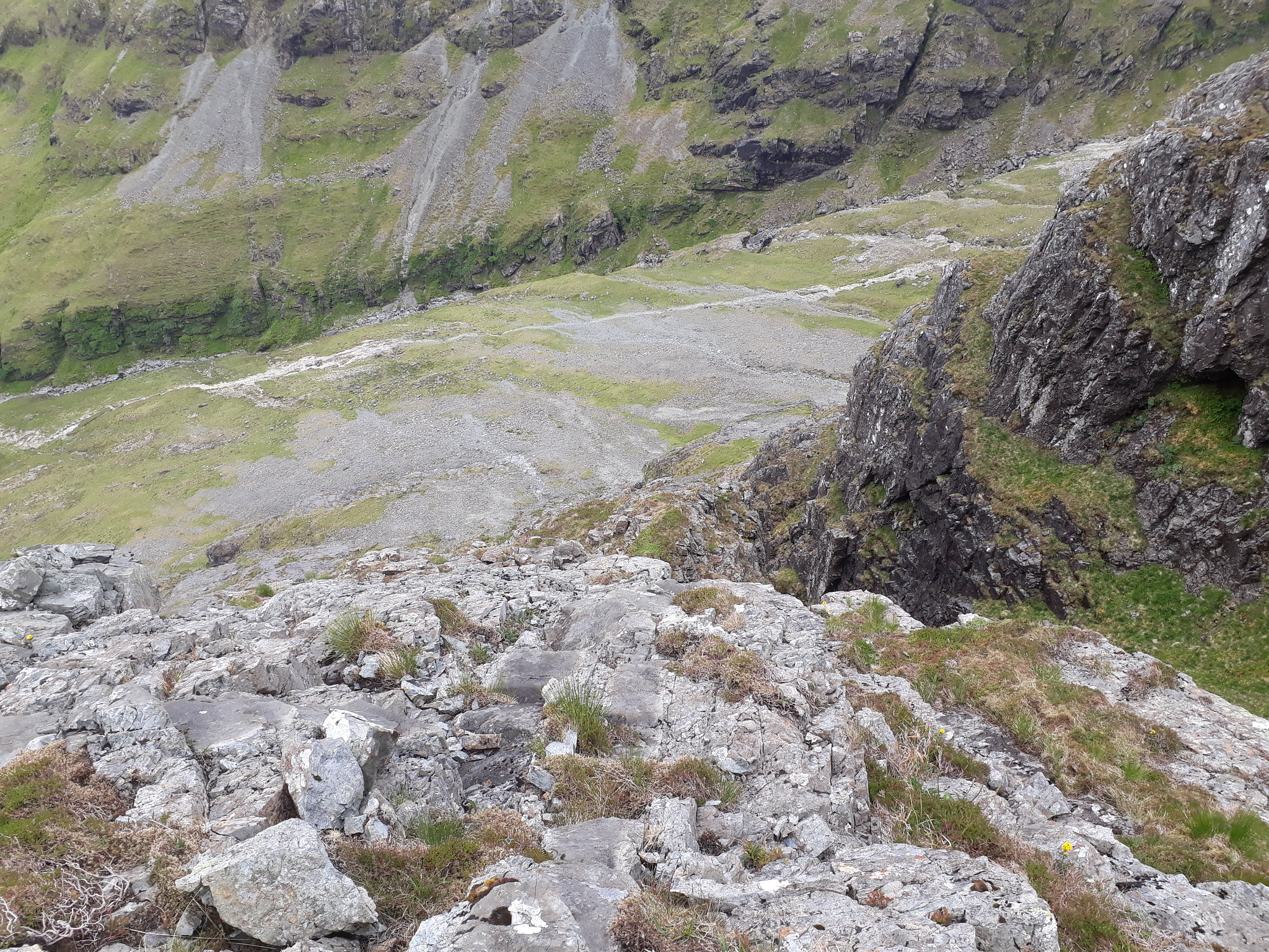
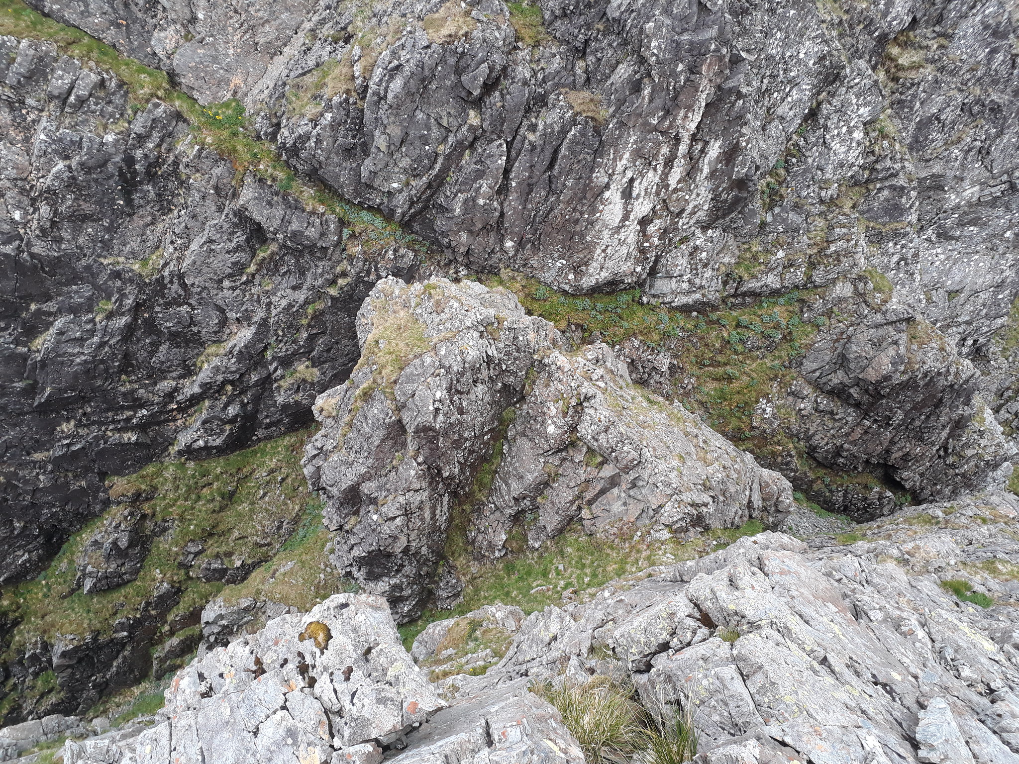
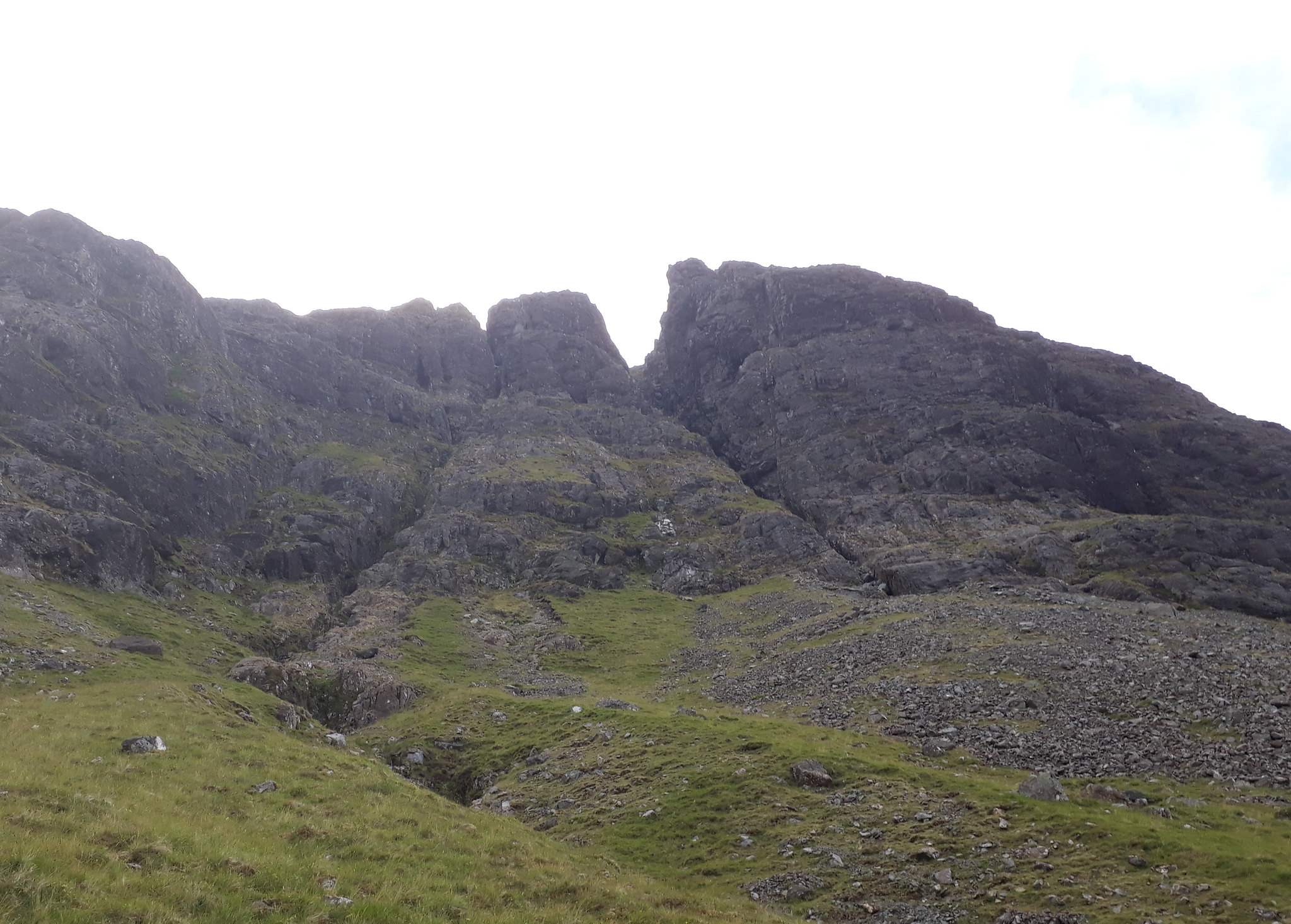
20180712_172426. This involves dropping about 15m in a NNW direction down Access Gully, and then ascending the dyke/notch about a quarter of the way in from the left on this pic.

20180712_172418. Looking back up towards the notch on the descent to the start point
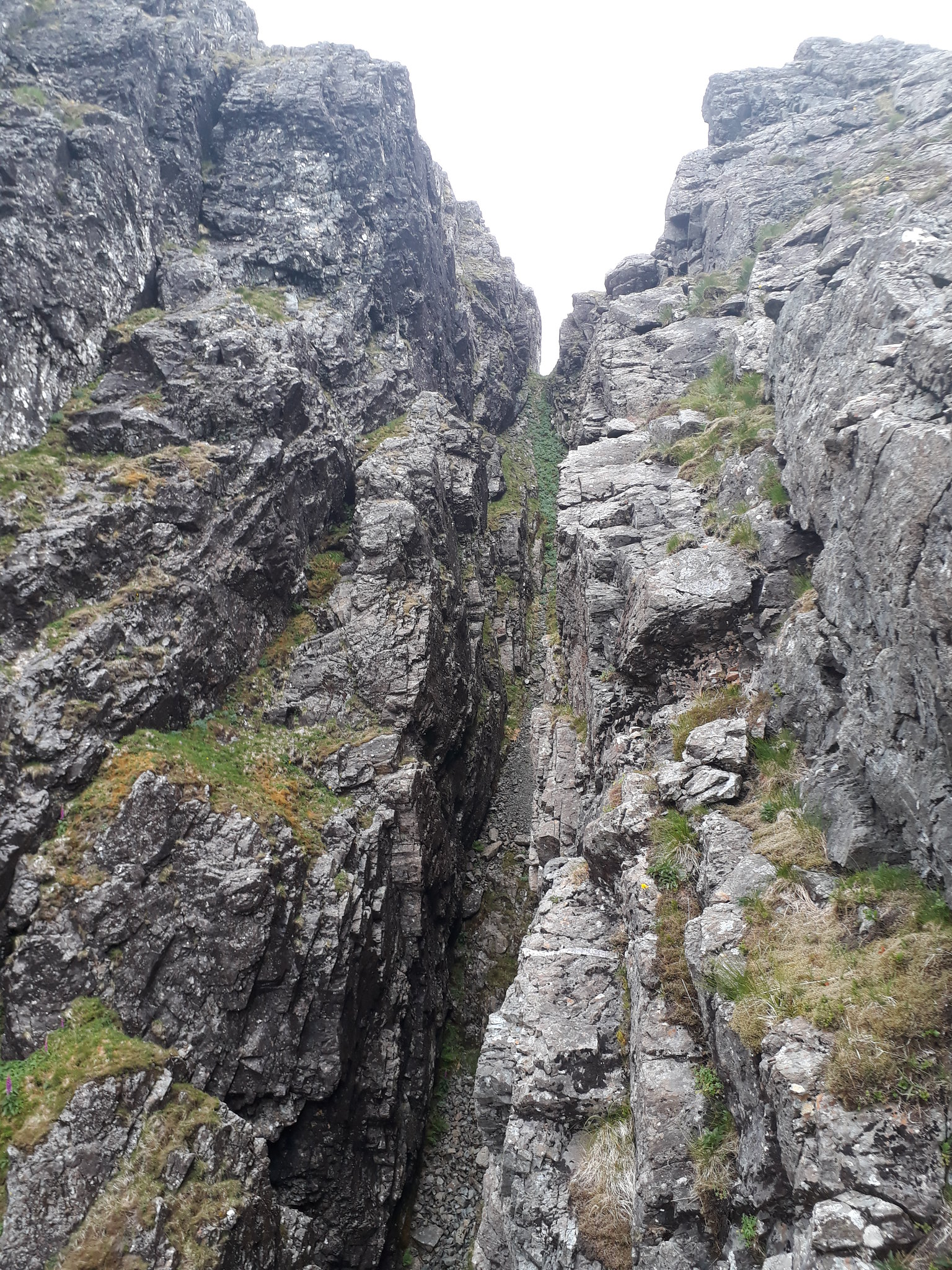
20180712_170858. This is a view of the cleft/dyke slightly further up, taken from the top of the first pinnacle - at this point I'd not been thinking of taking this route.
I follow the dyke for a while - perhaps 30m - and then cut up more or less vertical, following doable lines. It is a lot of fun, but quite intense, and I "forget" to take any pics - ie it really is quite intense
.
However: part of the intensity is a consequence of the state of the rock. Example: on one very memorable occasion I go for a narrow cleft - a shallow crack really, about 50cm wide at the mouth and narrowing over about a metre of depth to nothing - with little in the way of support except for a small (5 kg?) chockstone. I test it as a handhold on the way up - OK. I use it, with no problem. I test it as a foothold - no movement, feels solid. I make use of it as a foothold, and it feels "rock" solid. But a bit further up I reach an impasse, and have to climb back down. As I weight the chockstone in question with my left foot, it quite suddenly, and without any preliminary warning movement, gives way and plunges away into the depths. Fortunately I'm fully supported on the other 3 hand/foot points, and there is no bad outcome. But in principle there could have been.

Whew!
So: BIG health warning - if you take this route,
take super extra care with the rock. This is not particularly highlighted in the SMC book, and it may be that the route I took - somewhat off piste, and not as recommended - was especially questionable in terms of rock quality. In any event, I really would emphasize that anyone ascending this route should take extra special care.
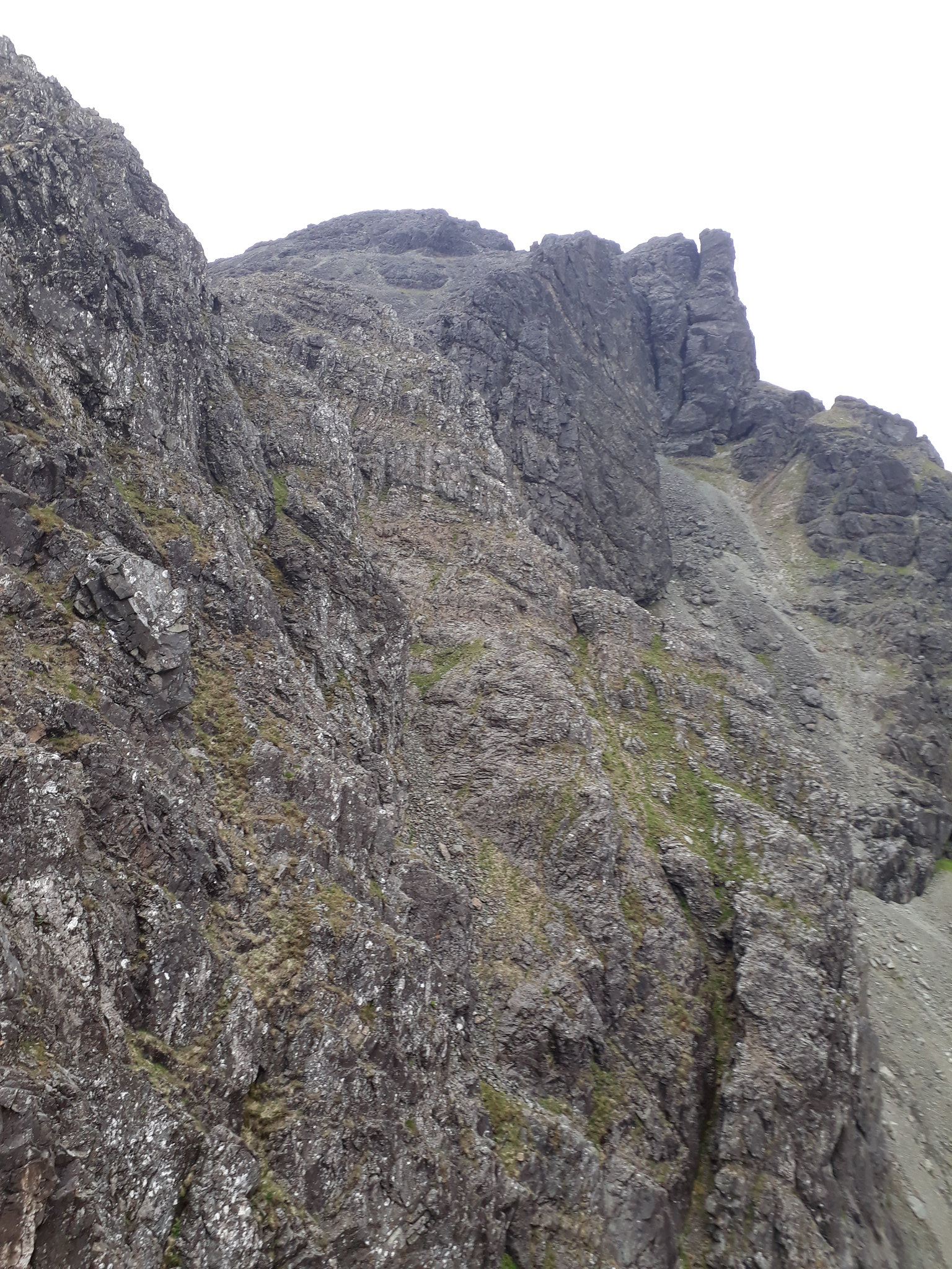
After which intensity, I arrive on the ridge itself.
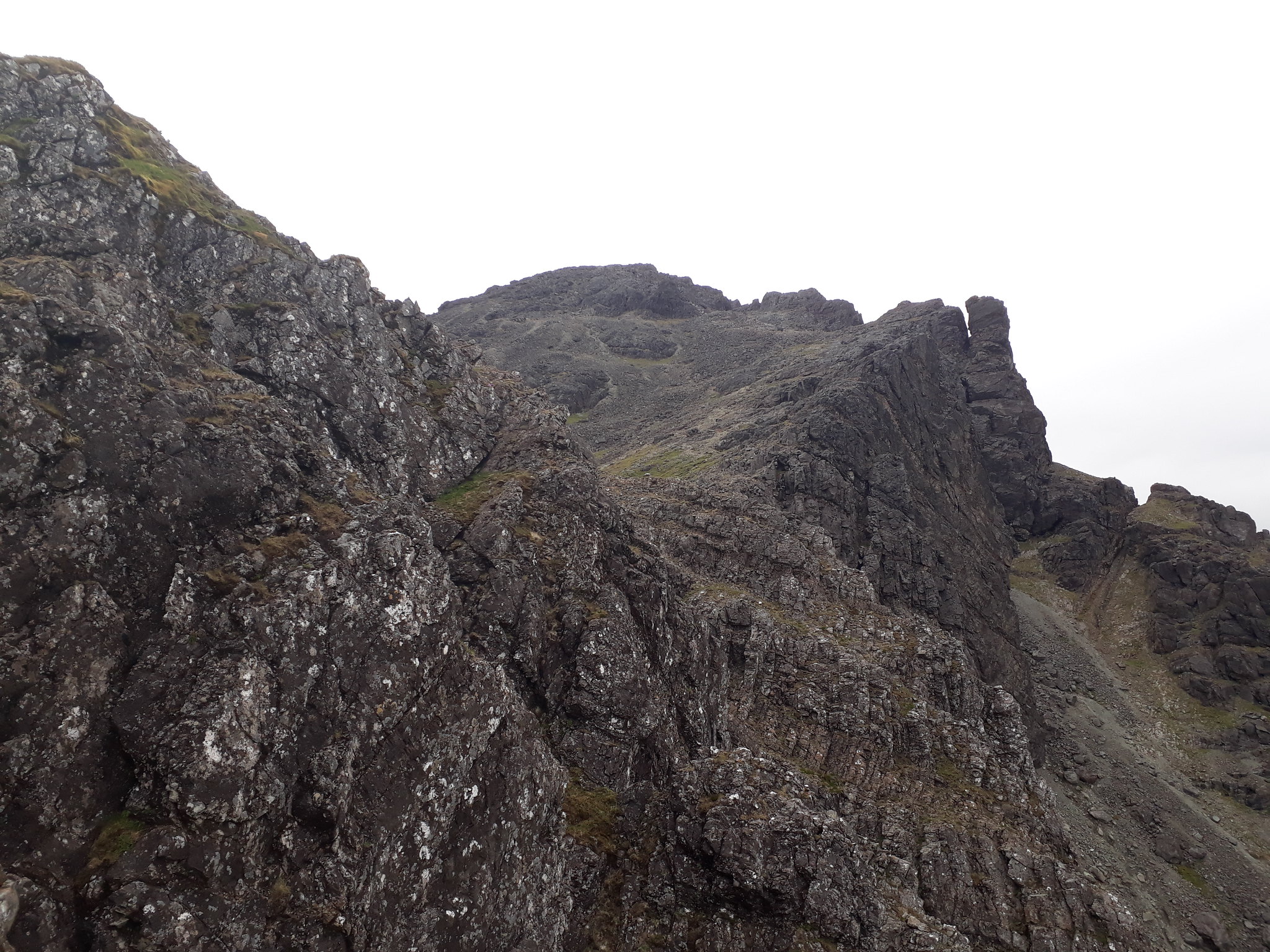
20180712_174859. This view is looking back at Pinnacle 1 on the way up the ridge to Pinnacle 2.
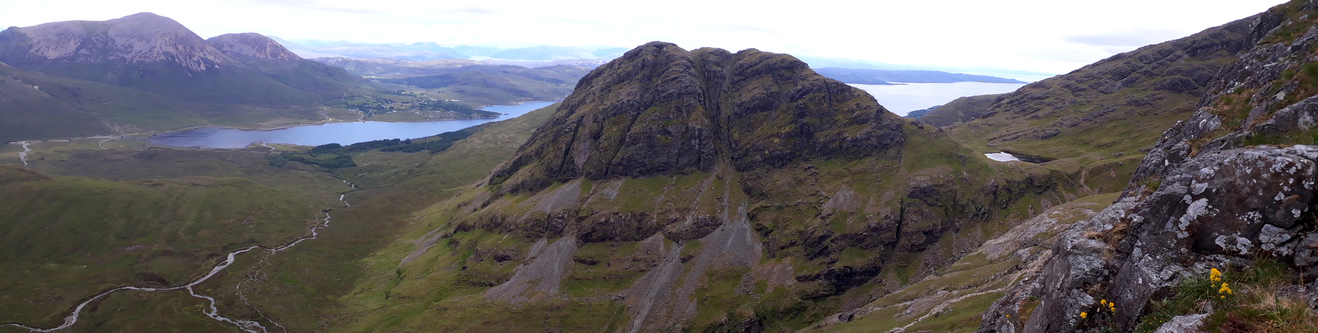
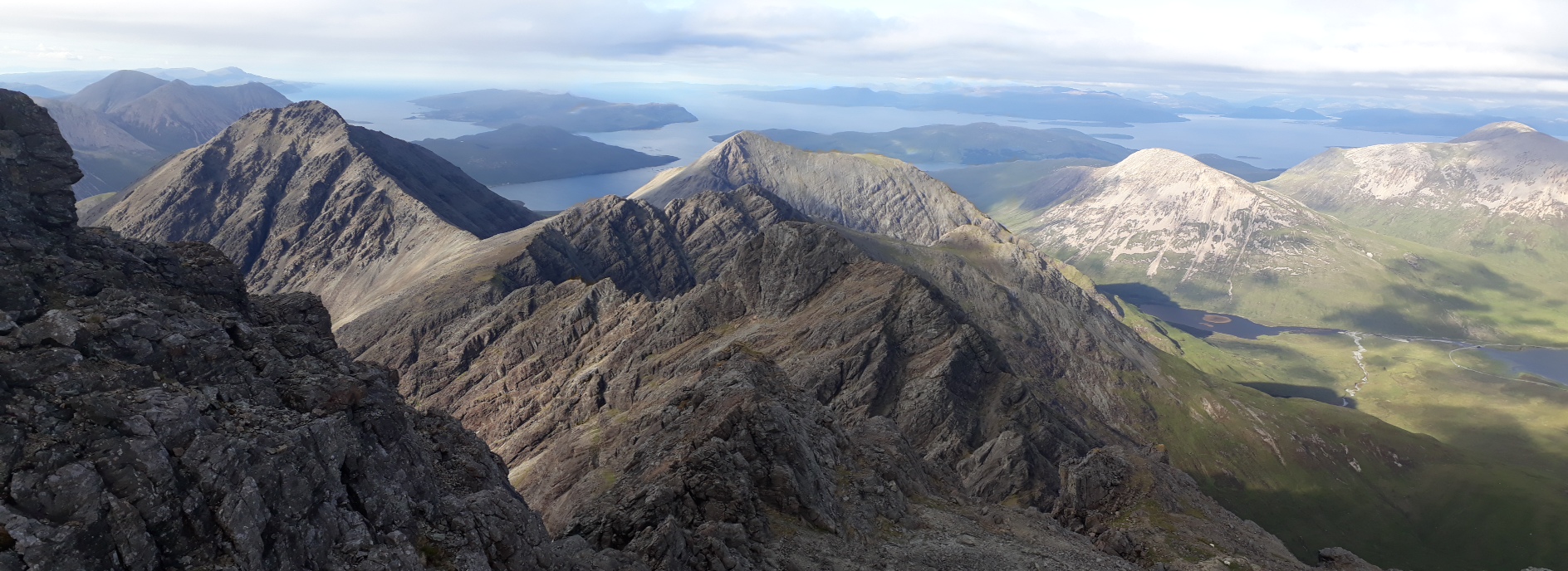
20180712_175240. Ongoing horribly seductive views of the East Face of Clach Glas - definitely I have to get back here!
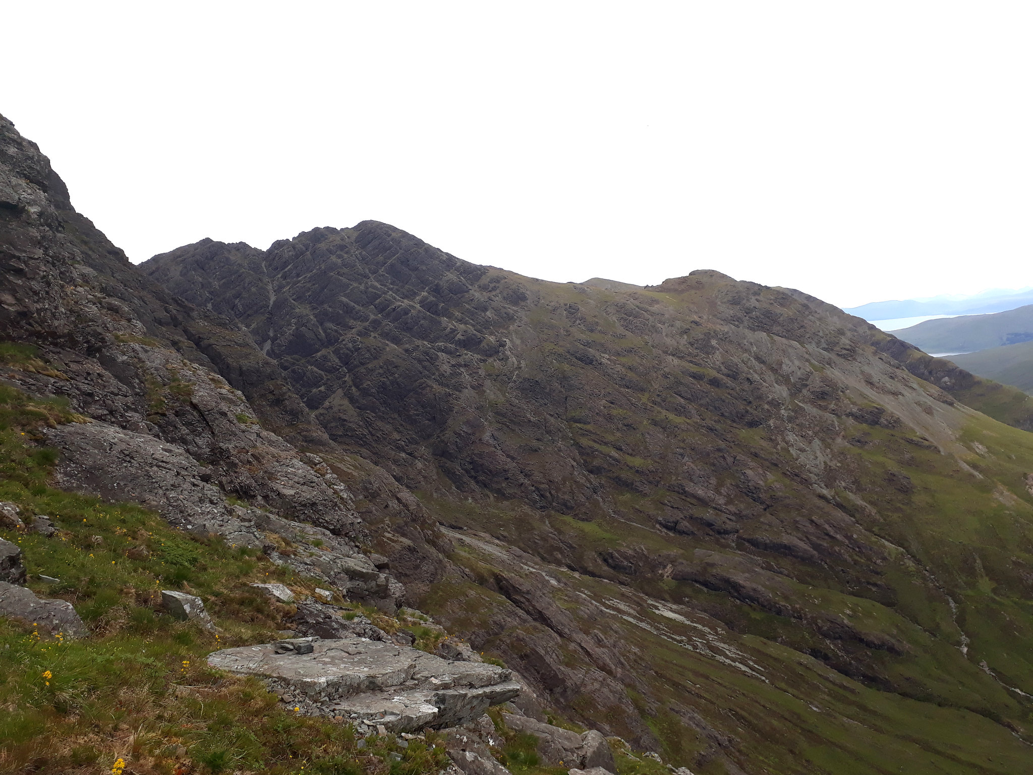
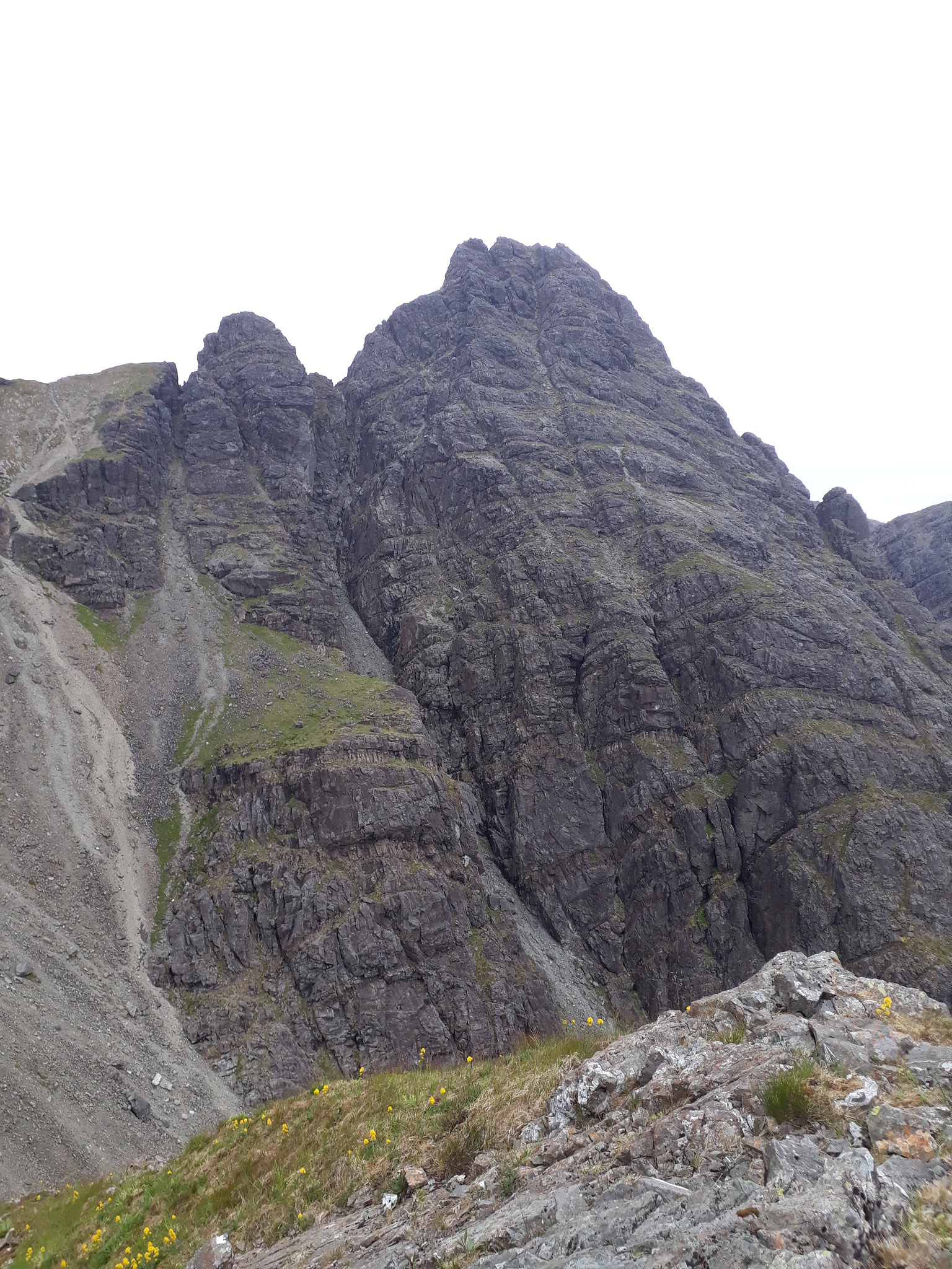
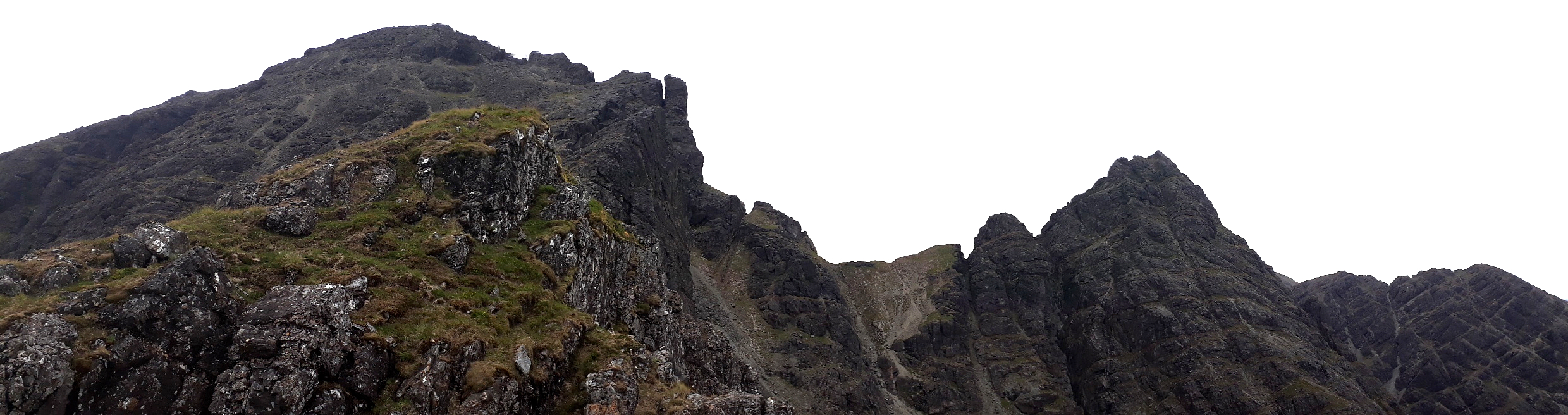
20180712_175245. Ahead the 2nd and 3rd Pinnacle.
20180712_175527.
20180712_180016. Clach Glas again, viewed from the bottom of the descent from Pinnacle 2 ( which is quite straightforward).
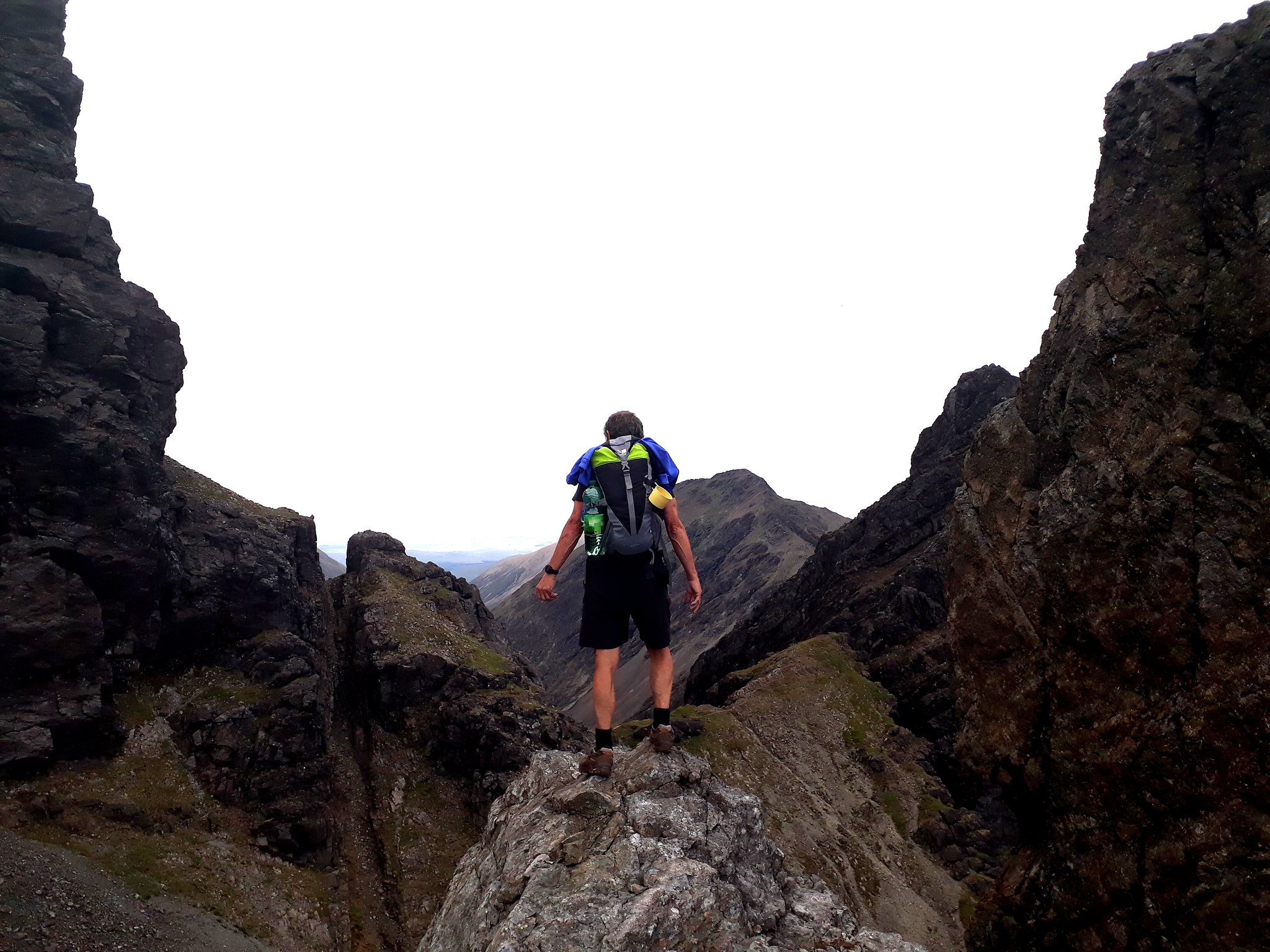
20180712_180618. After the descent from Pinnacle 3, I bump into Paul, who is quietly meditating on the environment, and he kindly takes this someoneelsie.
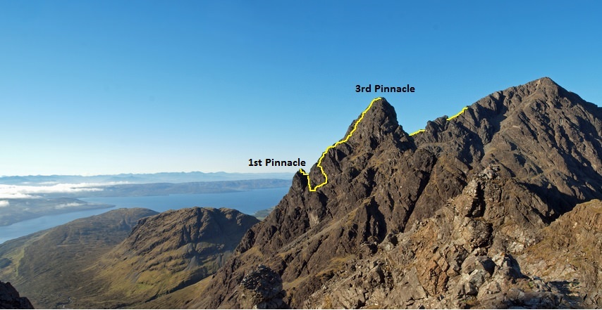
This is very approximately the upper part of the route I took (not my pic).
After this it's essentially walking - with some small detours to take in very short scrambles - until I reach the summit.
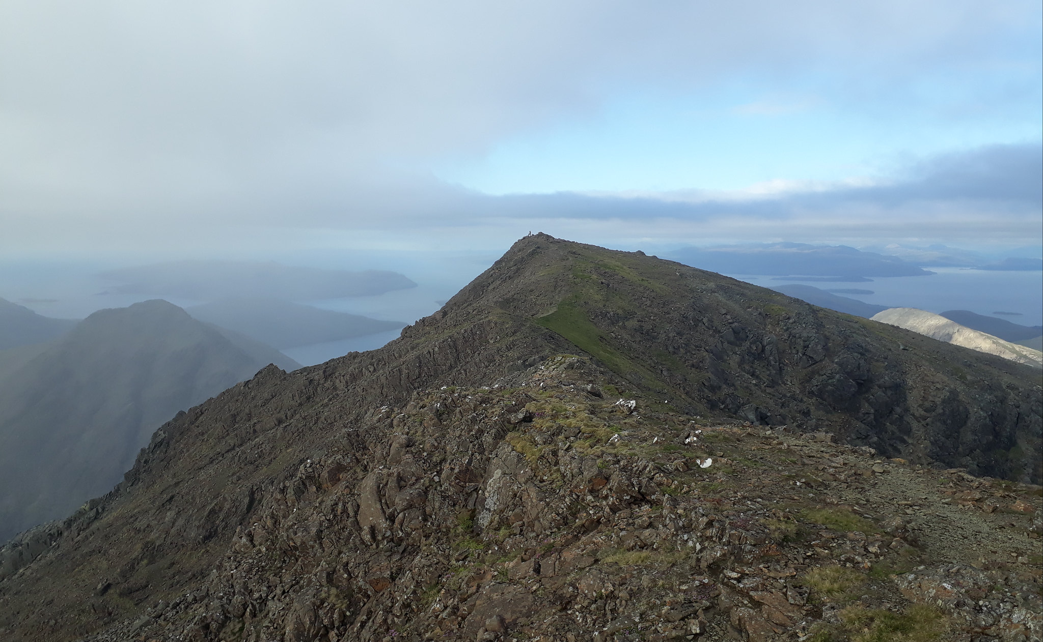
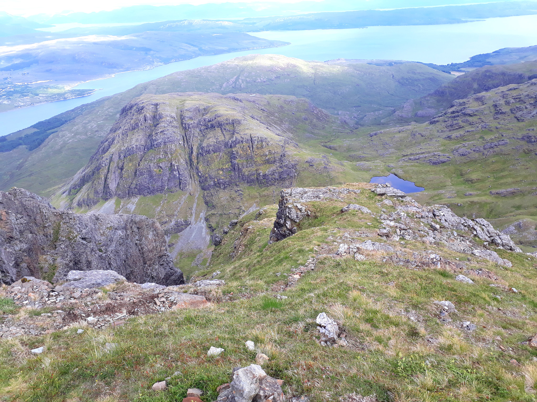
20180712_183230. From here it's just a few minutes walk to the south summit. This is looking across from the south false summit (926m) to the true summit (928m) - with Paul taking pics, giving it some scale.
20180712_183920. This ridge was dominant to the west - not sure what it is ....

?
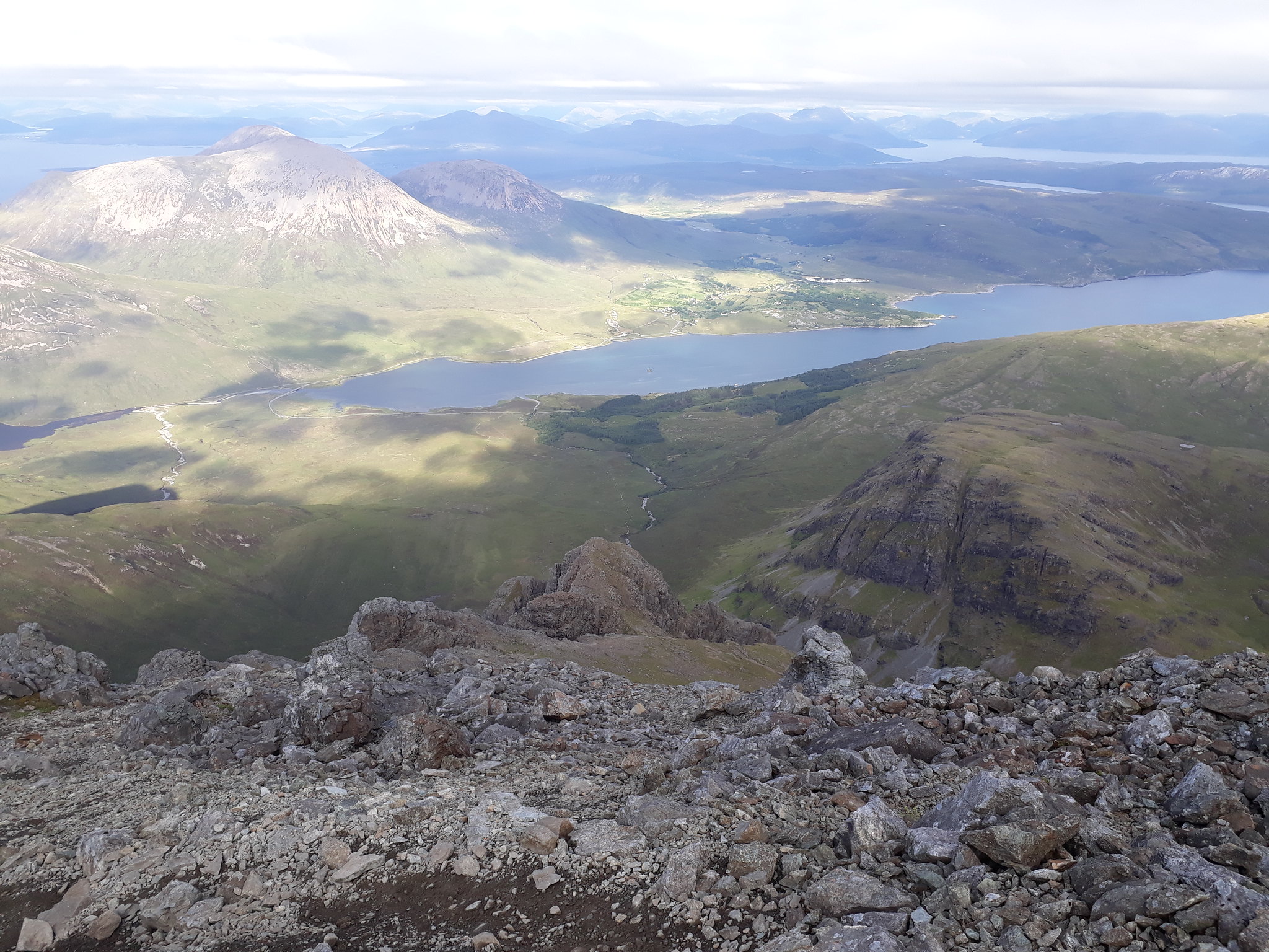
20180712_184602. The start of the descent by the standard path.
20180712_184654. Looking north towards Clach Glas, Sgurr nan Each and Garbh-bheinn. Simply sensational!
20180712_185602. On the way down.
20180712_190811. A final look back at the start of East Ridge (RHS buttress)...
Unfortunately I manage to trip when crossing the small allt just before the road, and gash my forehead in the fall - ironic, really, after surviving what one would think is the riskier undertaking of the East Ridge with its iffy rock

. Fortunately the island A&E is just at the end of the B8083 where it enters Broadford, and half a dozen stitches see me right.
Then it's on to Slig, where I'm camping before tackling Pinnacle Ridge on the morrow.

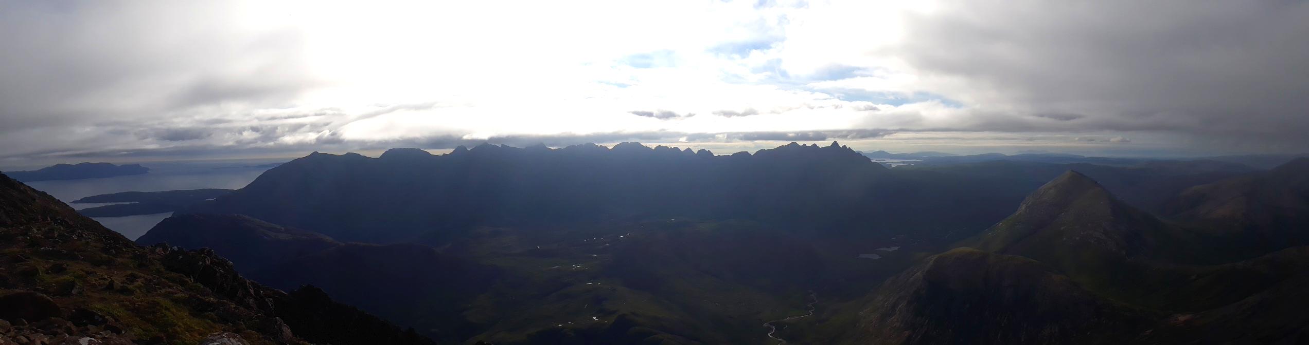
20180712_213937. As I travel north I'm treated to this fantastic evening vista.
.
Overall ratingI said at the start that I thought the rating in SMC was not very fair, so I tried my own assessment, going through all the factors, and weighting them equally. The resulting score was 2 stars, the main negative aspects being the extensive areas of poor rock, and the moderate level of escapability. The situation is utterly superb, as I hope the pics have shown: wonderful views at every distance - the faces one is climbing near at hand, Clach Glas and the other surrounding cliffs in the middle distance, and the distant hills in the east and north for most of the way. So I'd recommend the route, with the big proviso that one should exercise serious caution on the rock.
