free to be able to rate and comment on reports (as well as access 1:25000 mapping).
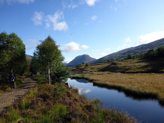
Another weekend closer to finishing Round Two for Sick Kid. It was a toss-up between heading up to Mullardoch for the two she has left there or doing something closer to home and (hopefully) allowing her back to recover a bit more. So it meant campsites (I haven't really got my head around wildcamp spots around Tyndrum) - we opted for the Wigwams at Strathfillan with some reservations - mainly the risk of noisy weekend party animals. Headed up on Thursday as usual, but had time when we arrived to make a proper meal, rather than the sandwiches that have become Thursday tea-time staples. And a bottle of high potency Belgian beer from Lidl... The forecast had suggested Saturday would be the best day, so we opted for Beinn Eunaich & Beinn a'Chochuill for Friday. Rather than the usual route, I'd elected to head up through Glen Strae, following the "path" beside the Allt Dhoirrean and arriving at the two Sims to the east of Eunaich. We'd used the path to the bealach to reach Beinn na Lus but I couldn't really remember what it was like.
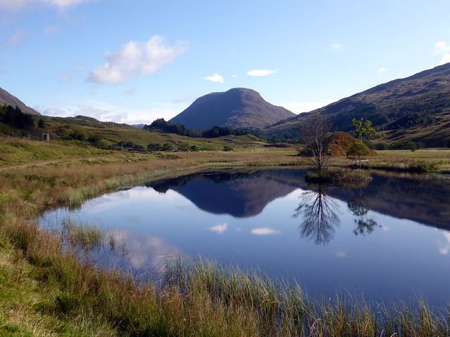
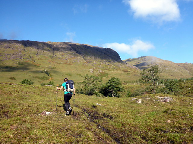
Friday started as a beautiful morning, not a ripple on the ponds used for duck "conservation" (ie shooting them from behind wicker hides). The path up the hillside started off boggy and often threatened to drop out of existence altogether. However, we made it to Lairig Dhoirrean, slowly and enjoyed the short climb up Meall Copagach. We could see cloud sitting stubbornly around 850m, obliterating the ridge from Eunaich to a'Chochuill. We pressed on, to the second Sim at 880m and found ourselves in a familiar world of wind and clag. Now that the sun was shut off from us it was also considerably chillier than a few minutes before.
 P1200540
 by
Al, on Flickr
Beinn Mhic Mhonaidh
 P1200541
 by
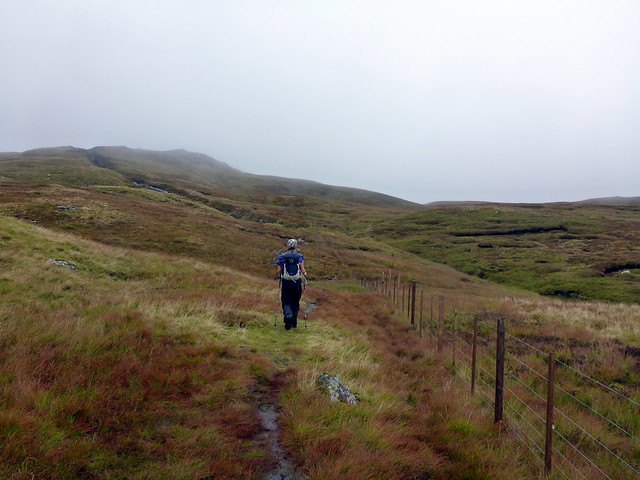
Al, on Flickr
To Lairig Dhoirrean
 P1200542
 by
Al, on Flickr
Meall Copagach
 P1200544
 by
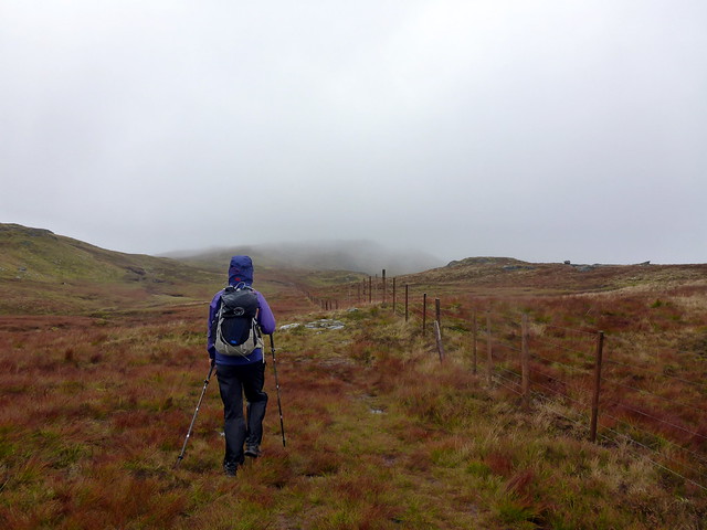
Al, on Flickr
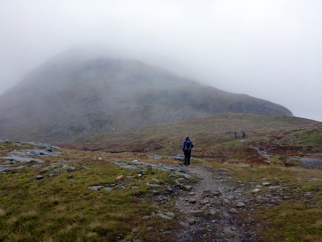
View along to Eunaich
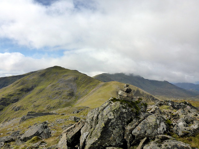 P1200547
 by
Al, on Flickr
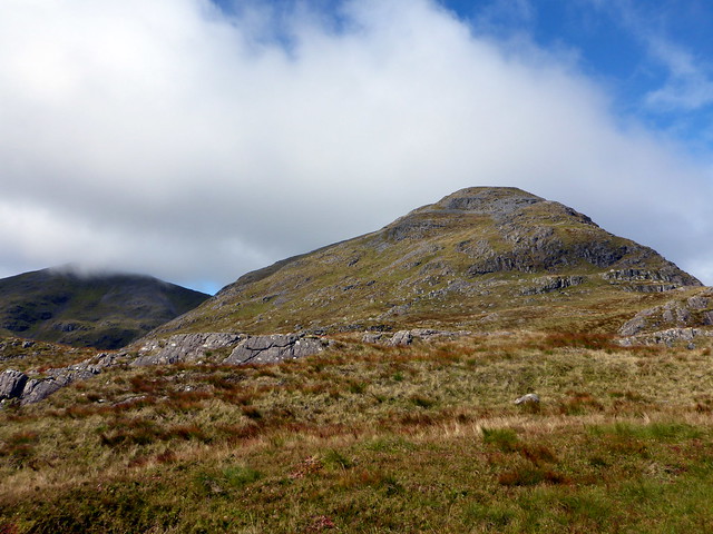
There's a path, probably animal, that follows the ridge round to the summit of Eunaich, avoiding any crags. I initially led us off the south shoulder before correcting to the north-west one that leads to Beinn a'Chochuill. Well it was claggy. As we dropped towards Lairig Ianachain we slipped beneath the clag and could see where we were headed. We met a young American/German couple who had come from a'Chochuill and had waited 30 mins at the top to see if it would clear. They didn't fancy going up Eunaich if they were going to get the same views, although both were full of praise for the Scottish countryside. They had found the opening to a tunnel on the way up which had piqued their curiosity. We reckoned it was part of the Hydro works - it's only now, looking at the 1:25000 scale map that I can see the extent of it.
 P1200549
 by
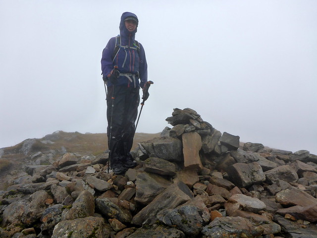
Al, on Flickr
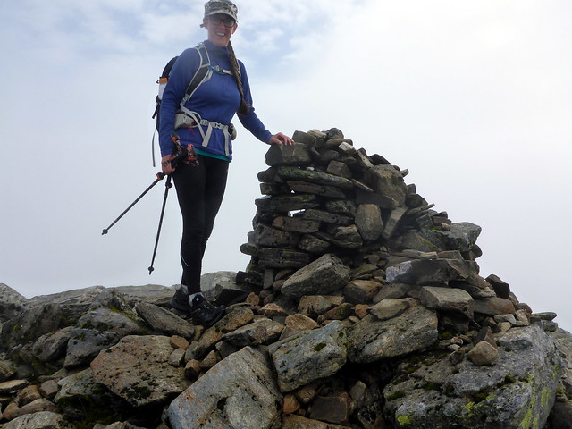
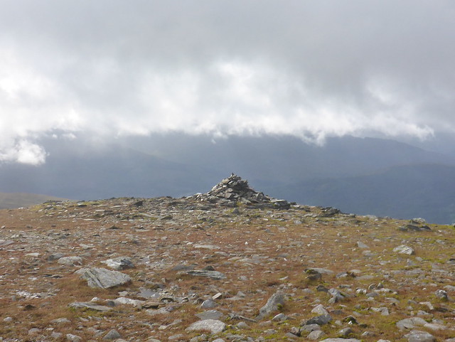
Summit Eunaich
 P1200550
 by
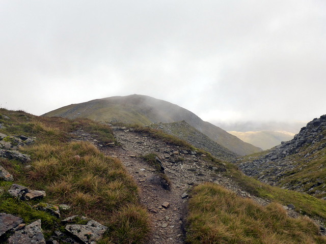
Al, on Flickr
Beinn a'Chochuill
 P1200551
 by
Al, on Flickr
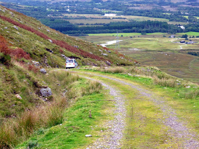
We passed on towards a'Chochuill, enjoying just the same views as we had from Eunaich. We descended by the standard route onto the Hydro track, where we met up with the couple again. Mildly surprised to find they'd driven their VW Caddy up to 350m and spent the previous night in it, they were now preparing to descend, having had another explore of the tunnel. We politely declined the offer of a lift

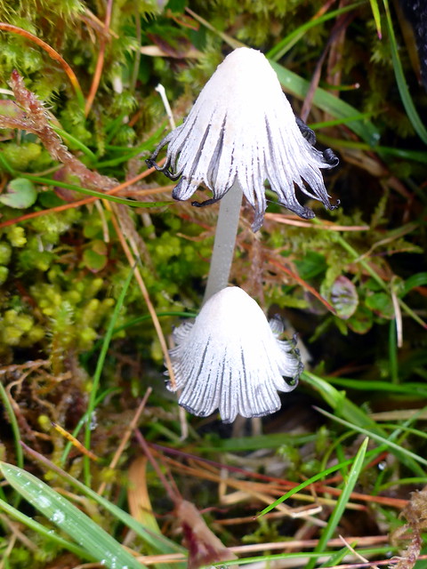
I did look for signs stating the usual "no unauthorised vehicles past this point" but I didn't see one. We got down to the farm, and had another km or so to walk back to where we were parked at the start of the track to Duiletter Farm. We passed a garden with very red apples, which reminded me of my musings last week as to why there are not fruit trees planted along mountain walks. It would be convenient and refreshing to have a choice of fresh fruit to pluck from the trees as you amble along. I'd particularly like mangoes. Anyway, we came across the next best thing - loads of perfectly ripe brambles, purple-black and bursting with sweet juices. We ate some handfuls and took a bagful back to the car, to consume with apple pie and custard later on.
The departure of the American/German couple
 P1200553
 by
Al, on Flickr
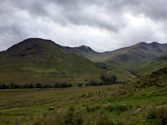
View across to Cruachan
 P1200554
 by
Al, on Flickr
 P1200555
 by
Al, on Flickr
 P1200556
 by
Al, on Flickr
A number of WHWers had pitched up at the campsite, in varying states of pain and discomfort including one man who approached the camping field along the track with a real hobble and once at his pitch simply collapsed and lay inert while his buddy pitched the tent. We shared a large packet of Wicker Man flavoured crisps - the taste of scorched Christian strangely more-ish.
https://www.seabrookcrisps.com/flavours/fiery-woodsmoked-bbq However, sleep was hard to come by for me, not least due to snoring sheep in the field adjacent to our tent. Now that's a new one

Dull, cloudy skies greeted us on Saturday. At least it was dry and not windy. It was time for teh Lui 4. Now I have some trepidation about this lot of hills - the last twice I've been up there they have tried to kill me - one horrible winter experience which I documented in these pages back in Jan 2016 and again 8 months later when I fell and cracked my ribs. What would the Queen of the Mountains hold in store for me today?
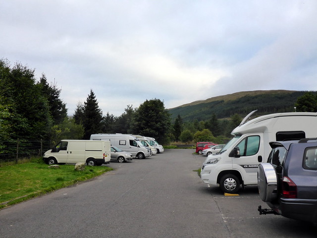
We parked at the visitor centre in Tyndrum, now rapidly becoming an informal campsite for motorhomes. Not content with snarling up the roads, these monstrosities now take up our parking areas, when there are two caravan sites within 500m of where they've beached themselves.

We walked along to Cononish, noting the goldmine workings have expanded since the last time we were here. It occurred to me that there are lead mines on the opposite side of the mountain, and a gold mine on this side, so Beinn Chuirn is really a mountain alchemist? I wondered how often lead and gold are mined together, and found that the biggest goldmine in North America is in the city of Lead, SD. What do you do with that sort of information.
New Motorhome Park at Tyndrum

 P1200557
 by
Al, on Flickr
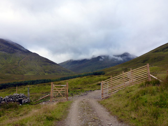
Through the gate to the Mountain of Peril
 P1200558
 by
Al, on Flickr
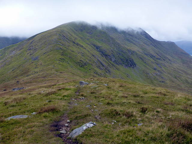
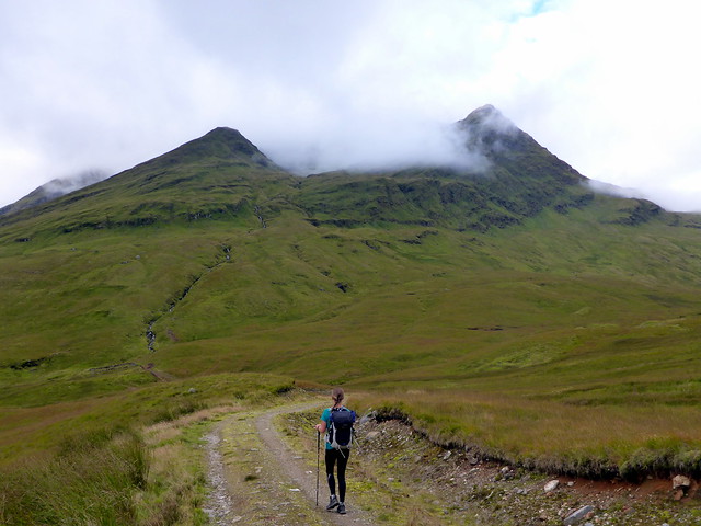
Moving swiftly on - we continued to walk along the track to the river crossing. On the other side there are new path improvement works being carried out. We walked up alongside the Allt Coire Ghaothaich until we were inside the coire. There was a cairn marking the path that went up the northern wall of the coire, the way I'd gone before. But the new path continued on further into the coire. What to do? I suspected this was some new fiendish ploy of the mountain to lead me to my doom, but Allison said I'd be fine as I was with her. So we continued on the new bit of path - which petered out in rubble and scree in the middle of the coire. Oh well, what about heading up the southern coire rim - that looks ok. We selected a gully and came out onto the shoulder at around 850m, in clag of course. We picked up a path of sorts which also ended abruptly, but we managed to get onto the shoulder leading to the summit. Success. Not dead or injured yet
Lui
 P1200559
 by
Al, on Flickr
Inside Coire Gaothach
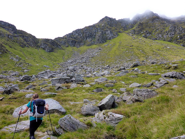 P1200562
 by
Al, on Flickr
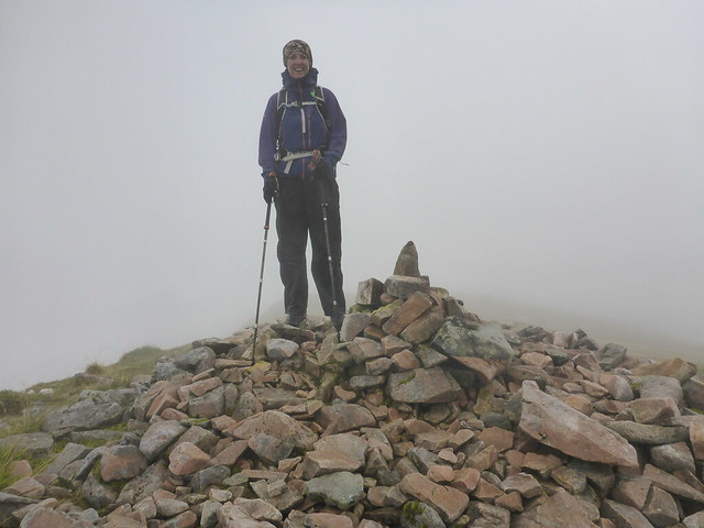
Lui Summit
 P1200563
 by
Al, on Flickr
Next came a claggy walk to Beinn a'Chleibh where we paused for lunch and passed a few walkers. I pointed out to Allison various spots from my near-death encounter. We climbed back up the slopes of Lui again to traverse round Coire Annaich (or the Valley of Death in my head) then had a skittery time navigating around the u-bend to Beinn Oss. This was my 200th Munro of the year. A mild lifting of clag on the way to Dubhchraig allowed us to see a little of the hillside. We met up with another couple who were heading back to Dalrigh but had lost the path back from Dubhchraig. We dropped down the northern shoulder of the hill, heading for Cononish and the firmness of the track back to the car. Quite a tiring day but enjoyable none the less.
Towards Dubhchraig
 P1200566
 by
Al, on Flickr
 P1200567
 by
Al, on Flickr
View to the goldmine
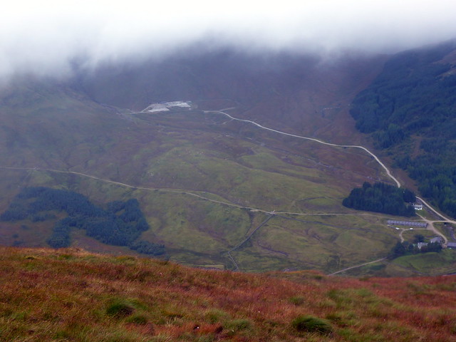 P1200568
 by
Al, on Flickr
 P1200569
 by
Al, on Flickr
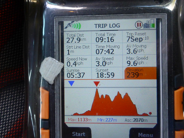
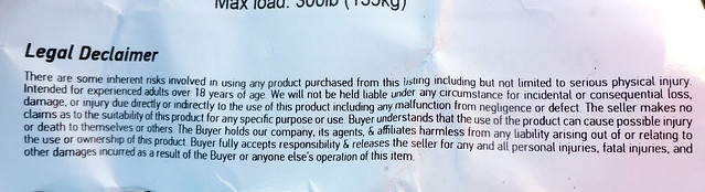
Back at the campsite, the sun was shining (typical) and we sat outside the tent having our tea. My attention was drawn to the legal disclaimer on an item...
 P1200570
 by
Al, on Flickr
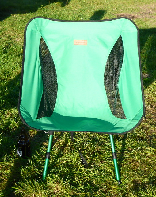
By the wording on that you might be forgiven for thinking we had purchased a nuclear-powered camp stove or some such hazardous artefact, but it was only this:
 P1200571
 by
Al, on Flickr
No snoring sheep tonight, just rain.
One of the mildly annoying things about the hills SK has left is the number of single hills. I had looked at linking BeinnChallum with Meall Glas but although the summits are only about 2km apart, the terrain between does not look favourable to such exploits. We had gone up Challum back in early March but only made it to the 997m top due to snow and whiteout, so it was galling to have to trudge up the boggy ramparts of this "godforsaken hill" as Allison put it again. In bad weather. Actually, it was dryish as we started off, looking at the new notices at the graveyard of early medieval inscribed stones found there, including one that looks as if it's a depiction of Grendel's arm as hewn off by Beowulf.
https://canmore.org.uk/site/23862/kirkton-st-fillans-priory-graveyardThe stones themselves have been hidden under turf for protection.
On and up the hillside, following the fence line and avoiding the deeper bits of bog - not always easy. First the cloud came in, then the wind got up, then the rain started. Ach well. We made it up to the 997m top and found our way along the narrow linking ridge to the Stob Glas summit. It was very windy indeed. we retreated to find a semi-sheltered spot for lunch and to put on a warmer layer underneath our waterproofs - not easy in the howling gale. As we sat huddled and drinking coffee the summit suddenly cleared - my 4th time up here and the first I've had a view of the summit. On the way down we met two slim lassies coming up, enquiring just how windy it was at the top. We reckoned they'd be fine, as Allison hadn't been completely blown off her feet. Looking down towards the south we realised we could see the Lui group from here. Views are wonderful things

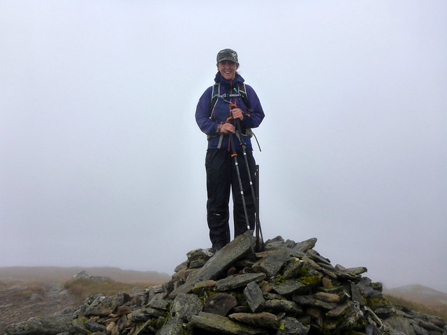
Blue skies on Challum? Surely not...
 P1200572
 by
Al, on Flickr
More familiar conditions
 P1200573
 by
Al, on Flickr
uh-huh
 P1200574
 by
Al, on Flickr
 P1200575
 by
Al, on Flickr
Oh look - there's the summit after all
 P1200576
 by
Al, on Flickr
 P1200577
 by
Al, on Flickr
 P1200578
 by
Al, on Flickr
So I survived another trip to the Mountain of Peril and Allison's now down to 15 to go. But 9 of those are single hills, so it will take longer than it sounds to get them done.
