free to be able to rate and comment on reports (as well as access 1:25000 mapping).
It was a clear start to our day out although there was full but high cloud cover which was probably the reason for it being as warm as it was despite the strong and gusty winds that were with us all day, winds that got progressively stronger as the day wore on. As the report title suggests we took in some of the Northern Fells today picking up a few Hewitt's and Birkett's on the way around this route of varied topographic features and landscapes.
To reach the start of this walk we had to take the A66 as per usual taking us past Keswick to then turn onto the A591 at the Great Crosthwaite roundabout along which we drove for quite some distance before once again turning right along a narrow metalled lane that leads to Walk Mill Bridge and eventually Orthwaite. But it wasn't to be as the road was blocked off due to road repairs - patching up holes in the tarmac - and upon asking directions from one of the workmen on getting around he directed us through Bassenthwaite on a road that would take us to Cassbeck Bridge where the road was also blocked off, well half blocked as we found that it was actually open for the locals, so we drove on going back to where we would have been had we been able to get through in the first instance. A fairly long detour that put us only about 350 metres away from the A591 and the start of our walk at a good sized piece of ground at approx NY235309 that was already occupied by a council road sweeper and small welfare unit though still leaving plenty of space for 3 or 4 cars.
Although it was warm where sheltered we donned some warm clothing due to the cold of the wind before we set off walking just a few metres up the road - northeast - to pass through a gate and straight out onto the open fell below the Birkett of Watches, a hill of some 333 metres in height with a grassy north face scarred by a number of small crags that were always in evidence as we followed a narrow trod - that soon ran out - southeast towards a gate in the intake wall that would take us from green pastures straight onto the rough fell grass of the lower slopes of Watches.
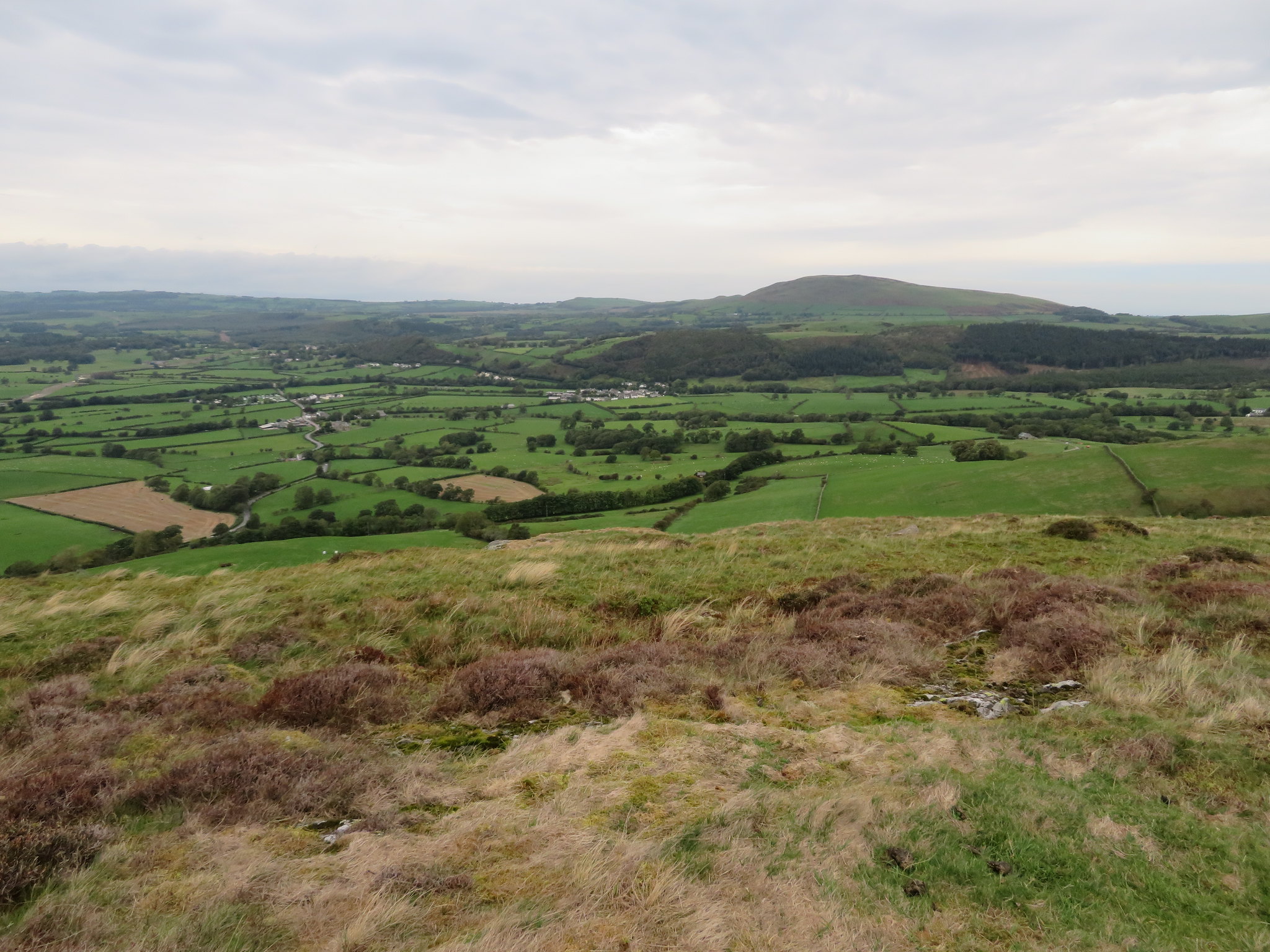
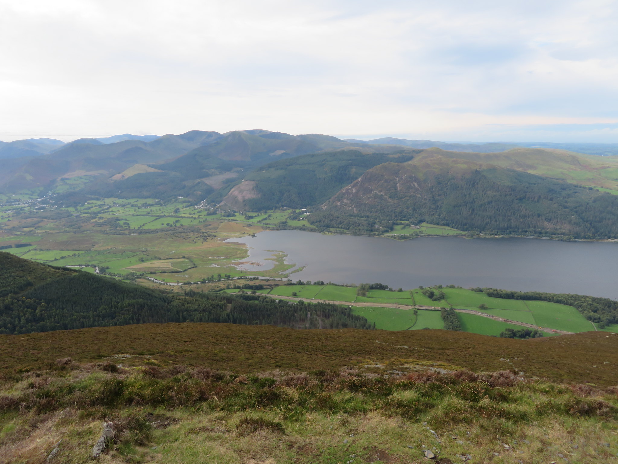
Initially there is not much of a view but as progress was made steadily higher the views began to slowly open up with the ever present Binsey being the highest piece of ground just west of north trying to look important amongst the flat pastures that surrounds her. Just to the west we could just see the north end of Bassenthwaite Lake with both Ling and Sale Fells rearing up behind it whilst further to the south there are the hills of Barf and Lord's Seat with more to come into view as we get much higher up the ridge. Southerndale was to the east of us with the ridge of Bassenthwaite Common hiding the smaller though no less interesting Barkbethdale and of course there is the mighty Skiddaw looming large and grey with patches of vegetation, mostly grass, hanging precariously to her flanks.
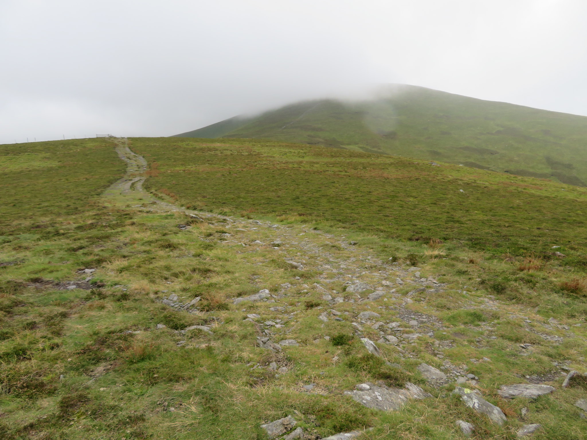
We soon reached the top of Watches that is adorned with a small cairn and patches of bare rock but it is lower down the north slopes that this great ridge walk really begins and before we topped out on Watches we could see almost the whole line of the ridge ahead of us plus the ominous sight of low cloud cover over the higher fell tops.
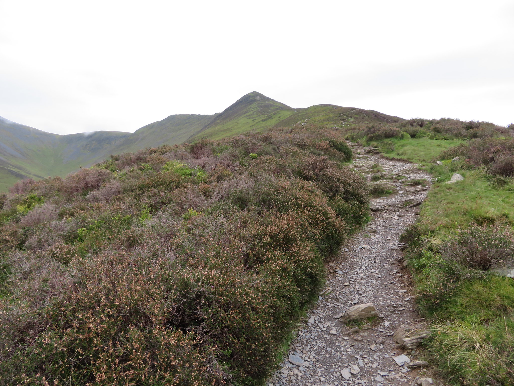
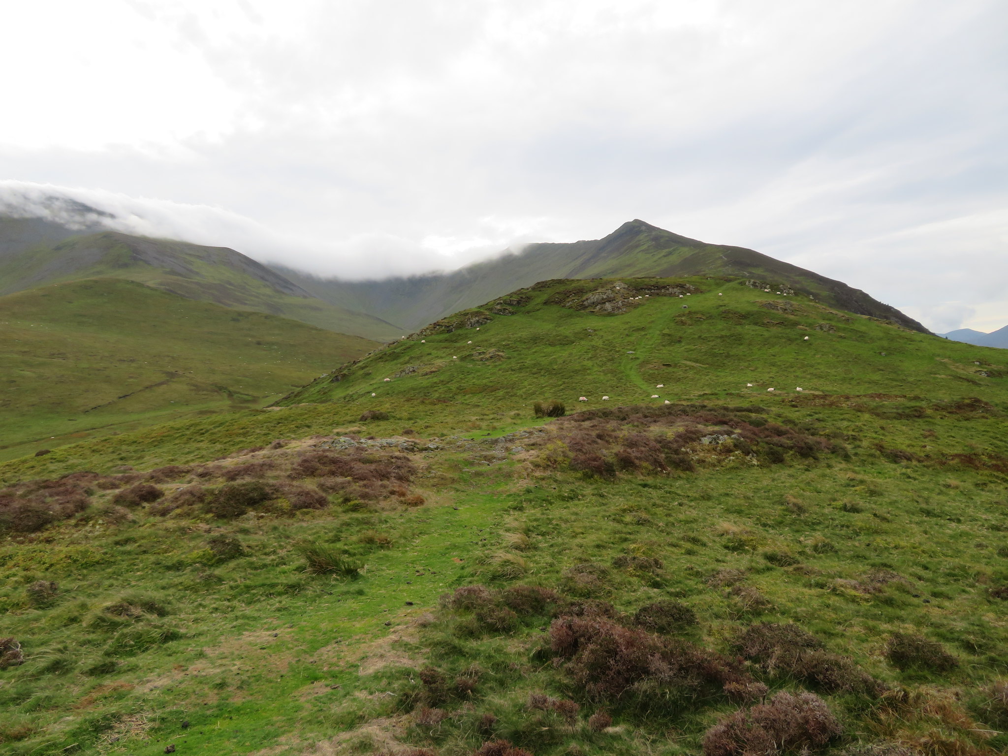 Start of the ridge walk proper from the north slopes of Watches
 And looking north there is Binsey.
 Long view to Binsey
 From the top of Watches we could see a lot more of Bassenthwaite Lake and into the head of Southerndale on our left with Southerndale Beck starting its journey right at the head from somewhere below Carlside Tarn whilst its own ridge of Great Knott, Buzzard Knott and Randel Crag that separates Southerndale from Barkbethdale looks like it could make for an interesting skirmish one day. A good view of the grey and pock marked green face of Gibraltar Crag was to be seen although at this lower altitude it was partly covered by Randel Crag. The path alongside the beck makes an interesting alternative way down from Carlside Tarn and although it’s a tad steep initially once the head of the beck has been reached the going is easy along the path and good time can be made along it.
 Ullock Pike and Longside Edge from Watches
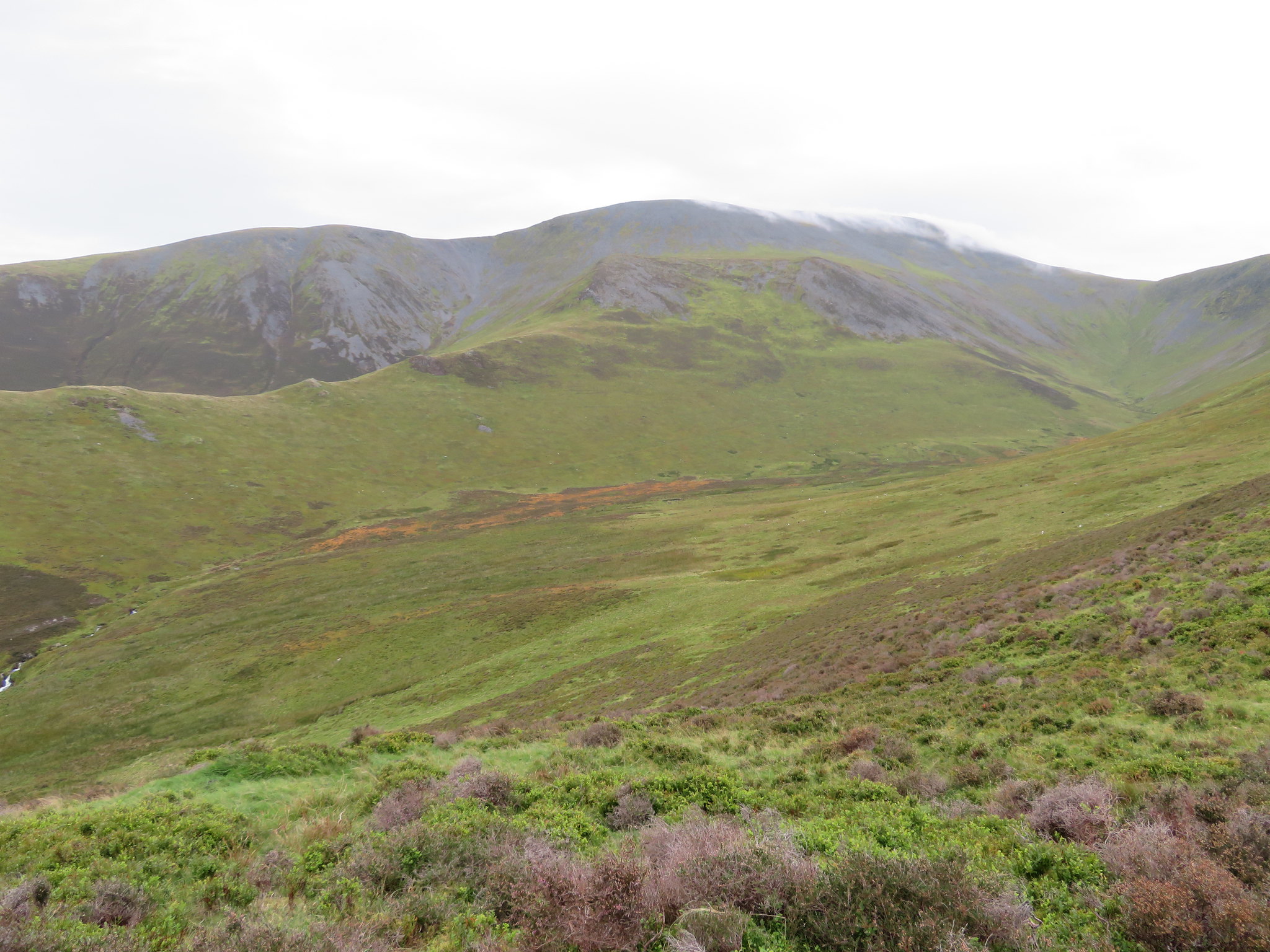
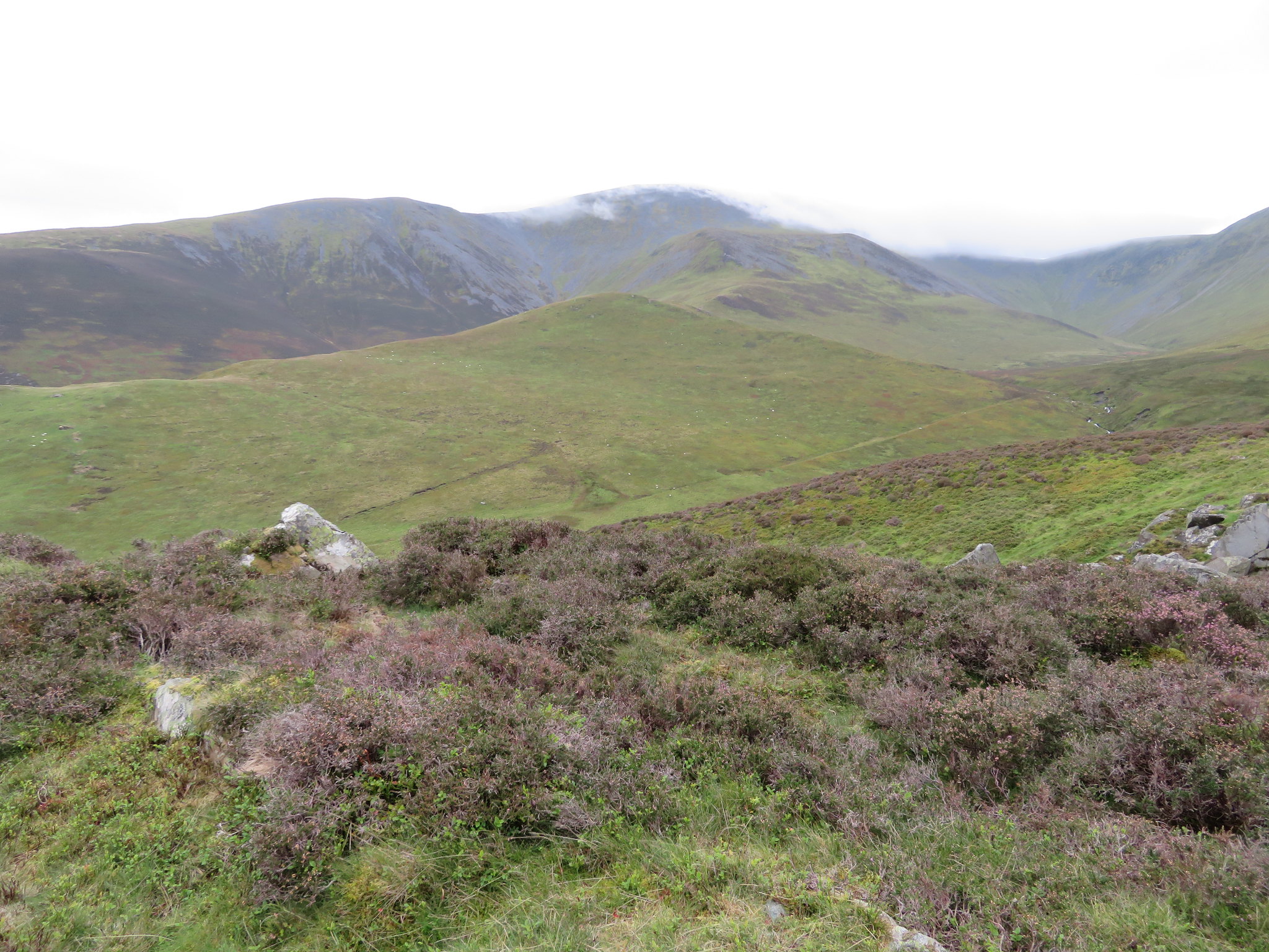 Buzzard Knott and Randel Crag with Gibraltar Crag in cloud
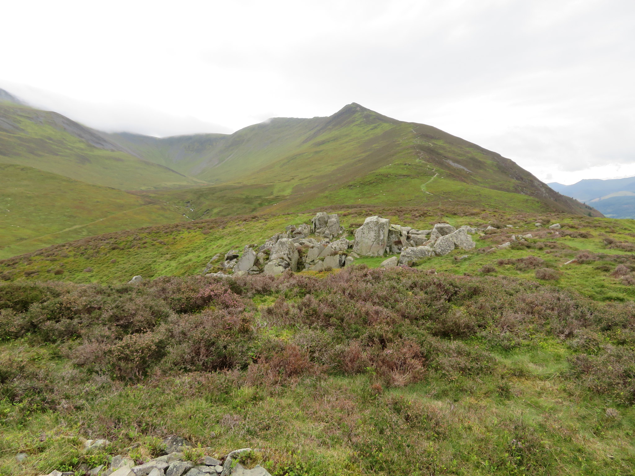
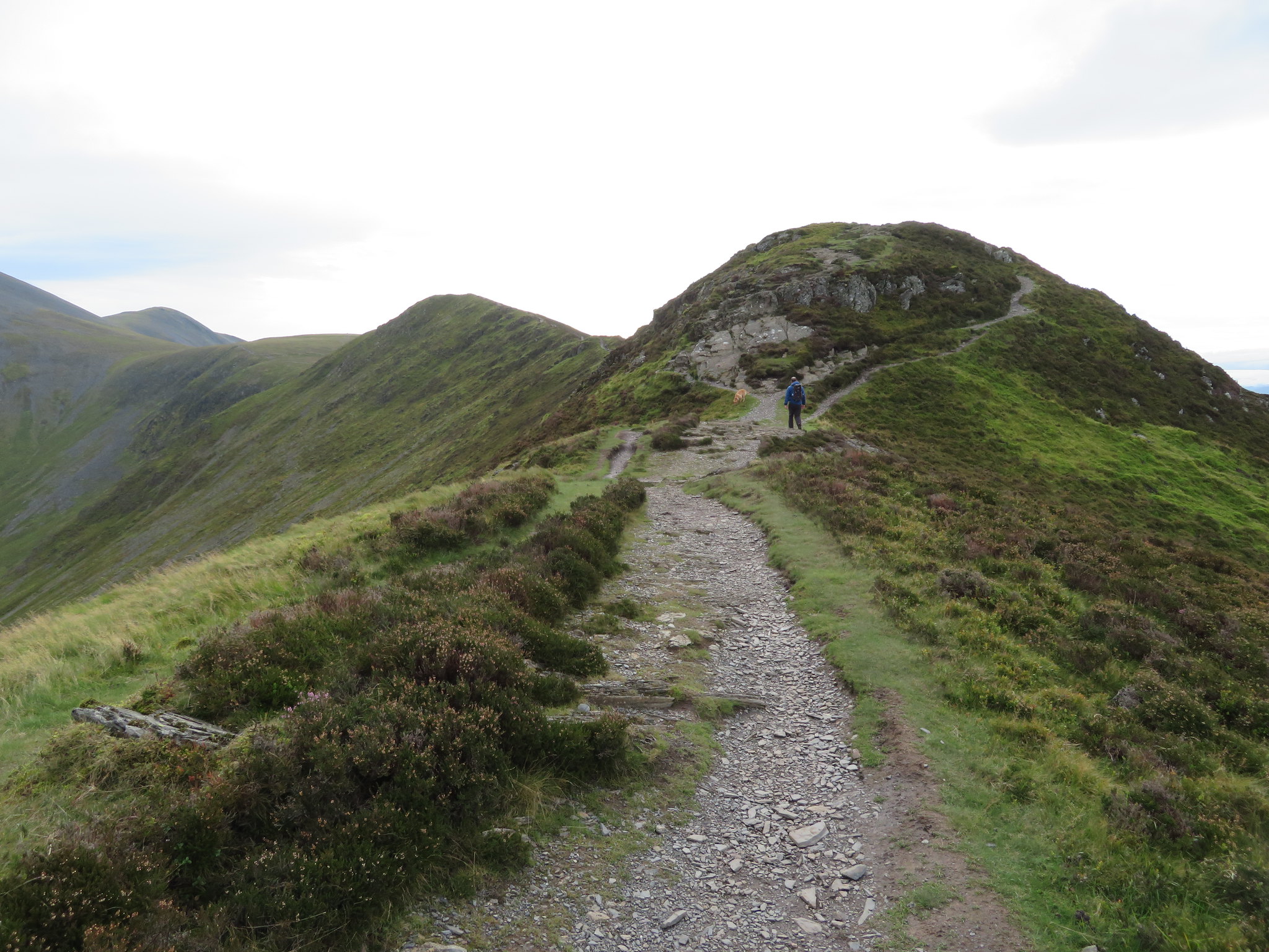
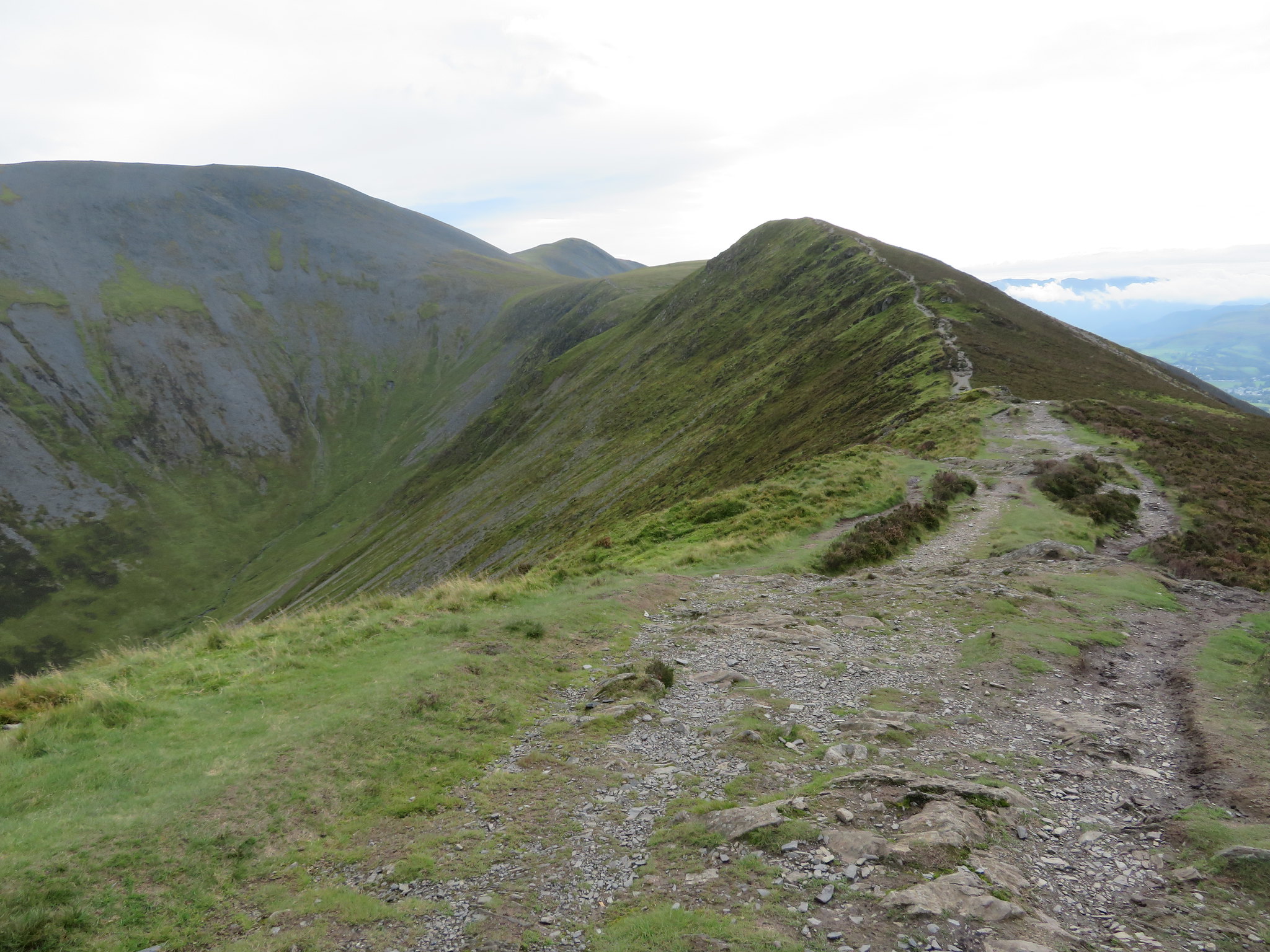
 We left Watches to its own devices and continued to climb steadily higher with the wind increasing in strength considerably and as we reached Ling How the second - if Watches is counted as the first - of the many humps on the ridge a look forward gave a decent view of the ridge for most of its way along to Carl Side.
 A view of the ridge and Southerndale Head from Ling How
There's plenty of heather on the ridge that just about had an inkling of purple about it in many places but to compensate for the lack of purple on the remaining heather the brown of the dead flowers were made a golden colour by the sun that was with us at this time. A little higher and we had a decent view into Southerndale with a couple of walkers climbing alongside the beck at the head of the dale.
 Across Southerndale towards Skiddaw
 A couple of walkers passed us as they descended from Carl Side and stopping for a chat told us that they had set out early and were just doing a there and back walk. We were now on The Edge and hadn't far to go to top out on Ullock Pike with the well worn path leading its wiggly way to the pointed false summit…
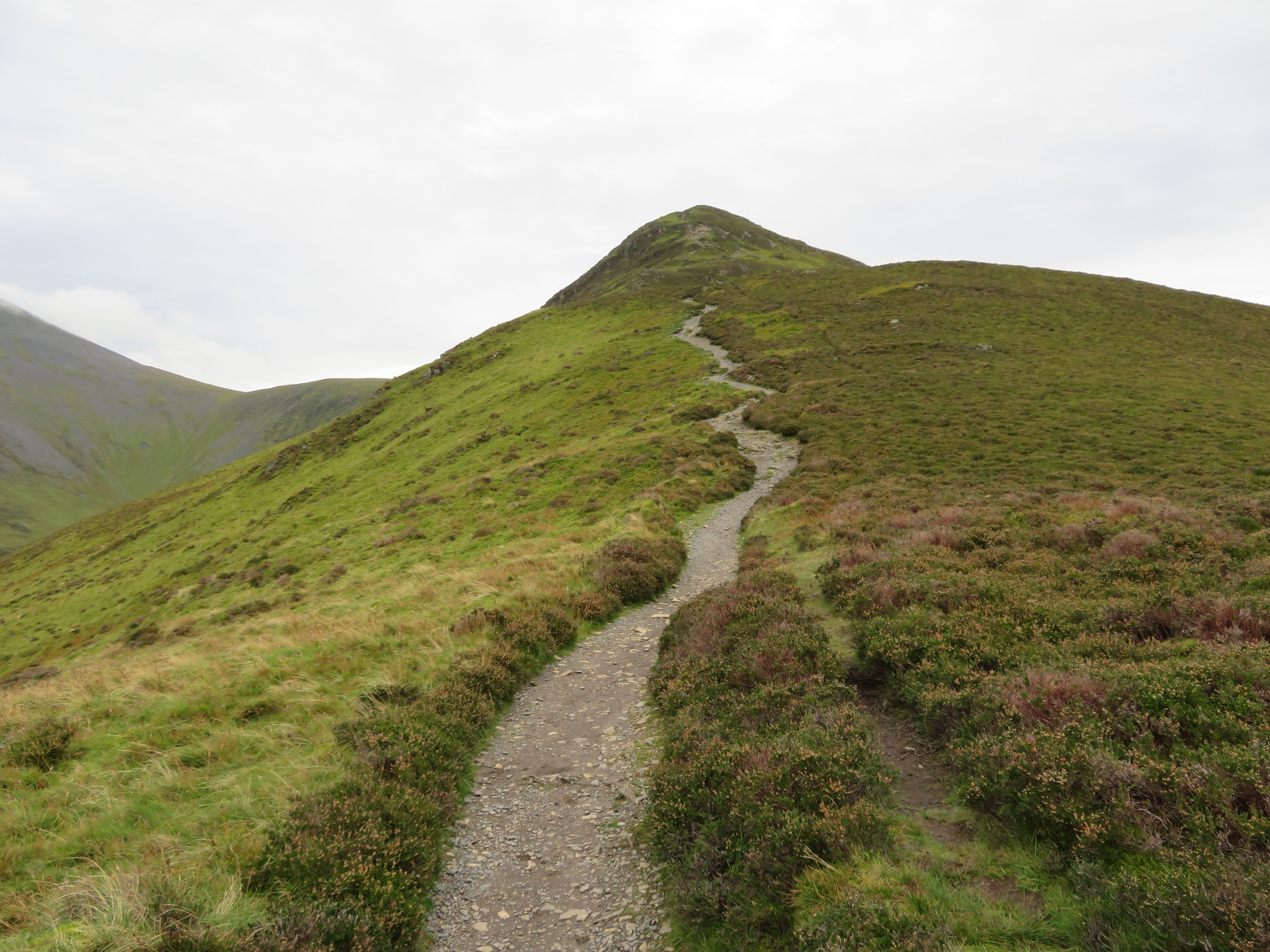 Ullock Pike
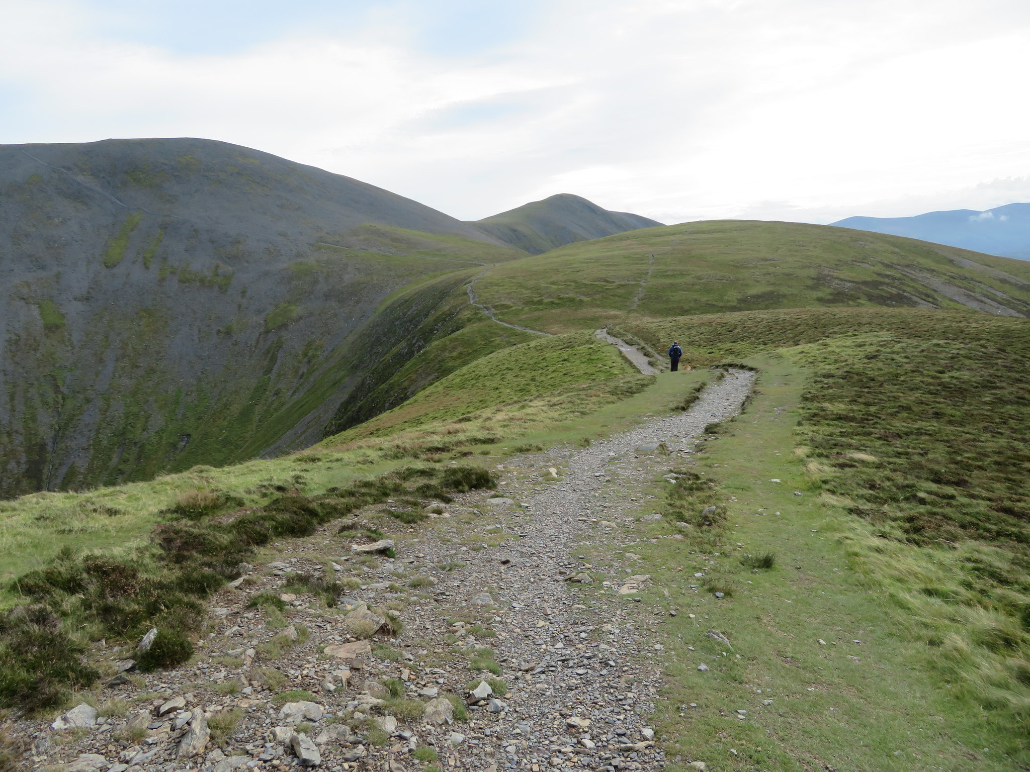
 before the final dome of the true summit at 692 metres in height but before we got to that point we stopped a couple of times to look over the magnificent landscape that makes up this part of the Lake District with many of the far distant and higher fells and mountains now sporting a head of white cloud, something that will be with us before too long.
 View down the ridge from just below Ullock Pike
 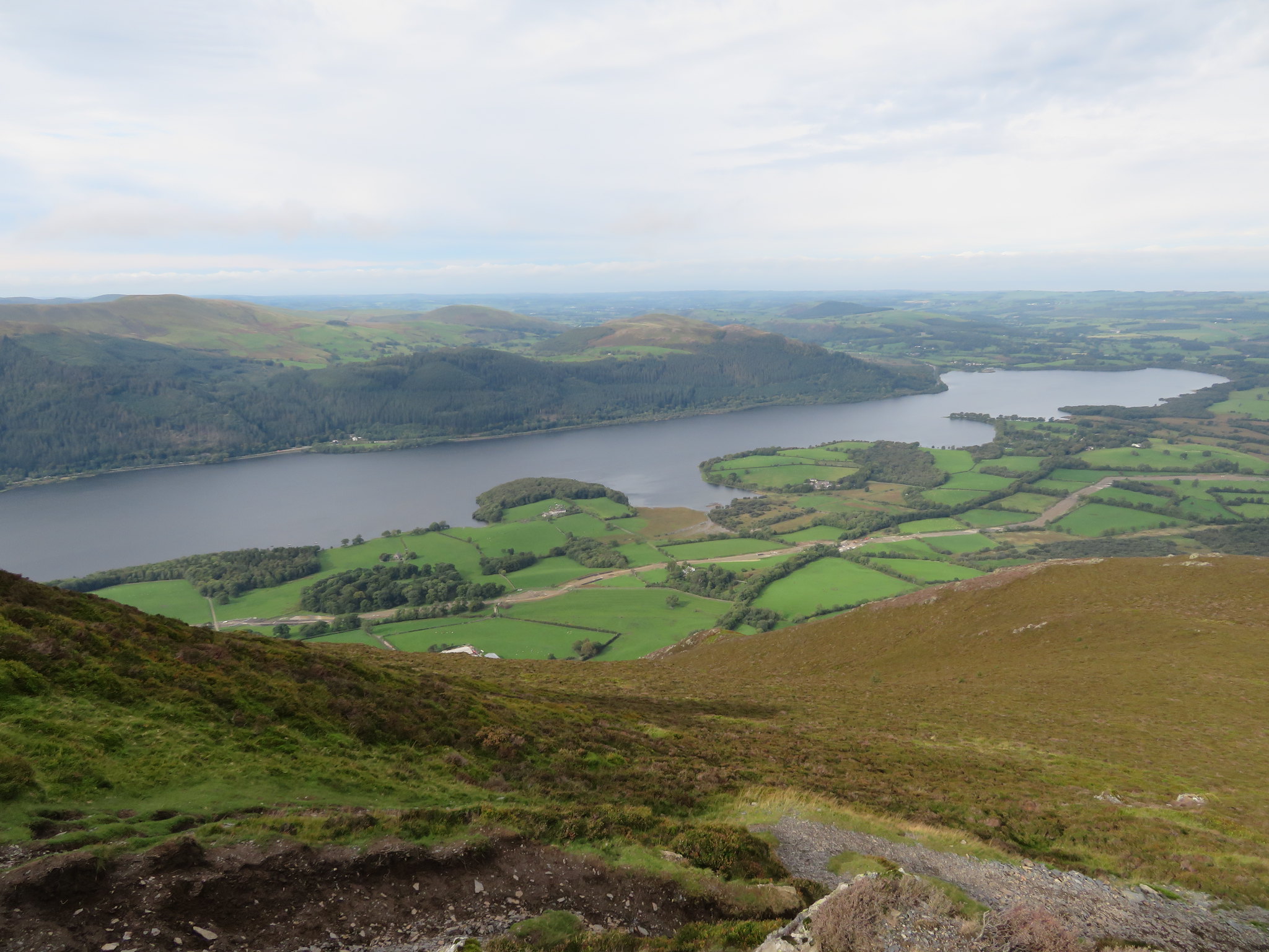 Bassenthwaite Lake from the 600 metre contour
 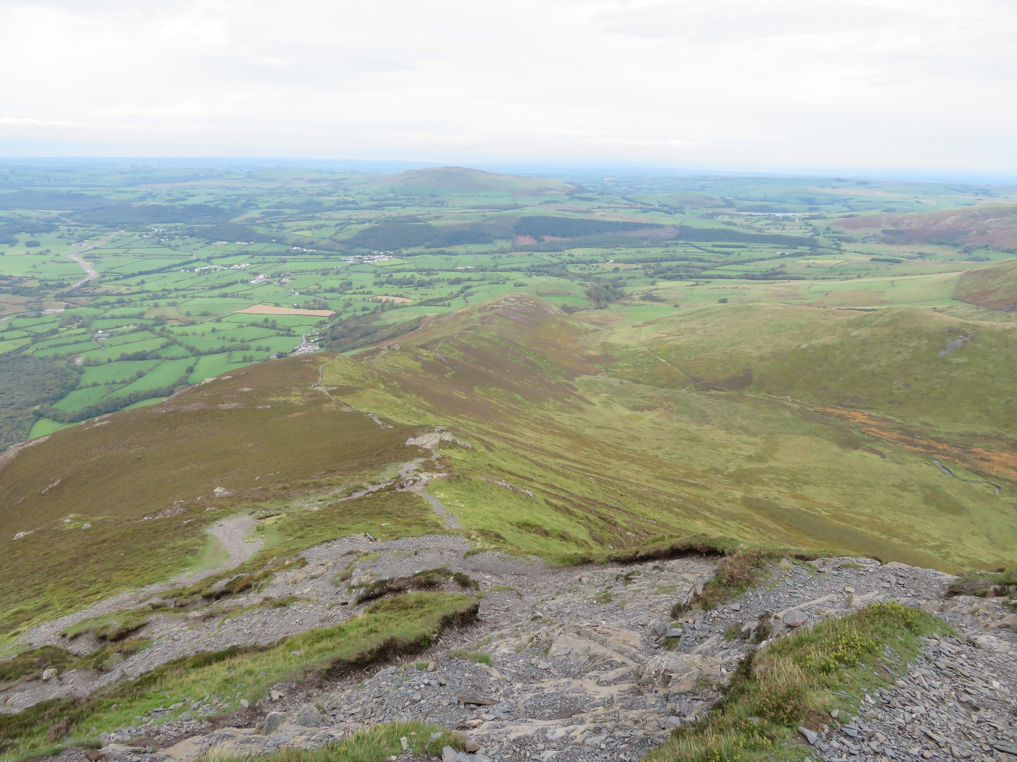 The ridge and Binsey from 650 metres
The final pull up before the summit has lots of exposed rock of the slippery type when wet but there are plenty of opportunities to avoid it with many small scree covered paths running through but once over this the way to the actual summit is easy.
 Last pull to Ullock Pike summit
 Ullock Pike is a rounded dome of rock mostly covered with grass apart from its top that has a lump of exposed rock surrounded by scree from where there is a good view across to Keswick and its surrounding fells.
 Ullock Pike top - Longside Edge and Derwent Water
 We also now had a great view along the ridge towards Skiddaw and Little Man with the head of Southerdale and its beck leading up to Carl Side.
 Longside Edge - Skiddaw and Little Man
 The nearer fells could quite easily be seen with the odd patch of blue still lingering above them, but not for much longer. Barf, Lord's Seat, Broom Fell, the hills of the Coledale Round, Newlands Round and beyond could all be seen, a great view indeed.
 View to the North Western Fells from Ullock Pike
 It was really windy by this time so we didn't linger too long, just long enough to grab a few shots and then we were off to Longside Edge just further along the ridge following the good and not as steep path as up to Ullock Pike but the wind was doing its best to unseat us and toss us over the edge into Southerdale and as we were going to ascend Skiddaw by the south scree path I was hoping that the wind would not hinder our progress along it on the exposed and steep climb. Although I say exposed it wasn't in the sense of the path being on a narrow ledge but exposed to the weather and as the path is wide there is not much chance of falling off unless fooling around but there could be a chance of being blown onto the steep scree face that forms the head of Southerdale if the wind was blowing in the right direction.
Once again the same good views from Longside Edge as lower down apart from more of Bassenthwaite Lake showing itself below us.
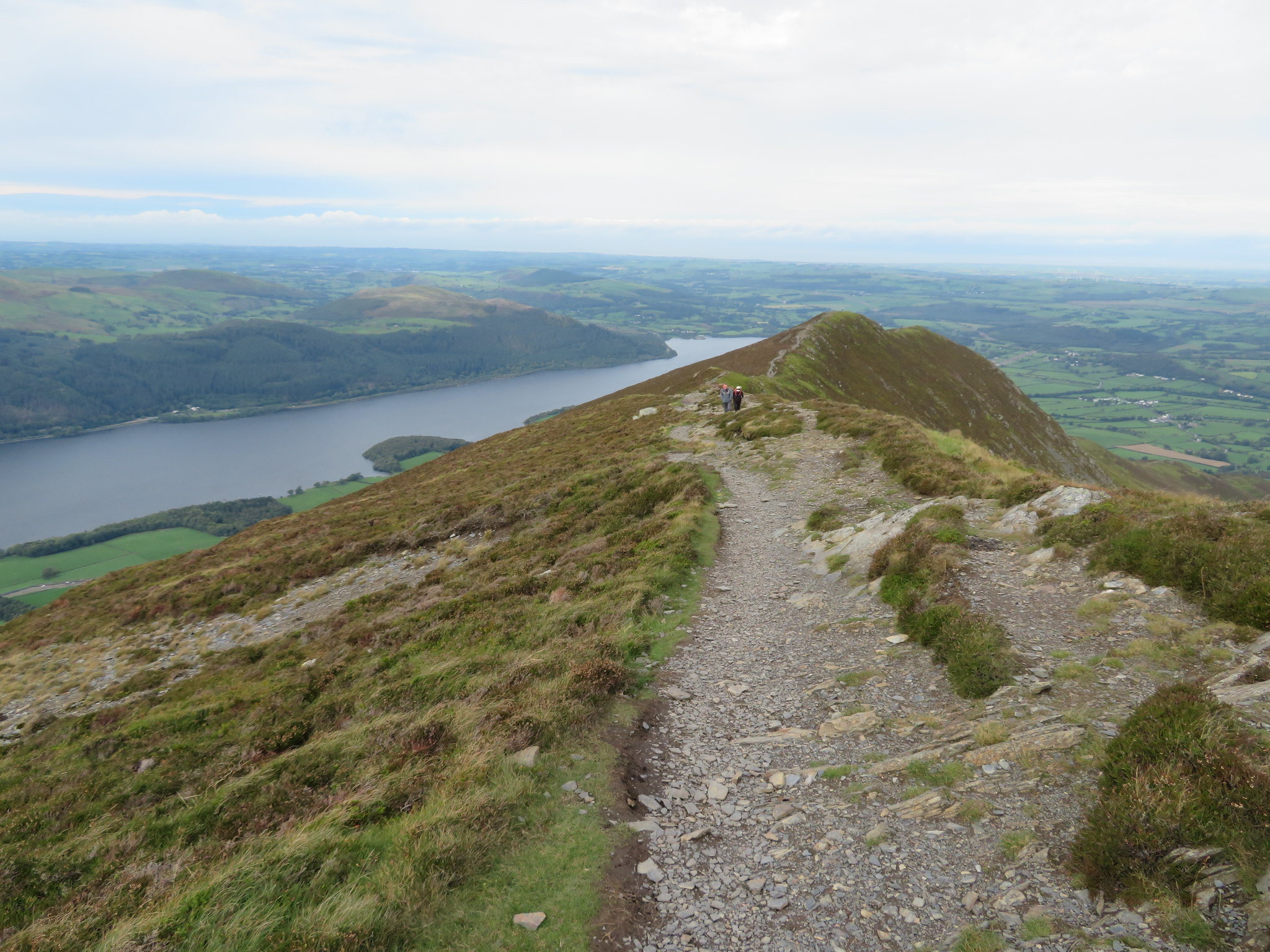 The ridge from Longside Edge
 There was a couple behind us by this time and we were catching up to a couple that was in front of us so quite busy on here today with more people arriving at Carl Side. The whole ridge is a delight to walk and after just a few minutes walking from Ullock Pike we were at the summit with its cairn of small stones that has largely been scattered about looking at the hundreds of small stones lying around its base.
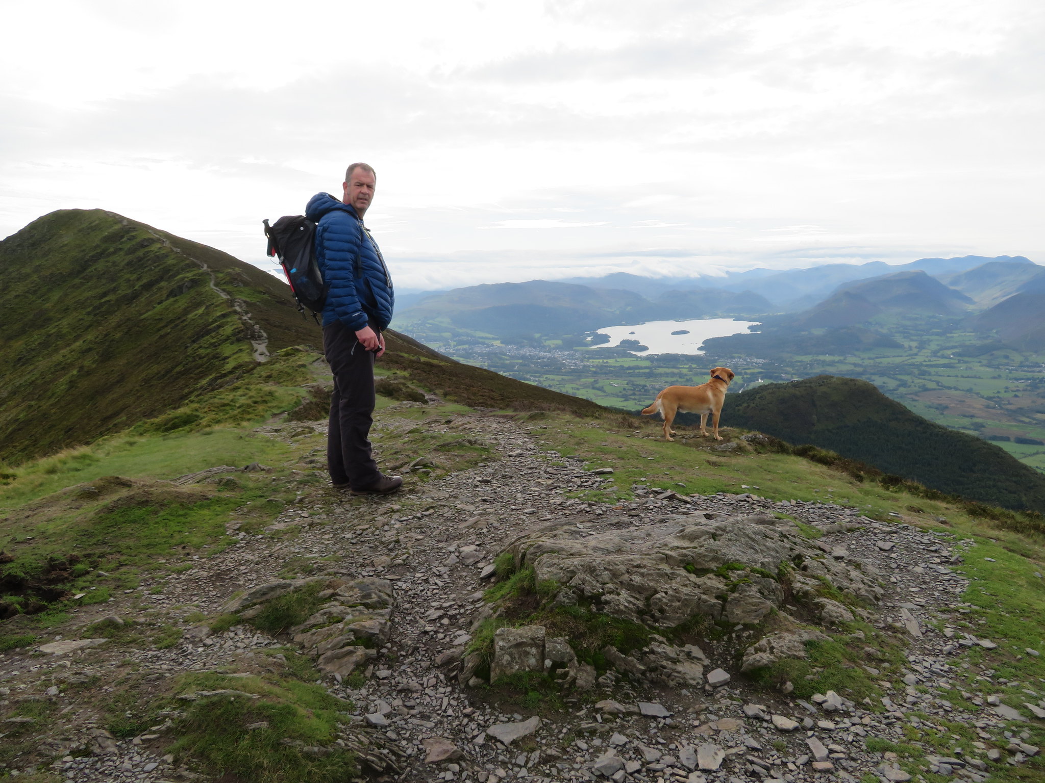
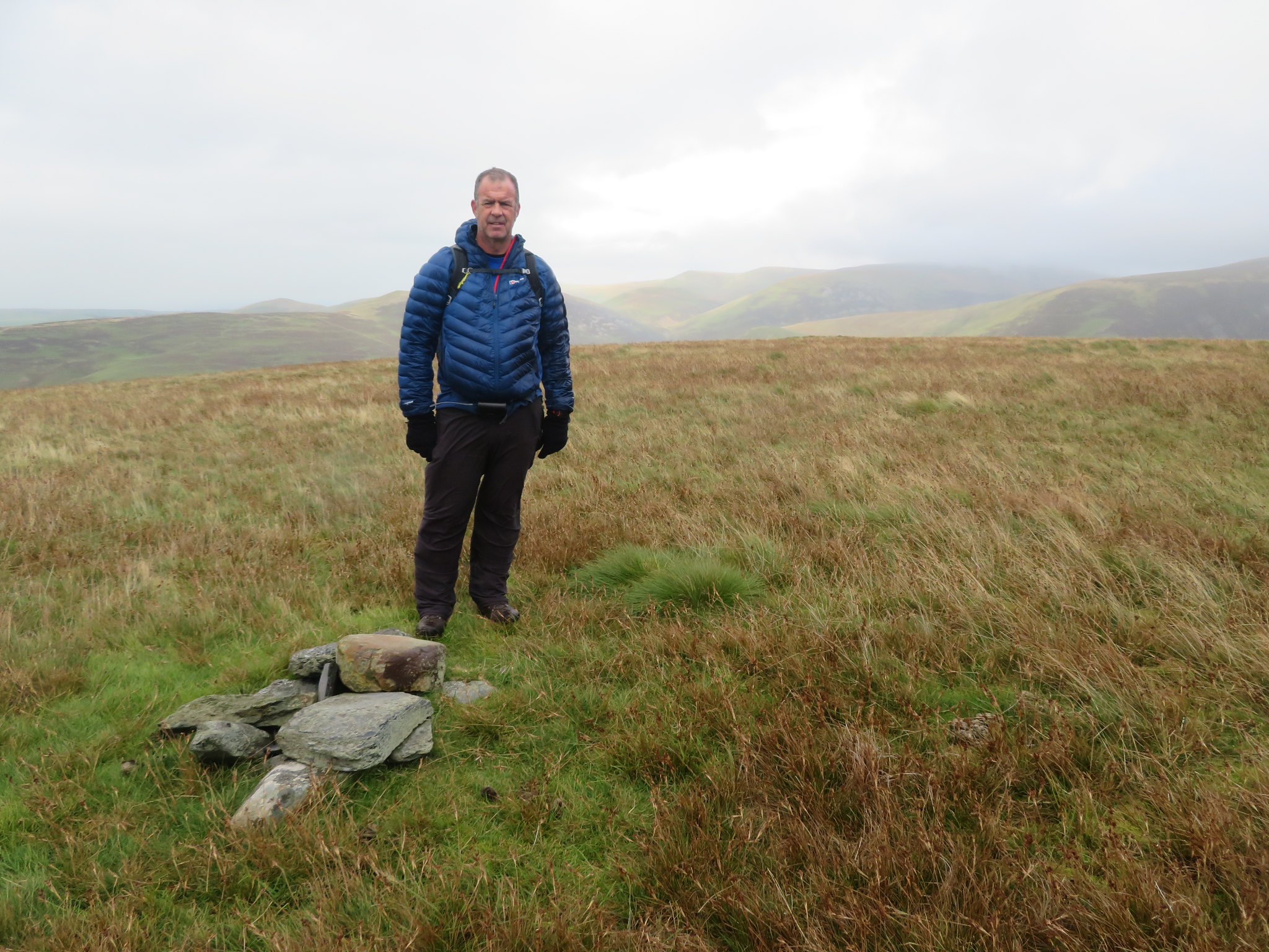
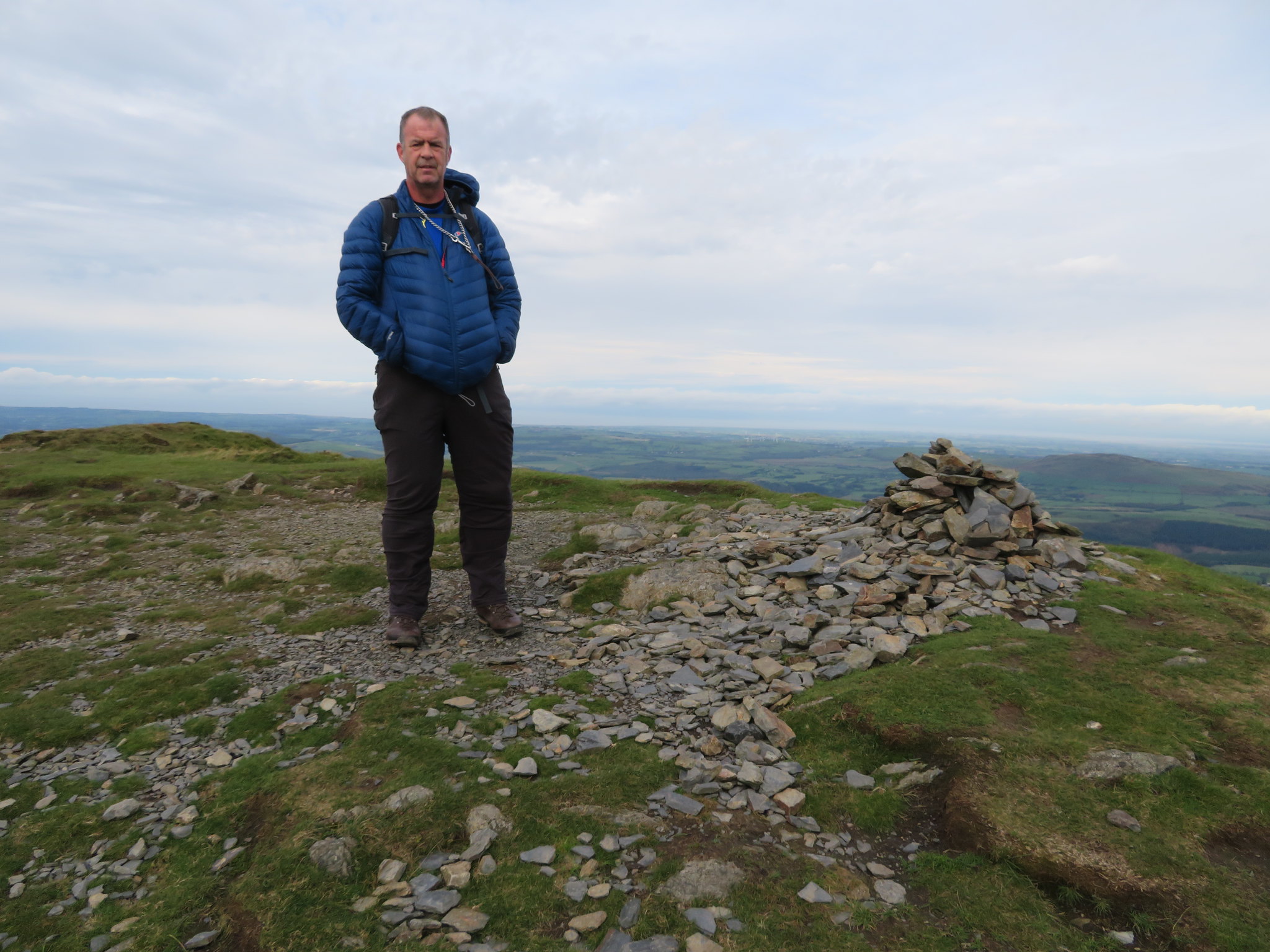 Chris at Longside Edge summit
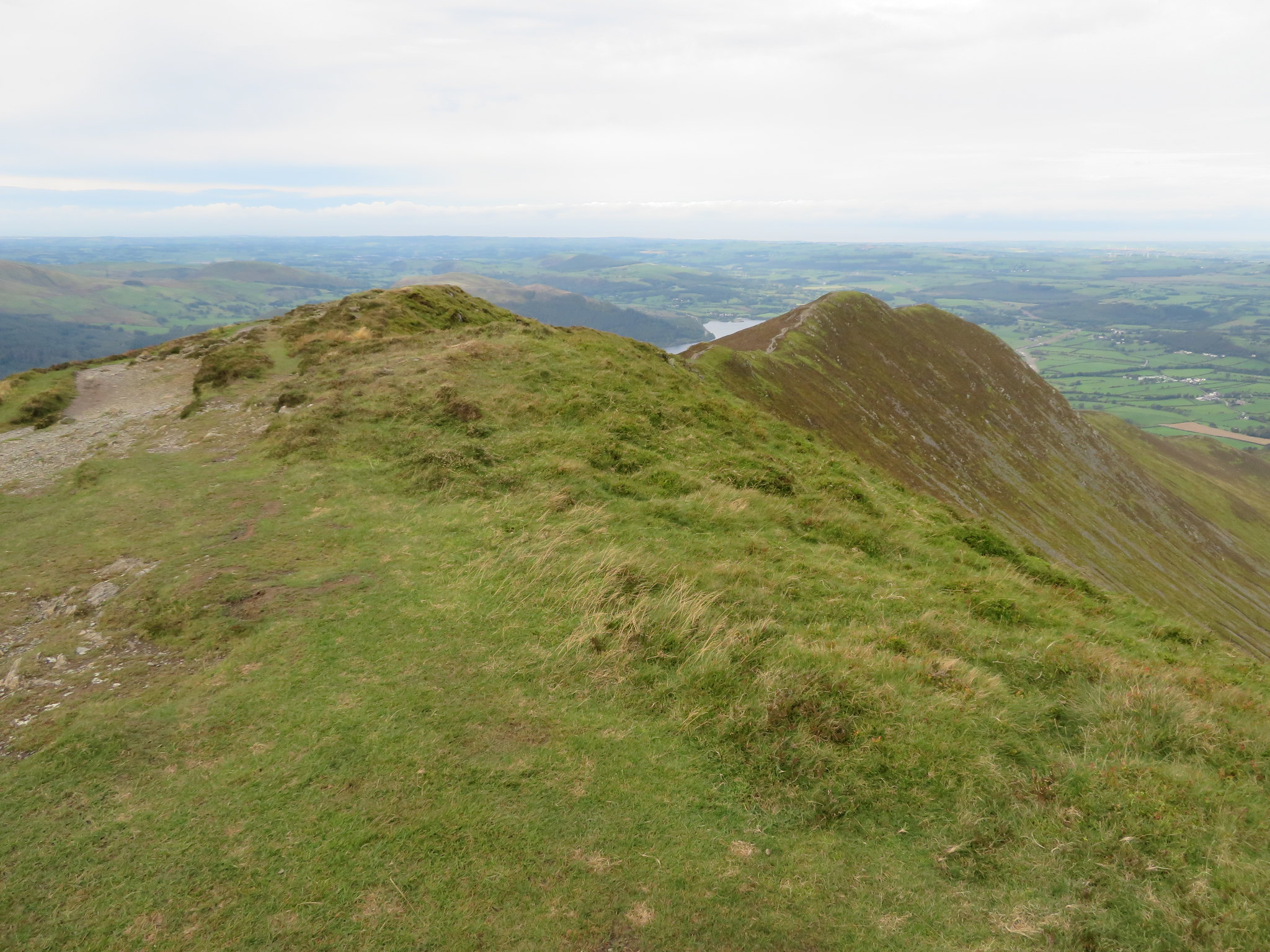 Ullock Pike from Longside Edge
 The cloud had cleared from off Skiddaw and the patches of blue were an encouraging sight to lots of windswept walkers of which we could see quite a few now that Carl Side was in view. We could also see our way to the summit of Skiddaw, a thin grey line running up and across the south face from the col and tarn that sits on the connecting bridge between Southerdale and the great hollow on its opposite side that carries Tongues Beck and Slade Beck from beneath Broad End on the Skiddaw side and Carsleddam on the Carl Side crags side.
 Carl Side with Skiddaw Little Man behind
 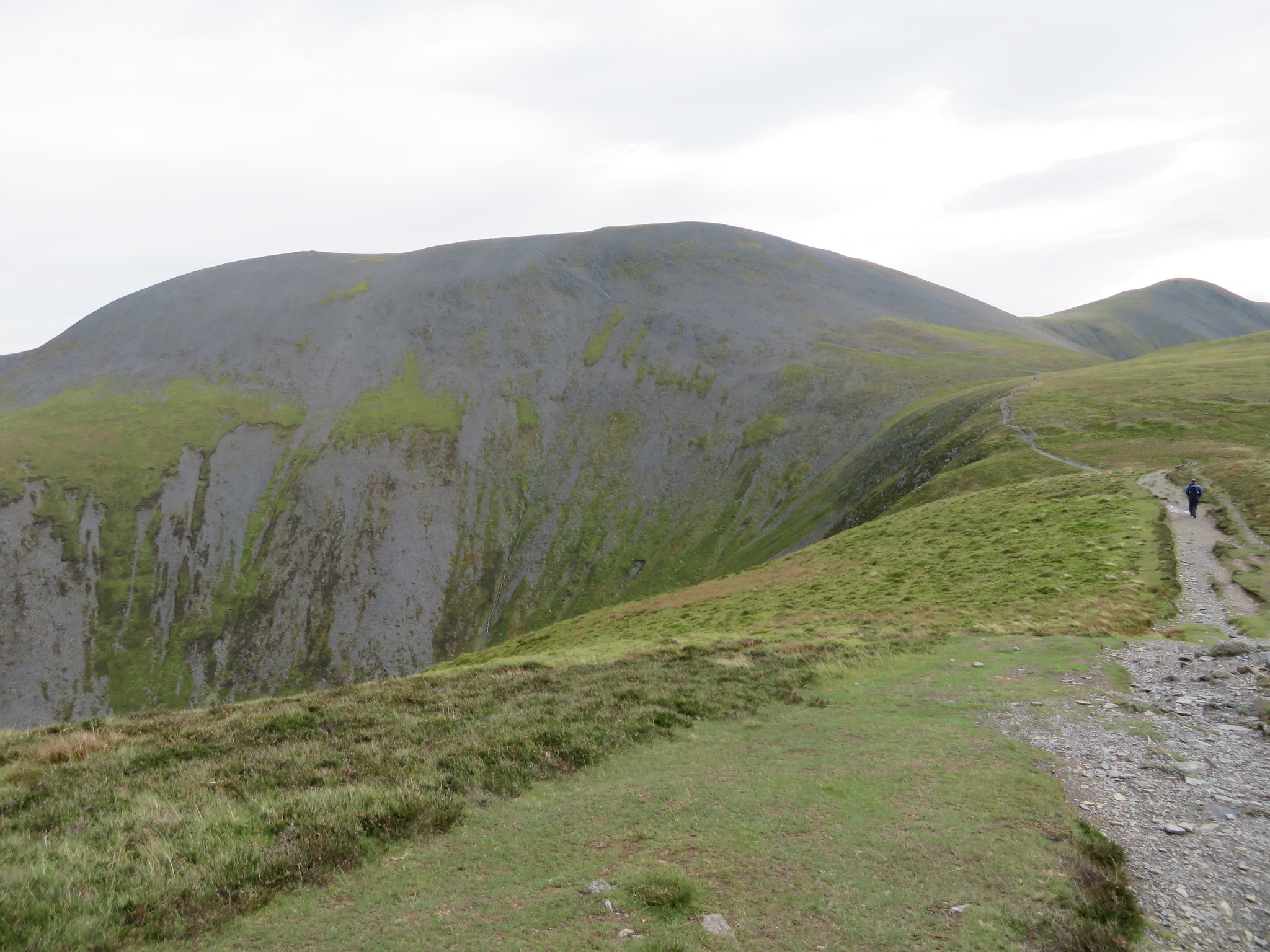 Skiddaw
 We were soon at Carl Side summit after an easy climb on the grass path with its spread out cairn sat on its massive grassy and rounded top and decided to take a break amongst many other scattered groups of walkers before starting the toil up the scree to the 928 metre south summit of Skiddaw.
 Skiddaw Little Man from Carl Side
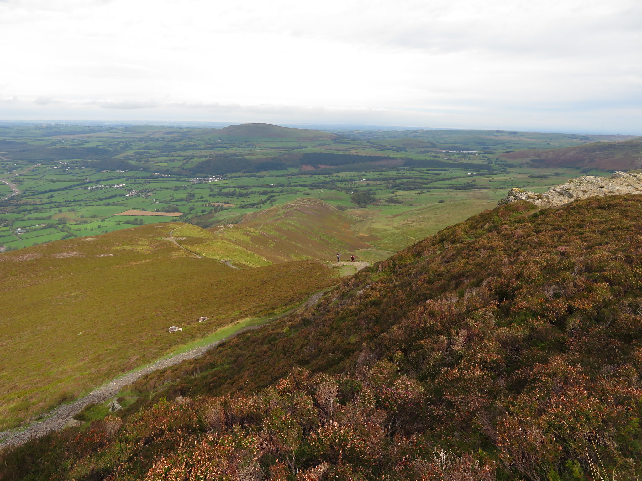
 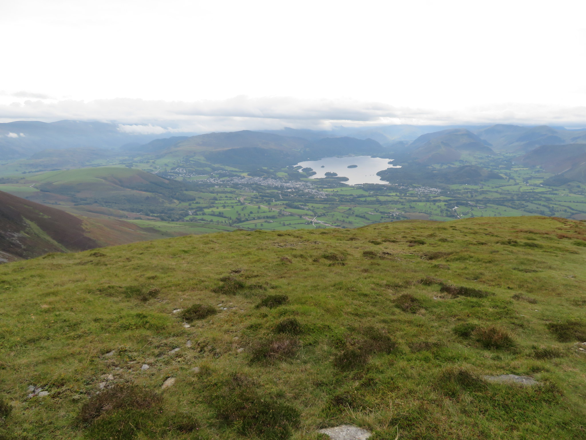 Keswick from Carl Side
 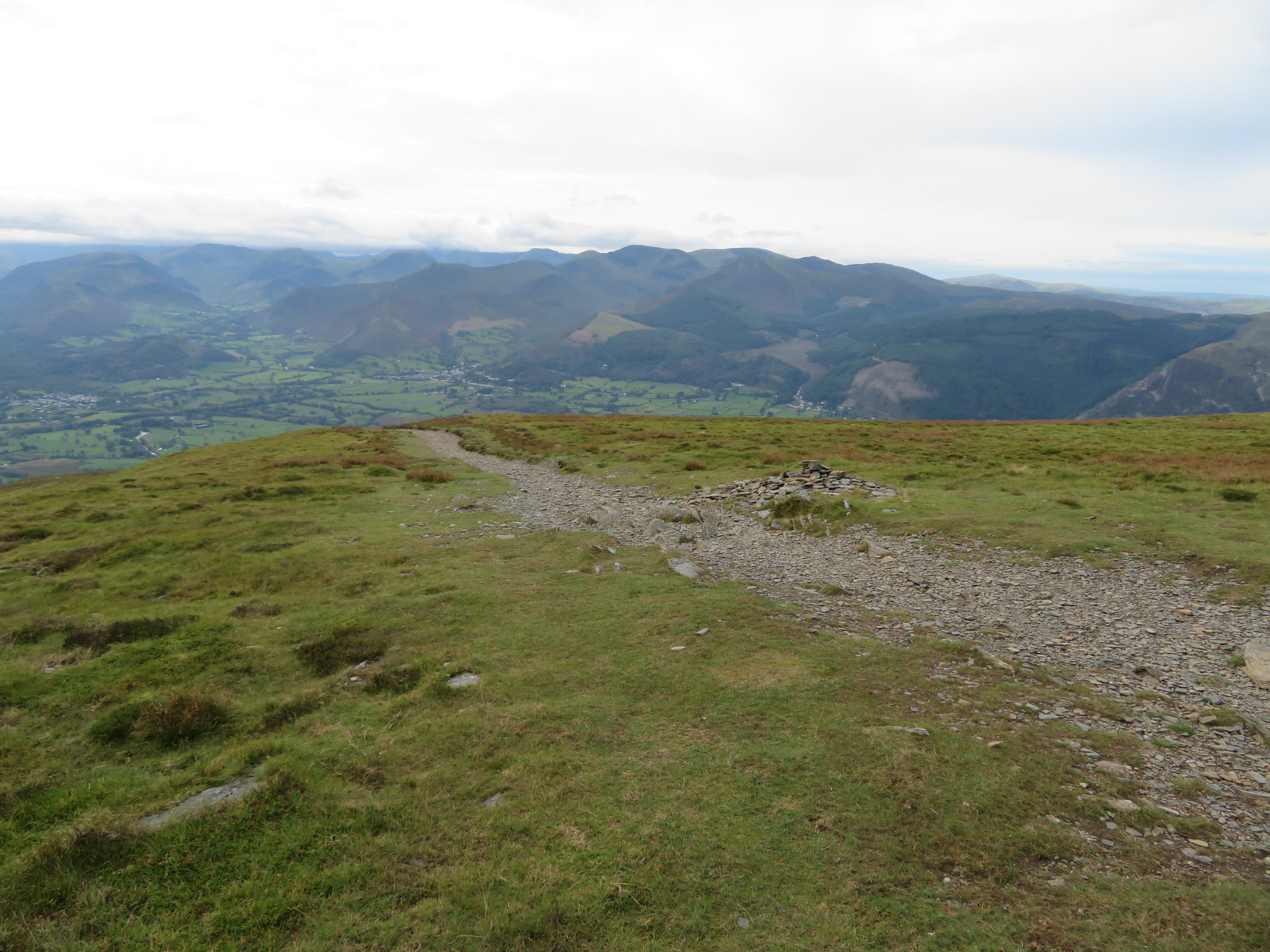 Northwest from Carl Side
 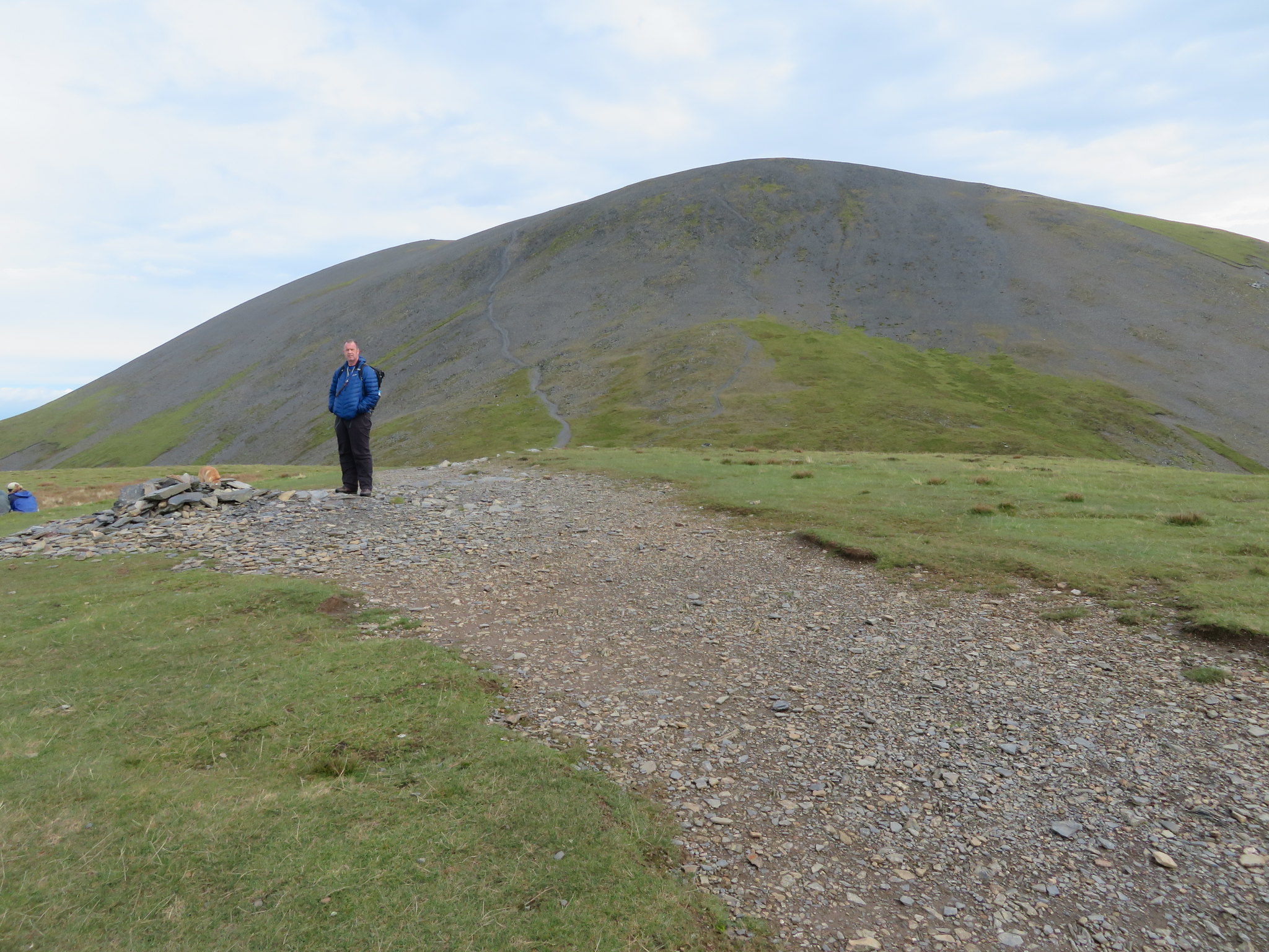 Carl Side top with Skiddaw behind
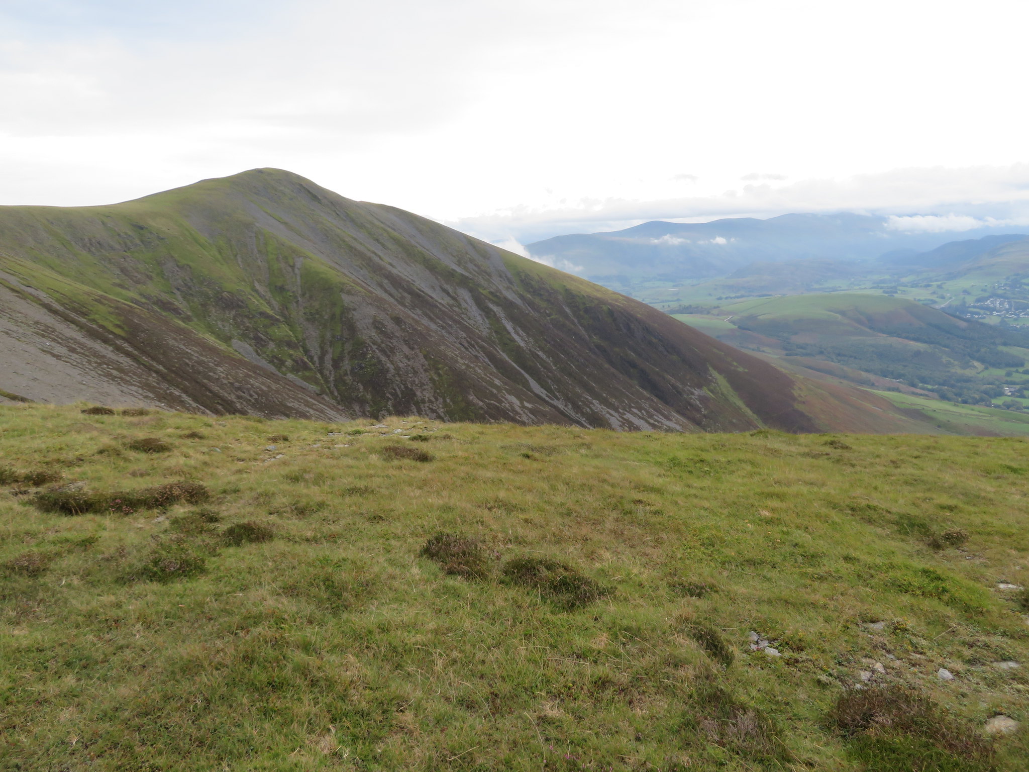
 Finding a bit of shelter under the brow of the summit gave us a bit of respite from the wind and noticed that one couple were taking theirs part way along the climb up the south path, a good plan, but we had done enough climbing for a few minutes so the break was welcome before we attacked the formidable looking slope ahead. There are two paths on this face, the other one being further to the right of the one that we were taking today and is more of a zigzag affair rather than the straight of the other. Although I have used today's route before it is this crooked path that I have ascended Skiddaw twice in the past and although it looks to be more of a serious engagement than the left hand path I found it easier and quicker to negotiate. In the next picture the right hand path can be seen rising up the grass bank and can then be traced along the grey face in a more or less straight line.
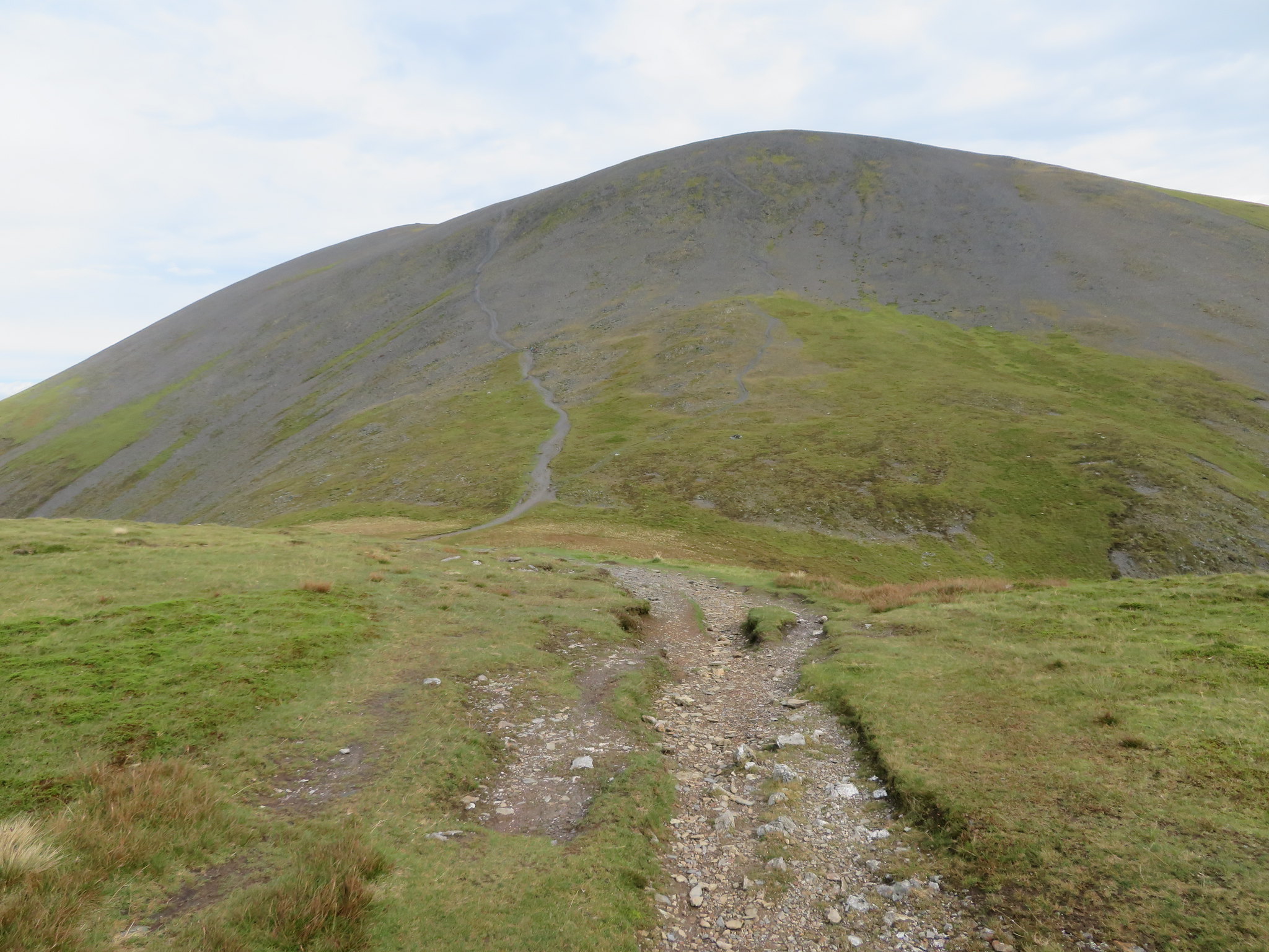 Left hand path to Skiddaw South Top
 We were sat for about 20 minutes and in that short time the blue had gone to be replaced by thick swirling cloud that was now low enough to cover Longside Edge, Ullock Pike and Carl Side. We may have been better forsaking our break and climbing up Skiddaw first. The photo was taken from the start of the climb.
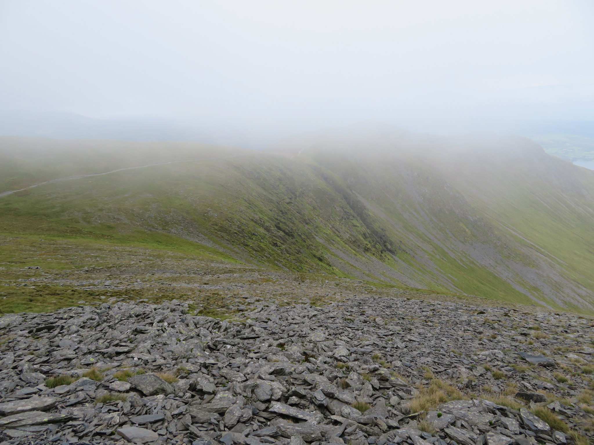 Longside Edge now in cloud
 The first half and last quarter of the path is easy to get along as the gradient is not too severe, it’s the third quarter that makes the path a bit harder going as it steepens considerably and consists of loose scree. It was at this point that my knee began to trouble me yet again and even though I carry poles I don't like using them, but on this occasion there was no other option apart from going back down and that was never going to happen so out the poles came and from then on it was a lot easier on the leg and speeded up my progress enormously. Despite this little setback we were soon on easier ground with Chris making it to the 931 metre south cairn first where all was enwrapped in a cloak of damp grey that even the strong wind wasn't able to shift.
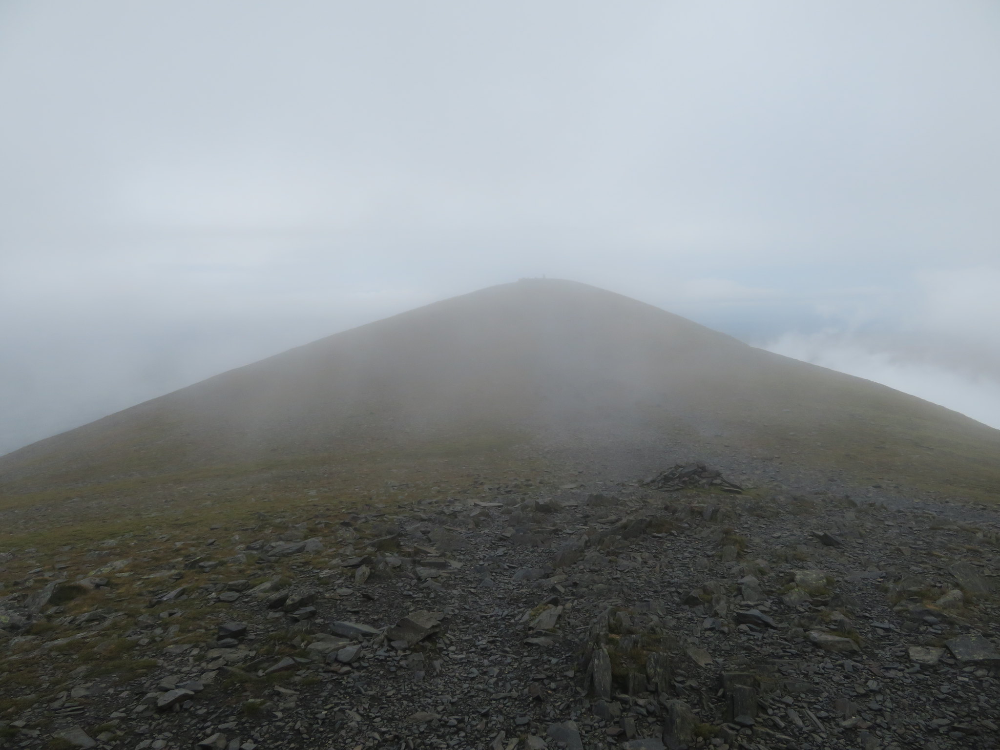 Skiddaw summit
 Leaning into the wind and a good few steps later we were at the true summit of 931 metres alongside the patched up concrete trig column sat on its patched up concrete base around which boots and weather has eroded the stones leaving it perched on its own small plinth of ground.
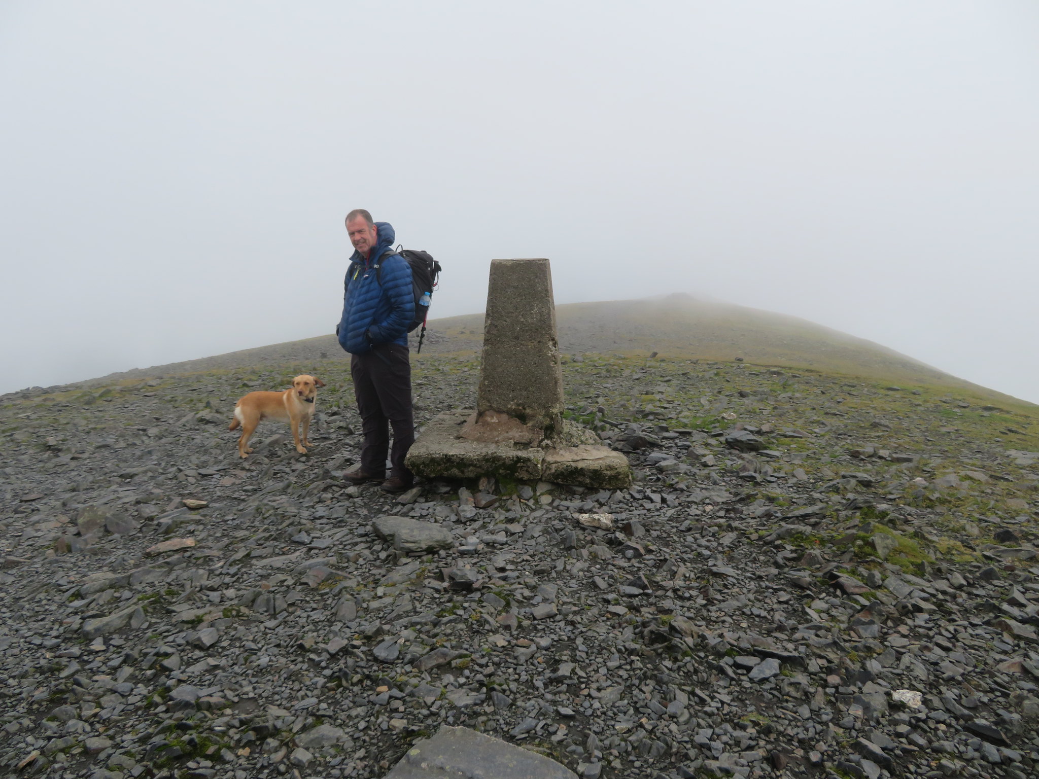 Skiddaw summit
 Apart from us climbing the south path there were probably another 3 or 4 pairs of walkers and looking for a bit of shelter in any of the many walled shelters that are scattered around the summit proved to be a hopeless task as each one was occupied so, on we walked fighting the wind knowing that for somewhere to have a sheltered break would now be in the old sheepfold just before rising up to the summit of Bakestall. It was no hardship really as we had not long before had a decent break but it would have been a welcome break just to ease my leg for a few minutes after the climb up. We continued on over the north summit of Broad End at 831 metres and made good time along the well worn path all the way down to the sheepfold that sits just below the south slope of Bakestall summit. As we sat having a short break the summit of Skiddaw was beginning to empty as quite a few walkers passed us by on their way off to a destination known only to themselves. It was quiet and pleasant sat in the shelter out of the wind for a while from where we could see our last hill of the day after Bakestall, that being the Birkett of Cockup way down to the northwest across the far side of Dead Beck where there are the remains of an old mine of which nothing remains only a scar in the landscape where it once made a living for some hardy souls. But first of all we will gather our things together and make our way to Bakestall summit and a view of some of the northern fells.
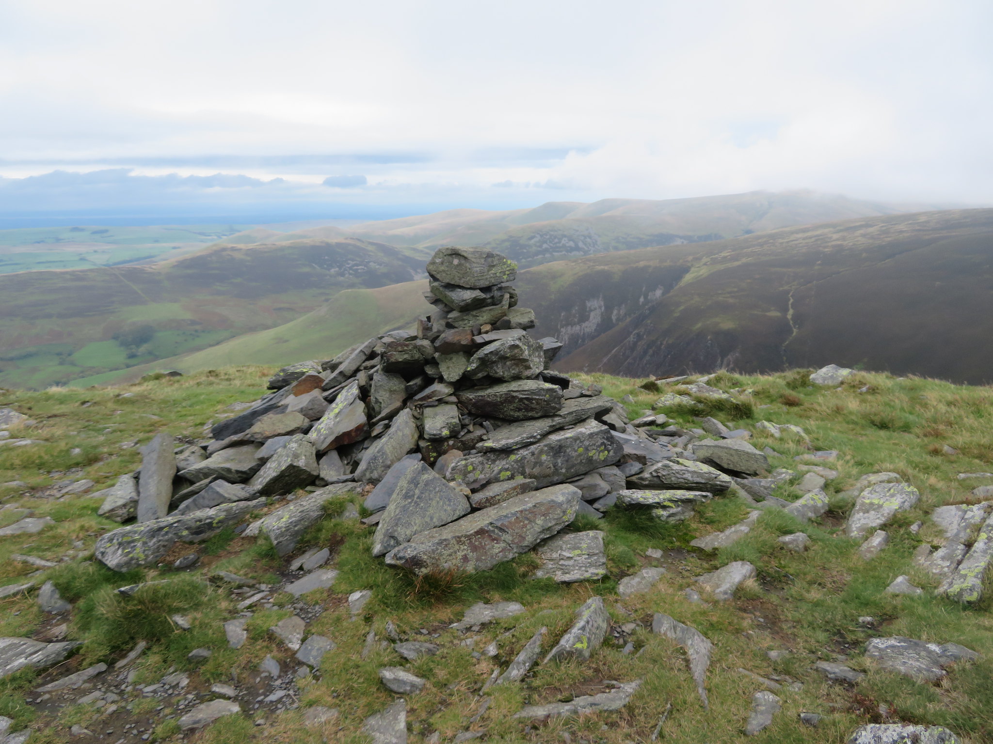 Bakestall summit and the Northern Fells
 By this time it had started to rain, not a lot but just for now a few drops blowing around in the wind and we also noticed that the cloud was now dropping down towards us, rolling down Broad End and bringing the proper rain with it.
 Looking back to Broad End top
 We continued walking north for a short distance before turning to the west and then northwest across pathless but easy ground down to Dead Beck where we found an obvious crossing point, a place that has the look of being used many times before and following the path out of the beck saw that it was running in roughly our direction so it was an easy decision to make to just follow it and apart from the odd swerve took us directly to the summit. Cockup is a great grassy mound of a hill sat at the northern foot of Broad End and is only roughly around 10 metres higher than the ground on its south side. The top is bare of rock apart from the tiny cairn of stones and the last time that I was here there was a white pole stuck out of the centre of the cairn, but time and weather…
 Cockup summit
 It had now begun to rain and waterproofs became the order of the day as the wind now made it a tad difficult to get this outer layer on and after we had responded to the weather we set off down the easy slopes following a faint trod heading west in our direction of travel that traced the north side of Cockup Gill down to the intake wall before turning south for a short distance to cross over the gill and then follow the line of the wall first of all a few metres above it and then dropping down alongside it at the Cockup Gill feeder watercourse on Brown Knott. This path that is unmarked on the map until Brown Knott is reached was a most welcome surprise and instead of having to walk over rough grassed and sloping ground it made our progress a whole lot easier than I imagined it would be. Due to this piece of good fortune we were at the entrance to Barkbethdale earlier than anticipated and realised that our favourite pub wouldn't be open when we had finished the walk so we slowed down somewhat, but a man can only go so slow before his usual stride takes over again so we decided to cart on as normal and find another similar like place of refreshment for the replacement of lost fluids during this walk.
 Crossing Barkbethdale to Southerndale
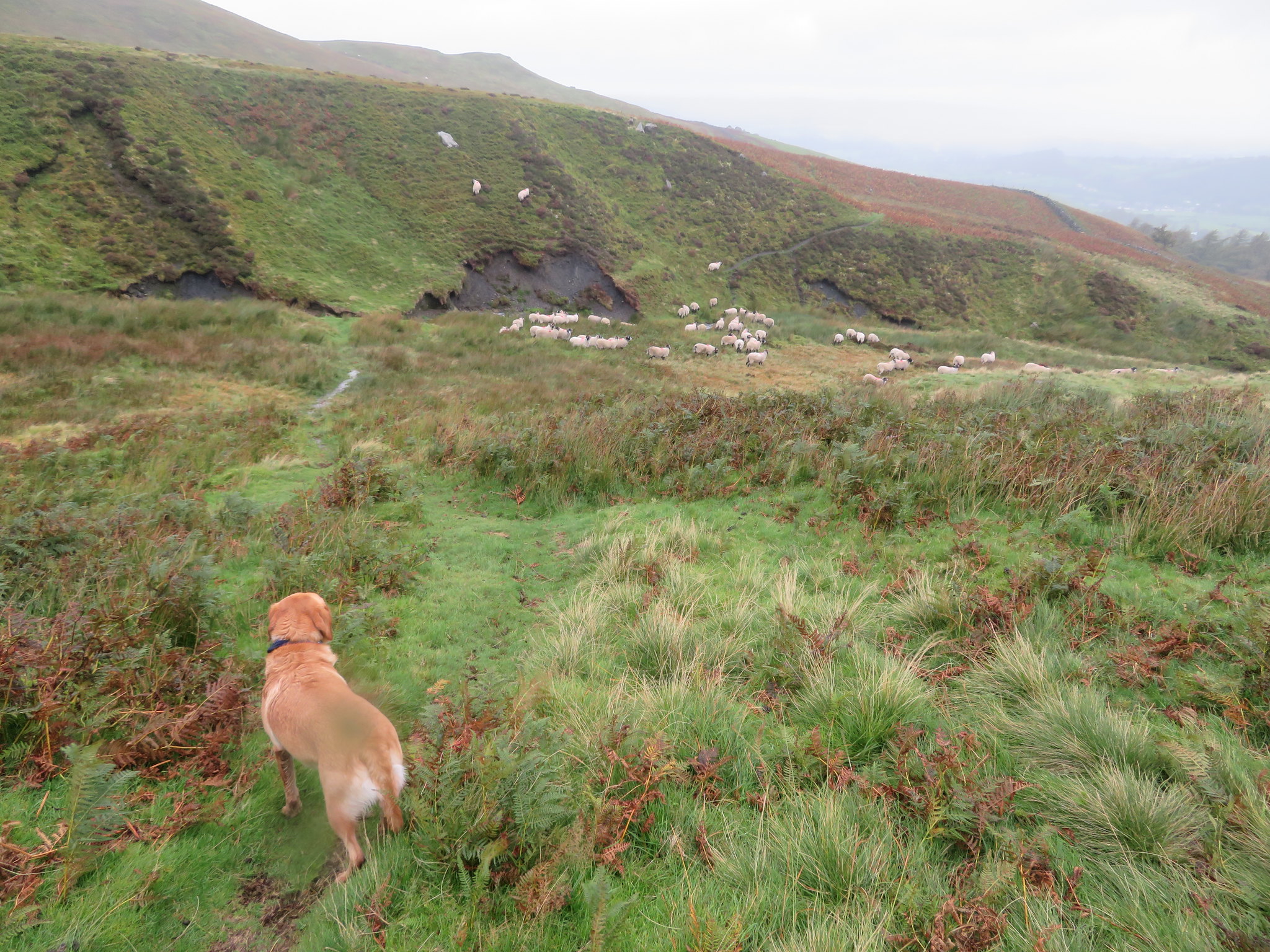
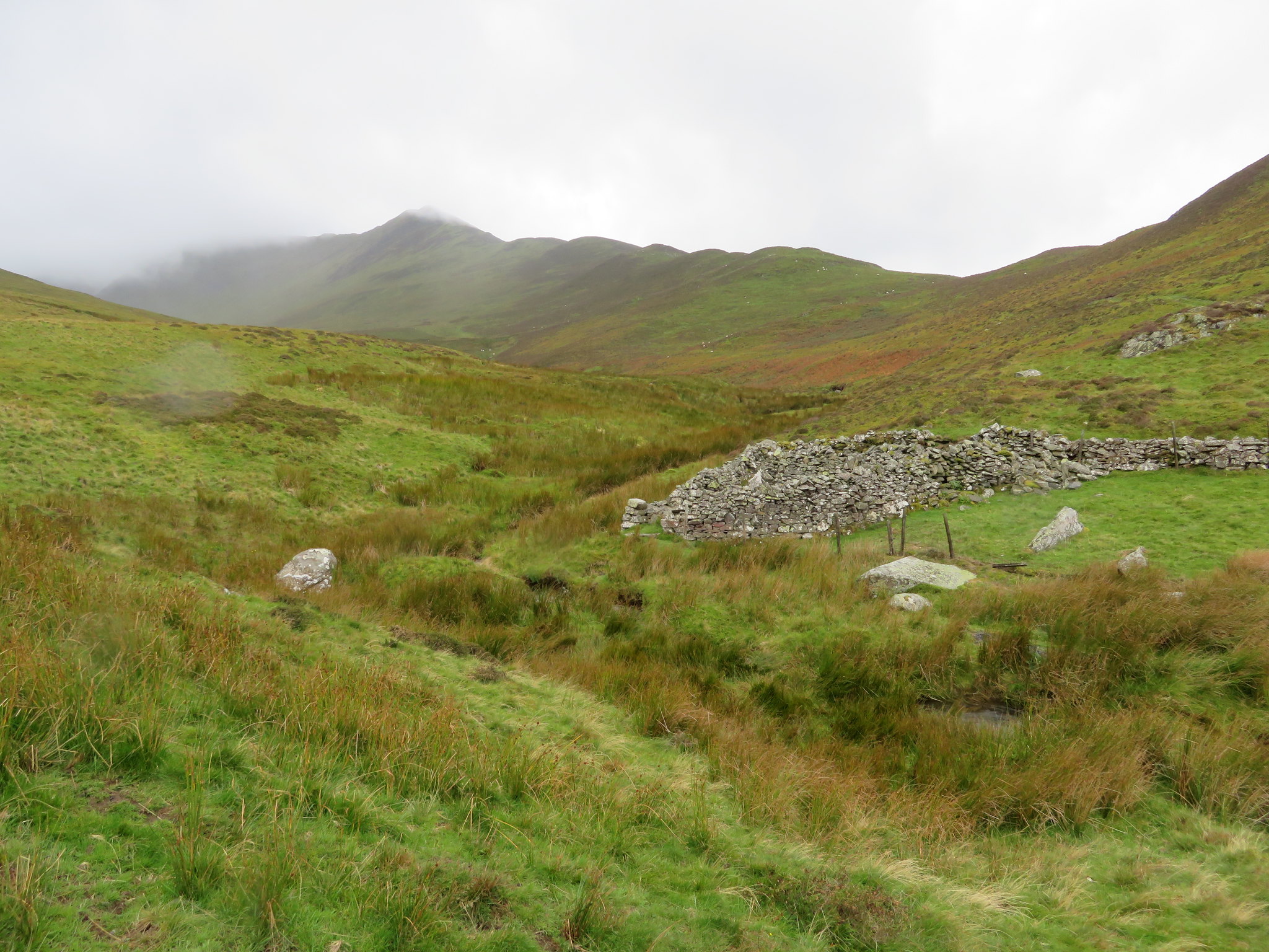
 Barkbethdale although not as long or wide as Southerndale is still quite an impressive dale, Barkbeth Gill running from beneath Gibraltar Crag as it passes through the level grass lands of the valley bottom. It's quite a wild place even though it's so near to the local farms and roads, inhabited just now by two old sheepfolds, one at either end of the dale, and numerous woolly locals that made a run for it upon seeing Sonny. We passed below Little Knott to now cross the entrance to Southerndale to make our way over fairly wet ground as we walked towards Watches where our journey along the ridge more or less began.
 Below the Birkett of Watches from Southerndale
 We crossed Southerndale Beck by a sheepfold to take a good track that would accompany us all the way back to the car park. From the beck there is a good view along the Ullock Pike ridge - or would have been but for the clag and rain - and Longside Edge, a reminder of the climb and fight against the wind as we ascended it.
 Ullock Pike and Longside Edge from Southerndale
 I must have been on Skiddaw a dozen times by now and only on maybe 2 or 3 occasions have I had a clear view of the surrounding fells as more often than not the summit had been as it was on this day, but to be fair Skiddaw wasn't to be the main target of the walk today, it was just in the way of reaching the Birkett of Cockup and as we're not really into linear walks it suited our purpose of making a longer walk rather than turn around and walk back along the ridge.
It's been warm, wet, and windy but not enough to dampen the pleasure of being out and about on some of England's finest. I would have liked to have taken more photos than I did but when the wind is blowing the rain onto the camera lens it does nothing to enhance the meagre views that are visible through the clag and rain.
Upon leaving the car parking area we decided not to take the long drive back through Bassenthwaite Village but would take our chances of a bollocking from the lads laying the new patches of tarmac just a few metres along the road but when we arrived at their place of work they had abandoned it due to the inclement weather, but in any event we would have argued our case as the road was open to the local residents and delivery wagons one of which was just in front of us as we drove off the car park. It goes without saying that we did find a decent place to linger awhile and replenish lost fluids as we did a post mortem on our day out in the northern hills of Lakeland.
