free to be able to rate and comment on reports (as well as access 1:25000 mapping).
For my last hike of my 2018 Munro trip to Scotland, I originally wanted to go up the four eastern Fannichs. I got up early and was at the parking north of Torrandhu bridge at 6:30 a.m. The weather forecast had announced thunderstorms for noon/afternoon, so I watched the sky distrustfully and set off quickly. After a bit more than half a kilometre, I decided to turn around. The clouds were already piling up high and growing quickly, and it looked very dark to the East.
Back at the car, I drove to Assynt to have a "tourist day" instead. The weather was absolutely fine there, so when I approached Inchnadamph, I decided to tackle Conival and Ben More Assynt. Luckily, I had the right map in the car.
I didn't take many photos on this walk, so i'll make this report a short one.
![2018-06-01 6. Wanderung_ACTIVE LOG084702_Grafik2D.jpg]()
- Altitude profile created with GPSTrackAnalyse.net
During the rather long walk into Gleann Dubh, I was constantly observing the weather. Conival was in clouds, but all looked well in the sky in all directions, except far to the East. My (basic) meteorological training told me there was no danger of thunderstorms here in the next hours, but I speeded as much as I could anyway. Somehow I didn't feel like walking, but it got better the longer I walked. Walking steeply uphill next to the Allt a' Choinne Mhill, I lost the path - again - and crossed the stream too early, making things more difficult than they needed to be.
In the small hanging valley further up, things started getting more interesting with the rocky path up to the bealach below Conival. It was quite windy and chilly here, almost in the clouds. The path now climbed steeply up the north-west ridge of Conival, and I reached the summit after 2h50 and 7.5 km from the start. The clouds had risen along with me, and visibility was good to the East, but absolutely none to the West.
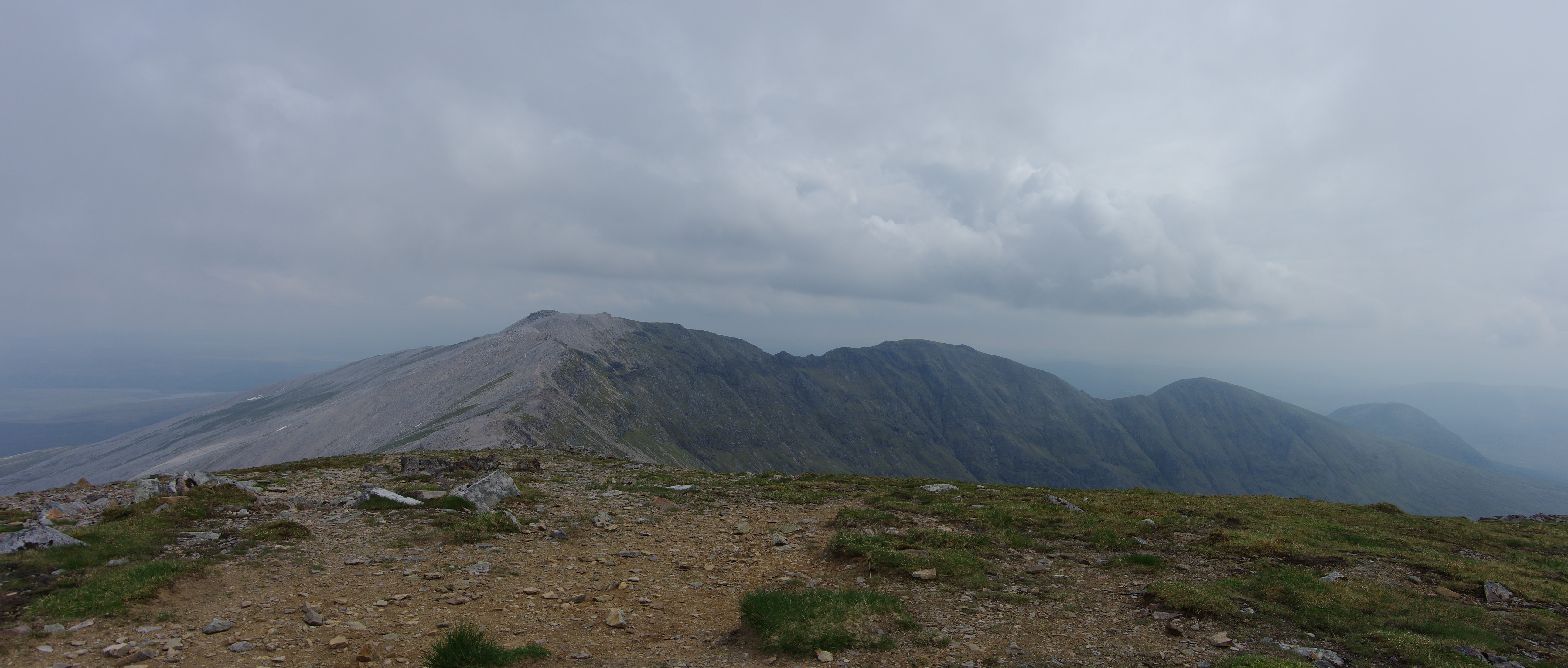 Looking towards Ben More Assynt from Conival. Click to see large.
The walk along the beautiful ridge between Conival and Ben More Assynt proved more cumbersome than I had thought. It took me less than an hour to get to Ben More Assynt, but it felt at least twice that time.
![IMGP5782a DSC_4568.JPG]()
- Half-way along the ridge, Ben More Assynt ahead, Dubh Loch Mòr to the right below
On Ben More Assynt, I had no idea which one the true summit was, so I went to the three points that looked highest to me. The GPS didn't show a significant difference in height between these points, and by the eye it was impossible to tell.
![IMGP5784.JPG]()
- This one sure looked higher than the one I was standing on, but the GPS said it wasn't...
![IMGP5782a DSC_4571.JPG]()
- Looking back to Conival along the ridge from Ben More Assynt. The three little lochs of Coire a' Mhadaidh visible to the right.
 360° panorama from Ben More Assynt. Click to see (very) large.
The weather was absolutely fine now, and I took my time to go back to the car. Shortly before reaching Conival again, a met a Scotsman with whom I talked for a quarter of an hour about my dried-mouth feeling of the first three days, especially
during my marathon in Fisherfield, thunderstorms in the mountains (he had experienced some), and people struck by lightning. Apparently, the best position is to squat down on your feet, connect the elbow to the knee, and point the hand up. If lightning strikes you, it will go from the hand via the knee into the ground, bypassing the heart and keeping you alive. We wondered if anyone had ever lived to confirm that it works or if this is just to give people some hope of surviving.
After we had said our goodbyes, I briefly enjoyed the views from the now cloud-free Conival to Suilven, then, after passing a taciturn young couple approaching the summit, had an eventless walk back to the car. After all, it had been a fantastic day out, and the deep dark clouds I saw in the south-east all day confirmed that my decision to abandon the Fannichs had been right.
![IMGP5799a DSC_4572.JPG]()
- Looking back to Conival along the Gleann Dubh in the late afternoon
![IMGP5801.JPG]()
- Looking out to Inchnadamph, and that's quite some villa on the hillside here!
