free to be able to rate and comment on reports (as well as access 1:25000 mapping).
For the first time in months, the weekend forecast was good - full sunshine, no rain (maybe some winds). So I was excited to get away somewhere interesting. But then I remembered Allison's dodgy back from last weekend. When I asked her what she felt able to do she'd said "something easy" which didn't really fit with my plans for the good weather. I did think about scheduling some hills in the eastern part of the country with tracks up to the tops, but it was too awful to contemplate wasting good weather on such places. I wanted to go west. I suggested that she'd be able to manage Beinn Loinne, which has a track up part of it, Sgurr an Airgid; likewise, and Sgurr Mhic Bharraich which is very short. Although these were less exciting options than I'd hoped for, they seemed a fair compromise.
We headed up to Kintail on Thursday as usual and camped near the Cluanie, which is still in the process of a very major refurb, having been taken over by Black Sheep Hotels group along with the Invergarry Hotel (both part of the Mars hospitality Indian empire it seems). A cold but quiet night, heard the winnowing of snipe for the first time in a while. A cloud inversion in place when we woke in the morning, but that rapidly cleared as we started walking. We'd been up Beinn Loinne from the east side a few weeks ago and failed to go to the correct summit (by some 2 kilometres) so this was a chance to put that error straight. Glorious sunshine, little snow left on the surrounding Munros. Walking up the track was pleasant, sun in our eyes, dry underfoot - well until we left the track that is.
 P4120188
 by
Al, on Flickr
 P4120189
 by
Al, on Flickr
Into the sun
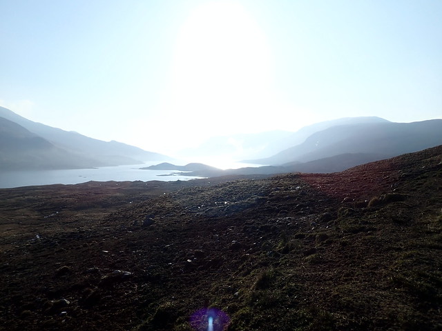 P4120190
 by
Al, on Flickr
View back along the track
 P4120191
 by
Al, on Flickr
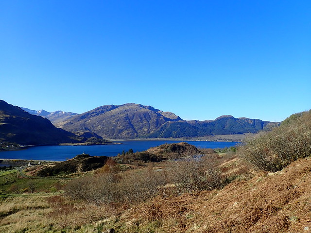
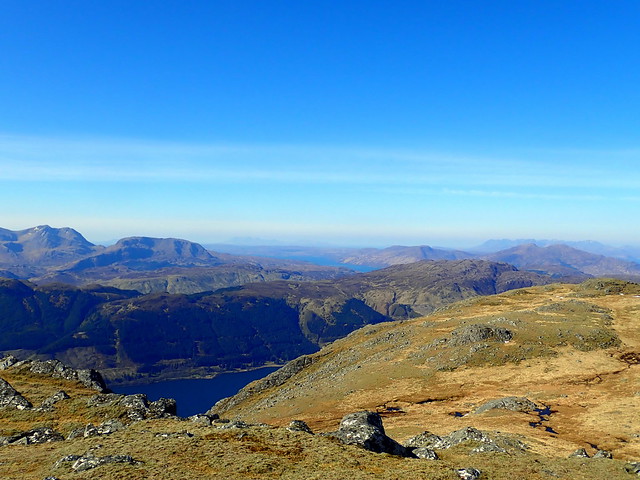
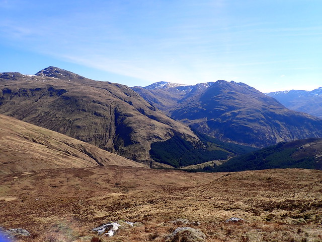
South Shiel ridge and Glen Quoich hills
 P4120193
 by
Al, on Flickr
Some bogginess initially then onto rockier ground, just an easy paced stroll to the (proper) summit.Allison said she was coping ok after we got back to the car - it was only 1pm, so definitely time for another hill of some sort. I'd plotted routes for a few of the nearby Marilyns and suggested we could do one of them, or maybe Sgurr Mhic Bharraich - she had a look over the possibilities on the map and suggested the Marilyn of Beinn a'Chuirn down at Ratagan. I'd been hoping she'd choose Mhic Bharraich, which would have meant we'd get in another Corbett on the Sunday, but I agreed it might be a bit steep for today.
Summit of Loinne with "that other summit" of Loinne in backdrop
 P4120194
 by
Al, on Flickr
 P4120195
 by
Al, on Flickr
We drove down to Shiel Bridge campsite - still very reasonable at £7.50 pppn, got the tent pitched. Allison had been looking at the map and suggested an alternate route to the one I'd plotted for Beinn a'Chuirn - instead of going up after the forestry she thought it would be better to leave from the viewpoint at Mam Ratagan which, although a bit longer - would mean less height gain as the starting elevation was around 140m higher. Fine, says I, (don't argue with your co-pilot). We parked up at the viewpoint and set off on a very squelchy forestry track that petered out quickly onto spongy tussocks. And ups and downs. And a patch of trees that weren't shown on our map (although they are on the GPS planner map). It was tough going, to put it mildly. However, we were kind of committed, so had little choice but to press on. Eventually we reached a deer fence line which goes right to the summit, and followed this. Time drifted by real slow. I had thought it might take us about 2.5 hours tops, but it took us more than two hours to even reach the summit. The views were good though - out to Skye and an unusual view down onto Eilean Donan Castle. We discussed which way to return and I was pretty insistent that we'd go back on the road, using the descent line I'd originally plotted to ascend and descend by. Following the edge of the (cleared) forestry plantation led us back to the road (where the car should have been

) then we had another mile and a half back uphill to the viewpoint. Seeing the car waiting for us was a very welcome sight. Drove back down to the campsite for a later than planned evening meal. We heard the wind getting up overnight, sighing and howling through the valley right at the campsite.
View to the Sisters from the viewpoint
 P4120196
 by
Al, on Flickr
 P4120198
 by
Al, on Flickr
 P4120199
 by
Al, on Flickr
Going for the "Pie Rat" look
 P4120200
 by
Al, on Flickr
Eilean Donan
 P4120202
 by
Al, on Flickr
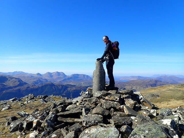
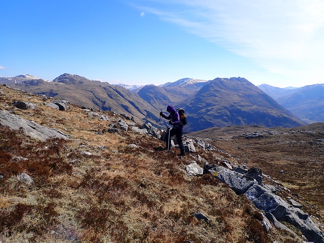
Saturday was planned for Sgurr an Airgid. Rather than just do the simple up-and-down that we'd done previously, I'd planned a route that took in the north eastern ridge, including the Simms of Beinn Bhuidhe and Beinn Bhreac - incidentally this is a really good extension to the Airgid walk and I'd strongly recommend it if you have a day with good views. We parked at the burial ground and set off through the metal gate and up the track to the bealach, as per the standard WH route. Although the sun was bright, the wind was both strong and icy. A straightforward walk along the path to the summit of Airgid with grand views all around - over to Skye and Rum, up to Torridon, Achnashellach, even An Teallach was visible. The shapely pyramid of Cheesecake stood proud in the north.
 P4130204
 by
Al, on Flickr
Airgid
 P4130206
 by
Al, on Flickr
A land of high lochans
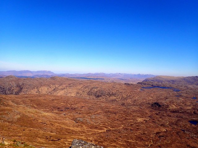 P4130207
 by
Al, on Flickr
Airgid summit, Bheinn Bhan in background
 P4130208
 by
Al, on Flickr
 P4130209
 by
Al, on Flickr
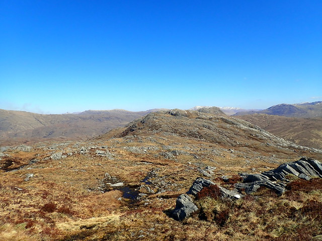
Beinn Bhuidhe
 P4130211
 by
Al, on Flickr
We retraced our steps along to the bealach, then continued up onto Beinn Bhuidhe, pausing for lunch in a sheltered spot. We saw a group of deer come up to the path towards Airgid, plodding very slowly indeed - maybe they were enjoying the views too. From the summit of Bhuidhe, good views to the Corbetts next door in Glen Elchaig and a view of high level lochans. An enjoyable and surprisingly dry walk over to Beinn Bhreac, view continuing to enchant, even a wee bit of scrambling up to the summit of Bhreac. The next hill along from here is the tough wee bugger of Carnan Cruithneachd, one of the steepest Grahams, a real mountain with attitude. It wasn't on today's menu, although it would have been quite simple to do it from the rear - but I've been up it twice already. Instead we continued along the length of Bhreac, heading for the track going through Dorusduain Wood. It was pleasant to walk in mossy glades after the glare of the sun and chill of the wind. Eventually, after several zig-zags, we came out of the trees and joined the path that leads to the Falls of Glomach, we headed back towards Strath Croe. On the way we encountered a ruined howff that had more than a little of the Blair Witch about it - from the blue daubings on the walls of one of the rooms and the disintegrating caged kennels - I suspect it was used as a place to summon demons, with the aim of containing said demons in the caged runs.

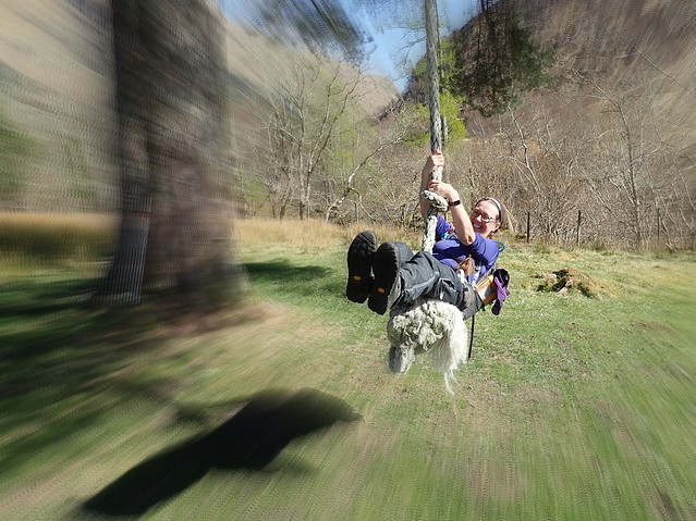
One of the rooms was fairly clean and would make for an emergency bothy. Further along we found a giant rope swing which a certain someone had a go on (well I did too actually). A good day out, fine walking conditions.
Cheesecake
 P4130213
 by
Al, on Flickr
Summit Bhuidhe, looking back at Airgid
 P4130215
 by
Al, on Flickr
On to Bhreac
 P4130216
 by
Al, on Flickr
 P4130217
 by
Al, on Flickr
Bheinn Bhan
 P4130218
 by
Al, on Flickr
Beinn Fhada
 P4130219
 by
Al, on Flickr
Bhreac summit
 P4130220
 by
Al, on Flickr
Wee scramble to the top
 P4130221
 by
Al, on Flickr
Carnan Criuthneachd
 P4130224
 by
Al, on Flickr
Down to the woods
 P4130225
 by
Al, on Flickr
Creepy cottage
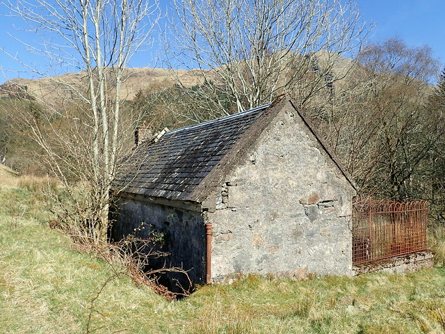 P4130228
 by
Al, on Flickr
 P4130226
 by
Al, on Flickr
 P4130229
 by
Al, on Flickr
 P4130230
 by
Al, on Flickr
 P4130232
 by
Al, on Flickr
Another windy evening at Sheil Bridge. A Tarptent was now pitched next to us - this belonged to a guy walking from his front door in the west end of Glasgow to his mother's house in Skye, just because he'd always said he would. A grand adventure, was good to talk to him. We did sit watching poorly pitched tents being caved in by the wind, then had to retreat inside when the sun slid away from where we were perched and the chill became too much.
Another lovely morning - we were up fairly early, though not as early as Mr Walk-to-Skye who was gone before 7. Breakfasted, packed the tent away then set off up Sgurr Mhic Bharraich. As we started off, some lines from "Granchester Meadows" came into my head:-"Icy wind of night be gone, this is not your domain". The wind refused to listen. We followed the standard WH route, not much to say about it really - some good views of Beinn Sgritheall and the Sisters. All the lochans had a thick coat of ice on them and there were icicles on the streams on the way up, so the cold wind was doing its stuff. Descended off the east flank, back into Gleann Undalain and the waiting car. It was just gone 12, far too early to call it a day - I wasn't going back home early two weeks on the trot. Luckily the weekend didn't seem to have adversely affected Allison's back. What about Garbh Bheinn down at Loch Leven - a tiny walk of only 6km...yay!
 P4140233
 by
Al, on Flickr
 P4140234
 by
Al, on Flickr
Sgritheall
 P4140237
 by
Al, on Flickr
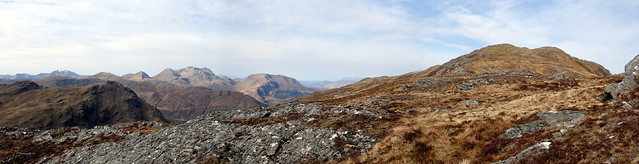
Summit pano
 P4140239
 by
Al, on Flickr
 P4140241
 by
Al, on Flickr
 P4140242
 by
Al, on Flickr
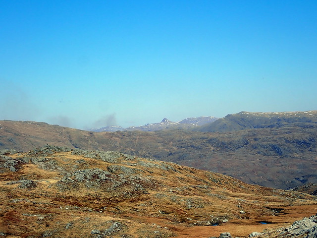
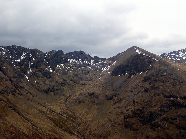
Yesterday's route - Airgid to Bhreac
 P4140243
 by
Al, on Flickr
 P4140244
 by
Al, on Flickr
We drove down towards Glencoe, quite a lot of tourist traffic about. Parked up by the bridge at the start of the route and set off around 2.15. Took the standard WH route - ie the path - up. Sadly the sun had left us, although the wind was still strong and chilly - we were shielded from it to some degree on the way up. Met a group of three folk coming down from the top as we arrived there - good views of The Ben and the crazy pinnacles on the Aonach Eagach. We looked down to the north and saw the shoulder we'd just managed to reach a few weeks ago when we were ascending from Kinlochleven - before the blizzard repulsed us. Quite an enjoyable stroll today, back at the car in 3 hours (GPS battery died before we got there).
 P4140245
 by
Al, on Flickr
 P4140246
 by
Al, on Flickr
 P4140247
 by
Al, on Flickr
 P4140248
 by
Al, on Flickr
Aonach
 P4140249
 by
Al, on Flickr
 P4140251
 by
Al, on Flickr
 P4140252
 by
Al, on Flickr
 P4140253
 by
Al, on Flickr
 P4140254
 by
Al, on Flickr
