free to be able to rate and comment on reports (as well as access 1:25000 mapping).
Sub 2k Marilyns: Sgurr na Stri.
Date: 10 - 12/04/2019.
Distance: 23 km + 4.5 km.
Ascent: 800m + 90m.
Time taken: 7 hours, 30 minutes + 1 hour, 20 minutes.
Weather: Sunny and hazy with cold breeze.
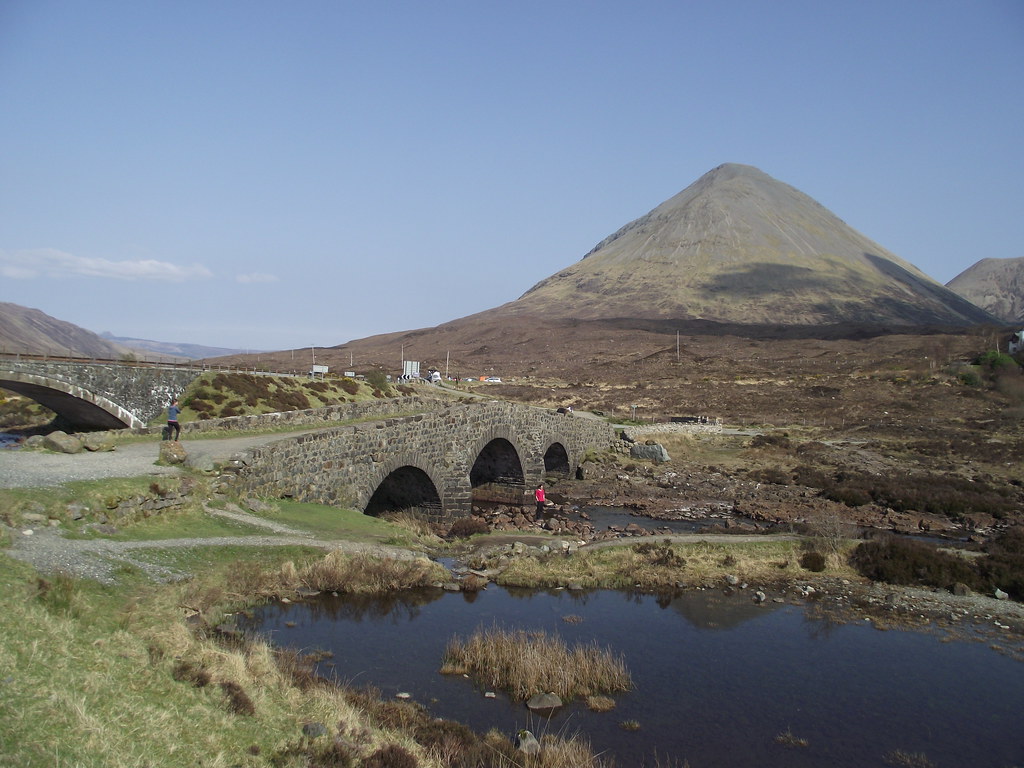
Link to previous partWe had decided to abandon working our way north up the coast for a few days on Skye instead - there was a greater variety of walking here, and we had been looking at it all week from Applecross. Plus the weather looked reasonably settled for getting a couple of good summit camps in...
We finally departed the hostel in Applecross on Wednesday morning and swung by the Co-op in Kyle for a re-stock of supplies. By 2:30 pm, we were parked up at Sligachan for the walk-in to Sgurr na Stri.
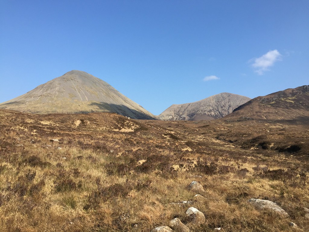
 Glamaig
 Both of us had
summit camped on this before separately (in fact we had both approached it rather unconventionally via Marsco


), but is was one we were both keen to camp on again. Jackie's camera had stopped working on her previous visit so she was keen to get some better photos than the ones from her phone. I did my usual messing around and we didn't get going until after 3pm. The weather had improved over the afternoon and was now a mixture of sweatily warm in the sun and rather chilly in the shade (or when the breeze got up).
 Glamaig and Beinn Dearg Mo
 We soon saw off the tourists who tend to visit the first few hundred meters of the Camasunary path, after which we passed very few people. We weren't taking in Marsco today thankfully, and settled for a nice sensible walk along the path to Druim Hain.
 Marsco
  Crags on Marsco
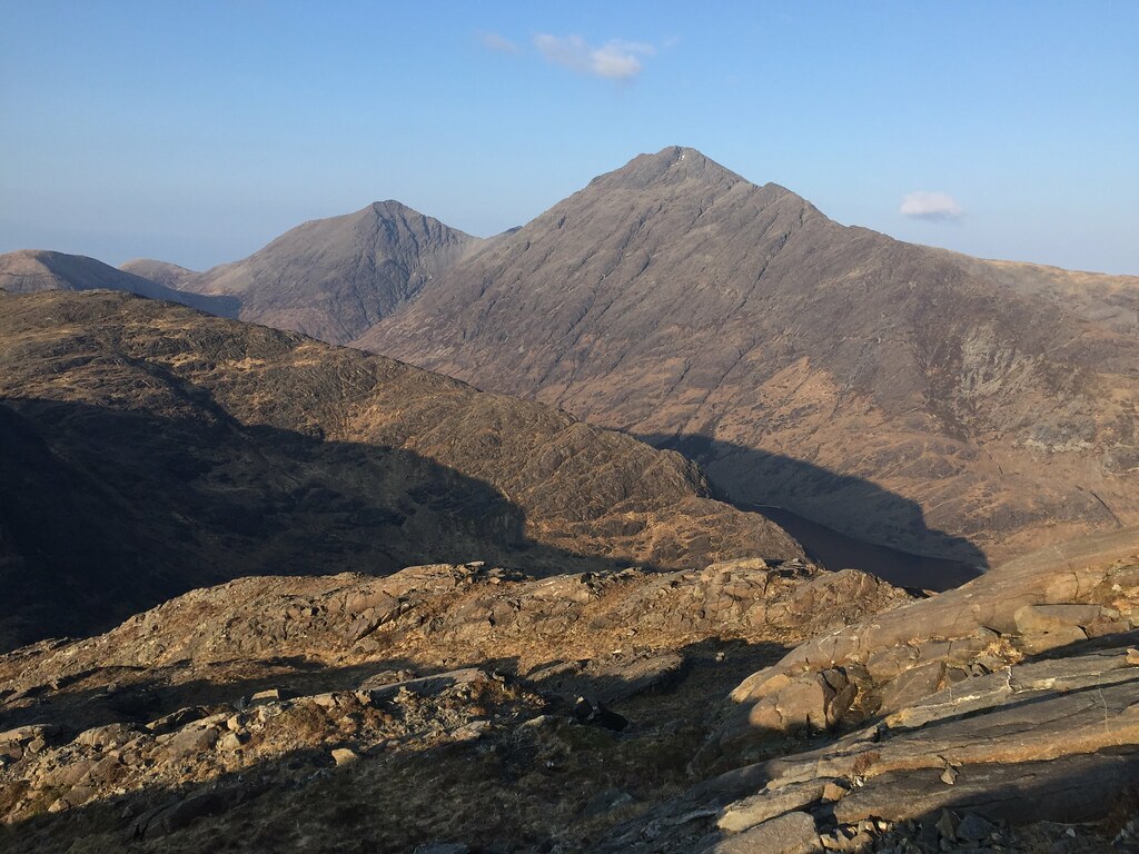
  Bla Bheinn
  Clach Glas and Bla Bheinn
  Zoom to Clach Glas
  Garbh-bheinn and Bla Bheinn
  Bla Bheinn
 We passed some mountain bikers descending from Druim Hain - they had been trying to reach Loch Coruisk but had run out of time. Probably for the best as their intended route on was around the coast via the 'bad step' - I don't think they were aware of how much carrying this would have involved! A guy with a dog was also headed our way with his tent - could be some competition for camp spots up there?
 Sgurr nan Eag to Sgurr Alastair
 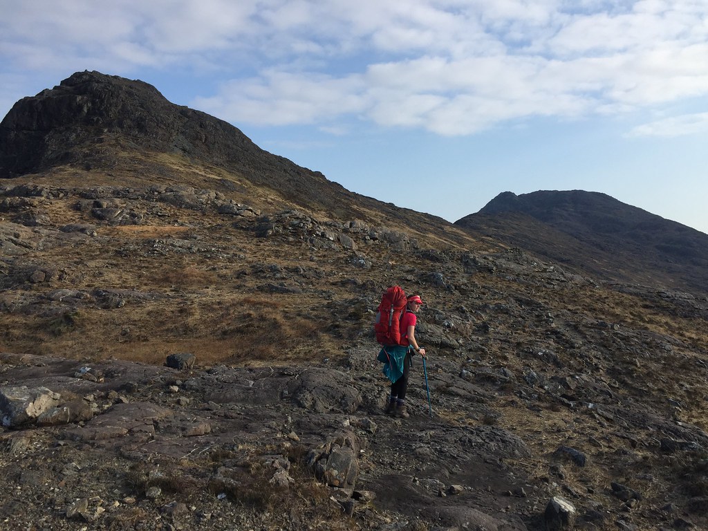 Jackie heading for Sgurr na Stri
  Crossing Sgurr Hain
 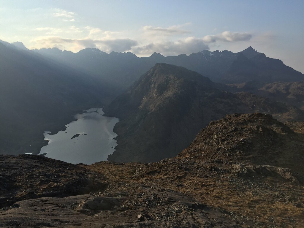 Loch Coruisk
 It was a bit of a slow, sweaty trek to the summit from Druim Hain - there is a path of sorts but it is faint, and we had both forgotten how far it was. We had gear and supplies for a couple of nights out as we were considering dropping to Coruisk and doing a section of ridge the next day (Gars-bheinn to Sgurr nan Eag), but I suspected this was a bit ambitious for Jackie just now. No harm in taking the stuff just in case though! I topped up on water at the last burn before the summit and by 7pm we had the tent up. No sign of the guy and his dog, even though he hadn't been far behind....he was concerned that his dog was tiring, but it looked like he had stopped just short of the top and its brilliant views. Oh well, we get it to ourselves then!
 Bla Bheinn
  Out to Muck and Rum
  Rum from Sgurr na Stri
  Jackie on Sgurr na Stri
  Northern Cuillin from Sgurr na Stri
 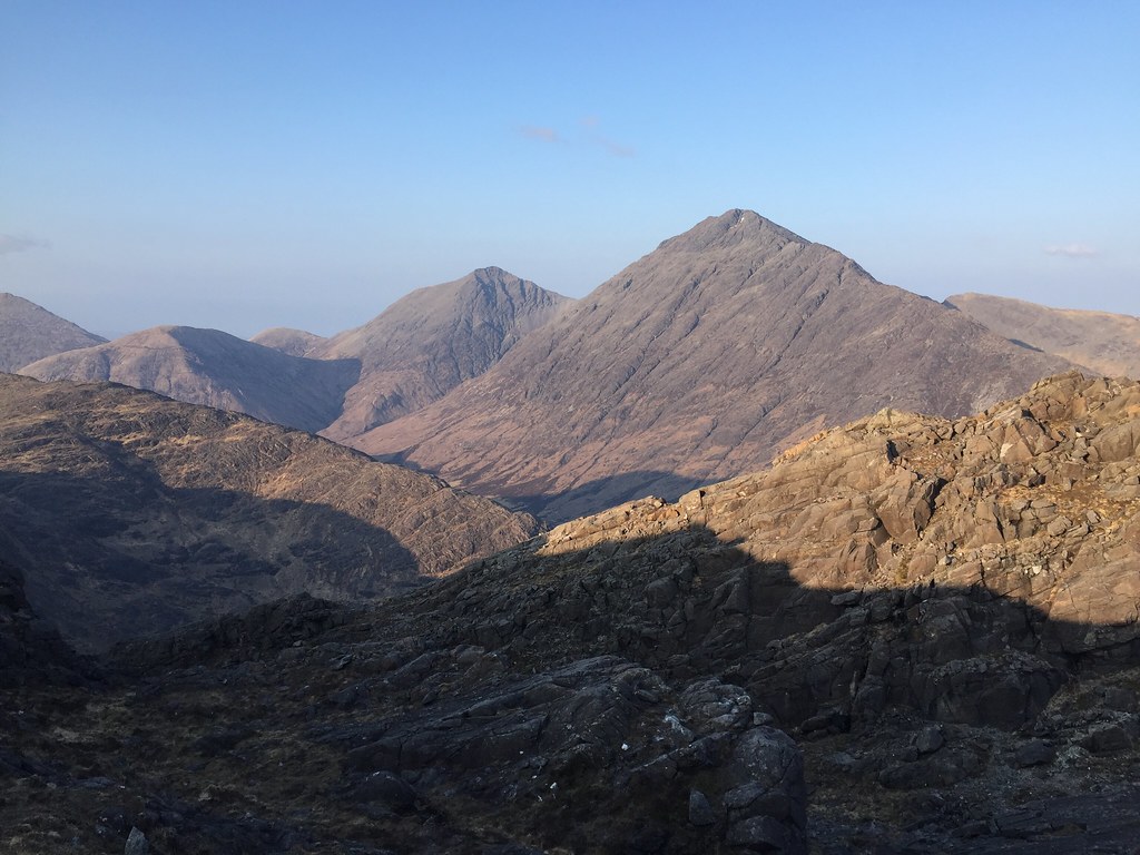 Garbh-bheinn and Bla Bheinn
 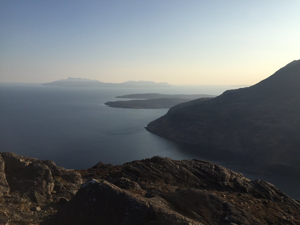 Rum
Rum Although the air was chilly once the sun set, it was still a great evening to sit out looking at the Cuillin and out to sea. Sunset hadn't been that spectacular, but it was almost windless and we were on for a good sunrise, we suspected.
 Tent up on Sgurr na Stri
  Out to Rum
  Coruisk
  Ben Meabost and Elgol
  Coruisk and sunset
  Sunset behind Sgurr Dubh Mor
 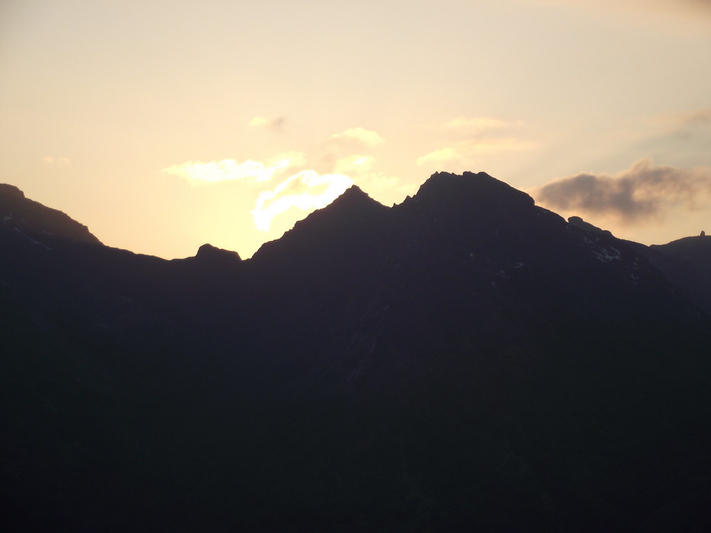 Sgurr Dubh Mor
  Summit camp
  Garbh-bheinn and Bla Bheinn
 We were up in time for sunrise, and despite the cold (even a smidgen of frost around), it was pretty good. Alpenglow on Gars-bheinn wasn't quite up to the standards of my last visit, but when the situation is this great, who's complaining?

 First light
  Muck and Rum
 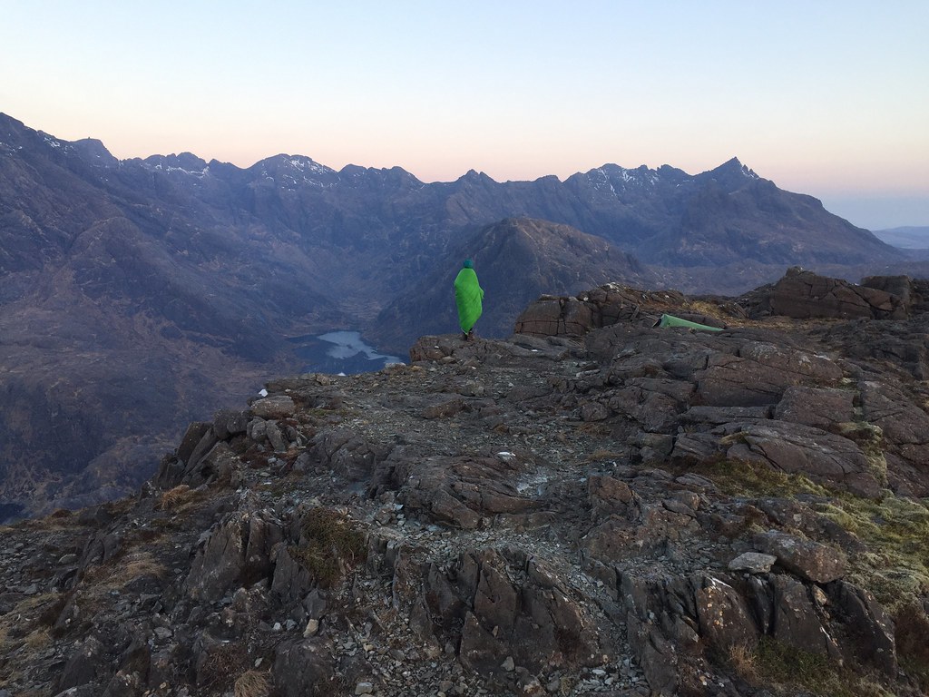 Sleeping bag cloak over Coruisk
 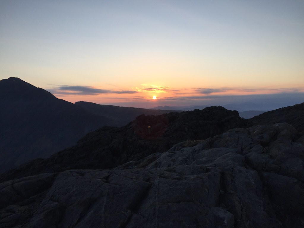 Sun up
  Rum
Rum 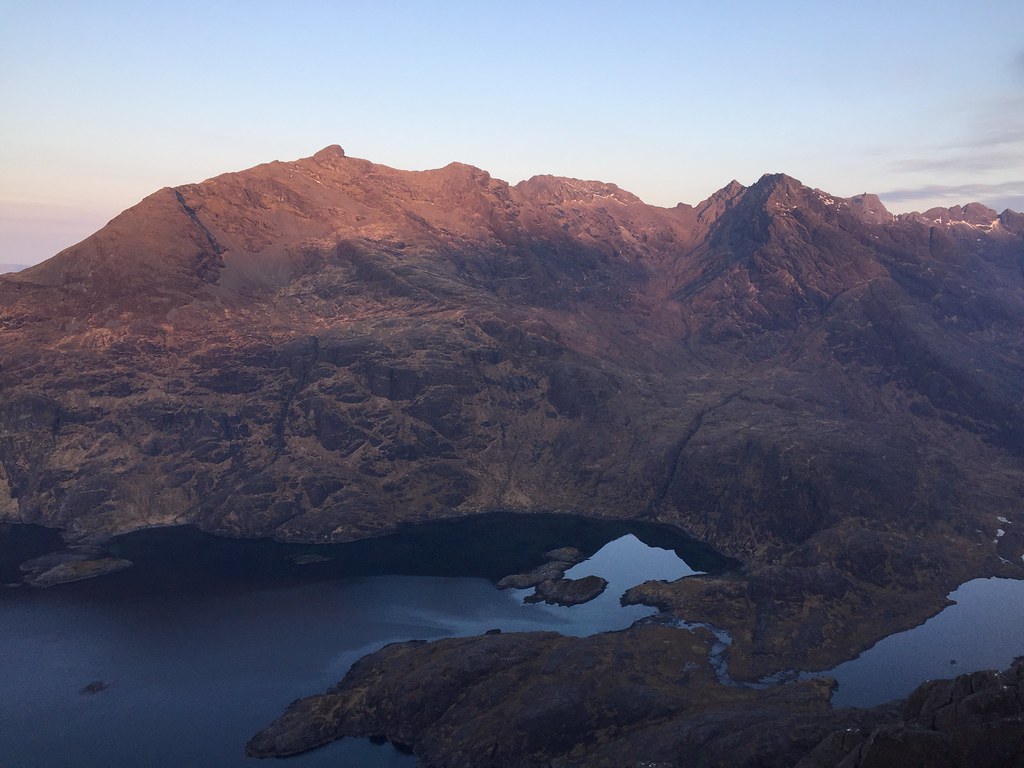 Sunrise on Gars-bheinn
  Rum
Rum  Coruisk
 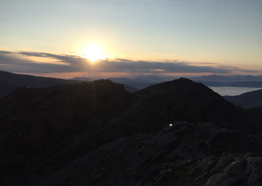 East to the mainland
  Gars-bheinn
  Loch Coruisk
  Bidean Druim nan Ramh to Sgurr nan Gillean
 As it was a bit chilly, we went back to bed after the best of the sunrise and napped a bit longer. Strong sunshine on the tent woke us again to a glorious late morning. A party of 7 or 8 folk had hiked up from the Coruisk hut, but we managed to outstay them, drinking tea for hours. Finally at about 1pm, we were ready to head back - no Black Cuillin summits for us today
.
 Gars-bheinn from Sgurr na Stri
 Loch Coruisk
 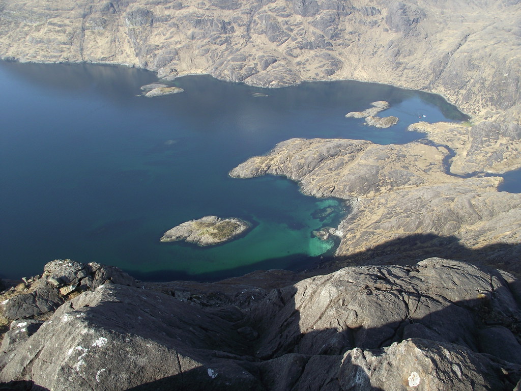 Loch na Cuilce and Loch nan Leachd
  Gars-bheinn
  Loch Coruisk
  An Garbh-choire and Loch Coruisk
  Rum and Rubha an Dunain
  Other summit of Sgurr na Stri
  Across Loch Scavaig
 We headed back to the path via a memorial that I've often seen marked on the map but never actually passed - the walk out was a bit of a trudge even though the scenery was even better than on the way in. I think we're getting lazy

.
 Dubh ridge and Loch Coruisk
  Northern Cuillin from the memorial
  Sgurr nan Gillean
  Garbh-bheinn and Bla Bheinn
  Bla Bheinn
  In Pinn
 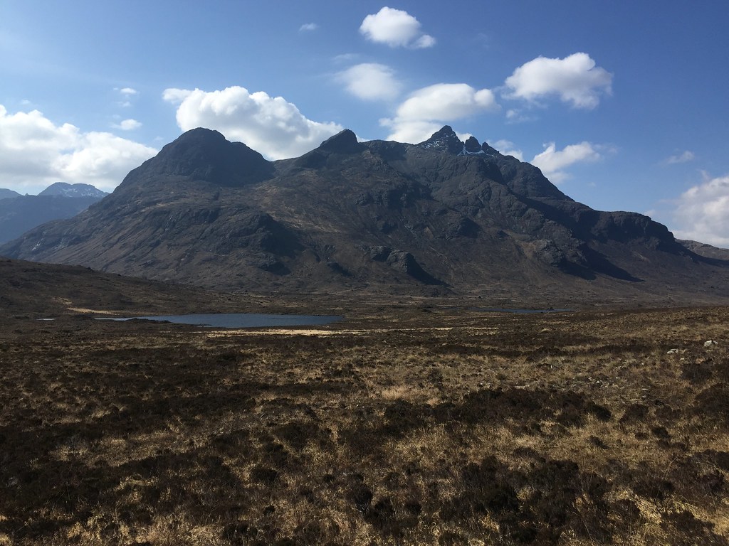 Sgurr nan Gillean
  Sgurr nan Gillean and Pinnacle Ridge
  Am Basteir
  Dubh Ridge
  Pinnacle Ridge
 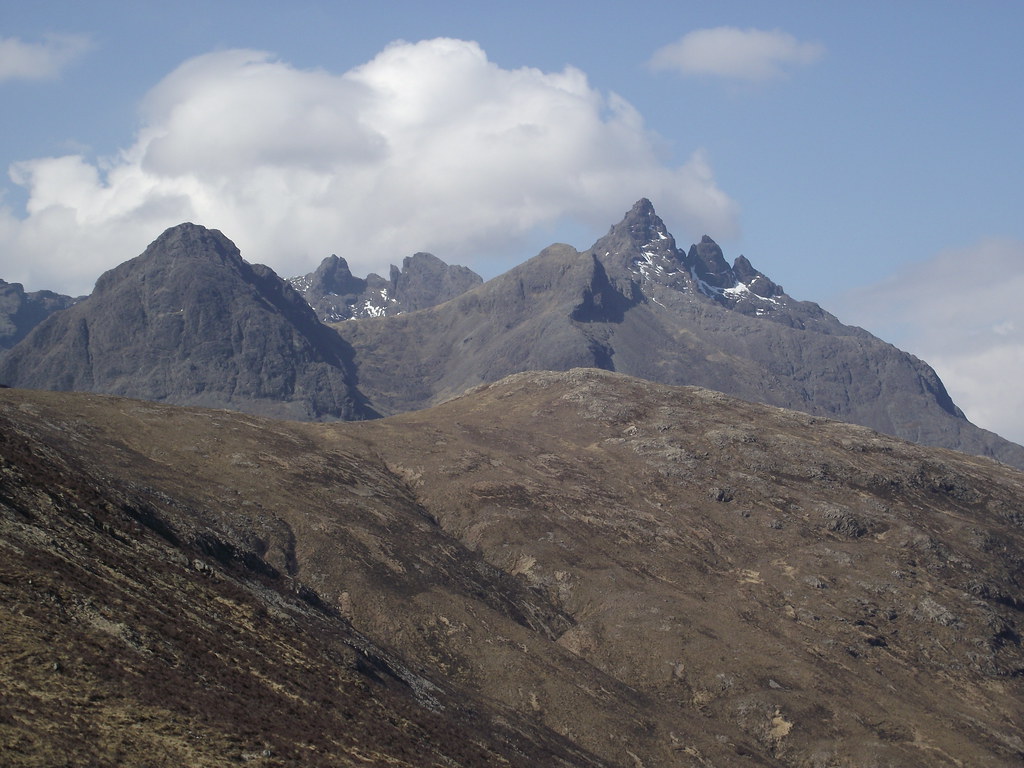 Basteir and Sgurr nan Gillean
 b
 In Pinn
  Walking out to Sligachan
 _______________________________________________________
A look at the weather highlighted Friday night as another potential cracker, so we decided to do something a little more leisurely for Thursday night. Abandoning my car at Sligachan, we headed up to the north of the island for a night at the Lookout bothy.
The walk-in is a fairly straightforward 35-40 minutes along a path that I hadn't expected. We suspected this might be a busy so carried a tent with us. Good plan - the bothy has sleeping area for 5 or 6, and was already full. We could probably have squeezed in somewhere, but the tent seemed more appealing. We found a great spot not too far from the bothy on the cliff top.
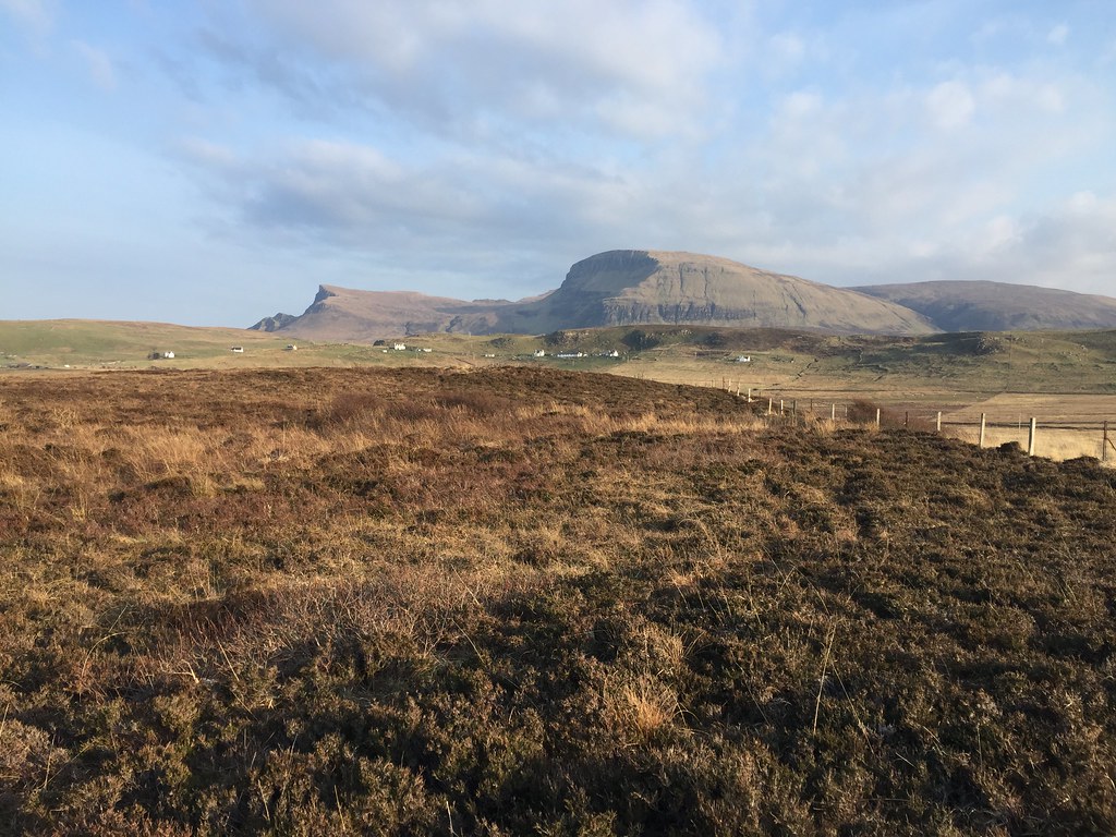 North end of the Trotternish
  West from Rubha Hunish
  On the way to the Lookout
  Lookout Bothy
  Camping on Rubha Hunish
 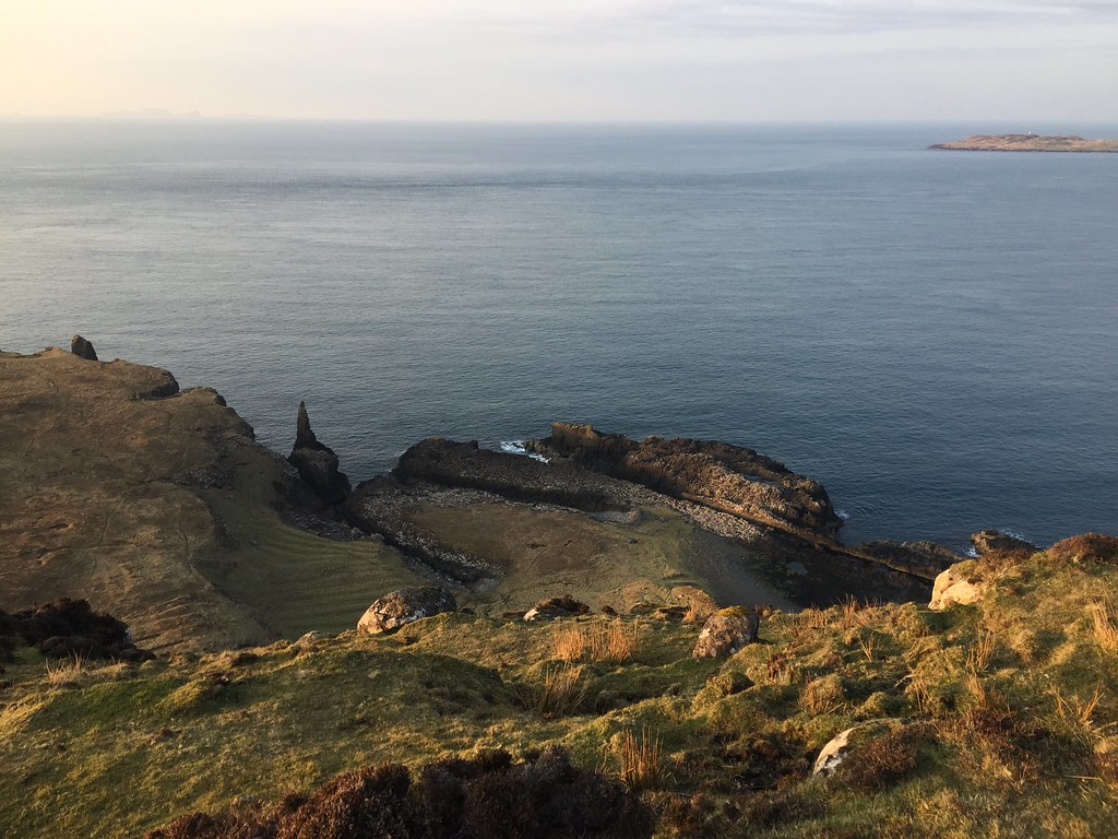 Over the cliffs at Rubha Hunish
 Another good sunset, although the air was becoming increasingly hazy and the Western Isles were barely visible. We were lower down this evening, so slightly warmer.
 Sun going down
  Sunset
  Jackie
  Sunset
  Sunset at the Lookout
 The following morning, we had a leisurely start and inspected the bothy before walking back out to the car and taking a leisurely drive down past Kilt Rock to the next of our summit camp plans...
 Hunish from the Lookout
  Inside the Lookout
 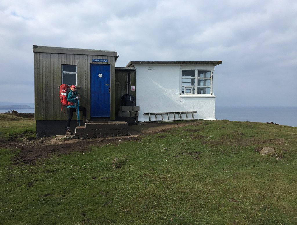 Lookout Bothy
  The Lookout
 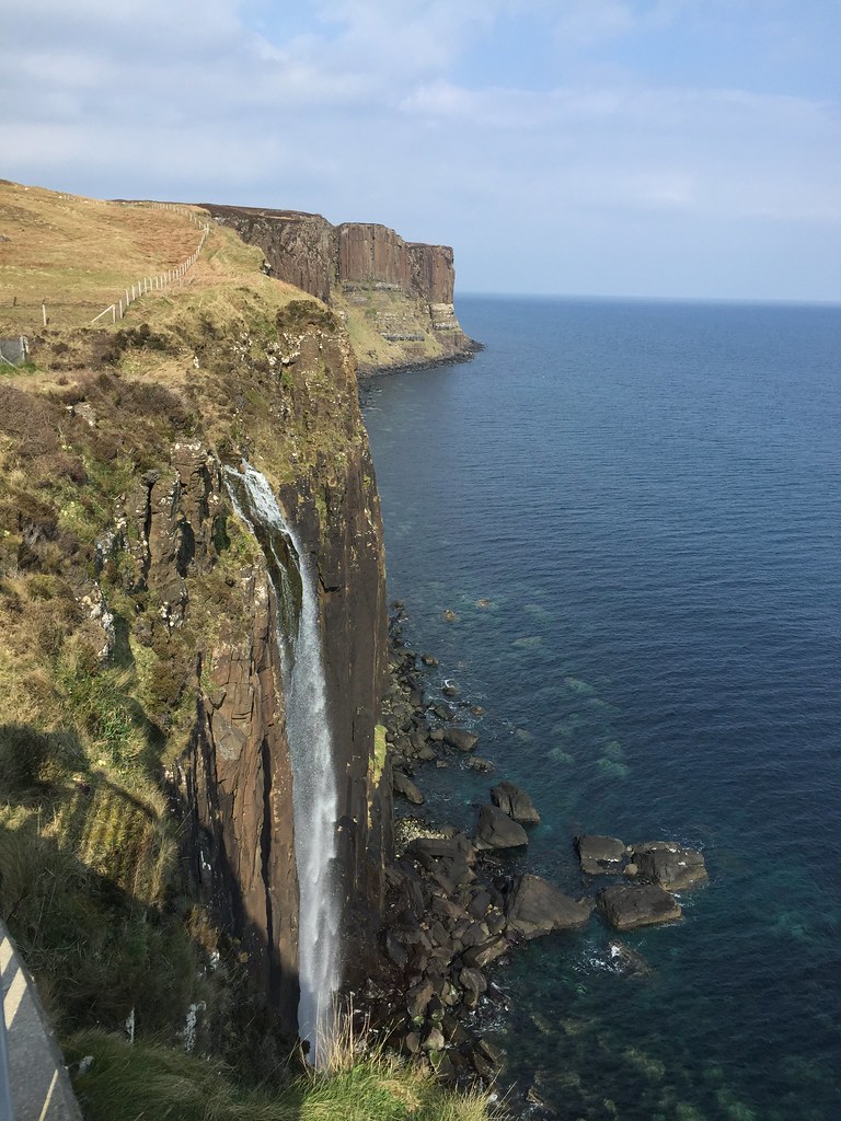 Kilt RockLink to next part