free to be able to rate and comment on reports (as well as access 1:25000 mapping).
Sub 2k Marilyns: Hill of Stake.
Date: 26/05/2019.
Distance: 23 km.
Ascent: 770m.
Time: 6 hours, 10 minutes.
Weather: Showery, grey, very windy.
Originally Saturday morning had looked like the time for getting out, but as it got closer, the front bringing poor weather appeared to be passing through earlier and earlier. In the end, Sunday afternoon was the time to do something. Feeling lazy, neither Jackie or I fancied going too far or driving anywhere, so I quickly came up with a linear route using the train. I'd never thought of using the train to get to Hill of Stake before, but it's really easy from Glasgow, and perfectly possible to finish in a different place too. I fancied an east to west traverse as Largs was a nicer place to kill time waiting for the train than Lochwinnoch, and also because I thought we'd get some nice evening views out over Arran and Bute. There was a strong westerly forecast that Jackie pointed out, but I decided this wouldn't be an issue......
No early start required, but we were still off the train at Lochwinnoch by 2pm. A heavy shower had just eased off.
 Lochwinnoch station
 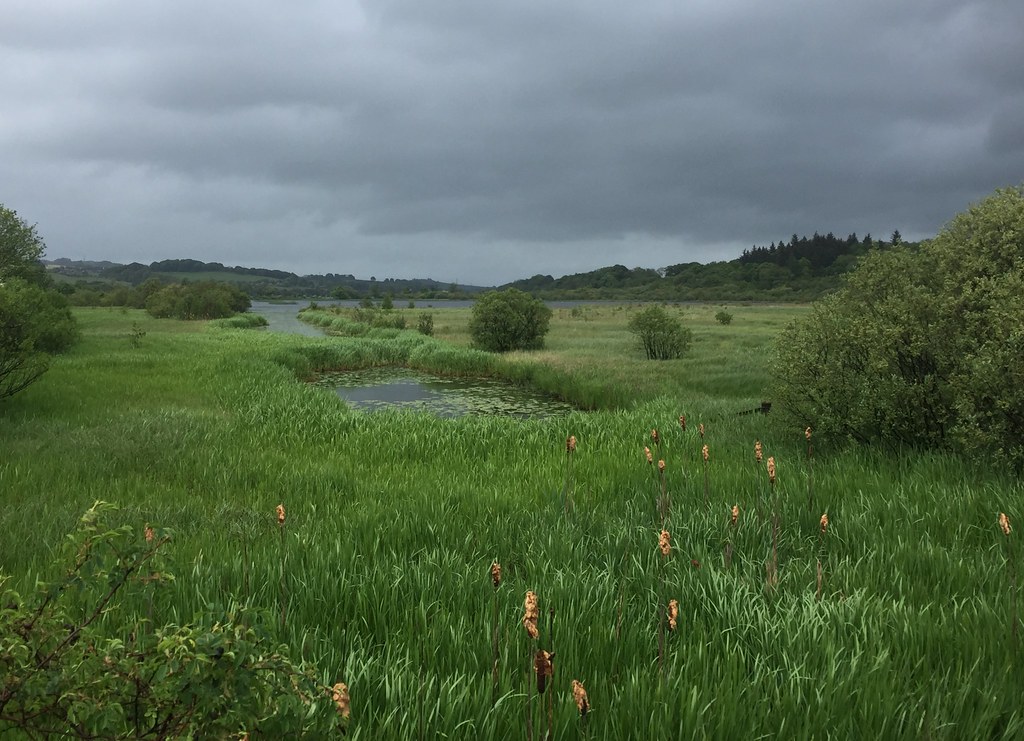 Castle Semple Loch
 A short walk along the pavement took us to the edge of the village, which we skirted, taking a minor road up past the golf course. This climbed up onto the hillside and ended at a house, where we picked up a faint track through fields. I wasn't sure what this track was going to be like - was it a new one for a prospective windfarm?
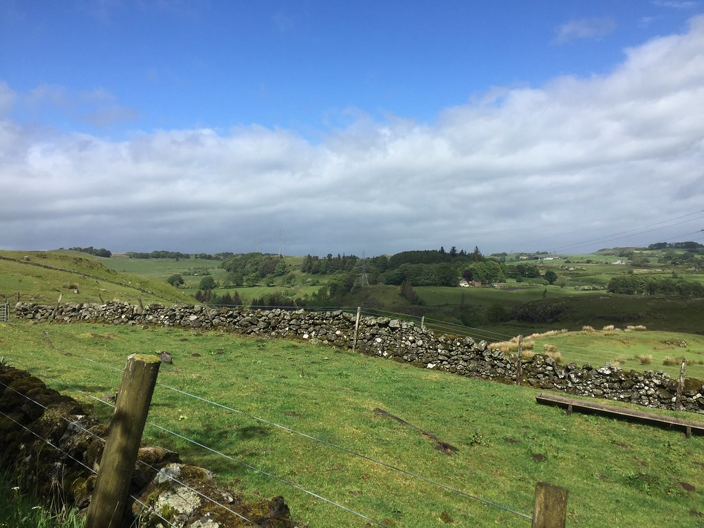 Heading onto the hills
  Looking back to Lochwinnoch
  Misty Law ahead
 No - it was a farm track, so pleasantly green. On the downside, it was also wet and puddly in places. It led pleasantly through open moorland and outcrops. When Misty Law came into view, it looked an awfully long way away, and even down at 300m, the wind was quite strong. How would it be up high? At least the rain was confined to a few short showers that never really got going.
 Turnave Hill
  Approaching Misty Law
  Glasgow and Paisley always visible in the background
 The track ran out just before the summit cone - Misty Law is quite a nice looking hill close up - much more conical and prominent than the map suggests. A steep couple of minutes led to the summit cairn, where it was
really windy

. I was finding the wind both tedious and a bit of a conversation killer, but being substantially lighter than me, Jackie was getting blown all over the place. She was not happy about this at all, especially as she was already feeling a bit ropey before we started

.
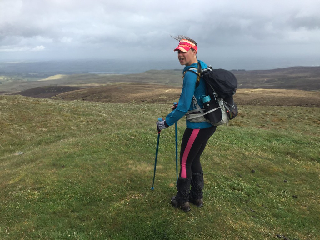 Misty Law
 The way over to Hill of Stake looked straightforward enough, but quite a distance

. Having read another report years ago, I had vague memories of mention of a path and a fence to follow the whole way. There was no fence at first, and the path was intermittent and faint at best - nothing for it but to pull up our collars and battle on with it. Any time we found enough shelter to speak, Jackie reminded me that doing the walk this way round was a stupid idea
.
 Angry on Hill of Stake - this trig point needs a good kick!
 Finally, Hill of Stake. Again quite a pleasing summit itself, although it soon dissolved into bog and hags around the base of the summit cone. Now we were more than halfway - just another 6 (or maybe 7 if we didn't take an arrow-straight route!) miles of pathless tussocks, facing into the wind! Although I had planned to stay up higher, we dropped into the glen of the Greeto Water, which would lead us to a path relatively close to Largs. Easy navigation - just follow the water!
 Looking back up Greeto Water
 Overall navigation was certainly easy, but the intervening ground was not -there were all manner of ascents, small burns to cross and tussocks to deal with. At least the wind was a little more bearable, although still annoying as hell. 'I'd rather be anywhere else than here!' Jackie was heard to say on more than one occasion...
 Another bit of ascent and contouring
 I wasn't finding it anywhere near as bad, but the long trek down (and sometimes up) the glen was something to be endured rather than enjoyed. Despite telling myself the bridge and path we were aiming for was miles away, I couldn't help get my hopes up a couple of times, only to have them dashed by rounding a corner and seeing another stretch of pathless glen ahead!
After another of these corners, Jackie suggested we follow a wall up onto the ridge bounding the north side of the glen, just for some variation so we wouldn't be contouring up and down all the time. It was a good move, as we finally got some views over Great Cumbrae and Bute, as well as a dark smudge indicating where Arran was. Yes, we probably should have gone the other way around, as the views weren't really up to the standard I was hoping for
.
 Bute
Bute  Great Cumbrae
  Across Bute
 We could now see a radio mast on the next hill on the ridge - this was above the path we wanted. A weary traverse down past this hill (but not over it!) took us to the path, which was now a big track to a hydro scheme. Less scenic than it probably was before, but our feet were relieved!
 Looking towards Hunterston power station
  Gorge on the Greeto Water
 Now it was just an easy stroll downhill into Largs, where it started raining again and we discovered we'd just missed the 7:55pm train by a couple of minutes. Never mind - a chance for a meal and a pint before getting the next train, which was nice and quiet.
 Finally Largs!
  Largs and Great Cumbrae (with Bute behind)
 I think Jackie has forgiven me for coming up with this plan, but possibly not entirely! Still, it was tough enough to perhaps push her back towards nice, easy big hills with paths on them again
.
