free to be able to rate and comment on reports (as well as access 1:25000 mapping).
It has taken me far too long to write this up, but this was the best day of my week in the Lakes last September.
Having left the hostel at Buttermere, I took the direct path to Scale Bridge
 High Stile etc
 by
Beery Hiker, on Flickr
The path towards Scale Force is much improved since Wainwright's day!
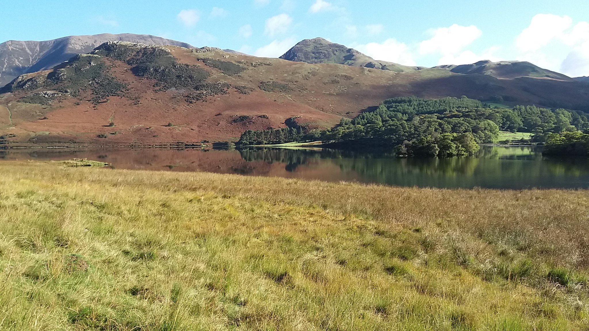
First view of Crummock Water
 High Stile etc
 by
Beery Hiker, on Flickr
Looking over to Rannerdale Knotts, with Grasmoor and Whiteless Pike behind
 High Stile etc
 by
Beery Hiker, on Flickr
Crummock Water again
 High Stile etc
 by
Beery Hiker, on Flickr
 High Stile etc
 by
Beery Hiker, on Flickr
 High Stile etc
 by
Beery Hiker, on Flickr
Scale Force
 High Stile etc
 by
Beery Hiker,
n Flickr
and from further back
 High Stile etc
 by
Beery Hiker, on Flickr
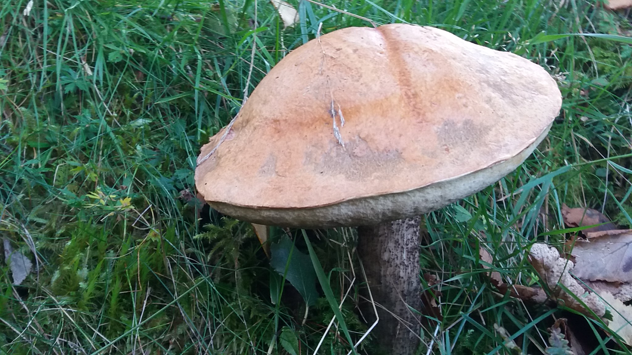
couldn't resist a few shots of the fungi
 High Stile etc
 by
Beery Hiker, on Flickr
 High Stile etc
 by
Beery Hiker, on Flickr
another glimpse of Scale Force
 High Stile etc
 by
Beery Hiker, on Flickr
above the force
 High Stile etc
 by
Beery Hiker, on Flickr
we could almost be in the Peak District now!
 High Stile etc
 by
Beery Hiker, on Flickr
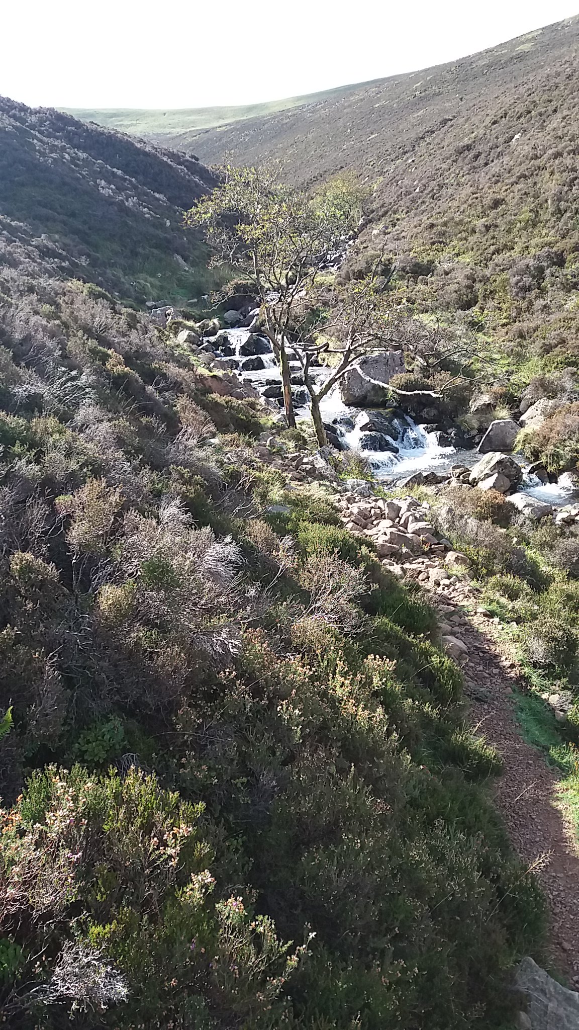
looking down Scale Beck
 High Stile etc
 by
Beery Hiker, on Flickr
 High Stile etc
 by
Beery Hiker, on Flickr
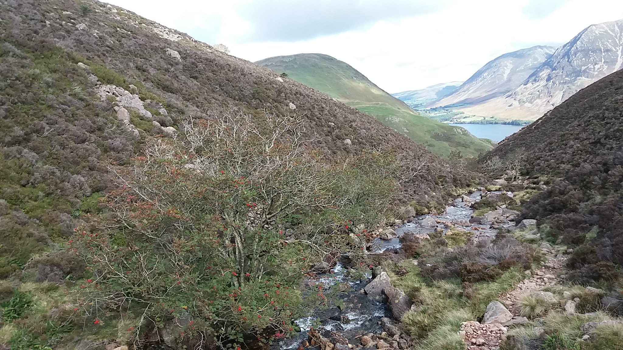
Having left Scale Beck, the steep heather slope was hard work, but the views were opening a little
 High Stile etc
 by
Beery Hiker, on Flickr
but I soon reached easier grass slopes
 High Stile etc
 by
Beery Hiker, on Flickr
first view of the Solway Firth and Galloway
 High Stile etc
 by
Beery Hiker, on Flickr
The cairn on Starling Dodd is still very much as Wainwright drew it
 High Stile etc
 by
Beery Hiker, on Flickr
looking over Ennerdale Water
 High Stile etc
 by
Beery Hiker, on Flickr
and from a slightly better viewpoint
 High Stile etc
 by
Beery Hiker, on Flickr
Loweswater hills, Solway Firth turbines and Galloway
 High Stile etc
 by
Beery Hiker, on Flickr
First shower of the day over Crummock Water
 High Stile etc
 by
Beery Hiker, on Flickr
On the walk to red Pike looking back over Ennerdale
 High Stile etc
 by
Beery Hiker, on Flickr
... and the Isle of Man
 High Stile etc
 by
Beery Hiker, on Flickr
from Red Pike looking down to Buttermere
 High Stile etc
 by
Beery Hiker, on Flickr
more weather on the way
 High Stile etc
 by
Beery Hiker, on Flickr
 High Stile etc
 by
Beery Hiker, on Flickr
the ridge towards High Stile
 High Stile etc
 by
Beery Hiker, on Flickr
Bleaberry Tarn
 High Stile etc
 by
Beery Hiker, on Flickr
and again from further round
 High Stile etc
 by
Beery Hiker, on Flickr
on the summit plateau of High Stile
 High Stile etc
 by
Beery Hiker, on Flickr
Crummock Water again
 High Stile etc
 by
Beery Hiker, on Flickr
 High Stile etc
 by
Beery Hiker, on Flickr
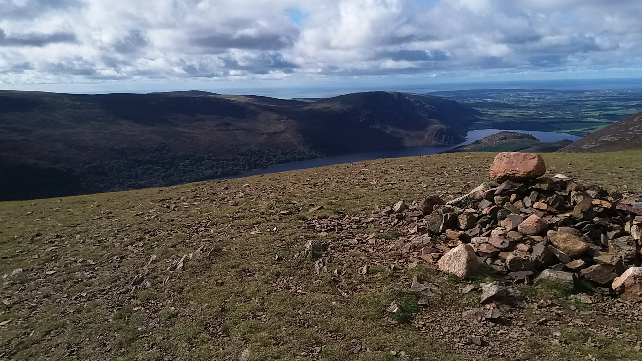
The highest point according to the OS (Wainwright disagreed)
 High Stile etc
 by
Beery Hiker, on Flickr
looking on towards High Crag
 High Stile etc
 by
Beery Hiker, on Flickr
another view down to Buttermere
 High Stile etc
 by
Beery Hiker, on Flickr
Buttermere and Crummock Water from High Crag
 High Stile etc
 by
Beery Hiker, on Flickr
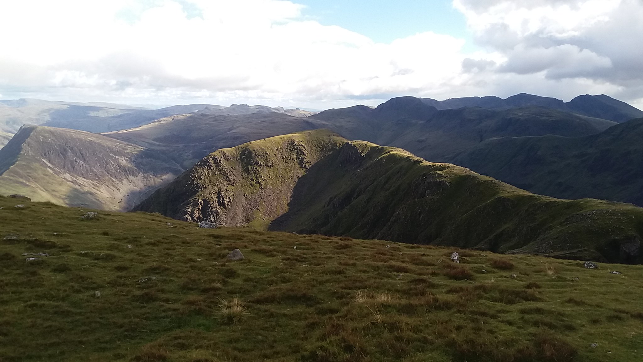
a rather untidy summit with a view towards Great Gable
 High Stile etc
 by
Beery Hiker, on Flickr
last view of Ennerdale Water
 High Stile etc
 by
Beery Hiker, on Flickr
the scree slope on Gamlin End is much improved by the well engineered zigzag path
 High Stile etc
 by
Beery Hiker, on Flickr
I continued over Seat to Scarth Gap, and took no more pictures until I reached the shores of Buttermere:
 High Stile etc
 by
Beery Hiker, on Flickr
