free to be able to rate and comment on reports (as well as access 1:25000 mapping).
Sunday 19 May 2019
Kincraig to Boat of Garten: "The Drowned Land"
Distance: 12 miles
Start: 9:00am
Finish: 3:35pm
Weather: Cloudy and humid
My host offered to drive me from Kingussie to Kincraig this morning and I gratefully accepted. My plan had been to catch a bus; but being Sunday, the only bus going to Kincraig was scheduled to depart at 12:37pm, which meant I would have been starting a 12-mile walking day at nearly 1pm. As it was, I began my walk out of Kincraig just before 9am.
The southern trailhead in Kincraig; for the time being, anyway:
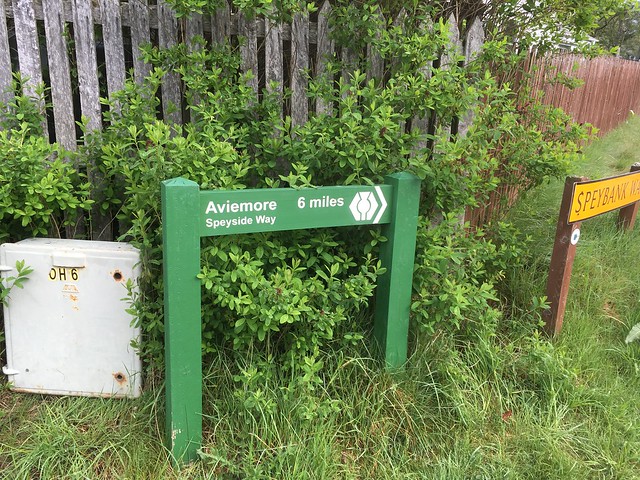
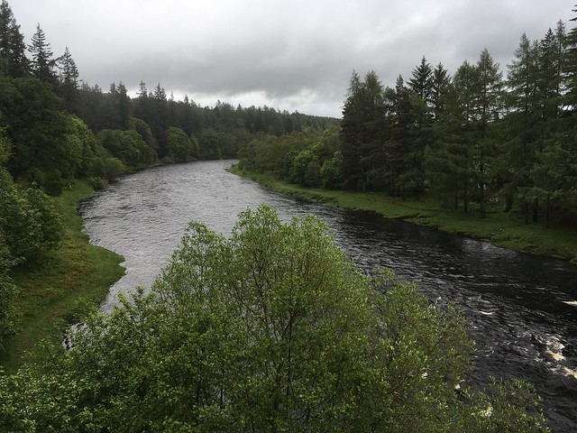
Leaving Kincraig, the trail goes through forest. There are actually several trails weaving through the forest in a latticework maze, one of which is the Badenoch Way, which sometimes coincides with the Speyside Way and sometimes meanders off to take a less direct but more scenic route toward Aviemore. There are large, friendly green signs pointing the way toward Aviemore at regular intervals, so any concerns I had about how "finished" this part of the Speyside Way truly is were laid to rest.
After about three miles, the trees thinned out and the trail ran parallel to the railway line pretty much the rest of the way to Aviemore. I saw one train go by: an LNER train, southbound - possibly going all the way to London. There were a few short, sharp climbs and descents, but the walking was mostly level. About a mile south of Aviemore I saw a male pheasant lounging in a field full of sheep. It was a comical sight, and as I stopped to take a picture I inadvertently flushed two females who'd been hiding near the fence.
One of these things is not like the others:

I got to Aviemore at about 11:30am - just a little too early for a lot of the restaurants to be open. But I needed a break, so I sat down on a bench outside a promising-looking pub and settled in to wait. Their spinach and pesto ravioli was passable and their music was, incongruously, American country-western.
The trail follows the road north out of Aviemore and then bears to the right. While this morning I was paralleling the main railway line, this afternoon I was paralleling the Strathspey Steam Train railway line. I waved to the steam engine and its passengers each time it passed me. National Cycle Route 7, my companion from the Rob Roy Way, has also found me again, so I was sharing the path with cyclists all afternoon. The afternoon's walk was level and unchallenging on a clear path through the heather, but it was unforgiving on my feet, particularly as it gave way to gravel and then tarmac on my way into Boat of Garten.

This marks the beginning of my third long-distance trail of this trip, and it feels like it's getting harder rather than easier. My rucksack feels heavier with every passing mile, and today was the first day that my back truly ached while carrying it.

Song of the day: "The Wind Cries Mary" by Jimi Hendrix
***
Monday 20 May 2019
Boat of Garten to Grantown-on-Spey: "I wonder as I wander"
Distance: 11 miles
Start: 9:55am
Finish: 3:50pm
Weather: Light rain in the morning, cloudy in the afternoon
Late start this morning. I told myself it was because I couldn't check in to my accommodation in Grantown-on-Spey until 4pm so there was little point in leaving early, but really I just COULD NOT summon any enthusiasm for this day. Yesterday's walking was mostly pretty dull, and I've already been fretting about tomorrow's walk (which is supposed to be the most challenging on the Speyside Way), so I was distracted, unenergetic, and surly as I trudged out of Boat of Garten.
I crossed the River Spey on my way out of Boat of Garten - the first of many such crossings I will be making in the coming days.
I soon entered the forest, and stayed there all the way to Nethy Bridge. I generally dislike walking in forest because the view never changes, so this did not improve my mood. The monotony made my mind wander. I wanted to put my MP3 player on to give my brain something to focus on, but I was still sharing the trail with occasional cyclists and needed to be able to hear them coming up behind me, so I couldn't.
I reached Nethy Bridge exactly two hours after leaving Boat of Garten and stopped for a quiche and a pot of tea at the cafe there. I must have looked truly down-and-out, because a girl who'd been sitting near me and who I'd chatted with a bit bought me a mint cake as I was leaving. Warmed by her kindness, I left Nethy Bridge in a better mood.
And my mood improved even more as I continued on. I'd left the forest behind and was now walking on a raised earth embankment between two fields - an old railway line, I came to find out. There were views toward the mountains and river...

...and toward the black clouds boiling up behind me. I passed through a farm, and the River Spey drew alongside again before I crossed it for the second time, racing the rain clouds.
The final part of the day took me into Anagach Woods (trees again!). I actually missed the right-hand turn into the woods on my first pass and had to double back when I reached a big traffic roundabout and realized I'd gone wrong somewhere.
After a short schlep through the woods, I left the trail where it made a sharp turn to the right and walked into Grantown-on-Spey.
Song of the day: "The Boxer" by Simon and Garfunkel (Mumford and Sons + Jerry Douglas version)
***
Tuesday 21 May 2019
Grantown-on-Spey to Ballindalloch: "Follow the squeeze gates!"
Distance: 15 miles
Start: 9:00am
Finish: 6:00pm
Weather: Cloudy in the morning, alternating rain and sun in the afternoon
I had a restless night last night. I was fretting about today's walk, and my stomach was fretting about the Indian food I had for dinner, so the night was not restful. Breakfast at 8am, and I was back where I left off yesterday by 9am. Back into Anagach Woods, in fact. I saw two men who looked to be out on a morning stroll, plus a woman walking her cocker spaniel. My hosts from last night have two cocker spaniels, one of whom is the mother of many of the other cocker spaniels who live in and around Grantown-on-Spey. I wondered if this one was one such.
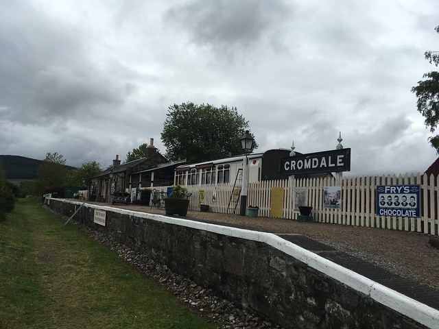
I emerged from the woods and made my way to Cromdale, passing the old railway platform and crossing the River Spey for a third time. Then I struck out cross-country toward Ballindalloch.
Reading online resources and other WH walk reports in preparation for this trail, I got the impression (from reading between the lines) that the landowners between Cromdale and Ballindalloch objected - and continue to object -
strenuously - to the Speyside Way going across their land. This impression was reinforced on the approach to Tom An Uird Wood. A section of the trail was clearly converted into a sheep-dipping pen recently, and various fencing apparatus remains in the way, often without an obvious access point through. I physically lifted a few gates out of the way today, and more was to come...
The path climbed up into Tom An Uird Wood, where I found a convenient tree stump for a lunch break. I had been bracing myself for a long stretch of monotonous forest walking, but I was through the woods surprisingly quickly and then onto more cross-country walking.
On my Harvey Map of the Speyside Way, the trail across Meiklepark Wood and Aird Farm is straight but pathless. This is very much NOT the case on the ground. The path skirts around (what I assume is) somebody's property line at right angles, bordered by barbed wire fencing. And it is often over steep ground, broken ground, tree roots, bog, or some combination thereof. It's like the landowner went "Nah," forced the path to be diverted, and has subsequently taken zero interest in ensuring that the path is actually passable. After a while I began to gaze longingly and hungrily at Knockfrink Wood ahead of me, because I knew it would have a sensible forestry track, rather than the landowner's power-trip of a "path" I'd been struggling over for the last two hours.
I motored through Knockfrink Wood, crossed a ravine to get to Garvault Plantation (my last significant wooded section of the day, heralded by a truly precipitous climb into the trees that made me ask "Are you s******* me?" out loud to no one in particular), and then descended to the A95 road. The trail follows the road for a bit before crossing it and going gradually downhill along fields and over some boggy ground to follow the River Spey into Ballindalloch.
I shuffled past Ballindalloch Station exactly nine hours after setting out, and then made my way along the road to the Delnashaugh Hotel. NB: The Delnashaugh Hotel is a good stopover if you're doing the Tomintoul Spur, but if not, it is two miles off-route.
Song of the day: "99 Problems" by Jay-Z
***
Wednesday 22 May 2019
Ballindalloch to Craigellachie: "Whisky Galore"
Distance: 12 miles
Start: 10:00am
Finish: 4:05pm
Weather: Rainy
I had dinner last night and breakfast this morning alongside four Yorkshiremen who are doing the Speyside Way southbound. Last night, one of them said "The forecast is meant to be decent tomorrow!" so I really should not have been surprised when the day dawned gray and rainy.
A hotel staff member named Andrew drove me up to Ballindalloch Station, sparing me a repeat performance of yesterday's 2-mile roadside walk. Today's walk was dead-flat disused railway line all the way to Craigellachie. I'm truly in whisky country now. I passed three distilleries in quick succession at the end of the day yesterday, and then several more today, including Tamdhu, Knockando, and Aberlour. They were closed to the public almost without exception, but the smells emanating from them gave a hint of what the finished whisky might taste like.
Selfie in the rain at Tamdhu Station:

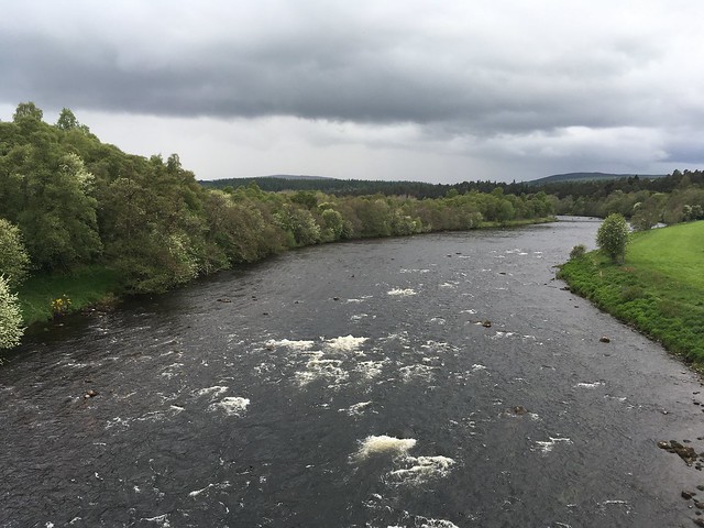
Today's walk also stays within sight of the River Spey for most of the day, crossing the river for the fourth and fifth time.
In better weather, this probably would have been my favorite day of the walk. As it was, it rained almost without ceasing. Parts of the trail were very muddy, and I got wet feet for the first time all trip. I think my Salomons may be nearing the end of their lifespan.
After getting to the day's halfway point in Carron without finding anywhere sheltered to take a break, I put my head down and absolutely power-walked to Aberlour. I walked into the Mash Tun in Aberlour at 2:20pm, only to be told the kitchen had closed twenty minutes earlier.

I was able to buy two cups of coffee and a bag of potato chips, though - enough fuel to get me to Craigellachie, a little over two miles further on.
The Spey on the way out of Aberlour:

Song of the day: "Lost Girls" by Lindsey Stirling
***
Thursday 23 May 2019
Craigellachie to Fochabers: "F*** this trail."
Distance: 12.5 miles
Start: 10:10am
Finish: 4:15pm
Weather: Windy and cloudy but mostly dry
Got a later start than intended this morning, because I had to make a mad dash to Craigellachie's one and only ATM to withdraw some cash to pay the landlady at my B&B. How embarrassing.
Back where I left off yesterday, I continued on the disused railway line for a short distance before bearing left to get on a minor road. There was a large group of people ahead of me on the railway line, but they were following it to Dufftown, which is five miles from Craigellachie and walkable as a spur. The minor road climbed up into the trees, with some views of the Spey far below. It was quite a long time before I saw another waymarker and I was getting nervous that I'd missed the turn onto a forestry road, but it turned out to be unmistakable - just look for the big green sign for Ben Aigan.
More uphill climbing on the forestry road, though it was mostly gentle climbing. I passed a woman coming down the hill on horseback. Eventually the path leveled off and began contouring around the hill, and about an hour and 45 minutes after setting out from Craigellachie I got to a picnic table with several of my fellow Yanks ranged around it. I had intended to walk a little further before stopping for lunch since I got such a late start, but it would have been churlish to refuse the table and the company! The group were walking southbound, having started from Buckie yesterday. I assured them it was all downhill to Craigellachie and then dead-flat to Ballindalloch, but to be prepared for the section between Ballindalloch and Cromdale.
Soon after leaving the picnic table the trees thinned out and I had my first views in a while, and they were splendid. Spirits lifted, I finished the last bit of forestry road and then followed a path down to the shooting range - no shooting today, thank goodness.

Farm tracks got me to Boat o'Brig, where I got on the minor road I was to follow the rest of the way to Fochabers. At this point my feet absolutely REVOLTED. They did not want to be on tarmac, they did not appreciate the steep switchback climb just after Boat o'Brig, and they definitely did not appreciate being in near-featureless forest again. I swore a blue streak all the way to Craiglug. At Craiglug my morale lifted slightly because I was now on the final page of the Harvey map, but it swiftly plummeted again when I got to the steep descent after Culfodie Farm, which is then IMMEDIATELY followed by a steep re-ascent. I shambled on past Ordiequish and finally into Fochabers. I'm really glad tomorrow is my last day on this trail.
How now brown cow?

Song of the day: "Keeping the Faith" by Billy Joel
***
Friday 24 May 2019
Fochabers to Buckie: "The Speyside Way Off-Piste"
Distance: 11 miles
Start: 9:20am
Finish: 3:45pm
Weather: Partly cloudy and windy
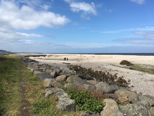
I left Fochabers this morning with more blue in the sky than I'd seen all week, so my spirits were high. I walked west and then north out of Fochabers, making my way towards the Moray coast with the River Spey broadening into a delta beside me.
I actually started the day by walking parallel to the actual path, which was a sign of things to come. Somewhere in the woods on the way to Spey Bay, I ended up on a side trail that ran hard alongside the river, rather than the actual trail which ran through the middle of the woods.

Seeing on my map that this path would rejoin the Speyside Way in a bit, I decided I'd had quite enough of walking in the woods and wanted to see more of the river thank you, so I just stayed on the side trail.
Speyside Way rejoined in due course, I continued north. A steady onshore wind was blowing, so I could smell the sea a full hour and a half before I could see it. The spot where the river meets the sea is obscured from the trail by gorse bushes and dunes, but if you really want to see it you can wander off-path a bit.

After a lunch break at the Dolphin Center, I struck out eastward for Buckie. I somehow got off-trail again here. The waymarkers seemed to direct me onto a minor road leading to the golf course, and I walked between the golf course and the sea for a while, enjoying the view.
Then the faint path I'd been following dead-ended into a gorse thicket. I consulted my map and realized I was meant to be waaaay on the other side of the golf course, in the treeline. I considered my next steps. I didn't want to backtrack all that way, and dodging golf balls to try and cross the links didn't appeal either. A passing golfer attempted to direct me to a path he said would eventually link up with the trail, but when I walked in the direction he indicated I ran into a fence.
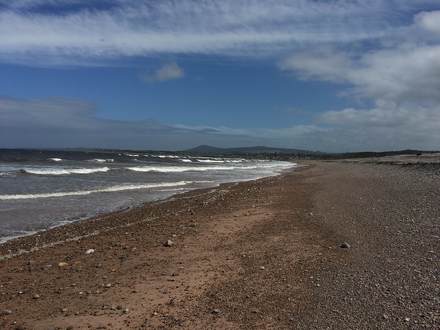
Lacking any better ideas, I glissaded down the shingle (rather gracefully, if I do say so myself) and started walking on the beach. Immediately I felt right at home. I live in a coastal state and have been walking and playing on beaches since I was small, so this was a cinch. Plus Portgordon was visible just ahead. I did have to negotiate one burn where it flowed into the sea, carving a channel about eight feet wide and two feet deep. I hemmed and hawed a bit looking for a good crossing point, but eventually just committed and splashed across, giving my boots and gaiters a much-needed wash in the process.
I rejoined the Speyside Way proper in Portgordon, but I wasn't quite home-free yet. The Moray Coast Path joins the Speyside Way about a mile south of Spey Bay, and a cycle path also follows the coast here, so it's unclear which waymarkers are for which paths. Walking out of Portgordon I somehow ended up on the cycle path, which runs a little above the Speyside Way. I realized it when I looked down at the road and saw a Speyside Way waymarker.
I almost quit a mile from Buckie. I've been weary of this trail since the second day and I really didn't want to be walking it anymore. But I pressed on, past Buckpool Harbor, into Buckie's town center, and finally to the finish.
Looking windblown at the finish line in Buckie:
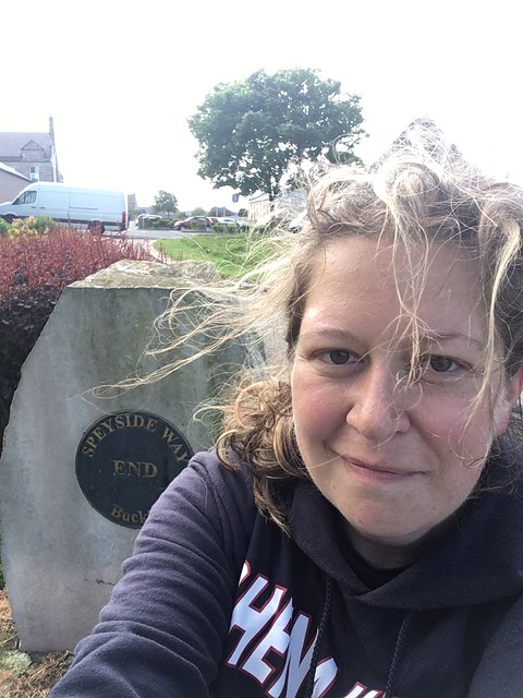
I have now completed three long-distance trails totaling 237 miles in just under four weeks. Wahey!
Song of the day: "Am I Wrong" by Nico & Vinz
*****
...I hope the weary tone of this WR doesn't put anyone else off doing the Speyside Way! As I mentioned, this was my third LDW in less than a month and I was TIRED. I do think this would make a good first- or second-timer's LDW, as the walking is pretty easy and straightforward except for the section between Cromdale and Ballindalloch. Walking northbound toward the sea means you walk generally downhill the whole way, but I suspect walking southbound toward the mountains would afford better views.
