free to be able to rate and comment on reports (as well as access 1:25000 mapping).
For my first Munro trip in a few months I thought I'd try a walk that looked fairly straightforward on paper...it appears I'll never learn! Carn a' Chlamain was one I'd never heard of, but it was relatively nearby and although a long walk most of it was flattish and it looked like there was a track all the way up. All this turned out to be true, but I was still praying for it all to end as I approached the car park at the end of the day.
I pulled into Old Bridge of Tilt car park at about 8am - room for 20 or so cars and no charge. Coming out of the car park I turned left, which is wrong as I soon realised. The direct route is to carry straight on into the woods opposite the car park, but I decided to head right into Old Bridge of Tilt and walk up the glen on the other side of the river, and take the direct route back. After initially missing the track that goes up the east side of Glen Tilt I eventually picked up a beautifully grassy track that was a pleasure to walk on.
Follow the road over the Old Bridge of Tilt and through the village. A path soon branches off to the left and a small wooden bridge takes you over the Fender Burn. Immediately after this a path heads off left into the woods.
 Track through the woods
I obviously missed a turn off because I eventually found myself wading through thick vegetation among fallen trees...turns out there was a clear track just a few dozen yards uphill away from the River Tilt. This track emerges from the woods and into some beautiful open countryside dotted with dozens of sheep with their lambs.
 Grassy track heading for the hills
 Hills getting closer
Eventually this track drops down from the hillside just after Auchgobhal Farm and joins the main track that runs along the east side of the River Tilt, which was looking gloriously Irn Bru-coloured in the by now strong sunshine. I stopped to slap on the factor 30 and then continued on past Marble Lodge (looks like a nice spot for a secluded break) and then over the river at Gaw's Bridge.
 The track alongside the River Tilt
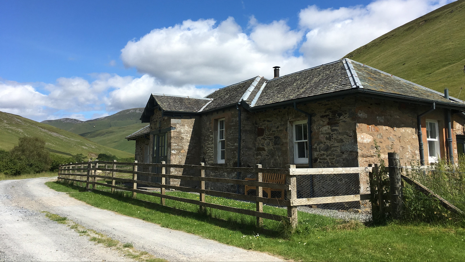 Marble Lodge
 Gaw's Bridge
 River Tilt from Gaw's Bridge with Beinn a' Ghlo in the distance
Once over the bridge it's a short stroll to the point where you actually have to start heading uphill. A bridge crosses a small stream tumbling down from the hills, and immediately after this you can see the walker's path heading up the SE ridge of Carn a' Chlamain.
 Bridge at start of path up the hill
It's now a short, steep haul up the side of the hill before you join a 4x4 track that will take you more or less all the way to the summit (with the odd short-cut along the way). It's easy going at first but gets increasingly rough and difficult to walk on as it gains height. About half way up it turns out there is detour path/track that is much easier going...but more of that later!
 Path joins the main track
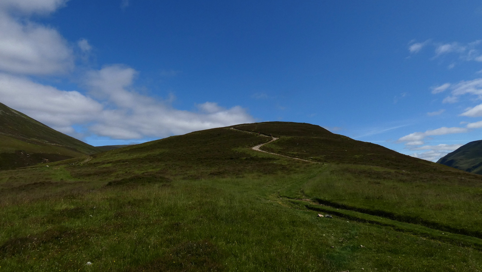
 The summit of Carn a' Chlamain (centre) eventually appears
 Summit getting closer
As you near the final summit ridge a clear path heads off to the left from the main track and takes you onto the final approach. The ground now levels off until a nasty, boulder-strewn last bit before the summit cairn is reached.
 Path leaving main track as summit approaches
 Final approach to the summit
From the summit there are some cracking views all round, especially looking south back to where you have just come from.
 Looking south from the summit of Carn a' Chlamain
 Views of Beinn a' Ghlo from the summit
Coming off the summit I picked up a path that eventually turned into a track that runs parallel to the main track. It was much more pleasant to walk on than the main track, which it unfortunately re-joins at roughly NN918740. If I'd known about it I would have taken this route up the hill.
After that it's just a matter of slogging back down the track, and then the short path to rejoin the main track by the River Tilt. Unfortunately, unlike everyone else I met on this walk who had cycled to this point, I had a two-hour plus trudge in the baking sun to look forward to. I made this as easy as possible by re-crossing Gow's Bridge and sticking to the main track all the way to Cumhann-leum Bridge and then along the forest track back to the car park, by which time my feet were killing me.
It's a very picturesque walk, a bit spoiled by the track gouged into the hillside all the way to the summit, but it's not to be underestimated!
