free to be able to rate and comment on reports (as well as access 1:25000 mapping).
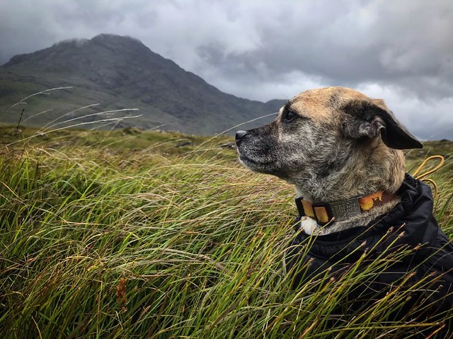
Just completed the Skye trail with my partner and our devoted terrier, Lucky. We did it in 8 days (including 1 rest day) opting to do the whole Trotternish Ridge and Bla Bheinn which was by far the highlight of our trip (and also made the distance shorter than that in the Cicerone guide but with more height gain)!
I've pasted my trip report below. Massive thanks to those of you who've posted trip reports of your own, which were immensely useful as we planned our trip.
Skye Trail Trip SummaryTotal distance: 70 miles
Total ascent: 4,414metres
Day 1: Rubha Hunish to the northern foot of the Trotternish Ridge
Distance: 12km (7.5 miles)
Ascent: 379m
Conditions: Clear skies, light breeze, dry
Start / Finish: ~3pm / ~7pm
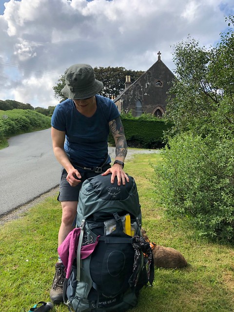
The night prior to starting our trip we stayed at an Airbnb near Broadford. Our hosts kindly let us keep our car parked at their home for our trip, which answered one of my trip planning questions: where to park our car for the Skye Trail? (See above for details.) Our plan then was to take a bus from Broadford to Rubha Hunish. We waited about 30 minutes for a bus only to discover that CityLink busses don’t allow dogs (unless they’re in a cage, which seems weird). Dogs are generally fine on StageCoach busses. We ended up calling around for a taxi and thankfully found one that was happy to take us and our dog to the north of the island for the sum of £97. Not as frugal as the bus, but it got us where we wanted to be, admittedly a bit later than we hoped! Top tip: if you need a taxi I highly recommend Gus’s Taxi. Very friendly and our driver, Helen, was incredibly sweet with our dog.
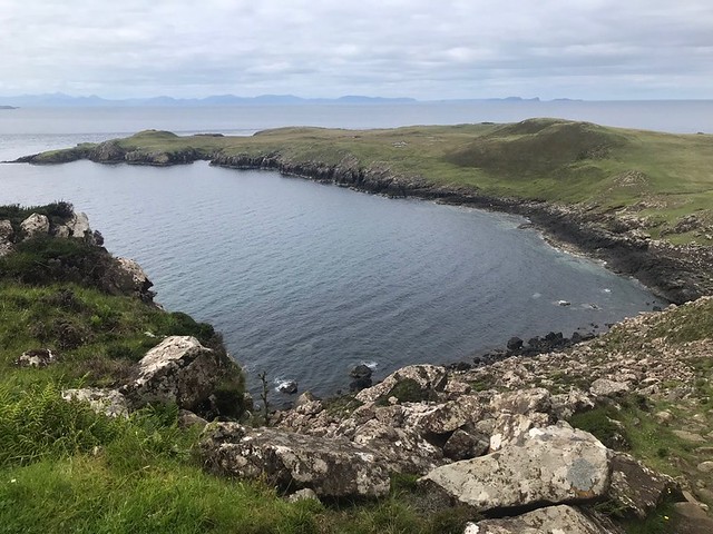
Fortunately the days are long during the Scottish summer so despite the late start we still had plenty of time to complete our Day 1 walk as planned. It begins at the telephone booth near Shulista. From here we walked north to Rubha Hunish and the iconic bothy overlooking the headland. It’s an idyllic spot that was a little ruined by a nice but overly social character at the bothy who seemed overly keen on us staying to camp and have “beer and ribs” with him on his portable bbq. Needless to say, we declined the offer (that is, got away as quickly as possible).
It was well worth spending a bit of time exploring the headland, which requires a small detour down a steep but straightforward path (we stashed our big packs for this). The headland was very calm but I can imagine in rougher weather the sea would be wonderfully dramatic. This is a haven for wildlife and I even spotted a seal!
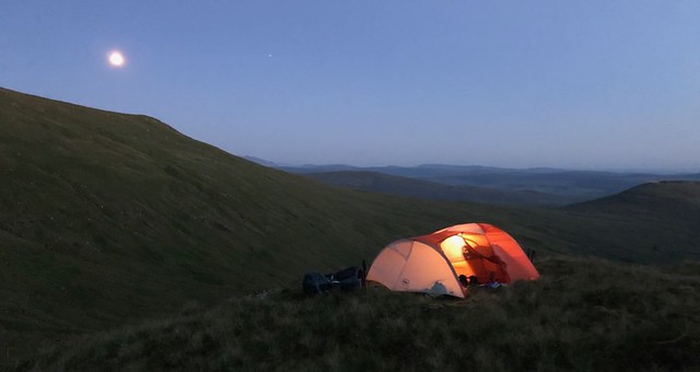
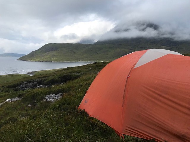
The route follows the coastline - you can take this all the way to Flodigarry or do as we did and diverge to catch the start of the Trotternish Ridge (shown on the Harvey Map). We walked south from Kilmaluag to Conista then along the river Lon Horro to just below Sron Vourlinn (the start of the Trotternish Ridge) where we wild camped for the night. As it was still there were a fare few midges and were glad thought to bring head nets along.

We fuelled up on lentil bolognese and pasta, with dark chocolate and a dram of Talisker for dessert, before crashing out and resting up for our big ridge walk the next day.
Day 2: The Trotternish Ridge (Sron Vourlinn to Hartaval)Distance: 20km (12.5 miles)
Ascent: 1417m
Conditions: Clear skies, sunny, light breeze (amazing), dry
Start / Finish: 10am / 10pm
We knew from the guide book that this would potentially be the hardest day, and indeed it was - even harder than the Bla Bheinn Munro (see Day 7). The Trotternish Ridge is essentially a series of ascents and descents. There are no seriously high summits, but the overall accumulation of uphill and downhill walking takes its toll, physically, but the journey is hugely motivating, especially on a clear day.
The views from the ridge are amazing, with the Cuillin mountains looming in the distance enticing you to keep moving. The section along the Quiraing is both dramatically wild with its cliffs and pinnacles but also quite busy with tourists. On the plus side, lots of tourists meant there was a snack van in the car park after the Quiraing where we could get a cold drink on this scorchingly hot day (and Andrew and Lucky could share a burger!). Our hope was to make it past The Storr and wild camp on the ridge. We got close but not quite, finishing just below Hartaval at around 10pm where we found a few streams. I saw a shooting star as we set up our tent which made the scene quite magical!

After such a long day it was welcome to cozy up in the tent and have an epic sleep before taking on The Storr!
 Day 3: Hartaval to Portree (to finish the Trotternish Ridge)
Distance: 17.2km (10.7 miles)
Ascent: 696m
Conditions: Light cloud, light wind (Andrew almost lost his hat), hot, dry
Start / Finish: 9am / 4pm

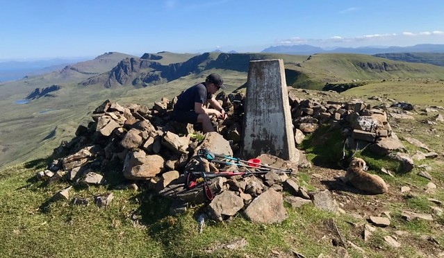
Our feet felt pretty battered from the previous day but we were excited to get moving and finish what we started. There are no paths up The Storr from our approach so we walked steeply through grass and heather for what felt like an eternity until we reached a gentler grassy incline that was like something from Sound of Music. The Storr followed soon after with its trig point and amazing views of the Trotternish and the sea beyond. Though I admit we were feeling pretty motivated to get ourselves to Portree, particularly after my suggestion that we aim to get there in time for fish & chips for lunch! We got there. For a rather late lunch!
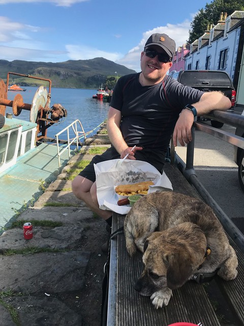
This was the only night of the trip we didn’t wild camp, but instead stayed at the very good Torvaig Campsite where we could charge up our electronic devices, have a shower, and resupply at the local co-op. As foodies, this was a challenge.
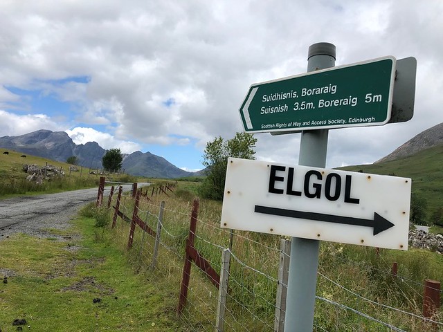
Portree is the only major resupply point along the route (particularly if you skip Elgol as we did - see Day 7). We’d used up almost all of our homemade dehydrated camping food and now needed to restock ourselves with 3-4 days worth of food. There is an outdoor shop in Portree with a very limited supply of ready made dehydrated meals, however they cost about £7 per meal which adds up quickly and in part defeats the purpose of our approach! So we did a bit of math and restocked ourselves with various goodies from the Co-op: wholemeal pasta, tinned mackerel, muesli, oat cakes, cheese, olives, and I couldn’t resist a couple green vegetables!
There’s also a whole foods shop in Portree just across from the Co-Op that’s a little pricy but has some nice items like quality snack bars, fancy chocolate, “High Energy Mountain Mix” (basically trail mix), and dried mushrooms!
Suffice to say our packs felt absurdly heavy as we left Portree!
 Day 4: Portree to Glen Sligachan
Distance: 20.6km (12.8 miles)
Ascent: 372m
Conditions: Light cloud, low breeze, dry
Start / Finish: 12pm / 9pm

This day was pretty straightforward as much of it is on a country road. This might sound easy but I find road walking can get arduous in boots meant for mountains, the stiff soles creating a lot of impact on the foot. So by the time we reached Loch Sligachan my feet were pretty sore! Fortunately at the Loch there is a perfectly situated picnic table overlooking the Loch and the Cuillins which now seem so much closer than they did just a day ago!
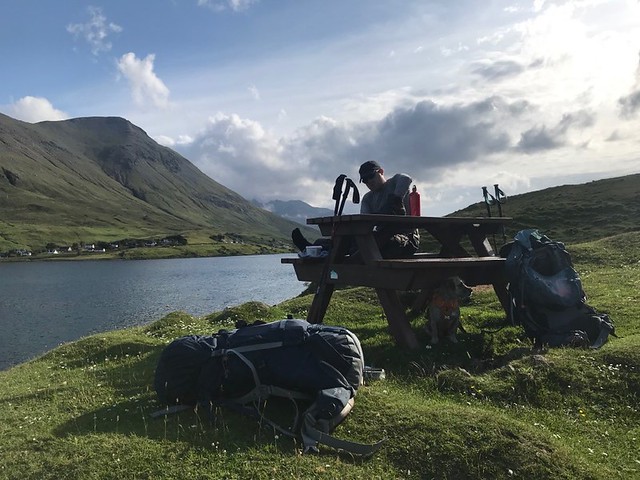
The walk along the Loch to Sligachan is straightforward and the Cuillins continued to beckon us forward. We landed in Sligachan at around 8pm and might have been tempted to stay had it not been full of people and generally loud, chaotic and unpleasant. So we carried on, taking note of the pub and brewery in town, then followed Glen Sligachan for about 30 minutes before finding a pitch for the night and listened to the weather come in.
 Day 5: Rest Day around Sligachan
Distance: Negligible
Ascent: Negligible
Conditions: Heavy rain and wind, mild temperatures, clear in the evening
When we awoke that morning it was pouring rain and dramatically windy. I had the bright idea that we take a rest day and catch up on admin: post cards, pictures, etc. This also allowed us the opportunity to visit the brewery and pub in Sligachan!
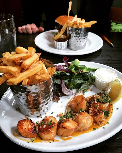
Having seen the campsite I was skeptical about the pub “Seumas’ Bar”, but it exceed expectations. The pub was very clean, dog friendly, had an insane selection of whiskies and beers, and really good food! Andrew got a venison burger with haggis and onion chutney. It was my birthday eve so I treated myself to grilled scallops with fries and a blessed green salad that was very well executed. We finished with a whisky flight, “The Island Hopper”, which included Arran 10yr, Jura 10yr, Highland Park 12yr, and Talisker 10yr. Needless to say all of this cheered up a very gloomy day!
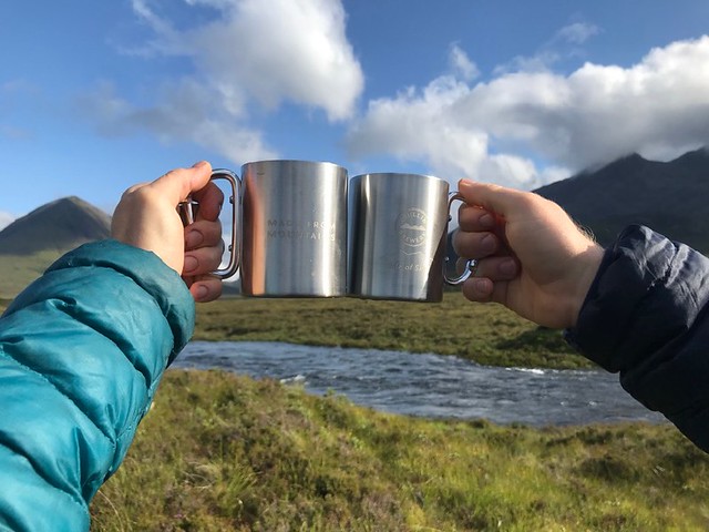
After the pub we visited the Cuillin Brewery next door. It was a small affair, just a few barrels in a small room and a couple of guys who were obviously very passionate about brewing beer. What more do you want? We picked up a selection of ales and couldn’t resist their mugs with carabiner handles which turned out to be an awesome investment in both money and weight. The mugs are slightly insulated and so keep beverages hotter for longer, a desirable prospect for most of my adventures!
By evening the sky began to clear and we were able to dry out some of our clothes before settling in for the night to try our beers and eat up some of our Portree rations. The only downside was the very growing puddle outside of my tent that I had to negotiate any time I wanted to get out and pee. A wild camping problem if ever there was one.
 Day 6: Glen Sligachan to Camasunary Bay
Distance: 11km (7 miles)
Ascent: 232m
Conditions: Windy, intermittent rain, heavy at times
Start / Finish: 8:30am / 3pm
One of my motivations for the rest day - besides beer - was that the weather was looking better for future days and offered more potential for us doing the Bla Bheinn Munro. So on this day we had to make a choice: to stop at Camasunary Bay and camp (or stay at the bothy) before doing the Munro or to carry on towards Elgol, which is supposedly beautiful in its own right. The weather wasn’t looking amazing but I figured let’s stop and if it’s diabolical in the morning, we’ll just carry on to Elgol and then Torrin on the following day.
From a distance, Camasunary Bay is idyllic, surrounded by mountains with just a house and a small bothy on the shores. As we got closer to the bothy, a notable problem became astonishingly visible: plastic pollution everywhere, particularly fishing debris as well as all kinds of plastic containers. Not just on the beach but also strewn across the surrounding grasslands. The bay is owned by the John Muir Trust, a charity stablished to conserve wild land and wild places. An article on their website called Plastic Peril talks about how plastic pollution in our seas is responsible for this kind of situation:
“I have been coming here for more than 60 years, so I am beginning to gain some perspective on what blows up on the shore of this lovely bay,” comments Alan Johnson, whose family has owned the land around Camasunary since 1916. “It faces due south, so welcomes whatever blows in from the Atlantic and Gulf Stream...
…The revolution in polymer science has given us a huge range of cheap, durable materials with a fantastic range of physical characteristics...It’s a technological miracle which has transformed how we live. But, as with all such revolutionary developments, there is a downside. And that is what you see on the shore at Camasunary.”

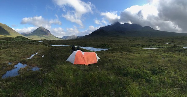
We arrived at the bothy at around 3pm. I didn’t have high hopes that it would be available given the weather and the bothy’s proximity to Elgol, but figured we would at least take some shelter and cook up some lunch. The bothy is simple: one bunk room that sleeps 15 people and one common area with two big eating tables and a counter for cooking. All of this was very welcome as the rain started to pour. Sure enough, as we cooked up some soup, people started to arrive and within 30 minutes the bothy was rammed. This day happened to be my birthday and I didn’t fancy sharing it with a bunch of strangers and their pot noodles, so when we bought a break in the rain we headed out up the hill towards Bla Bheinn and found a great spot far enough from the bothy and plastic to make the bay feel like a wild private paradise.
My birthday treat was a bottle of Cuillin Brewery’s Eagle Ale and some fancy dark chocolate, all enjoyed while tucked away safely in my tent. I occasionally took a peak outside to admire what I could see of Bla Bheinn which was mostly clouded over. Top birthday!
 Day 7: Camasunary Bay to Torrin via the Bla Bheinn Munro
 Distance: 8km (5 miles)
Ascent: 879m
Conditions: Heavy cloud, low visibility for the ascent, then clear weather for the rest of the afternoon
Start / Finish: 9:30am / 6pm
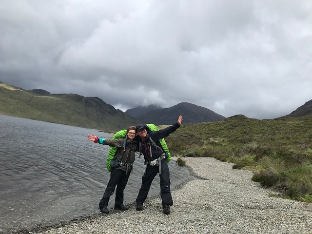
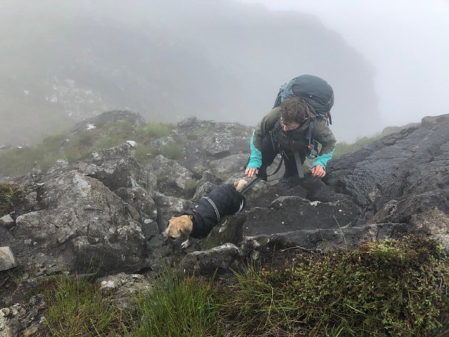
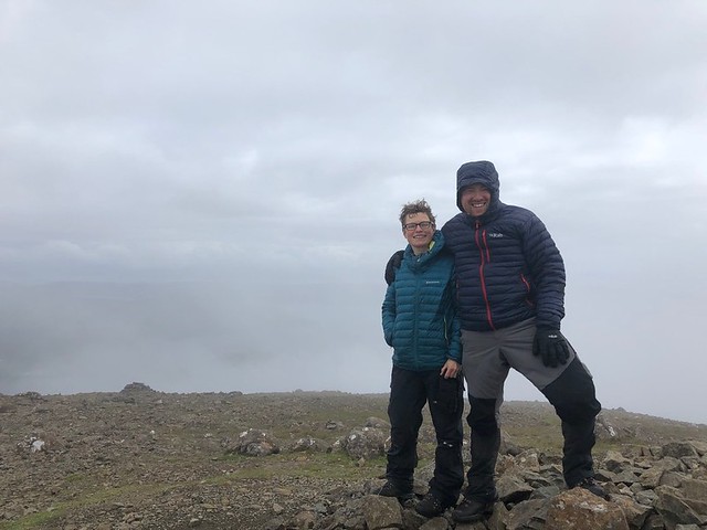
When we awoke in the morning it was still raining and Bla Bheinn was enshrouded in cloud. That said, the temperature was mild and the wind was negligible. There were also some patches of blue sky which got my hopes off so we decided to make a go of the Munro. We’d eaten up most of our heavy food and our packs felt blissfully light as we started the ascent. It’s a bit of a toughy as you’re starting from sea level and it’s basically a steep climb for 900+ meters until the spot height at 926m. Within 20 minutes of our start we were in cloud and remained that way to the very top. Bla Bheinn is mainly composed of gabbro, a rock with excellent grip for mountaineers and scramblers. As such the journey is slow going and often requires use of all four limbs (standard for Lucky). Eventually we reached the spot height after which the true scrambling began. From this point, an awkward descent is required using a rake on the eastern flank. It’s short lived but a bit scary, particularly with a heavy pack and a tethered terrier! Once at the bottom, it is straightforward to climb up the other side and make it to the trig point at 928m.
Like I said, we were in cloud. But the rain had stopped and it was remarkably still on the summit so we decided to light up the jet boil and have a little lunch before carrying on. A pair of friendly folks soon arrived (the first people we saw all day) and we talked about the great views!
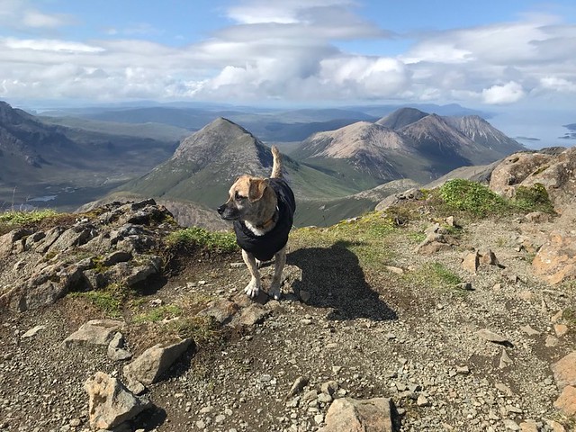
Then suddenly like magic we started to get a few glimpses of the sea through the clouds, and within minutes the cloud had totally blown over revealing the jaw dropping view of the Cuillins! It was incredible and one of the best mountain moments I’ve ever had. The view was somehow made better by having spent the day in cloud, with no idea what was to come.

As we descended the mountain we were on a high, which was fortunate as the steep descent is otherwise hard going and monotonous! Eventually we made it to a stream where we stopped to take off our boots and socks for a while and drink some water. We then carried on to the road from which you can see Torrin. Before the village there are a few wild camping spots (and indeed we saw at least 3 other people pitched up around the place) so we found ourselves a nook of our own and settled in for the night, eating up the last of our food and grateful that Torrin had a well regarded cafe that we were looking forward to in the morning!
Day 8: Torrin to Broadford Distance: 21.7km (13.5 miles)
Ascent: 439m
Conditions: Light cloud and breeze
Start / Finish: 11:30am / 6:30pm
As we were mostly out of food our plan was to go to the Blue Shed Cafe in Torrin for an epic breakfast and some snacks to take away. Turns out the cafe is more of a coffee and cake kind of place - so much for that Full English! They did serve soups so we ended up having soup for breakfast and a slice of orange and almond cake. Although a little disappointed that the epic breakfast vision wasn’t fulfilled, the food was of such a high quality that it almost didn’t matter. Both the carrot and coriander soup and the Mediterranean vegetable soup were of a high standard, with seemingly good quality ingredients, and seasoned appropriately. The bread was top notch. The coffee was perfect. And the cake was heavenly! The staff were also great, very friendly with our dog, and helped organise a camping spot for us in Broadford. We ordered a bunch of “oaties” (like a pimped out flapjack) to take with us and got started on our last day of the Skye Trail.

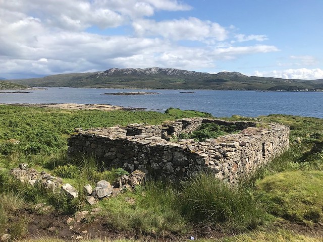
After the thrill of Bla Bheinn we had to caution against rushing through this leg of the journey. In fact, it’s a spectacular and fascinating walk. It includes the remains of Suisnish and Boreraig, two villages emptied as part of the Highland Clearances in 1853. In a nutshell, the landowner Lord MacDonald evicted his tenants and burned down their homes to make way for sheep. It’s all very eerie and a reminder of the dark side of human nature and the quest for riches!
The walk also follows the remains of some marble lines, with the last stretch of the route following an old railway line that ran between Broadford and a series of marble quarries until the mines closed in 1912. Navigation is easy and the path straightforward.
I suggested to Andrew that we try to get to Broadford in time for a celebration barbecue, the prospect of which spurred both of us on. We eventually got to the Camp Skye site in Broadford (our second campsite of the trip) which was a bit new and without personality but had great facilities and flat pitches. I set up camp while Andrew booked it to the Airbnb to pick up our car and a few groceries for our BBQ. The sun returned for a short while so we toasted our victory with venison burgers and a dram of Talisker, which seemed fitting. We were happy, but there was also a bit of melancholy, too, as we weren’t really ready for the trip to be over. It’s left us with a real love for Scotland and inspiration to spend more time in the mountains, ideally by actually living near them! I never thought I could move to Scotland - it’s too far, too cold, etc - but my feelings might be changing on that one. Time to plan the next trip!
