free to be able to rate and comment on reports (as well as access 1:25000 mapping).
Fri, July 26Travel to Denver. Journey very long—more than 24 hours door to door, but thankfully mostly uneventful. Stayed with Bob in Berthoud. K and the kids are in Wisconsin; I won’t see them until the wedding.
Sat 27 JulyBob drove me up to EP in the afternoon, and we met Bill at the house just after he arrived. We’d done a bit of food shopping in Loveland, and I was completely overwhelmed. So much stuff, so many choices! Clearly, I’ve been away long enough for such an experience to no longer be “normal.” I made Bob push the trolley (cart!) so I could try to concentrate on my list, and on breathing. On the plus side, though, I bought a huge bag of cherries that are nearly the size of golf balls, and peaches the size of baseballs. There aren’t many food miles on either, and they’re delicious.
Pizza dinner with my siblings.
Sun 28 July
Eagle Cliff
3 hrs / 5 km / 305m
sunrise view from the house
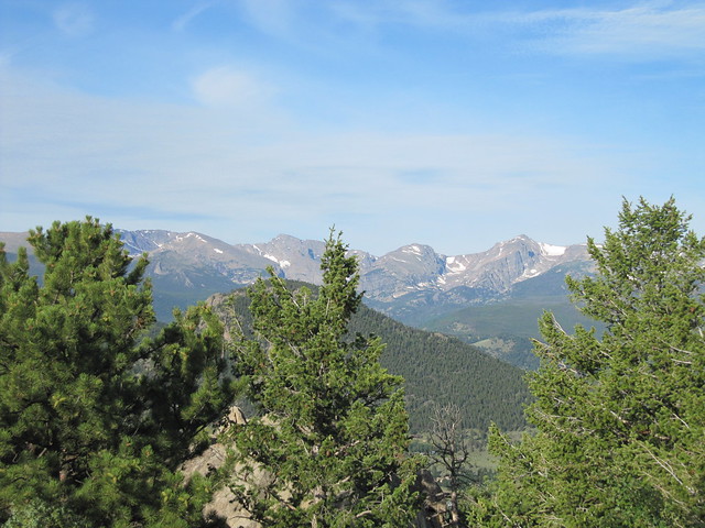
I had a wee walk around the neighbourhood in the morning, then sat on the deck and read my book. Bill and I climbed Eagle Cliff in the afternoon. We parked near our old house, then walked to Moraine Park VC, and climbed up the hill from there, coming down the other side. I really struggled with the ascent, my lungs aren’t yet acclimated to the thin air! It was hot, too, which didn’t help. But the view from the top was well worth the pain. Plus it was a joy to wear shorts, and trail shoes—not boots—over dry ground, mostly on a good path.

Moraine Park and the Front Range from just above the VC

Long's Peak

looking back toward EP from the top of Eagle Cliff

summit!
Our reward was a pint at the Rock Cut brewery. EP now has four breweries; we are, of course, aiming to visit them all. Clever names from this one: Enos Pils, Ptarmigan Ptart.
Mon 29 July
Lion Lake 1, elev approx. 11000ft (3353m)
9 hrs / 22km / 732mWith Amy. We left an already heaving car park at Wild Basin just after 7:30. We were chatting away, and I forgot to turn my phone tracking on until we were nearly at Cascade Falls.
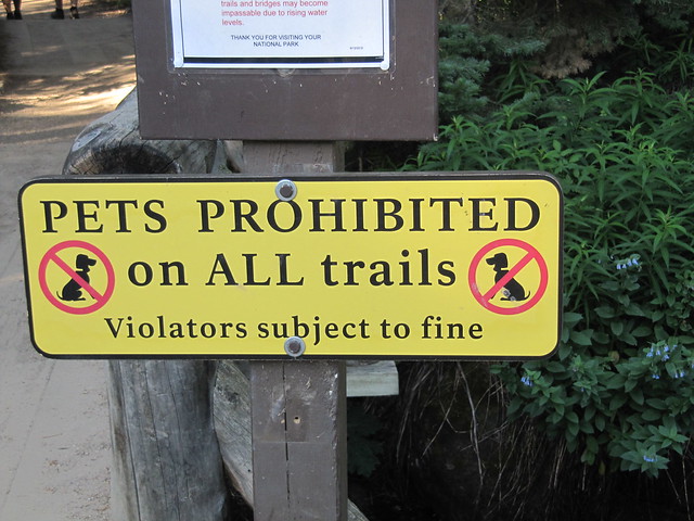
this (an NPS-wide law).


Cascade Falls
The trail was in very good condition, especially down lower, where it has all been replaced since the flood in 2013. But even the older parts are astonishingly well maintained. It’s much easier walking here than in Scotland. I even said to Amy late in the day that I might like it better! It’s definitely different.
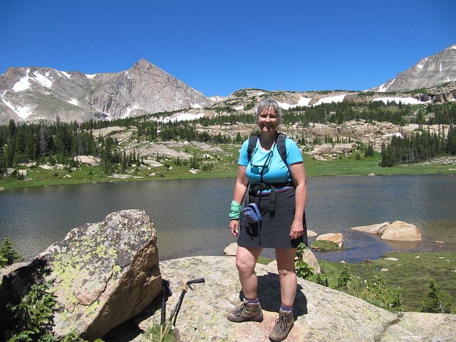
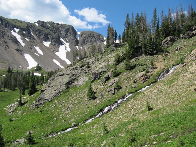
Lion Lake 1; Alice Peak behind
It was an amazing day. The wall-to-wall sunshine would have been brutal if we’d not been climbing our way gently through the forest. The lake is just about at treeline, but by the time we were out of the woods, the cool air and accompanying breeze compensated. But you have to be very diligent about slathering on the sun cream; 30% stronger UV rays than at sea level.
We were going to continue on up to Lion Lake 2 (imaginative naming here!), and possibly even beyond, but the recent snowmelt made for a swollen stream that needed to be crossed. The best spot for a ford required a very big step onto a rock that looked to be quite slippery, so we decided to just stay at the lower lake.

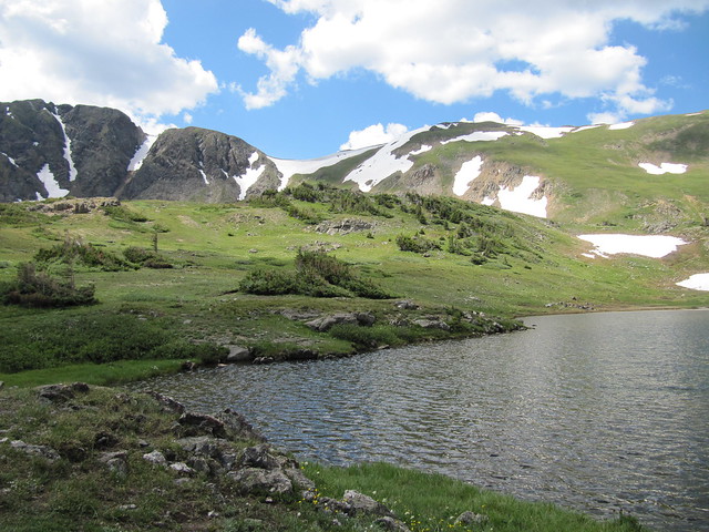
top end of the lake; not sure what the peak behind is
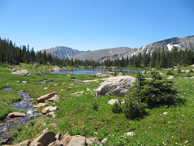
down the lake in the other direction (I couldn't go too badly wrong with pics, given the vivid blue/green/white colours!)
We found a large flat rock that looked down the lake and plopped ourselves down. We spent probably at least an hour there, including making our way down to the stream to numb our feet in the freezing cold water.

happy hikers
Tues, 30 JulyA not particularly eventful day, other than getting high marks at the dentist.

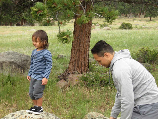
Bill went to Denver to pick up the kids, so I had him drop me off at Picadilly Square, and I had a bit of a walk around town before my appt. I walked all the way home afterwards, so I definitely got in my day’s steps! Lazy afternoon, reading (me) and napping (everyone else). T. is an adorable bundle of energy, the likes of which I don’t have the stamina to support, at least on an ongoing basis. Thankfully, I don’t need to!
Wed 31st July
Prospect Mountain
1½ hrs / 4 km / 200m Early morning hike with Bill up Prospect Mtn. Already quite warm!
Front Range, from Prospect Mtn (Eagle Cliff in the foreground)

downtown EP zoomed (from tramway station)

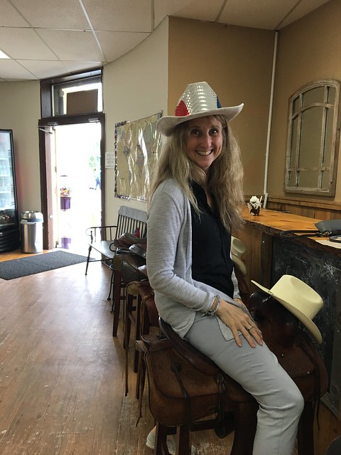
tourist!
In the afternoon, we all drove up the Old Fall River Road, and then back down the Trail Ridge Road.

Chasm Falls

making our way up Old Fall River Road; Alpine VC in the centre (just above car ahead)

looking back down to where we'd come up, more or less

snowfields and cornices near Alpine VC
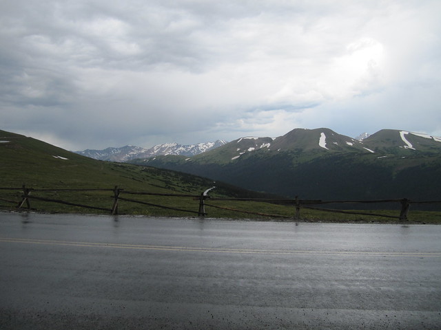
Never Summer Range

across Forest Canyon
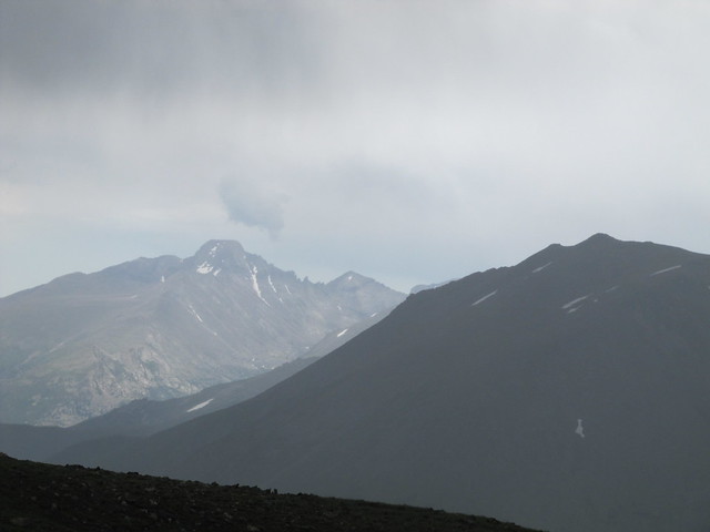
stormy Long's Peak

Arrowhead Lake is nestled in there...
Thurs 01 August
Deer Mountain
3 hrs / 9.65 km / 380m Early morning hike up Deer Mountain (10,013 ft /3052m) with Brad and Bill; we set off at 6am, and were back down shortly after 9am.

Long's Peak sunrise

toward Horseshoe Park

summit Deer Mtn; toward Long's Peak

summit team photo
Home to collect the kids, then up into the Park to pay respects to Mom and Dad. Into town for a late lunch (Mexican at Ed’s) and mooching around the shops.
 Fri 02 Aug
I walked to town and met Jeannie for lunch at Sweet Basilico. Afterward, we drove out to MacGregor Ranch to see Shirley.
Sat 03 Aug
Parika Peak (12394 ft /3778m)
9 hrs / 19.3km / 1078mWith Amy. A belter of a day, with glorious views—quite possibly one of my top 20 walks/hikes ever! I did precious little hiking when I lived here, so it’s pretty easy to go somewhere I’ve not been before. I never hiked on the west side of the Park, and when Amy invited me to go along, I jumped at the chance. It meant making another drive over Trail Ridge Road, but that’s certainly no hardship.
We set off from the Baker-Bowen trailhead at 7:45. We got one of the last available parking places; these days, you’ve got to be up with the sun to be able to park nearly anywhere within the Park. Everyone is saying that there are far more visitors (and traffic) than ever before, but it also seems to me that that’s the general consensus every year. It’s certainly much, much busier than it ever was when I lived here. Just like Scotland’s honeypot sites.
Anyway, back to the walk. We could see our target in the distance, and it looked far away. But we made our way up through the forest, crossing several small streams, and several sections of rockfall. Oh, and we also crossed the Grand Ditch, part of the hydro system that diverts water from near the Continental Divide through the mountains to the eastern plains. I remember, as a youngster, seeing the ditch from the road, far up the mountainside.

Amy striding up through the forest

crossing the Grand Ditch
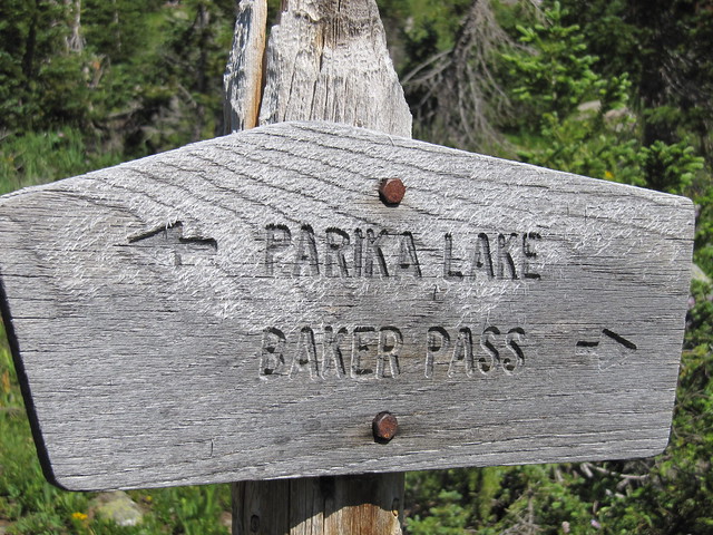
it's a that-a-way

my pics aren't very good, but the wildflowers were out in abundance
typical view on the way up

columbines

Indian paintbrush (at higher elevs, comes in all colours other than red -- dusty pink, violet, even yellow)

Parika Lake; Parika Peak behind on the right
and in the other direction; the hills we're not going to...

tiny Alpine forget-me-nots
We had a long break, and food, at Lake Parika. Amy had said from the beginning that she’d leave it to me to decide whether to carry on to the summit or not. It was about 1000ft more ascent over the course of a mile. I’d struggled with the last bit of ascent up to the lake—lungs more than legs—but knew I’d regret it if we didn’t at least try. I felt better after our rest, and the first part of the ascent wasn’t too difficult. It reminded me of the ascent path up toward the Forcan Ridge. It steepened considerably about halfway up to the saddle, and I was stopping every few steps to catch my breath.
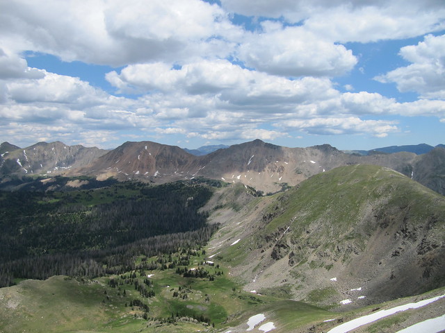
From the saddle, it was another steep section, pathless now, up to the first top, which wasn’t quite the summit. I struggled here, too, and tried to distract myself by looking for tiny Alpine forget-me-nots. The view from the summit, reached nearly five hours after setting off, was well worth the effort. We were sitting atop the Continental Divide! I’ll let the photos do the talking.

still gasping for air at the summit!

back toward the car park (which we could see from the top!); Long's Peak in the far distance

I *think* this is Mt Bowen...
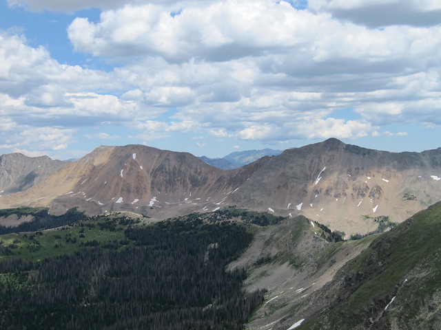
… and Mt Baker in the other direction (hence, Baker-Bowen trailhead)

Long's Peak zoomed (looks completely different from the only other views I've ever known...)
Baker again, plus more of the peaks further along the ridge

Bowen again, note the dark clouds...
In spite of the nearly full car park, we were lucky enough to have the summit to ourselves. We hung out for a while, getting out the map and trying to figure out what we were looking at (even Wyoming was across there somewhere), but were also very aware of several dark clouds overhead. It’s when they build up and merge together that things can get dicey, with regards to lightning strikes.
The descent was uneventful, but very long. I was tired! Even if I have fully acclimated to the altitude (and it’s impossible to know whether I have, or how long it takes), expending energy at nearly 4000m is much harder than at sea level. Even Amy said that she still notices a difference between EP and higher up. We managed to find a few wild raspberries; tiny, they are, no bigger than a pea, but packing an unbelievable punch of flavour. Amy said she used to give them to my mom to use in her raspberry jam; something I never knew.

from the trailhead, looking back up to where we'd been; Parika is the small peak in the middle, b/w Baker and Bowen
Sun 04 AugTeresa drove up from Denver, and we started out with a huge breakfast at the Mtn Home Café. Sadly, “Eggs South of the Border” is no longer on the menu.

From there, we went to the marina, and contemplated doing some sort of water-related activity, but the wind had kicked up, and the dark clouds were gathering, so we went and played a round of miniature golf instead. After a bit more miscellaneous running around, then we rounded out the day with hot fudge sundaes.
here comes trouble...in spades!
sundaes, western style
Mon 05 Aug
Lily Lake + toward Storm Pass
1½ hrs / 6.2km / 296m Early morning hike with Bill up by and around Lily Lake. Sam, Michelle, and numerous other family members and friends descended upon the house for lunch and the afternoon.

a very still Lily Lake

Lily Mtn through the trees
 Tues 06 Aug
Walked into town to do my souvenir shopping. I stopped by the visitor information center to see if Jolene still works there. She does, and I stole her away for an hour or so to have a catchup. She looks the same.
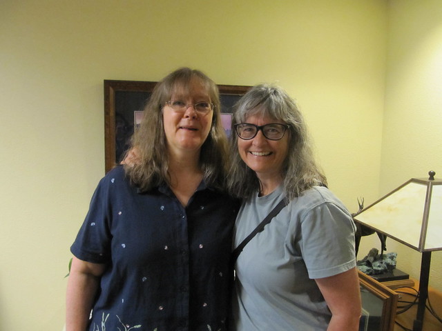
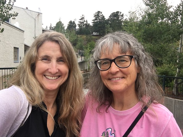
long-time friends (old ones, too

)
I’m more than a little annoyed that I’ll be missing my 40th class reunion that’s taking place this Sat (the day I fly home). Apparently, the details were disseminated only on Facebook, with not much (any?) effort expended to contact anyone who’s not on it.

I only found out about it at all because I asked Bill to see if the class had a FB page.
We all had dinner at Shirley’s.
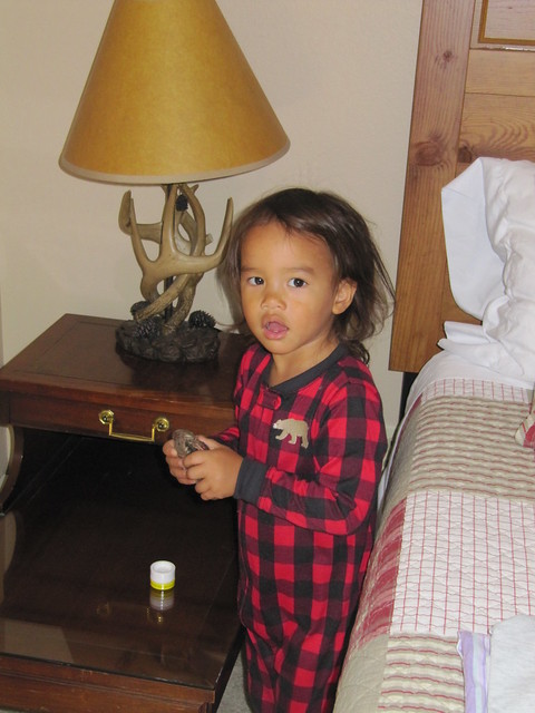
T exploring my room, and rearranging according to his preferences
Wed 07 AugA whole lotta nothing. The lads left for Denver, and I simply revelled in the silence. Aaaaaahhhh…..
Dinner (Mexican) with DB.
Thu 08 AugThe Wedding.


 Fri 09 Aug
Bob and G. were very patient with me whilst I did most of my “American” shopping.
Sat 10/Sun 11 AugA very long trip home. The rain was **** down when I arrived, and the temperature was much colder than when I left. What a difference two weeks makes! That autumnal nip is definitely in the air.
