free to be able to rate and comment on reports (as well as access 1:25000 mapping).
The good news is having the freedom to take advantage of late deals! (I should probably unsubscribe from all of the emails that tempt and tease with cut-rate, off-season, outwith-the-school-holidays offers.) The bad news is that I really miss my fuel card. (

but really

)
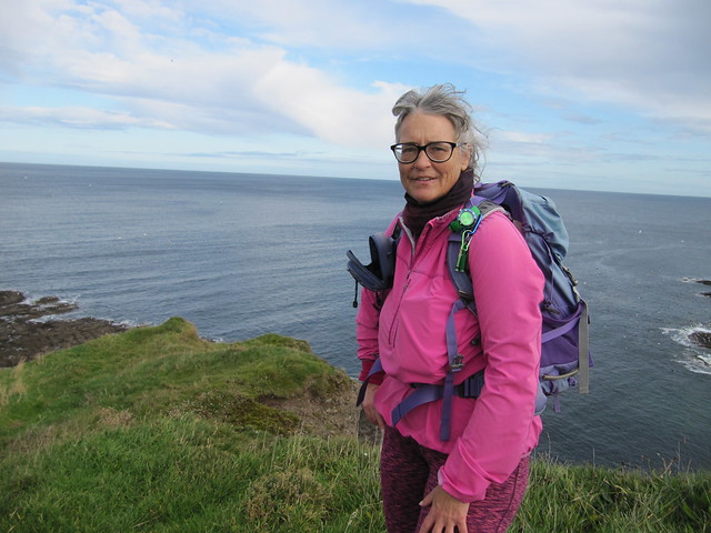
I’d booked a cottage near Pennan (of Local Hero fame) for a week. It’s an area I’ve not spend much time in, all told, but funnily enough, my grandfather (Andrew) was born and lived his early life in New Deer, which is only about 20 miles (by road) from where I stayed. His father (my great-grandfather, Alexander) settled in New Pitsligo, about 5 miles up the road from New Deer after his wife (my great-grandmother) died, and he took all the children to live with an aunt in Canada. It was a bit odd, hanging out in the places where they’d lived. I didn’t feel particularly connected to them through the locations, but I did like to imagine what their daily lives might have been like. I picture my great-grandfather as stern and austere—I’m not sure why that is; perhaps based on a photo I’ve seen. I don’t remember ever talking to my grandfather about his childhood, and it makes me sad that all of his history is now just … gone.
The cottage was nice: well-equipped, good heating, pet-free, fab view to Pennan through a wee side window. Shower was fairly crap.

the cottage; my bit was the right side of the building

view to Pennan (and Pennan Head) from just outside my door
I have some good memories of visiting the area with the Scottish dancers in 2000: staying at Huntly Castle Hotel (Connie by the River Deveron), visiting Duff House, a coastal walk from Buckie to Cullen (via the farmers’ field; he wasn’t very happy with us), and having Cullen Skink—in Cullen, of course. Little did I know at the time that the trip was going to set the course of my future.
Aberdeenshire is huge. And there are roads everywhere, none of them motorway; most of them not even dual carriageways. And some of them closed after recent heavy rains and flooding in the area. It took a long time to get around. There was much potential for getting lost, and yes, of course I did—many times—why do you ask?

After the first couple of days, I had generally good weather, whilst the rest of the country—or at least most of the west coast—suffered.
I discovered during this trip that I
AM a hillbagger (but no, I’ll not be changing my WH identifier)! Although I enjoyed lots of coastal walking, and love being near the sea (supported by the hundreds of photos!), I found myself hankering to climb some hills after only a few days. There aren’t any big ones, so I set about exploring a few of the little ones that didn’t require too much driving.
Sat 05 OctMy “on-the-way” plan had been to climb Bennachie, but when I reached the A90/A96 junction, the sheeting-down rain made for an easy decision to “bin”nachie. I’d left early enough to do a 5-6 hour walk, so I had time to kill. I stopped in New Deer for my lunch (sitting in the car park for the working man’s club; very sexy), had a wander around the New Pitsligo cemetery looking for Maitland graves (unsuccessfully), and then another wander around Fraserburgh.
Sun 06 Oct
~3-4 hrs / 14.2km / ~214mAnother mostly wet day, but I managed several short walks in between showers, first wandering around Banff, then Portsoy, then walking from Crovie to Gardenstown and back. These small fishing villages all have their own distinct harbours and charms, and remind me very much of those in the Kingdom of Fife.

Banff harbour

I wanted to visit this pub! Unfortunately, closed

looking across the bay to Macduff

Portsoy has the coolest harbour--it's actually three separate ones, all linked together

one of the inner harbours; there's another one behind the wall on the right

went here (Portsoy Marble) in 2000 (according to my notes), but I have no recollection of it whatsoever

nice coastline

Crovie

looking toward Gardenstown, from Crovie
adventurous path between Crovie and Gardenstown!
 Mon 07 Oct
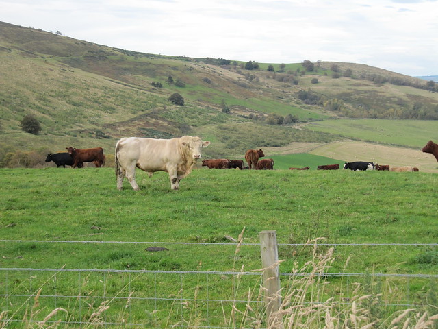
The weather was minging; ferocious winds and horizontal rain. I stayed put! There are some VERY noisy cows across the way—I suspect that they’ve just been put into the barn for the winter, and aren’t very happy about it.
Tues 08 Oct
Cullen to Findlater Castle
3 hrs / 10km / 335mParked up in Cullen Square.

purple boat for Karen!

there were some lovely stretches of coast along this walk


and loads of seabirds

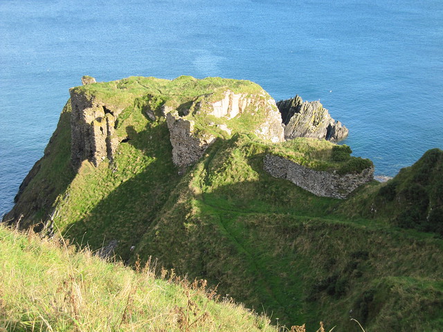
the castle ruins; a setting much like Dunnottar!

This is the day I realised that I wanted, nay, *needed* to climb a hill. I’d thoroughly enjoyed the walk to Findlater Castle, but wanted more, more, more. And no, it’s not lost on me that I actually ascended more metres walking along the coast than climbing the hill.
Cullen Bin
1¼ hrs / 5.3km / 198m 
nice walk up through woodlands that seemed native (tho I could be mistaken)

woohoo -- a hill!


out to sea, and over to Buckie
Wed 09 Oct
Tour De Sub2Ks (Aberdeenshire/Moray)Yesterday’s wee bump (Cullen Bin) left me wanting more. I tried to work out how to get to these hills, and the order in which to do them before I left the house, but also resigned myself to stopping often to consult the (paper) road map and (only when desperate) google map on my phone. And yes, it did occur to me—several times—that a satnav would have been helpful. But I remain proudly old skool.

I think I ended up doing Fourman Hill first accidentally, taking a wrong turn in a panic and finding myself heading toward Aberchirder.
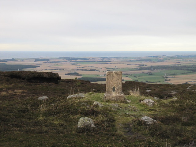
Fourman Hill (1½ hrs / 6.9km / 264m)
looking across arable Aberdeenshire on my way up Fourman Hill

summit!

traipsed through this field on the way down...
...to give this bad boy a wide berth!
Meikle Balloch (1¼ hrs / 5.2km / 214m)
through the tree tunnel on the way to the top of Meikle Balloch Hill

looking back down on Keith

summit!
Knock Hill (1hr / 2.15km / 232m)This was a steep little hill, but by far the hardest part of it was finding the start point! I must have driven past the wee minor road (unmarked) three or four times, thinking it was only a driveway before I finally saw another vehicle headed down it. I'd been looking for a signpost for Swilebog or even Gordonstown; neither are marked.
summit!
Thurs 10 Oct
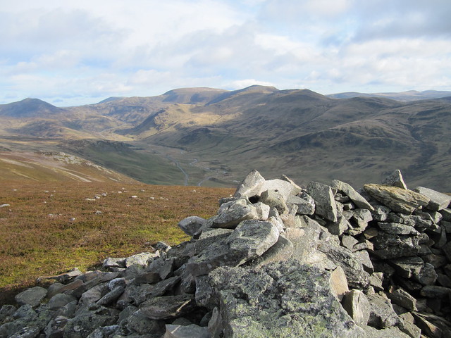
“The Complete Bennachie” (according to WH)
5¼ hrs / 18km / 862m Another driving adventure getting to the start point! A lovely walk, though, that I probably enjoyed much more mid-week than I would have the Saturday prior. The landscape is very Cairngorm-esque.

view from Rowantree car park

first view of Mither Tap

the hole in the ground that is Hosie's Well

summit Mither Tap

looking across to Oxen Craig; a target for later in the day


next objective, Millstone Hill

looking back at Mither Tap (which looks like a proper mountain!) from just below summit of Millstone
I overshot the "turnoff" to Watch Craig, but a brief heather bash soon saw me right. From there, it was a straightforward ascent onto Oxen Craig.

summit, Oxen Craig

Craigshannoch behind on the left; Mither Tap behind on the right

final look back to Oxen Craig, from near the summit of Craigshannoch
The summit of Mither Tap was now, as I passed it again on my way back to the car park, heaving. I could see at least a dozen souls along its top. I was glad I'd had it to myself earlier in the day!
Fri 11 Oct
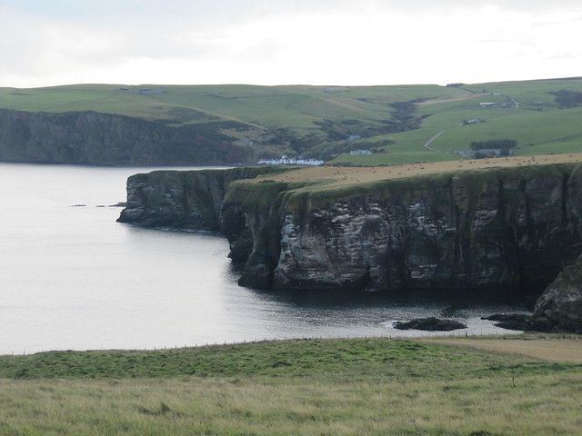
Troup Head RSPB, Cullykhan Bay + Fort Fiddes
4½ hrs / 13.3km / 468mA car-free day; walked from the cottage.

looking back to the cottage from along the road

approaching Northfield Farm; the reserve is beyond it (I quite like the rolls of hay; took lots of pics of them!)

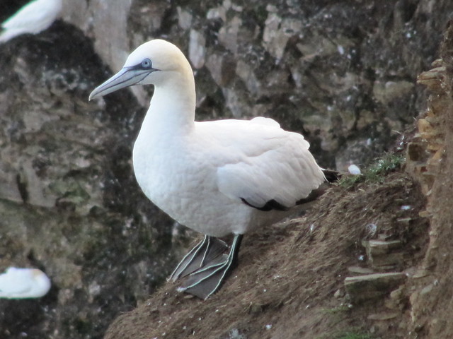
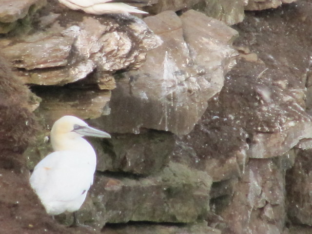
Given that it was almost mid-October, I wasn't really expecting to see many gannets, so I was surprised and pleased to see hundreds of them still hanging out on the cliffs. I can't imagine how many there probably are during "high season."


looking back to Pennan; doesn't look very far!
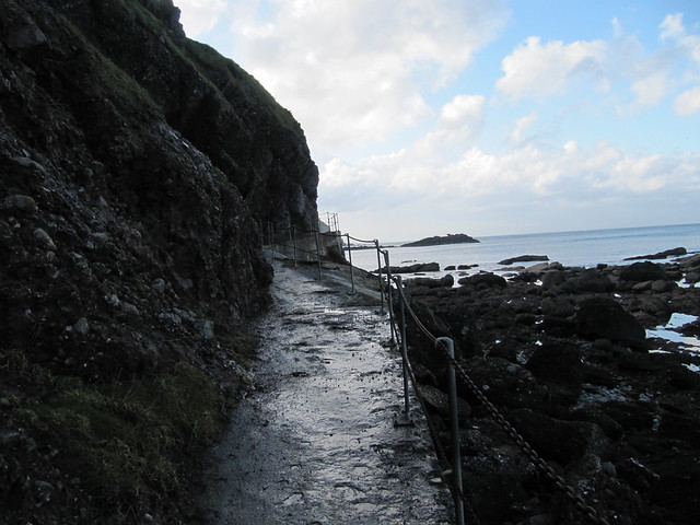
From Troup Head, I'd decided to follow the coast to Cullykhan Bay, instead of trudging back along the road. It looked straightforward enough, but I soon found that fences and dense areas of growth, mostly gorse, often blocked my way. I think I probably accumulated a few thousand extra steps in detours!

looking down into Hell's Lum

lots more seabirds; mostly cormorants
yes, it's a sheer drop just behind me. How brave (stupid) am I?

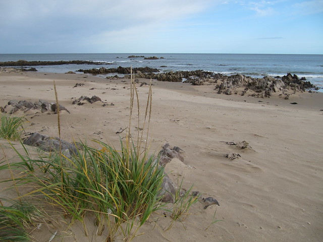
nice wee beach; I sat a while and had a paddle
Sat 12 Oct
Corbett: Ben Gulabin
2 hrs / 7.2km / 506mA quick leg-stretcher on my way home. Lovely drive through Deeside; autumn colours at their peak!

okey dokey; luckily, there's a track nearly to the top

Glen Shee was looking really lovely in the morning light

looking toward the hills I'd been on with David a few weeks before


over to Craig Leacach, etc.
