free to be able to rate and comment on reports (as well as access 1:25000 mapping).
A curtailed weekend due to Allison having an appointment on Friday (which was an absolutely beautiful day for the hills, I will add

) then going on holiday - again! - on Sunday. She had one Corbett left down in the south, so it seemed a reasonable opportunity to go that way. However - we were leaving on Friday afternoon, after her appointment and I was at a loss for camping options down Galloway way. Last time we'd done Cairnsmore of Carsphairn we'd pitched in the car park for Loch Doon and been visited during the night by carloads of techno-doggers, so after last weekend's intrusion on the way to Mull, I definitely wasn't risking car park camping again

It occurred to me that we could go in from Craigengillan and use Clennoch Bothy, nice and convenient for the circuit of Cairnsmore and Beninner - a Donald Top she also needed for her "proper" Donald completion. I'm a bit wary of bothies on Friday nights, but knowing Clennoch has no stove/fire I though it might be less likely to be visited by drunken pleasure seekers at least in the winter months.
We had a nice drive down the coast, a big, almost full, moon rising as the darkness fell. Parked in a big passing place just before the houses at Craigengillan and sat in the car having our tea before setting off. Several cars passed by, which puzzled me as it's a dead end road. Oh well, who knows the goings on of these Borderer-types. Collecting our kit, headtorches on, we set off up the track. Boy it was cold - the car had registered a slightly sub-zero temperature as we were driving in, add a bit of wind chill and it was parky for early November.
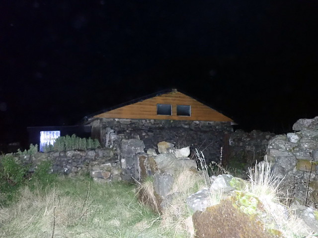
 PB080282
 by
Al, on Flickr
I do enjoy walks in in the dark - provided there's a reasonable track to follow and the rain isn't raining. So tonight was one of those times. The Plough sat over the silhouette of Moorbrock Hill; other stars were somewhat washed out by the lunar power. I managed to continue on the main track when we should have left it and we found ourselves heading for the top of Craigengillan Hill instead of where we should be going - oh well, what's another kilometre in the dark
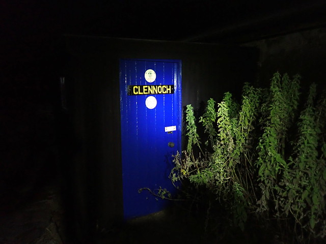
Back on track, we passed the farm buildings at Moorbrock before heading round Green Hill. The steady gain in height was warming us up, despite the frozen ground. Then the long straight track that ultimately brought us to Clennoch.
 PB080286
 by
Al, on Flickr
 PB080287
 by
Al, on Flickr
The squat shape of the bothy was a welcome sight as we finally arrived, at around 8.30. I hadn't stayed here before, but had popped in for a look whilst doing hills in the area about 3 years ago. No lights on inside. We slid open the door and yes, no other inhabitants. We unpacked, remarked on the provision of a mattress on one of the beds, which you don't find in every bothy, and unpacked our kit. A warming cup of tea with some biscuits brought the circulation back before we turned in. Read for a bit then waited to see if anyone else was going to roll up - I reckoned if we got past 11pm we'd likely be left alone. And indeed we were.
 PB080289
 by
Al, on Flickr
 PB080290
 by
Al, on Flickr
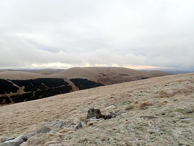
In the early hours we heard the wind getting up - the turbines in the windfarm just to the north of the bothy began to scythe the air. The forecast for Saturday had been for rain - it was a pleasant surprise to find that although it was frosty and a little claggy high up, the day was dry. We breakfasted frugally and set off - an easy crossing of the Bow Burn then onto the northeastern shoulder of Cairnsmore - steep initially then a long gradual ascent to the summit.. We could see frosty footprints ahead of us - someone else had been up this way already today.
 PB090291
 by
Al, on Flickr
Bothy and Dugland in backdrop
 PB090292
 by
Al, on Flickr
 PB090293
 by
Al, on Flickr
View over to Moorbrock
 PB090296
 by
Al, on Flickr
Summit Cairnsmore of Carsphairn
 PB090297
 by
Al, on Flickr
From the trig point/cairn we set off, in clag, for the nearby Donald Top of Beninner - an uneventful traipse following a fenceline once Nick of the Lochans was reached. Then back down into the valley. A couple of young deer - deerlings? were up ahead, just come out of the trees and hadn't seen/smelled me yet. Nibbling the grass. We reached the track and made good time back down towards the car - the surroundings having been stripped of the mystery they'd had in the darkness. We paused by the burn to have lunch before getting back to the car at 12.30.
Beninner
 PB090298
 by
Al, on Flickr
 PB090299
 by
Al, on Flickr
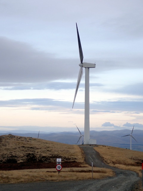
The day was still young, the weather still fine. I had been looking at my Simms map on Hill-bagging this week and noticed I had one Simm left in Section 27, Hare Hill up near New Cumnock - a northern outlier of Blackcraig Hill. I said to Allison that it was all windfarm track right to the top - she gamely agreed to go for it. A rather lovely drive in the last of the autumn colours. We drove through the quaint, interesting looking village of Moniaive then along towards Thornhill. There's a section of the A76 running alongside the River Nith that is currently single track due to landslip risk - here we saw numerous red kites - a "kettle" of kites if you will. They seemed very interested in the many pheasants along the roadside - whether the living ones that were exploring the new straw-lined drainage system or the many squished pheasants on the road wasn't entirely clear

We parked just inside the road to High Cairn Farm and set off along farm roads then across a field on a farm track, not a windfarm track
My bad. However we soon did reach the windfarm track which led us right the way to our objective. Big skies to the east, the Lowther Hills visible. Our objective was reached, a smile and a photo from me then back the way we'd come, getting back to the car around 4.15 as the light was starting to fade. I've now completed 75% of Scottish Simms - yay!
 PB090301
 by
Al, on Flickr
 PB090302
 by
Al, on Flickr
Hare Hill (right) Blackcraig Hill (left)
 PB090303
 by
Al, on Flickr
 PB090304
 by
Al, on Flickr
 PB090305
 by
Al, on Flickr
 PB090306
 by
Al, on Flickr
 PB090307
 by
Al, on Flickr
