free to be able to rate and comment on reports (as well as access 1:25000 mapping).
The forecast for this weekend was wet and windy. One of the advantages of having virtually the whole country to choose your targets from is the ability to go to where the best - or at least not the worst weather is to be found. The far north was too far to go, but Speyside/Moray was within my range. Unfortunately I have little in the way of wild-camping spots in my almanac for the Northeast, so campsites it would need to be. I spent some time on Thursday morning looking at options and eventually came with the plan of heading up to Comrie Croft (again) on Thursday night, doing one of our few remaining Perthshire Subs, Creag na Criche on Friday morning then driving up to Grantown on Spey for a fun packed weekend of Subs

Hopefully we would miss the rain.
Quite a mild night on Thursday, and largely dry. We drove along from Comrie to Little Glenshee, down a succession of narrow but quiet roads. Parked at the small parking area on the south of the ford and used the bridge to cross over to the track. Good quality track, with galvanized steel ladders to cross the deer fence. The track is followed round the back of the hill - then it's a short romp over heather to reach the summit. I decided we'd come off the south face of the hill and meet the path again more quickly - however this wasn't a very clever idea as it means you have to cross the deer fence without a ladder. Better go back the way you came up. Anyhow, we were back at the car in one piece and prepared to set off for the second leg of our weekend.
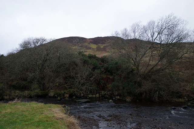 DSC02843
 by
Al, on Flickr
 DSC02844
 by
Al, on Flickr
 DSC02846
 by
Al, on Flickr
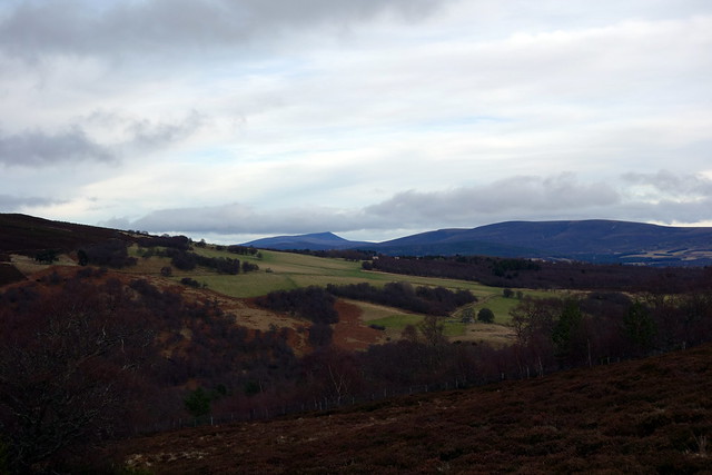
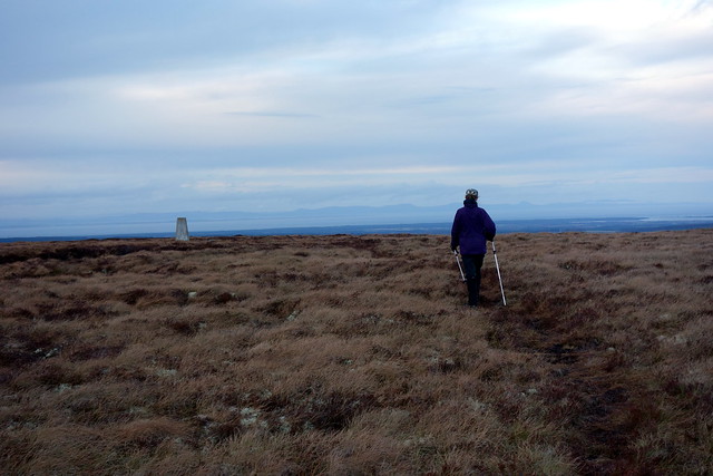
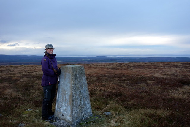
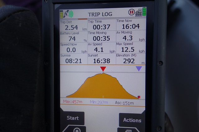
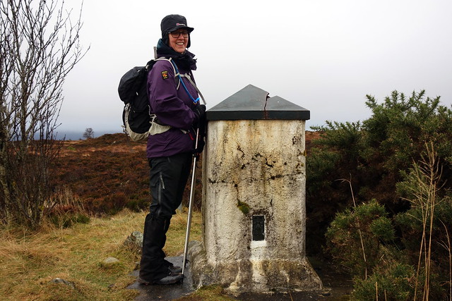
I'd booked 2 nights at Grantown on Spey Caravan Park and we were supposed to arrive before five. Plenty of time to get up Beinn Mhor, just immediately south of Grantown in Glen Beg. Another narrow road, with parking in a quarry space just before the end of the public road. A peculiar choice of name, Beinn Mhor, for a wee hill of 471m in this area, with the might of the Cairngorms just over the valley. Maybe whoever named it was being sarcastic

. Anyway, more good track past a farm building then into some woods. The path seteriorates to a vague ATV one heading up by some gross butts, heathery and a bit boggy, then onto better ground as the last 30m or so af ascent are reached. Views to Ben Rinnes to the North, the Cairngorms to the east. From the trig point we decided to take a walk over to the fort marked on the map. From here we rejoined the track and returned to the car.
Can you see a "big hill" here?
 DSC02847
 by
Al, on Flickr
Hmmm...
 DSC02848
 by
Al, on Flickr
North to Rinnes
 DSC02849
 by
Al, on Flickr
East to the 'Gorms
 DSC02850
 by
Al, on Flickr
 DSC02853
 by
Al, on Flickr
Fort
 DSC02855
 by
Al, on Flickr
 DSC02856
 by
Al, on Flickr
Along the road to the campsite, pitched in a spot we'd used before. Manicured grass, all very tidy. One of the three bedroom chalets is up for sale - offers over £180k

It's still quite early, around 3pm, so we've time to get another hill in. Knock of Braemoray is just a few miles along the A940. We parked in a layby at the southern end of the hillside and found a clear path up through the heather, right to the top - a pleasant surprsie given that we'd expected to be galumphing up through heather. Big skies over towards the Moray Firth. Back down the same way, just over half an hour.
 DSC02858
 by
Al, on Flickr
 DSC02859
 by
Al, on Flickr
 DSC02861
 by
Al, on Flickr
 DSC02862
 by
Al, on Flickr
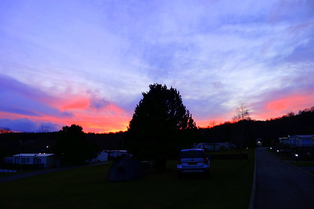
Warm at the campsite - 11 degrees. A rosy sunset, then intermittent drizzle. A quiet night.
 DSC02864
 by
Al, on Flickr
Forecast for Saturday was rain for Grantown, but dry in Elgin. We had three hills on the menu today - Brown Muir, Hill of the Wangie and Burgie Hill, all fairly short, but needing a bit of navigation around country lanes to get to them. I have to say that none of them seemed like hills - forestry generally kept the view of them obscured and the ascents were minimal. Brown Muir was first - I had a route in from Teindland. Parking was in the middle of a pig farm - unusual

Lots of free range piggies in the fields, more in their little shelters keeping out of the wind and threatened drizzle. Another good track - all the way to the transmitter mast at the top of the hill. Had a laugh at the brilliant warning sign for bees someone had painted. There's a geocache at the summit, not much else to comment on. Back the same way - rain had started and the fields were crammed with gulls.
 DSC02865
 by
Al, on Flickr
Brilliant sign
 DSC02866
 by
Al, on Flickr
Summit looms ahead
 DSC02867
 by
Al, on Flickr
 DSC02869
 by
Al, on Flickr
Gulls over pigs
 DSC02870
 by
Al, on Flickr
A little overgrown...
 DSC02873
 by
Al, on Flickr
We drove for quite a while to get to our next one, Hill of the Wangie, Allison taking me the long way round

Part of this involved driving into Elgin, which was quite a shock - Elgin seems to have grown substantially since I worked there briefly in the early 90s at the wonderfully named Bilbohall Hospital (treatment for hobbits only
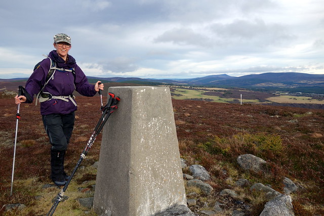
). For one thing it was really busy, for another there seemed no end to the new housing estates/industrial estates etc on the way in. Once we eventually found the B9010 and headed out into the countryside - past more fields of pigs. |As we neared our destination, we came across about 20 transit vans scattered round one opening into the forest - God knows what was going on there. Parking at the start of a forest track for us. There's a good track for most of this one, but near the summit one has to leave the track and clamber across a mixture of felled trees and new young trees, many of which were dead. We entered a stand of older trees, with branches all festooned on lichen, which altered the light as you walked through and gave off just a faint whiff of magic. On the other side of these trees the scene was like something out of the Somme - tree decimation. The trig point was just visible though, like the last man standing. We picked our way over to this, which was my 200th Sub, and apparently Allison's 150th, though I was surprised to find she was that many behind me - I suspect she has forgotten to log some. Back the same way.
 DSC02874
 by
Al, on Flickr
Lichen festooned trees
 DSC02875
 by
Al, on Flickr
Desolation
 DSC02876
 by
Al, on Flickr
 DSC02877
 by
Al, on Flickr
200 subs - so happy I'm eating my glove
 DSC02878
 by
Al, on Flickr
 DSC02881
 by
Al, on Flickr
A few miles away we parked at another forest track for our third non-event of the day - Burgie Hill. This pimple is all of 254m in height, and you start at 212m
That must be the smallest ascent to do any hill I have yet encountered. All on forest tracks, that lead you round in a spiral to another transmitter mast with a trig column tucked away behind it.
 DSC02882
 by
Al, on Flickr
 DSC02883
 by
Al, on Flickr
 DSC02884
 by
Al, on Flickr
Impressive graphic for an unimpressive hill
 DSC02886
 by
Al, on Flickr
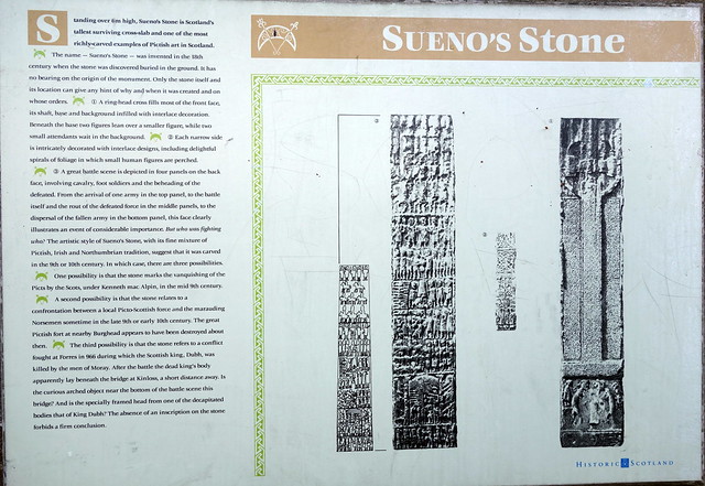
On the way back to the campsite we passed by Sueno's Stone in Forres - the tallest cross-slab in Scotland, living in its own controlled environment. Pretty impressive it was too.
 DSC02888
 by
Al, on Flickr
 DSC02889
 by
Al, on Flickr
 DSC02891
 by
Al, on Flickr
We called in at the Co-Op for some munchies then returned to the tent. The temperature had been dropping steadily as we drove back to Grantown, and I could feel ice forming on the tent before we went off for hot showers (this campsite has the best showers of any I have encountered - truly sumptuous

) A Thai green curry followed by rhubarb tart, then some hot cross buns. We sat outside drinking our tea and watching the stars. A clear sky - temperatures rapidly falling. And a cold night it was - breathless but chill. All the grass was white in the morning, the car registering -3.5 when we left, though I suspect it was well below that level in the midst of the night.
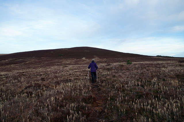
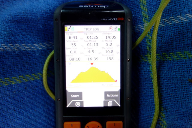
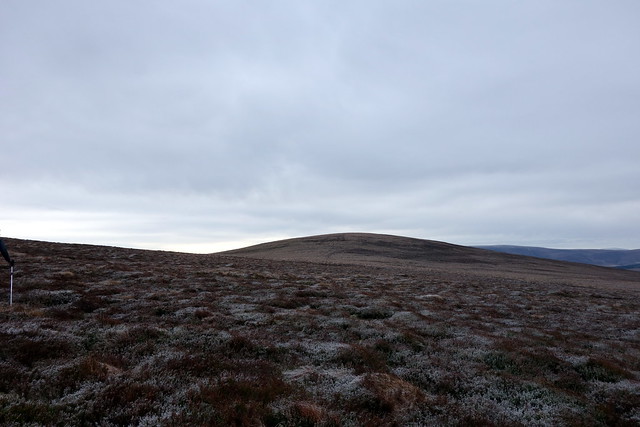
Our hill today was Carn na Loine,(probably the tufted cairn?) just a few miles from the campsite at Auchnagillen - more narrow farm roads to navigate. Plenty parking at the start, again a good bit of track to walk along, passing the cold-looking sheep. Quite interesting rocky terrain on the way to Sgor Gaoithe then we had to leave the track and struggle over heather and tussocks. The Cairngorms looked as if they'd seen some snow overnight. This was a much more satisfying hillwalk than the others had been this weekend - although we were just a few miles from Grantown, the land felt quite remote and again the skies were big. The summit of Carn na Loine was reached, then another kilometre of yomping through tussocks to reach the descent track. The Cairngorms had disappeared by this time under an approaching blanket of snow. We walked back to the car, first along the track, surprising a bunch of sheep with their heads stuck in a feed bin guzzling - when we passed they over-reacted and ran off as if satan and his minions were upon them - then onto the road for a bit to get back to where the car was parked. The sky had whitened over by this time and snow was starting to fall as we drove off - fat flakes flying at the windscreen as if someone had pressed the "hyperdrive" button on the Millenium Falcon. Fortunately there wasn't too much snow on the road down - the gritters had been out. But what a change from the balmy weather of Friday.
 DSC02895
 by
Al, on Flickr
Distant Cairngorms
 DSC02896
 by
Al, on Flickr
Carn na Loine from Sgor Gaoithe
 DSC02897
 by
Al, on Flickr
 DSC02898
 by
Al, on Flickr
 DSC02899
 by
Al, on Flickr
 DSC02901
 by
Al, on Flickr
