free to be able to rate and comment on reports (as well as access 1:25000 mapping).
After Allison's failure to be restored to health last weekend, I was dubious about going anywhere with her this weekend. She's been back to the doc and issued with another course of antibiotics, which seemed to have been the right ones this time, as she wasn't coughing her lungs up at every moment. We went out on Thursday and walked the Greenock Cut: her ability to complete that circuit without dying made me feel more comfortable about going away at the weekend. But they would need to be little wee hills, with tracks. A look at the map and the North East suggested itself - there were a cluster of 6 modest hills there - some very modest

We headed off on Friday morning with the aim of climbing Turin Hill and Hill of Garvock on the way up to Deeside Holiday Park. Turin Hill has been in my mind ever since Graeme D published his iconic account of open warfare with the "grumpy farmer" on his way to the top. That was back in 2012! At the time I had just started climbing Munros and wondered why on earth anyone would care enough to climb such a small and uninteresting hill anyway

How things change...
I was a little frustrated that we'd have the best day, weatherwise, for the last God knows how long to travel up the A90 and climb two poky wee hills, rather than do something more, um, worthwhile, but that's the way it goes at times. We had a detour into Forfar to try and find a toilet as Allison was desperate for a pee - half the town seemed to be closed off due to gas mains work and it took forever to try and get to where the toilets were meant to be.
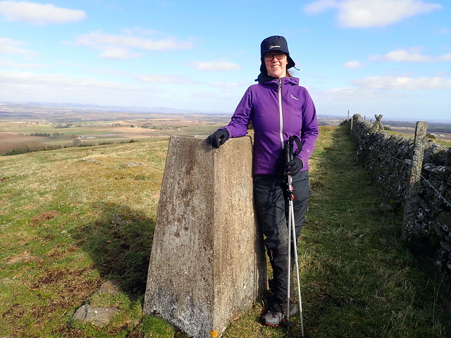
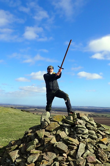
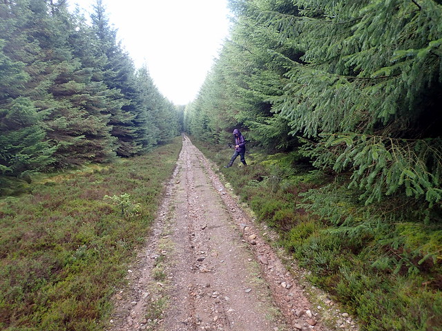
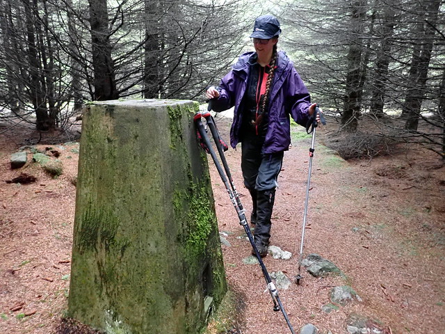
After that it was onto the B9134 to attempt the hill from the north - we were not going to risk aggravating the "grumpy farmer" by going through his land on the southern approach. There's a small layby at Carsegowrie Farm - we favoured a more direct approach than that using the track from Back of Turin Hill - and we set off along the field edge. First problem was to get over the wall and under the (electric) wire - actually it wasn't electrified today, but who knows when that will change. Then another obstacle course at the field corner, with a combo of barbed and electric wire to be negotiated. The sheep in the field we were about to walk into were watching us closely. We made it up to the tree line of March Wood and found ourselves on a muddy track, with a red warning board pointing out that live firing might be taking place. Is there no end to this hill's challenges? Up to the trig point without mishap, then we crossed over the wall to the cairn, where an old bit of fence or gate post was stuck in the stones at the top of the cairn - I had to do the old "if you can pull the sword from the stone" routine... We then paused for lunch in the sunshine beside the cairn, watching a very small helicopter, a bit like something from a James Bond film, flying on the "grumpy farmer's" side of the wall. I imagined, as it disappeared from sight below us, that it would suddenly rise up ahead of us with machine guns blaring and the farmer screaming "Get orf my land". But it didn't, which was a little anticlimactic. We wandered back down to the car unscathed.
 P3130453
 by
Al, on Flickr
 P3130454
 by
Al, on Flickr
 P3130455
 by
Al, on Flickr
 P3130457
 by
Al, on Flickr
 P3130459
 by
Al, on Flickr
Excalibur needs a bit of a clean...
 P3130460
 by
Al, on Flickr
Allison favours the more dignified pose
 P3130461
 by
Al, on Flickr
 P3130462
 by
Al, on Flickr
 P3130463
 by
Al, on Flickr
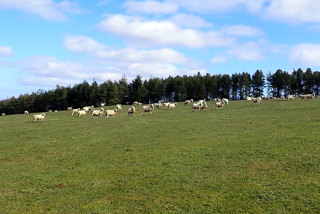
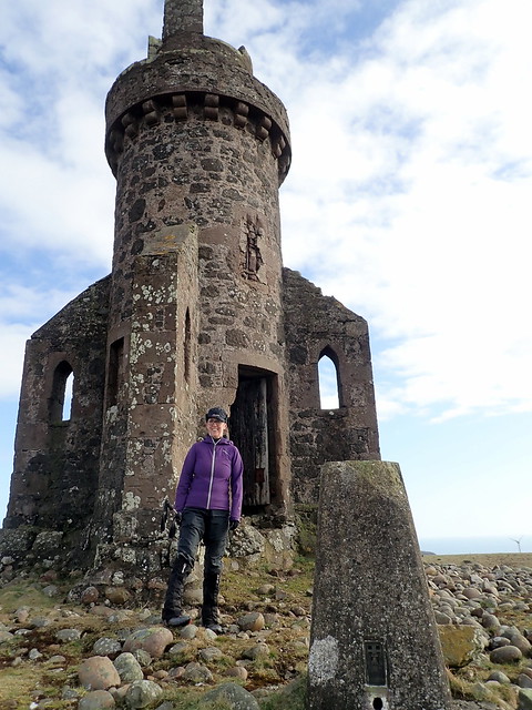
From there we drove along towards Laurencekirk, for Hill of Garvock. I was surprised to find, when we drove up to the viewpoint/car-park that we were already at 230m and the summit was only 277m. At the start of this walk there was a warning sign about "protective cows", but since we only encountered a few non-protective sheep, there was no reason for alarm. One walks along a grassy field for almost two kilometres, gaining height incredibly gradually until a strange squat tower comes into view. This marks the summit. The tower - a folly - apparently dates from 1845. It is possible to enter and climb to the top, meaning that for once, when there has been a structure on a hill beside and higher than the trig columnn - you can actually ascend it and be at the real highest point

I would advise caution, as three of the spiral stone steps near the top have broken off and require to be climbed past. It also gave me cause to ponder - as I was waiting for Allison to come down, standing on the other side of the broken steps - just how safe the remaining steps above actually are

 P3130465
 by
Al, on Flickr
 P3130466
 by
Al, on Flickr
 P3130468
 by
Al, on Flickr
 P3130470
 by
Al, on Flickr
 P3130472
 by
Al, on Flickr
 P3130473
 by
Al, on Flickr
 P3130474
 by
Al, on Flickr
After retracing our steps we motored along to Peterculter to Deeside Holiday Park. Very friendly, but not a great place to camp - it was one of those sites for caravans and motorhomes where the campers have a small green patch, surrounded on all sides by the dead eyed stare of motorhomes. But it did the necessary for a couple of nights for us. I swithered whether to try another short hill - it wasn't yet 4 o'clock, but Allison reminded me that she was meant to be recuperating. So we walked the couple of miles into 'Culter to get some things from the Coop, including some very satisfying Northern Bloc Peanut Chip icecream

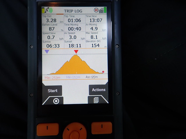
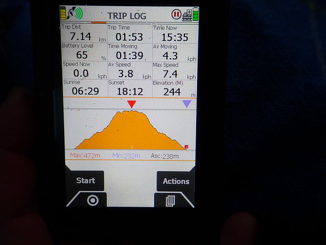
What would Saturday bring? The forecast had suggested showers, but we basically got a day of rain and clag. I'd left two of the longer walks for Saturday and we started by driving out past Banchory and setting out on Kerloch. We used the WH route for this one - 10k on track or footpath. We sat in the car at the parking place looking out at the wind and rain and grimacing somewhat - why couldn't it be sunny like yesterday? Well it wasn't. We could see no sign of the hill itself - just kept plodding along the forestry track. Still some snowy residue up here - and this is a bigger hill than we've been used to of late, over 500m. Woo! We missed the turn up to the summit and had to struggle through heather for a little way before reaching the cairn and trig column. Met some other walkers on their way up as we were descending back through the trees.
 P3140476
 by
Al, on Flickr
What new hazard would today on the hills bring?
 P3140477
 by
Al, on Flickr
 P3140478
 by
Al, on Flickr
 P3140479
 by
Al, on Flickr
 P3140481
 by
Al, on Flickr
 P3140482
 by
Al, on Flickr
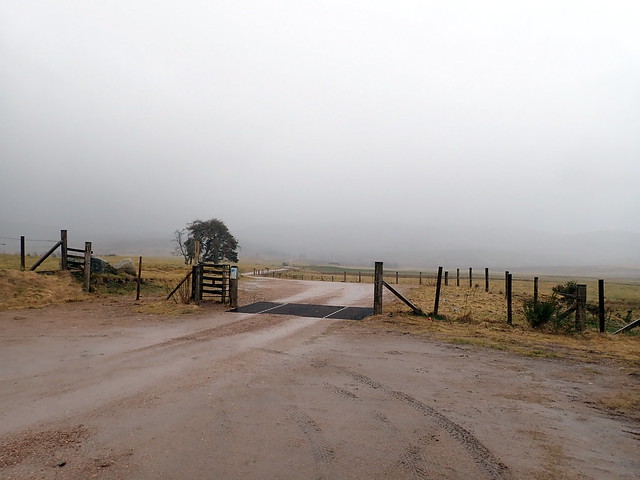
From here we headed north to tackle Hill of Fare. I decided against the WH route on this one as it's an indulgent 18.25km "an enjoyable walk with extensive views" - well not today. Instead we chose to go up from north of Torphins, reducing the walk distance by two thirds. Result!
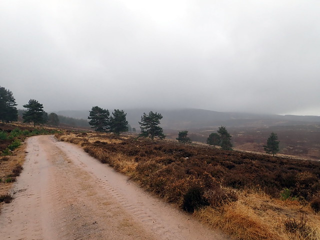
We parked by a large log pile where there's room for a couple of cars and set off along more forestry track, which deteriorates into extraction track for a bit before coming to a gate and joining a footpath. This meets with a footpath heading up the hillside - very reminiscent of the heather/red granite footpaths of the Cairngorms. There wasn't much to see due to the clag. I'd switched GPS maps to a 1:25000 Adventure Map, which is good for footpaths etc, but doesn't have OS info like contour heights etc. We reached the summit according to this map, with no summit feature to be seen - had to change back to my 1:50000 OS map card to find where the cairn was

. As before it was back the way we'd come and a journey back to the campsite.
 P3140483
 by
Al, on Flickr
 P3140485
 by
Al, on Flickr
 P3140486
 by
Al, on Flickr
 P3140487
 by
Al, on Flickr
 P3140488
 by
Al, on Flickr
Typically the weather improved once we were back at the tent. During the night there were many different birds conspiring to stop us sleeping - two flights of geese with creaking wing sounds, a screech owl, a wood pigeon perched immediately above the tent, and several others who's sounds I couldn't identify. We did see the evidence of a sparrowhawk having claimed a pigeon on the grass by a caravan beside us.
Sunday - we woke to sunshine at seven. There were two more hills to be done today in the region - Cairn Mon Earn, another forestry encumbered hill south of Crathes, and Strathfinella, nearer to Fettercairn. We drove through Crathes and gained a significant amount of height getting to Durris Forest, meaning that we had less than 200m ascent to climb Cairn Mon Earn. Parked by the forestry gate and started off uphill, an easy pace. Unusually for a commercial forest, the air was full of birdsong. We came to a barrier saying the path was closed for forestry work and that no unauthorized persons were allowed past. No-one was working (one of the advantages of it being early on a Sunday) and we passed by the rather half-hearted barrier, continuing our walk to the top. There are at least five transmitter masts on the top of this one.
 P3150489
 by
Al, on Flickr
 P3150490
 by
Al, on Flickr
 P3150491
 by
Al, on Flickr
 P3150492
 by
Al, on Flickr
 P3150493
 by
Al, on Flickr
Once back at the car it was a trip back to the B974 that we'd used for Kerloch the day before. Strathfinella hill is reached via a twisty up and down road with the Mount Battock massif on the western side - reminiscent of the drive from the Lecht to Braemar in places. We turned down into Strath Finella and drove a couple of miles along, following a tractor going to feed sheep at the base of our hill. we found a large-ish passing place to park in, leaving sufficient room for others to get by, and set off up the hillside, following a track initially, covered in sheep slurry (not a place to slip and fall
) then onto the hillside, following sheep tracks and aiming for the corner of the forestry, where there's a gate. Larks were spiralling upward, filling the air with song - spring must be nearly here. A bit of fumbling around amongst trees with no path til the track is reached, then easily - if muddily - to the summit. The trig column is nestled in the trees, a small cairn marking where it hides.
 P3150494
 by
Al, on Flickr
 P3150495
 by
Al, on Flickr
 P3150496
 by
Al, on Flickr
 P3150497
 by
Al, on Flickr
Swampy track to the trig column
 P3150498
 by
Al, on Flickr
 P3150499
 by
Al, on Flickr
Allison loves Marilyns
 P3150500
 by
Al, on Flickr
 P3150501
 by
Al, on Flickr
I took a more direct route on the descent, to avoid the sheep slurry and we were back at the car in an hour and three quarters, including a stop for lunch. What would we do now? There was still time for something short, despite the long drive down. I got it into my head to go and do Cairnpapple - I'd done it years ago as part of a Geography/History field trip when I was at school, but Allison needed it for her numbers. So we drove down the road, going over the Queensferry Crossing and enduring various back roads near Broxburn to arrive at the hill. This needed even less work than Hill of Garvock - we parked in a field at 299m and had the mighty job of gettting to the summit of 314m
Of course, I mistook the cairn on the viewpoint as being the summit and went there first. Then we noticed a stone circle in a field nearby, beside Knock farm and went to investigate. I had no recollection of any such circle being here and it wasn't on the map...must be a modern replica (indeed it was put up in 1998 as a 50th birthday present for the farmer). Then we went back to the car and headed to the trig point, passing a group of Landrovers on an off-roading day out. All very exciting. So we'd managed to accumulate a little more ascent than necessary, but still only 25 metres, less than Hill of Garvock. So I guess Cairnpapple must be the Marilyn with the least ascent required from where you can legitimately park your car. But please tell me if I'm wrong can there really be a Marilyn that needs less than 11m ascent

No, that isn't the top
 P3150502
 by
Al, on Flickr
No, that isn't a real stone circle
 P3150504
 by
Al, on Flickr
No, this isn't the top either - apparently it's a spot 5m away that's 5cm higher...

 P3150506
 by
Al, on Flickr
Landy day out
 P3150507
 by
Al, on Flickr
 P3150509
 by
Al, on Flickr
