free to be able to rate and comment on reports (as well as access 1:25000 mapping).
Since picking up the dreaded Coronavirus the week before lockdown, it had been a pretty rough journey for the past 3 months. Following the best part of a month in bed, fitness was down to nothing so it had been a frustrating and slow road back. Malky had been amazingly patient since I was able to get out and about, and we had managed to push both my distance and ascent on the bikes to a level where he suggested something stupid (and I suggested a way to make it even more stupid

)
It was a relatively easy cycle out of town and before we knew it we were at the bottom of the Crow Road. Never terribly steep, but a big ascent….however, the views were fabulous

 Malky stopping for a breather
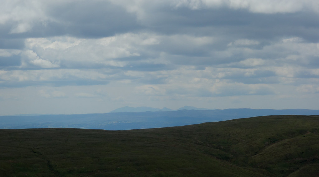
  Looking across to the Kilpatrick Hills
 Unfortunately I’d forgotten that this was only about half way
 A quick breather at the car park
 There were a LOT of people here, including a guy sitting in his car with a disposable BBQ

 Lots of folk heading up Cort ma Law
 We left the road just before the top of the hill and took a forestry track which went dramatically uphill straight away…of course
 Time for some off-roading
 To be fair, once the steep section was over the track was very reasonable, if a little tough on the backside

We lost all the height again before overtaking a family with a dog in a bike trailer
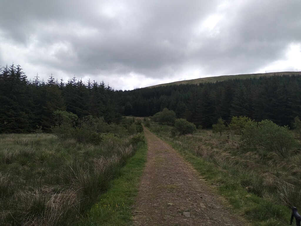
We took the right fork when the track split; this took us gently uphill for a short section before the track ended and we dumped the bikes.
We were on foot from here….headgear switched, and poles out – off we went. There was a fairly well-trodden route through a gap in the trees which was a bit damp underfoot but easily avoidable

 On foot
 As we escaped from the trees we could see our route ahead – the top of the firebreak was where we met the track and the “standard” route up Meikle Bin
 Ahead to the firebreak
 We climbed steeply down a grassy bank, made easier by the dry underfoot conditions and footmarks from many people before us
 The Bin Burn
 We easily crossed the Bin Burn (despite being very out of practise on river crossings
) and started up the fire break – this would probably be a swamp during wetter times, but there was nothing to worry about here and even a faint path to follow
 Heading up the fire break
 It was steep and tough going for poor unfit Jaxter
The views were already pretty awesome
 Holehead and the radar station
 As we popped out onto the track we could see the end of the reservoir
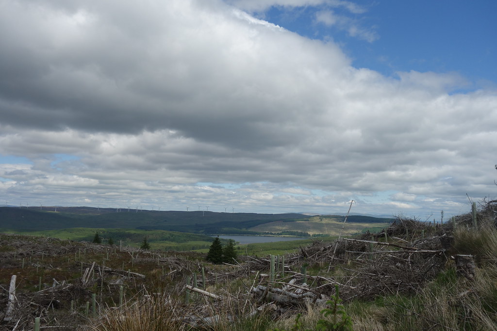 Carron Valley Reservoir
 This was also where we started to see people, although not as many as we’d thought! We started up the path to the summit of Meikle Bin – again it was good underfoot, but definitely steeper than I’d remembered!
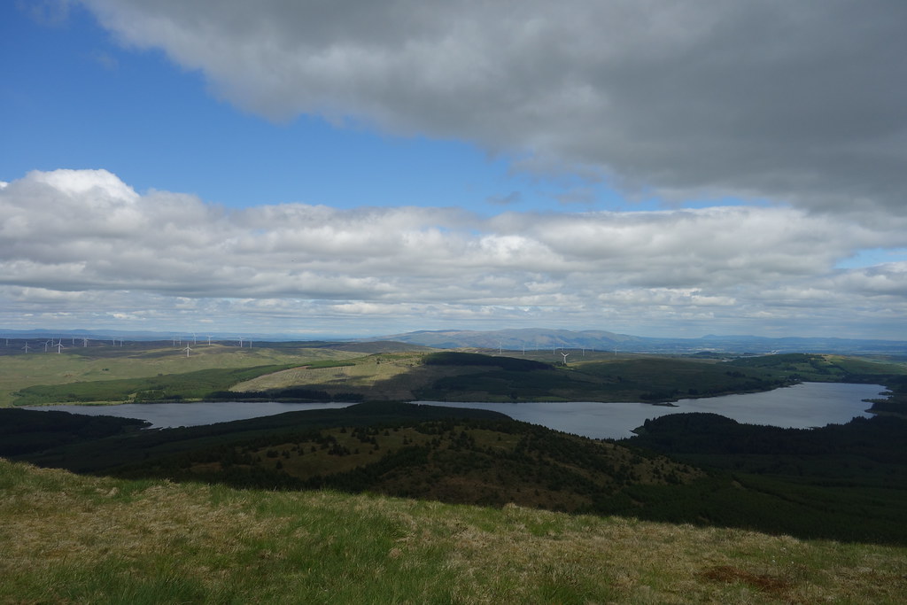 Carron Valley Reservoir
  Summit ahoy
  Lovely views to bigger hills
 And I’d made it!! (So had Malky, but then it’s not such a challenge for him
)
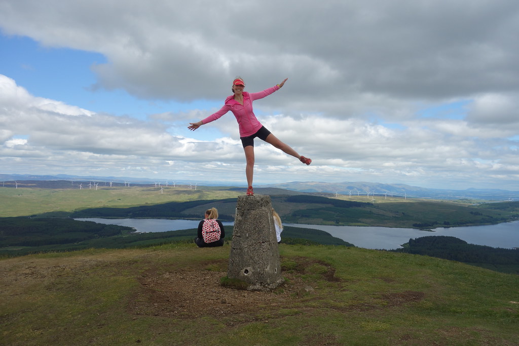 Jaxter on Meikle Bin!
 The
last occasion I’d been up here had been foul weather so it was nice to finally get those views that people go on about
 Some view
 We saw several mountain-bikers up here, one of whom recognised us from the forum
They seemed to be pushing up the steep side and heading off down the back.
Arran was visible (so was Ailsa Craig, but wasn’t picked up on my wee camera)
 Arran
Arran We had seat on some dry-ish grass and enjoyed a well-earned picnic, whilst admiring the seagulls
 Lots of seagulls
 After a while I realised my bum was getting damp so we headed off, passing an aircraft wreck that neither of us had noticed before. Since looking it up it appears to be wreckage of a fatal accident in January 1950, when a Fairey Firefly of the Royal Navy Fleet Air Arm crashed just below the summit in low cloud while en route to HMS Sanderling Naval Air Station. Both crewmen were killed on impact.
 Aircraft wreckage
 We carefully made our way down to the track – I was trying not to aggravate my knee-injury which had flared up again with all the inactivity

It was an easy walk back down to the Bin Burn, passing a man wearing a fabulous Batman t-shirt
 The Bin Burn
 Safely across the burn again, we climbed up the steep back, bashed through the trees and picked the bikes back up. The midges were starting to find us so we quickly got back on the bikes.
Back on track – downhill on average from here….
 Forest track
 We had decided to drop down to Waterhead on the track – giving us slightly more distance but probably easier ascent. Plus, everyone likes a circuit
 Pretty but spiky
 We found a couple of cattlegrids (my favourite
) and a locked gate – fortunately Malky was a gent and lifted the bikes over
and we were back on the road. Just a case of the long cycle home then….
 Looking back to Meikle Bin
 This was where my version of the stupid came in – I suggested going back via Strathblane – would only add on a couple of km and a wee hill, and would make more of a loop. Seemed like a good idea at the time….
It was an easy free-wheel back to Lennoxtown and we dropped onto the cycle path to Strathblane. The views back where wonderful
 Cort ma Law
 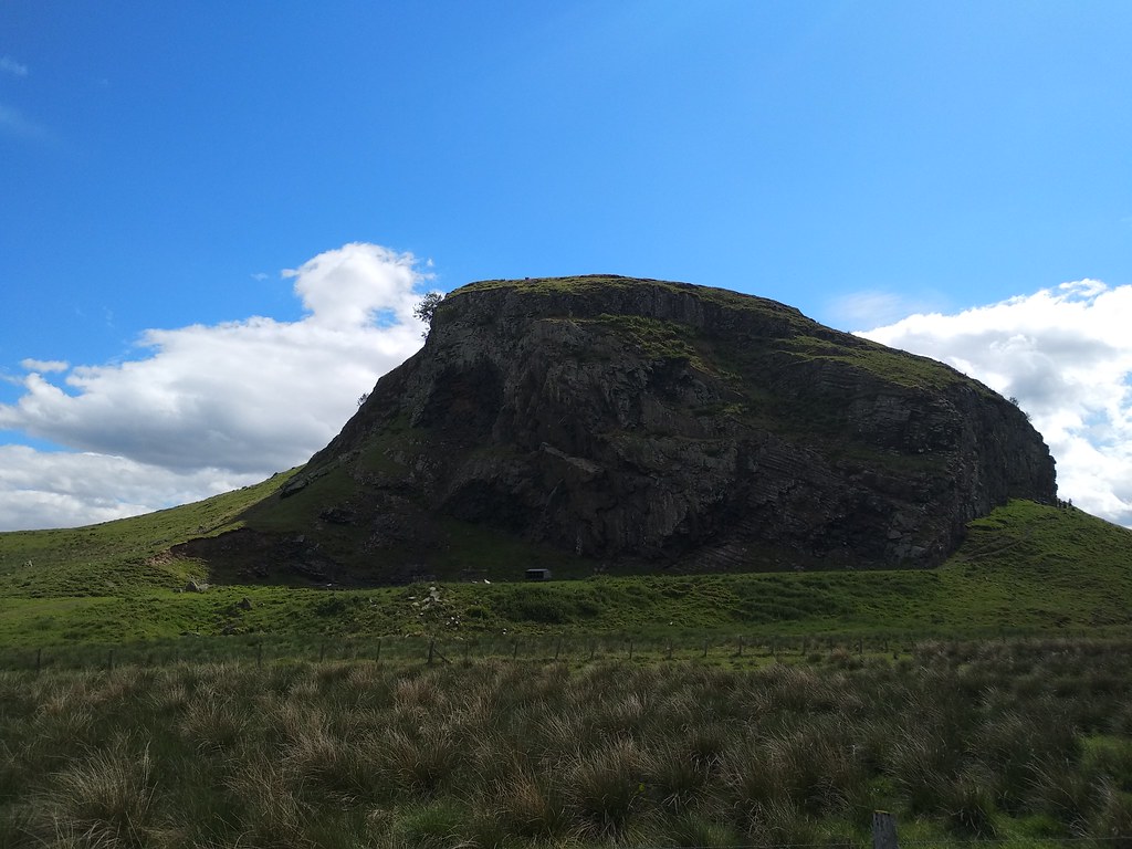 Cool basalt
 The hill out of Strathblane was pretty nasty, but luckily also short. We also passed the scene of where I’d fallen off my bike the last time I’d been here as I was admiring the views rather than watching the road
We stopped to admire the views this time
 Dumgoyne and Earl's Seat
 From here it was an easy roll into Milngavie (and an icecream stop – Unicones are back!!) before a very tired ride back to Glasgow. Just over 60km (with 770m ascent!) in all – a lot longer than I’d planned but so far no ill effects that a plate of take-away pancakes from our favourite “Stack and Still” and an early night couldn’t fix
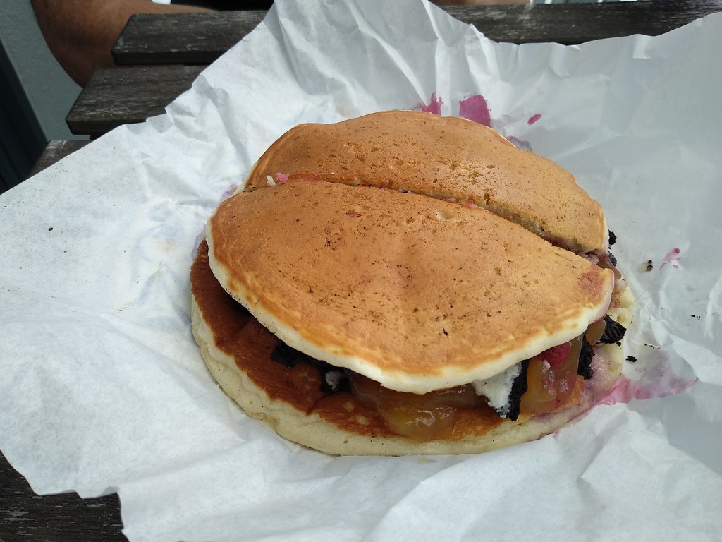 Well-earned pancakes
 **** you, corona-virus!!
