free to be able to rate and comment on reports (as well as access 1:25000 mapping).
Another weekend, another decision to make about where to go. I had narrowed it down to South of Oban, Morar and Campbeltown. Allison decided she'd opt for the latter, which surprised me a bit as I had expected her to favour hills in Ardgowar and Mallaig. But so be it - I was quite happy to continue our exploration of the Kintyre Peninsula. As neither of us had been further down that the ferry terminal to Islay it was new ground to us both, despite Campbeltown being less than 50 miles ATCF from Inverclyde.
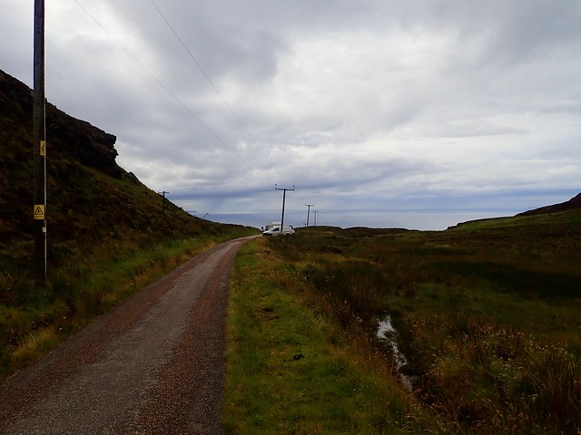
We headed off on Thursday late afternoon as the rain threatened. The forecast suggested that the night would be a wet one, at least til 9pm. So I rather dawdled up the road, stopping off in Inverary to have out tea. We sat in the rain drenched car park looking out over the sea and not particularly looking forward to our evening summit. However by the time we arrived at Tullochgorm to make a start on Cnoc nam Broighleag the rain was going off and the sky was lightening. We shoved the car just off the construction track by the houses at the start of the track and got our gear together.
The first km is on construction track, arriving at a dam / small quarry where there were numerous parked vehicles. I was all for setting off up the hillside across a horrendous bramble-filled patch when Allison noticed there was a road going the way we wanted

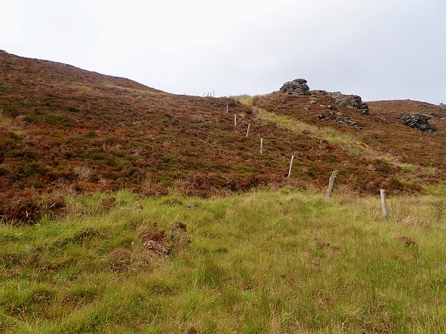
Which made matters much easier. Through a gate then onto a vague ATV track which ran along the south side of Creag Chaise, keeping an eye out for places to pitch. We spotted a perfect grassy shelf, level and flat - however it was sadly knee deep in cow ****. There was ongoing evidence of more bovine poop as we walked along - where were the creators of all this mess? And sure enough, down by Lochan Dubh there was a largish herd of cows with their protective- and large - bull. Allison not entirely happy with this development

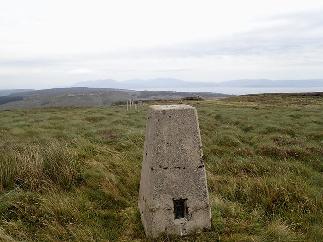
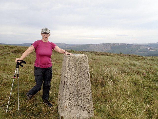
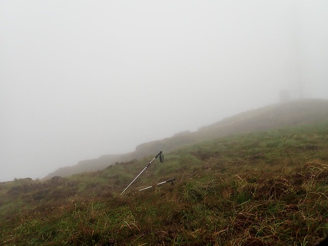
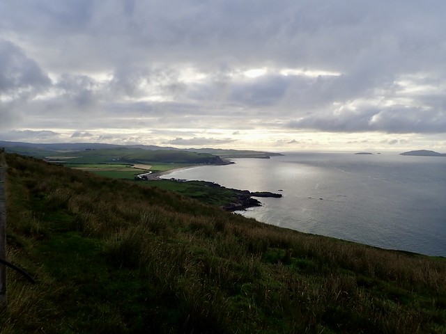
We skirted round the edge of these beasts heading up to higher ground as we neared the summit and spotting a couple of possible pitch spots. The summit trig column afforded good views across to the islands and would have been alright to camp upon had the wind not been as blustery. We retreated the way we'd come and found an acceptable place out of sight of the cows.
 36CC81C7-ADB9-46CB-AFB0-212DF6EDA906_1_201_a
 by
Al, on Flickr
 D2E3E9F7-A2C5-4B74-9026-FDDBDD3C658F_1_201_a
 by
Al, on Flickr
 A00E2CD1-CA2B-4800-A7E8-6096208BD6FA_1_201_a
 by
Al, on Flickr
Summit
 FFE8BF78-8C9B-4802-8566-DA4FD472742E_1_201_a
 by
Al, on Flickr
 736C1590-2643-4943-A5F7-747BD358B80C_1_201_a
 by
Al, on Flickr
 285D4C19-F9EF-4999-B46B-438DCB403B45_1_201_a
 by
Al, on Flickr
 78D6D6F0-FAF2-45B5-919B-57DD698BF4C0_1_201_a
 by
Al, on Flickr
 17A2CD3F-4839-49C9-8D81-98770C8E2FF7
 by
Al, on Flickr
After a night of showers we got started in dry weather and made it back to the car just as the works were making their way up to the site. A bit of driving down to Bellochantuay where we'd planned to drive up the Beinn an Tuirc wind farm road, as in M3Doc's report for the hill, adding on the nearby Sgreadan Hill for good measure. However there's a new phase of wind farm works going on and access up this road is barred - a man with a clipboard came out to see me at a barrier just up the track and was having none of it when I suggested we could drive up to climb a hill. A little thrown, I pondered what we could do. Having no paper map for this area didn't help...I recalled that I'd drawn an alternate route for Sgreadan Hill from the south, starting at the southern end of Lussa Loch - presumably I could add Beinn an Tuirc onto that route...but how much that would add I wasn't sure - maybe 10-12km
We continued on almost to Campbeltown itself, taking a small road north to Gobagrennan (love the names down here, by the way) and parked at a forest walk spot. As it happened, we could have driven along the west side of Lussa Loch for another 2.5km to a locked forestry gate, saving 5k on the walk, but we'll know that for next time
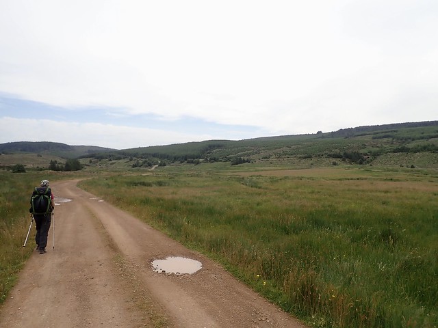
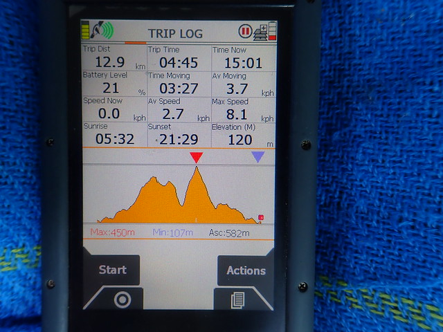
It was around noon when we set off - because of uncertainty how long it would take I decided we'd need to take the big packs around with us and camp out on the route (actually as it's mostly on track we could have done the 30km with day packs and got back to the car before nightfall)
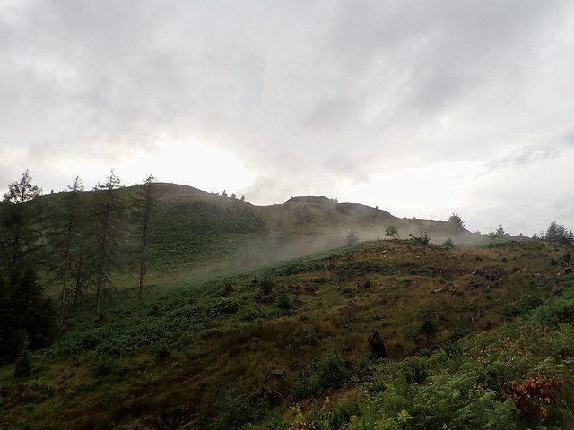
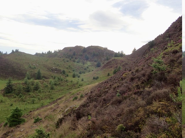
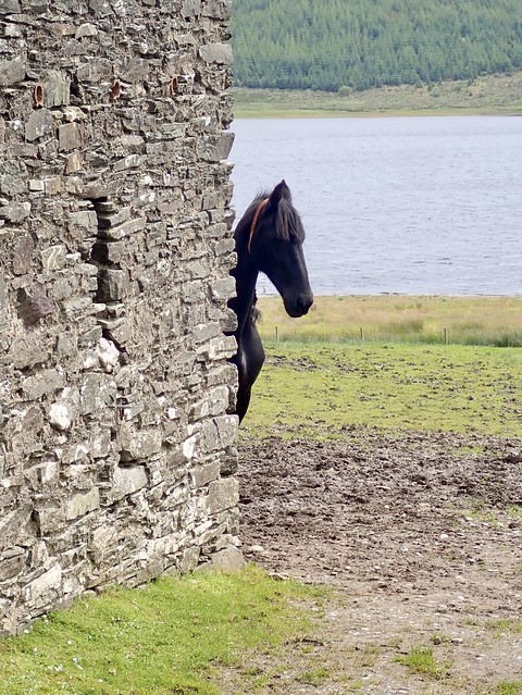
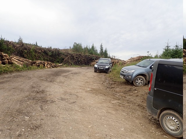
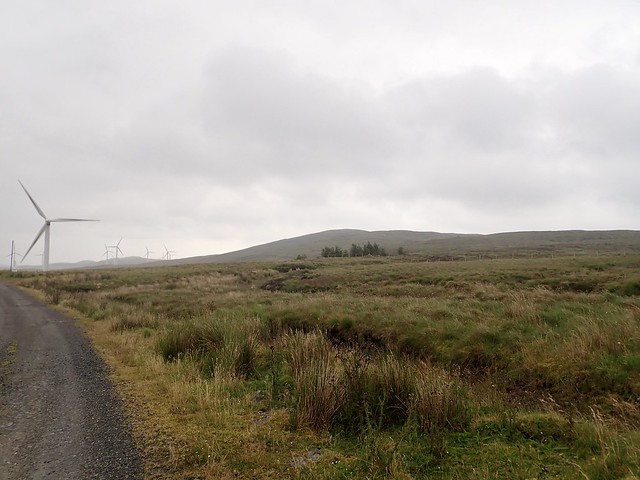
We could see Sgreadan Hill across the loch as we wandered along - this being part of the Kintyre Way. Some houses about 2km in, including one that had a horse with a coiffed mane that peered around the stable wall at us as we went past. At the north end of the loch the path splits, the Kintyre Way weirdly going east and west. We turned east, past Bird a'Dubh, where there are some nice places to camp. Lots of traffic on the wind farm tracks - all kinds of machinery and vans going up and down. After a bit we headed up into forestry, where there are active works going on at present. There's a doubling back of the track, which is where the work's going on. We followed a stream up the hillside, making use of deer tracks to get to the open hillside. A bit of spongy-tussock traversing to reach the summit where there were nice views to Arran. Backtracked the way we'd come to the construction track and made our way alongside the Strathduie Water. Vans and tractors passed us, none offering us a lift sadly, though in these days of Covid maybe that's no surprise. The clouds were coming in again as we neared the top of the track and a heavy, prolonged shower had us soaked as we got to the summit.
Sgreadan Hill across Lussa Loch
 29DE378B-E2D7-43CB-8EE0-C841821B3779_1_201_a
 by
Al, on Flickr
Hiding horse
 13B460E6-9832-4C61-A6DA-9645F3142A52_1_201_a
 by
Al, on Flickr
Track past Bord a'Dubh
 49F373AC-EC54-469F-8A34-0D5E2185AF41_1_201_a
 by
Al, on Flickr
Forestry work at the U-bend
 F737495D-4D29-41E0-8821-E78D08EFF38B_1_201_a
 by
Al, on Flickr
Sgreadan Hill
 9010DC71-21DD-4DEA-8BC9-9C6CDD2572D8_1_201_a
 by
Al, on Flickr
 72BC9E62-A77D-42AE-BD28-1B4EF3F08F64_1_201_a
 by
Al, on Flickr
View to Beinn a'Tuirc
 3B9C625D-1CE2-4353-B2A2-73C501F4F286_1_201_a
 by
Al, on Flickr
Nearing Beinn a'Tuirc
 B51567C0-4643-4911-894D-7A770D2A74FE_1_201_a
 by
Al, on Flickr
 57D5E9F2-7A12-4155-8FB2-1CB1D6F27591_1_201_a
 by
Al, on Flickr
 C9DF37F7-5C08-45C5-9AEA-C8735248BF2E_1_201_a
 by
Al, on Flickr
 AEFD47C2-6F08-4116-BD3C-39F8FD973AFE_1_201_a
 by
Al, on Flickr
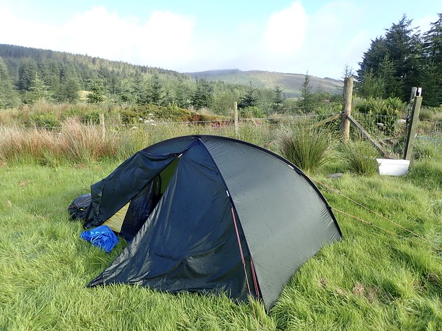
Allison was feeling the effects of the big pack by now, however, there wasn't really any place to camp up in the wind farm: we'd spotted a couple of flat fields by a disused farm building near the beginning of the wind farm track that we made for - almost all down hill on good surface, so that helped. Midges welcomed us as we set up the tent, which provided the usual challenges for cooking. Then the wind got up and the rain came on, heavily for much of the night.
 133D003F-0F32-411E-A70E-76568394E57A_1_201_a
 by
Al, on Flickr
 1312C131-A263-46AD-B987-1DDA2CD5689D_1_201_a
 by
Al, on Flickr
In the morning we walked out the last 5k to the car and headed for Machrihanish where we would take on the challenge of The Slate and its neighbour Cnoc May. I had been looking through Hill-bagging for routes for The Slate and most reports condemned it as unpleasant - eg "contender for worst Marilyn of the year". We drove along another narrow, potholed road to a parking area at Ballygrogan, parked beside the one other car that was there, and prepared for the worst.
We took the Kintyre Way initially, finding a "visitors book" in a rusty iron box beside a bridge, then followed a vague ATV track over heather and tussocks up towards the tree line on The Slate. There's a "V" where two fence lines meet and from here we waded into the trees, following a sort of fire break used by deer that quickly brought us out into the open and it was then take your pick which of the peat hags was the highest one - we visited the most likely candidates then stopped for lunch, pleased that the hill had been easier than we imagined.
 E0278E86-F2B5-4948-9F06-C8B98EADA69C_1_201_a
 by
Al, on Flickr
 7771C3FC-BC14-41C0-9546-B6C513E7B294_1_201_a
 by
Al, on Flickr
Kintyre Way
 54F3CEEC-A073-4E14-9754-0CADA801B323_1_201_a
 by
Al, on Flickr
Box for the "visitors book"
 C00C56B0-E9F0-430F-9C61-08733A5A609A_1_201_a
 by
Al, on Flickr
Heading for The Slate
 0A85EB8B-9D8A-4F49-BAE6-49F82A4823B4_1_201_a
 by
Al, on Flickr
 0AA85448-CA52-4A9E-BBBA-E500AEEB9D68_1_201_a
 by
Al, on Flickr
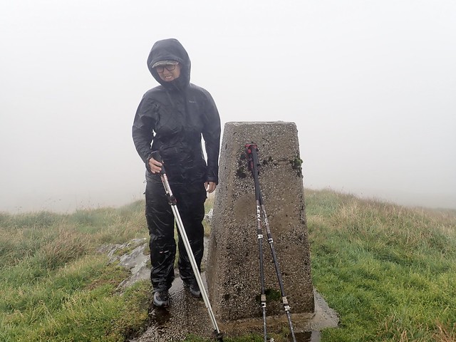
Summit - somewhere!
 9EA54366-A71B-4983-9411-A8C7E0F16AC2_1_201_a
 by
Al, on Flickr
Looking to Cnoc Moy
 B63413BB-DE5A-47DD-B83E-F5B8797422A7_1_201_a
 by
Al, on Flickr
From here we took the western fence line and followed this over Creag nan Cuilean, surprising a few deer, one of which "boinged" way on spring loaded legs across the tussocks - most amusing. I spotted people - people! On a remote hill on the Mull of Kintyre! Well we met up with Colin and Isobel, both on their 1131st Marilyn, if I remember correctly, and both also Full House completionists. We chatted for a while - it's rather nice to meet folk on obscure Marilyns as you know they must share some of the same kind of crazy as yourself (NB some have way more crazy than I ever hope to have, but not Colin and Isobel). It's something I used to feel when meeting people on obscure Grahams. They were doing the circuit in reverse order from us and we shared our tips of getting to the top. As we continued towards Cnoc Moy we saw another bagger having come from there and heading up The Slate. Given that there are no logged ascents for this hill on Hill-bagging since April 19, five folk in one day is a bit weird
Passing across the valley between The Slate and Cnoc Moy we found a strange wooden building with a hammer and old rusty machete embedded. Allison noticed an adder skin, and as I came across to take a picture of it, I almost trod on the owner of the recently discarded wrapper, who slithered away into the heather, definitively answering the question I'd posed on the drive down "are there snakes in Kintyre?". It's a steep haul of some 250m up Cnoc Moy but the going was reasonably easy and the summit had rewarding views to Arran, Ailsa Craig and back to Machrahannish. We walked down the northeast shoulder of the hill, re-connecting with the Kintyre Way and meeting a couple of young lads setting off to do The Way.
Cnoc Moy
 3D696E2D-2C9E-404C-BEED-17120F460A1F
 by
Al, on Flickr
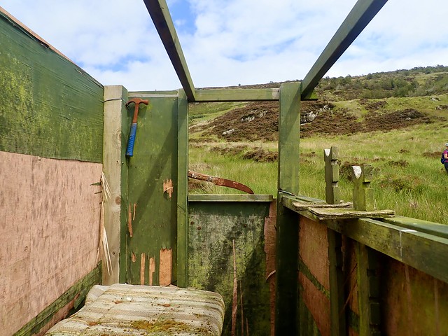
Interesting structure - if you are a serial killer...
 3F28FD0A-9C2B-49E9-9298-A92FEA05340D_1_201_a
 by
Al, on Flickr
New shed skin
 DA2090D0-2A7D-400E-BA8E-AB29177DAA79_1_201_a
 by
Al, on Flickr
Towards Ireland
 FC9291AC-2C2E-4E2D-A272-94014C7D36AB_1_201_a
 by
Al, on Flickr
The Slate, Machrihanish beyond
 762051D0-4632-479F-AD8B-C4DE2F5E2708_1_201_a
 by
Al, on Flickr
Cnoc Moy
 45D23F18-714E-4A55-B7E5-983BBE146C30_1_201_a
 by
Al, on Flickr
 3C292AC6-5066-4C85-97AD-FFD8FFCA46E2_1_201_a
 by
Al, on Flickr
 2E8185FD-0B41-4FE9-9254-D27A35526D65
 by
Al, on Flickr
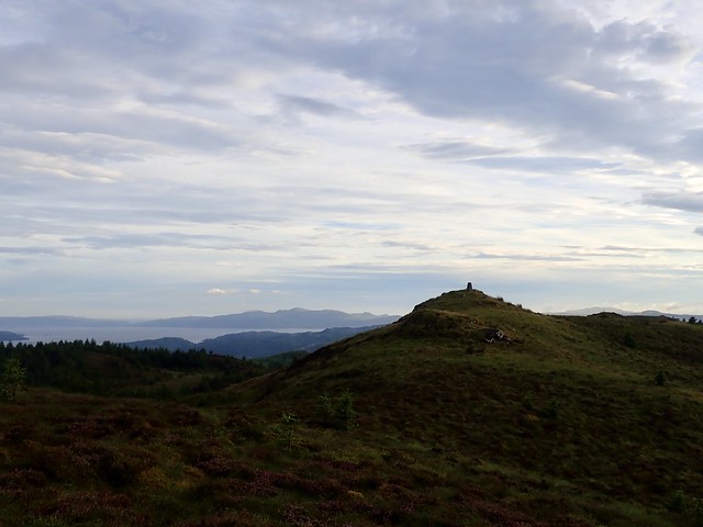
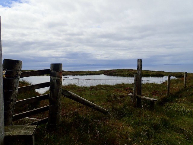
Back at the car it was still quite early and it seemed worthwhile taking a drive down to the Mull of Kintyre where we had our penultimate hill, Beinn na Lice awaiting us. It was very short and I reckoned we could either find a place down there to camp or return and pitch somewhere in the dunes at Machrihanish. We took the B842 south, turning west onto unclassified road signed for the MoK. Seven miles of twisty, narrow road with few passing places. Not great on a busy day, I'm sure. There's a parking spot at the end of the public road which will take maybe 8 cars. As we drove towards it we spotted the bagger we'd seen on The Slate heading along the road, having just been up Beinn na Lice. As we set off from the car, an ancient motor home we'd passed on the road in drove up to the parking spot, couldn't get parked, turned and drove back away down the road again.
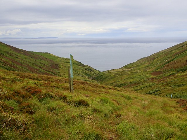
We set off following a fence line steeply up over heather and grass, then boggy tussocks before spotting the trig pillar and cairn on the skyline. Less than 80m ascent, around 1.5k in distance - a good way of ending the day. We were less than 15 miles from Ireland from here, Rathlin Island being closest to us.
End of the road
 3D0FB7C4-B7CF-4152-B2F7-9A107C6101D8_1_201_a
 by
Al, on Flickr
 01585D65-AEA1-41EF-B634-4D78489FF4A6_1_201_a
 by
Al, on Flickr
Beinn na Lice
 F259CA03-0BEB-4FB3-A263-9BFD3D65EC29_1_201_a
 by
Al, on Flickr
 89AC3116-FD3C-46A1-AFA1-BBDA13239912_1_201_a
 by
Al, on Flickr
Rathlin Island & Ireland
 1499C764-7E79-433A-8F89-09F168B2770A_1_201_a
 by
Al, on Flickr
 B88FBE0C-2A99-4F11-93FE-5D9A98DD8BE6
 by
Al, on Flickr
There's a sign at the parking area expressly forbidding camping/campervans/sleeping in your car or overnight parking, so we didn't want to risk staying there - instead we drove about 100 metres along the road to the start of a track going up to the mast on Torr More, parked in behind the fence and scouted around up there to see if we could find a spot to camp. After a bit we did get somewhere acceptable, if slightly sloping, and hauled the gear up. As soon as we started to pitch the wind died completely and several million midges emerged from their grassy lairs to torment us. At 350m, on a headland, not a breath of wind? who would have thought it...Another challenging evening meal to prepare, me not being able to taste it to see if it was hot enough because of having my midge net on...I beat a hasty retreat into the tent with the chick pea/tofu curry just as the rain came on.
 69DF88A3-DFBB-4864-96A3-630E6A288438_1_201_a
 by
Al, on Flickr
Another showery night, we were sadly deprived of a glorious sunset. The morning was windy and we were subsumed within that famous "mist rolling in from the sea..." to the point where we could barely see the mast just above us. We headed off early, breaking through the Clag as we dropped height along the road and having a pleasant drive on the back road to Campbeltown- also narrow and bereft of many passing places - without meeting another vehicle. We did pass the lads we'd seen walking the Way the day before, breaking camp at Southend.
Morning View...
 D150962A-9188-44E9-B296-3ED2C6256FF1_1_201_a
 by
Al, on Flickr
Our final hill on this mission was Beinn Ghuilean, just to the south of Campbeltown. There's debate on Hill-bagging as to whether the unmarked 354m summit or the Trig pillar is the higher point - I decided the trig would therefore suffice and had planned my route accordingly from Glenramskill Farm. There's a parking area just across from the tidal Island Davaar. After having been dry during our drive the weather was now looking ominous and rain started falling as we left the car.
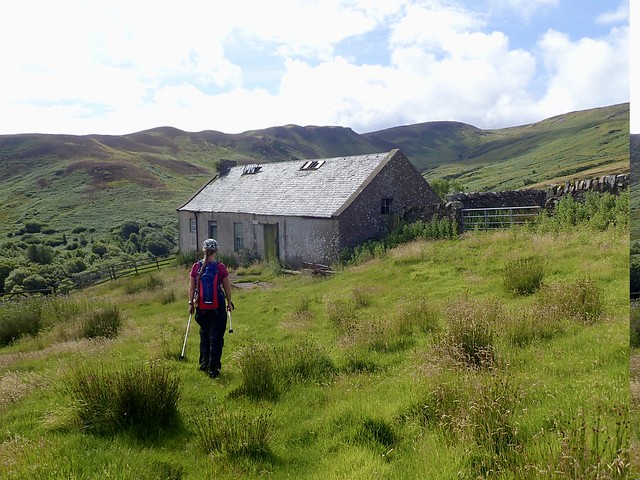
We walked past the MoD Oil Depot for the warships and found a narrow disused lane full of nettles that goes in behind some houses and onto the farmland. A faint farm track, mostly grass, leads up the hillside to the ruined cottage of High Glenramskill and ever more sketchily beyond. The rain stopped, some blue sky appeared. After a while we left this and just ploughed our way up the hillside towards the trig column. We paused and had a "second breakfast" at the top. Every time we looked back the sea had swelled a little more of the causeway to Island Davaar until it was a proper island...bit of a pity, as it looked quite interesting to go over and climb to the lighthouse on the top (it's also a HuMP and a SIB). Anyway, we couldn't, unless we waited for the tide to go out again, so instead headed to Campbeltown for a nosey.
 0DAC7D73-ADF1-4183-9953-4FD337516723_1_201_a
 by
Al, on Flickr
Island Davaar
 E0C15F99-7AD4-49E1-8B6C-FD4E46D01B6F_1_201_a
 by
Al, on Flickr
 0E60DFA0-3EA8-42D2-B26C-8A7BFE07CFEE_1_201_a
 by
Al, on Flickr
MoD Oil Terminal
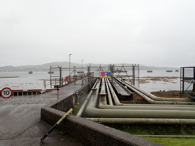 DE522DDD-02AF-4791-A854-8EF5F793E4AE_1_201_a
 by
Al, on Flickr
Beinn Ghuilean behind the house
 4ADB817B-BD58-4D65-B19E-83236044D7E6_1_201_a
 by
Al, on Flickr
Causeway still visible
 783DC4DA-F2A3-4645-804A-39E5C7662153_1_201_a
 by
Al, on Flickr
 1ACD3034-ADE2-4E6C-8BAA-574B3222DAE0_1_201_a
 by
Al, on Flickr
Beginning to disappear...
 D6E48F51-9719-41B0-93EA-4E1345299582_1_201_a
 by
Al, on Flickr
Beinn Ghuilean
 5FBA1118-0C7D-4E77-8CC1-C937964AC369_1_201_a
 by
Al, on Flickr
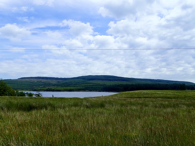
An island once again...incidentally, this is Campbeltown Loch and if it was whisky I doubt anyone would be drinking it dry...
 67E8DBDB-37F5-41DD-B9D4-6E4BCDB9F8E5_1_201_a
 by
Al, on Flickr
 6E3E7C9E-3AA4-4189-91A2-0C6D7E6D192F_1_201_a
 by
Al, on Flickr
 096E1F29-4BAA-4AA9-9762-F4CF98407F70
 by
Al, on Flickr
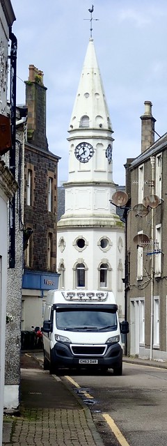
There are some pretty, old buildings around, a lot of closed-down businesses and a fair amount of re-development work going on. A large ship sat at the harbour laden with blades for off-shore wind turbines. The Co-Op had an extremely poor selection of food (maybe the delivery way yet to arrive) and not even a bottle of any of the local malts (the distilleries were shut, it being Sunday). The area looks to have been devastated by Covid in terms of closed shops and the like. Sad.
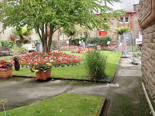
Then it was time for the drive back home again, the roads not too busy. Passed a lovely wildflower garden just north of Campbeltown, would have enjoyed a closer look at that.
 CBD658B0-C9F3-4AEA-A9F0-C392DFE3D35E_1_201_a
 by
Al, on Flickr
 C650798A-D3A4-4EE2-9C45-83FB9B8BD097_1_201_a
 by
Al, on Flickr
Linda McCartney memorial garden
 22256683-503D-4981-A2A9-DE3045B8CBD6_1_201_a
 by
Al, on Flickr
