walkhighlands

Share your personal walking route experiences in Scotland, and comment on other peoples' reports.
Warning Please note that hillwalking when there is snow lying requires an ice-axe, crampons and the knowledge, experience and skill to use them correctly. Summer routes may not be viable or appropriate in winter. See winter information on our skills and safety pages for more information.

Paddling to Sgorr Tuath (Coigach)

Paddling to Sgorr Tuath (Coigach)


Postby Ch55 » Sun Jul 01, 2018 11:36 am

Date walked: 30/06/2018

Time taken: 3.3 hours

Distance: 5 km

Ascent: 540m

10 people think this report is great.
Register or Login
free to be able to rate and comment on reports (as well as access 1:25000 mapping).

Image

The rosy picture above was taken one evening about 6 years ago along the road below Stac.
We’ve driven past the elongated pyramid countless times on the way on and off the Coigach peninsula and paddled below it a few times, too. Now, having climbed just about all the main hills in the area, I decided it was time to knock it off. Sgorr Tuath is the name, I’ve lately learned.


Image

Another motivation was a curious twisted sandstone pillar located somewhere near the summit.
Could make a nice picture and for some reason it reminded me of similarly rosy Aniseed Twist sweeties from the 1960s.


Image

The weren’t particularly my favourite, but some regressive synapse must have made the connection.
I think Old English Spangles may have been my gateway drug.

Image

Here it is from the Fiddler: the dark band peeping behind Beinn an Eoin of which it seems to be classified as a subsidiary peak. The 50k OS map sort of suggests this which makes sense as ‘Tuath’ means north peak and there’s a Sgorr Deas (‘south’) on the other side of the 430-m saddle and unnamed lochan.

Considering Tuath is less than 2km from the road (OK, and over the loch) it’s surprising how few reports there are here on WH, presumably because it falls 68’ short of the magic number and a metre short of another category.
Rohan 2015: https://www.walkhighlands.co.uk/Forum/viewtopic.php?f=9&t=56908
BlackPanther in April: https://www.walkhighlands.co.uk/Forum/viewtopic.php?f=9&t=80178
(great photos)
From the south, even dodging BM-Coigach it would be quite a roller-coaster slog.
It seems the usual way is in from the east end of Loch Lurgainn over the bogs around Lochanan Dubh.
How lovely.


Image

Wading the narrow outlet at the west end of Lurgainn could be another option. I’ve been there and even with the current dry spell (the driest in many years) the Loch is only a few inches down. You’d want a solid staff to get across. If it was me I'd soon pre-emptively fall in and swim it.


Image

But with a boat it’s just a 10-minute paddle from the sandy beaches south of the Stac car park over the narrowest part of Loch Lurgainn to another sandy bay. From there the 500-metre climb via the west ridge added up to less than 2.5km.


Image

Of course no one said the short climb wouldn’t be a steep, pathless, ankle-twisting, shin-scratching slog; the Mrs foresaw all this and decided to read the paper then admire the pipers at Achiltibuie's Coigach Gathering instead.
Me, I was in need of a good work-out.


Image

Nearing the beach below Sgorr. Little did I know what hell awaited me there.
Last edited by Ch55 on Wed Jul 04, 2018 3:49 pm, edited 2 times in total.
Ch55
 
Posts: 26
Joined: Oct 24, 2013

Re: Paddling to Sgorr Tuath (Coigach)

Postby Ch55 » Sun Jul 01, 2018 4:41 pm

Image
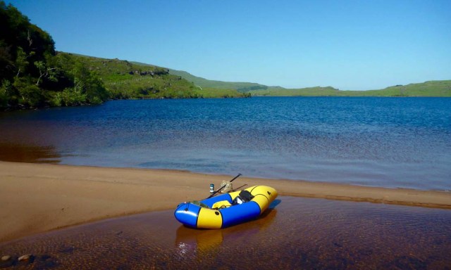
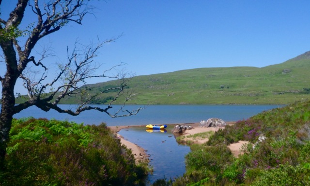
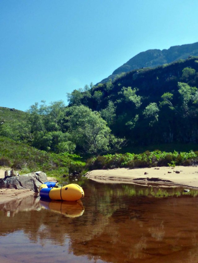
I could have rolled the boat up and shoved it under a bush but figured I’d appreciate it ready to go once I got back pooped. How right I was because what you can’t see is the growing onslaught of rabid clegs, or horseflies (deer flies?) to you and me. Heck it’s even on the forum:
https://www.walkhighlands.co.uk/Forum/viewtopic.php?f=1&t=82205
and on the BBC:
https://www.bbc.co.uk/news/uk-scotland-highlands-islands-44695515

Hot dry weather I suppose. One way to annoy midges.
Today’s it set to be 25°C - the hottest day up here this year (and probably all year).


Image
If you’re a paddler you’ll know it’s always a bit unnerving to leave your boat unattended.
Around this point I also got paranoid I’d not let enough air out of it to compensate for expansion as it heated up through the day (a lesson I learned in Colorado one time...). That’s why I left it floating in the cooling pool. A good packraft can actually take much more over-pressure than you can ever blow into it.
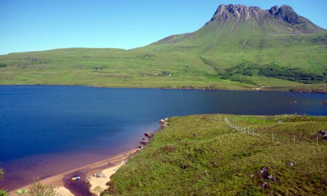
Meanwhile, over on Stac the weekend queues are building up.


Image
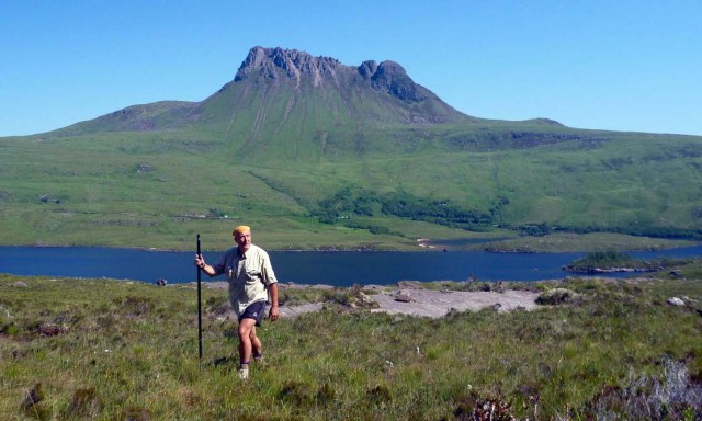
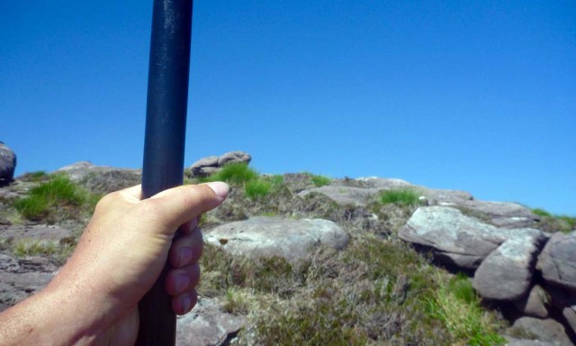
I’m recently over a dodgy knee but anticipated this rugged and steep walk would still benefit from my packstaff – the 4-piece paddle converted into a staff with a 'nib' at one end and a comfy canoe handle on the other. I've never got on with those telescoping walking poles. Good for probing or vaulting bogs too, but today the ground is crunching rather than squelching.

Image
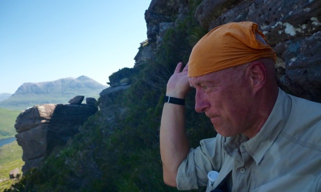
First time walking up here I find myself erring towards the shade of the crags.
I’m getting some cardio all right and sit down for a breather, swishing away at the noisome clegs.
Unlike midges, at least you get the tactile satisfaction of thwacking the odd tormentor, but I got many, many more bites than kills.

McMole titled his post: Confused in Coigach and you can see why.
https://www.walkhighlands.co.uk/Forum/viewtopic.php?f=9&t=65449
According to current OS 50k map (and subsequent online imitations) this should all be a deathly cool plantation of conifers while his early Landranger showed it bare as it is now bar the odd stunted wild tree clamped to the lee of a crag. The 25k map is correct.
Unless they were exceedingly fast-growing trees harvested exceedingly tidily, it doesn’t look like that ever happened.


Image
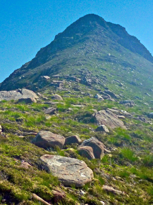
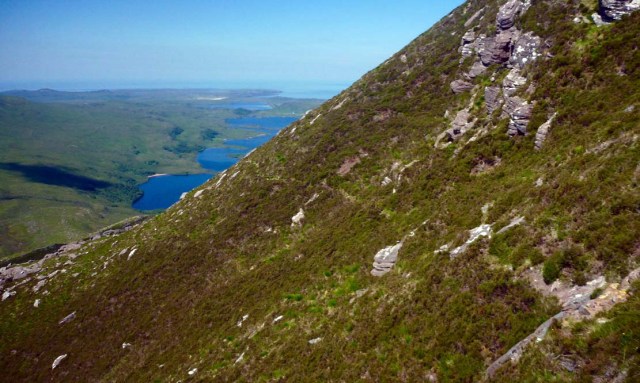
An hour from the shore I’m finally on the west ridge – like Nuptse but more flies.
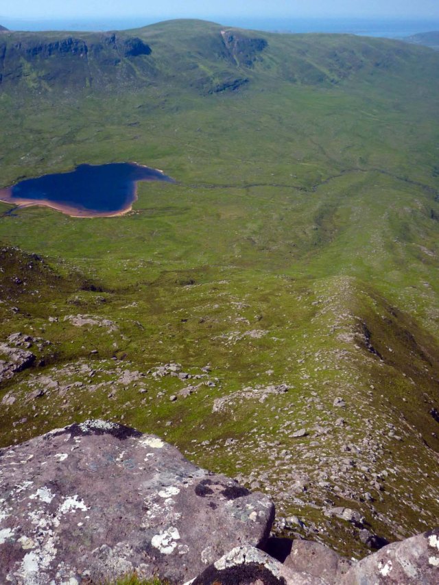
I'm pleased to see all that effort has put me just about level with the saddle by the lochan where two deer are dashing away.
For a moment I wonder about going straight up the spine to the west summit.
But even without my glasses I can see the top crags will take more than a couple of moves to get over and we all know how that can end.
I follow the spur for a bit anyway then contour off right towards the pass. Soon I pick up traces of a path.
I suppose exfoliating your shins by wading through springy scrub might become the next big thing in Beverly Hills, but next time I do cross-country in shorts up here I'll wear canvas gaiters.


Image
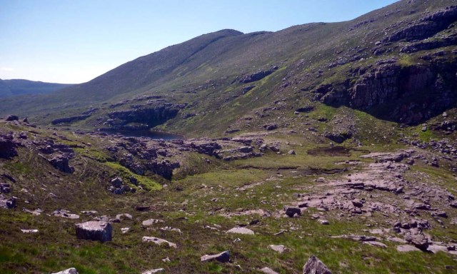
Near the pass. You can easily visualise how the arm of a glacier scrapped over, grinding rock on the upstream side and plucking as it passed. I may need that lake later for a drink, if not a damn good wash.


Image
The way up to Beinn an Eoin. I thought I might go up there too today. Now I’m not so sure.
Instead I get stuck back into another 1:1 slope, winding around the outcrops up to Tuath’s west summit.


Image
Just a few more steps…


Image
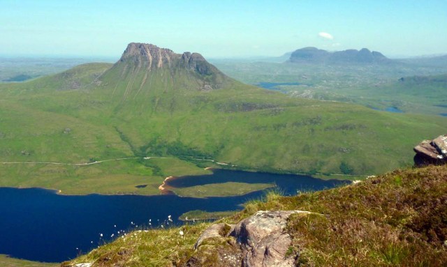
And… there’s the view we want. Shame I brought the basic camera.
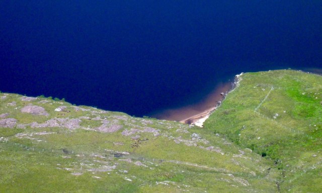
Can’t see anyone gambolling on the sandy beaches below Stac. I think I know why.


Image
Looking back down the west spur. Hmm, probably a good idea I didn’t try that.


Image
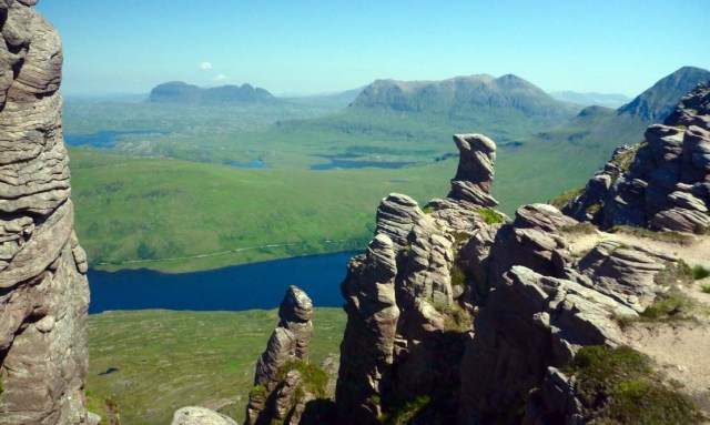
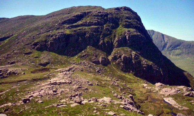
I set off east along the wind-carved summit ridge, passing the deep cleft mentioned by Rohan and wondering where this sugared pillar might be.
Just past the middle summit there it is, poking out above a precipitous gully.


Image
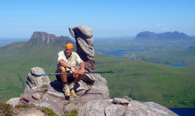
And there am I sitting by it and blessedly out of cleg range.


Image
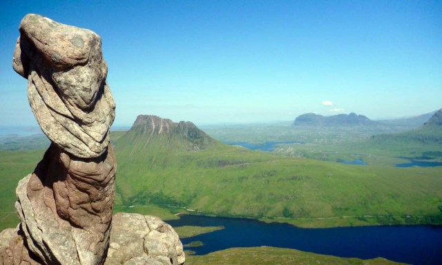
Aniseed twist? Not really, but an unusual formation for sure.
This sandstone weathers up into great-looking rock.


Image
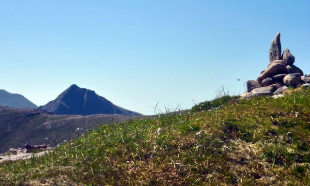
Just nearby is Sgorr Tuath's stupa-like summit cairn at a lonely, neglected 589m.
Fiddler at the back.


Image
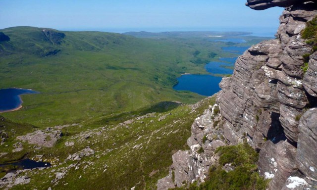
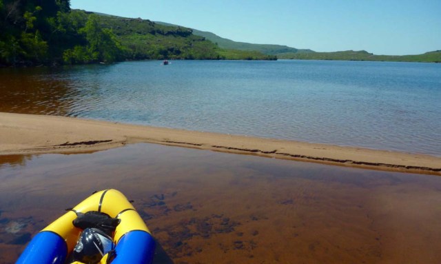
From here can I can finally see my escape boat far down below, hopefully not fit to burst a seam.


Image
Coming across, between here and the middle summit there looked like a bit of a path dropping back down to the lochan.
Initially there is, but it doesn’t last or maybe it swings off east. So it’s back to edging around the outcrops…


Image
… and across the steep slopes. Sure glad I got my stick to lean on.
Note the bit of path – about as good as it gets on this route.

Dropping off the west ridge back towards the shore a little later, I realise that in the blur of green it’s hard to spot the edges of the crags from above. Some I slide on my bum, others I chuck the stick and clamber down before marching across the pit-and-tussock flats to the next one. At least it's crispy dry, but with terrain like this I sometimes think 'Right to Roam' was a hollow bequest ;-) It's not like it's ever going to get worn out by the tramping hoards!


Image
I am now quite weary: I did the whole walk on 500ml and a few slices of chewy dried mango – my go-to superfood now that I’ve outgrown Spangles. I need a drink and a High5 tablet.
Just after I took this picture some Ozzie canoeists rocked up but didn’t bother deboating.

‘Jeez mate if it aint the midges it’s the bloody horseflies!’


Image
You can see them paddling away at full speed, chased by a humming swarm.
I can’t strip off fast enough while slapping and swishing at the biting fiends.
They’re much worse than this morning.


Image
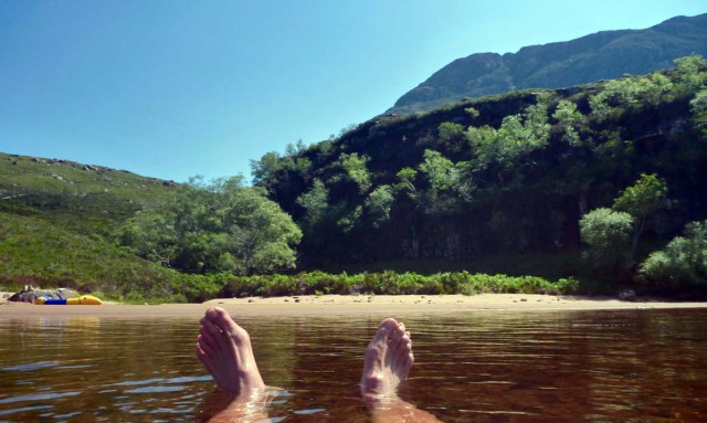
Ahh... sigh of deep pleasure. But being wet doesn’t seem to discourage them.


Image
I was way up there (you can just see the pillar in the nick); now I’m down here. The marvel of hill walking.
The descent was only 15 minutes quicker, but no rests needed.
A quick prod and the boat is fine. Top-up the air, hop in and try to outpaddle the clegs.


Image
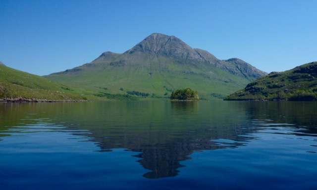
Nice mid-loch view of Cul Beag. ‘Better climbed than admired’ we observed a couple of years back.
https://www.walkhighlands.co.uk/Forum/viewtopic.php?f=9&t=56613
In no hurry to get back to a beach from hell, I paddle around the promontory but in the
end have to face the clegging menace one last time.


Image
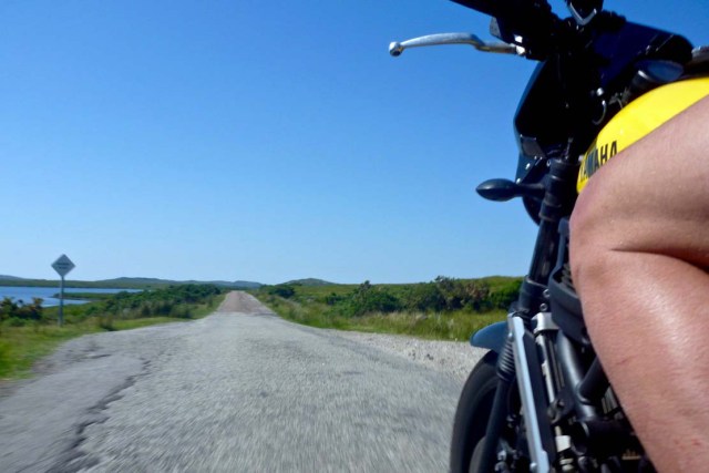
After the summits and the swim there's one more highlight to enjoy: riding home faster than a galloping horsefly.
As I write this a day later I haven't got enough hands to scratch all the itches.


Tuath.gpx Open full screen  NB: Walkhighlands is not responsible for the accuracy of gpx files in users posts

Last edited by Ch55 on Wed Jul 04, 2018 4:02 pm, edited 1 time in total.
Ch55
 
Posts: 26
Joined: Oct 24, 2013

Re: Paddling to Sgorr Tuath (Coigach)

Postby kevsbald » Wed Jul 04, 2018 3:42 pm

Fantastic report. The Graham proper isn't as good a summit as the one you were one although it does give a lovely view to the Fiddler North face. I came in from Achiltibuie over 'the Heel'. A delightful area. Thanks for posting.
User avatar
kevsbald
Munro compleatist
 
Posts: 2249
Munros:273   Corbetts:134
Fionas:82   Donalds:53
Sub 2000:17   Hewitts:17
Wainwrights:29   
Joined: Jan 15, 2009
Location: Glasgow

Re: Paddling to Sgorr Tuath (Coigach)

Postby SAVAGEALICE » Wed Jul 04, 2018 4:43 pm

Great report :clap:
Really enjoyed that :)
Recently i’ve Been thinking how handy it would be to have a wee boat to access some hills . Now you’ve got me really thinking 🤔! ....... 😊
User avatar
SAVAGEALICE
 
Posts: 615
Munros:282   Corbetts:222
Fionas:81   Donalds:8
Sub 2000:46   Hewitts:22
Wainwrights:33   Islands:21
Joined: Aug 26, 2008
Location: Alness, Ross-shire

Re: Paddling to Sgorr Tuath (Coigach)

Postby Ch55 » Wed Jul 04, 2018 6:00 pm

Thanks both.
As it happens I've been testing a few packrafts lately – large and small.
You can read about them here: https://apaddleinmypack.wordpress.com

This one is about as light as they get:
https://vimeo.com/274122668
Ch55
 
Posts: 26
Joined: Oct 24, 2013

Re: Paddling to Sgorr Tuath (Coigach)

Postby Mal Grey » Wed Jul 04, 2018 6:36 pm

Enjoyed this, as it ticks so many boxes;

- Its in the most beautiful part of the whole planet, Assynt and Coigach.

- Its got paddling in it as well as a fabulous hill.

- I spent 3 days wild camping beneath the hill, gazing up at it, at the SW corner of the loch, at Easter. If the weather had been better, I might have headed up. (https://www.wildernessisastateofmind.co.uk/blog/the-pirates-go-wild-in-assynt) There were no cleggs or midges. And only one tick.

Interesting review of the MRS Nomad. I enjoy paddling as much as walking, so Packrafts have always seemed a little slow, except on the bouncier stuff. That looks like a good compromise, and weighs just 1/4 as much as my folding Ally DR15 canoe.
User avatar
Mal Grey
Wanderer
 
Posts: 4634
Munros:113   Corbetts:23
Fionas:12   
Sub 2000:9   Hewitts:116
Wainwrights:71   Islands:6
Joined: Dec 1, 2011
Location: Surrey, probably in a canoe! www.wildernessisastateofmind.co.uk

Re: Paddling to Sgorr Tuath (Coigach)

Postby Gary752 » Fri Sep 11, 2020 2:20 pm

Loved this. Thank you
Gary752
Mountaineer
 
Posts: 1
Joined: Apr 3, 2017

Re: Paddling to Sgorr Tuath (Coigach)

Postby Mountainlove » Mon Sep 14, 2020 9:57 pm

Brilliant , I have thought to do the exact same when I was up there a few weeks ago! Did not had my inflatable kayak with me, great to see the photos though. This trip is certainly on my to do list! Know the feeling of leaving the 'boat' behind always a bit scary... Specially when you are miles away!
User avatar
Mountainlove
Munro compleatist
 
Posts: 1346
Munros:88   Corbetts:54
Fionas:7   Donalds:10
Sub 2000:3   
Islands:10
Joined: Feb 2, 2010
Location: North Ayrshire

10 people think this report is great.
Register or Login
free to be able to rate and comment on reports (as well as access 1:25000 mapping).


Can you help support Walkhighlands?


Our forum is free from adverts - your generosity keeps it running.
Can you help support Walkhighlands and this community by donating by direct debit?


Return to Walk reports - Scotland

Who is online

Users browsing this forum: albamc, Andyh503 and 35 guests