free to be able to rate and comment on reports (as well as access 1:25000 mapping).
Staying in the Yorkshire Dales for a company meeting, but a free day today before everyone else arrives so I figured I'd go walking. Woke up to pouring rain, but checked the forecast for the Lake District, which looked not too bad, and figured it wasn't THAT far to the eastern lakes from here...

Parking at Mardale Head
Arrive at Mardale Head, at the top of Haweswater reservoir, just after 9:30. Plenty of room in the car park still at this time. Chose a parking spot that should be safe from being blocked in, or blocking anyone in. It had been raining most of the drive over, but it stopped just about as I arrived.
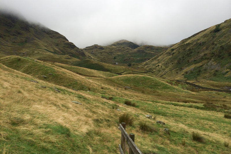
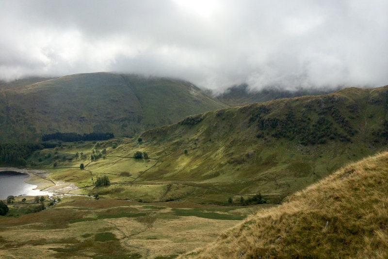
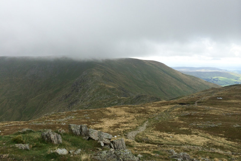
Looking up the valley - low cloud alert
Weather forecast had warned that I might be stuck with low cloud for much of the day, and sure enough all the summits (and the passes) were in cloud as I set off.
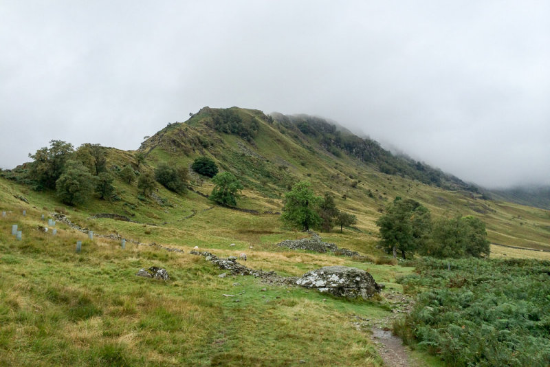
Rough Crag ridge
I hadn't made up my mind exactly what route up I was going to take, so I stood at the point where the path up the Rough Crag ridge to High Street branches off for a little while, weighing up the pros and cons. On the one hand, the Rough Crag ridge to High Street looked like a lovely route, but on the other hand ascending via Kidsty Pike would give me a new Wainwright and options to do a few more before descending. It would also mean I spent longer to reach the cloud level, which might give it time to clear. As I waited, I heard a couple of walkers approaching, chatting away, and I decided I would take whatever route they did not, as I fancied a bit of peace and quiet. They turned off up the Rough Crag ridge, and so I headed across to Kidsty Pike.
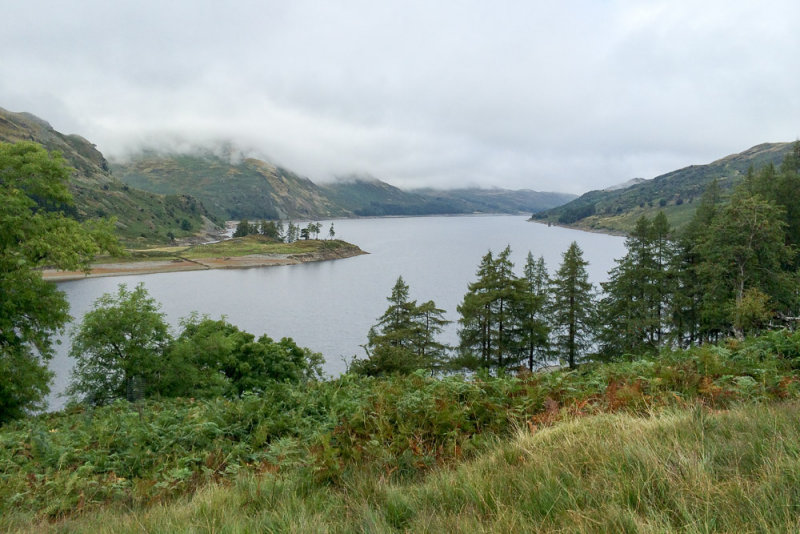
Haweswater
The first part of the walk stays close to the banks of Haweswater. The water level was fairly low, and it was intriguing to see the old stone walls just under the surface.
Path marked by upright stones
According to Wainwright, "Originality has been shown here in marking this path by a parallel line of upright stones". Certainly not something I have seen before...
Spot the eagle?
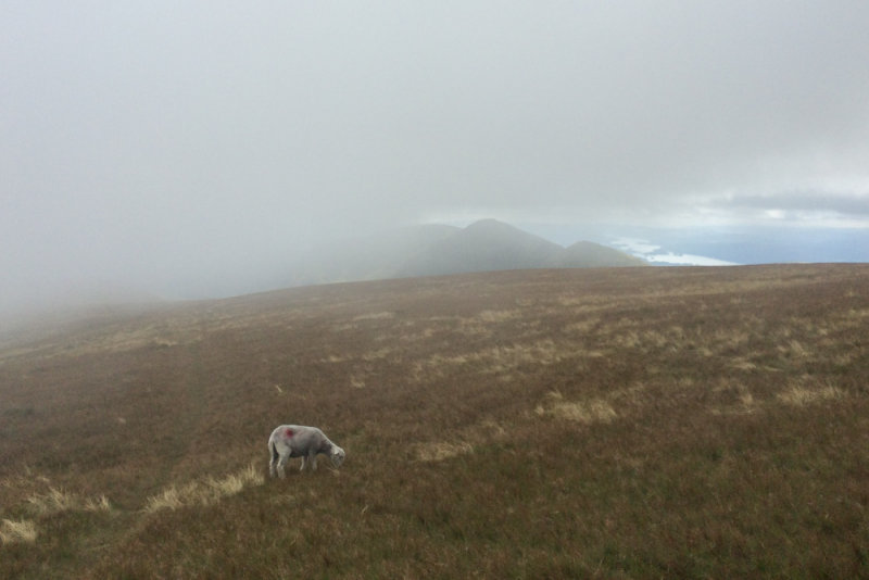
Apparently you can see eagles in Riggindale if you know where to look. I didn't see any, though you can see the RSPB hide in the valley...

Reached the ridge above Kidsty Howes
The walk up to Kidsty Howes was a bit of a struggle until I learned how to pace myself (I'm used to walking with the family where everyone ends up at the pace of the slowest member). But at around 1600 feet the going got a lot easier - there was even what looked like a newly-laid path of stone chippings.

Approaching Kidsty Pike Summit
Unfortunately my cunning plan to ascend slowly enough that the clouds could rise out of my way was not a complete success. They were rising, but not as fast as I was. So no views from the top of Kidsty Pike.
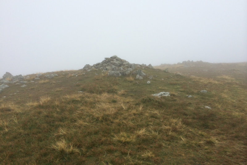
Rampsgill Head summit
The plan from Kidsty Pike was to pick up the nearby summits of High Raise and Rampsgill Head - ideally in that order. However I couldn't see the path to High Raise in the mist, and didn't fancy striking out cross country, so I carried on up the good path from Kidsty Pike towards High Street. Having not seen another walker since I set off up the Kidsty Pike path, suddenly there were lots, all going the other way.
This path doesn't go directly to the top of Rampsgill head, but once the GPS told me I was level with it I cut across to the summit cairn. Still no views...

High Raise summit
From Rampsgill Head the path towards High Raise was clear. The clouds were starting to lift to the point that I got occasional views to the north and west, but none long enough to get the camera out. The path soon joins the old Roman Road, which bypasses the summit of High Raise, but a short detour took me to the top.
As I left the top, a group of walkers on the Roman Road were looking towards me seeming rather confused, and asked me if I was alright, which was odd. It later dawned on me that I had passed this same group on the path from Kidsty Pike towards High Street, and I think they were concerned that I might not realise I was going in circles! As I headed back towards High Street I passed more walkers that I had passed earlier (they obviously had managed to find the path from Kidsty Pike towards High Raise better than I did).
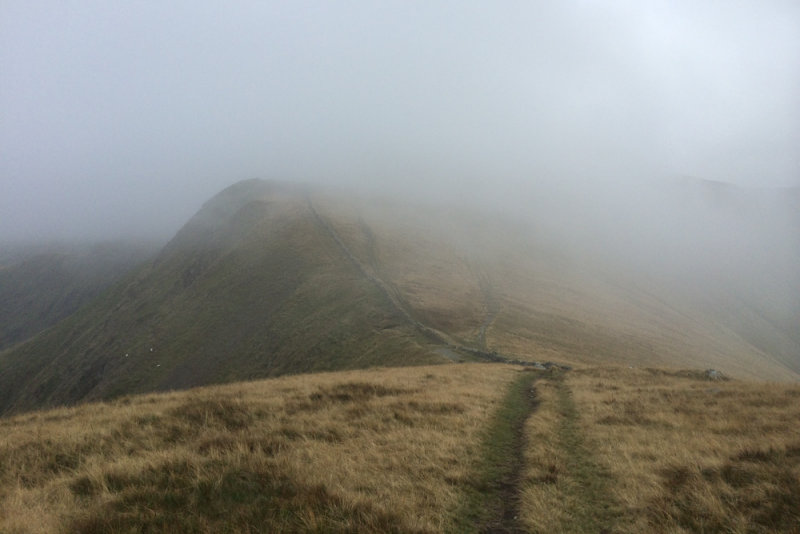
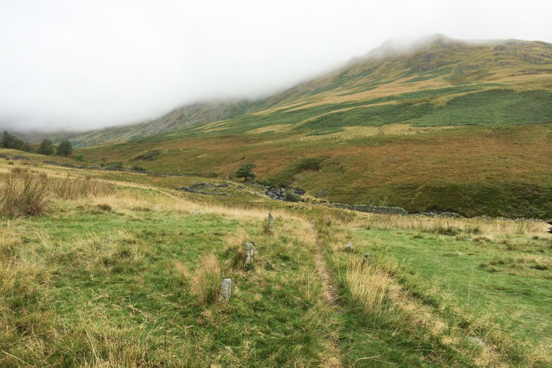
The Straights of Riggindale
After a couple of slight detours where every path I chose seemed to take me further north than I had intended, I managed to pick up the Kidsty Pike to High Street path again, and having completed my circle I carried on towards High Street. Last time I was up this way the cloud was even lower than today, and while I had noted the interesting name of the Straights of Riggindale I had not actually been able to see the lay of the land. This time it was just about clear enough to see how the ridge narrowed at this point.
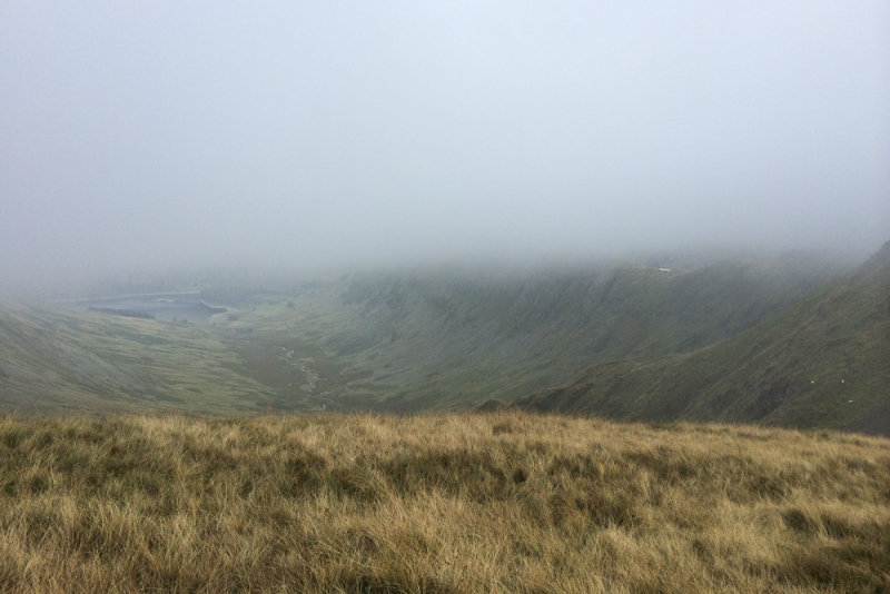
Riggindale
As I paused to look down Riggindale, a group of walkers passed me complaining about the cold, all wrapped up in waterproofs and wishing they had brought gloves. I was walking in a t-shirt and wishing I had brought shorts.
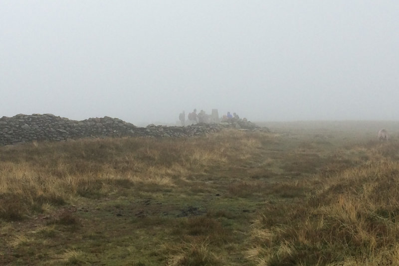
High Street summit, and crowds
There was standing room only at the top of High Street, as everyone seemed to have decided it was lunchtime. I carried on a little way along the ridge before finding a good spot to sit on the wall for a sandwich.
Froswick ridge
The cloud was lifting enough to get the occasional view. The western arm of the Kentmere horseshoe looks like it could be a very interesting walk - it was one I had wondered about for today...
Rough Crag and Kidsty Pike ridges
I wasn't sure exactly where the path to Mardale Ill Bell left the ridge, but I spotted a feint path and followed it. It got me there, but I think it was just cutting off the corner - when it reached the main path to Mardale Ill Bell it was anything but feint - almost a motorway! Still, it made for very easy walking, with occasional views back the way I had come.
Mardale Ill Bell summit
My 5th Wainwright of the day was very easily reached, and I started to wonder how many more I could do... my original thought was that I would PROBABLY go over Harter Fell and down the Gatescarth Pass road, but at this rate, maybe I could carry on to Branstree?
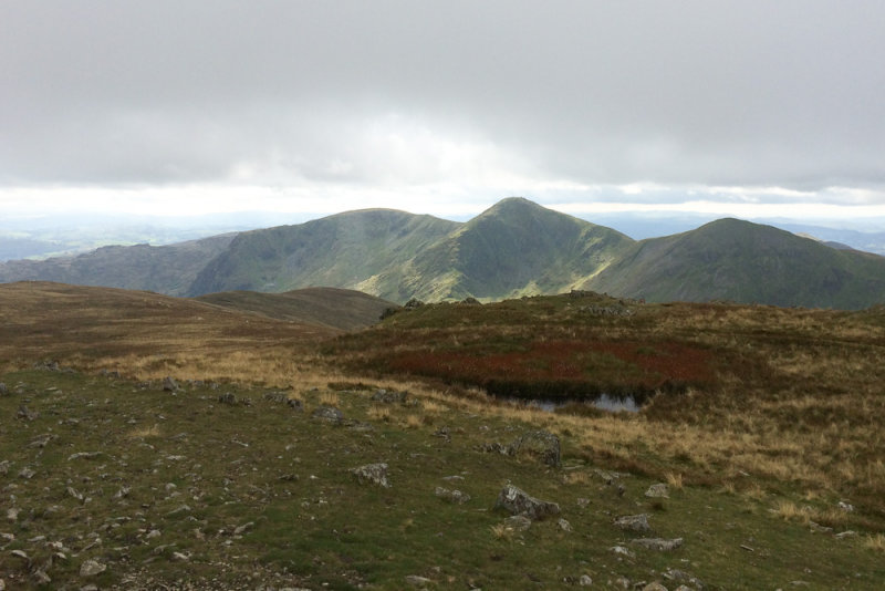
Ill Bell looking lovely
More views across to the other side of the horseshoe, and the "other" Ill Bell. It looks like a lovely shaped mountain!
Nan Bield Pass
The ridge between Mardale Ill Bell and Harter fell goes across the top of Nan Bield Pass (wonder how it got its name). A lovely little ridge.
Kentmere Reservoir
Crowds at the top of Nan Bield Pass
Lots of people at the crossroads, debating which way to go. I think most of them decided to head up towards High Street... I headed straight on towards Harter Fell.
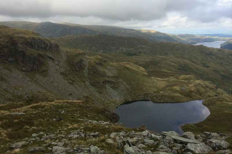
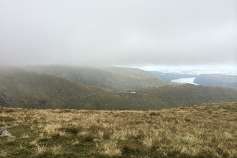
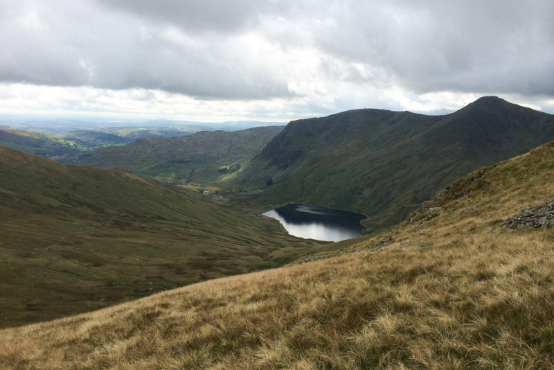
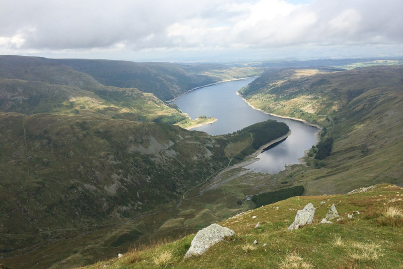
Small Water with Haweswater behind
Beautiful views from this part of the walk, even if High Street itself would not quite emerge from the cloud,
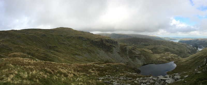
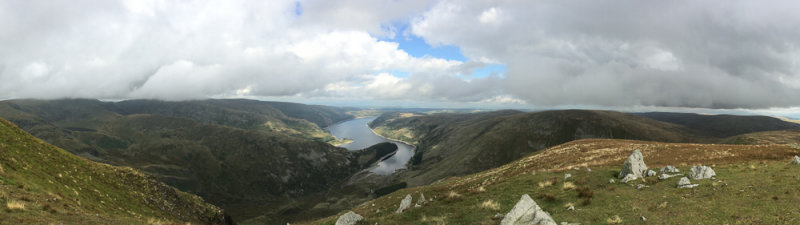
Small Water panorama
Small water is beautifully situated.
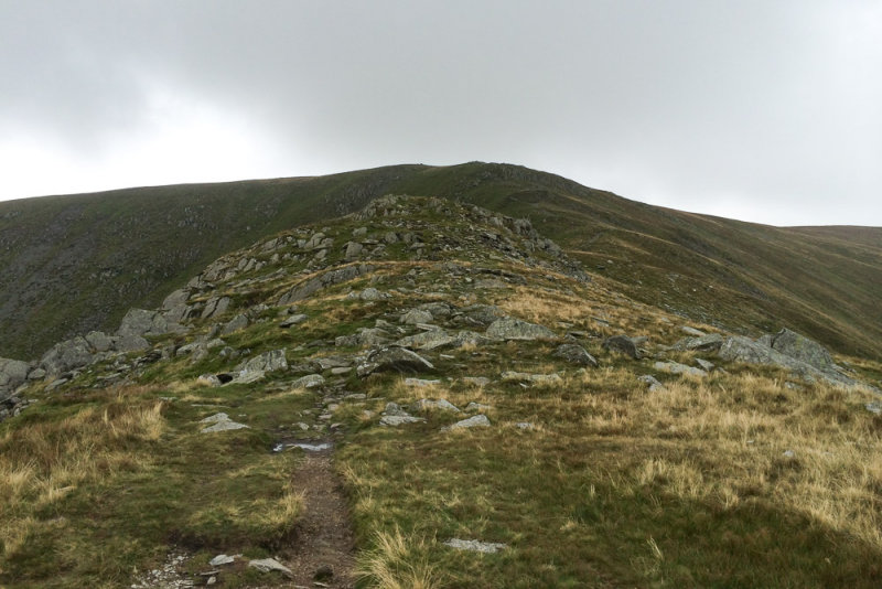
Ascent to Harter Fell
Any thoughts of carrying on to Branstree were quickly dismissed as I started to get cramp on the way up to Harter Fell. It soon passed, but it was also starting to spot with rain...

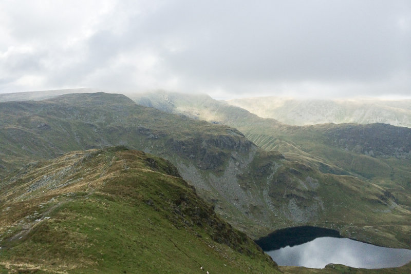
First distant view of the day
The photos don't do the views justice - do they ever? Unfortunately I discovered when I was setting off that the battery in my normal fell walking camera was flat, so all I had was the iPhone. I find it's usually lacking in contrast on shots like this.
High Street almost out of cloud
I was really hoping for a view of High Street out of the cloud - I've not really seen it from this side before. So close...

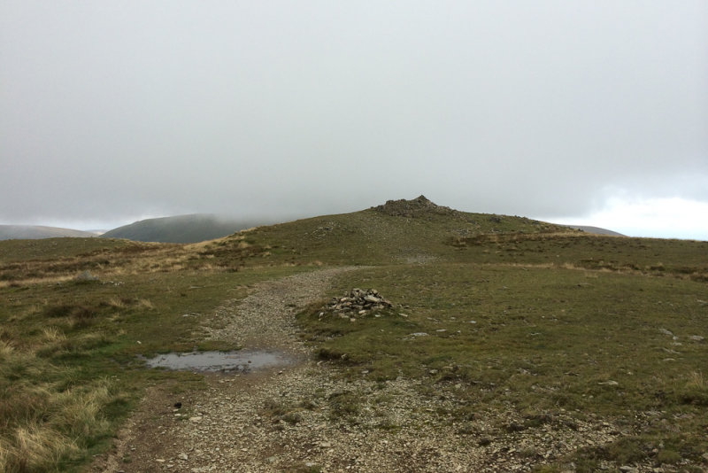
Harter Fell Summit
Finally I reached the top of Harter Fell, my 6th Wainwright of the day (and my 5th new one - only High Street was a repeat for me).
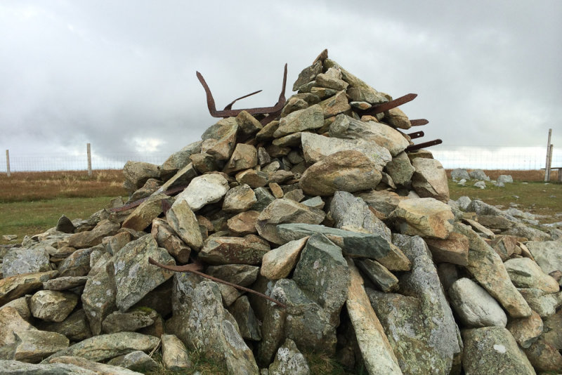
Tangled posts in summit cairn
They don't look as dramatic as they did in Wainwright's drawing of them, since the stones have been piled up around the iron posts a bit more. But they are still quite a striking sight.
Panorama from the fence corner
Followed the fence down from the summit of Harter Fell until it turns a sharp corner to the right - as does the path. One advantage of the iPhone is that it does do rather nice panoramas...
View from the fence corner
And here is the standard photo from the same spot. I think I prefer the panorama.
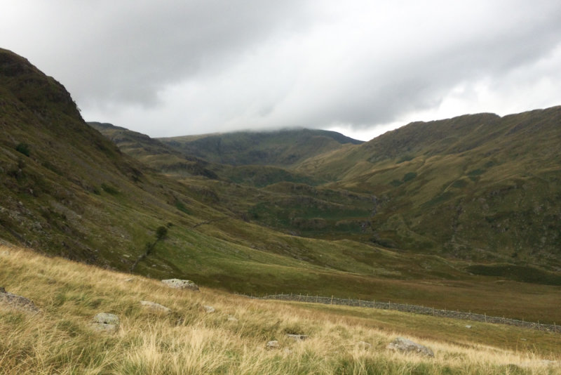
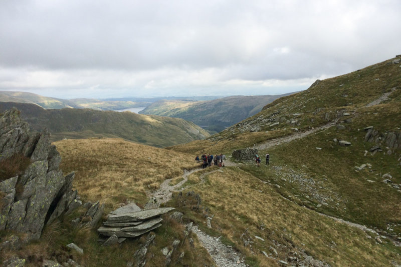
Final view up the valley - still low cloud, but higher than it was
From the fence corner, it was a easy descent to the Gatescarth Pass road, then followed the road (technically, it's a road, though I don't think I'd want to drive it...) back down to Mardale Head and the car.
A really enjoyable day in a corner of the Lakes that I don't really know. And 5 new summits ticked off.
