free to be able to rate and comment on reports (as well as access 1:25000 mapping).
A nine day peakbagging trip to SA and Lesotho, focussing on the three Southern Africa ultras (1500m prominencepeaks), with a few days spare for a P1000, a P900, two P600m peaks and a few lower prominence Western Cape summits. Route descriptions, GPX route files and Facebook photo albums for the individual peaks, are linked from within this report and can also be accessed via my Peakbagger.com ascents pageI flew into Johannesburg, peak-bagged my way south via Lesotho, flying home from Cape Town.
It was the rainy season in the north, but the dry season in the south. I drove through some heavy storms but managed to stay dry on the peaks, tweaking my schedule to dodge wet weather with the help of weather apps such as yr.no which worked well in SA.
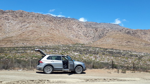
I hired an SUV, although as it turned out there was little call for high clearance, with driving being on paved and (mostly) good unpaved roads.
The North (Limpopo)Sat 18 January: Lesotho’s Thabana Ntelyana was the first main target, but with wet weather forecast I made a detour northeast to climb
2217m P1045 Iron Crown, a straightforward bonus Ribu (
Ribu is the Indonesian word for 1000: Indonesia is where the listing of 1000m prominence summits started, and the term and list is now applied worldwide).
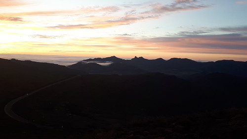
 Jan 18: Iron Crown late afternoon
 on Flickr
I’d left Joburg early afternoon, started walking about 1730, summitted at dusk via forest roads and half-decent trails, and descended by torch light (actually the phone torch

), with African wood owls calling in the forest. With a wet forecast for Sunday, it made sense to climb this peak in reasonable weather, then drive to Lesotho on Sunday with a reasonable forecast for Monday.
LesothoThabana Ntlenyana 3482m P2390 is the 15th most
prominent peak in Africa, the highest peak in Lesotho and higher than anything in South Africa. It’s close to the eastern border with SA, accessible via Sani Pass, but only if you have a 4WD vehicle; another complication is that the border closes early evening. The
Hiking South Africa Facebook group advised that the Caledonspoort crossing in the west is open from 0600 to 2200 and the drive from there is paved road all the way nowadays. It wasn’t until I arrived at the border on Sunday afternoon that I discovered Lesotho require an International Drivers Permit! I assured the official that a British licence is international, and must have caught him in a good mood. I enjoyed a scenic drive east, through impressive gorges and high mountains. Less pleasant but very memorable was being 'mugged' by 3 young girls - they'd apparently been assigned to clear storm debris partially blocking the road, but were instead using their shovels to demand money with menaces! Crossing a pass southwest of the peak I spotted a track heading in the right direction, and decided this might as well be my (ad-hoc) route to the summit.
 Thabana Ntelyana trailhead (for tomorrow)
 The top of Sani Pass is the usual starting point, and I drove down to Sani Lodge for a meal. Cold, misty, muddy and expensive, the Lodge didn’t seem the ideal overnight spot; there’s a cheaper choice nearby, but it suited me best to sleep in the car at the trailhead, for an early start to beat forecast rain later.
Jan 20: Monday dawned clear and I was off at first light.
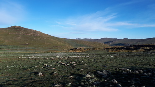
 Jan 20: Thabana Ntelyana trailhead at dawn
The track soon ran out but the terrain was generally straightforward,
 Thabana: approach from SW
with a few rocky crags bypassed without difficulty, and two bonus summits crossed en route.
 Kotisephola (3360m P120)
 Thabana from kaNtuba West (3320m P80)
An advantage of my route was that the river was crossed quite high up and was an easy boulder hop. Then a long easy slope led to the remote cairned summit; the weather chilly but still fine.
 Thabana Ntelyana summit
 Thabana - tiny plants encrusting summit rocks
I saw a shepherd and flock below, but our paths didn’t cross.
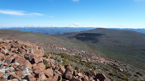 Thabana - sheep near summit
On the descent I kept further north to avoid re-crossing the P80, and ran into dogs guarding a shepherd encampment. They seemed content to bark not bite, and I was soon clear of their territory. The 7h30 round trip was rather quicker than expected, despite the 3000m altitude making for sluggish progress, and I was back at the car early afternoon. I returned to Sani Lodge for a meal, and had hoped Sani Pass would be feasible downhill in my SUV. However, I was assured a rugged 4x4 was needed, so instead I drove back west to the Caledonspoort border crossing. With heavy rain en route I was glad of the morning’s early start. The ‘road block’ was a concern; 3 young boys were there on way back but I was in a fast moving 3 car convoy which wasn't stopping!
Eastern CapeThe next ultra, Seweweekspoort, was more a full day’s drive away, and rain was forecast for Wednesday. An additional complication was that the car needed servicing – this isn’t unusual on long road trips. Online research while at the Bloemfontein VW dealers, located
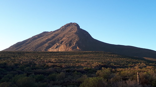
2503m P948 Kompasberg. Access arrangements weren’t entirely clear, the single web page I’d found suggested it may be a significant scramble, and nothing was forthcoming from the Facebook group – a rather obscure peak. I drove to Middelburg, then on 60km of good unpaved roads through fine arid Karoo scenery.
 Jan 21: unpaved road leading to Kompasberg
 Kompasberg approach - locked gate on direct route (the button didn't help) - an hour's detour
I made Compassberg (the farm uses the English spelling) by 7pm in daylight but there was no-one home to ask, so I drove 2km to a locked gate and parked for the night, hoping for the best.
 Kompasberg northern trailhead
Jan 22: Wednesday morning after an hour’s road hike, the recommended north ridge was in shadow and looked unfriendly,
 Jan 22: Kompasberg N ridge early morning
so I skirted left to find easy angled scrambly groove.
 Kompasberg ascent - scrambly groove NE face
The ground above was brushy in places, then higher up I enjoyed a string of short boulder problems, some a little technical but probably bypassable.
 Kompasberg ascent: Karoo view
Just below the summit I joined a cairned route leading to the bouldery summit, a pleasingly remote spot with a fine view north and a sea of cloud to the south.
 Kompasberg summit: 2 trig pillars
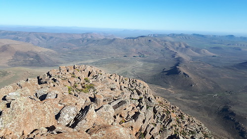 Kompasberg summit: Karoo view N
I reckoned the southeast ridge might make a less technical descent,
 Kompasberg SE ridge
but soon encountered a mauvais pas at a narrow gap involving a boulder-hugging out-of-balance manoeuvre above a 40m drop. After a few minutes’ exposure I followed a path marked on OpenStreetMap (the Peakbagger app’s mapping is my main navigation tool in good weather, with a Garmin GPS as backup). I kept to clean easy rock slabs to avoid scrub where possible,
 Kompasberg E face - my ascent route was towards the left
then cattle trods eased the way across the scrubby lower slopes to rejoin the jeep track leading back to the car.
 Kompasberg N ridge late morning
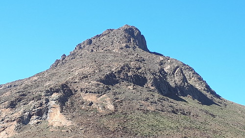 Kompasberg N ridge - looking more doable in good light
Calling at the house, I found the owner’s son was there and fortunately unfazed by my unauthorized ascent! Pleased to have this fine bonus Eastern Cape peak in the bag, I continued southeast to Ladismith, for the first of the two ultras within South Africa itself.
Western CapeThe Western Cape isn’t the ideal place for car-sleeping, so I booked into the
Waterval homestay at the foot of
Seweweekspoort Peak 2325m P1543, the Western Cape highpoint. Waterval proved to be an excellent choice: Desmond the owner is a great host and knows the mountains well.
 Jan 22: Waterval Eco Farmstay wall hanging
Next morning, Seweweekspoort was a rocky 5 hour round trip from the north. There’s a designated gate where one parks, first notifying the landowner by WhatsApp.
 Jan 23: Seweweekspoort trailhead
 My ascent route kept R of the gorge
 Seweweekspoort summit trig pillar and view west
 View west from summit
 Seweweekspoort descent: view N
The scrambling was mostly straightforward, although I declined to follow Tobias Coatzee’s GPS track down one of his downclimbs (in my defence, he may have been ascending at that point – but he’s maybe just a better climber).
Access for
Dutoitspiek 1994m P1724 is more involved, as its only reasonably feasible access involves crossing well-defended farmland, via a mountaineering club hut. In retrospect, the best approach is probably to consult the Mountain Club of SA online calendar for suitable meets and time a visit accordingly. The key-holder lives in Cape Town, and I was to collect him next morning, so I checked into a cheap hotel (Cape Town definitely isn’t the kind of place to sleep in the car, or even to park on-street if it can be avoided). Next morning, we call at Du Toit's Kloof Lodge for a CapeNature permit (seemingly impossible for a foreigner to buy online), then drive to Du Toit's Kloof hut where I parked, and enjoyed a fine scrambly 8 hour round trip in excellent weather, amidst very grand rocky scenery.
 Jan 24: Dutoitspiek ascent: paved road initially
 Farm gate: access strictly by arrangement
 Approach to ridge: unpaved road on L then a trail
 Farm view, from below first tower
 View down on trailhead (this side of N1 highway), from near the first tower
 First tower: this obstacle is bypassed quite easily on L (climber's R). Then a scramble ...
 Scrambly ascent above first tower. Good holds but care needed. Crux of route
 Another tower, bypassed on R (climber's L)
 Ascent follows the ridge for a while, then L of another tower further up
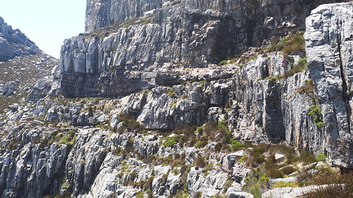 This ledge is crossed on approach to summit; not as exposed as it looks
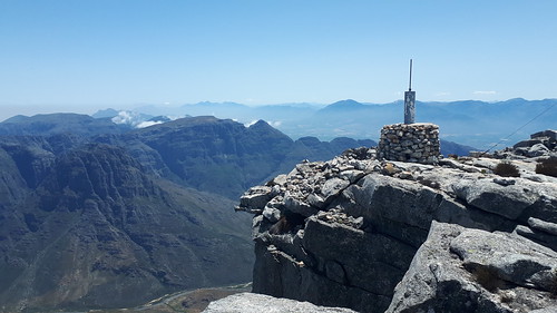 Dutoitspiek summit trig (the actual highpoint is to R)
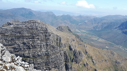 Summit: view NE: the N1 highway was my approach route from Seweweekspoort the previous day
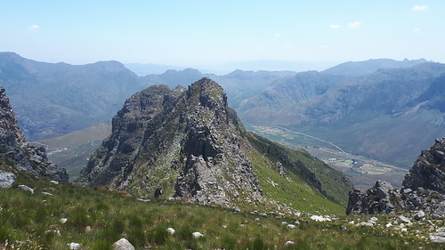 Dutoitspiek descent: the route passes R of the towerCape Peninsula
I decided to spend the remaining two days on the Cape Peninsula. Whilst
Sneuberg further north beckoned, with its 1027m of prominence and dramatic profile, I didn’t really have time for the long drive and it wasn’t clear whether I’d manage it solo unroped. The Cape, despite a few security concerns, has a nice range of peaks and I’m able to include
Swartkop 678m P630,
 Jan 25: Swartkop from 550m P112 SimonsbergCape Point Old Lighthouse Peak 238m P112
,
 Jan 25: Cape Point, looking towards Antarctica
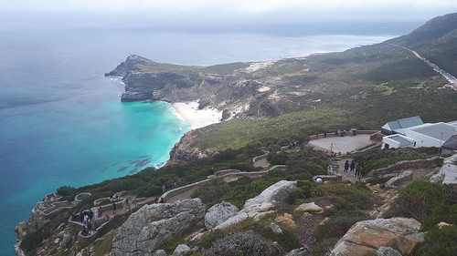 Cape Point: view N
;
the iconic and very popular
Lions Head 669m P409,
 Jan 26: Lions Head trailhead
with its views across Cape Town,
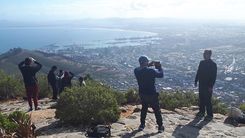 Lions Head summit: Cape Town viewConstantiaberg 928m P691
,
 Jan 26: Constantiaberg ascent: view SE
with its impressive popular Elephants Eye cave
 Constantiaberg ascent: Elephants Eye cave
and coast views,
 Constantiaberg view NW: Hout Bay and Karbonkelberg
and finally the very entertaining scrambly
Higher Steenberg 537m P218  Jan 26: Higher Steenberg Peak: one of several competing scrambly summit contenders
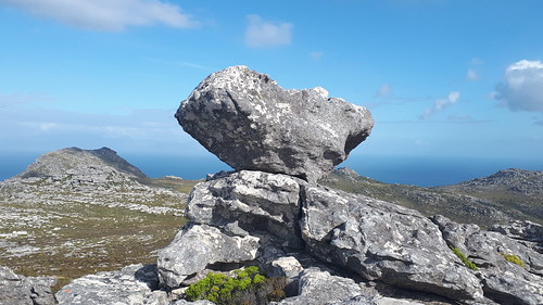 Higher Steenberg Peak: another striking formation
before my evening flight home.
Little did I know that this would be my only ‘normal’ trip of the year, with the world soon overtaken by the Covid-19 pandemic.
SA photo album
