free to be able to rate and comment on reports (as well as access 1:25000 mapping).
As it’s been getting busier in the Lake District these last few weeks we decided to have another go at the Southern Howgills picking off the two steep ridges just southeast of our descent route down White Fell during our last skirmish amongst those sylvan fells and would take in Bram Rigg Top on the ascent and Nab on our return from the 600 metre plus skyline.
Everything was going for us this day as the weather was near perfect and the travelling was hassle free due to our driving along Fairmile Road – the old Roman Road – and Howgill Lane from Tebay that hardly bears no other traffic apart from local farmers and the odd vehicle making their way to any one of the few camping/caravan sites that are dotted about on some of the farms. The only cause for worry was whether my knee would stand up to the long uphill pull from the Holy Trinity Church at Howgill to Bram Rigg Top and as it had been around 4 weeks since I had done anything like a walk I felt as though I should give it a good outing and see how things went. Strange as it may seem I tend to get a lot more pain whilst climbing than I do descending despite the wearing of a very good knee support strap. I try to lead with my left leg whilst climbing and taking a high step, but of course that isn’t always possible so after a good few weeks of my knee having a good doss it was time to give it an outing, albeit a fairly strenuous one.
Our choice of a parking place was at the side of Howgill Church, correctly named as the Holy Trinity Church and is to be found at SD633950 and sits alongside the metalled lane that leads on to a row of a few houses...
 Howgill's Holy Trinity Church
 and then back on to the ‘main’ Howgill Lane. An old red telephone kiosk adorns the opposite verge – a bit of nostalgia there – whilst across the rock strewn bed of Chapel Beck there are a couple of cottages, one of them painted in the standard LD white that has a most colourful array of flowers set in the small but very neat garden. The gentleman who lives there gave us a cheery greeting as we arrived and we spent a good few moments passing the time of day with him before we set out on the walk.
 Cottage garden by Chapel Beck
 A brief history:- Holy Trinity Church stands in a country lane near the hamlet of Howgill, between Sedbergh and Tebay, Cumbria. The church was built in 1838 to a design by the Lancaster architect Edmund Sharpe. It replaced a small chapel on the other side of Chapel Back that dated back to about 1685.The main person responsible for its creation was Revd Isaac Green, the second master at Sedbergh School, and incumbent of the parish. The land was given by Stephen Sedgwick. The new church was consecrated on 29 October 1838 by the Rt Revd Charles Longley, Bishop of Ripon.
Passing through the gate leading back onto Howgill Lane we turned right and climbed the short bank for a few metres to find an almost buried in undergrowth stile on our left of which the patch of nettles gave some concern to the ladies as though they were a nest of adders awaiting their next meal. Having negotiated the stile we were now in a lovely hay meadow through which we walked following the edge of the field alongside Smithy Beck to then pass over two more stiles to enter into the farmyard at Birkhaw. The very pleasant walk through the fields with the smell of wild flowers in the air the fragrance of the clover being especially so was marred only by the numerous and bothersome flies.
This is a peaceful place, pastureland overlooked by the mighty Howgills, a vast plain stretched out for miles bordered by the distant skylines of the Yorkshire Dales and the Lake District today just a mere smudge of grey due to the hazy conditions despite the blue skies.
We passed through a metal gate to now enter a tidy yard from which we turned to the left to pass through a second metal gate to make our way onto a track with lazy sheep lying in the shade beneath a wall whilst the hens scooped out dry dust holes from the adjacent tree lined bank to be used as nests and/or places to stay cool.
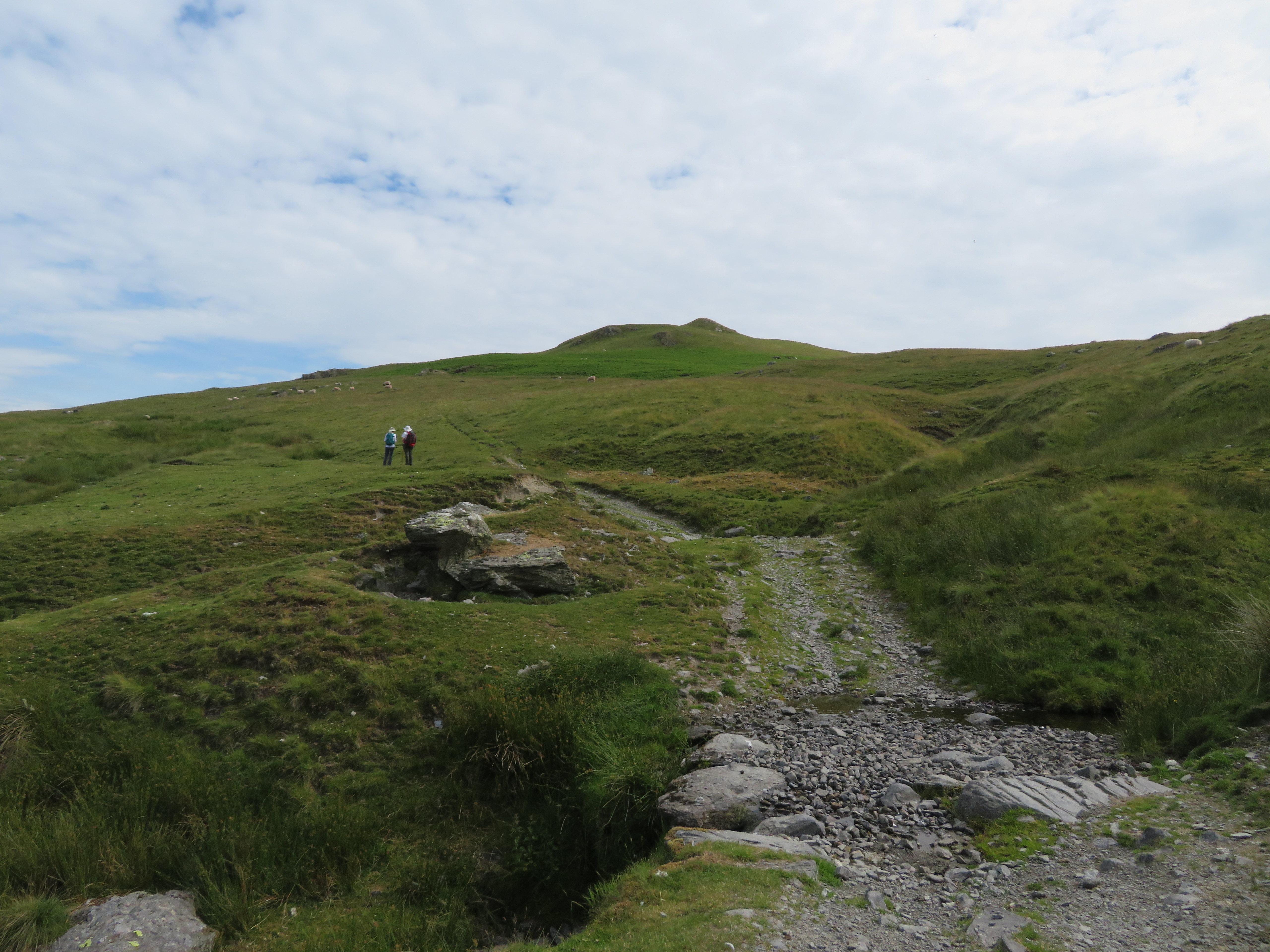
 The lane from farm to fells
 We were basically following the course of Smithy Beck along the easy rising track with pastures either side and the Howgills rearing up in front of us and at about the 212 metre mark we got our first good view of Fell Head.
 Fell Head skyline
 Another 20 or so metres of rise saw the Lake District skyline appear behind Grayrigg Common...
 Lake District skyline behind Grayrigg Common
 and behind us rose the steep southwest slopes of Arant Haw and Nab.
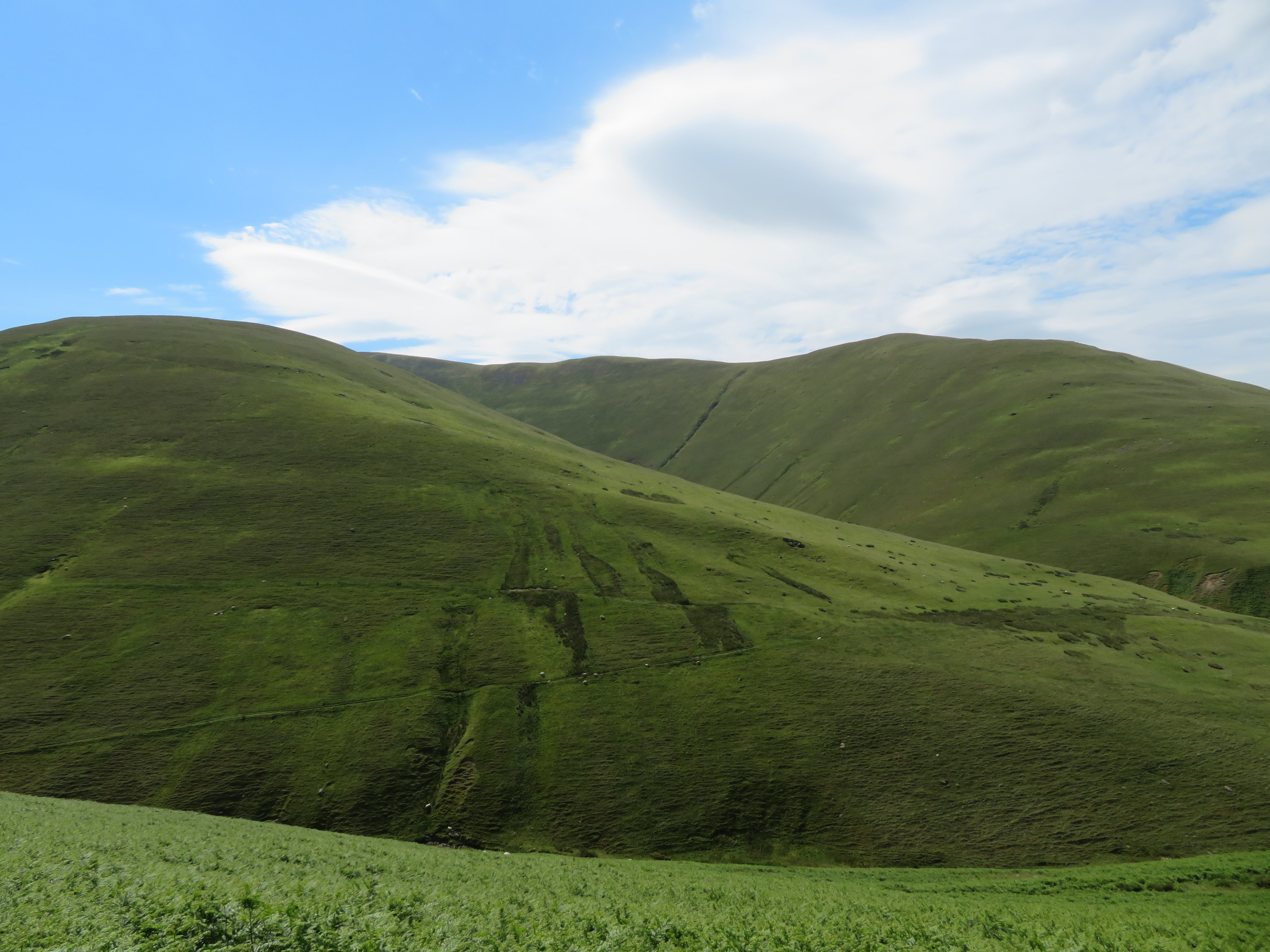
 The southwest face of Arant Haw and Nab
 The way is good and clear and as we approached the junction of Smithy Beck and Eller Mire Beck, Seat Knott was to be seen just peeping over the foreground humps and bumps.
 Seat Knott from the headwaters of Smithy Beck
 We decided to take a break below the west slopes of Seat Knott and espied a row of seagulls looking as though on parade with beaks in the ‘present arms’ position.
 Seagulls on parade
 As we climbed on we noticed that there were many seagulls scavenging on the fell sides and as they weren’t in any particular spot we couldn’t put a dead sheep as the centre of their interest.
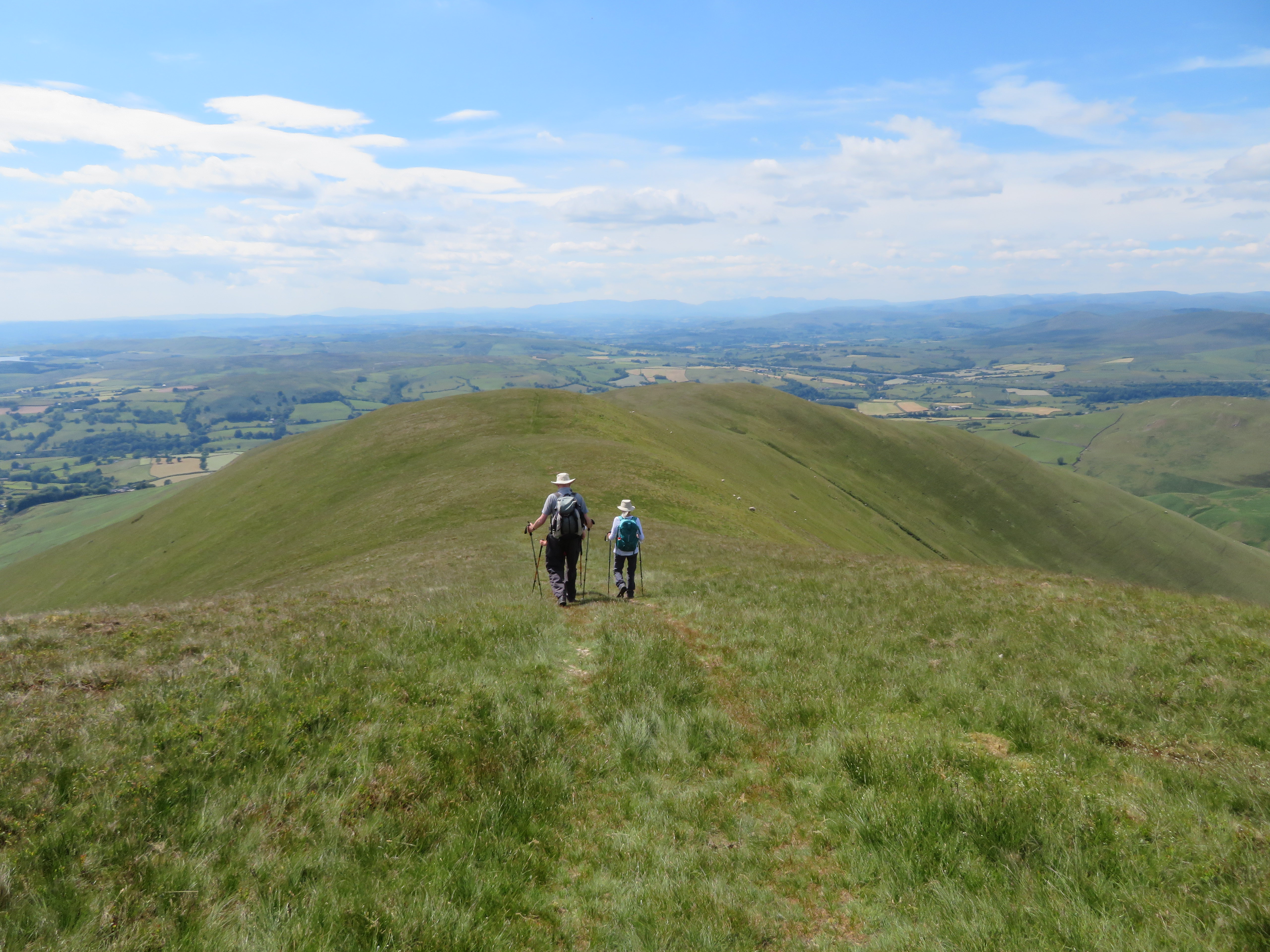
We had been out maybe an hour when we got our first decent view of part of the Howgill 600 metre plus skyline and our approach path to Bram Rigg Top.
 Fell Head round to White Fell Head skyline
 Behind Bram Rigg is the White Fell ridge that we descended on our last visit to this area and was the inspiration for this walk as I looked across and made my mind up to get on its back as soon as was possible. Bram Rigg’s lower slope, like so many others, was cloaked in bracken and the pathways through it were very obvious. Our chosen way missed out Seevy Rigg, an oversight on my part and although it isn’t too far below Bram Rigg we decided to give it a miss. We could have taken the obvious track from Bram Rigg Beck but it would have meant circling around to the west before starting the climb direct to the summit.
These giant grassy hills were opening up nicely around us with the great green mounds of Brown Moor and Castley Knotts over to the west of us conjoined onto the south side of Fell Head making for a lovely long ridge walk in days to come.
We could make out our way forward along the skyline towards The Calf with the path above the head of Calf Beck looking very exposed from this position.
 Howgill ridge between The Calf and Calders
 The paths and tracks so far had been good and obvious and would remain so for most of the way and as we approached Bram Rigg Beck we could see the sheepfold and our place of crossing at an old ford. There were no problems crossing the beck today but after rain...
 Looking across Bram Rigg Beck towards Seevy Rigg
  Sheepfold near the ford on Bram Rigg Beck
Seevy Rigg is nothing more than a flattish patch of rocky ground poking up through the grass whilst Bram Rigg is of more character having a somewhat larger and sturdier outcrop of rock to it. We passed across the ford without a hitch to first climb northeast along a well graded path that zigzags up the steeper and lower slopes to then widen out to a great grassy track that we would follow all the way up to our turn to the north for The Calf.
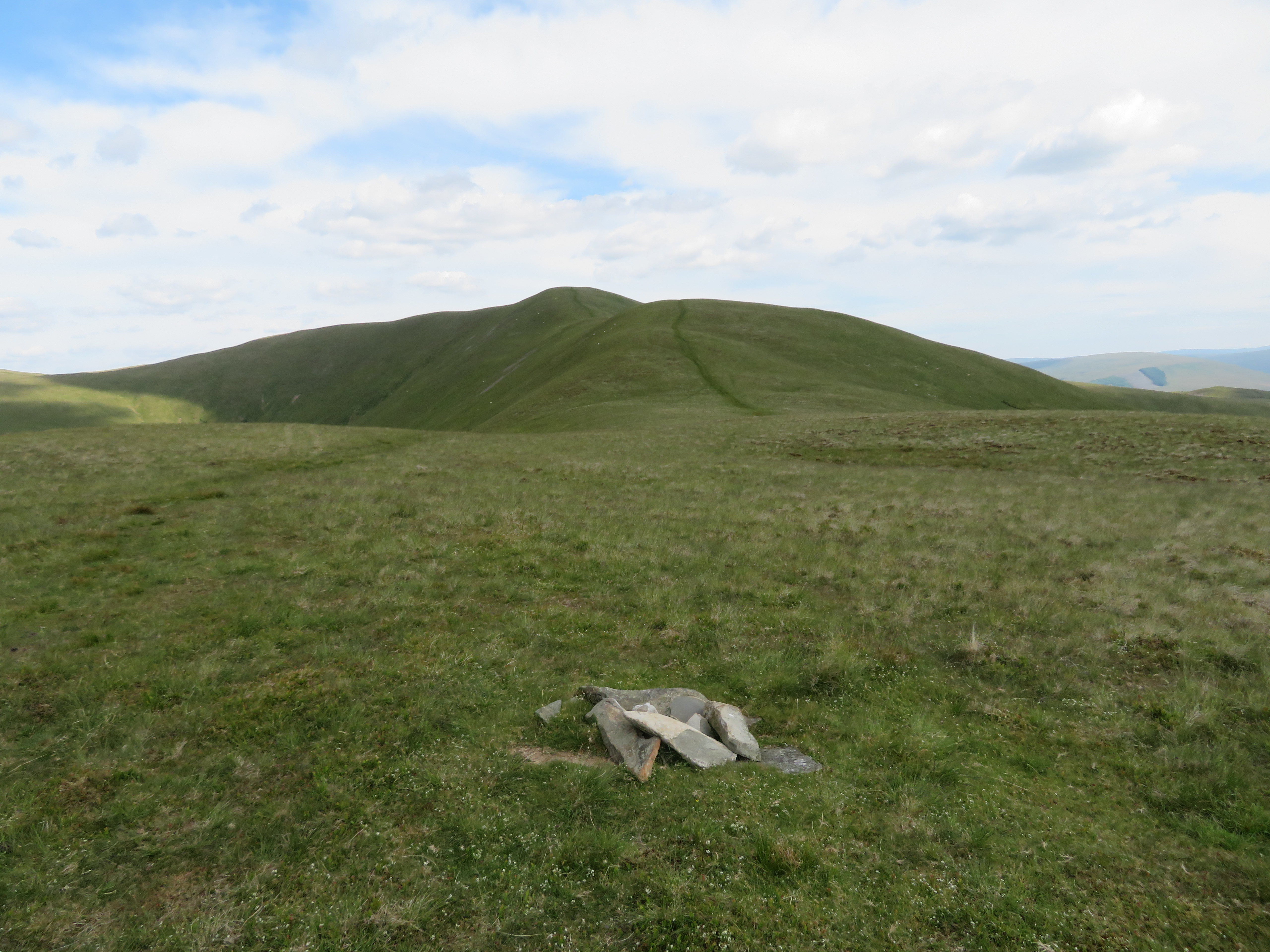
 Bram Rigg Top and Calders from the lower slopes of Seevy Rigg
 Now, although this looks an easy climb when viewing the photos and because it is well graded there are a couple of steep stretches that task the lungs and infirm legs, albeit so far my knee has given me no problems apart from the odd ache and not the stabbing hot knife feelings that occur with monotonous regularity so maybe the leg resting period has helped things along in that quarter.
At around the 300 point the great green slopes to the immediate south of us were opening with an unnamed ridge running down from Rowantree Grains being the nearest and the ridge of Bland our as yet unknown way of descent being the one running down from the hidden summit of Arant Haw.
 The northwest ridge to Rowantree Grains with the Bland ridge behind
 Some steady walking and leaking of skin soon had us within sight of Bram Rigg...
 The stony Bram Rigg with a view of Calf Beck far below
 and what we still had to do to get us up to the top. It made one sweat just looking at it. We peered into Calf Beck to our left and could see the sheepfold that is shown on the OS Map but we couldn’t see any signs of the hut that is shown on the same map. No doubt that it’s long gone and we were probably standing in the wrong place to have a good enough look but I wasn’t prepared to wander down the fellside and lose height in the hopes of it still being there.
 The knobbly hump of Bram Rigg
There is an old sheepfold at Bram Rigg – who would want build one there at a height of 420 metres you would wonder – and from this one another can be seen far below to our right on Bram Rigg Beck. There are so many out of the way sheepfolds around the Howgills mostly near water but the one here on Bram Rigg is a bit baffling.
 Sheepfold at the foot of Calders Rigg on Brant Fell
 Continuing along the climb and looking back saw the landscape opening up to the far distance.
 View along the Bram Rigg Top ridge from 530 metres
 The air had cleared somewhat and we could make out the obvious Blencathra, Great Gable, and the Scafells.
The next photo indicates where we would turn off to roughly north instead of climbing right to the summit of Bram Rigg Top and retracing our way back again from The Calf.
 And on it goes
 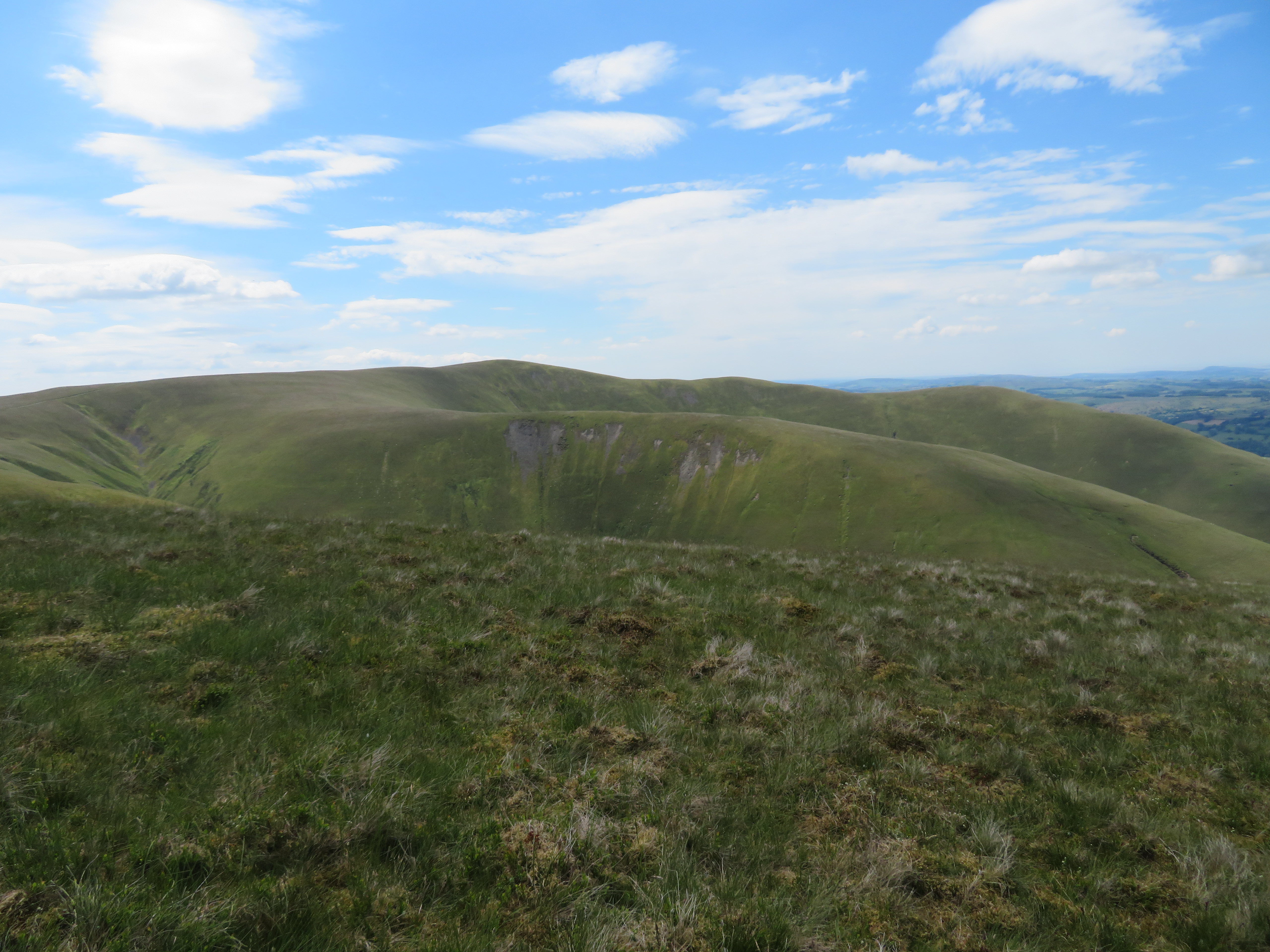 A view across to Calders
 We decided to fuel up before we arrived at The Calf and sat on the path that runs along the fellside and above Calf Beck as the views were absolutely incredible with the pasture lands below split by the M6 Motorway with the bright waters of Killington Lake and Morecambe Bay drawing the eye over to the southwest. This is an airy seat way above Calf Beck with the open views to the front as we sat wrapped in this best seat of the gallery of the surrounding high Howgills behind and to the sides of us. This would be a great place for a house with a view.
 A view to the southwest and the LD skyline
  A view to the northwest and LD skyline
 We eventually tore ourselves away from the view and began our walk to The Calf along the narrow path clinging to the fellside gently rising as it made its way to the low point between Bram Rigg Top and The Calf...
 The Calf from above Calf Beck
and the well made path that links all the high points together from Fell Head all the way along to Arant Haw, but as it’s part of the Dales Way and takes a lot of footfall I suppose that it’s as well that it has been beefed up to a very good standard. We arrived at The Calf to find a few other walkers already there and one chap sat on the trig Column so whilst he decided to get himself off it although he didn’t appear to be in any rush to do so and give others the chance of a summit shot we used the 1 metre higher summit point for our initial photo shoot.
 The true summit of The Calf
 Apart from Ann we had all been here before so we hung around until the aged teenager removed himself from the column leaving only a few sheep to keep us company. A few of the higher fells to the north are discernible from here, Green Bell, Randygill Top, Kensgriff and Yarlside sit behind the lower Hazlegill Knott and Cobles.
 A Lake District skyline from The Calf
 Leaving this first top behind we descended the 35 metres or so to the saddle between Force Gill Beck and Calf Beck and looking down the former named beck got a decent view towards Wild Boar Fell.
 A view along Red Gill Beck towards Wild Boar Fell
 We walked on passing over the uninspiring grassy top of Bram Rigg Top as we made our way to Calders and I wonder why BRT is without a cairn as so much effort has been put in to furnishing the other tops around here with decent sized cairns. Another first for Martin and Ann.
A good steady undulating walk passing quite a few other walkers soon had us at the large summit cairn of Calders and yet another new top for Ann and Martin. And this is from where I took quite a few photos.
 Calders summit
  Baugh Fell behind Arant Haw
  Sickers Fell and Knott behind Arant Haw
 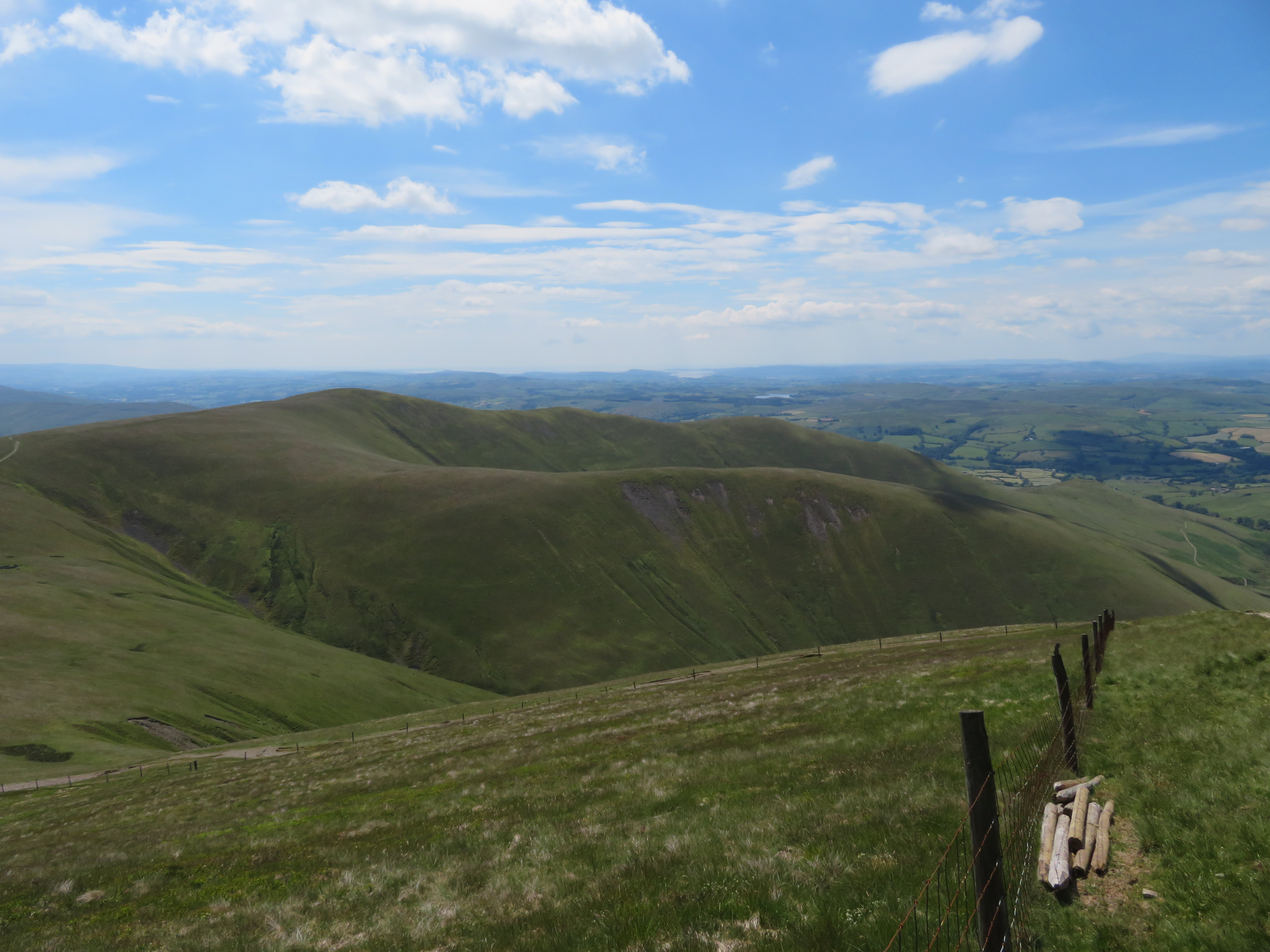 Looking across Arant Haw towards Killington Lake
 I moved down the fellside hoping to get a better view of what was below us.
 Looking down on Bram Rigg Beck from the top of Calders Rigg
 Arant Haw looked so far away from Calders it must fill tired walkers with doom and gloom, though in fact it doesn’t take all that long to cover the distance at all...
 Arant Haw ahead
 and we were soon at the spot where we left the main drag to bear off to the right and climb along the grassy track to the summit cairn where we last rested up here a few weeks ago when walking Crook and Winder. On arriving at the summit we were met by the aged teenager from The Calf as we moved into sitting position for pleasant views over Winder and the open land below us.
 Winder from Arant Haw
  The 600 plus metre Howgill skyline from Arant Haw
 I’ve been here a few times and the views still take my full attention with the magnitude of the scene. Despite the hazy conditions the views are far reaching and we could just spot the outline of some of the higher hills of the Yorkshire Dales Pen-y-ghent, Ingleborough and Whernside being the most prominent. Our time of relaxing was over once again and it was time to get going on the last leg of our walk with the original chosen route being modified whilst we had been walking and looking across the various spurs leading down from the skyline. I had planned to descend from Arant Haw by taking the west ridge down to Nab and then on down to Crosdale Wood from where we would walk across the lower fields back to the church, but on our climb on to Bram Rigg I kept looking at the easy slopes of Bland and although no path was shown on the map or could be seen on the ground I felt sure that a way down would be easy enough and save quite a bit of road walking. So that is what we did.
 Nab summit with the Bland ridge to the right
 A wide grassy track leads off to the west on the shown route for the 515 metre high point that is central to Nab, Middle Tongue, and Bland, the ridge that we would take from this high point. The three ridges form a sideways lying Y facing west and are all of undulating grassy slopes. Within a matter of a few minutes of descending we were about halfway down the first ridge to Nab from where a look back gave a good view of the wide track leading from Arant Haw.
 Looking back up Arant Haw
  Southwest view across Crosedale
 A few metres before the highest point of Nab the path splits with our original route to the left and our new one, to the right, that would take us over the high point and minutes later we were standing at the small summit cairn of Nab.
 Arant Haw from Nab summit of 515 metres
 From this point we now took to the northwest on an unmarked on the map wide track that would take us all the way down to Seat Knott. I’m surprised that this is not marked on the map as it is obviously an old track that is well worn into the fellside and impossible to miss although no sign of it can be seen from the approach to Bram Rigg along the bottom and when passing Seat Knott. It drops straight down at an easy gradient to the 440 metre point from where it then zigzags down to pass close by an old sheepfold to our right from where we climbed the easy pathless slopes of this 344 metre fell.
Although it was still very sunny the clouds had begun to roll in and thicken up making for dark fells where we were and lovely and sunny on the other side of Chapel Beck. Seat Knott looks a mere pimple against the backdrop of the main Howgill fells but has the same characteristics of being grass covered with a touch of protruding rock here and there. The sheepfold can be seen as small white dots at the end of a wrinkle in the grass at the bottom of Seat Knott.
 Seat Knott from Bland
 An easy climb soon had us at the cairnless summit of thin grass and a few small outcrops of rock that forms a neat and small rounded dome.
 Seat Knott summit
  Castley Knotts-Brown Moor and Fell Head from Seat Knott
 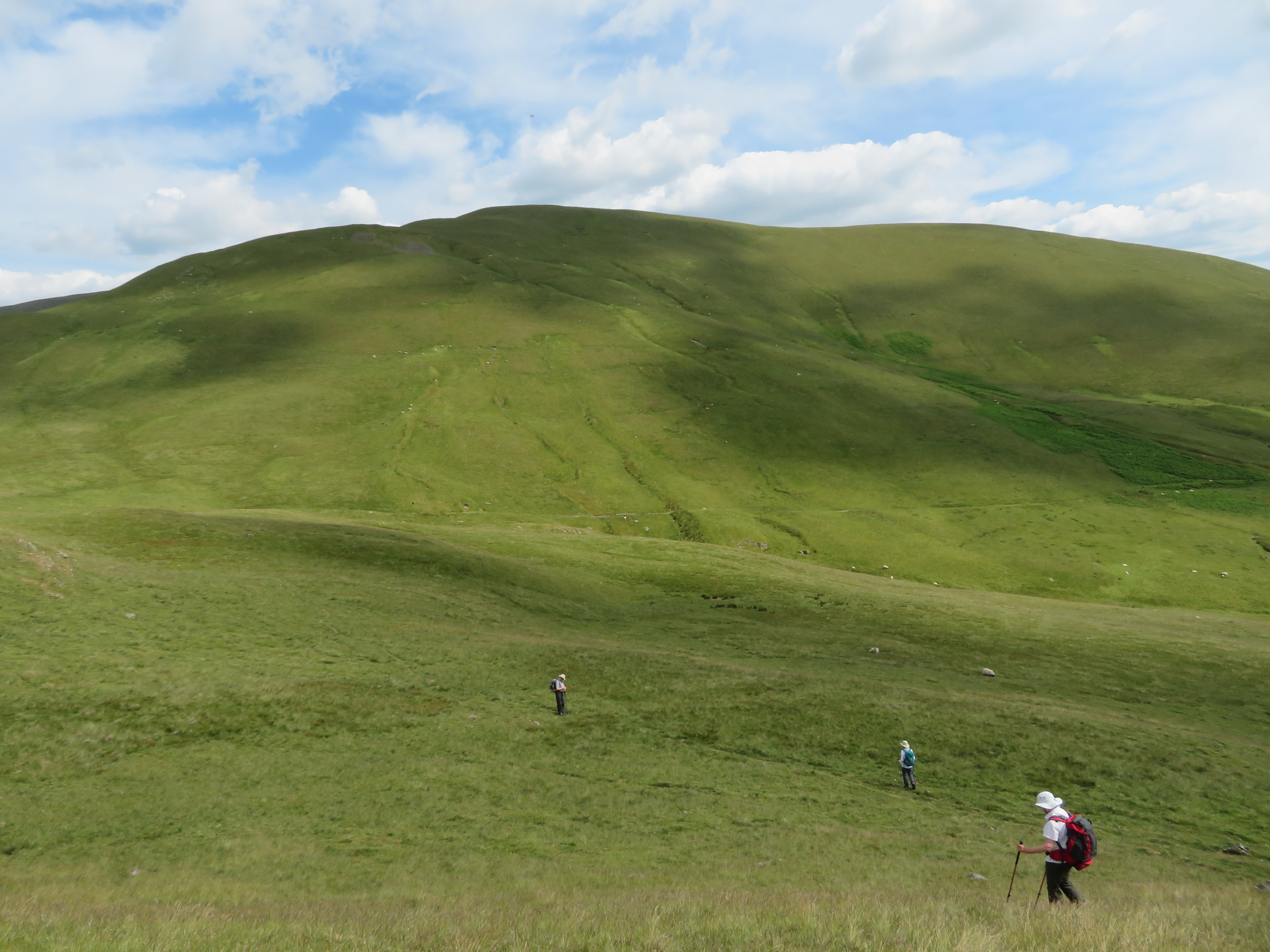 Bland from Seat Knott
 Now as we left the summit is where things somehow got confusing because instead of just walking down the west side of Seat Knott we retraced our way east back from the summit and made for the path that runs behind the intake wall and would have taken us back on to our original route and I think that this was done by following the ladies down the easier slopes and then with normal conversation taking place it was a while before we noticed our mistake. No harm done but unnecessary walking done. We turned our backs towards Bland and Nab and made our way back to the ford at Eller Mire from where simply followed our outgoing route back to Birkhaw, the hay meadows...
 Flowering hay meadow at Birkhaw
 the strangled by undergrowth stile and back to Howgill Church.
Well that was another good day out in the Howgills roaming those great grassy fells where we saw but a few other walkers about, mostly on the The Dales Way. When visiting the Howgills a long climb is to be expected no matter from which direction they are tackled from with the easier – though no less shorter - slopes being from the northern side of the group. I was happy with the performance that my knee gave me, some aching and a short jab or two but seems to be much improved by the enforced rest period during which I got cabin fever, made even more so by torturing myself by looking longingly at Cross Fell and its close neighbours that are sat just across the road from where I live but only time will tell if I simply got a slight reprieve or I will get attacked by a vengeance on future outings.
Martin and Ann are relatively new to the Howgills and have yet to see the full beauty of these fells and have fully appreciated what they have seen so far. A bonus was finding the track down from Arant Haw to Seat Knott and all we had to do now was go and have a bottle of the finest at The Inn at Home and though it may not be the same as one of the local hostelries the beer will taste just as good after the walking on a hot day as this.
