free to be able to rate and comment on reports (as well as access 1:25000 mapping).
It's a real trial making up routes at the moment. There's the weather to deal with, which is always an issue, but currently there's deer stalking too, which becomes more of a problem when I want to add in Simms or other summits to Munro rounds. I'd a nice route planned for the Tilt hills which incorporated a Corbett and a number of Simms. I emailed the estate office to enquire if my route would be problematical, but got an out-of-office reply saying the person would be away til Monday. Well that's not much help. Friday's forecast was truly awful, so I thought we'd head for the southern Cairngorms - initially A'Bhuidheanach Beag and Carn a Caim which I wanted to do from Sronphadruig Lodge - it makes for a nice loop from that side...but then I reckoned stalking would be an issue there too. So I chose Meall Chuaich, followed by a trip to the cairngorms proper to get Allison's final Munro and Tops in that area.
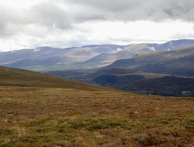
We camped near Dalnaspidal on Thursday night, dry and quite calm, although the noise from the adjacent A9 does still reach you. A short drive to the lay-by for Meall Chuaich - the fourth time I've done this hill using the same route - that's a (not very inspiring) record. We met a Northumbrian shepherd on the way up (and back, actually) and had a good chat with him. Windy up top. On the descent we came down to the dam where we had lunch, then headed up the Graham of Creag Ruadh which is easily added on to this route. Sheep tracks took us to the summit, then we followed sketchy ATV tracks on the way back to the main track.
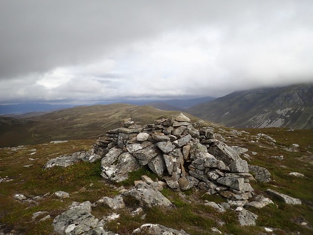
Chuaich Summit
 08C23635-493B-471E-91DD-8A66C772B37A_1_201_a
 by
Al, on Flickr
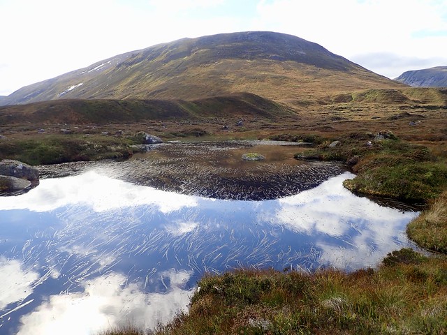
Loch Cuaich
 9ACD7604-81A7-412A-ADB4-B7559C1AF474_1_201_a
 by
Al, on Flickr
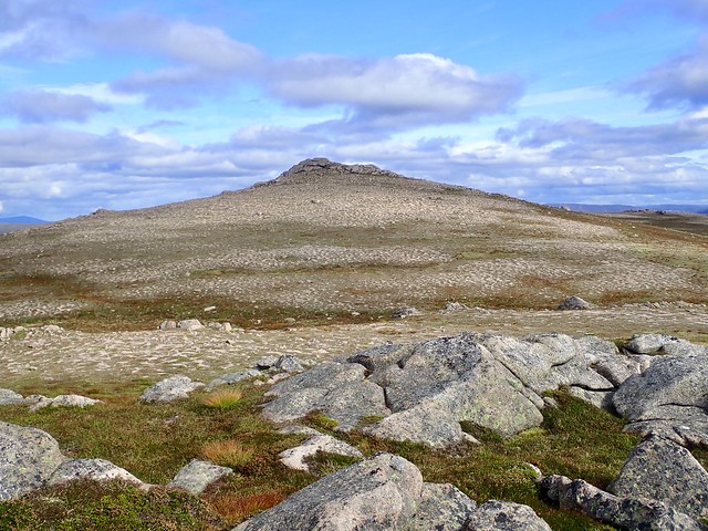
Creag Ruadh
 F22F559E-21C9-45AA-9380-45E41A0E4CD0_1_201_a
 by
Al, on Flickr
 C34ACBBA-EDC8-42AE-8EDA-2DB8AF70535C
 by
Al, on Flickr
Back at the car, it was time to head up the road to Aviemore and do a bit of walk in to Bynack More. Quite a pleasant, if windy afternoon. We headed through the woodlands by Glenmore Lodge and past the lovely An Lochan Uaine which was quite busy. I wasn't really sure where to camp - I wanted to head up Meall a'Bhuachaille and thought we might camp by Ryvoan Bothy, although then I decided we'd walk on to the grassy place I've often seen folk camped on...trouble was I couldn't remember just where that was. Time and distance was going on and no sign of anywhere to pitch in a mass of heathery tussocks. I'm getting crosser and crosser, knowing that for every step I go on, I'm going to have to go all the way back to Meall a'Bhuachaille and then return. Finally, we found the spot, which is just by the bridge at the head of Strath Nethy. Wind was being channelled down the strath, and the rain looked like it was starting. We pitched and I left Allison to set things up whilst I stormed off the 2.25km back to Ryvoan Bothy and the path up Meall a'Bhuachaille. Yes, we could have pitched outside the bothy. 400m of ascent aided by a good path/stone steps took the ire out of my mood and to my surprise the rain had stayed off. There were even summit views. I fair trotted back along the path to the tent, noting another 3 tents had pitched at the start of Strath Nethy.
Pet Cemetery from early 1900s near Glenmore Lodge
 704C77CF-2684-4E0B-B96E-F05EB9D1A96A_1_201_a
 by
Al, on Flickr
Meall a'Bhuachaille
 538CE866-2B0D-40F9-A046-F24628CA7A53_1_201_a
 by
Al, on Flickr
 880D60FA-896B-40EF-81BB-6B074DDBA3AE_1_201_a
 by
Al, on Flickr
We expected a blowy night, but it wasn't bad, did rain heavily for much of it though. Sunshine and blue sky on opening up in the morning. We packed up and set off along the path to Bynack More. As we neared the summit we took a bypass that led to Bynack Beg. The wind was strong and chill up there, despite the sun. Over to the fine blocky summit of More, then past the Barns and out to A'Choinneach. We headed steeply down the Leachd a'Bhainne to reach the path then straight up Creag Mhor, which is pretty easily achieved if done from here. Back to the track to pass the Fords of Avon refuge, sequestered within its stony shell and over the boggy ground through Glen Avon to reach The Saddle. Loch A'an was looking lovely, as usual, and the craggy side of the 'Gorms always impresses me when seen from here.
 BE62E893-76B5-41C1-A9CB-C40AB1D4F6B5_1_201_a
 by
Al, on Flickr
 3F50CE29-23C7-4F31-AF23-B9DC9BC1B508_1_201_a
 by
Al, on Flickr
 1F2DECFC-3F9A-44AE-BCBE-CA220816B7EC_1_201_a
 by
Al, on Flickr
 56A95726-9771-4992-AAF5-14286DFE8748_1_201_a
 by
Al, on Flickr
The Bynacks
 53F7A508-D273-4E7B-A81A-22DC87FB16FA_1_201_a
 by
Al, on Flickr
 8664AC9D-8142-410B-B1EA-6E070B9AF465_1_201_a
 by
Al, on Flickr
 553DB5A4-ACC0-4F47-93B3-362E778B4306_1_201_a
 by
Al, on Flickr
 D8E39707-1174-47E4-883D-ADA9D61D5E79_1_201_a
 by
Al, on Flickr
A'Choinneach
 8ED14BF0-F4D2-48D0-8920-BC8AC36091B4_1_201_a
 by
Al, on Flickr
Leathd a'Ghlinne
 58EFA4FF-8BEE-4BD5-AF44-993DC4A752D8_1_201_a
 by
Al, on Flickr
Summit Creag Mhor
 81E01C3B-28FF-4D6F-A4D2-D76972079F87_1_201_a
 by
Al, on Flickr
 04F6B059-7A75-479A-BD65-3F8FE44E20C2_1_201_a
 by
Al, on Flickr
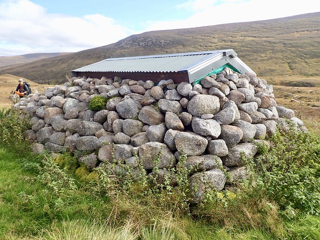
Fords of Avon Hut
 4C2EF97C-F83C-4DF6-A863-84BF1B4E3E58_1_201_a
 by
Al, on Flickr
 98BB0958-46E2-46AC-B367-B8310715B387_1_201_a
 by
Al, on Flickr
Loch A'an
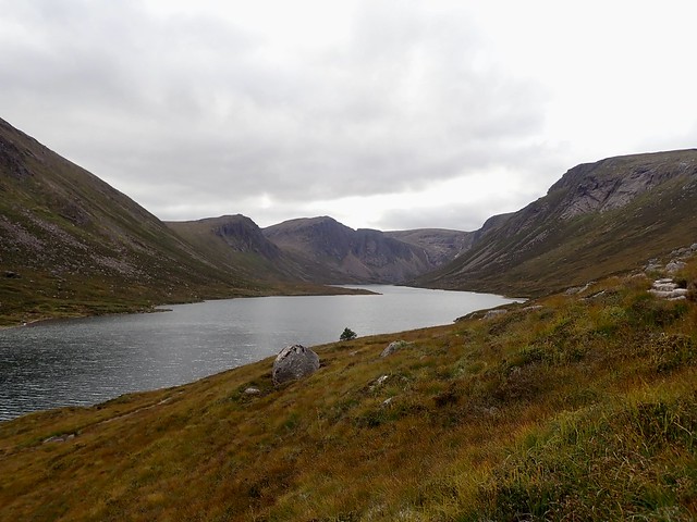 C4519DFA-920A-457E-8311-5D0599DDEEBD_1_201_a
 by
Al, on Flickr
We started off up the track towards Cnap Coire na Spreidhe, the final Cairngorm Top she requires. I hadn't any idea where to camp - whether to try for something in the coire below this top, or just head back to the car. We found a flat place near the top of the coire - this may be Ciste Mhearad or Margaret's Coffin...anyway it was pitchable and we made use of it. We left the tent to dry whilst we went up the short distance to the Munro Top then returned for some Huel and coffee. The sun was out, but we were increasingly in the shadow of Cairn Gorm - I suggested we head up there for the last of the sunlight. Quite a lovely evening, looking out over the strange collection of shaped that make up the Cairngorms, with numerous protuberances on some of the mountains. Back down to the tent in the coolness of shadow.
 C288DB3E-759E-47C3-BB4E-50F1A8D171EC_1_201_a
 by
Al, on Flickr
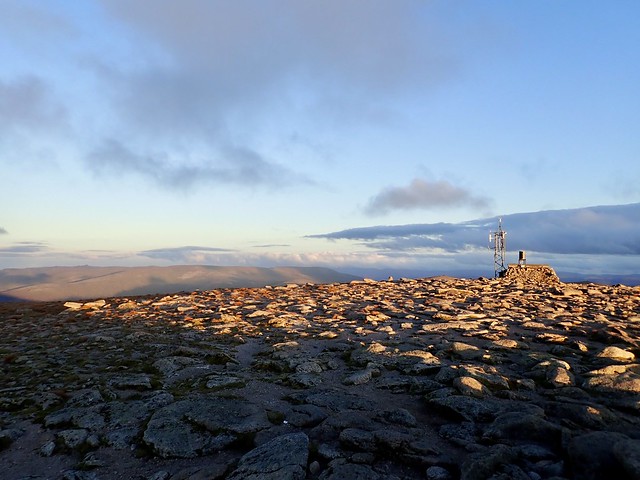
Cairn Gorm summit
 FD1257AE-BAC0-488B-9C4B-885ECD941AED_1_201_a
 by
Al, on Flickr
 79C7E7B8-9E84-41E5-B1BA-47BDBEE96DE8_1_201_a
 by
Al, on Flickr
 45CADAD4-CD64-4141-AC9C-FE4778CE707E_1_201_a
 by
Al, on Flickr
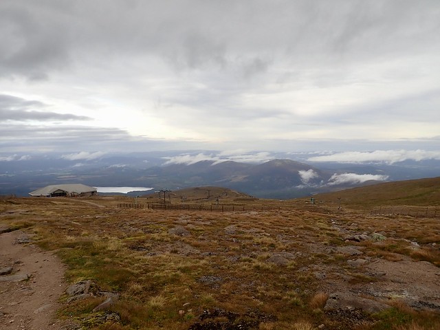
We heard the rescue copter hovering somewhere to the south of us about 7.30, then circling for a while. I reckon it was probably down by Loch A'an. We couldn't see anything. I thought I heard a rescue team go down the track nearby the tent at 5am, but I might have been dreaming. Around lunchtime we saw the chopper making a beeline in the direction of Raigmore Hospital, so maybe there was an incident - haven't seen anything about it on line. But back to our morning...a bit claggy and cool - we packed up the tent and wandered down from Cairn Gorm, passing a few folk on their way up. We walked down the road for a bit then took the Allt Mor path, which had a sign up saying it was unsafe underfoot and dangerous after Utsi's Bridge. I'm guessing this was on account of trolls. But I thought the last trolls were run out of Scotland in 838AD? I think there is a case for their re-introduction, just as with lynx, wolves and woolly mammoths. We debated what kind of warning sign the authorities might put up beside bridges presumed to harbour trolls...And whilst we're at it, I think the re-introduction of a few Frost Giants in the far north would be a nice touch.
 4DE7CA07-EF6B-4D15-8E64-F7835E429A33_1_201_a
 by
Al, on Flickr
Utsi's Bridge - sadly no trolls in sight
 ED20D44E-FE04-4749-84FF-64E591FD034E_1_201_a
 by
Al, on Flickr
 D7ED8236-2E6E-47FA-B380-A843EB105AB5
 by
Al, on Flickr
Back at the car, having safely negotiated Utsi's bridge without a giant hand emerging and pulling us to a watery death, we had to choose what to do now. It was 11am, since we'd got up late and really the obvious was to head across the A9 and do Geal Charn Mor. Now Allison isn't doing a third round of Corbetts, but she has said that she'll willingly do "interesting" ones. Geal Carn Mor does not fall into that category, although, in its favour, it does have track all the way to the top. We took the standard WH route, up the Burma Road and back by Balliniluig and I didn't even look at the Simms around it - I know when to reel it in

The drive home turned into a small nightmare due to closed roads and dodgy directions from google, but we won't dwell on that.
 4652BFBD-223D-4B40-8465-07FACFC3634D_1_201_a
 by
Al, on Flickr
 D6E49F44-12B9-40F3-8D1A-0F35BF31E1B9_1_201_a
 by
Al, on Flickr
Allison at the top of a Corbett she didn't expect to be at the top of again
 4450D6BC-7C6A-4B27-BDFD-F520A2DC0BF7_1_201_a
 by
Al, on Flickr
 9A79AD3C-5B7B-4BFE-8E49-BE96D9A8E5DA_1_201_a
 by
Al, on Flickr
A field of rust
 80ABE9BB-55BE-4FDA-A4B0-1E7E0DD1212A_1_201_a
 by
Al, on Flickr
 703CAFEA-1B34-4C35-B229-2E9E0A634955
 by
Al, on Flickr
.
