free to be able to rate and comment on reports (as well as access 1:25000 mapping).
maps: further down; gear: last paragraph
Just lovely
My spirits were heightened by misty Oban harbor. Nothing epitomises getting away better than the sight of a Calmac ferry, engines running. When I arrived on the Isle of Mull, at Craignure pier, the bus driver said: ‘I’ll give you a free ride’. None of my cards worked and she didn’t carry any cash. ‘It’s beautiful where you’re going’ she said, pulling out of the bus stand and switching on the voice of the electronic tourist guide. Minutes later, I was standing on the asphalt, a small road winding uphill, the sound of the bus dying away. The prospect of a new walk, just lovely. A real
holiday, mind you.
 All photos by Klaas van der Veen
, on Flickr.
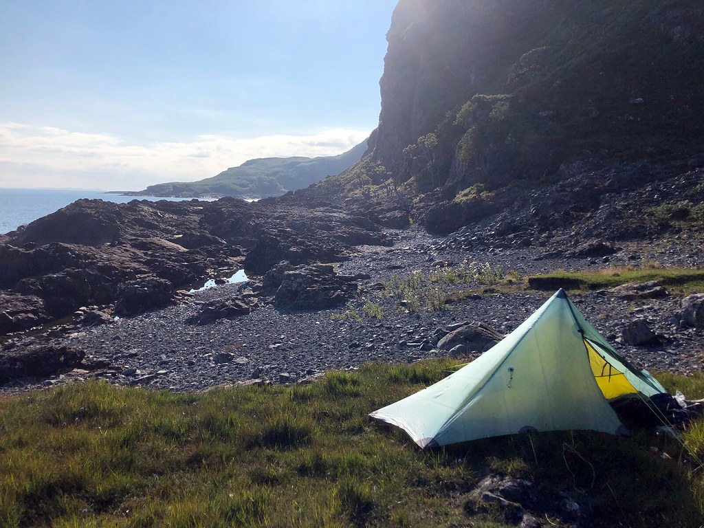
The Laggan peninsula of Mull
 The ground below the cliffs is broken black volcanic rock, split by eroded dykes, contrasted with small meadows where goats graze.
The weather improved during the walk along Loch Spelve, and by the time I turned onto the Laggan peninsula, the sky was blue. I had never visited Scotland in August, so I was pleasantly surprised at the beauty of the tall grass, the heather in bloom and the lush green of the ferns. The downside became clear very soon: it swarmed with ticks, which took some getting used to. Some Smidge and a lot of checking worked well (no permethrin on
my skin)
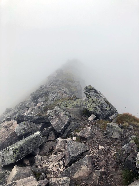
After a short dip at Port a’Ghlinne, I wrestled the rough terrain along the coast to Rubha na Cotha. The map announces this attraction beautifully by showing dense bundles of contour lines and a ragged coastline.
Day 1: 14.5km, 400m (distance and ascent of hand drawn Viewranger route)
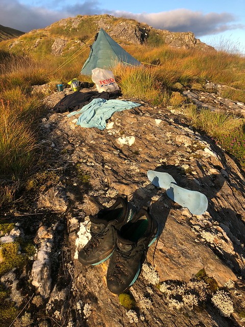
 Grassy pitch with private beach
 I sat down in the surf, rinsing the sweat away. The higher island across the Firth of Lorn is Scarba, north of Jura
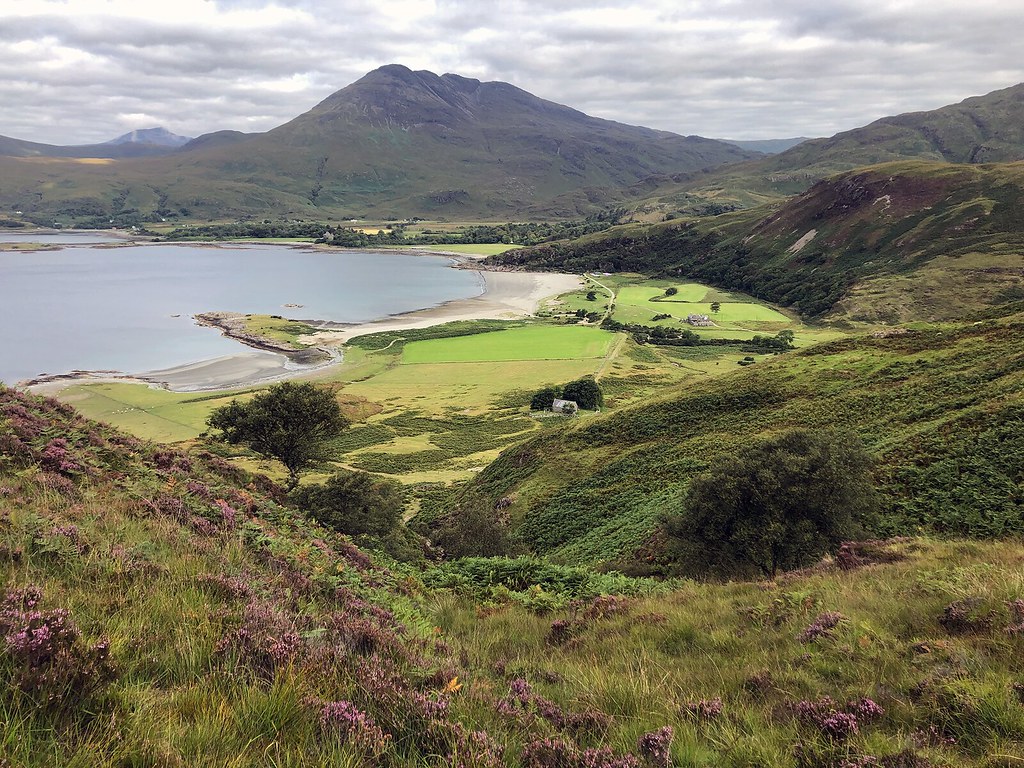
Intermittent pathsIn the morning I climbed very very slowly across pathless Beinn a’ Bhainne and sneaked past a chapel into the lovely Lochbuie area. I stopped for two cakes and excellent coffee at the Old Posthouse. ‘Is this coffee grown in Scotland?’, a girl in yellow crocs asked. The hills of Mull are empty, but when crossing a road, one dips into the campervan-queue.
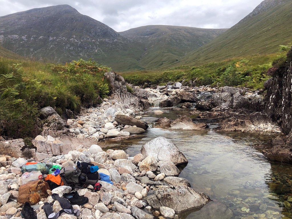
Across the Mam an Trotanaich I came down through the big plantation to the A849 and rested by the river near the bridge. I had planned a detour to the Pennyghael shop, but didn’t go there, though I was a little short on food. The path up to the Bealach near Creag MhicFhionnlaidh was, erm... ‘intermittent’. The way paths on the map can be no more than imprints on the grass reminded me of Jura. A muggy heat got me all sticky. The ground was dry, so to go for a swim and have plenty water to drink, I aimed for a pitch near the lochan on top of Tor na-h Uamha.
Day 2: 22.7km, 1,260m
 Loch Buidhe area
 Fine old path up the flank of Beinn nan Gobhar soon to turn vague
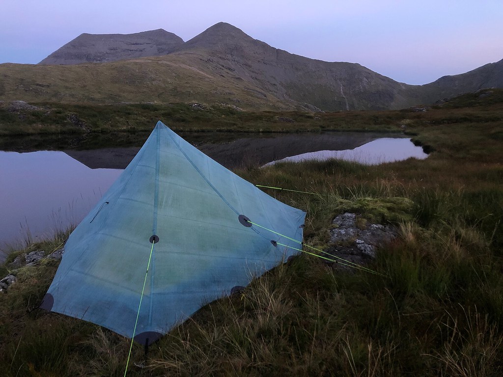 Paradise, surrounded by hills and lochs. The water was too organic to drink unfiltered, but I had a short swim to cool off. No filter was needed for the images of Ben More taken from here.
An eagle a day
I got up at six, a good habit when the sky is blue, and was away to Ben More by 7, leaving the tent in place. I skirted above the screes of A’ Chìoch to connect with the narrow ridge up Ben More. In this weather, still and dry, the climb is great fun, right along the crest.
I returned by a route below the A’ Chìoch screes, a sensible choice. Back at the tent I bathed and ate and lazied about till it was time to break up and move on, to Corra-Bheinn. In my underwear, due to the heat. Two Sea eagles (an adult up high and a juvenile circling low) accompanied the climb. I videoed them, and took a long time watching. On Mull it’s an eagle a day (Tip: you won't spot them from the roadside).
Corra-Bheinn is along the ring of hills between Ben More and Ben Tallaidh. I had imagined walking the whole chain, but after the steep descent to the col below Beinn Mheadhoin I gave in: no water at all on the col, and staying on the ridge would entail more ascent and more miles than my legs or supplies would support.
Day 3: 13.6km, 1100m
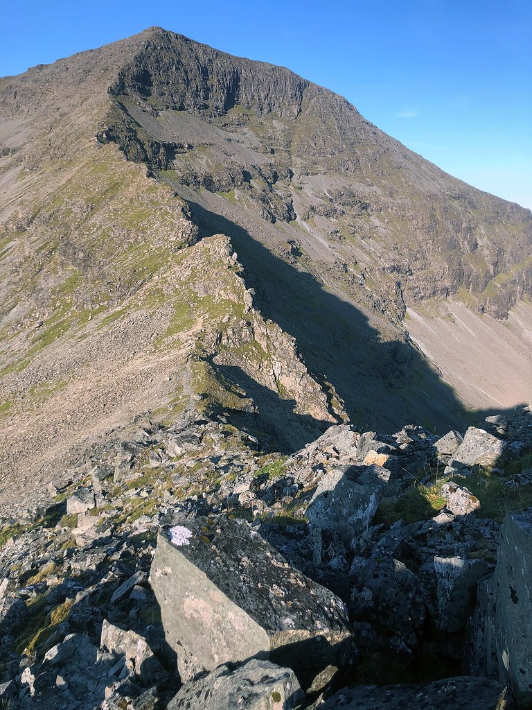 Up Ben More along the north ridge
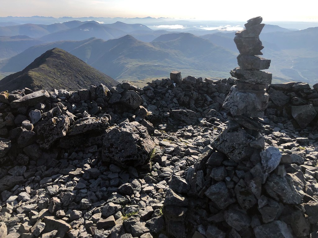 Needless to say, the views across Morvern, Skye and Rum were tremendous
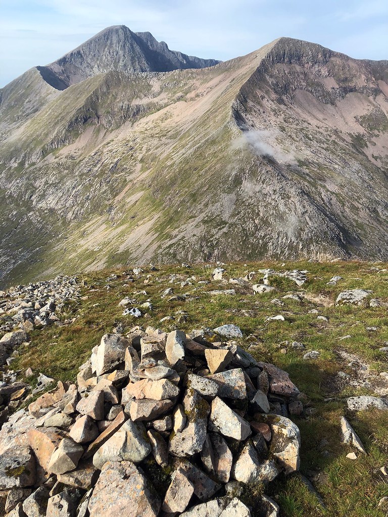
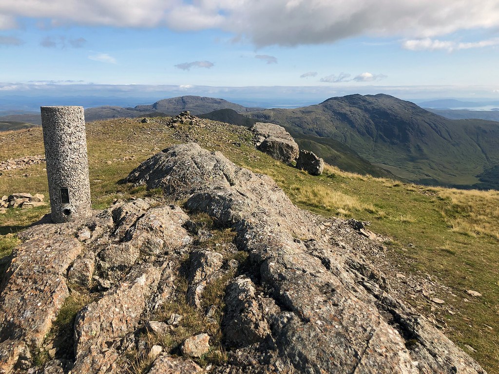 Corra-Bheinn summit, looking east-northeast
 Early morning near GortenbuieUlva
I walked out along Loch Ba and saw an eagle again (golden, this time), and a merlin harassing a harrier. On the way to Gruline, a big bull walked ahead of me. The owner, a farmer as tall as the shoulder of the animal, said: ‘He’s seen enough of the ladies and went for a walk’.
I walked across to Salen and had a delicious lunch at the Little Bespoke Bakery. I tried my luck calling the Ulva Community Bus. “No, it’s not in operation now, but I’ll see what I can do” said Ewan. Within 10 minutes he called me back and half an hour later Alec zoomed into view to pick me up at the Spar busstop. This gave me enough time to stock up and to note that the Spar sells everything. Except methylated spirit.
The Ulva ferry put me and two school kids (carrying brandnew wellies) on the island. I walked up one of the lovely tracks west. Amazing woodland, winding tracks, heather in bloom, ferns high. I loved it. Ulva is lush, lush equals Ulva.
I visited Craig bothy and continued to Cille Mhic Eoghainn to camp but streams off the hill didn’t make it to the beach. Therefore I searched for water ‘one shelf up’. I filtered 2 litres of water from a stream half an inch deep and fended off the midges till a breeze came. I ate a local mature cheese I had bought in Salen, and sat enjoying the island-studded view.
Day 4: 14.6km, 120m + 8km, 180m
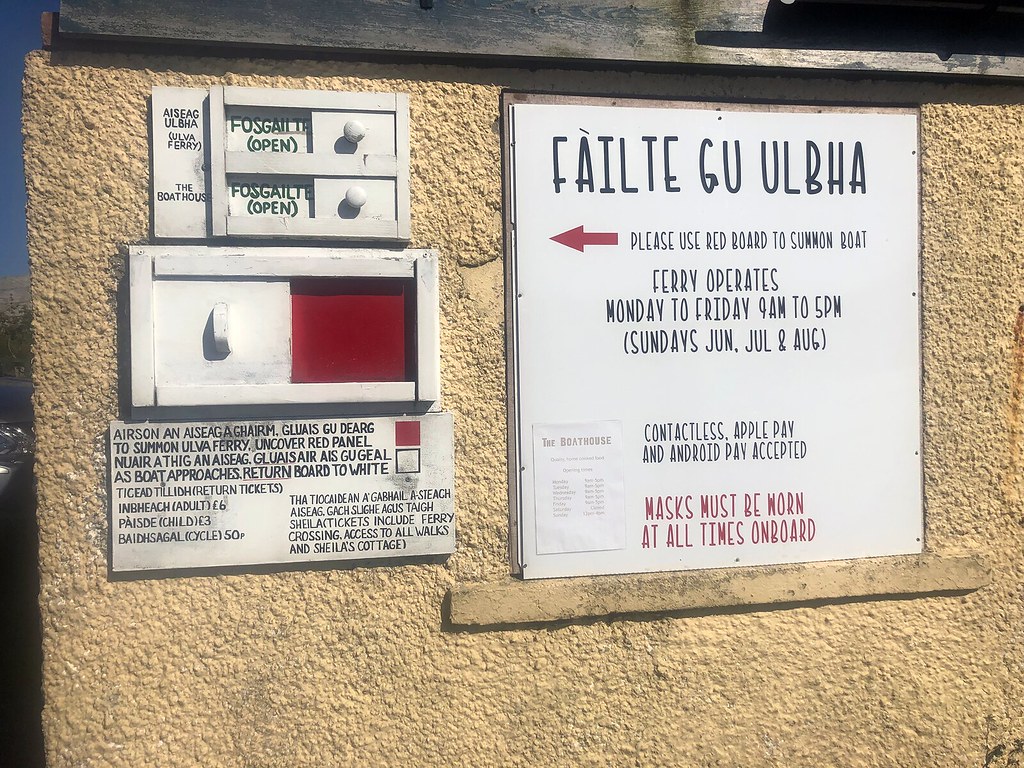 An ancient method to signal the ferry, but tickets can be paid using Apple Pay
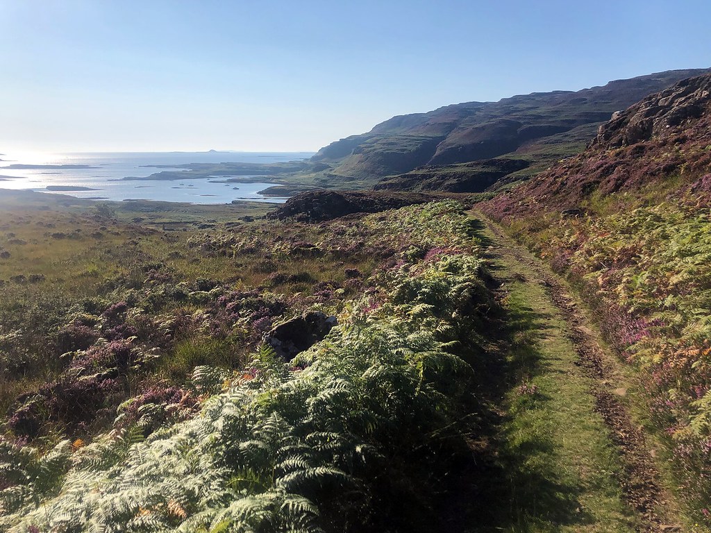 The south coast of Ulva coming into view
 Tent pitched higher up
Island Marilyns
Yay, I had found myself an island Marilyn nobody visits! The Cicerone guide describes Beinn Chreagach as ‘unapproachable after summer due to man-size ferns and deep heather’, but a careful look at stream cuttings and sheep tracks got me up quite effortlessly.
I followed the spine of the island to the next hill, Beinn Eolasary. After that progress was cut short by biodiversity (in the real world it’s the other way around). I mistakenly crossed the deer fence by a stile and got swamped in Ulva’s lushness until I got out near the Gometra bridge, covered in seedpods, flower leaves and other organic stuff that itches like ticks. We need an App that scans the skin and compares it to a previously made map of birthmarks.
Clouds came in and I played some old music to help get me to the ferry in time. I had time left for langoustines and a chat at The Boathouse. Barry brought his black cabbage to the restaurant kitchen and then signaled me to walk along to the ferry. He came to the island like people come to Alaska, in search of work and away from something. He ferried me across and took me back to Salen in the community Nissan Leaf. “I love this car, all cars should be like this” he stated, just when I thought he looked very much out of place in this sort of car, its purple and blue screens contrasting with his gardener’s outfit.
I took the bus to Tobermory for a lengthy and very disappointing try at finding a room. Got offered only one for £140. This took me so long I had to make an uphill run to a hardware store to get the fuel I needed. With that ticked of, I relaxed in the queue near the chips shack.
‘I’m living the life’, the boy in the window claimed. ‘It’s my first payday as a chippy boy’, he went on to say. I got my excellent supper and a coke. ‘I don’t know what I’m earning yet’ he said, a bit less cheery, ‘but a day here is a day off’. A good approach to life. I ended up on the campground, a nice and laid-back place. I washed my clothes and put them back on. I had walked more than 10km in Oban alone. I should have come prepared.
Day 5: 14.8km, 500m + Tobermory 10.5km, 300m
 Looking down on one of the many Ulva ruins, with Cille Mhic Eoghainn chapel higher up in the picture
 Beinn Chreagach summit. Ben More ws always on the eastern horizon, etched against the blue
 Super rich plant life, super unwalkable
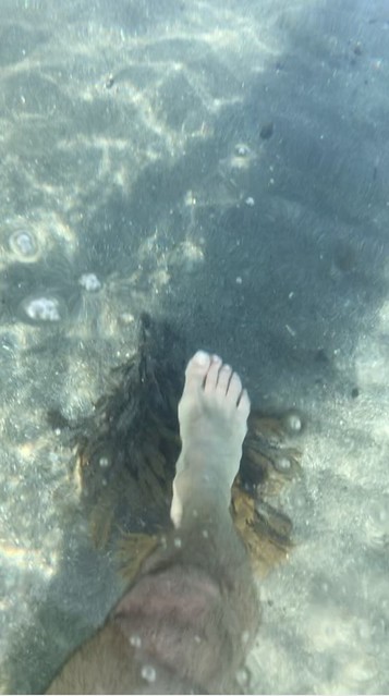
I had a swim in the insanely clear sea near Bearnus bothy
Long straight lines = bus/taxi/ferry
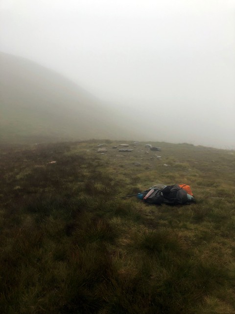
Another high camp
The second leg of my walk starts at Lochaline, Morvern. I skipped the fleshpots at the ferry landing and headed up the west side of the loch. A landrover track lead to Leacraithnaich bothy, luxuriously refurbished. I chatted to an older couple and left. All too soon the path ended and was replaced by brand-new poles, spaced 100 m apart, hoping to turn the dotted line on the map into a path. At Caol Lochan I turned north and climbed Beinn Meadhoin along the gash in its southern flank. Rough terrain and a sprawling hill. Golden eagle again. I popped out onto the summit ridge where the stream originates at 700m. The lochan there was not only too small to deserve being on the map (as someone had told me already), it was also nearly empty. I pitched somewhat higher on short grass and went back to filter water. After dinner, I walked the 300m to the summit of the hill.
Day 6: 17.2km, 900m
 Found meths here
 After walking mile after mile finding a room in Tobermory, my mood went all mild in the evening sun on the way to the campground
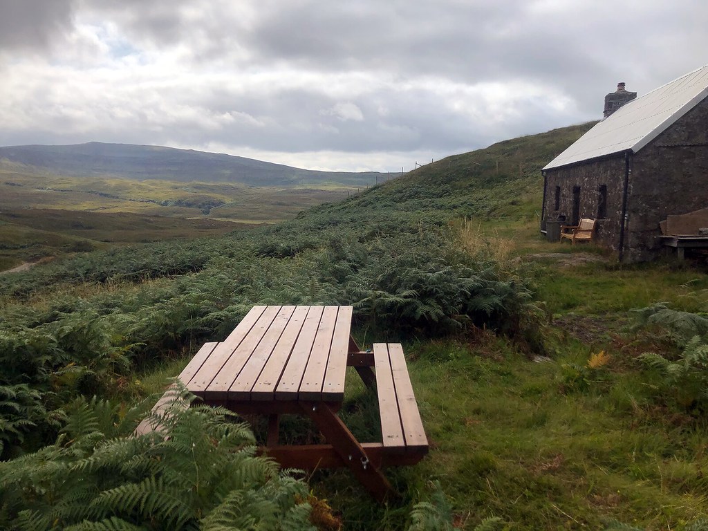 Leacraithnaich bothy
 Tent near the summit of Beinn Mheadhoin
Ardgour views
Beinn Mheadhoin is a mini massif. Many bumps, many branching ridges. The southeast side of the hill is eaten into by Glensanda Superquarry. Quite a grim thing, even for someone who likes things industrial every now and then.
I ate a lot of brambles on the way through Kingairloch. I walked around to Camasnacroises tiny white church and up Glen Galmadale where I had a swimwash in one of the river’s delectable pools. Same story: the path disappeared and I was left to fend for myself turning north and up into the bowl of Coire a’ Chuil Mhàim. I camped on the col between the two corbetts. Before dinner, I climbed Fuar Bheinn, its summit twenty minutes away. The view wasn’t big, but it was heavy, looking onto the back of Garbh Bheinn and it’s satellites, and over the firth of Lorne to Oban. Surely, rain was coming.
Day 7: 19.7km, 920m
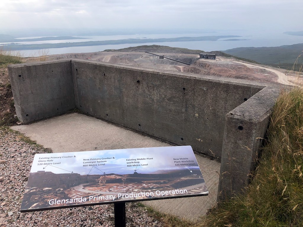 Glensanda quarry. Seemingly bothy-sized sheds grow to 30m high buildings once you realise the wheels of the trucks are 2m high.

 Nice pool for a wash! Glengalmadale river
 Looking at Creach Bheinn and the grumpy ol' Ardgour peaks on the way up Fhuar Bheinn. The notched peak in the center of the photo is Garbh Bheinn (885m). To me, Garbh Bheinn is the King of Corbetts. It was the first hill in Scotland I climbed, and I got lost on it immediately (June 1, 1994).
The long road to Corran
The morning sky looked VERY water-laden. The wind had turned up overnight and Creach Bheinn was hidden by shards of mist every now and then. Above the edge of the corrie, two golden eagles were balancing themselves on the upward stream, nearly motionless.
The trig point on Creach Bheinn is a rusty tube surrounded by rubble, and the napoleonic camp looked very desolate. Some bumps and ridges later I was on my way down to the road. The road was long, all the way to Corran. I was willing to make a sign saying ‘two jabs, neg test, mask’ to aid hitchhiking, but I tried only one time and then gave up.
On the ferry I cornered Joe and his girlfriend, kayakers, into taking me to Fort William. I learned of their mental map of the Highlands: it’s all rivers and dam releases. “To Morrison’s carpark, is that okay?”
At three, the rain started. At four I found myself in a very good room in Guisachan Guesthouse. At six the owner poured me a pint of local beer, at seven I was having dinner, in house, and at eight I was reading Ian Rankin amidst my gear explosion. Wonderful.
Day 8: 20.4km, 490m
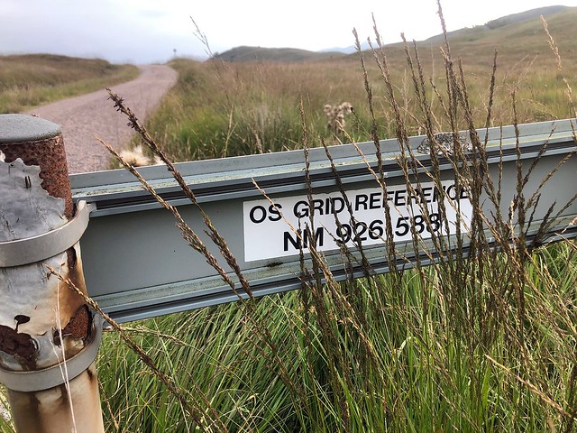 Did you know there's grid references on the back of the road signs?
A rainy intro to the Mamores
I have an ambition to walk continuous routes, so I took a late morning bus back to Corran Ferry and walked a stretch so typical of many TGO Challengers routes: a rainy forest track followed by a farmland road. I tackled it playing Supergrass’ ‘In it for the money’. My route hit the West Highland Way, that pinnacle of mental effort. I sat under a small shelter and ate. I chatted to a woman from Birmingham and fell in love. On the long long climb onto the Mamores ridge I generated opening lines to keep myself entertained (they all worked).
Mullach nan Coirean is a dull hill. I slanted into the upper corrie to get water. I knew the easiest way out (slightly back and due west), but I refused to use this hard won information. Instead I clambered through the only line of cliffs on the whole hill. Not so dull after all.
Misty and drizzly, it wasn’t like the first 7 days, but it was special in the way the clag makes you focus on the ten yards ahead, the changing color of the rocks. After the white quartzite of Stob Ban I descended to Lochan Coire nam Miseach and found a flat pitch along its outflow. Plenty of water this time. Standards plummeting, I praised my mackerel in spicy salsa, thrown in with the noodles. This was the only night that reminded me of
last year's windy, snowy walk.
Day 9: 20.3km, 1,295m
 Stob Ban (Mamores) summit cairn
 Let's call it 'Atmospheric', this spot in Coire nam Miseach, just below the main ridge
The suns wants to come through
Weather promised to improve later in the day, so I found myself in cloud right on the Mamore ridge, with Sgurr a’Mhaim the closest objective. The Devil’s Ridge sat inbetween. The clag took away the intimidating drop and I found there was only one bad step with an easy bypass, so in half an hour I was on the Munro summit.
On a no-view day, only the duration of the climbs makes you feel the size of the hills. Navigation didn’t prove a problem, since there’s a baggers path all the way. The only exception is the descent of Am Bodach, with an easy to miss tight turn to go down the rough north ridge.
An Garbhanach was more difficult than the Devil’s ridge. On An Gearanach I met three people doing the Ring of Steall. Nice to meet someone. “You doing it anti-clockwise?” asked the man before reckoning that to be here at this hour I would have had a start well before sunrise.
The sun wanted to come through but didn’t. I decided to leave Sgurr Eilde Mor for another year (a route south-north, connecting Glen Etive, S Eilde Mor and S Coinnich Mor, Spean Bridge). By 3 o'clock the weather forecast and my location had me thinking. Curling my route back westward would bring the Big Ben on board…
Day 10: 18.5km, 1,575m
 The delightfully narrow summit ridge of Binnein Mor
 Looking across Glen Nevis from the flank of Binnein Beag, to Sgurr a'Bhuic and Sgurr Coinnich Beag
 Evening household In this weather, anything is possible, and many things are easy.
The first hour uphill, on tufty grass, that’s the difficult part. I Collected some water on the saddle between Coinnich Beag and Sgurr a Bhuic and went up Aonach Beag. A big hill, with a giant rough corrie beneath it to the northeast. On the way to the next col I met a young guy which from a distance seemed to carry a toddler. Coming closer, I saw it was a gigantic rucksack. He carried seven days of food. He asked advice on how to get down to Nevis Water from the summit of Aonach Beag and I saw myself, 30 years earlier: strong, young, inexperienced but sane enough. He said “you’ve packed more efficiently than I did”.
“I’m old, I can’t carry that kind of load.”
“I barely can, this things weighs 80 pounds.”
I once carried 60 pounds, ages ago, but even that would be quite odd in 2021, considering how gear has evolved. His sleeping bag was tied to his rucksack with carabiners that one could hang up a swing from. He hadn’t thought of weight
at all, just went. Wow.
[/i]
 The marker for the path down to the saddle with Carn Mor Dearg. A very long and steep descent to 'col 830' followed by CMD, the Arrête and The Ben.
I fell into my one breath in - one step up - one breath out - one step up, to do the climb to CMD in one go. A fantastic leg of the journey, a really nice ridge up. The next three quarters of an hour I let myself be absorbed by the CMD arrête. In the still air, I tiptoed across the dry boulders along the crest. The bliss of focus! Early afternoon I was on top of The Ben. With 200 others. When you live in India, South Africa, London or New Zealand, it seems Ben Nevis finds its way to your bucket list, whether you’re a climber, a walker, a shopper or a pub crawler. I sat down and ate my meal at this mental endpoint of the trip.
Did I say ‘endpoint’?! I sped down the zigzags when lots of people were still going up. Most were reddened, hurting, supported, sweating profusely. My admiration grew and grew. The descent is LONG, an ascent must surely be hell. Halfway, I took a dip in Loch Meall an-t Suidhe. Upon continuing my speedy descent, I was accompanied by another hasty guy.
“When I start showing off, I slip” I admitted

.
“Haha, I do too, when I say to myself ‘this is going nicely’”. We had a good laugh. When we couldn’t muster the necessary concentration, we slowed down. After a big drink at the Nevis Inn I walked to the campsite. A shower, washing clothes and putting them back on. Wettish pants in the restaurant, no-one notices. I wiped the seat with a napkin.
Day 11: 18.8km, 1,650m
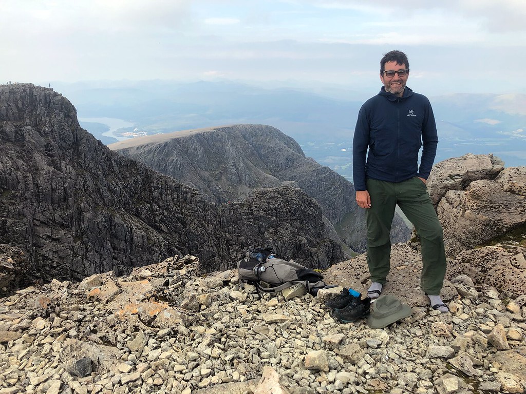 Very touristy photo: nice sunglasses, never mind the socks. (Photo by a Chinese Malaysian who offered taking anyones picture)
Next day I rode the train back to Glasgow, it was full of WHW walkers. I had a good shopping trip to two tiny record stores in Glasgow Barrowlands and some good meals. After an antigen test in a beauty parlour I got my flight home.
Day 12: 5km
GearI had bought a water filter, a hat and a midge net for the June TGO Challenge. The water filter was needed more often than I would have thought, due to rather empty streams. The hat is indispensable. The midgenet, I used it maybe twice.
My shoes were scarpa’s again, Mescalito, but I did not like everything about them: a suede outer is utter nonsense when wet, and the heel-to-toe drop is too big.
I also brought an 80 grams pair of waterproof trousers (OMM Halo). They work, but I escaped any real downpour this year. Let's keep them for Holland and bring something more substantial to Scotland next time.
My quilt was much too warm, but I have only one and that’s fine. Can’t buy gear for any and every type of trip.
Finding meths was harder than I remember. I’m thinking of switching to gas for the TGOC22.
PlansThis year I was to participate in the 2021 TGO Challenge, but COVID rules kept me from coming to Scotland at all. I told the airline to defer my flights to the end of August, betting on simpler rules. This worked out well.
Come 2022, I’ll be on the TGO Challenge. Interesting to have a walk bound by simple rules. Very difficult to write down the entire route when I’m so used to having freedom at every turn.
