free to be able to rate and comment on reports (as well as access 1:25000 mapping).
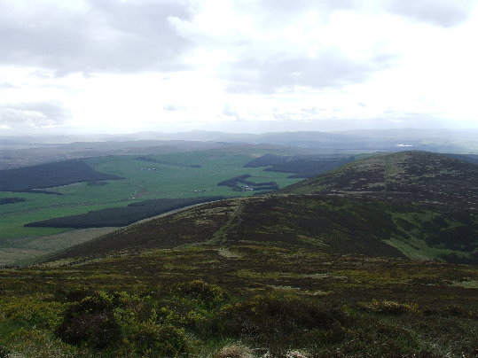
Some time back I worked out the highest points visible from Blackhill Transmitter. Having travelled to Black Hill in the Pentlands I had taken care of the east. My next objective was south, to Tinto. While Culter Fell, it’s neighbour, is higher at 748m, it cannot be seen from Blackhill, likewise Green Lowther and Lowther Hill are hidden by the transmitter, so Tinto at 711m is the highest visible point visible to the south.
To make my route a bit more challenging I decided to cycle up to Blackhill, past Lochhill and Wester Bracco farms- no easy ride this one, with a gain in height from the A89 to Blackhill of over 170m/500ft! Speed is never great with such an ascent, giving you time to admire the piles of discarded tyres and Buckfast bottles which litter the roadside. Dropping to Mountcow is sadly even worse, as the field here is littered with empty booze bottles. There was a bin here once; it appears to have quietly been removed. Between here and Duntilland is a stretch of road that is really not suitable for road bike tyres, and a bit of dodging and weaving is required to avoid the potholes. While travelling over this section I noticed someone had dumped a large fruit machine in the field next to the road! The lengths some people will go to dump rubbish never ceases to amaze me.
Past Duntilland and past the new lambs, down to Kirk o’ Shotts church, where I stopped for a drink at Kates Well, a spring dedicated to St Catherine of Siena.
From here I headed along the B7066 back towards Salsburgh, before heading south on to Manse Road (passing the signpost for the right of way). This road twists a bit and as I passed the woods on the left I couldn’t help but notice the number of old televisions lying among the trees. I cycled on, and the wind was beginning to pick up as I came over towards Westfield Farm, a ramshackle collection of agricultural machines and rust, which makes Steptoe’s Yard look like Princes Street Gardens.
On then, past Law’s Castle, which isn’t a castle at all. It’s actually two very large boulders on a slight bump. My first visit here was to the geocache hidden here, also coincidentally, my first geocache. At that time it was also home to an abandoned Hackney taxi, which has now been removed. Long before that it was apparently a favoured spot of Bertram de Shotts, a seven or eight foot high giant of a highwayman, who made his fortune by robbing travellers and traders on the road which passed over the moors. Such was his notoriety that King James IV offered a reward for his capture, either dead or alive. In the event it was gained for his death, by a man called John Gilchrist (or Willielmo De Muirhead, depending on what you read). While Bertram lay down drinking from Kates Well, he was attacked from behind, hamstrung and then beheaded.
I carried on south-west, into the wind, then south-east, past the entrance to Mudostoun Castle and up into the oddly named Bonkle. From here its only a few minutes to Newmains. From here I headed towards Lanark on the A73 and with the quiet roads behind me and now cover it was a dual battle with the wind and the traffic which flies past at fair old speed. There’s a wide, and empty pavement for part of the way, and it being safer than the road, I took to it. Carluke came and went, I noticed that the junior football ground where I saw a few Airdrie reserve games, is now gone. Work was underway clearing the site, soon to provide a home to another Tesco. I wonder how many Scottish ground now lie under supermarkets?
A few miles further on and a bus shelter provided a timely seat, no sooner had I sat down than the heavens opened, full on. The water was running down the road like a burn. I brought the bike in to the shelter as well. No-one likes a wet bike seat.
Finally I picked up speed going downhill, then I crossed over the Mouse Water before the long, steep pull up into Lanark. The last time I had cycled to Lanark it took me 90 minutes from Airdrie. This time, going over Blackhill and into a strong wind added almost an hour to that. No time then to stop, and I took the road out past Lanark Loch where the road is lined on both sides with newly painted cycle lanes- brilliant!
Across the impressive old Hyndford Bridge, which dates from 1773 and onto the A70, a new road for me. I’ve been up Tinto a few times, but always from the car park on the Thankerton side. This time I would come in from the village of Carmichael. Passing Howford Farm there’s a copse at the top of the hill and I took this minor road past small farms and long forgotten quarries, before coming down in to the village of Carmichael, which consists of a few houses, a church and a school. As I go along the main street I could see a house on top of an incredibly steep hill and at this point my body said NO! Thankfully a small road led off to the south, past Syde, before turning east to Lochlyoch. Just beyond this farm the track double backs towards the reservoir, and it was here that I locked up the bike, changed shoes, and headed uphill.
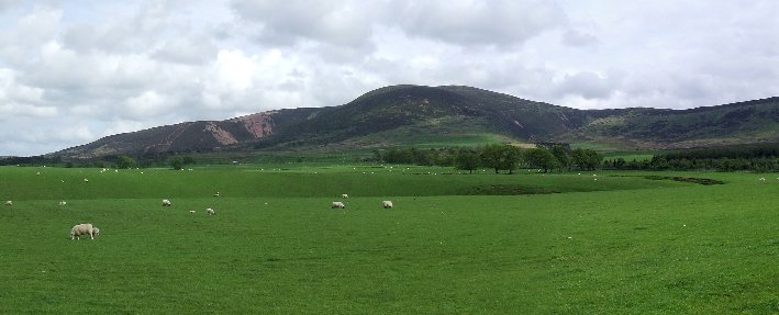 Tinto from the north west.
There’s a track marked on the map, which runs up to Cleuch Reservoir, cleuch being Scots for a gorge or ravine. The track entrance is fenced off, now appearing to start in someones garden, so a detour round the fences is needed, starting at a gate at NS 93286 35876. I followed this up, sticking close to the fence so I could loup over quickly, there being some very active and inquisitive cattle in the field. After about 400m I came to gate and crossed, before heading south west up the slope.
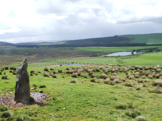 Standing stone with Cleuch and Lochlyoch Reservoirs
Crossing another gate I came upon a solitary standing stone, of which I can find no information. I carried on up the slope, it’s steep, convex and even. This means that as you go up you can only see a short way ahead of you. Convex slopes can be the most depressing to walk up, as you cannot gauge how much you still have to climb. There is no path here, and progress is through heather, straightforward enough if a little time consuming.
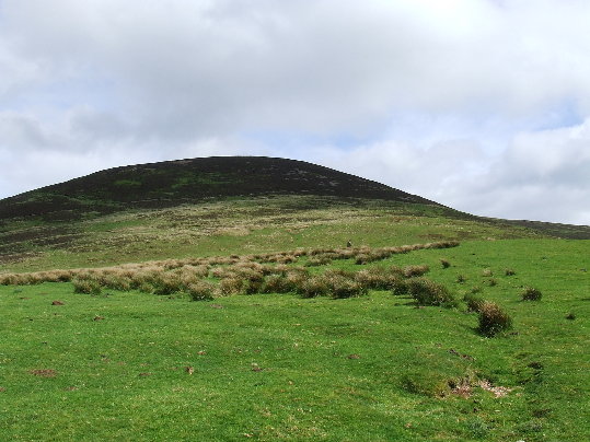 Convex slopes- ARGH!
Eventually I came on to the crest and found what appeared to be a land rover type track through the heather, leading me in the direction of the summit. It was fairly easy to follow, and although the wind was strong and slowed me down a bit, I was soon at the trig point. A quick hop over the fence and I was on the massive cairn.
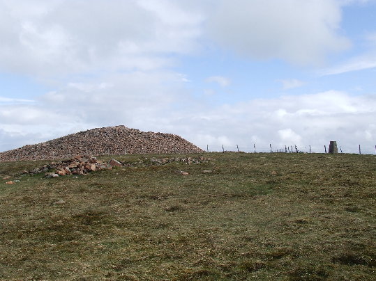 Trig point and cairn
Unfortunately it wasn’t the weather for hanging around; I was measuring the wind there as gusting up to 55mph!
 Descending west towards Lochyloch Hill
I followed the fence down the west ridge, there was another vehicular track here and I followed it down for about a kilometre before heading north along the ridge to Cleuch Reservoir. From here it was back along the fence to the bike, again dodging the cows as I went. It had taken me just under an hour to get up to the top, and about 45 minutes to come back down.
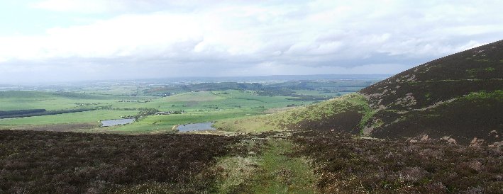 Looking down the Cleuch towards the reservoirs
From here it was back the way I had came to Lanark and on arriving at the train station I checked the GPS- 39 miles all in! I could be happy with that. Two down off my list of hills, two to go. But the day wasn’t over, as train problems saw the train sitting at Motherwell station. My feet were itching to go, so instead of a relaxing journey home it was another 7 miles to go, and pretty much all uphill. Good days are never easy!
