
Blair Atholl to Aviemore - Heaven and Hell
Date walked: 16/08/2016
Time taken: 30.5 hours
Distance: 65km
Station to Station
Blair Atholl to Aviemore by Glen Tilt and the Lairig Ghru
16/08/2016
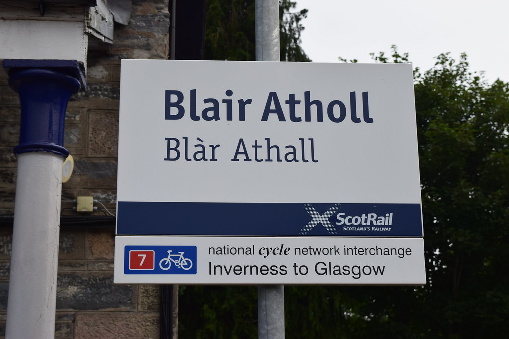
An early departure got me by train to Blair Atholl at 08:52 and I sent a few quick texts to let folk know I was setting off. The weather was OK – misty but bright and it was set to warm up as the day went on.
 20160816_57775 by Neil MacNeill, on Flickr
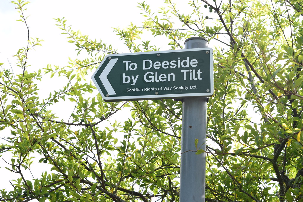
I headed for Glen Tilt and, as I’d been this way a few times before, didn’t give any thought as to where I was actually going. A SROWS (Scottish Rights of Way Society) sign said “To Deeside by Glen Tilt” so I went the way it was pointing because that’s where I was going. After passing through Fenderbridge the road was rising sharply and seemed to be heading away from the glen. Disappointingly early in the expedition I had to get the GPS out to get my position and check the map. I found there would be a turn off and footpath back into the glen not much further on. At the turn off there was another SROWS sign and I was slightly surprised to find I was still on their route so I carried on.
 20160816_57777 by Neil MacNeill, on Flickr
As it turned out this was a nice way of getting into the glen as it went through old woodland and was a nice change from the “usual” approach.
 20160816_57778 by Neil MacNeill, on Flickr
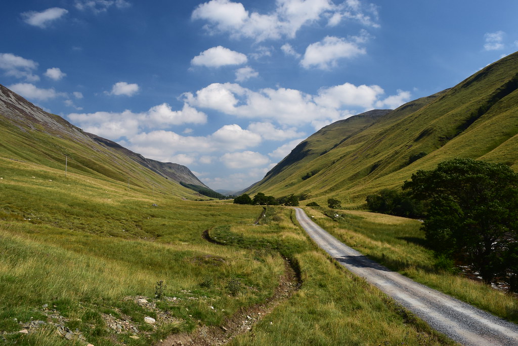
And, because I’d come up so high, the next few miles were gently downhill until the path joined the main track up Glen Tilt just north of Auchgobhal near where the Allt Mhairc joins the River Tilt. The sun had come out at about 10:15 and it had become a hot day.
 20160816_57785 by Neil MacNeill, on Flickr
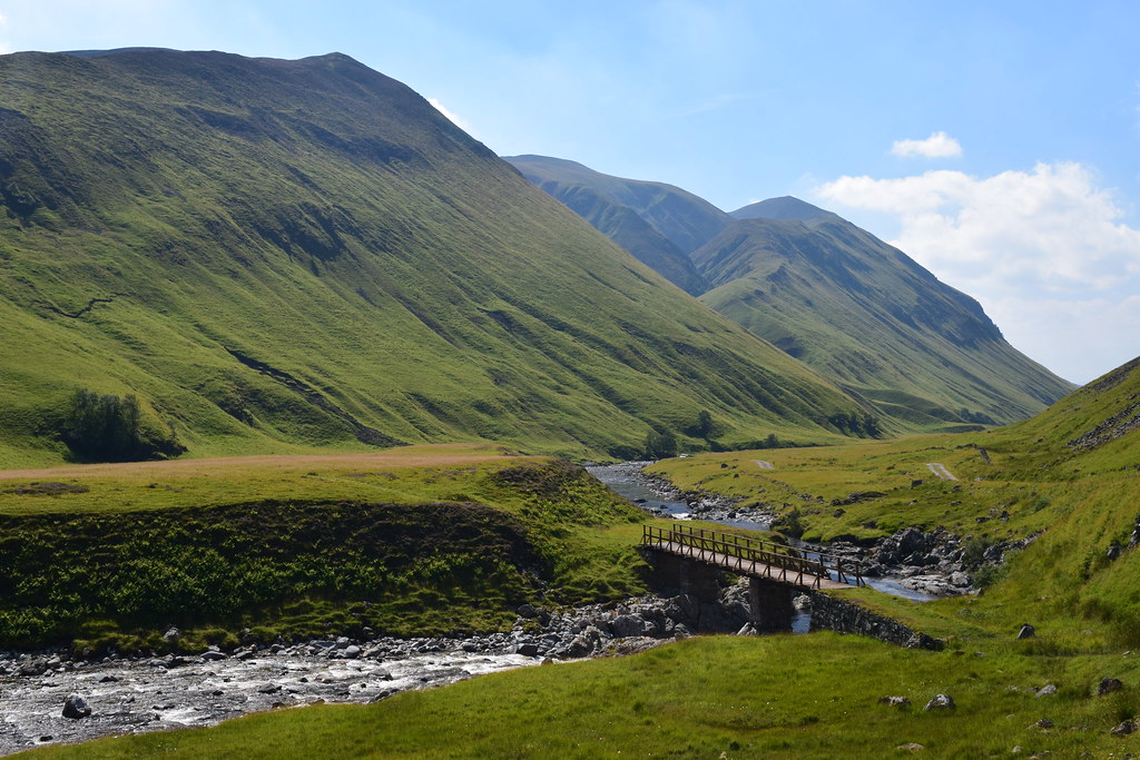
At about 11:30 I stopped for about 15 minutes just after Clachghlas where a wooden bridge crosses the river above a roaring, rocky narrowing.
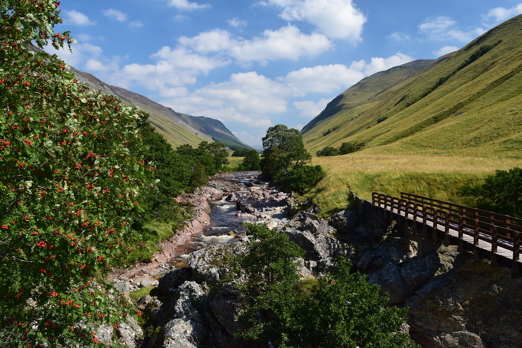 20160816_57802 by Neil MacNeill, on Flickr
A sudden hot gust of wind nearly takes my map into the river! The glen looks great from here as its sides steepen and close in further north.
 20160816_57805 by Neil MacNeill, on Flickr
A figure approaches from down the glen and when I look back to say hello he’s gone! He must have turned up the track behind Clachghlas en route to Carn a’Chlamain.
I’d intended to stop for 5 minutes every hour and even set the timer on my watch to remind me but this didn’t happen – I was always wanting to see what was round the next corner or over the next rise!
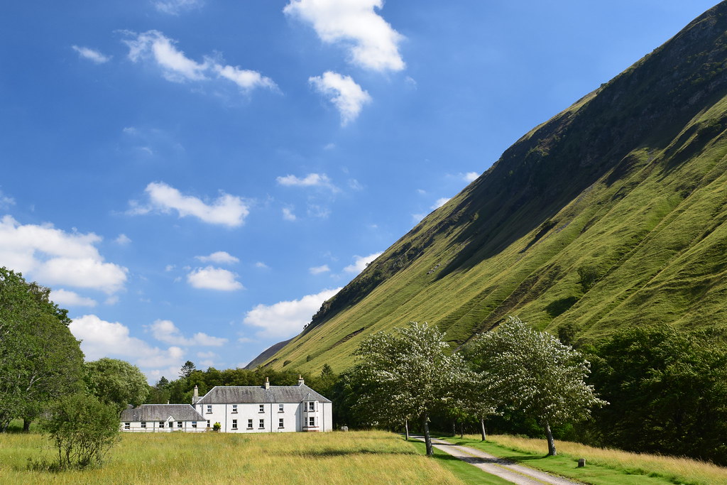
Forest Lodge.
 20160816_57813 by Neil MacNeill, on Flickr
I did stop at about 13:30 for a little while to filter some water and fill a couple of bottles. This was shortly after I’d passed four men, one of whom was fishing a deep, still pool while the others spectated!
 20160816_57825 by Neil MacNeill, on Flickr
 20160816_57842 by Neil MacNeill, on Flickr
My right foot had been getting sore and I’d had a few sharp pains in my left knee (the “bad” knee which has been very good of late) so took a few ibuprofen. This was a bit of a concern as I still had two more days walking ahead. I slowed down a little after this.
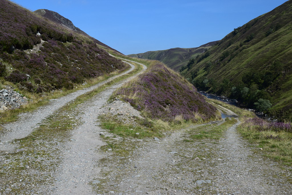
Further up the glen I came to a fork in the road – one branch leading uphill and the other down. I’d been here before but didn’t recognise this junction as I had approached it from the other direction. A quick check of the map and I was pleased to see my route was the lower one!
 20160816_57854 by Neil MacNeill, on Flickr
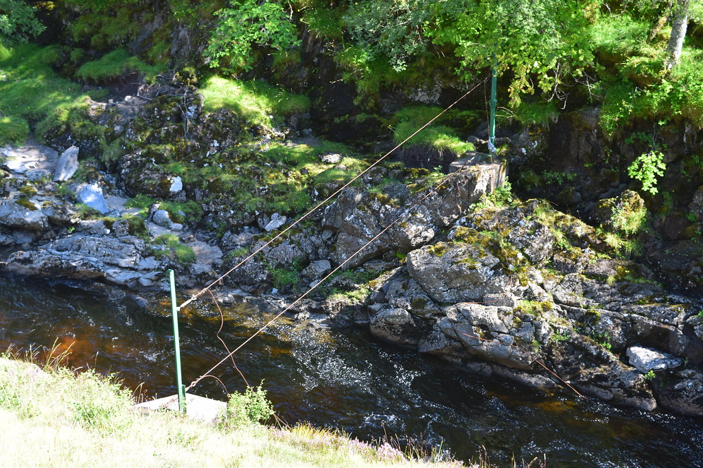
Now in the upper reaches of Glen Tilt I passed the wire “bridge” (two wire ropes – one for feet and the other for hands!) that I wished I knew about the last time I came down the glen after joining it from Glen Loch (after crossing the three Munros of Beinn a’Ghlo and a camp in Glen Loch).
 20160816_57857 by Neil MacNeill, on Flickr
Soon after that I was at the junction of the aforementioned glens and smiled (wryly, probably!) when I recognised the area of the river where I’d boulder-hopped across!
 20160816_57858 by Neil MacNeill, on Flickr
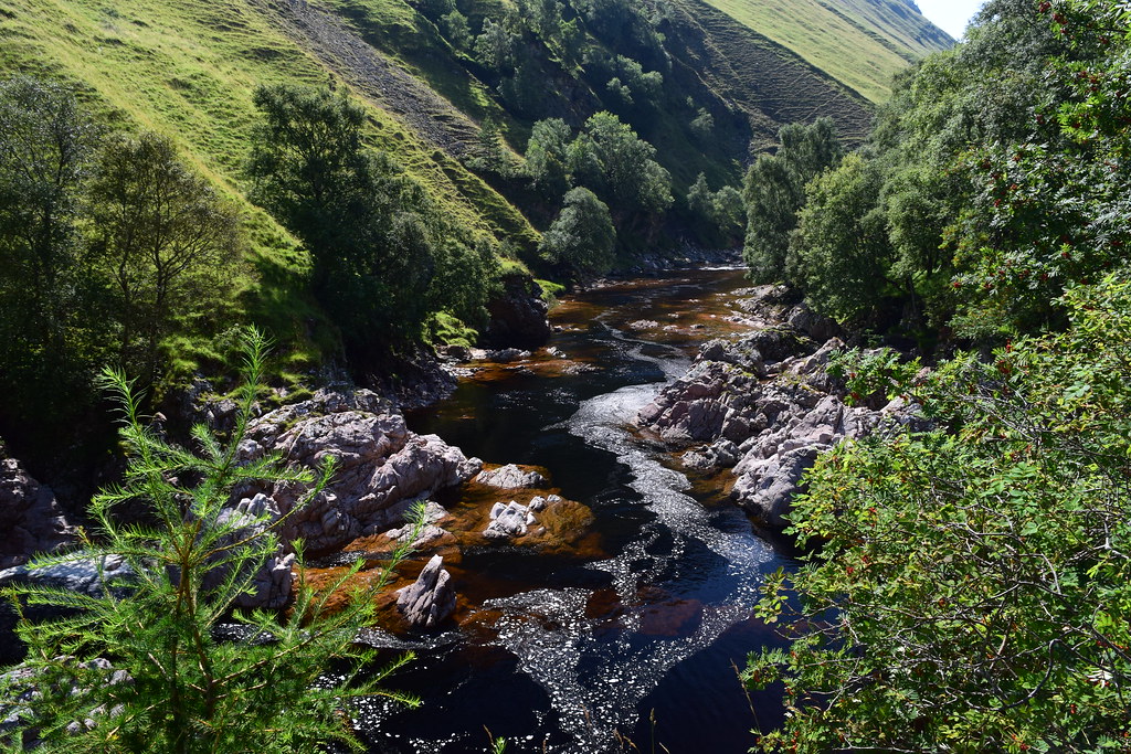
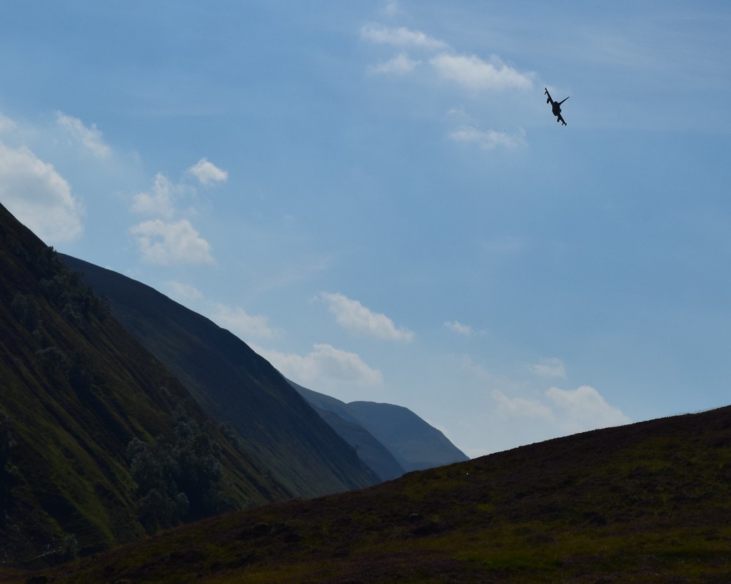
Continuing on from here at about 14:30 I was in new territory. And it was just about here I was buzzed by a very low flying Typhoon! Those crazy fly-boys!
 20160816_57863 2 by Neil MacNeill, on Flickr
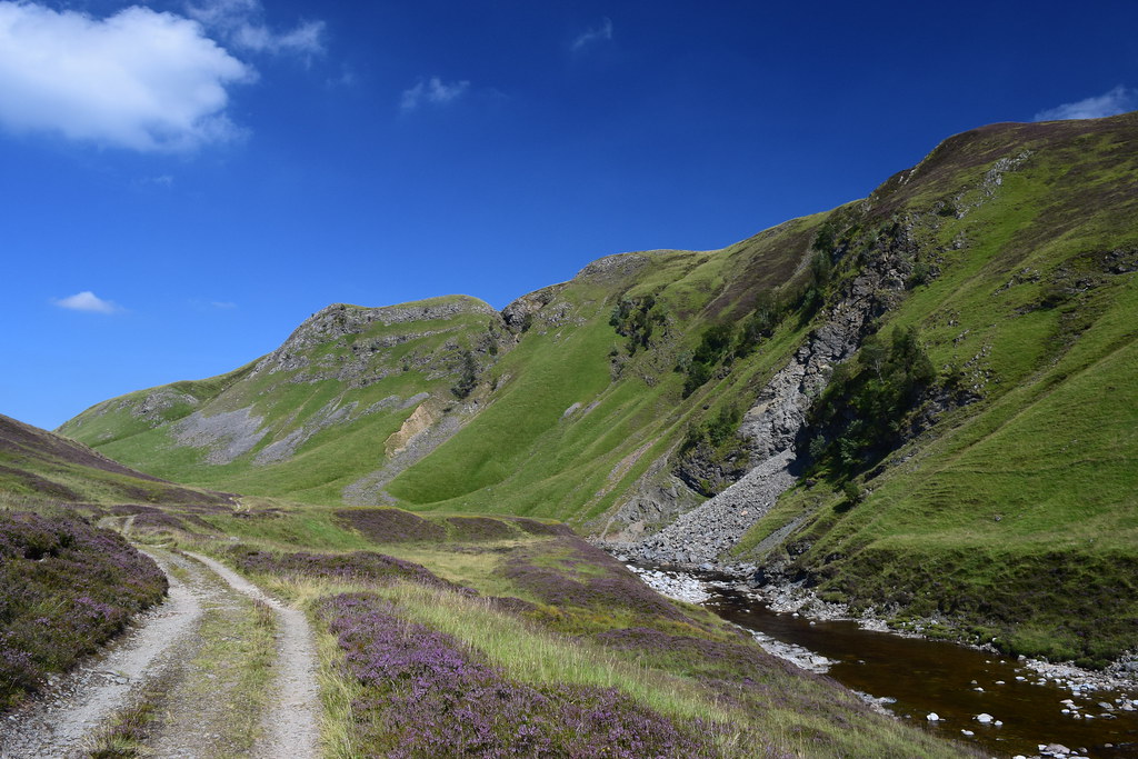
This stretch of the glen reminded me a little of the Lake District with the steep green hill-sides and rocky crags.
 20160816_57865 by Neil MacNeill, on Flickr
I pressed on (not having stopping since I took on water) to Falls of Tarf. The good Landrover track ended abruptly before the Falls and had become a typical narrow hill path.
 20160816_57872 by Neil MacNeill, on Flickr
As I came over a little rise I saw a tent already pitched on the little grassy area at the Falls and a couple and their big black dog were lazing in the sunshine.
 20160816_57874 by Neil MacNeill, on Flickr
 20160816_57876 by Neil MacNeill, on Flickr
 20160816_57879 by Neil MacNeill, on Flickr
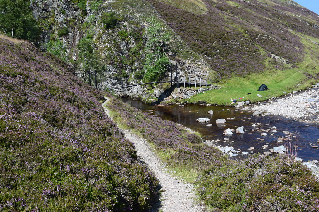
As it was only about 15:00 I had thought about pressing on past the Falls to camp further on so the fact that the “campsite” was already occupied made that a done deal. I don’t think the couple even noticed me passing despite me stopping on the squeaky bridge (well, it is 130 years old!) to take photos but the dog did! It had retreated to the shade of the tent and it barked a few time as I passed but it refused to come and talk to me!
I stopped for a proper rest a little further on at the Allt Garbh Buidhe where I found a great stone with an arse-shaped depression to sit on with my feet in the water! Bliss!
 20160816_57890 by Neil MacNeill, on Flickr
Here too I checked the map to see how far it was to Bynack Lodge which was where I thought I might stop for the night. Going up to Loch Tilt was also an option but a little off route. It looked like Bynack Lodge was only about three miles distant so I decided to make my way there. It was only 16:00 and there was nothing else to do!
I met three cyclists – Mum and Dad and teenage daughter - none of whom were having a good time as they pushed and carried their bikes along the narrow, rocky trail.
 20160816_57895 by Neil MacNeill, on Flickr
 20160816_57898 by Neil MacNeill, on Flickr
After them I met an Australian couple who were doing the same route as me in reverse and I had a good chat with them. They said that the path they’d come up was very wet and boggy, “water all across the path” was how it was described. I didn’t find this at all – maybe they just weren’t familiar with our Scottish paths?! I found the going to be fairly good as a lot of work had been done to make little bridges over streams and bogs - good work by the Cairngorm National Park staff – much appreciated!
 20160816_57909 by Neil MacNeill, on Flickr
Bynack Lodge took a long time coming! So long that I had to get the GPS out again to check my position as I feared I might have passed it without seeing it. But no, it was still about a mile away – the miles are long out here! Maybe I’d just misjudged it. I got there at about 18:00. It looked like it was once quite a fine place but is now a complete ruin.
 20160816_57928 by Neil MacNeill, on Flickr
 20160816_57927 by Neil MacNeill, on Flickr
The crossings of the Bynack and the Geldie were no trouble and having decided that I was camping beyond them just kept my shoes on as they'd have overnight to dry out.
 20160816_57933 by Neil MacNeill, on Flickr
I had a look around for a spot to bivvy but just felt that it was a rather sad place to stop. So, again, I decided to “press on” (after having checked the map of course!). White Bridge was my next potential stopping place. Again, it seemed to take a surprisingly long time to get there but the going was good and I probably got there relatively quickly (my pace having quickened again as the desire to find a stopping place increased!).
On getting to White Bridge I, again, had a look around for potential bivvy spots but this was a desolate place! I took a photo of it and decided (again!) to “press on”!! Surely there would be a decent spot to stop somewhere before Corrour bothy?!
 20160816_57935 by Neil MacNeill, on Flickr
Soon I met a cyclist coming down the track. He was staying at Braemar with his family (I assumed he was “dad”) and had hired a bike to cycle in and then walk up the Munro “Devils Point”. Dinner and beer (and presumably a nice bed!) were waiting for him so he didn’t linger. I thought about him sympathetically the next day when I found how bad the path he’d cycled was!
I headed on to some trees in the distance hoping that this would be my stop for the night. The trees were at Chest of Dee where there are some lovely wide waterfalls. It was quite apparent that there was no decent stopping place so (again!) I decided to “press on”!
 20160816_57942 by Neil MacNeill, on Flickr
I didn’t go a lot further as the terrain ahead looked fairly featureless. I was now tired and hungry (and it was getting late in the day) so could no longer be fussy. I went uphill a little away from the path but all I found was bog! Just for a little privacy I wanted to get away from the path (I’d just passed a couple descending and there could be more yet). Finally, I decided (well, forced to!) on a spot by the river which had wide flat rocks which would be good to cook and wash at.
 20160816_57944 by Neil MacNeill, on Flickr
I wanted to get dinner on and have a wash as soon as possible but THE MIDGES! My goodness they were incredible! I’d never before encountered anything like this. As soon as I stopped they appeared in a thick cloud! I’m a midge magnet at the best of times but this was insane! They made everything impossible – I was even inhaling them and they were getting in my eyes! I tried to carry on – I needed to filter water, cook dinner and set up my sleeping arrangements but it was impossible! I doused myself in insect repellent (the 50% DEET type – it the only thing I’ve found that works) and wore my midge net like a burqa. Then I found the little devils were getting THROUGH the net! Now I was demented and considered “pressing on” to Corrour Bothy for sanctuary but I was now just too weary.
I sat down and tried to compose myself as I felt like I was starting to panic. There was nothing for it but to do what I had to. I got the stove on, somewhat reluctantly as I knew all the CO2 it was generating would attract even more midges! I got a change of clothes ready to get into as quickly as possible and stripped for a wash in the river. I got midge bites in places… well, I’m sure you can imagine! Dressed and applied the midge repellent like a teenage boy applies Lynx!
I now felt like I’d gotten a little control back. I scoffed dinner quickly and considered moving to a high spot I could see to maybe reduce the midge count. But it was now getting late and I didn’t fancy moving across rough, pathless terrain in the dark - and it may not be high enough to escape the midges. I stayed put.
“When the night comes down
And I'm here all alone
When the night comes down
And there's no place to go”
- Judas Priest, “Night Comes Down”.
Before stopping for the day and knowing I’d gone a lot further than the suggested stopping point for doing this route in three days I had considered my options for what to do with the extra time I’d given myself. I really fancied popping down to Braemar for a meal and a pint. Or I could just have a really easy day and wander up to Corrour bothy and relax. Or go to Corrour, dump the backpack and nip up the Munro “Devils Point” (whose Gaelic name is “Bod an Deamhain” which means "Penis of the Demon” – the story goes that Queen Victoria’s ghillie, John Brown, told her that it was called “Devils Point” to avoid embarrassment and the name has stuck!). Or maybe have a relatively easy day and camp somewhere on the other side of the Laraig Ghru? But no, I had decided that I was NOT going to risk spending another night being an all-you-can-eat buffet for the midges!
I now quote directly from my notebook:
“10:57. Earlier I watched the moon rise over hill ??? [it was Carn Liath] just as the sun was setting. Magic! Now I sit here writing with the friendly chuckle of the river – the full moon reflecting in it. The temperature has dropped considerably but I’m still just wearing T-shirt and shorts. The midge hell has abated and all seems good! I’m going to have another “Rum and Dee” (the water I’m diluting it with) and turn in. I am NOT going to spend another night like this – I’ll be “pressing on” to Aviemore tomorrow.”
Bivvy in the moonlight:
 20160816_57968 by Neil MacNeill, on Flickr
The morning after.
I think I woke at about 5am – possibly as the midge swarm resumed its attack. I tried to protect myself as much as possible but there was no chance of getting any more sleep. I got up at about 5:30 and the midges were unbearable – possibly worse than last night. I had to do a little about camp then run away to clear air. Repeat until everything was unceremoniously stuffed into my rucksack. I set off at 6:00 precisely.
Since there was no chance of cooking I breakfasted on a packet of Fig Rolls as I walked. The day was very calm and there were patches of mist which were pretty. Any and every attempt to stop for water had to be abandoned as the midge swarm immediately pounced! Eventually I braved it long enough to filter some water but only by doing it where the sun shone, albeit weakly.
The Devils Point appears as the sun rises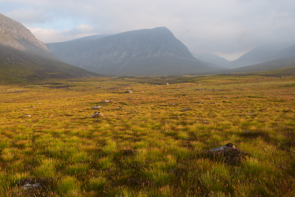 20160817_57978 by Neil MacNeill, on Flickr
The going was alternately boggy and bouldery which meant that progress was fairly slow. Pretty much all of the route through the Lairig Ghru was like this which was frustrating as I was desperate to avoid another night at the mercy of the midge.
The views were, as seemed to be the norm on this route, spectacular! Even more so now as the early morning sunshine illuminated the mountains. The Devils Point was particularly spectacular and reminded me of Buachaille Etive Mor – I’m sure it would be photographed just as much as BEM if a road had ever been pushed through the Lairig Ghru!
It could be a more famous hill in Glen Coe!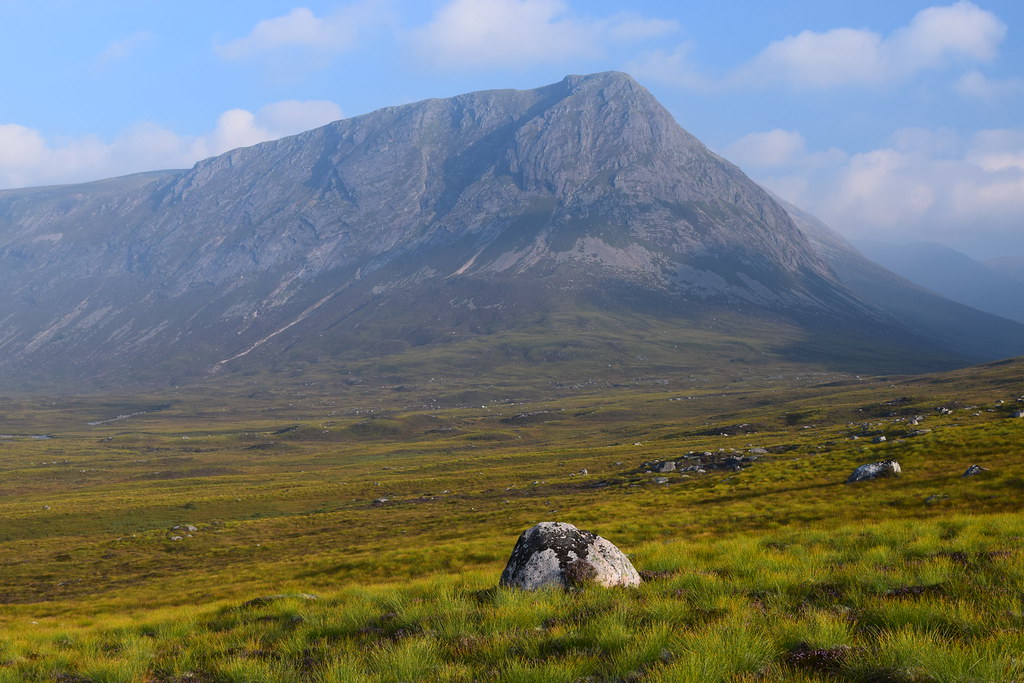 20160817_57984 by Neil MacNeill, on Flickr
First light on Corrour Bothy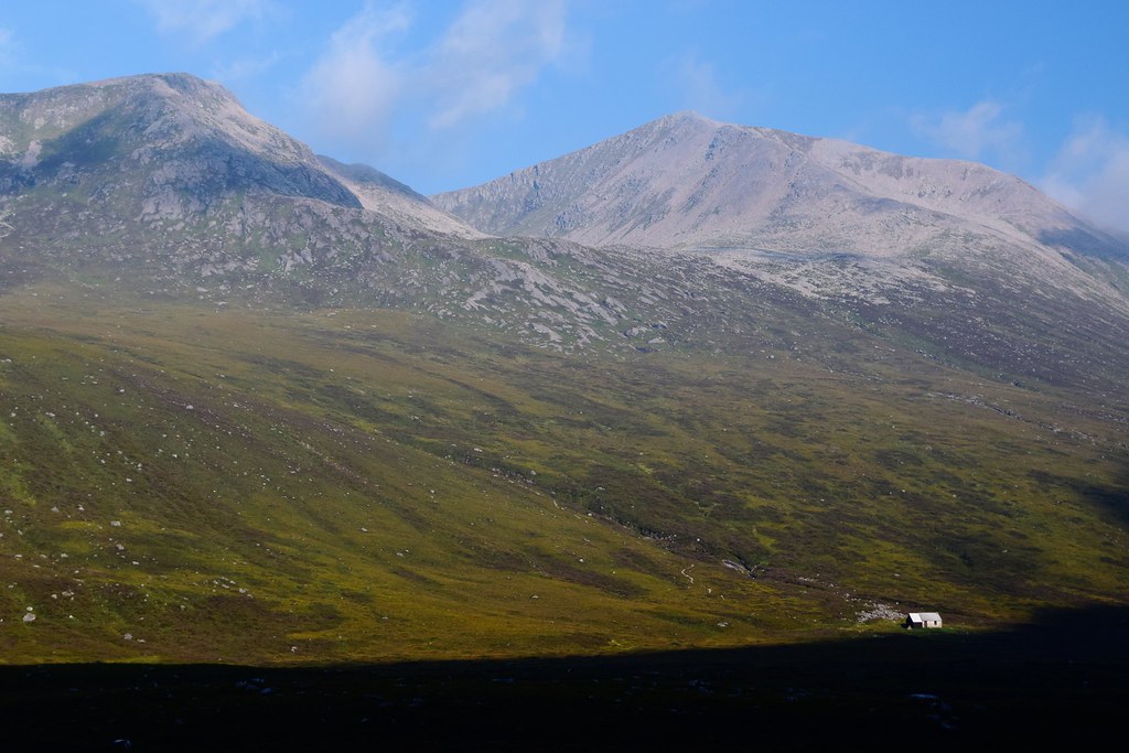 20160817_57997 2 by Neil MacNeill, on Flickr
I must have missed a bit of path (easily done as it’s so fragmented when crossing bogs) as I found myself at the bridge over the River Dee which takes one to Corrour Bothy.
Rather than double back I cut across the bogs to re-join the path – nearly losing a shoe many times! There was no sign of life as I passed the bothy but a lone figure appeared when I was a bit further up the Lairig.
At about 8:30 the sun was quite strong so, for the first time that day, I stopped and made a coffee. But damn! Even with the sun the midges were still brave enough to have a go! I was also glad of a forgotten banana that had survived the journey so far relatively unscathed.
 20160817_58005 by Neil MacNeill, on Flickr
The path along the section near the bothy, about 3 kilometres, had been fairly level but now began rising steadily, first moving away from the river then re-joining it higher up and staying with it until it’s source near Pools of Dee.
 20160817_58017 by Neil MacNeill, on Flickr
I met a couple running down the track with two playful brown collies. They were heading for Corrour Bothy and then traversing the whole ridge from Devils Point to Braeriach, quite an undertaking “normally” done over two days!
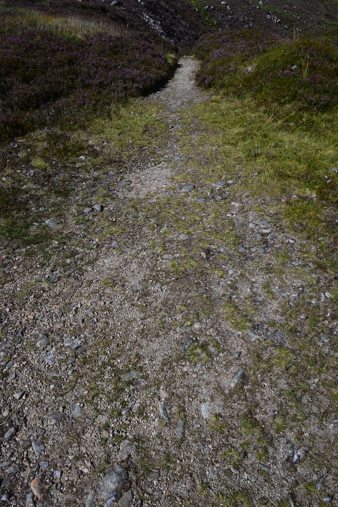
It was about here that the going got very bouldery and continued like this for a considerable distance.
 20160817_58024 by Neil MacNeill, on Flickr
I was making my way very gingerly across a steep boulder slope above of the Pools when another solo walker appeared from the other direction and gaily stravaiged along a good path on the other side!
 20160817_58026 by Neil MacNeill, on Flickr
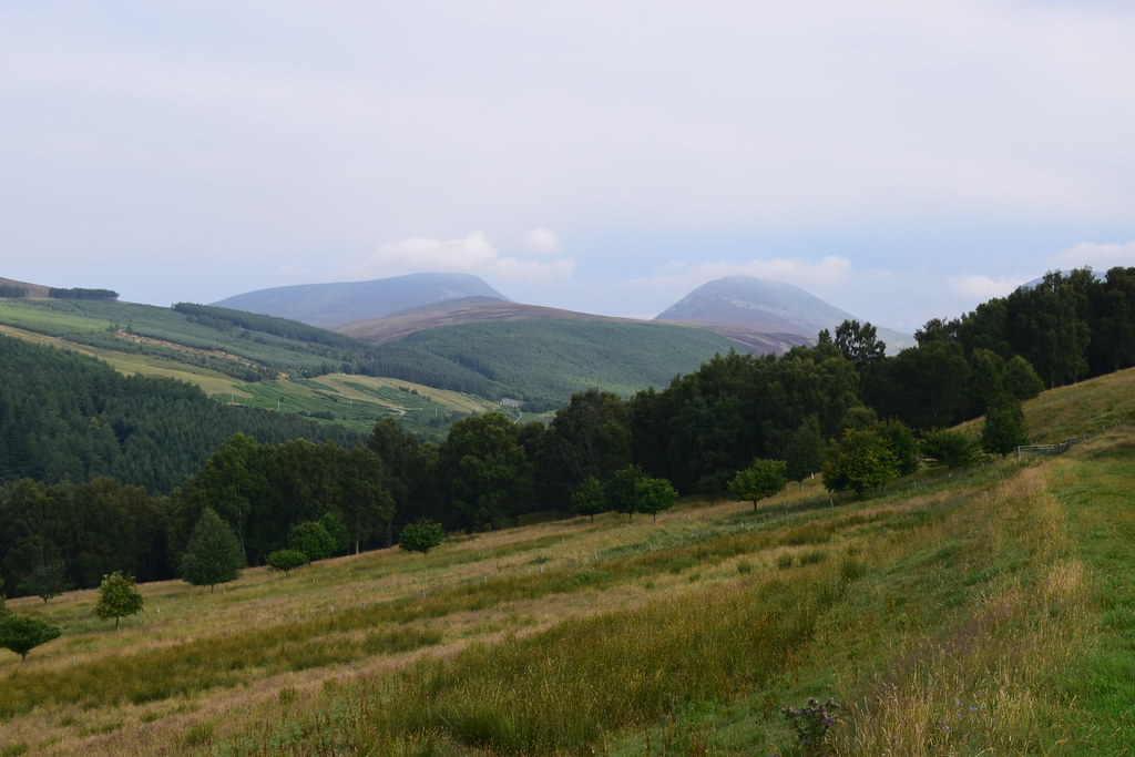
After the Pools I finally, thankfully, reached the summit of the Lairig at 2733 feet. Despite this lofty height the slopes of Breariach and the south-western reaches of Cairn Gorm still tower above. A little turn in the direction of the Lairig reveals the first glimpse of distant Aviemore and I realise how far I still have to go.
 20160817_58029 by Neil MacNeill, on Flickr
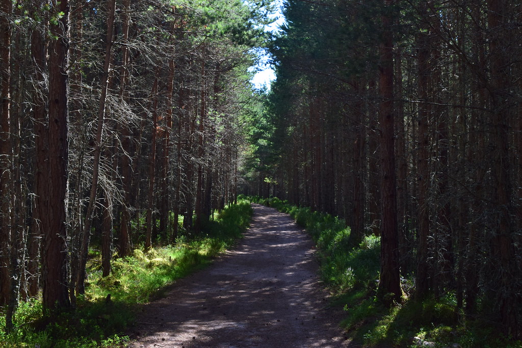
The going is still rough and doesn’t really improve much until one is down on the cycle tracks in Rothiemurchus Forest. A good excuse for a rest is to admire the rock architecture of Lurcher’s Crag high above on the east side of the Lairig.
 20160817_58037 by Neil MacNeill, on Flickr
It’s slow going but eventually the path descending from the Chalamain Gap is reached - the path ascending Braeriach is directly opposite.
 20160817_58045 by Neil MacNeill, on Flickr
I did consider walking over to the ski centre road via the Chalamain Gap and catching a bus into Aviemore at the Sugar Bowl carpark but I couldn’t – my conscience told me that was cheating!
The path does improve but this is only temporary.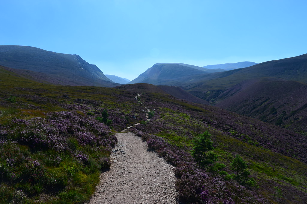 20160817_58049 by Neil MacNeill, on Flickr
The edge of the forest is reached and, as it’s density increases, so does the welcome shade on a hot day. The last trees passed were yesterday at Chest of Dee.
A split in the path is reached. The right fork leads to Rothiemurchus Lodge and I take the left which leads on down into the forest. Here I meet a young French couple heading for Braeriach. They have the relevant Ordnance Survey map but have very little else, only the lady having a small rucksack. I hope they are OK.
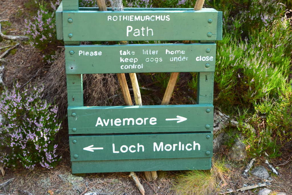
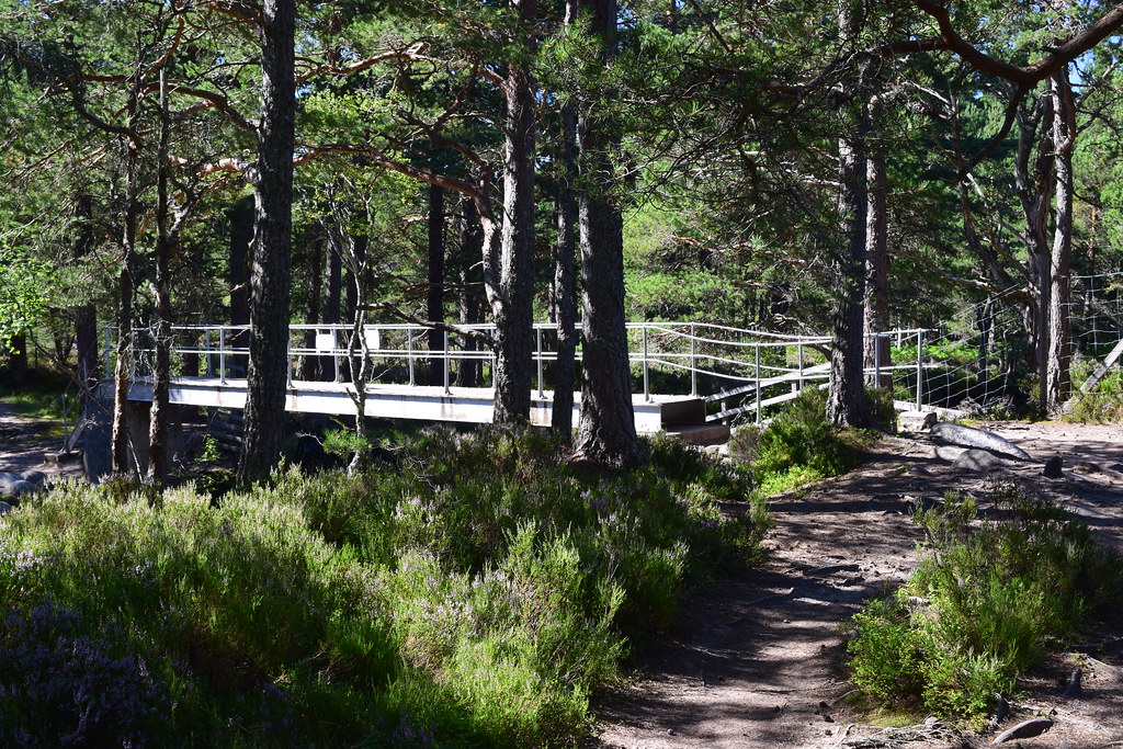
A mile or so further on and another junction is reached - right to Loch Morlich (another shortcut to the ski centre road I refused!) and left towards the Cairngorm Club footbridge over the Am Beanaidh. I go left.
 20160817_58061 by Neil MacNeill, on Flickr
 20160817_58065 by Neil MacNeill, on Flickr
Shortly after crossing the bridge I fork off right along the path to Coylumbridge. Here I stop to remove irritating grit from my shoes and check the train timetables. I wasn’t rushing and was prepared to stay the night in Aviemore but it turned out there was a train in about two and a half hours. A sign on the footbridge suggested Aviemore was a one and a half hour walk from there so I could now relax and walk the last four miles at my leisure.
 20160817_58067 by Neil MacNeill, on Flickr
I pick and joyfully scoff plump blueberries, which were incredibly abundant, from the side of the path. There are a lot of cyclists around here, none of which gave any warning when approaching from behind.
I meet a heavily laden Spaniard who is attempting my route in reverse. Despite appearing to be well equipped he doesn’t seem to know much about the route and only has a large scale map of the entire Cairngorm National Park. I describe as best I can what he is letting himself in for and suggest possible campsites (he, at least, has the good sense to have a tent!) but his English wasn’t great and I doubt I was able to communicate just how horrific the midges could be! I was left with the impression that he had grossly underestimated what he was taking on. The scale of the map he was using led him to believe he was already nearly out of the forest but he had really only just enetered it. He was heading for Edinburgh at the weekend so maybe I’ll check at the hostel he had booked to see if he arrives safely!
The paths here are excellent so one can enjoy looking around the forest and trying to spot a red squirrel (I didn’t).
 20160817_58072 by Neil MacNeill, on Flickr
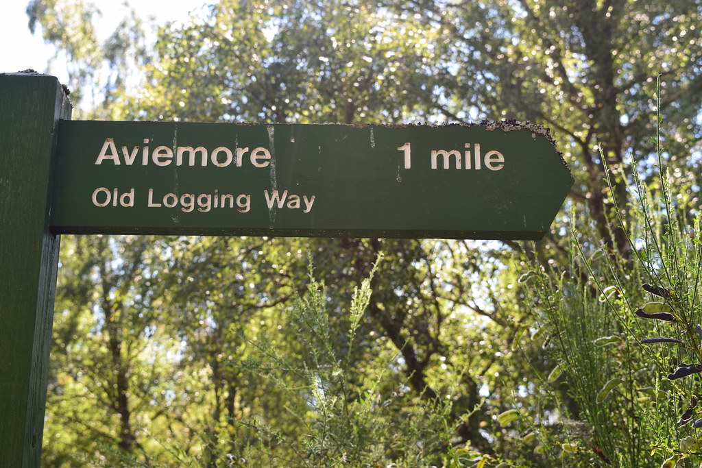
A campsite is reached on the right and shortly after the ski centre road by Coylumbridge. A sign says, “Aviemore 1 mile”. This was a cruel lie!
 20160817_58075 by Neil MacNeill, on Flickr
I checked when I got home and from there to the Train Station (which was at the nearer end of town) was over 2 miles. As I said, the miles up here are long!
I get to the train station at 15:30 – thirty and a half hours after leaving Blair Atholl.
Looking to the Lairig Ghru from the bridge at the train station. Shame it was so cloudy!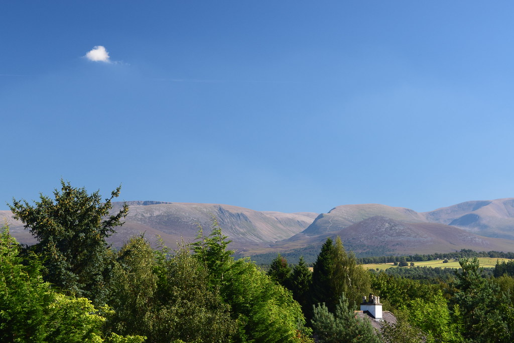 20160817_58083 by Neil MacNeill, on Flickr
The End.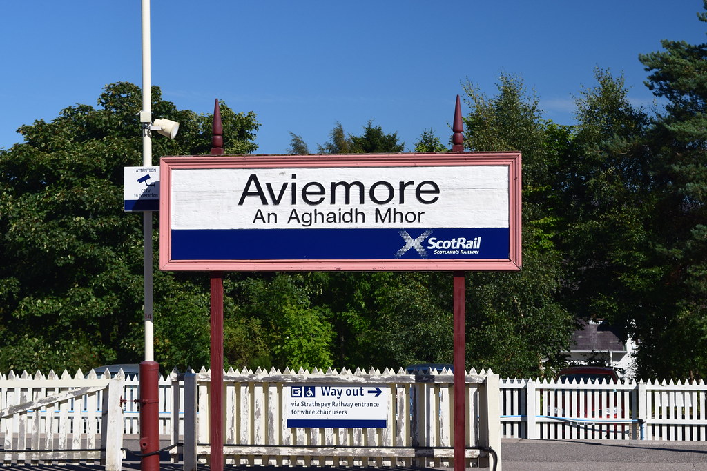 20160817_58085 by Neil MacNeill, on Flickr
Blair Atholl to Aviemore by Glen Tilt and the Lairig Ghru
16/08/2016
An early departure got me by train to Blair Atholl at 08:52 and I sent a few quick texts to let folk know I was setting off. The weather was OK – misty but bright and it was set to warm up as the day went on.
20160816_57775 by Neil MacNeill, on FlickrI headed for Glen Tilt and, as I’d been this way a few times before, didn’t give any thought as to where I was actually going. A SROWS (Scottish Rights of Way Society) sign said “To Deeside by Glen Tilt” so I went the way it was pointing because that’s where I was going. After passing through Fenderbridge the road was rising sharply and seemed to be heading away from the glen. Disappointingly early in the expedition I had to get the GPS out to get my position and check the map. I found there would be a turn off and footpath back into the glen not much further on. At the turn off there was another SROWS sign and I was slightly surprised to find I was still on their route so I carried on.
20160816_57777 by Neil MacNeill, on FlickrAs it turned out this was a nice way of getting into the glen as it went through old woodland and was a nice change from the “usual” approach.
20160816_57778 by Neil MacNeill, on FlickrAnd, because I’d come up so high, the next few miles were gently downhill until the path joined the main track up Glen Tilt just north of Auchgobhal near where the Allt Mhairc joins the River Tilt. The sun had come out at about 10:15 and it had become a hot day.
20160816_57785 by Neil MacNeill, on FlickrAt about 11:30 I stopped for about 15 minutes just after Clachghlas where a wooden bridge crosses the river above a roaring, rocky narrowing.
20160816_57802 by Neil MacNeill, on FlickrA sudden hot gust of wind nearly takes my map into the river! The glen looks great from here as its sides steepen and close in further north.
20160816_57805 by Neil MacNeill, on FlickrA figure approaches from down the glen and when I look back to say hello he’s gone! He must have turned up the track behind Clachghlas en route to Carn a’Chlamain.
I’d intended to stop for 5 minutes every hour and even set the timer on my watch to remind me but this didn’t happen – I was always wanting to see what was round the next corner or over the next rise!
Forest Lodge.
20160816_57813 by Neil MacNeill, on FlickrI did stop at about 13:30 for a little while to filter some water and fill a couple of bottles. This was shortly after I’d passed four men, one of whom was fishing a deep, still pool while the others spectated!
20160816_57825 by Neil MacNeill, on Flickr20160816_57842 by Neil MacNeill, on FlickrMy right foot had been getting sore and I’d had a few sharp pains in my left knee (the “bad” knee which has been very good of late) so took a few ibuprofen. This was a bit of a concern as I still had two more days walking ahead. I slowed down a little after this.
Further up the glen I came to a fork in the road – one branch leading uphill and the other down. I’d been here before but didn’t recognise this junction as I had approached it from the other direction. A quick check of the map and I was pleased to see my route was the lower one!
20160816_57854 by Neil MacNeill, on FlickrNow in the upper reaches of Glen Tilt I passed the wire “bridge” (two wire ropes – one for feet and the other for hands!) that I wished I knew about the last time I came down the glen after joining it from Glen Loch (after crossing the three Munros of Beinn a’Ghlo and a camp in Glen Loch).
20160816_57857 by Neil MacNeill, on FlickrSoon after that I was at the junction of the aforementioned glens and smiled (wryly, probably!) when I recognised the area of the river where I’d boulder-hopped across!
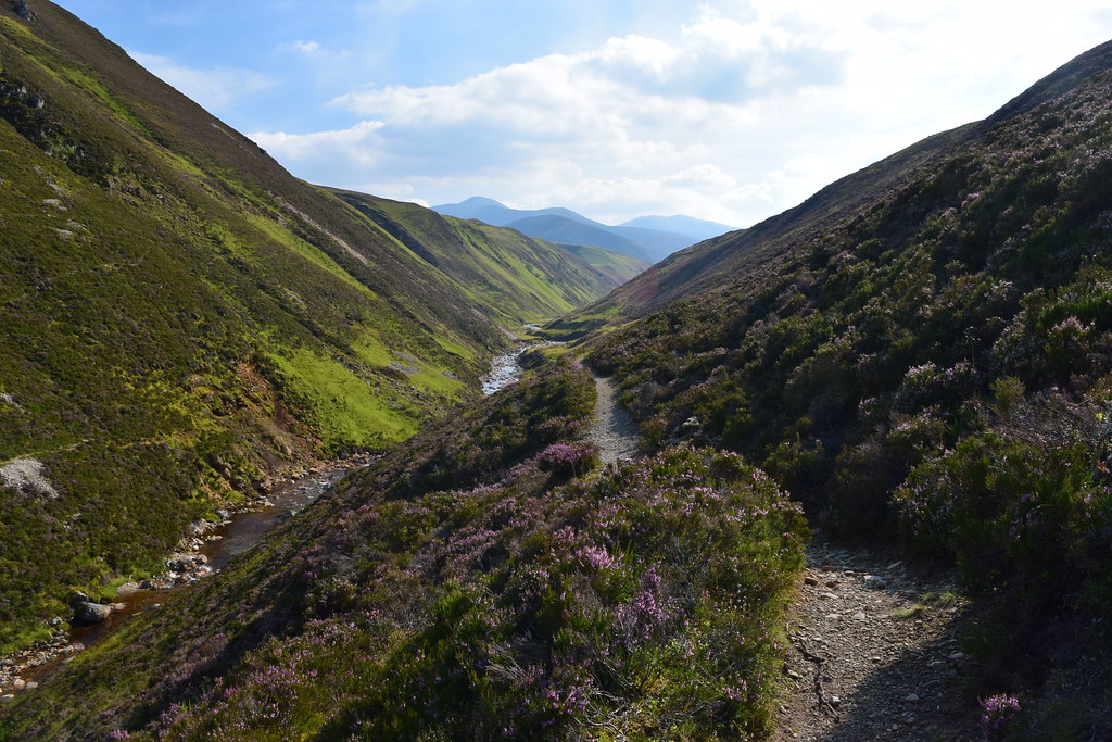
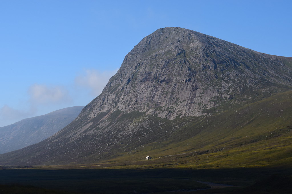
20160816_57858 by Neil MacNeill, on FlickrContinuing on from here at about 14:30 I was in new territory. And it was just about here I was buzzed by a very low flying Typhoon! Those crazy fly-boys!
20160816_57863 2 by Neil MacNeill, on FlickrThis stretch of the glen reminded me a little of the Lake District with the steep green hill-sides and rocky crags.
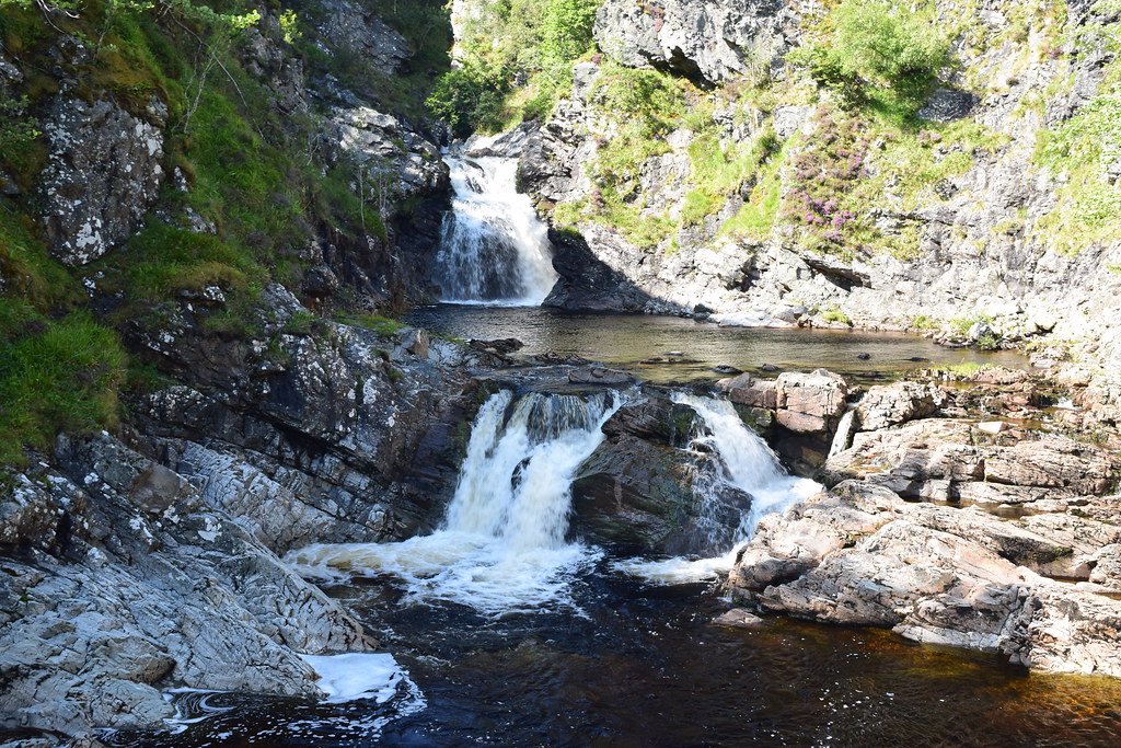
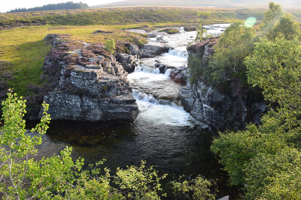
20160816_57865 by Neil MacNeill, on FlickrI pressed on (not having stopping since I took on water) to Falls of Tarf. The good Landrover track ended abruptly before the Falls and had become a typical narrow hill path.
20160816_57872 by Neil MacNeill, on FlickrAs I came over a little rise I saw a tent already pitched on the little grassy area at the Falls and a couple and their big black dog were lazing in the sunshine.
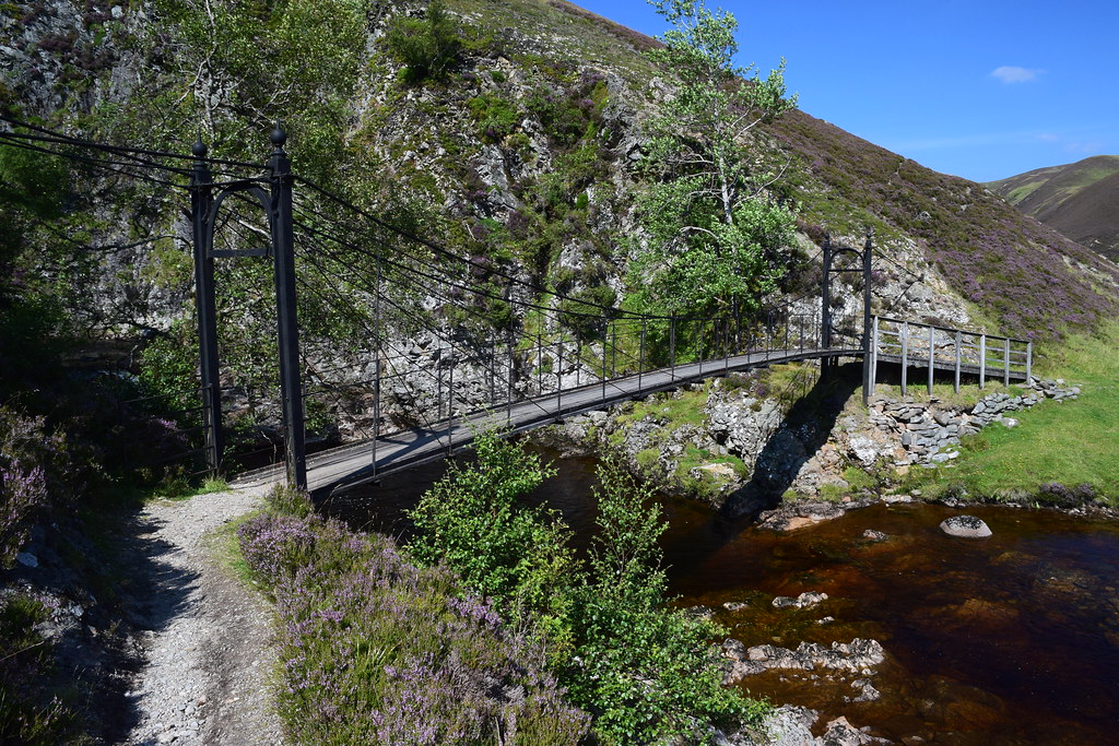
20160816_57874 by Neil MacNeill, on Flickr20160816_57876 by Neil MacNeill, on Flickr20160816_57879 by Neil MacNeill, on FlickrAs it was only about 15:00 I had thought about pressing on past the Falls to camp further on so the fact that the “campsite” was already occupied made that a done deal. I don’t think the couple even noticed me passing despite me stopping on the squeaky bridge (well, it is 130 years old!) to take photos but the dog did! It had retreated to the shade of the tent and it barked a few time as I passed but it refused to come and talk to me!
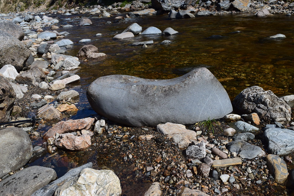
I stopped for a proper rest a little further on at the Allt Garbh Buidhe where I found a great stone with an arse-shaped depression to sit on with my feet in the water! Bliss!
20160816_57890 by Neil MacNeill, on FlickrHere too I checked the map to see how far it was to Bynack Lodge which was where I thought I might stop for the night. Going up to Loch Tilt was also an option but a little off route. It looked like Bynack Lodge was only about three miles distant so I decided to make my way there. It was only 16:00 and there was nothing else to do!
I met three cyclists – Mum and Dad and teenage daughter - none of whom were having a good time as they pushed and carried their bikes along the narrow, rocky trail.
20160816_57895 by Neil MacNeill, on Flickr20160816_57898 by Neil MacNeill, on FlickrAfter them I met an Australian couple who were doing the same route as me in reverse and I had a good chat with them. They said that the path they’d come up was very wet and boggy, “water all across the path” was how it was described. I didn’t find this at all – maybe they just weren’t familiar with our Scottish paths?! I found the going to be fairly good as a lot of work had been done to make little bridges over streams and bogs - good work by the Cairngorm National Park staff – much appreciated!
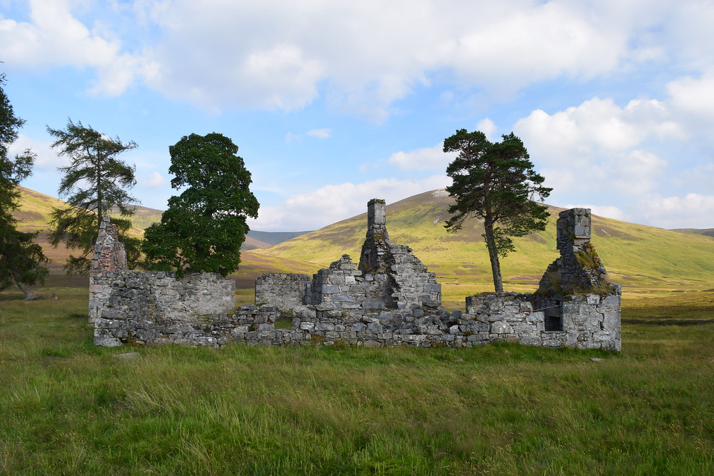
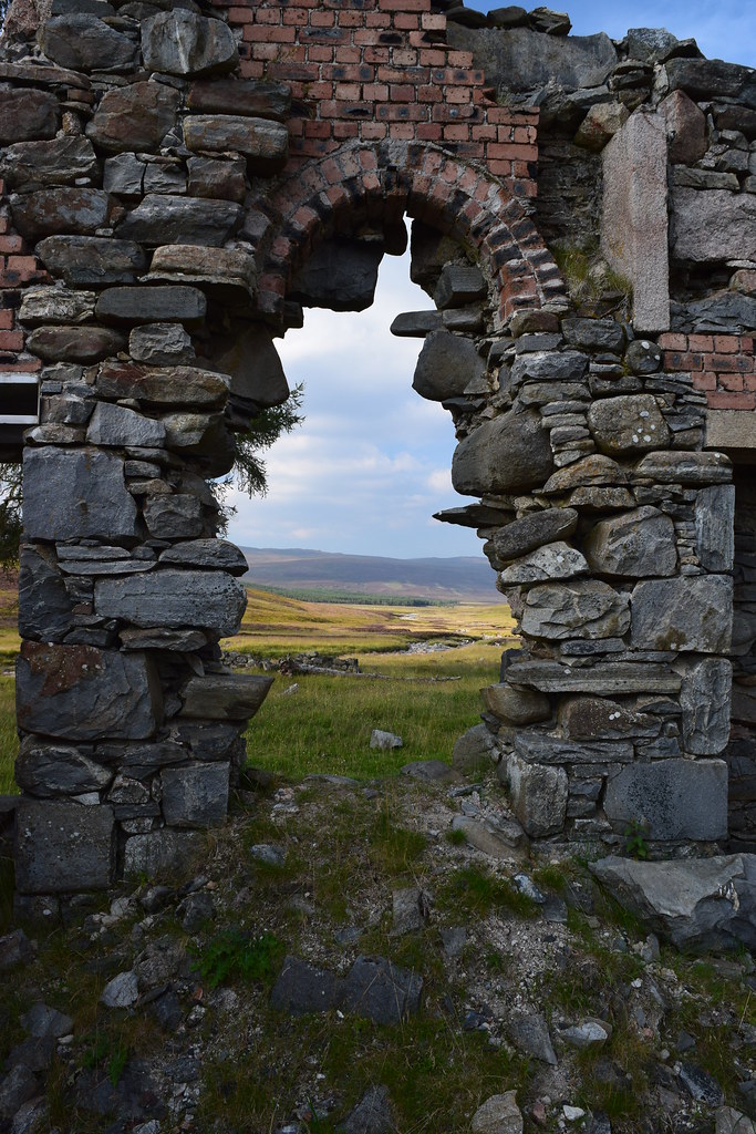
20160816_57909 by Neil MacNeill, on FlickrBynack Lodge took a long time coming! So long that I had to get the GPS out again to check my position as I feared I might have passed it without seeing it. But no, it was still about a mile away – the miles are long out here! Maybe I’d just misjudged it. I got there at about 18:00. It looked like it was once quite a fine place but is now a complete ruin.
20160816_57928 by Neil MacNeill, on Flickr20160816_57927 by Neil MacNeill, on FlickrThe crossings of the Bynack and the Geldie were no trouble and having decided that I was camping beyond them just kept my shoes on as they'd have overnight to dry out.
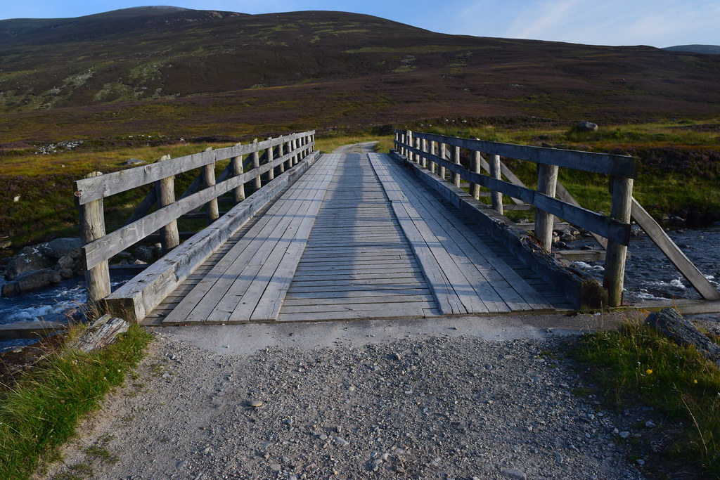
20160816_57933 by Neil MacNeill, on FlickrI had a look around for a spot to bivvy but just felt that it was a rather sad place to stop. So, again, I decided to “press on” (after having checked the map of course!). White Bridge was my next potential stopping place. Again, it seemed to take a surprisingly long time to get there but the going was good and I probably got there relatively quickly (my pace having quickened again as the desire to find a stopping place increased!).
On getting to White Bridge I, again, had a look around for potential bivvy spots but this was a desolate place! I took a photo of it and decided (again!) to “press on”!! Surely there would be a decent spot to stop somewhere before Corrour bothy?!
20160816_57935 by Neil MacNeill, on FlickrSoon I met a cyclist coming down the track. He was staying at Braemar with his family (I assumed he was “dad”) and had hired a bike to cycle in and then walk up the Munro “Devils Point”. Dinner and beer (and presumably a nice bed!) were waiting for him so he didn’t linger. I thought about him sympathetically the next day when I found how bad the path he’d cycled was!
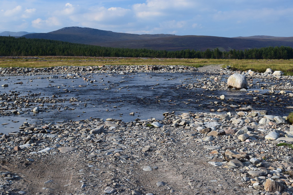
I headed on to some trees in the distance hoping that this would be my stop for the night. The trees were at Chest of Dee where there are some lovely wide waterfalls. It was quite apparent that there was no decent stopping place so (again!) I decided to “press on”!
20160816_57942 by Neil MacNeill, on FlickrI didn’t go a lot further as the terrain ahead looked fairly featureless. I was now tired and hungry (and it was getting late in the day) so could no longer be fussy. I went uphill a little away from the path but all I found was bog! Just for a little privacy I wanted to get away from the path (I’d just passed a couple descending and there could be more yet). Finally, I decided (well, forced to!) on a spot by the river which had wide flat rocks which would be good to cook and wash at.
20160816_57944 by Neil MacNeill, on FlickrI wanted to get dinner on and have a wash as soon as possible but THE MIDGES! My goodness they were incredible! I’d never before encountered anything like this. As soon as I stopped they appeared in a thick cloud! I’m a midge magnet at the best of times but this was insane! They made everything impossible – I was even inhaling them and they were getting in my eyes! I tried to carry on – I needed to filter water, cook dinner and set up my sleeping arrangements but it was impossible! I doused myself in insect repellent (the 50% DEET type – it the only thing I’ve found that works) and wore my midge net like a burqa. Then I found the little devils were getting THROUGH the net! Now I was demented and considered “pressing on” to Corrour Bothy for sanctuary but I was now just too weary.
I sat down and tried to compose myself as I felt like I was starting to panic. There was nothing for it but to do what I had to. I got the stove on, somewhat reluctantly as I knew all the CO2 it was generating would attract even more midges! I got a change of clothes ready to get into as quickly as possible and stripped for a wash in the river. I got midge bites in places… well, I’m sure you can imagine! Dressed and applied the midge repellent like a teenage boy applies Lynx!
I now felt like I’d gotten a little control back. I scoffed dinner quickly and considered moving to a high spot I could see to maybe reduce the midge count. But it was now getting late and I didn’t fancy moving across rough, pathless terrain in the dark - and it may not be high enough to escape the midges. I stayed put.
“When the night comes down
And I'm here all alone
When the night comes down
And there's no place to go”
- Judas Priest, “Night Comes Down”.
Before stopping for the day and knowing I’d gone a lot further than the suggested stopping point for doing this route in three days I had considered my options for what to do with the extra time I’d given myself. I really fancied popping down to Braemar for a meal and a pint. Or I could just have a really easy day and wander up to Corrour bothy and relax. Or go to Corrour, dump the backpack and nip up the Munro “Devils Point” (whose Gaelic name is “Bod an Deamhain” which means "Penis of the Demon” – the story goes that Queen Victoria’s ghillie, John Brown, told her that it was called “Devils Point” to avoid embarrassment and the name has stuck!). Or maybe have a relatively easy day and camp somewhere on the other side of the Laraig Ghru? But no, I had decided that I was NOT going to risk spending another night being an all-you-can-eat buffet for the midges!
I now quote directly from my notebook:
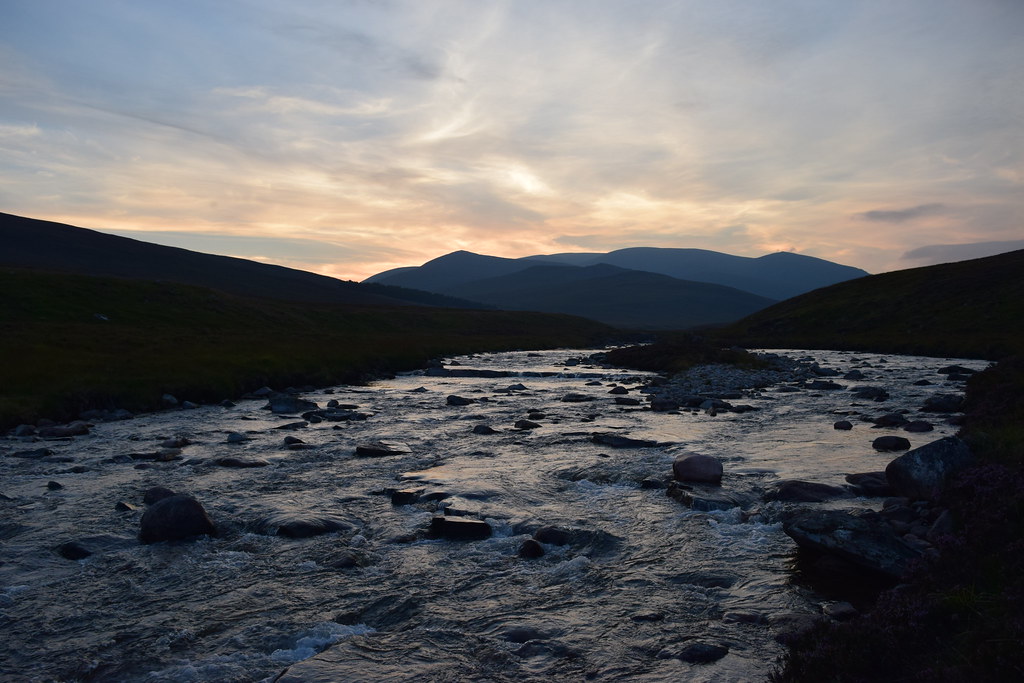
“10:57. Earlier I watched the moon rise over hill ??? [it was Carn Liath] just as the sun was setting. Magic! Now I sit here writing with the friendly chuckle of the river – the full moon reflecting in it. The temperature has dropped considerably but I’m still just wearing T-shirt and shorts. The midge hell has abated and all seems good! I’m going to have another “Rum and Dee” (the water I’m diluting it with) and turn in. I am NOT going to spend another night like this – I’ll be “pressing on” to Aviemore tomorrow.”
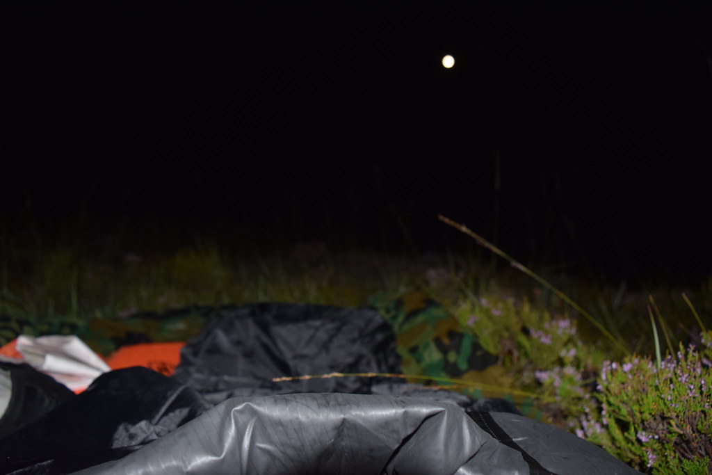
Bivvy in the moonlight:
20160816_57968 by Neil MacNeill, on FlickrThe morning after.
I think I woke at about 5am – possibly as the midge swarm resumed its attack. I tried to protect myself as much as possible but there was no chance of getting any more sleep. I got up at about 5:30 and the midges were unbearable – possibly worse than last night. I had to do a little about camp then run away to clear air. Repeat until everything was unceremoniously stuffed into my rucksack. I set off at 6:00 precisely.
Since there was no chance of cooking I breakfasted on a packet of Fig Rolls as I walked. The day was very calm and there were patches of mist which were pretty. Any and every attempt to stop for water had to be abandoned as the midge swarm immediately pounced! Eventually I braved it long enough to filter some water but only by doing it where the sun shone, albeit weakly.
The Devils Point appears as the sun rises
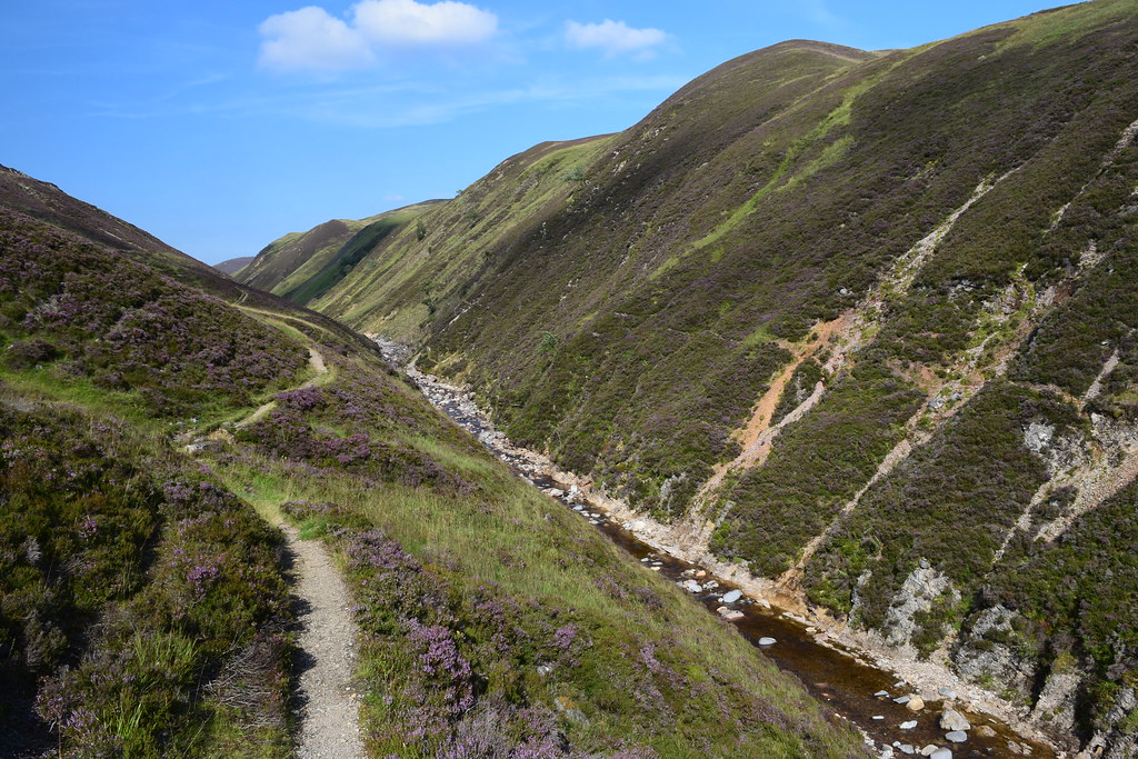
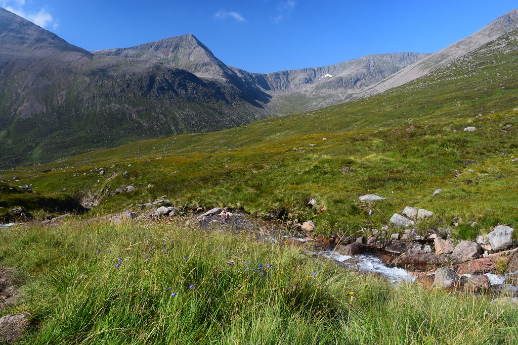
20160817_57978 by Neil MacNeill, on FlickrThe going was alternately boggy and bouldery which meant that progress was fairly slow. Pretty much all of the route through the Lairig Ghru was like this which was frustrating as I was desperate to avoid another night at the mercy of the midge.
The views were, as seemed to be the norm on this route, spectacular! Even more so now as the early morning sunshine illuminated the mountains. The Devils Point was particularly spectacular and reminded me of Buachaille Etive Mor – I’m sure it would be photographed just as much as BEM if a road had ever been pushed through the Lairig Ghru!
It could be a more famous hill in Glen Coe!
20160817_57984 by Neil MacNeill, on FlickrFirst light on Corrour Bothy
20160817_57997 2 by Neil MacNeill, on FlickrI must have missed a bit of path (easily done as it’s so fragmented when crossing bogs) as I found myself at the bridge over the River Dee which takes one to Corrour Bothy.
Rather than double back I cut across the bogs to re-join the path – nearly losing a shoe many times! There was no sign of life as I passed the bothy but a lone figure appeared when I was a bit further up the Lairig.
At about 8:30 the sun was quite strong so, for the first time that day, I stopped and made a coffee. But damn! Even with the sun the midges were still brave enough to have a go! I was also glad of a forgotten banana that had survived the journey so far relatively unscathed.
20160817_58005 by Neil MacNeill, on FlickrThe path along the section near the bothy, about 3 kilometres, had been fairly level but now began rising steadily, first moving away from the river then re-joining it higher up and staying with it until it’s source near Pools of Dee.
20160817_58017 by Neil MacNeill, on FlickrI met a couple running down the track with two playful brown collies. They were heading for Corrour Bothy and then traversing the whole ridge from Devils Point to Braeriach, quite an undertaking “normally” done over two days!
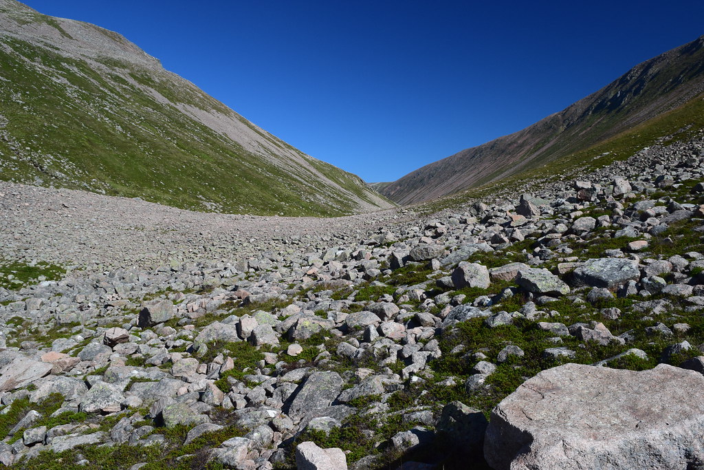
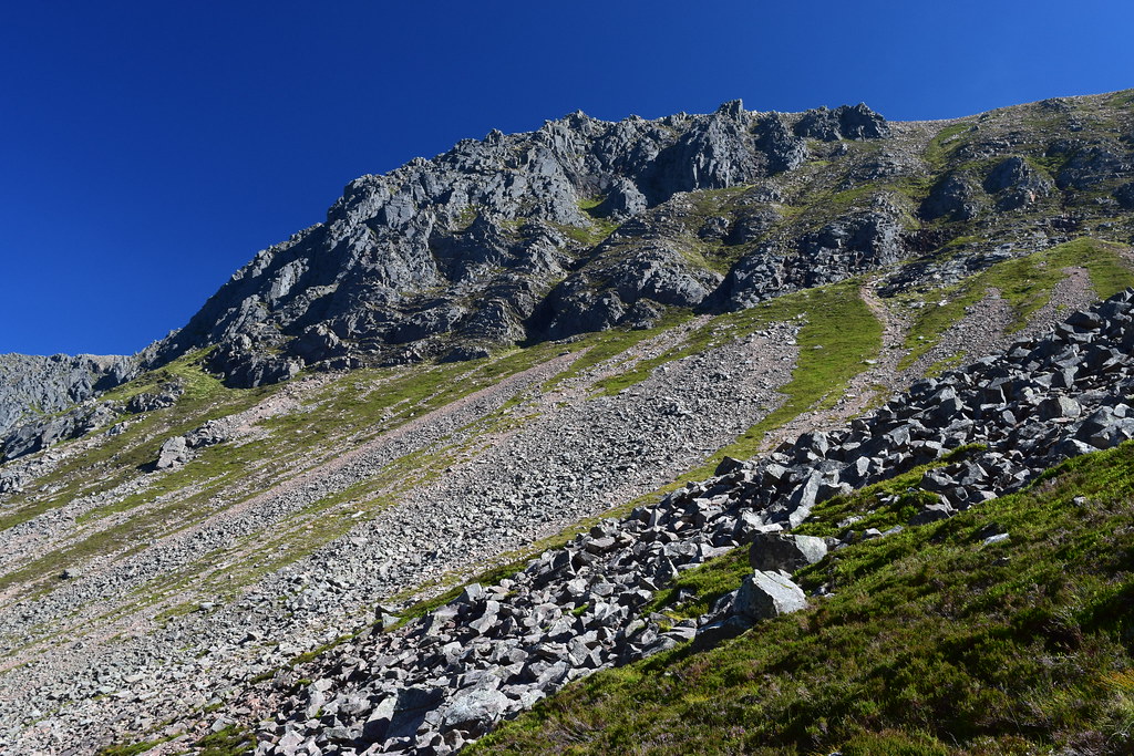
It was about here that the going got very bouldery and continued like this for a considerable distance.
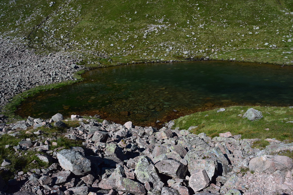
20160817_58024 by Neil MacNeill, on FlickrI was making my way very gingerly across a steep boulder slope above of the Pools when another solo walker appeared from the other direction and gaily stravaiged along a good path on the other side!
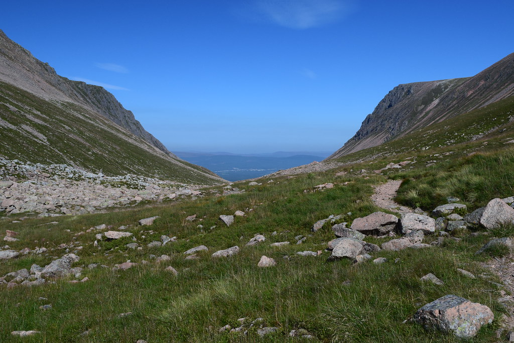
20160817_58026 by Neil MacNeill, on FlickrAfter the Pools I finally, thankfully, reached the summit of the Lairig at 2733 feet. Despite this lofty height the slopes of Breariach and the south-western reaches of Cairn Gorm still tower above. A little turn in the direction of the Lairig reveals the first glimpse of distant Aviemore and I realise how far I still have to go.
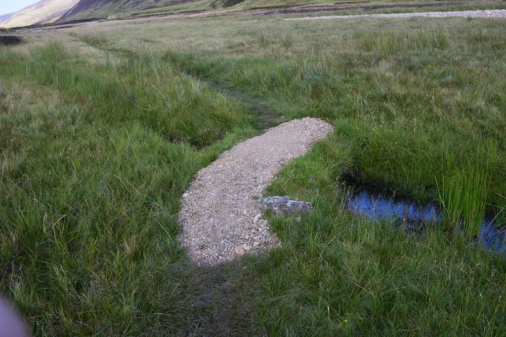
20160817_58029 by Neil MacNeill, on FlickrThe going is still rough and doesn’t really improve much until one is down on the cycle tracks in Rothiemurchus Forest. A good excuse for a rest is to admire the rock architecture of Lurcher’s Crag high above on the east side of the Lairig.
20160817_58037 by Neil MacNeill, on FlickrIt’s slow going but eventually the path descending from the Chalamain Gap is reached - the path ascending Braeriach is directly opposite.
20160817_58045 by Neil MacNeill, on FlickrI did consider walking over to the ski centre road via the Chalamain Gap and catching a bus into Aviemore at the Sugar Bowl carpark but I couldn’t – my conscience told me that was cheating!
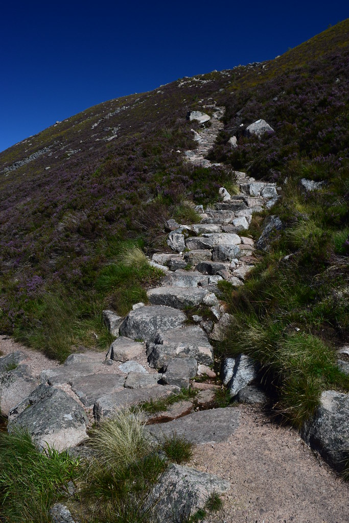
The path does improve but this is only temporary.
20160817_58049 by Neil MacNeill, on FlickrThe edge of the forest is reached and, as it’s density increases, so does the welcome shade on a hot day. The last trees passed were yesterday at Chest of Dee.
A split in the path is reached. The right fork leads to Rothiemurchus Lodge and I take the left which leads on down into the forest. Here I meet a young French couple heading for Braeriach. They have the relevant Ordnance Survey map but have very little else, only the lady having a small rucksack. I hope they are OK.
A mile or so further on and another junction is reached - right to Loch Morlich (another shortcut to the ski centre road I refused!) and left towards the Cairngorm Club footbridge over the Am Beanaidh. I go left.
20160817_58061 by Neil MacNeill, on Flickr20160817_58065 by Neil MacNeill, on FlickrShortly after crossing the bridge I fork off right along the path to Coylumbridge. Here I stop to remove irritating grit from my shoes and check the train timetables. I wasn’t rushing and was prepared to stay the night in Aviemore but it turned out there was a train in about two and a half hours. A sign on the footbridge suggested Aviemore was a one and a half hour walk from there so I could now relax and walk the last four miles at my leisure.
20160817_58067 by Neil MacNeill, on FlickrI pick and joyfully scoff plump blueberries, which were incredibly abundant, from the side of the path. There are a lot of cyclists around here, none of which gave any warning when approaching from behind.
I meet a heavily laden Spaniard who is attempting my route in reverse. Despite appearing to be well equipped he doesn’t seem to know much about the route and only has a large scale map of the entire Cairngorm National Park. I describe as best I can what he is letting himself in for and suggest possible campsites (he, at least, has the good sense to have a tent!) but his English wasn’t great and I doubt I was able to communicate just how horrific the midges could be! I was left with the impression that he had grossly underestimated what he was taking on. The scale of the map he was using led him to believe he was already nearly out of the forest but he had really only just enetered it. He was heading for Edinburgh at the weekend so maybe I’ll check at the hostel he had booked to see if he arrives safely!
The paths here are excellent so one can enjoy looking around the forest and trying to spot a red squirrel (I didn’t).
20160817_58072 by Neil MacNeill, on FlickrA campsite is reached on the right and shortly after the ski centre road by Coylumbridge. A sign says, “Aviemore 1 mile”. This was a cruel lie!
20160817_58075 by Neil MacNeill, on FlickrI checked when I got home and from there to the Train Station (which was at the nearer end of town) was over 2 miles. As I said, the miles up here are long!
I get to the train station at 15:30 – thirty and a half hours after leaving Blair Atholl.
Looking to the Lairig Ghru from the bridge at the train station. Shame it was so cloudy!
20160817_58083 by Neil MacNeill, on FlickrThe End.
20160817_58085 by Neil MacNeill, on FlickrClick to mark this as a great report. Register or Login free to be able to rate and comment on reports (as well as access 1:25000 mapping).
Comments: 4
-
Cobbler
- Munros: 124
- Corbetts: 23
- Fionas: 10
- Donalds: 24
- Wainwrights: 24
- Hewitts: 15
- Sub 2000: 19
- Filter reports
- Trips: 1
- Distance: 65 km
- Joined: Jul 08, 2013
- Last visited: Apr 04, 2024
- Total posts: 3 | Search posts