
A Castle and the Hill of Danger
Route: An Caisteal and Beinn a'Chròin, near Crianlarich
Munros: An Caisteal, Beinn a' Chròin
Date walked: 12/02/2011
Time taken: 7 hours
Distance: 15km
The forecast for Saturday for Southern Highlands was a claggy start brightening up in the afternoon. So after a lot of deliberation looking for a couple of new Munros with exciting winter sport I decided to head out Crianlarich way to do An Caisteal and Beinn a Chroin. I also loaded the route into GPS for Beinn Chabhair just in case I flew up the mountain and conditions turned out perfect - some chance.
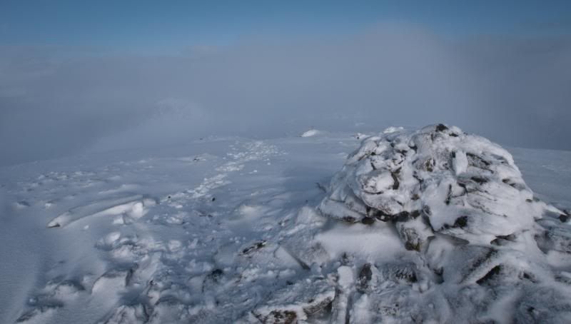
I knew there was going to be lots of new snow and wasnt dissapointed, unfortunately the mist only got worse, lifting for a few short moments on An Casiteall. Not many blue sky photos then but I've hopefully captured the excitement later in the day climbing up Beinn a Chroin's buttress.
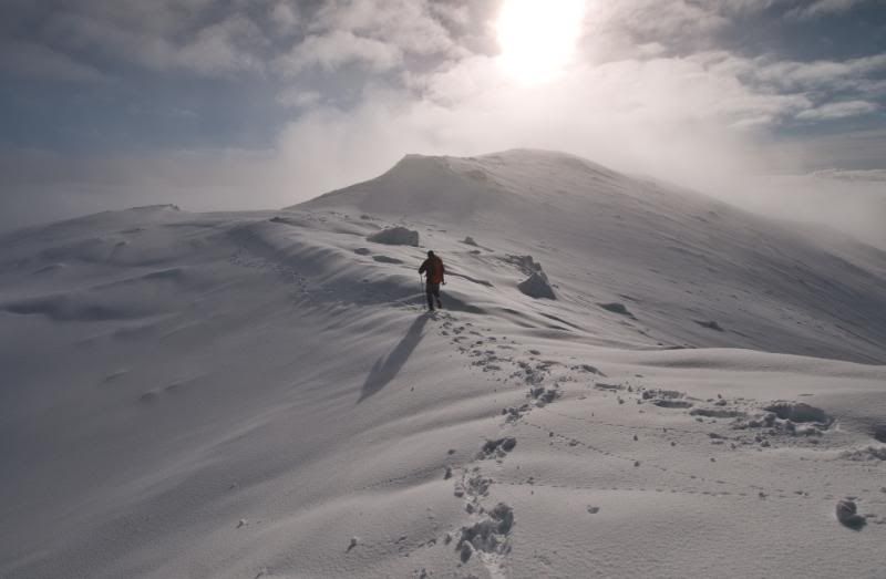
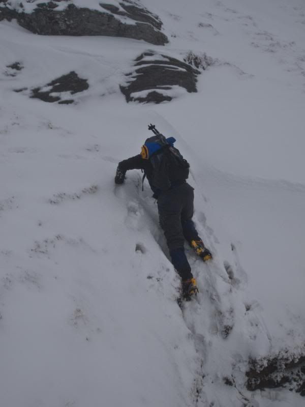
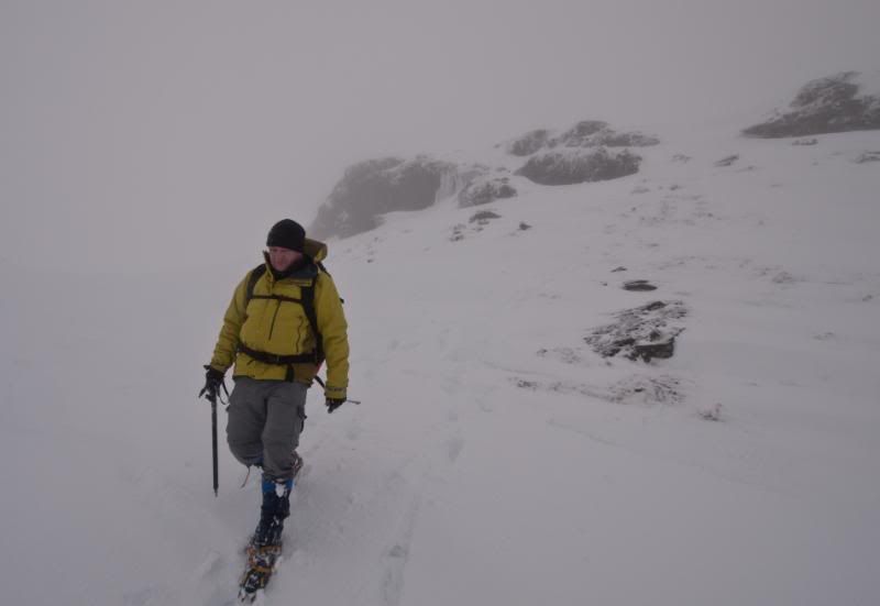
Despite best intentions and judging by the cars already there, I managed to be last one starting up the hill. The early morning mist was still clinging to the valley. After about 1 km on the track I decided to take an early direct line straight up Sron Garbh. I could see a couple of other walkers ahead of me which gave me an incentive to keep a reasonable pace up. I hit patchy snow at about 500m but also came out of the mist. It looked like I might be treated to panaramic inversion shots later.
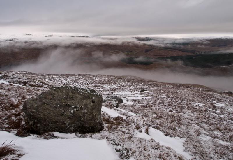
I got to the top of Sron Garbh in 1½ hrs. I stopped for some photos as the low lying mist was now becoming high mist and was surprised to see I had overtaken one walker and another was a short distance in front.
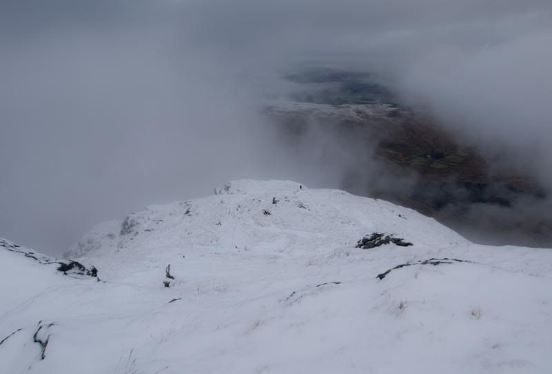
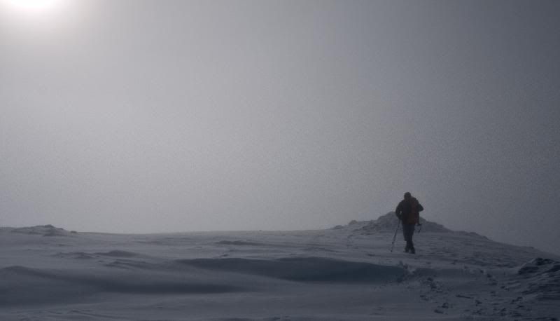
Going up Twistin Hill should have been interesting but the mist was getting thicker.
With the new snow there was no sign of the footpath, but at least there were now a couple of footprints to follow so I only needed a couple of waypoint checks to make sure I was headed in the right direction.
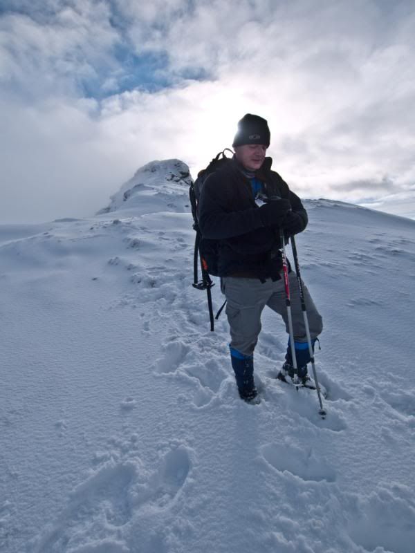
I caught up with the other walker (Graham) ahead of me at the fissure below the 'Castle', which was handy as he offered to take a photo of me. The fissure was banked out with windblown snow so presented no problems.
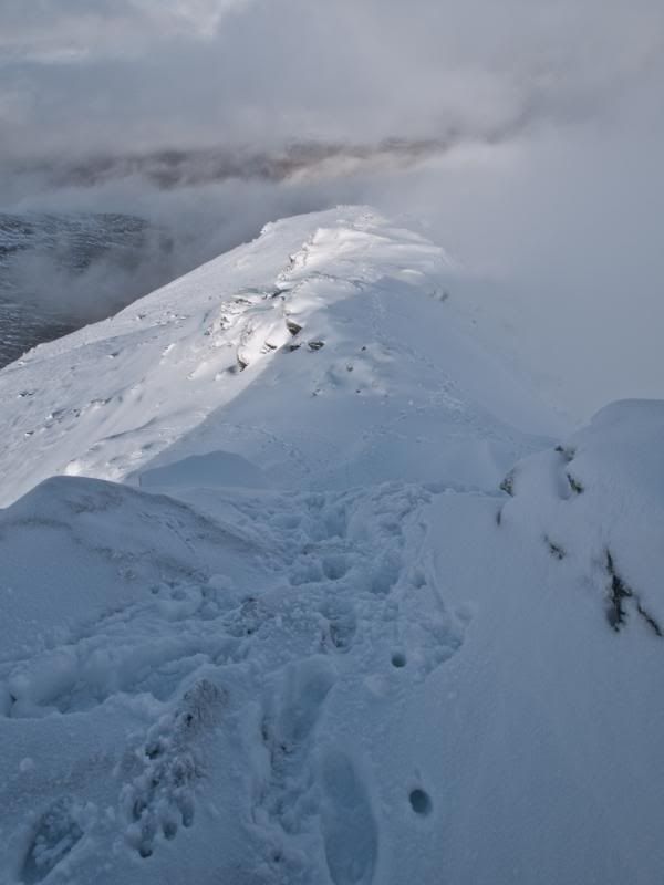
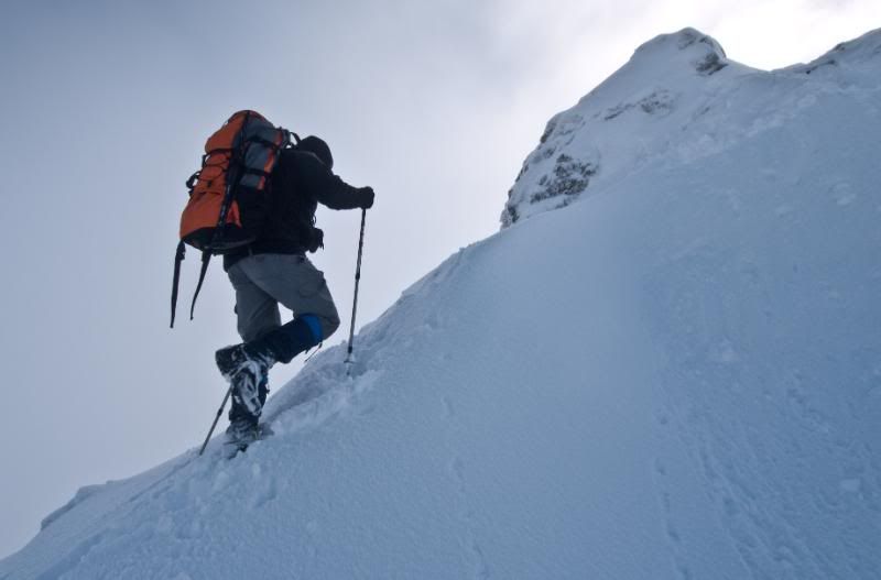
Blue sky amazingly appeared as we headed up to the 'Castle'
Graham on the last short steep bit up to the castle.
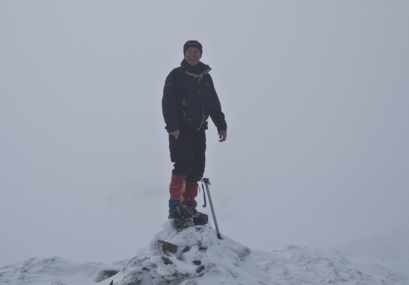
The actual summit is 300m further on from the castle which I reached in 2½ hrs
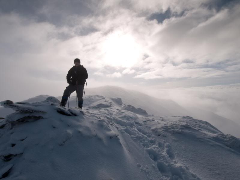
After a short time at the summit the clag was closing in again, so much for the 'good' forecast. This definately looked set for the day now, so we headed off on a bearing across the summit plateau to find the way down to Bealach Buidhe.
I was glad that I had put close waypoints in the GPS as the way down was not obvious and begining to get rocky.
We decided not to follow the footprints as they deviated from my GPS track.
At the next rocky step we met Jason who was putting his crampons on as he wasn't too happy about the descent.
However I managed to find an easier way down by scouting around.
Jason said he had met another walker who seemed to have turned back at this point as there were no futher tracks in the snow, but strangely we never met anyone - must have passed by in the gloop.
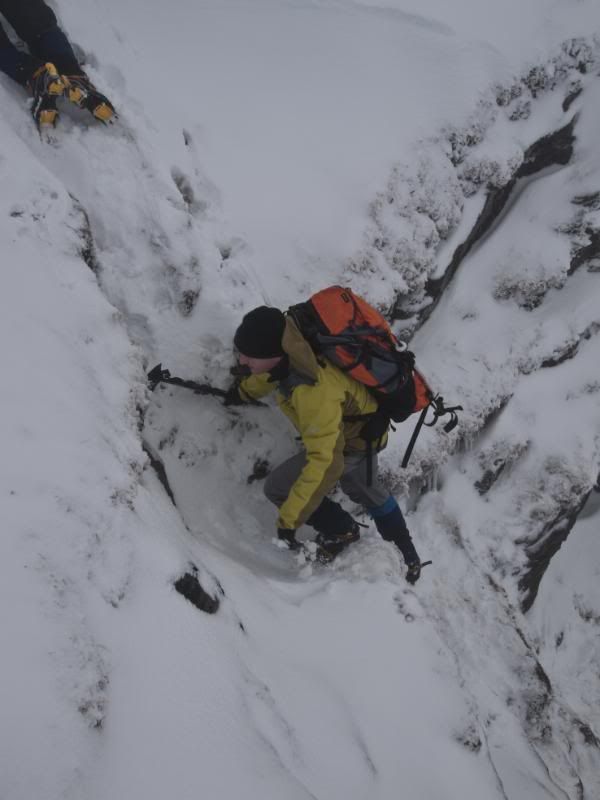
The snow was quite deep where it had drifted so fun was had descending off An Caisteall. At this point I was still using my poles and hadn't put on my crampons yet.
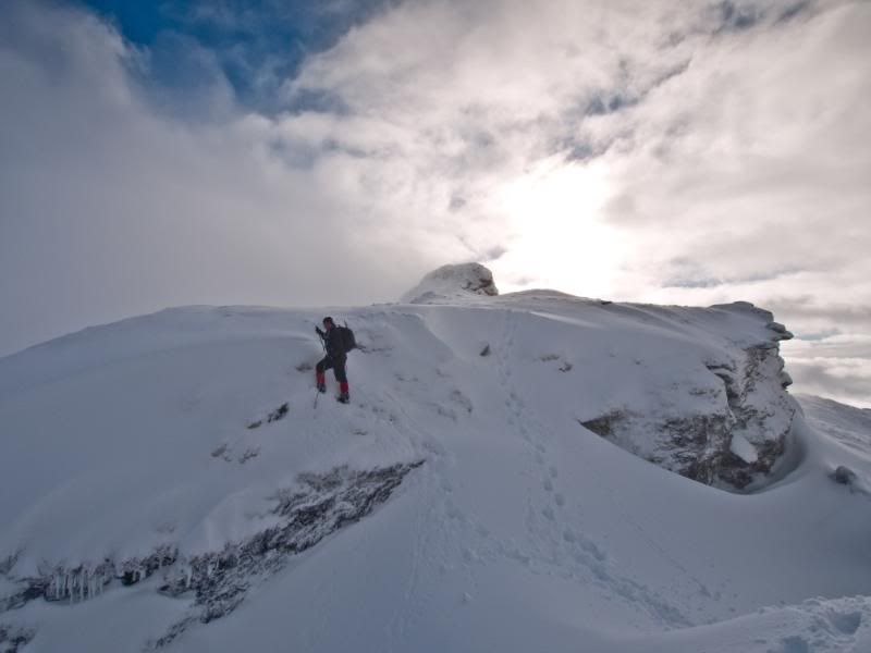
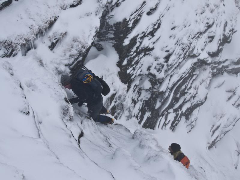
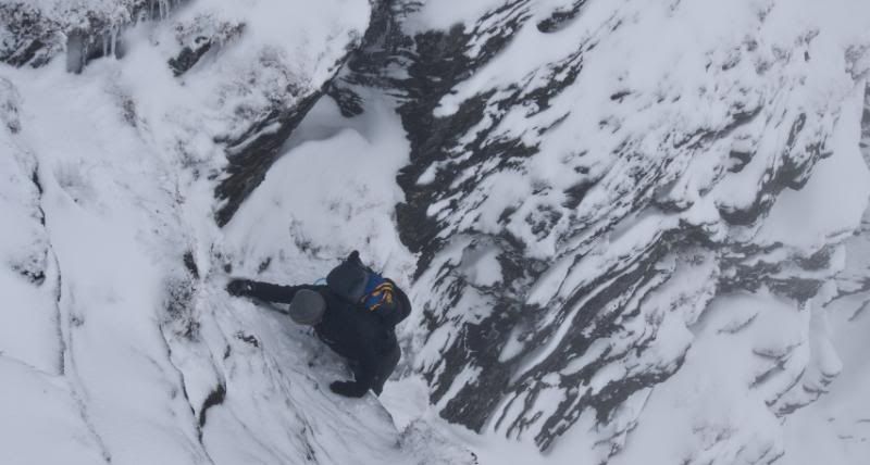
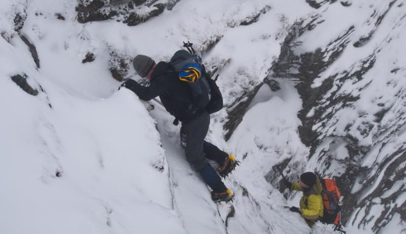
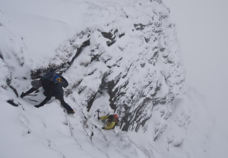
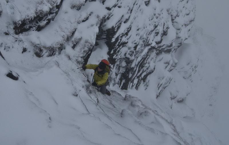
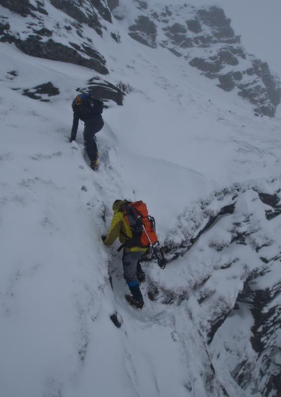
This soon changed as we reached the Bealach and desperately tried to scope a way up the buttress - no chance. Crampons on & ice axe definately needed.
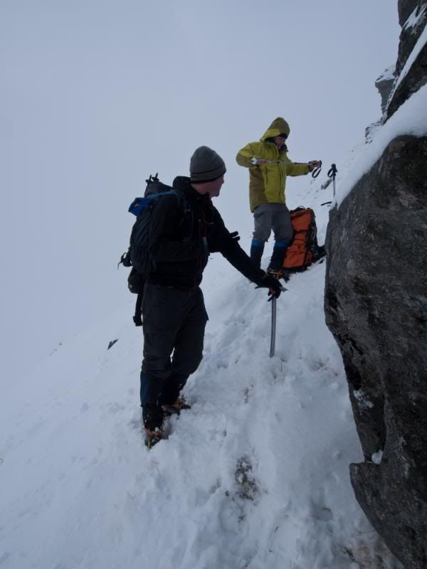
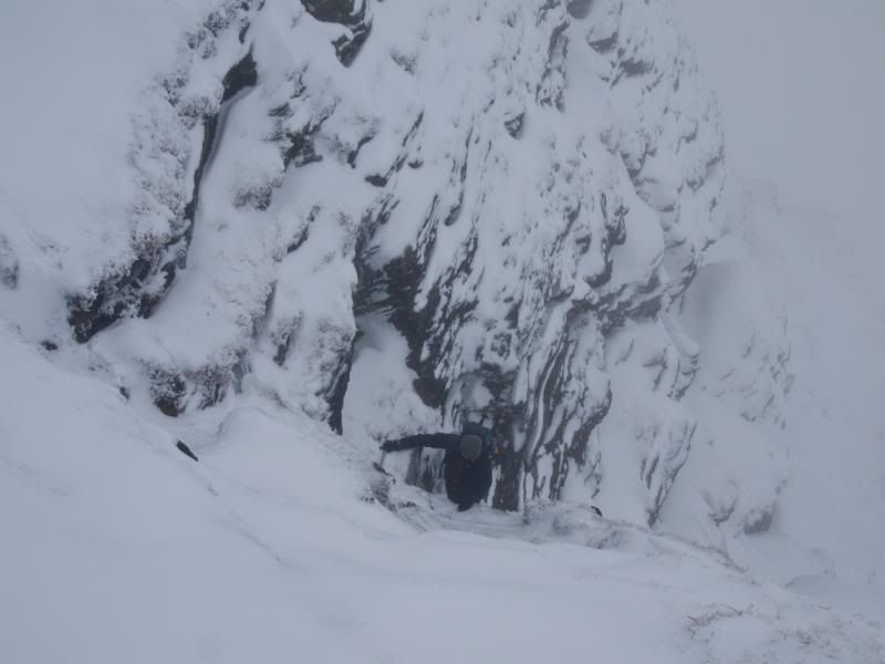
We all had an idea from photos of the line but route finding was a real challenge in the conditions.
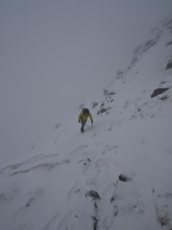
The climb up through the buttress (short scramble ha) was as much fun as I had expected and I'm sure the other two found it a worthwhile challenge. The photos tell the story.
I reached the top after 4½ hrs. 2 hours of this had been from An Caisteall to Beinn A Chroin aka Hill of Danger.
Another gaelic interpretation of the name is 'Hill of the Cloven Hoof' after the twin summits. In the gloom its funny how each summit retrospectively looks slightly higher than the other. The altimeter showed the right top at a couple of feet higher.
We didnt linger long at the top as it was getting cold in the wind and we had a fair walk out yet. A wee lapse of concentration meant that we dropped too low before the East top, but this was quickly corrected. We had a few laughs at Graham who was getting tricked by the flat light conditions and nearly falling on his face a few times by misjudging a step down or up.
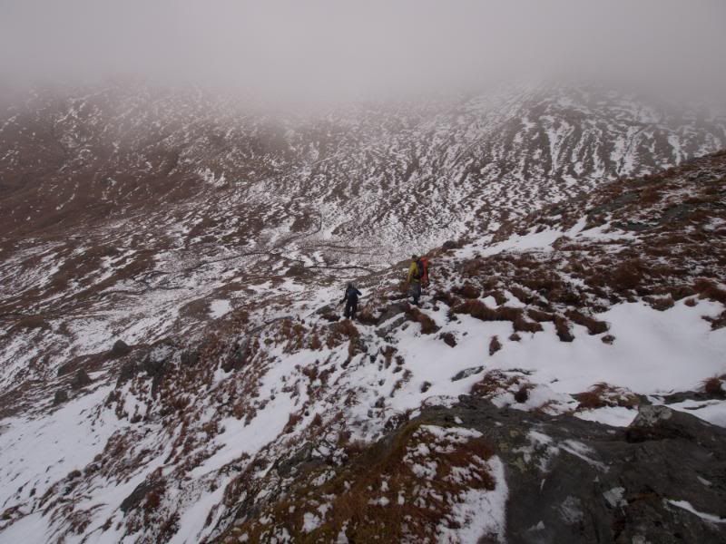
A short climb up and we then knew it was downhill all the way. It was at this point that we realised my GPS route was taking the drop towards Coire Dhonnacha before turning into Coire Earb. Jason's GPS track took the ridge line. We decided to take Jason's line. This was a good decision and an enjoyable route down. We soon were taking crampons off as the snow turned wet
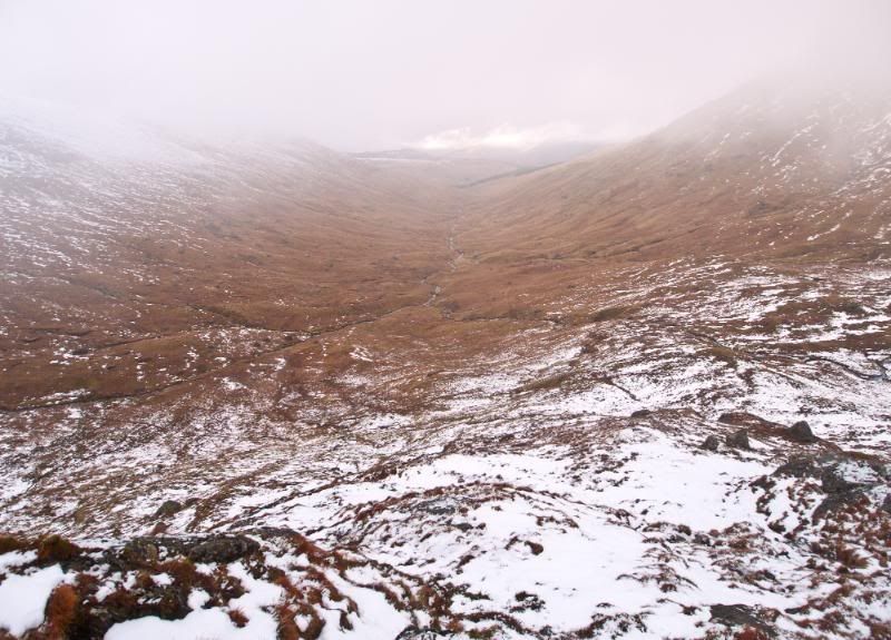
view down Coire Earb
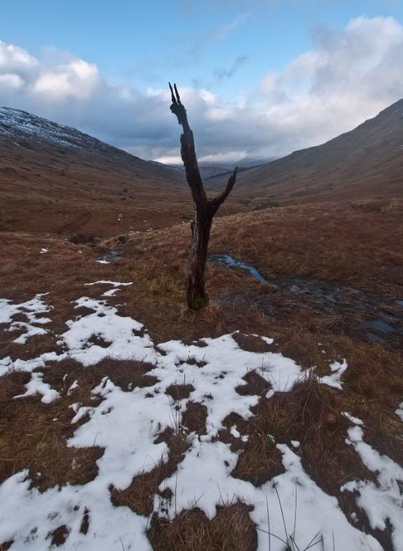
then as we got to the head of Coire Earb we emerged into daylight again
We crossed the Falloch easily high up and had the prosepct of the 4+ km trudging out in rather boggy condtions. I was so glad I had taken the decision to put on my Yeti gaiters, which were as good as wellies in these conditions.
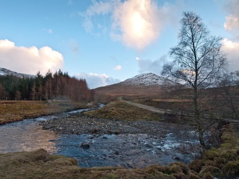
The friendly chat meant that the final trudge passed in no time. I grabbed a couple of photos at the bottom of the Glen as the sun was setting just under 7 hours from start to finish.
I was pleasantly surprised that from a couple of guys who had randomly met for the first time on An Caisteall, we were well matched for pace and the other 2 coped well with challenging navigation and the route finding up Beinn a Chroin. Credit must go to Jason who has only done 15 Munros in total!
If we would have had blue skies it would have ranked as one of my best days - I'll dream on
I knew there was going to be lots of new snow and wasnt dissapointed, unfortunately the mist only got worse, lifting for a few short moments on An Casiteall. Not many blue sky photos then but I've hopefully captured the excitement later in the day climbing up Beinn a Chroin's buttress.
Despite best intentions and judging by the cars already there, I managed to be last one starting up the hill. The early morning mist was still clinging to the valley. After about 1 km on the track I decided to take an early direct line straight up Sron Garbh. I could see a couple of other walkers ahead of me which gave me an incentive to keep a reasonable pace up. I hit patchy snow at about 500m but also came out of the mist. It looked like I might be treated to panaramic inversion shots later.
I got to the top of Sron Garbh in 1½ hrs. I stopped for some photos as the low lying mist was now becoming high mist and was surprised to see I had overtaken one walker and another was a short distance in front.
Going up Twistin Hill should have been interesting but the mist was getting thicker.
With the new snow there was no sign of the footpath, but at least there were now a couple of footprints to follow so I only needed a couple of waypoint checks to make sure I was headed in the right direction.
I caught up with the other walker (Graham) ahead of me at the fissure below the 'Castle', which was handy as he offered to take a photo of me. The fissure was banked out with windblown snow so presented no problems.
Blue sky amazingly appeared as we headed up to the 'Castle'
Graham on the last short steep bit up to the castle.
The actual summit is 300m further on from the castle which I reached in 2½ hrs
After a short time at the summit the clag was closing in again, so much for the 'good' forecast. This definately looked set for the day now, so we headed off on a bearing across the summit plateau to find the way down to Bealach Buidhe.
I was glad that I had put close waypoints in the GPS as the way down was not obvious and begining to get rocky.
We decided not to follow the footprints as they deviated from my GPS track.
At the next rocky step we met Jason who was putting his crampons on as he wasn't too happy about the descent.
However I managed to find an easier way down by scouting around.
Jason said he had met another walker who seemed to have turned back at this point as there were no futher tracks in the snow, but strangely we never met anyone - must have passed by in the gloop.
The snow was quite deep where it had drifted so fun was had descending off An Caisteall. At this point I was still using my poles and hadn't put on my crampons yet.
This soon changed as we reached the Bealach and desperately tried to scope a way up the buttress - no chance. Crampons on & ice axe definately needed.
We all had an idea from photos of the line but route finding was a real challenge in the conditions.
The climb up through the buttress (short scramble ha) was as much fun as I had expected and I'm sure the other two found it a worthwhile challenge. The photos tell the story.
I reached the top after 4½ hrs. 2 hours of this had been from An Caisteall to Beinn A Chroin aka Hill of Danger.
Another gaelic interpretation of the name is 'Hill of the Cloven Hoof' after the twin summits. In the gloom its funny how each summit retrospectively looks slightly higher than the other. The altimeter showed the right top at a couple of feet higher.
We didnt linger long at the top as it was getting cold in the wind and we had a fair walk out yet. A wee lapse of concentration meant that we dropped too low before the East top, but this was quickly corrected. We had a few laughs at Graham who was getting tricked by the flat light conditions and nearly falling on his face a few times by misjudging a step down or up.
A short climb up and we then knew it was downhill all the way. It was at this point that we realised my GPS route was taking the drop towards Coire Dhonnacha before turning into Coire Earb. Jason's GPS track took the ridge line. We decided to take Jason's line. This was a good decision and an enjoyable route down. We soon were taking crampons off as the snow turned wet
view down Coire Earb
then as we got to the head of Coire Earb we emerged into daylight again
We crossed the Falloch easily high up and had the prosepct of the 4+ km trudging out in rather boggy condtions. I was so glad I had taken the decision to put on my Yeti gaiters, which were as good as wellies in these conditions.
The friendly chat meant that the final trudge passed in no time. I grabbed a couple of photos at the bottom of the Glen as the sun was setting just under 7 hours from start to finish.
I was pleasantly surprised that from a couple of guys who had randomly met for the first time on An Caisteall, we were well matched for pace and the other 2 coped well with challenging navigation and the route finding up Beinn a Chroin. Credit must go to Jason who has only done 15 Munros in total!
If we would have had blue skies it would have ranked as one of my best days - I'll dream on
Click to mark this as a great report. Register or Login free to be able to rate and comment on reports (as well as access 1:25000 mapping).
Comments: 9
-
Dave_W
- Activity: Stravaiging
- Filter reports
- Trips: 1
- Distance: 15 km
- Munros: 2
- Joined: Feb 12, 2011
- Last visited: Mar 02, 2011
- Total posts: 4 | Search posts