
Pico de la Zarza, Fuerteventura
Date walked: 06/07/2011
Time taken: 4 hours
Distance: 14km
Ascent: 807m
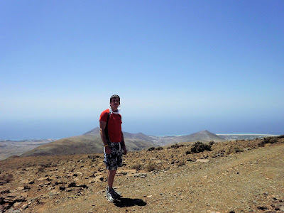
Pico de la Zarza is the highest point on Fuerteventura at 807m. It lies within the area of Jandia which is the peninsula at the south of the island. The developed side of the peninsula lies to the eastern side of the mountains as it is in shelter of the wind and in contrast the western side of Cofete is relatively undeveloped and unspoilt as gets the full force of the weather making the beaches and water very choppy which is not good for bathing but has a reputation for those who like watersports.
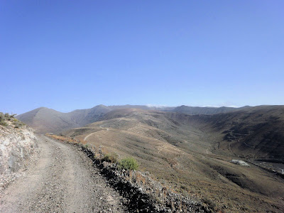
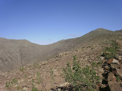
The mountain range in Jandia has long shoulders running in parallel with large U shaped valleys between them and the shoulders all terminate to a ridge forming a half circle spanning the range with a steeper drop down the other side to Cotefe. This half circle is actually the remains of an ancient volcano caldera, like Teide on Tenerife, and the shoulders are lava flows.

I attempted this the first time on the Thursday and left at 2pm hoping to catch the coolness of the afternoon but I was wrong and at 4pm it was still 35c and I was only half way up. I had consumed most of my water and was I getting dizzy. I estimated that I would not be able to get back up and down safely in the sizzling heat of the day so made the decision to turn back.
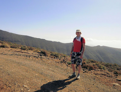
Two days later and refreshed I left again at a much cooler time of 9am and found the going much easier.
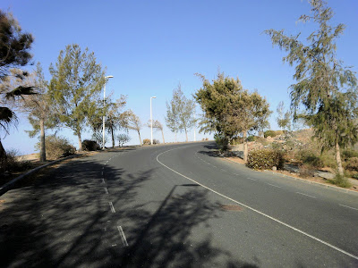
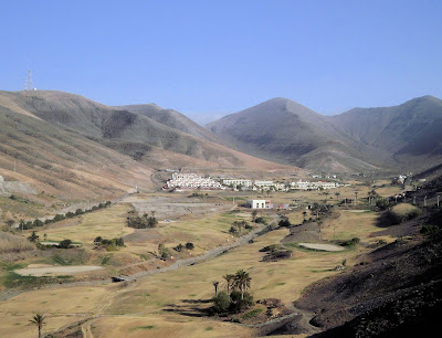
The start of the route is from the Barcelo Hotel which actually sits elevated upon the ridge itself. There is a road which runs up behind it which you follow until it reaches a fork. You take the right fork to a (disused I think) water treatment plant. The left fork goes off down into the valley where a golf course used to be.

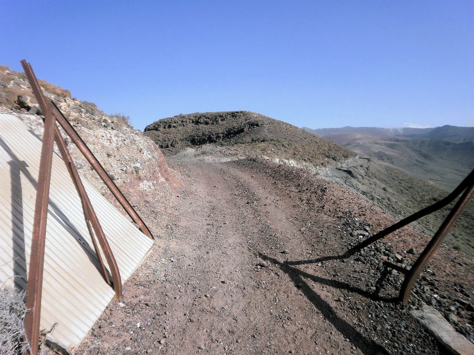
At the water treatment plant a dirt track countours off and up to the right.
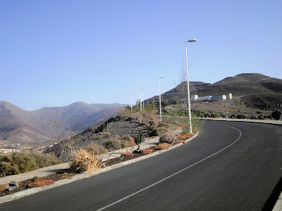
The track goes up and continues to contour round a minor top on the ridge. The track is pretty unsightly and was used by workers who ran a research station at the top.
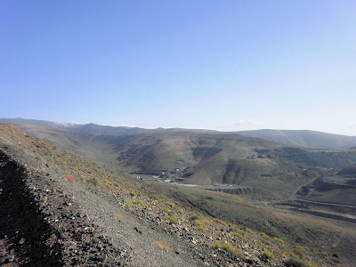

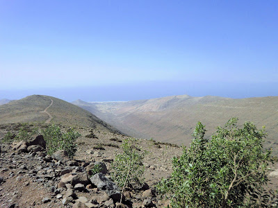
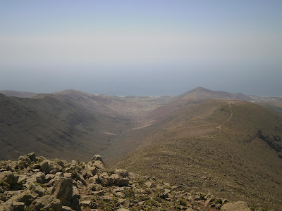
The golf course was in the valley to the left of the ridge and you are now contouring the right of the top so the views are down to the valley on the right which appears to be some extensive quarrying. The ridge and track can be seen snaking off into the distance.
The ridge is very broad and the track easy to follow, but I still feel sadness at the scar on the mountain. Occasionally gusts of wind would come down the ridge and was very refreshing but when they died down the searing heat would start again. It was still morning and the mid 20s but felt cool compared to the 38c which I had experienced the day before on ground level.

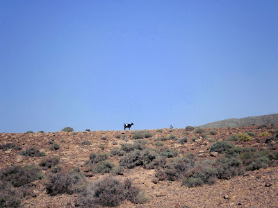
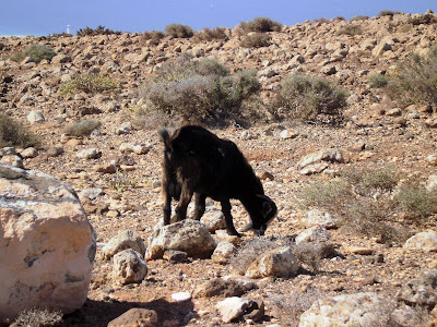
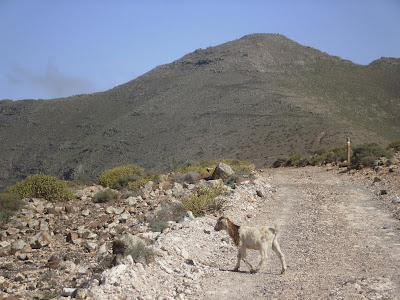
There are lots of goats up high enjoying the cooler temperatures and more abundant fauna and flora.
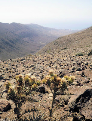
As the final summit cone approaches things start to get a lot greener and more wildlife is visible.

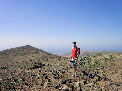

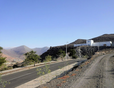
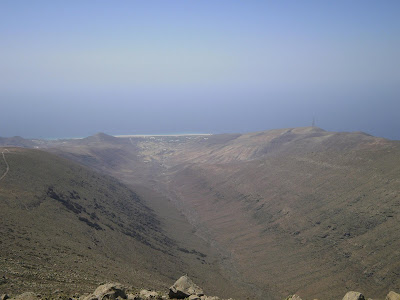
In the distance in the direction I came, the minor top I traversed can be seen with the beaches of the coastline.
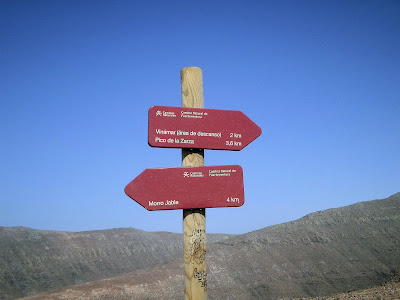
On the final summit cone the large dirt track becomes a smaller less imposing single track which is engineered into a selection of switchbacks of which it is advised to not stray from in order to preserve the environment.
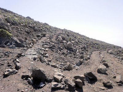
Eventually you reach a fenced off area which was built to keep the goats out and preserve the area, however whatever gate used to be there has since been pulled down.

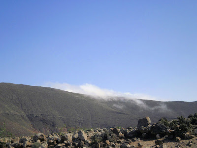
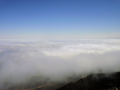
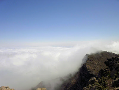
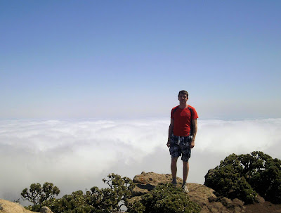
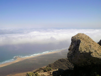
Upon reaching the summit I was greeted with a fantastic cloud inversion on the Cotefe side; a phenomenon caused by the winds sweeping inland and up the north face. It is reported that birds use these thermal updrafts to ride up the mountain.
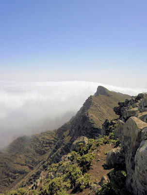
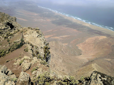
The north face down into what was the ancient caldera is steep and exposed.

The beaches of Cotefe can be seen below.

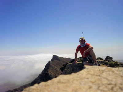
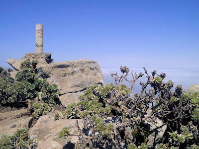
A trig point which has been vandalised with graffiti. It doesn't matter where you go in the world, someone will spoil it.
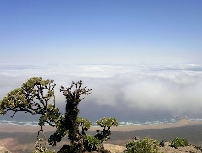
Another view to the north face cliffs and the undeveloped area of Cotefe.
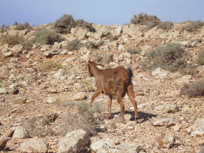
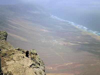
There is a hardy mountain goat mucking about on the cliff edge. I dared not go and explore the ridge in case I scared him off the other side.
Looking back the way you can see the ridges running back to where I started and the valleys between. The valleys look polished and round and must have seen glacial activity some time in the far distance past although the last ice never came this far south.
On my way back down again in time for all you can eat buffet lunch at the hotel.
The mountain range in Jandia has long shoulders running in parallel with large U shaped valleys between them and the shoulders all terminate to a ridge forming a half circle spanning the range with a steeper drop down the other side to Cotefe. This half circle is actually the remains of an ancient volcano caldera, like Teide on Tenerife, and the shoulders are lava flows.

I attempted this the first time on the Thursday and left at 2pm hoping to catch the coolness of the afternoon but I was wrong and at 4pm it was still 35c and I was only half way up. I had consumed most of my water and was I getting dizzy. I estimated that I would not be able to get back up and down safely in the sizzling heat of the day so made the decision to turn back.
Two days later and refreshed I left again at a much cooler time of 9am and found the going much easier.
The start of the route is from the Barcelo Hotel which actually sits elevated upon the ridge itself. There is a road which runs up behind it which you follow until it reaches a fork. You take the right fork to a (disused I think) water treatment plant. The left fork goes off down into the valley where a golf course used to be.


At the water treatment plant a dirt track countours off and up to the right.

The track goes up and continues to contour round a minor top on the ridge. The track is pretty unsightly and was used by workers who ran a research station at the top.

The golf course was in the valley to the left of the ridge and you are now contouring the right of the top so the views are down to the valley on the right which appears to be some extensive quarrying. The ridge and track can be seen snaking off into the distance.

The ridge is very broad and the track easy to follow, but I still feel sadness at the scar on the mountain. Occasionally gusts of wind would come down the ridge and was very refreshing but when they died down the searing heat would start again. It was still morning and the mid 20s but felt cool compared to the 38c which I had experienced the day before on ground level.


There are lots of goats up high enjoying the cooler temperatures and more abundant fauna and flora.


As the final summit cone approaches things start to get a lot greener and more wildlife is visible.


In the distance in the direction I came, the minor top I traversed can be seen with the beaches of the coastline.

On the final summit cone the large dirt track becomes a smaller less imposing single track which is engineered into a selection of switchbacks of which it is advised to not stray from in order to preserve the environment.

Eventually you reach a fenced off area which was built to keep the goats out and preserve the area, however whatever gate used to be there has since been pulled down.

Upon reaching the summit I was greeted with a fantastic cloud inversion on the Cotefe side; a phenomenon caused by the winds sweeping inland and up the north face. It is reported that birds use these thermal updrafts to ride up the mountain.


The north face down into what was the ancient caldera is steep and exposed.

The beaches of Cotefe can be seen below.


A trig point which has been vandalised with graffiti. It doesn't matter where you go in the world, someone will spoil it.

Another view to the north face cliffs and the undeveloped area of Cotefe.


There is a hardy mountain goat mucking about on the cliff edge. I dared not go and explore the ridge in case I scared him off the other side.

Looking back the way you can see the ridges running back to where I started and the valleys between. The valleys look polished and round and must have seen glacial activity some time in the far distance past although the last ice never came this far south.


On my way back down again in time for all you can eat buffet lunch at the hotel.

Click to mark this as a great report. Register or Login free to be able to rate and comment on reports (as well as access 1:25000 mapping).
Comments: 7
Cul Mor, Assynt (Photo Report)
Date walked: 01/05/2011
Comments: 11
Views: 8155
Ben More (Assynt) & Cornival (Photo Report)
Munros: Ben More Assynt, ConivalDate walked: 30/04/2011
Comments: 5
Views: 5449
Cairn Gorm via Coire an t-Sneachda
Munros: Cairn GormDate walked: 13/10/2010
Comments: 5
Views: 7660
Sron na Lairig - Stob Coire Sgreamhach
Date walked: 18/05/2010
Comments: 3
Views: 11804
Skye - Sgurr a' Mhadaidh and Sgurr a' Ghreadaidh
Munros: Sgùrr a' Ghreadaidh, Sgùrr a' MhadaidhDate walked: 24/04/2010
Comments: 4
Views: 7701
Ben Starav
Munros: Ben StaravDate walked: 11/04/2010
Comments: 5
Views: 5803
Curved Ridge, Buachaille Etive Mor
Munros: Stob Dearg (Buachaille Etive Mòr)Date walked: 10/04/2010
Comments: 2
Views: 12955
Carn Mor Dearg & Ben Nevis
Munros: Ben Nevis, Càrn Mòr DeargDate walked: 10/03/2010
Comments: 13
Views: 15541
Goatfell - Arran
Corbetts: Goat FellDate walked: 20/02/2010
Distance: 12km
Ascent: 874m
Comments: 10
Views: 16247
-
Milesy
- Location: Airdrieland.
- Occupation: Software Engineer
- Interests: Big hills! :)
- Activity: Stravaiging
- Pub: Kings House Hotel!
- Mountain: Buachaille Etive Mor
- Place: Glen Coe
- Gear: Hot Tea Flask!
- Ideal day out: The elements at their worst!
- Ambition: To reach the stars!
- Filter reports
- Trips: 3
- Distance: 14 km
- Ascent: 807m
- Munros: 2
- Corbetts: 1
- Trips: 9
- Distance: 12 km
- Ascent: 2000m
- Munros: 11
- Corbetts: 1
- Trips: 3
- Ascent: 1370m
- Munros: 1
- Joined: Jun 12, 2009
- Last visited: Mar 15, 2024
- Total posts: 1520 | Search posts