
Top O'Selside & Carron Crag
Date walked: 14/09/2013
Time taken: 4.5 hours
Distance: 13km
Ascent: 455m
Top O'Selside - Carron Crag
A quick blast around on the ridges of Grizedale between Coniston & Windermere covering a couple of Wainwrights Outlying Fells (although not following any of the recomended routes in his guide books.
We were originally to set off from High Nibthwaite near the shores of Coniston but on arriving there we couldn't find a decent place to park so changed our minds and drove up through Oxen Park and out through Force Forge (where we stopped for a quick geocaching trail, approx 40 minutes walk round beautiful scenery and passing the cascading waters of Force Beck) before parking up at a lay-by just south of Satterthwaite.
The walk took us up a bridle path into an area of Grizedale Forest in which we made the most direct path following a GPS compass bearing towards Top O'Selside. The path was fairly clear for the entire journey there and cut across the more profound forestry tracks that litter this area of the forest on a much narrower path before it opened out to the north of the fell top on to open moor land near High Parkamoor.
We traversed round the fells northern path trying to find a clear route up before deciding that our only options were sheep tracks over quite boggy land. We covered at least 3 tops to ensure we'd reached the highest point but took the photos at the only one with a nice stone cairn where we met another couple of lads out for a quick wander.
The path down and back to the gate that led us out of the forest area was more direct on the way back after dropping first to Arnsbarrow Tarn for a quick quiet cache grab.
From here we followed a number of forest tracks round Mustard Hill and on past the western flanks of Carron Crag that were densely covered in trees with no route through.
On walking round to its northern flanks, Damson & I made the decision to try and cut through the tree cleared area on a more direct route to Carron Crags summit which made for very heavy going over logs & bogs before we reached another track leading to the gateway to the summit.
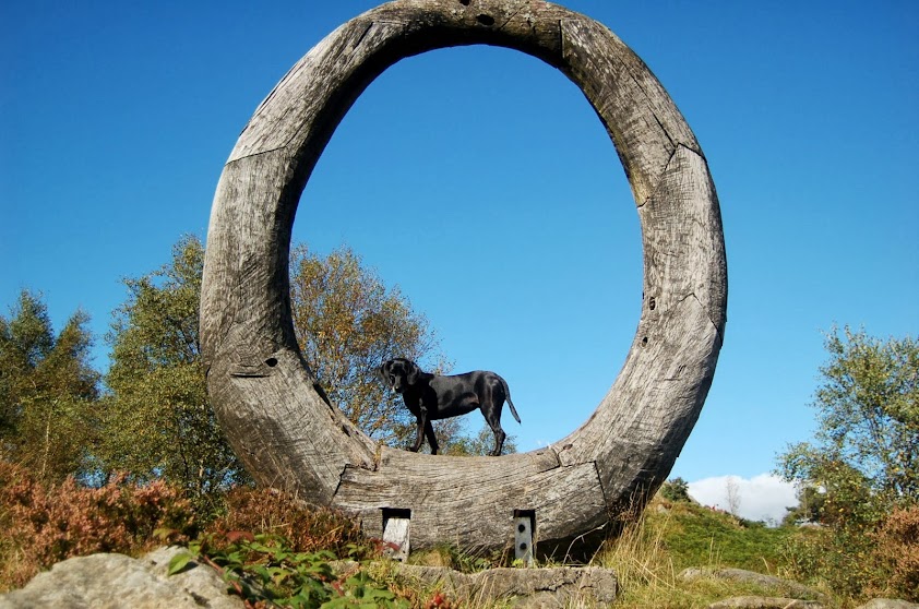
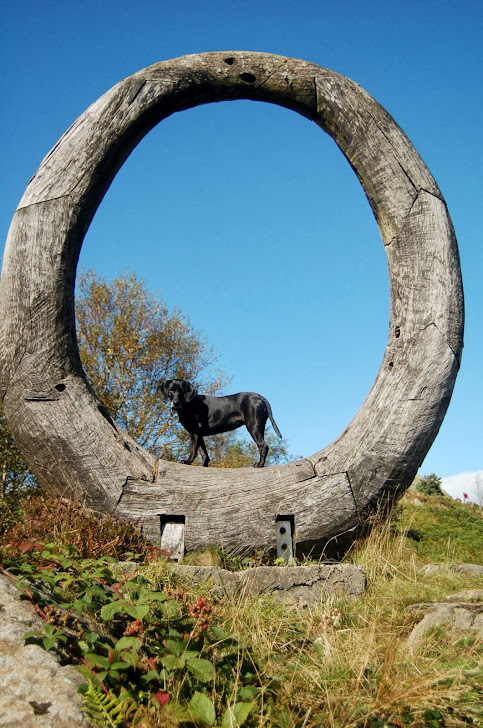
The final push up to the top was easy and we were soon taking in a bite and a drink and a few photos (Damson posing on the trig point as usual). A further 50m on was a nice wooden sculpture which gave Damson even more opportunity to pose before we made our way down and back along slightly lower paths back towards Satterthwaite and the car.
The weather was great for this time of year and the scenery beautiful, especially the views over to the Coniston Fells. A few piccies of the wander are shown below.
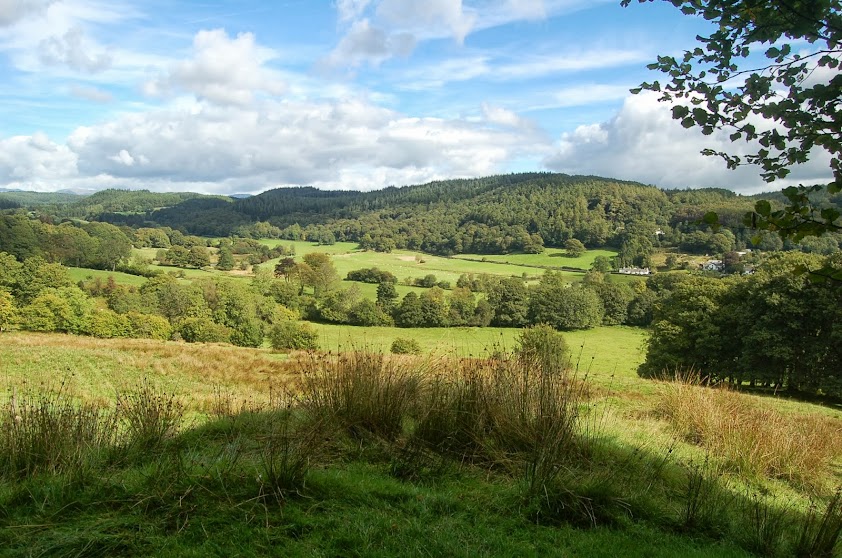
Valley around Satterthwaite from initial bridleway
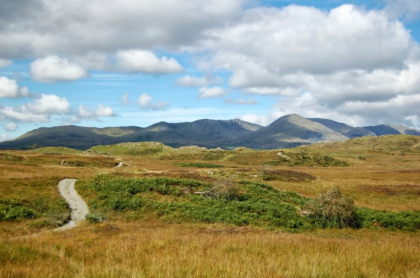
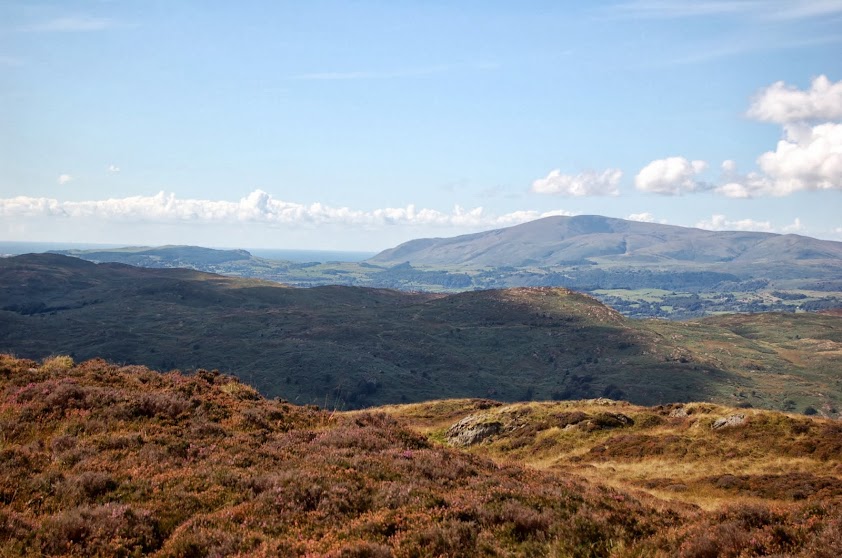
First glimpse of Conison Fells from near High Parkamoor
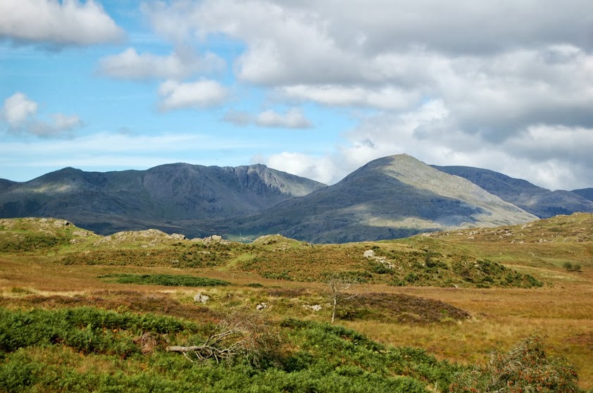
Zoom on Coniston Old Man and Dow Crag (right & left)
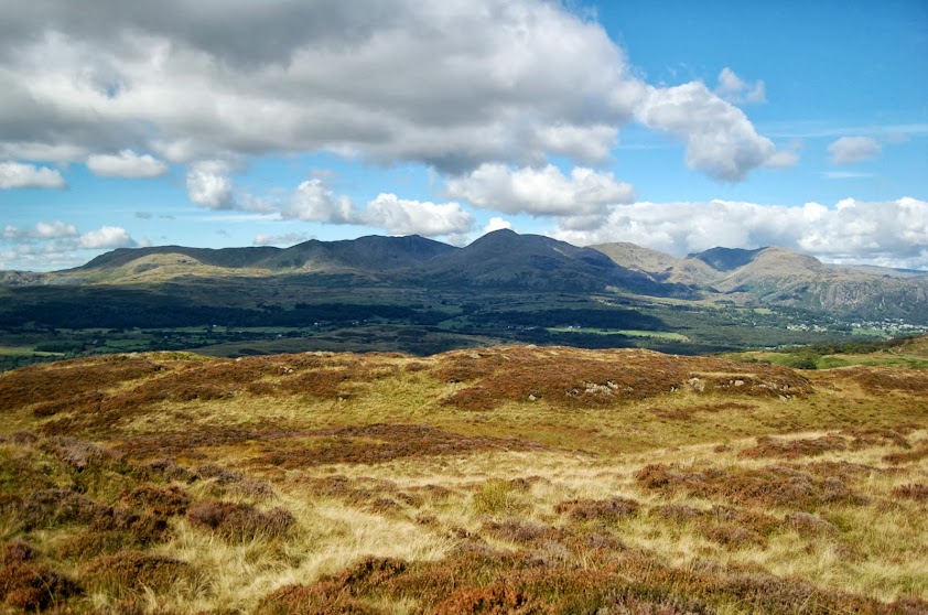
Coniston Fells from High Parkamoor
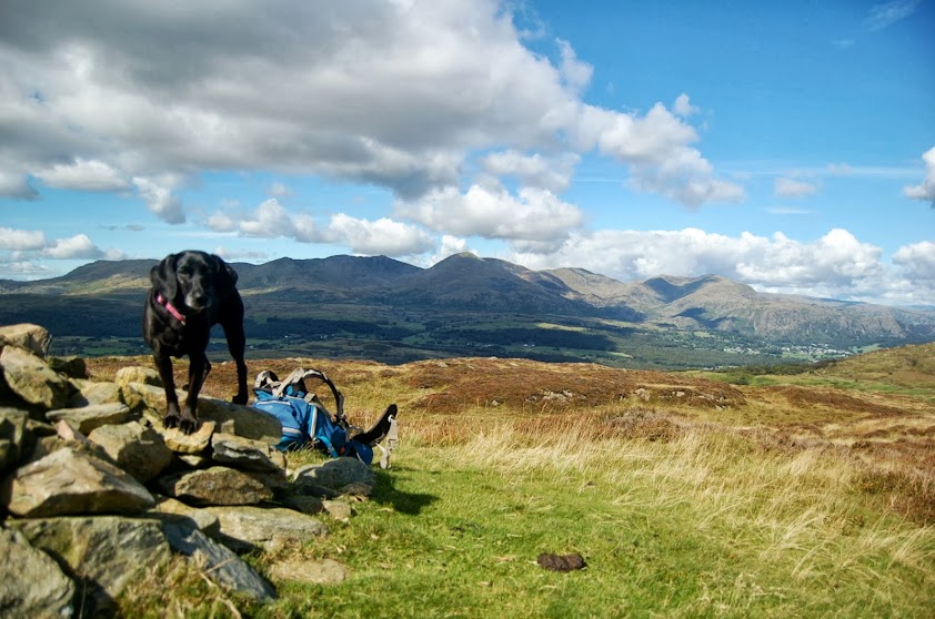
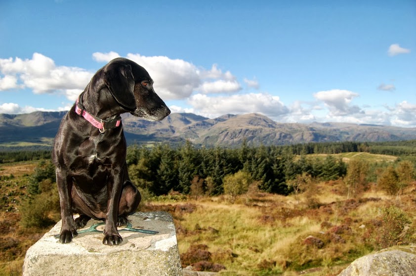
View to Black Combe and Furness from Top O'Selside
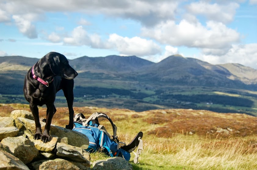
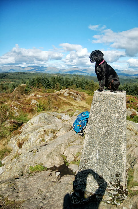
Damson on Top O'Selside before Coniston Fells
And again but with her paying attention this time
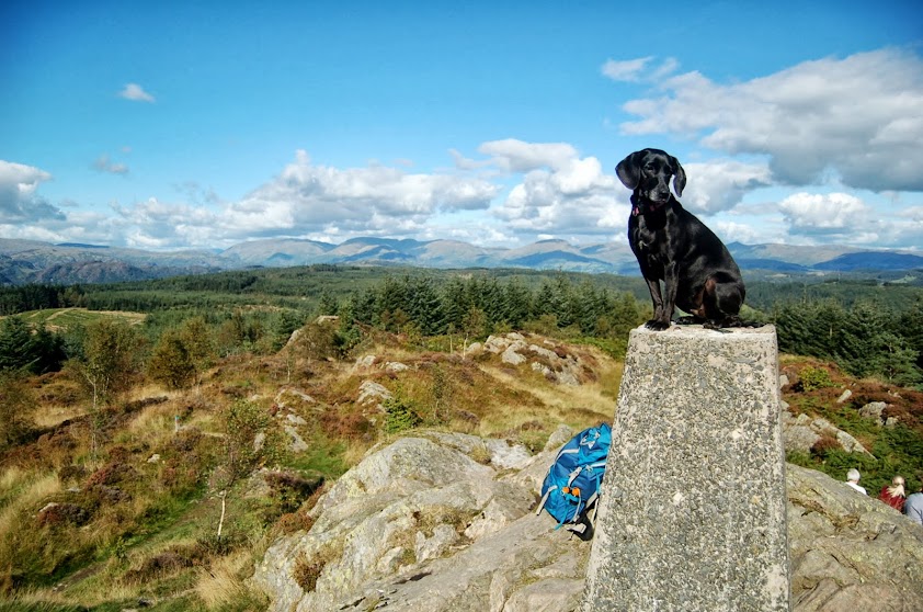
Damson on Carron Crag summit
And another !!
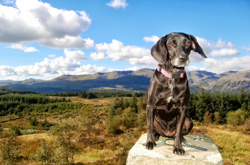
And a couple of close ups
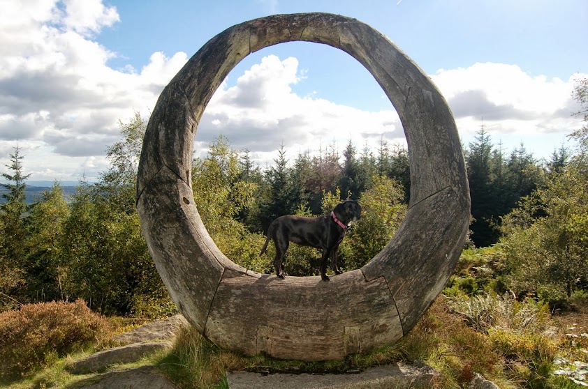
And a few poses on the wooden sculpture !!
A quick blast around on the ridges of Grizedale between Coniston & Windermere covering a couple of Wainwrights Outlying Fells (although not following any of the recomended routes in his guide books.
We were originally to set off from High Nibthwaite near the shores of Coniston but on arriving there we couldn't find a decent place to park so changed our minds and drove up through Oxen Park and out through Force Forge (where we stopped for a quick geocaching trail, approx 40 minutes walk round beautiful scenery and passing the cascading waters of Force Beck) before parking up at a lay-by just south of Satterthwaite.
The walk took us up a bridle path into an area of Grizedale Forest in which we made the most direct path following a GPS compass bearing towards Top O'Selside. The path was fairly clear for the entire journey there and cut across the more profound forestry tracks that litter this area of the forest on a much narrower path before it opened out to the north of the fell top on to open moor land near High Parkamoor.
We traversed round the fells northern path trying to find a clear route up before deciding that our only options were sheep tracks over quite boggy land. We covered at least 3 tops to ensure we'd reached the highest point but took the photos at the only one with a nice stone cairn where we met another couple of lads out for a quick wander.
The path down and back to the gate that led us out of the forest area was more direct on the way back after dropping first to Arnsbarrow Tarn for a quick quiet cache grab.
From here we followed a number of forest tracks round Mustard Hill and on past the western flanks of Carron Crag that were densely covered in trees with no route through.
On walking round to its northern flanks, Damson & I made the decision to try and cut through the tree cleared area on a more direct route to Carron Crags summit which made for very heavy going over logs & bogs before we reached another track leading to the gateway to the summit.
The final push up to the top was easy and we were soon taking in a bite and a drink and a few photos (Damson posing on the trig point as usual). A further 50m on was a nice wooden sculpture which gave Damson even more opportunity to pose before we made our way down and back along slightly lower paths back towards Satterthwaite and the car.
The weather was great for this time of year and the scenery beautiful, especially the views over to the Coniston Fells. A few piccies of the wander are shown below.
Valley around Satterthwaite from initial bridleway
First glimpse of Conison Fells from near High Parkamoor
Zoom on Coniston Old Man and Dow Crag (right & left)
Coniston Fells from High Parkamoor
View to Black Combe and Furness from Top O'Selside
Damson on Top O'Selside before Coniston Fells
And again but with her paying attention this time
Damson on Carron Crag summit
And another !!
And a couple of close ups
And a few poses on the wooden sculpture !!
Click to mark this as a great report. Register or Login free to be able to rate and comment on reports (as well as access 1:25000 mapping).
Overnighter in deepest Borrowdale
Date walked: 12/08/2013
Distance: 20km
Ascent: 715m
Comments: 2
Views: 4308
Great Rhos
Date walked: 09/08/2013
Distance: 16km
Ascent: 750m
Comments: 1
Views: 3673
Rannerdale Knotts
Date walked: 28/07/2013
Distance: 5km
Ascent: 344m
Comments: 10
Views: 5524
Striding Edge & Helvellyn
Hewitts: Helvellyn, Raise, White Side
Date walked: 21/07/2013
Distance: 14km
Ascent: 1061m
Comments: 3
Views: 7833
Haycock & Caw Fell - Penultimate Wainwrights
Hewitts: Haycock
Date walked: 06/07/2013
Distance: 13.8km
Ascent: 889m
Comments: 4
Views: 6774
Yewbarrow
Hewitts: Yewbarrow, Yewbarrow North Top
Date walked: 22/06/2013
Distance: 6.2km
Ascent: 626m
Comments: 2
Views: 3749
Great Calva
Hewitts: Great Calva
Date walked: 19/06/2013
Distance: 8km
Ascent: 505m
Comments: 5
Views: 5590
Mellbreak & Hen Comb
Date walked: 16/06/2013
Distance: 11.2km
Ascent: 930m
Comments: 6
Views: 7050
Base Brown, Green Gable & Seathwaite Fell
Hewitts: Base Brown, Green Gable, Seathwaite Fell
Date walked: 08/06/2013
Distance: 15km
Ascent: 1070m
Comments: 3
Views: 7051
-
Phooooey

- Location: Dalton -In-Furness
- Wainwrights: 214
- Hewitts: 111
- Filter reports
- Trips: 20
- Distance: 245.7 km
- Ascent: 15494m
- Hewitts: 27
- Wainwrights 41
- Trips: 31
- Distance: 369.44 km
- Ascent: 23098m
- Hewitts: 37
- Wainwrights 82
- Trips: 23
- Distance: 278.65 km
- Ascent: 19165m
- Hewitts: 46
- Wainwrights 87
- Trips: 17
- Distance: 158.1 km
- Ascent: 10907m
- Hewitts: 18
- Wainwrights 36
- Joined: Apr 04, 2010
- Last visited: Oct 04, 2021
- Total posts: 244 | Search posts
