
A Battering at Bridge of Orchy
Route: Beinn Achaladair and Beinn a'Chreachain
Munros: Beinn a' Chreachain, Beinn Achaladair, Beinn Mhanach
Date walked: 31/05/2012
Time taken: 11.33 hours
Distance: 24.8km
Ascent: 2007m
Having not been up a Munro for a couple of months since finally doing Buachaille Etive Mor with my dad in March I thought it was about time to get out again and also to do a big one. Jamie hadn’t been out in a while either and he hadn’t been introduced to the joy (or misery  ) of doing more than two Munros in one day so this was as good a time as any to start.
I was short on time for arranging this walk but as usual I logged onto WalkHighlands and loaded up my Munro Map to find which out which red flags could be turned blue. I spotted these three Munros just past Bridge of Orchy and thought they would be perfect then realised that the usual walk route only covers two of them and not the third and further away Beinn Mhanach. A quick search and it was easy to find a few people had done this already though after doing Beinn a'Chreachain and Beinn Achaladair then hitting Beinn Mhanach on the way back to the start. It’s only a 300m ascent to it so it shouldn’t be too tough I thought, not taking the time to check the rest of the route back and whether there was any more ascent needed.
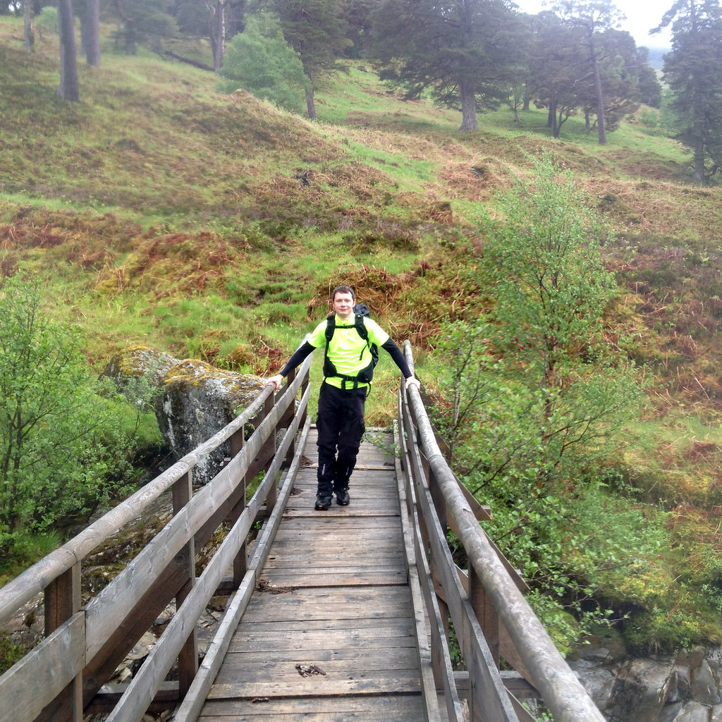
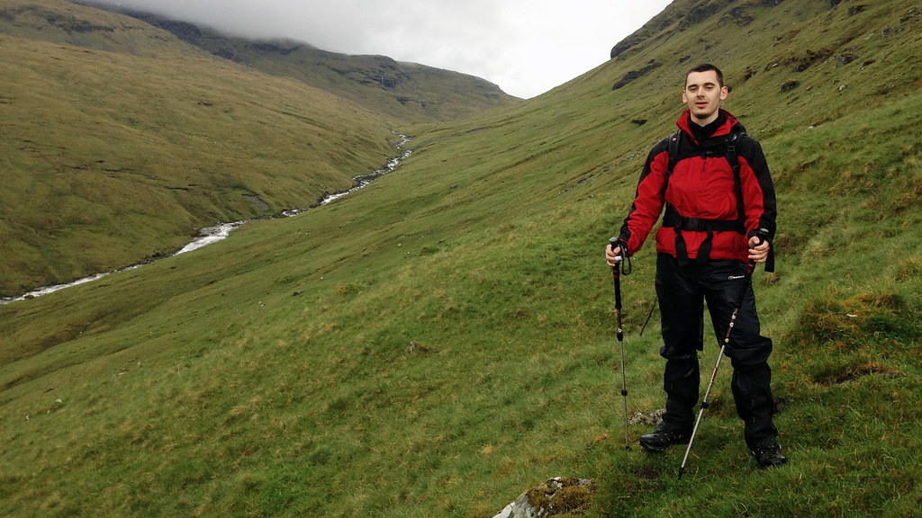
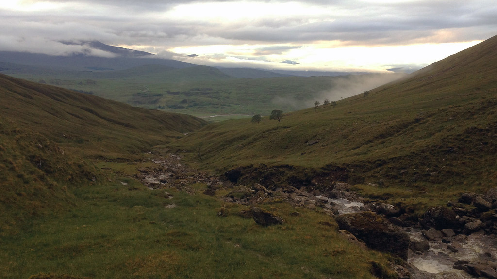
So off we went to Achaladair Farm to start our epic 15 mile walk. It was a cloudy day but hopes were high that it would clear and we were excited for what lay ahead. As with the usual route, we were doing it clockwise so had a 2 or 3 mile walk north east along the flat dirt track which followed the Water of Tulla. We left the track to join the path and bridge crossing over the river and into the Black Wood of Rannoch.
 Looking Back To Achallader by Rossco Mac 7, on Flickr
 Bealach an Aoghlain by Rossco Mac 7, on Flickr
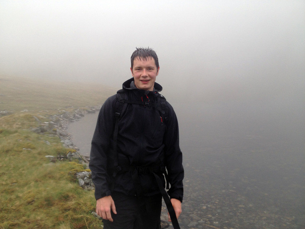
 Crossing The Water Of Tulla by Rossco Mac 7, on Flickr
 Crossing The Water Of Tulla by Rossco Mac 7, on Flickr
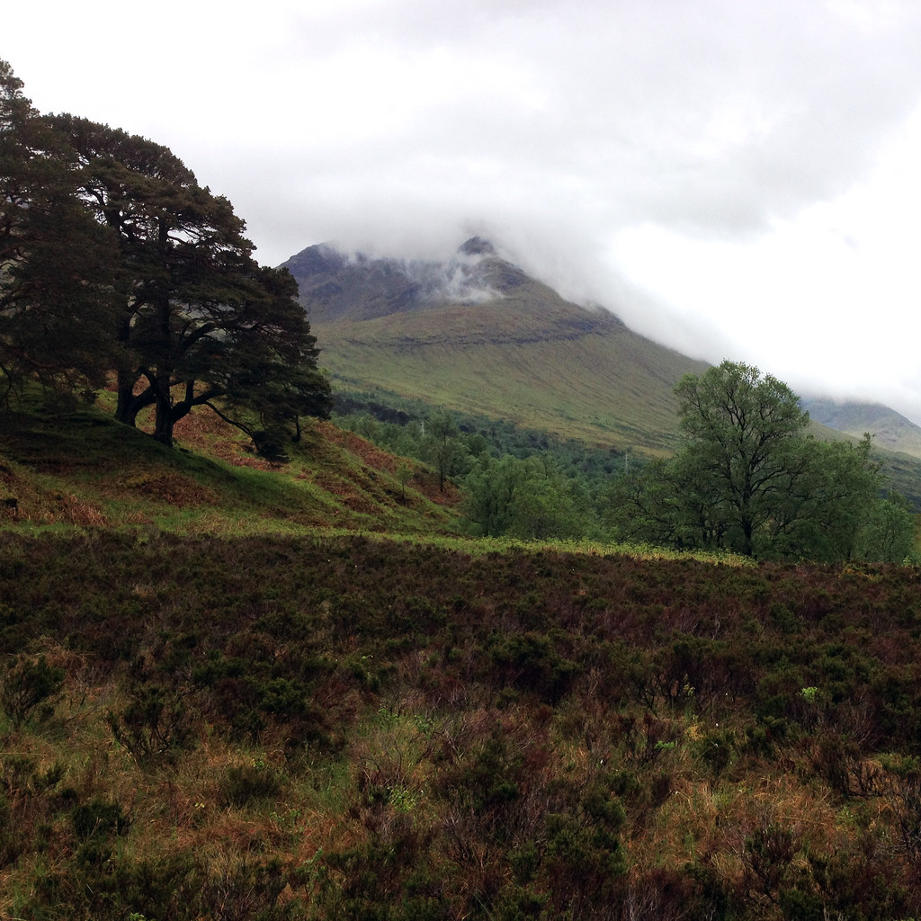
Although the area looks beautiful with the Scots pines all around and the the first two of three challenges for the day in the background we didn’t have the best of views thanks to the cloud. We pushed on, ducking under the small railway bridge and followed the path up by the Allt Coire an Lochain seeing some fantastic looking flat waterfall areas on the way.
 Black Wood of Rannoch and Beinn Achaladair (1036m) by Rossco Mac 7, on Flickr
 The Route Up Following Allt Coire an Lochain by Rossco Mac 7, on Flickr
 Looking Back Towards Rannoch Moor by Rossco Mac 7, on Flickr
 The Black Mount by Rossco Mac 7, on Flickr
 Allt Coire an Lochain by Rossco Mac 7, on Flickr
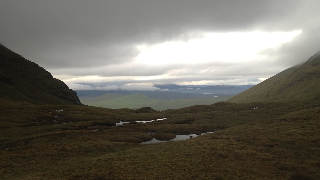
Although the route on WalkHighlands veers left before reaching Lochan a’Chreachain we decided to go all the way up for somewhere to stop and enjoy the scenery and look at the small lochan. By that time though the cloud had moved right in and with the rain pounding on us we couldn’t even see the other side of the lochan which must only have been a couple of hundred metres wide.
Not exactly the best place to stop then so we kept going up towards the first Munro of the day, Beinn a’ Chreachain which sits high above the lochan. The steep face here along with rocky nature of it means you have to go around to reach it via a smaller summit on the way at 961m.
By the time we reached Beinn a’Chreachain and our highest point of the day at 1081m we were both puggled. Two months since our last Munro outing and having been up The Cobbler just two days prior to this meant our legs were like jelly.
 Cloudy At Lochan a'Chreachain by Rossco Mac 7, on Flickr
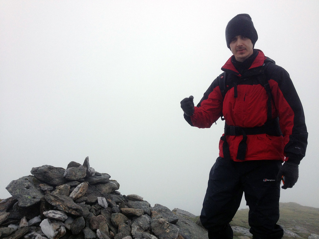
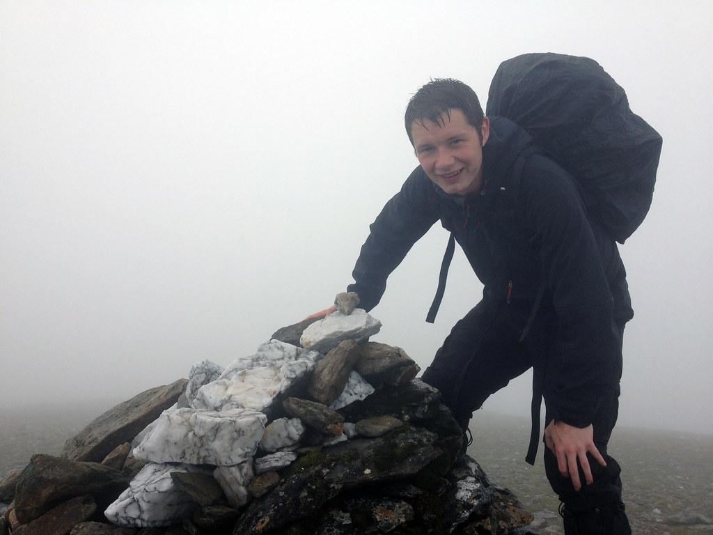 On Top Of Beinn a'Chreachain (1081m) by Rossco Mac 7, on Flickr
 On Top Of Beinn a'Chreachain (1081m) - Still Smiling by Rossco Mac 7, on Flickr
The cloud was not relenting so we didn’t hang around and moved on towards Bealach an Aoghlain to get some lunch before the ascent to the second Munro of the day, Beinn Achaladair. The wind was really gusting now which was making walking in a straight line difficult never mind trying to go up the side of a mountain. We didn’t want to sit out in this for something to eat so found shelter down the north side of the bealach on some steep rocks which hid us from the wind.
We sat there perched on the edge of a couple of rocks regaining energy and giving the legs some well-deserved rest. As we shuffled around fumbling with our bags trying not to drop anything Jamie’s box of pieces slipped from his hand and momentarily sat precariously on the edge and before either of us could make a move, it was gone, tumbling down the rocks. It bounced down what must have easily been 100m and finally the lid cracked open and the contents exploded all over the hillside. I’m sure some wandering mountain sheep spotted those sandwiches and bananas and stuffed their faces with them as there was no way either of us fancied the long trip down and back again!
After that excitement we got back on our feet and made the final ascent to Beinn Achaladair. The wind and rain was still battering us when we got there so we didn't hang around. We still had some hope and determination to finish the day so on we went to the final Munro, Beinn Mhanach.
 Passing Over Meall Buidhe by Rossco Mac 7, on Flickr
 Bealach an Aoghlain by Rossco Mac 7, on Flickr
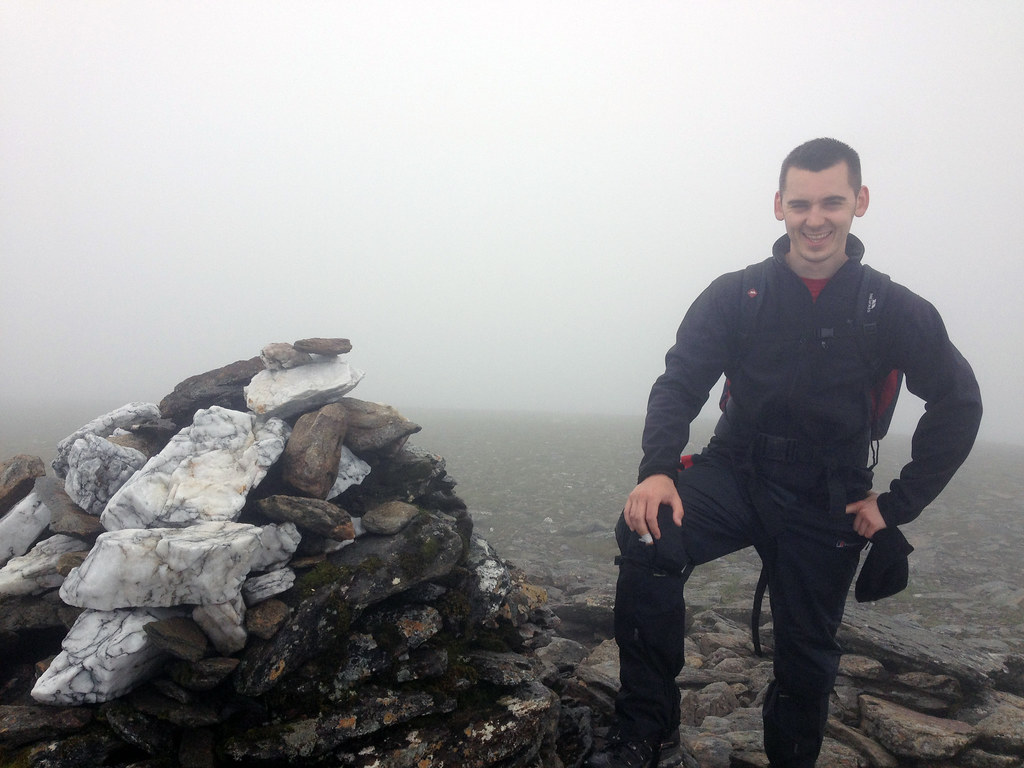
 Beinn Achaladair (1036m) - Looking Relieved by Rossco Mac 7, on Flickr
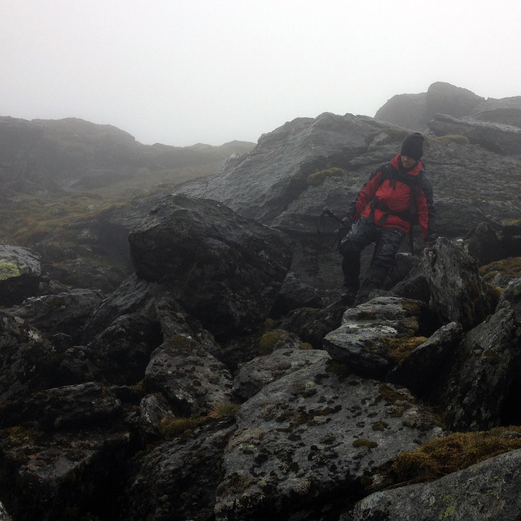
At this point we were leaving the track and making our own way to Beinn Mhanach since it was not a commonly walked route. The first part was quite a large boulder field to descend but that was swiftly tackled with no drama and onto the open hillside and final slog of the day up to the summit.
As you can see, by the time we reached the summit we were completely done in. Not an ounce of energy left, so glad to be finished and knowing it was all downhill from here back to the car even though still quite a distance.
 Climbing Down Coire nan Clach by Rossco Mac 7, on Flickr
 Going Off The Beaten Track by Rossco Mac 7, on Flickr
 Beinn Mhanach (953m) Up Ahead by Rossco Mac 7, on Flickr
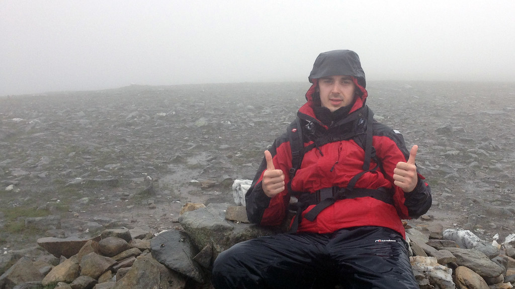 Beinn Mhanach (953m) - Shattered! by Rossco Mac 7, on Flickr
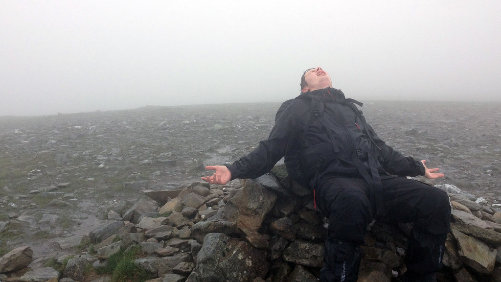 Lost The Will To Live On Beinn Mhanach (953m) by Rossco Mac 7, on Flickr
We now decided to skirt around and down the south side of Beinn a’Chuirn where we came across a pile of rocks with a small wooden box with engraving on it. Probably not many people have seen it due to this not being a well walked route so it was a nice spot for a memorial whoever put it there.
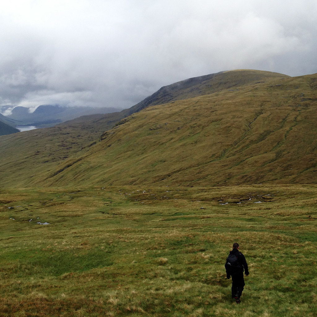
It was around this time though that I started to realise a problem. The visual I had in my head of what should have lay ahead wasn’t matching up with what we were seeing. I got my GPS and the maps out and seen the error. “Jamie…” I said “Remember how I said it’s all downhill from here?” “Aye…” he says, almost knowing I’m about to ruin his day. “Well, see that bealach all the way up there, we’ve still got to go up that!” Whatever was exchanged between us after isn’t suitable for kids so I better not say it. Needless to say we were pretty gutted that we still had to descend and re-ascend what worked out to be another 300m before finally having nothing but downhill.
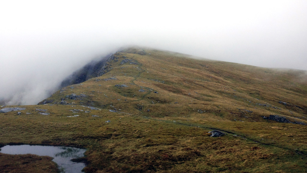
There was nothing to do but just get on with it, so we did. Slowly. The descent down was bad enough and by the time we had to ascend again we were on our last legs and soaked through to our core. We clambered our way up to the top and onto the bealach between Beinn an Dothaidh and Beinn Achaladair finally seeing that the end was near with 4 miles of downhill left this time!
 Descending To Cross The Allt an Loin by Rossco Mac 7, on Flickr
 Looking Down Coire Achaladair by Rossco Mac 7, on Flickr
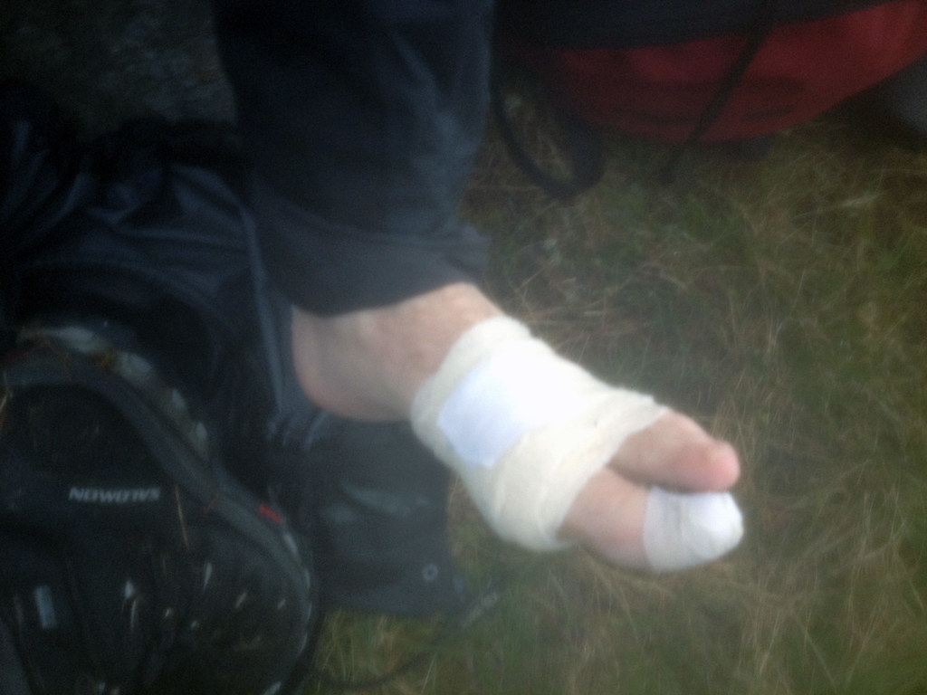
Unfortunately for me, the pain was not over. Just as we started to get a skip in our step I suddenly yelped out in pain thinking I’d stood on something that punctured right through my boot. I had no idea what had happened. I fell to the ground like a sack of tatties and when taking my boot off to examine what on earth had happened was greeted with a burst blister about 2 inches wide on the ball of my foot. I hadn’t even felt it all day until it had burst somehow. The fact our boots and socks were sodden must have made the blister worse on such a long walk.
Not wanting to be defeated so close to the end, we wrapped it up as tight as possible with a bandage. At this point we are both screaming out loud hysterically. Jamie in laughter and me in pain! We walked - Well, Jamie did. I limped – the rest of the way back down Coire Achaladair and back to the car for 10:30pm, eleven and a half hours after we started. Upon reaching the car, we were greeted by swarms and swarms of bloodthirsty midges. It was the quickest change ever, throwing all the wet clothes and gear in the boot and driving out of there like we’d just robbed the place.
 Bandaged Up For The Long Walk Back by Rossco Mac 7, on Flickr
 Following The Allt Coire Achaladair Back To The Car by Rossco Mac 7, on Flickr
Looking back now we were broken men at the end of that day. Two years later and I still haven’t done a walk that was higher in distance, ascent or time but we still loved it. We were pushed to our limits and we kept going past it. How either of us would have managed on our own I don’t know, that’s the beauty of walking with other people, you keep going so you don’t let one another down.
Every time I drive towards Glencoe now, I will look at Loch Tulla on my left then up the right towards these three Munros and fondly remember the day we had, knowing I can always look back on the strength we showed to keep on going any time I’m struggling in future.
35 down, 247 to go…
I was short on time for arranging this walk but as usual I logged onto WalkHighlands and loaded up my Munro Map to find which out which red flags could be turned blue. I spotted these three Munros just past Bridge of Orchy and thought they would be perfect then realised that the usual walk route only covers two of them and not the third and further away Beinn Mhanach. A quick search and it was easy to find a few people had done this already though after doing Beinn a'Chreachain and Beinn Achaladair then hitting Beinn Mhanach on the way back to the start. It’s only a 300m ascent to it so it shouldn’t be too tough I thought, not taking the time to check the rest of the route back and whether there was any more ascent needed.
So off we went to Achaladair Farm to start our epic 15 mile walk. It was a cloudy day but hopes were high that it would clear and we were excited for what lay ahead. As with the usual route, we were doing it clockwise so had a 2 or 3 mile walk north east along the flat dirt track which followed the Water of Tulla. We left the track to join the path and bridge crossing over the river and into the Black Wood of Rannoch.
Looking Back To Achallader by Rossco Mac 7, on FlickrBealach an Aoghlain by Rossco Mac 7, on FlickrCrossing The Water Of Tulla by Rossco Mac 7, on FlickrCrossing The Water Of Tulla by Rossco Mac 7, on FlickrAlthough the area looks beautiful with the Scots pines all around and the the first two of three challenges for the day in the background we didn’t have the best of views thanks to the cloud. We pushed on, ducking under the small railway bridge and followed the path up by the Allt Coire an Lochain seeing some fantastic looking flat waterfall areas on the way.
Black Wood of Rannoch and Beinn Achaladair (1036m) by Rossco Mac 7, on FlickrThe Route Up Following Allt Coire an Lochain by Rossco Mac 7, on FlickrLooking Back Towards Rannoch Moor by Rossco Mac 7, on FlickrThe Black Mount by Rossco Mac 7, on FlickrAllt Coire an Lochain by Rossco Mac 7, on FlickrAlthough the route on WalkHighlands veers left before reaching Lochan a’Chreachain we decided to go all the way up for somewhere to stop and enjoy the scenery and look at the small lochan. By that time though the cloud had moved right in and with the rain pounding on us we couldn’t even see the other side of the lochan which must only have been a couple of hundred metres wide.
Not exactly the best place to stop then so we kept going up towards the first Munro of the day, Beinn a’ Chreachain which sits high above the lochan. The steep face here along with rocky nature of it means you have to go around to reach it via a smaller summit on the way at 961m.
By the time we reached Beinn a’Chreachain and our highest point of the day at 1081m we were both puggled. Two months since our last Munro outing and having been up The Cobbler just two days prior to this meant our legs were like jelly.
Cloudy At Lochan a'Chreachain by Rossco Mac 7, on FlickrOn Top Of Beinn a'Chreachain (1081m) by Rossco Mac 7, on FlickrOn Top Of Beinn a'Chreachain (1081m) - Still Smiling by Rossco Mac 7, on FlickrThe cloud was not relenting so we didn’t hang around and moved on towards Bealach an Aoghlain to get some lunch before the ascent to the second Munro of the day, Beinn Achaladair. The wind was really gusting now which was making walking in a straight line difficult never mind trying to go up the side of a mountain. We didn’t want to sit out in this for something to eat so found shelter down the north side of the bealach on some steep rocks which hid us from the wind.
We sat there perched on the edge of a couple of rocks regaining energy and giving the legs some well-deserved rest. As we shuffled around fumbling with our bags trying not to drop anything Jamie’s box of pieces slipped from his hand and momentarily sat precariously on the edge and before either of us could make a move, it was gone, tumbling down the rocks. It bounced down what must have easily been 100m and finally the lid cracked open and the contents exploded all over the hillside. I’m sure some wandering mountain sheep spotted those sandwiches and bananas and stuffed their faces with them as there was no way either of us fancied the long trip down and back again!
After that excitement we got back on our feet and made the final ascent to Beinn Achaladair. The wind and rain was still battering us when we got there so we didn't hang around. We still had some hope and determination to finish the day so on we went to the final Munro, Beinn Mhanach.
Passing Over Meall Buidhe by Rossco Mac 7, on FlickrBealach an Aoghlain by Rossco Mac 7, on FlickrBeinn Achaladair (1036m) - Looking Relieved by Rossco Mac 7, on FlickrAt this point we were leaving the track and making our own way to Beinn Mhanach since it was not a commonly walked route. The first part was quite a large boulder field to descend but that was swiftly tackled with no drama and onto the open hillside and final slog of the day up to the summit.
As you can see, by the time we reached the summit we were completely done in. Not an ounce of energy left, so glad to be finished and knowing it was all downhill from here back to the car even though still quite a distance.
Climbing Down Coire nan Clach by Rossco Mac 7, on FlickrGoing Off The Beaten Track by Rossco Mac 7, on FlickrBeinn Mhanach (953m) Up Ahead by Rossco Mac 7, on FlickrBeinn Mhanach (953m) - Shattered! by Rossco Mac 7, on FlickrLost The Will To Live On Beinn Mhanach (953m) by Rossco Mac 7, on FlickrWe now decided to skirt around and down the south side of Beinn a’Chuirn where we came across a pile of rocks with a small wooden box with engraving on it. Probably not many people have seen it due to this not being a well walked route so it was a nice spot for a memorial whoever put it there.
It was around this time though that I started to realise a problem. The visual I had in my head of what should have lay ahead wasn’t matching up with what we were seeing. I got my GPS and the maps out and seen the error. “Jamie…” I said “Remember how I said it’s all downhill from here?” “Aye…” he says, almost knowing I’m about to ruin his day. “Well, see that bealach all the way up there, we’ve still got to go up that!” Whatever was exchanged between us after isn’t suitable for kids so I better not say it. Needless to say we were pretty gutted that we still had to descend and re-ascend what worked out to be another 300m before finally having nothing but downhill.
There was nothing to do but just get on with it, so we did. Slowly. The descent down was bad enough and by the time we had to ascend again we were on our last legs and soaked through to our core. We clambered our way up to the top and onto the bealach between Beinn an Dothaidh and Beinn Achaladair finally seeing that the end was near with 4 miles of downhill left this time!
Descending To Cross The Allt an Loin by Rossco Mac 7, on FlickrLooking Down Coire Achaladair by Rossco Mac 7, on FlickrUnfortunately for me, the pain was not over. Just as we started to get a skip in our step I suddenly yelped out in pain thinking I’d stood on something that punctured right through my boot. I had no idea what had happened.
Not wanting to be defeated so close to the end, we wrapped it up as tight as possible with a bandage. At this point we are both screaming out loud hysterically. Jamie in laughter and me in pain!
Bandaged Up For The Long Walk Back by Rossco Mac 7, on FlickrFollowing The Allt Coire Achaladair Back To The Car by Rossco Mac 7, on FlickrLooking back now we were broken men at the end of that day. Two years later and I still haven’t done a walk that was higher in distance, ascent or time but we still loved it. We were pushed to our limits and we kept going past it. How either of us would have managed on our own I don’t know, that’s the beauty of walking with other people, you keep going so you don’t let one another down.
Every time I drive towards Glencoe now, I will look at Loch Tulla on my left then up the right towards these three Munros and fondly remember the day we had, knowing I can always look back on the strength we showed to keep on going any time I’m struggling in future.
35 down, 247 to go…
Click to mark this as a great report. Register or Login free to be able to rate and comment on reports (as well as access 1:25000 mapping).
Comments: 8
The Big Buachaille With Big Bill
Date walked: 26/03/2012
Distance: 13.5km
Ascent: 1333m
Views: 2776
Crackin' Cruachan
Date walked: 24/03/2012
Distance: 13.8km
Ascent: 1604m
Comments: 5
Views: 5413
Tarmachan Trio
Date walked: 18/03/2012
Distance: 13.1km
Ascent: 1101m
Comments: 4
Views: 3837
Deliberating The Dorain Double
Date walked: 05/03/2012
Distance: 14km
Ascent: 1324m
Comments: 6
Views: 6824
Meall Glas In The Snow
Date walked: 13/01/2012
Distance: 11.5km
Ascent: 958m
Views: 3043
Sgiath Chuil In The Snow
Date walked: 05/01/2012
Distance: 10.9km
Ascent: 936m
Comments: 6
Views: 6794
A calm day on Ben Challum
Date walked: 27/12/2011
Distance: 11.8km
Ascent: 1094m
Comments: 6
Views: 6287
Better Than Being Stuc Inside
Date walked: 22/10/2011
Distance: 14.5km
Ascent: 1626m
Views: 3074
Ime Scared!
Date walked: 17/10/2011
Distance: 6.4km
Ascent: 945m
Comments: 3
Views: 4492
-
Rossco

- Location: Stirling, Scotland
- Interests: Hills and Bikes
- Activity: Mountain Walker
- Mountain: Carn Mor Dearg
- Place: Glencoe
- Gear: Garmin eTrex 30
- Camera: Sony Alpha 200/Xperia Z3
- Munros: 129
- Corbetts: 12
- Fionas: 6
- Donalds: 4
- Sub 2000: 7
- Islands: 4
- Long Distance routes: West Highland Way Skye Trail Affric Kintail Way
- Filter reports
- Trips: 7
- Distance: 101.6 km
- Ascent: 9263m
- Munros: 12
- Trips: 17
- Distance: 220.7 km
- Ascent: 19299m
- Munros: 23
- Corbetts: 3
- Fionas: 1
- Joined: Apr 18, 2011
- Last visited: Apr 16, 2024
- Total posts: 183 | Search posts
